

Browse Items (70 total)
- Collection: City Planning Commission
Sort by:
Insurance Rating Request for the City of Roanoke
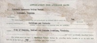
Prepared for the Virginia Insurance Rating Bureau, this request contains an inventory of city owned property with descriptions and in many cases photographs.
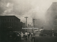
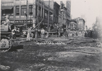
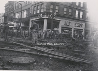
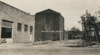
CPC 9e Phillip Levy Fire
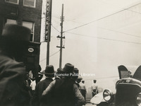
The Philip Levy Exchange Company furniture store caught fire for the second time on 31 August 1928. The first fire occurred the previous year and only caused minor damage. This fire would prove more disastrous. Philip Levy Exchange Company was…
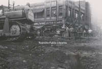
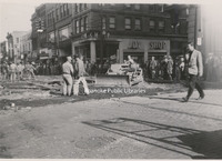
CPC 9d Phillip Levy Fire
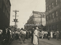
The Philip Levy Exchange Company furniture store caught fire for the second time on 31 August 1928. The first fire occurred the previous year and only caused minor damage. This fire would prove more disastrous. Philip Levy Exchange Company was…
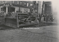
CPC 9c Phillip Levy Fire
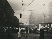
The Philip Levy Exchange Company furniture store caught fire for the second time on 31 August 1928. The first fire occurred the previous year and only caused minor damage. This fire would prove more disastrous. Philip Levy Exchange Company was…
CPC 9b Phillip Levy Fire
The Philip Levy Exchange Company furniture store caught fire for the second time on 31 August 1928. The first fire occurred the previous year and only caused minor damage. This fire would prove more disastrous. Philip Levy Exchange Company was…
CPC 9a Phillip Levy Fire
The Philip Levy Exchange Company furniture store caught fire for the second time on 31 August 1928. The first fire occurred the previous year and only caused minor damage. This fire would prove more disastrous. Philip Levy Exchange Company was…
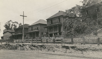
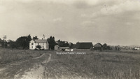
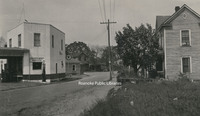
CPC 99 Madison and 2nd
East side of 2nd Street NE and Madison Avenue. I-581 runs through this area today.
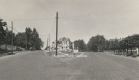
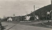
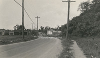
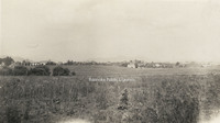
CPC 98 Madison Avenue
Madison Avenue east from 2nd Street NE. I581 runs through this area today.
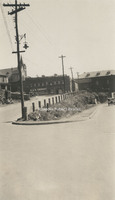
CPC 8 Campbell and Chapman
Point where Chapman Avenue forks off of Campbell Avenue
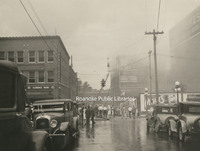
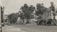
CPC 7e Campbell Avenue
Removal of street railways on Campbell Avenue at the intersection with Jefferson Street.
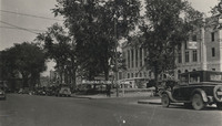
CPC 7d Campbell Avenue
Removal of street railways on Campbell Avenue at the intersection with Jefferson Street.
CPC 7c Campbell Avenue
Removal of street railways on Campbell Avenue at the intersection with Jefferson Street.
CPC 7b Campbell Avenue
Removal of street railways on Campbell Avenue at the intersection with Jefferson Street.
CPC 7a Campbell Avenue
Removal of street railways on Campbell Avenue at the intersection with Jefferson Street.
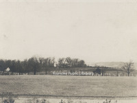
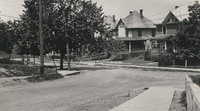
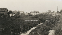
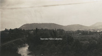
CPC 65 Highland Park
Looking south from Highland Park.
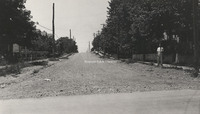
CPC 64 Norfolk Avenue
Looking west on Norfolk Avenue.
CPC 62 Shenandoah Avenue
Shenandoah Avenue and Centre Avenue. Norfolk & Western General Offices visible in background.
CPC 60 Ridgewood
Ridgewood Manor House, was built by industrialist Samuel H. McVitty. It is located at 1900 South Clearing Road just above Ridgewood Farms Shopping Center.
CPC 6 Highland and Franklin
Jog intersection at Highland Avenue and Franklin Road. Beth Israel Synagogue visible.
CPC 59a Bryan McDonald House
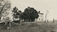
Located near Mt. Union village on the headwaters of Tinker Creek in Botetourt County, the Bryan McDonald house was built in 1766.
CPC 58 Crystal Spring
Houses along Richelieu Avenue in Crystal Spring.
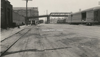
CPC 57 Freight Truck
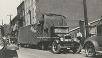
Southern States Motor Freight truck parked on the 100 block of Campbell Avenue.
CPC 54 Elmwood Pond
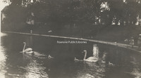
Swans in the pond once located in Elmwood Park.
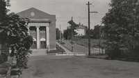
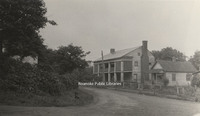
CPC 53 Terry House
Terry House, formerly located in Elmwood Park. The Terry House was gifted to the City of Roanoke in 1921 for use a library. It operated in this capacity until a new library was built in 1952.
CPC 52 Japanese Magnolia
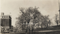
Japanese Magnolia in Elmwood Park.
CPC 5 Church and 5th
Jog intersection at Church Avenue and 5th Street.
CPC 48 10th Street
Looking north on 10th Street from Madison Avenue.
CPC 47 2nd Street
2nd Street NE at the intersection of Lick Run.
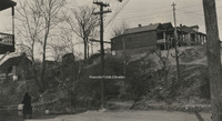
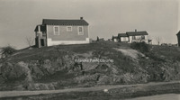
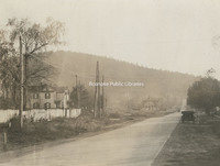
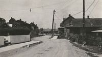
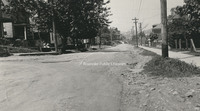
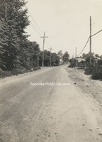
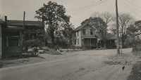
CPC 46 Orange Avenue
Derelict homes along Lynchburg(Orange) Avenue. Exact location unknown.
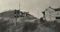
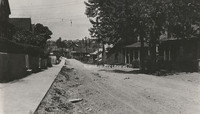
CPC 44 Orange Avenue
Looking east on Lynchburg (Orange) Avenue.
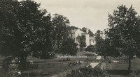
CPC 43 Elmwood Park
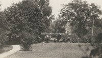
A view in Elmwood Park.
CPC 42 2nd Street
A view of 2nd Street NE between Walker Avenue and Rutherford Avenue.
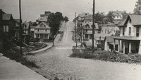
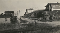
CPC 41 Rorer Avenue
Looking east on Rorer Avenue from 5th Street.
CPC 40 Wells Avenue
Looking west on Wells Avenue.
CPC 4 Franklin and Mountain
Jog intersection at Franklin Road and Mountain Avenue.
CPC 39 Bullitt Avenue
Looking west at the 500 block of Bullitt Avenue.
CPC 38 Church and 3rd
Looking east on Church Avenue from 3rd Street. Post office (now Commonwealth Building) is under construction at right.
CPC 37 Church and 3rd
Looking east on Church Avenue from 3rd Street. Post office (now Commonwealth Building) is under construction at right.
CPC 36 Crystal Spring
Looking up Crystal Spring Avenue from roughly 23rd Street.
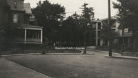
CPC 35 2nd and Rutherford
Intersection of 2nd Street and Rutherford Avenue NE.
CPC 3 Stone Home
The home of Edward L. Stone of Stone Printing and Manufacturing, formerly located at 210 Mountain Avenue.
CPC 29 2nd Street

2nd Street NE at Lick Run.
CPC 28 Wells Avenue
Jog at Wells Avenue NW.
CPC 27 Walker Avenue
View of Walker Avenue at the intersection with 2nd Street NE.
CPC 26 2nd Street
Unidentified children at Lick Run along 2nd Street NE.
CPC 25 Furnace Row
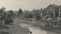
A view of Furnace Row on Tinker Creek, once roughly located at Orange Avenue and Rhodes Avenue.
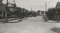
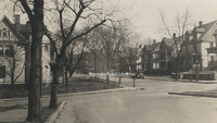
CPC 24 Albemarle Avenue
Looking toward Albemarle from the 6th Street intersection.
CPC 23 Albemarle Avenue
Looking west an Albemarle Avenue SE at the 6th Street intersection.
CPC 22 Hollins Entrance
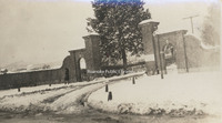
Entrance to Hollins College.
CPC 21b Trout Field
Located adjacent to and east of Fairview Cemetery along Melrose Avenue, Trout Field was Roanoke's first airfield.
CPC 21a Trout Field
Located adjacent to and east of Fairview Cemetery along Melrose Avenue, Trout Field was Roanoke's first airfield.
CPC 20 Moorman Spring
Moorman Spring was located on the Captain Robert B. Mooman property roughly located at the intersection of Moorman Avenue and 10th Street.
CPC 2 SW from YMCA
Looking southwest from the top of the YMCA building on 2nd Street. Lee Junior High School is visible in the left background.
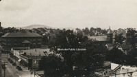
CPC 19 Mill Mountain
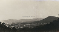
Looking south from atop Mill Mountain.
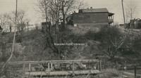
CPC 18 Dale and 8th
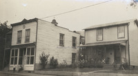
Structures once located at the corner of Dale Avenue and 8th Street.
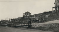
CPC 17 Wasena Bridge
A view of Wasena Bridge from Riverside Boulevard.
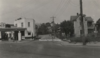
CPC 16 Orange Avenue
Looking east from about the 1100 block of Lynchburg (Orange) Avenue.
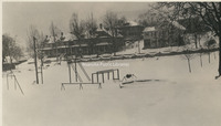
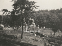
CPC 14a Riverside Park
Pool at Riverside Park
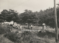
CPC 14b Riverside Park
Pool at Riverside Park
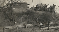
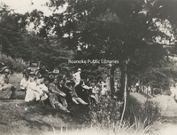
CPC 14c Riverside Park
People sitting on the knoll overlooking the pool in Riverside Park.
CPC 13 2nd Street
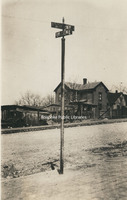
Sign at intersection of 2nd Street NE and unknown cross street.
CPC 128 4th Street
A view of 4th Street NE in the Gilmer School area. Exact location unknown.
CPC 12 Graybar Electric
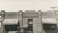
Storefront of Graybar Electric Company, formerly located at 603 Salem Avenue.
CPC 11 Raleigh Tavern
Raleigh Tavern, Roanoke's first hotel, was located on Lynchburg (Orange) Avenue NE. Built in the early 1800s and long known as Pate's Tavern, it was a popular stopping-place on the north-south stages or on the road from Lynchburg west to Seven Mile…
CPC 10d 4th Street
View of 4th Street NE. Northside Filling Station was located at 1201 4th, roughly where the post office is located today.
CPC 10c 4th Street
View of 4th Street NE. Northside Filling Station was located at 1201 4th, roughly where the post office is located today.
CPC 10b 4th Street
View of 4th Street NE. Northside Filling Station was located at 1201 4th, roughly where the post office is located today.
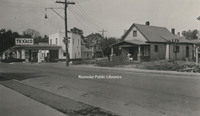
CPC 10a 4th Street
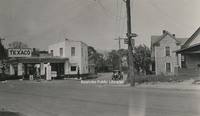
View of 4th Street NE. Northside Filling Station was located at 1201 4th, roughly where the post office is located today.
CPC 100 Hanover Avenue
Looking west on Hanover Avenue from 10th Street.
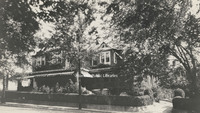
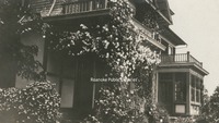
CPC 1 Goodwin Home
Rose arbor on the porch of the Thompson Goodwin home, once located in Orchard Hill. Orchard Hill, also known as "Official Hill" was located in the area where Community Hospital stands today.