

Browse Items (8429 total)
Sort by:
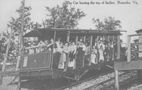
A Guide to the Roanoke Greenway Collection
The collection is contained in 8 document boxes, and 1 oversized flat box and is broadly organized as follows:
Sections I-III include documents related to the development of the Greenway, including correspondence, meeting agendas and minutes,…
Sections I-III include documents related to the development of the Greenway, including correspondence, meeting agendas and minutes,…
A Guide to the Greenvale School Collection
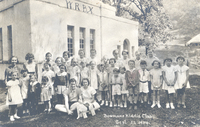
The Greenvale School collection consists of materials kept by administration regarding school initiatives, activities, and fundraising. The bulk of the collection was housed in two oversized scrapbooks containing photographs, news clippings, and…
Colonel 1948
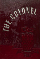
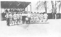
The Colonel is the annual for William Fleming High School.
Sorting Some of the Wrights of Southern Virginia Part XXIII: Edward Wright of York County, His Wife Joan (Evans) Wright, and His Descendants
Sorting Some of the Wrights of Southern Virginia is a multipart project. Each part will discuss a separate Wright family, beginning with the oldest known ancestor of that line.
The McCutcheon Collection
This family history covers about 300 years of the McCutcheon Family, beginning with John McCutcheon and his five sons.
A Guide to the Papers of the Gainsboro Road Expansion Project
The Gainsboro Road Expansion Project is a project that started in 1985 to expand the Second Street NW / Gainsboro Road NW corridor to create a four-lane road connecting Orange Avenue NW to Salem Avenue SW, the realignment of Wells Avenue NW, and also…
Williamson Road Corridor Urban Design Catalog
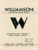
This draft of the Williamson Road Corridor Urban Design Catalog was created on 19 May 1986, and it details Design Concepts, Development Strategies, Planning Documents, and other Maps.
This project was never completed. It is assumed that this is…
This project was never completed. It is assumed that this is…
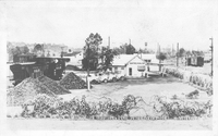
PCS 90.0
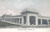
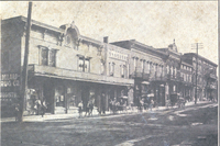
The Randolph Street Market was located at the corner of Williamson Road (Randolph Street) and Campbell Avenue.
PCS 5.7
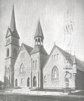
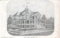
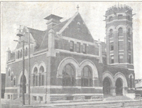
Greene Memorial United Methodist Church is located at 402 2nd Street SW.
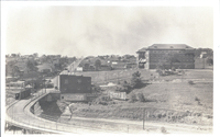
PCS 89.2
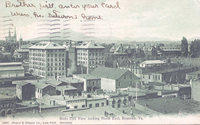
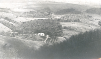
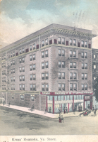
Birds-eye view looking northeast toward the Norfolk & Western General Offices and Hotel Roanoke.
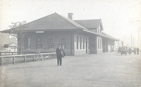
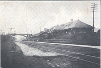
PCS 89.1
Located at Jefferson Street and Williamson Road, the Virginian Railway Station served passengers from 1910 to 1956. It was the only station constructed of brick along the entire length of the Virginian's 608 miles network.
PCS 89.0
Located at Jefferson Street and Williamson Road, the Virginian Railway Station served passengers from 1910 to 1956. It was the only station constructed of brick along the entire length of the Virginian's 608 miles network.
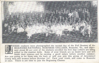
PCS 88.3
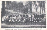
Group photo of National Business College students.
PCS 88.2
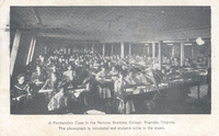
A penmanship class in National Business College.
PCS 88.1
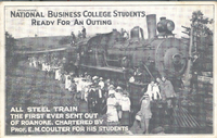
"The student body assembled at the college building on Church Avenue and with well-filled baskets marched to the Norfolk & Western where they boarded a special train chartered for the occasion by Professor Coulter. The management of the Norfolk &…
PCS 88.0
Group photo of National Business College students.
PCS 87.0

The President's house at Virginia Tech.
PCS 5.6
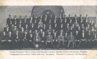
Young Business Men's Class of First Baptist Church.
PCS 86.2
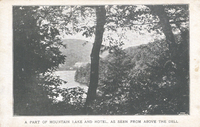
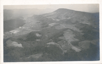
Mountain Lake in Giles County.
PCS 86.1
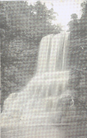
Cascade Falls located in Giles County.
PCS 86.0
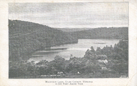
Mountain Lake in Giles County.
PCS 85.0
For many years, Salem had also benefited from passenger service provided by the Virginian Railroad. Virginian passenger service in Salem ended in 1954, five years prior to its merger with the N&W.
PCS 5.5

The old First Baptist Church, formerly located on opposite side of 3rd Street from the current building.
PCS 84.0
Prominent on the left is a sign for W.B. Dillard Drug Co., Prescription Druggists, Soda and Mineral Waters. Watts Dillard was a prominent Salem business man involved in numerous civic projects. His drugstore, at the corner of Main and College, got a…
PCS 39.1
Roanoke Lodge #197 of the Benevolent and Protective Order of Elks. The lodge stood on the corner of Jefferson Street and Franklin Road where Anthem is now located.
PCS 83.0
Roanoke Post Office was located on the northeast corner of Church Avenue and 1st Street.
PCS 3.21
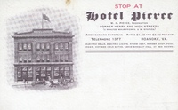
The Hotel Pierce was located on the site that would be become the Hotel Dumas.
PCS 44.3
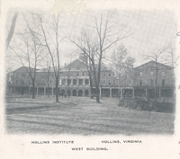
West Building on the campus of Hollins University.
PCS 44.2
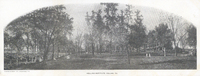
A panoramic view of the Hollins University campus.
PCS 82.1
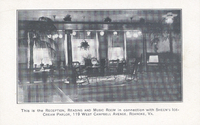
An interior view of the reception, reading, and music room in connection with Sheen's Ice Cream Parlor. Sheen's was located at 119 Campbell Avenue SW.
PCS 82.0
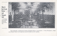
An interior view of Sheen's Ice Cream Parlor, formerly located at 119 Campbell Avenue SW.
PCS 81.0
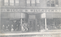
Wills & Willauer was located at 111-113 Campbell Avenue SW.
North Star 1966
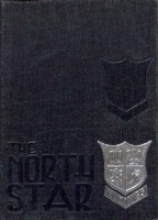
The North Star is the annual for Northside High School.
North Star 1964
The North Star is the annual for Northside High School.
North Star 1962
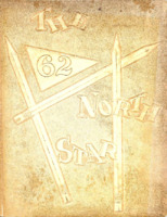
The North Star is the annual for Northside High School.
Virginia Western Community College 1969
Virginia Western Community College yearbooks.
The Compass 1998
The Compass is the annual for North Cross School.
The Compass 1994
The Compass is the annual for North Cross School.
The Talon 1974
The Talon was the annual for National Business College.
The Talon 1966

The Talon was the annual for National Business College
Central Academy Middle School 2015

Central Academy Middle School 2015 yearbook.
The Trailblazer 1971
The Trailblazer was the annual for Salem Intermediate School.
The Key 1975
The Key is the annual for Roanoke Catholic High School.
The Key 1963
The Key is the annual for Roanoke Catholic High School.
The Key 1962
The Key is the annual for Roanoke Catholic High School.
The Shield 1973
The Shield is the annual for Lord Botetourt High School.
Bulldogs 1979
Bulldogs was the annual for Lucy Addison Junior High School.
Bulldogs 1976

Bulldogs was the annual for Lucy Addison Junior High School.
The Shield 1972
The Shield is the annual for Lord Botetourt High School.
The Shield 1971
The Shield is the annual for Lord Botetourt High School.
The Shield 1970
The Shield is the annual for Lord Botetourt High School.
The Accolade 1969
The Accolade is the annual for Cave Spring High School.
Crystal Spring Elementary School 1976
Annual for Crystal Spring Elementary School.
The Accolade 1967
The Accolade is the annual for Cave Spring High School.
The General 1947
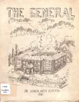
The General was the annual for Lee Junior High School.
The Oracle 1928
The Oracle was the annual for Salem High School.
The Oracle 1925
The Oracle was the annual for Salem High School.
The Oracle 1924
The Oracle was the annual for Salem High School.
The Oracle 1922
The Oracle was the annual for Salem High School.
The Oracle 1921
The Oracle was the annual for Salem High School.
The Oracle 1920

The Oracle is the annual for Salem High School.
The Oracle 1918
The Oracle was the annual for Salem High School.
The Oracle 1916
The Oracle was the annual for Salem High School.
The Oracle 1914
The Oracle was the annual for Salem High School.
The Oracle 1912
The Oracle was the annual for Salem High School.
The Oracle 1911

The Oracle was the annual for Salem High School.
The Eagle 1962
The Eagle was the annual for Willis High School.
The Crossroads 1951
The Crossroads was the annual for Stewartsville High School.
The Crossroads 1950
The Crossroads was the annual for Stewartsville High School.
The Eyrie 1966
The Eyrie is the annual for Staunton River High School.
The Shawnee 1949

The Shawnee was the annual for Shawsville High School.
The Shawnee 1948
The Shawnee was the annual for Shawsville High School.
The Shawnee 1947
The Shawnee was the annual for Shawsville High School.
The Shawnee 1946
The Shawnee was the annual for Shawsville High School.
The Anchor 1950
The Anchor was the annual for Max Meadows High School.
The Anchor 1949
The Anchor was the annual for Max Meadows High School.
The Cook Book 1950
The Cook Book was the annual for Woodrow Wilson Middle School.
The Black Swan 2008

The Black Swan is the annual for William Byrd High School.
The Black Swan 1999

The Black Swan is the annual for William Byrd High School.
A Guide to the Victory Stadium Studies
In 2004, the Victory Stadium Study Committee was appointed and requested that certain background materials related to the study of the future of Victory Stadium be placed in three Roanoke City Public Libraries locations: Main Library, Williamson Road…
A Guide to the Virginia Cook Papers
This collection consists primarily of secondary sources related to the Clay Family.
PCS 80.21
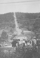
Crowds watch as the Mill Mountain Incline makes its journey.
PCS 80.20
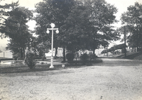
A view of Mountain Park.
PCS 80.19
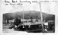
Mountain Park. Caption reads, 'The last Sunday here soldiers were in Roanoke.'
PCS 80.18
Footpaths in Mountain Park.
PCS 80.17
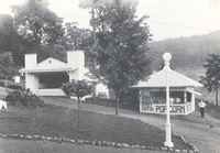
Some concession stands at Mountain Park.
PCS 80.16
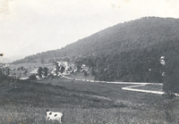
A view of Mountain Park.
PCS 80.15
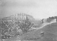
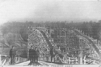
Construction of The Thriller roller coaster in Mountain Park.
PCS 80.14
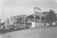
Entrance of The Thriller roller coaster in Mountain Park.
PCS 80.13
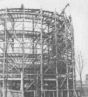
Construction of The Thriller roller coaster in Mountain Park.
PCS 80.12
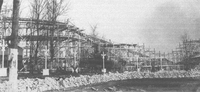
Construction of The Thriller roller coaster in Mountain Park.
PCS 80.11
Men stand on the tracks of The Thriller roller coaster during construction.
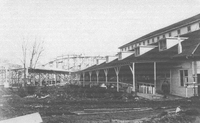
PCS 80.10

Various buildings on the grounds of Mountain Park. In addition to The Thriller, Mountain park had a casino, dance pavilion, shooting gallery, and bowling alley.
PCS 80.9
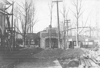
Various buildings on the grounds of Mountain Park. In addition to The Thriller, Mountain Park had a casino, shooting gallery, dance pavilion, and bowling alley.
PCS 80.7
Construction of The Thriller roller coaster in Mountain Park.
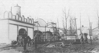
PCS 80.6
The Thriller roller coast under construction at Mountain Park.
PCS 80.5
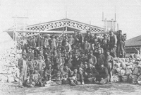
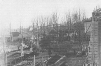
Group photograph of the construction crew at Mountain Park.
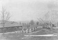
PCS 80.4
Men work on building structures in Mountain Park.
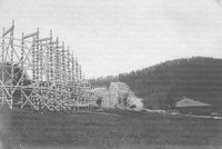
PCS 80.3
Workers raise the infrastructure for The Thriller roller coaster in Mountain Park.
PCS 80.2
Construction of The Thriller roller coaster in Mountain Park.
PCS 80.1

A view of Roanoke from the Mill Mountain Incline.
PCS 80.0
Passengers ride the Mill Mountain Incline down Mill Mountain.
PCS 79.0
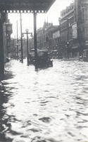
Looking west on a flooded Campbell Avenue near the Jefferson Street intersection.
PCS 78.0
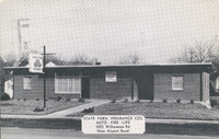
State Farm Insurance Company once had an office at 5005 Williamson Road.
PCS 77.0

The Mexican Craft Shop was located across from the entrance to Hollins University on Route 11.
PCS 76.0
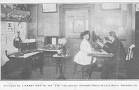
Dr. J. Harry Martin performs an eye exam in his office located at 134 Campbell Avenue SW.
PCS 75.0
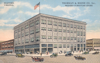
Thurman & Boone was located at 401 S. Jefferson Street.
PCS 74.0
Interior view of The Hobbie Company, formerly located at 14 Campbell Avenue SW.
PCS 73.0

The Elks National Home in Bedford.
PCS 72.0
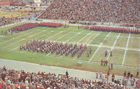
The Corps of Cadets of VMI parades on the football field in a colorful pregame appearance at the Thanksgiving Day classic between VMI and VT at Victory Stadium.
PCS 71.0
A view of Wasena from the north entrance of Wasena Bridge.
PCS 70.0
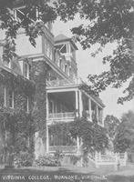
The Virginia College for Young Women was located in the South Roanoke neighborhood at the end of Rosalind Avenue. The college closed in 1933.
PCS 69.4
Walter S. Slicer's Hospital was located at 601 S. Jefferson Street. The building was later occupied by National Business College.
PCS 69.3
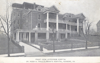
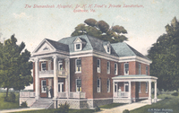
Jefferson Hospital, which was founded in 1907 by Dr. Hugh Trout, was a predecessor to Carilion Roanoke Community Hospital. Formerly located at 1313 Franklin Road SW, the hospital closed in 1967 and was later razed.
PCS 69.2
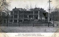
Jefferson Hospital, which was founded in 1907 by Dr. Hugh Trout, was a predecessor to Carilion Roanoke Community Hospital. Formerly located at 1313 Franklin Road SW, the hospital closed in 1967 and was later razed.
PCS 69.1
Roanoke Hospital was built in 1893 with the aid of Norfolk & Western and the Roanoke Gas and Water Company. Carilion Roanoke Memorial now occupies the site of the old hospital.
PCS 69.0
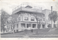
The Shenandoah Hospital was located at 712 Campbell Avenue SW.
PCS 68.4
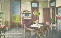
A view of the dining room inside Roanoke Sanitarium. Roanoke Sanitarium was located at 1906 Salem Avenue SW. It was opened by Dr. Walter Slicer in 1911 to treat "nervous and mild mental cases" as well as alcohol and drug addiction. The sanitarium…
PCS 68.3
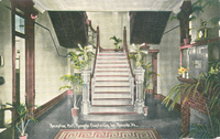
A view of the reception hall inside Roanoke Sanitarium. Roanoke Sanitarium was located at 1906 Salem Avenue SW. It was opened by Dr. Walter Slicer in 1911 to treat "nervous and mild mental cases" as well as alcohol and drug addiction. The sanitarium…
PCS 68.2
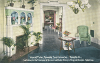
A view of the parlor inside Roanoke Sanitarium. Roanoke Sanitarium was located at 1906 Salem Avenue SW. It was opened by Dr. Walter Slicer in 1911 to treat "nervous and mild mental cases" as well as alcohol and drug addiction. The sanitarium closed…
PCS 68.1
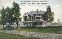
Roanoke Sanitarium was located at 1906 Salem Avenue SW. It was opened by Dr. Walter Slicer in 1911 to treat "nervous and mild mental cases" as well as alcohol and drug addiction. The sanitarium closed in 1913.
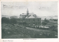
PCS 68.0
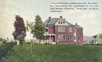
Roanoke Sanitarium was located at 1906 Salem Avenue SW. It was opened by Dr. Walter Slicer in 1911 to treat "nervous and mild mental cases" as well as alcohol and drug addiction. The sanitarium closed in 1913.
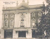
PCS 67.2
The Academy of Music was located in the 400 block of West Salem Avenue. The Academy opened 7 October 1892. After World War II, it fell into disuse and was razed in 1953.
PCS 67.1
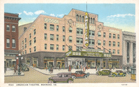
The American Theatre once stood on the corner of Jefferson Street and Kirk Avenue. Built in 1928, the theatre remained in operation until 1971; it was razed in 1973.
PCS 67.0
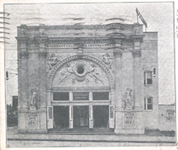
The Jefferson Theatre was located at 417 S. Jefferson Street.
PCS 66.0
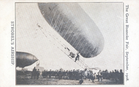
Strobel's Airship at the Roanoke Fair. The airship was designed by Charles J. Strobel, after the general idea of the Zeppelin, and took a championship at the 1904 St. Louis World's Fair. The airship was filled with hydrogen and had a gas engine that…
PCS 65.0
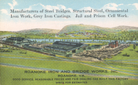
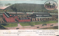
Roanoke Iron & Bridge Works
PCS 64.0
Adams, Payne, and Gleaves was located along the south end of Jefferson Street.
PCS 63.0
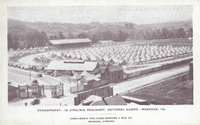
Encampment of the 2nd Virginia Regiment of the National Guard at Maher Field.
PCS 62.0
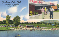
Fairland Lake Club was located at 2611 Ordway Drive NW.
PCS 61.0
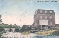
Vinton Roller Mills, along Glade Creek, grew out of mills originally built by David Gish that pre-dated the Civil War. By the Twentieth Century, the remaining mill was owned and operated by James Bowie and produced three kinds of flour. By 1924, the…
PCS 60.0

A view of First Street in Vinton.
PCS 59.0
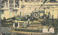
The bottling department of the Virginia Brewing Company. Virginia Brewing was located in the 1200 block of Wise Avenue SE.
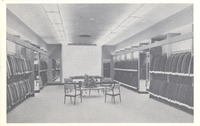
PCS 58.2
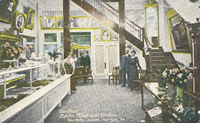
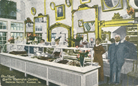
Interior view of Martha Washington Candies, formerly located at 310 S. Jefferson Street.
PCS 58.1
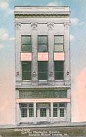
Martha Washington Candies was located at 310 S. Jefferson Street.
PCS 58.0
Interior view of Martha Washington Candies, formerly located at 310 S. Jefferson Street.
PCS 57.0
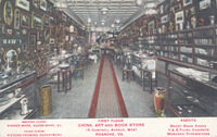
Interior view of China, Art, & Book Store, formerly located at 15 Campbell Avenue SW.
PCS 56.2
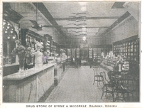
Interior view of Byrne & McCorkle Drug Store, formerly located at 207 S. Jefferson Street.
PCS 56.1
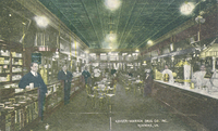
An interior view of Keyser-Warren Drug Company, formerly located at 106 Salem Avenue SW.
PCS 56.0
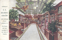
An interior view of E.S. Becker's Grocery, formerly located at 209 S. Jefferson Street.
PCS 55.2
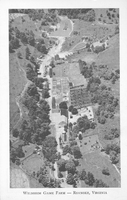
An aerial view of Wildheim Game Farm, a private zoo owned by J.J. Bower on Peters Creek Road. The zoo contained thousands of birds and small animals from all over the world.
PCS 55.1
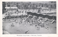
Wildheim Game Farm was a private zoo owned by J.J. Bower on Peters Creek Road. The zoo contained thousands of birds and small animals from all over the world.
PCS 55.0
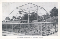
Wildheim Game Farm was a private zoo owned by J.J. Bower on Peters Creek Road. The zoo contained thousands of birds and small animals from all over the world.
PCS 54.0
Roanoke Country Club was originally located in South Roanoke.
PCS 53.0
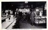
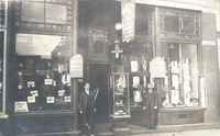
Interior view of Burrell Pharmacy, formerly located at 510 Gainsboro Road NW. Dr. Isaac Burrell is on the left.
PCS 52.0
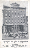
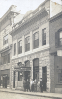
People's Furniture Company was located at 118-120 Salem Avenue SW.
PCS 51.0
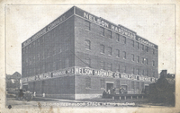
Nelson Hardware Company warehouse. The building is located at 207 Bullitt Avenue SE.
PCS 50.0
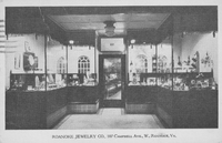
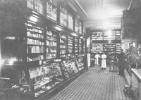
Interior view of Roanoke Jewelry Company, formerly located at 107 Campbell Avenue SW.
PCS 49.2
Interior view of Mitchell's Clothing, formerly located at 307 1st Street SW.
PCS 49.1
Interior view of Mitchell's Clothing, formerly located at 307 1st Street SW.
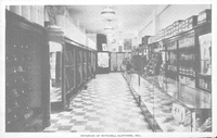
PCS 49.0
Interior view of the first floor and mezzanine of Mitchell's Clothing, formerly located at 307 1st Street SW.
PCS 48.2
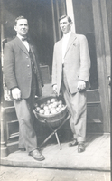
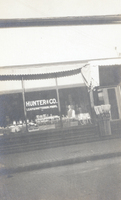
Lester Leap and Jacob Patterson in front of their grocery store, Hunter & Company at 143-145 Salem Avenue SW.
PCS 48.1
Interior view of Hunter & Company grocers was located at 143-145 Salem Avenue SW. Lester Leap and Jacob Patterson were proprietors.
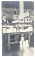
PCS 48.0
Hunter & Company grocers was located at 143-145 Salem Avenue SW. Lester Leap and Jacob Patterson were proprietors.
PCS 47.0
A view of the valley from McAfee Knob.
PCS 46.0
Twins Billy and Hiram Fenster were newsboys for the Union News Company. The boys sold newspapers and magazines aboard trains.
PCS 45.0
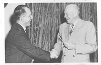
Richard Poff is given a pen by President Dwight Eisenhower. The pen was used to sign the bill enabling railroad men who have paid into the Railroad Retirement Fund and Social Security to draw from both.
PCS 44.1
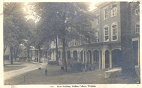
Main Building on the campus of Hollins University.
PCS 44.0

Main Building on the campus of Hollins University.
PCS 43.0
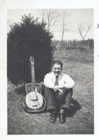
Burney Edward Witt was known as the Elliston Yodeler.
PCS 42.0
Lawrence Campbell, Walter Dale, and Gertrude Dale at 6 Campbell Avenue SE.
PCS 41.0
Hunter Coal Company was located at 1600 Cleveland Avenue SW.
PCS 40.0
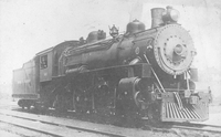
Baldwin Locomotive Engine No. 548.
PCS 39.0
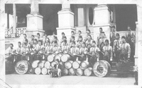
Group photo of the Dramatic Order of Knights of Khorassan Rajah Temple No. 195 band on the steps of the Elks Club once located at the corner of Jefferson Street and Franklin Road.
PCS 38.0
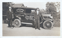
Thomas Raike and William Massey stand next to their truck, Raike and Massey sold beauty supplies for Belle-Terra Products.
PCS 37.0
The Frederick J. Kimball Memorial Fountain, carved out of red granite, was erected in 1907 by Kimball’s friends in a Shenandoah Avenue Park near the N&W passenger station. It provided water for "man and bird and beast". Horses drank from the front…
PCS 36.0
Looking north from the 900 block on Franklin Road SW
PCS 35.0
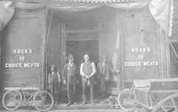
Hock's Meats was located at 15 Salem Avenue SW.
PCS 34.0
Roanoke Notion Company was located at 210 Salem Avenue SW.
PCS 33.0
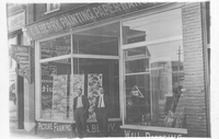
C.A. Berry Painting, Paper Hanging, and Decorating was located at 28 Church Avenue SW.
PCS 32.0
Silverman & Heyman Clothiers was located at 11 Salem Avenue SE.
PCS 31.0
An interior view of Jefferson Pharmacy, located at 315 S. Jefferson Street.
PCS 30.0
Davis & Stephenson was an insurance agency located at 112 Kirk Avenue SW.
PCS 29.0
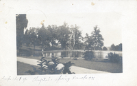
Crystal Spring reservoir.
PCS 28.0
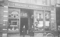
Roanoke Hardware Company was located at 22 Campbell Avenue SW.
PCS 27.0
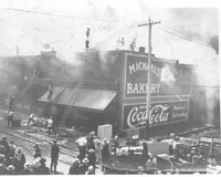
Fire engulfs Michael's Bakery at 501 2nd Street SW. The fire started in Crystal Spring Laundry next door to the bakery and quickly spread to other buildings.
PCS 26.5
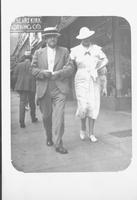
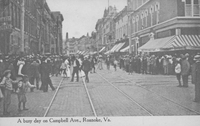
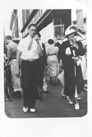
An unidentified couple walks in the 100 block of Campbell Avenue SW.
PCS 26.4
Looking east on Campbell Avenue from 1st Street SW.
PCS 26.3
Looking east from 16 W. Campbell Avenue.
PCS 26.2
Looking east from 16 W. Campbell Avenue.
PCS 26.1
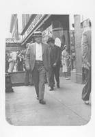
Roanoke Police Chief Moore speaks to an unidentified man in front of the Terry Building.
PCS 26.0
Crowds bustle at the corner of Jefferson Street and Campbell Avenue.
PCS 25.0
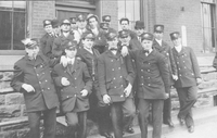
Group photo of Roanoke Railway and Electric streetcar drivers.
PCS 24.0
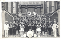
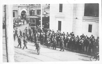
Jefferson High School marching band.
PCS 23.0
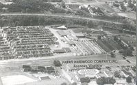
Aerial view of Harris Hardwood Company. Harrs Hardwood was located in Norwich.
PCS 22.2
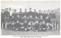
Roanoke High School football team.
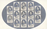
PCS 22.1
Composite of the 1909 Roanoke College baseball team.
PCS 22.0
Composite of the 1909 Roanoke College baseball team.
PCS 21.0
The Jolly Jay Tea Room was located one mile north of Roanoke on Route 11.
PCS 20.0
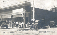
Auto Tire Company was located at 501 2nd (Commerce) Street SW.
PCS 19.1
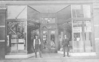
Roanoke Furniture Company was located at 305 1st Street SW.
PCS 19.0
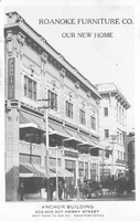
Roanoke Furniture Company in its 'new home' in the Anchor Building, located at 305 1st Street SW.
PCS 18.0
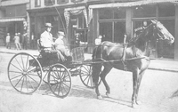
Unidentified man and boy ride in horse-drawn carriage in Downtown Roanoke.
PCS 17.0
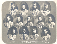
Roanoke Grays baseball team.
PCS 16.10
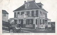
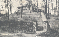
Home located at 325 Mountain Avenue SW.
PCS 16.9
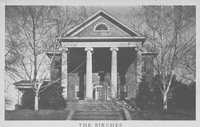
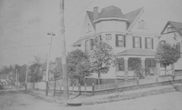
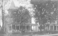
The Birches was the home of Mr. and Mrs. M.M. Caldwell. It is located at 1525 Memorial Avenue SW.
PCS 16.8
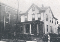
The home of Dr. Isaac D. Burrell was located at 117 Patton Avenue NW.
PCS 16.7
Moulse home located off of Twelve O'Clock Knob Road in Roanoke County.
PCS 16.6
Home formerly located at 307 Bullitt Avenue SE.
PCS 16.5
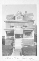
Home located at 1332 Maple Avenue SW.
PCS 16.4
Home formerly located at 921 2nd Street SW.
PCS 16.3
Home located at 3015 Avenham Avenue.
PCS 16.2
The home of Ira Meals was located at 318 Church Avenue SW.
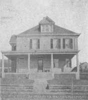
PCS 16.1
Home located at 1164 Montrose Avenue SE.
PCS 16.0
Home located at 1335 Clarke Avenue SW.
PCS 15.4
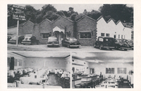
Bradford's Seafood and Steakhouse was located at 2523 Franklin Road SW.
PCS 15.3
The Virginian was located on Williamson Road.
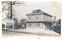
PCS 15.2
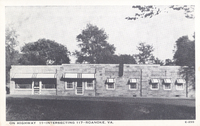
Davidson's Restaurant was located at the corner of Peters Creek Road and Williamson Road.
PCS 15.1
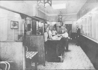
Interior view of the Virginia Cafe, formerly located at 12 1/2 Salem Avenue SE.
Imprint 1998

The Imprint is the annual for Roanoke Valley Christian School.
Imprint 1995
The Imprint is the annual for Roanoke Valley Christian School.
Chargers 2001
The Charger was the annual for Stonewall Jackson Middle School.
PCS 15.0
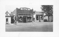
Ray's Restaurant and Melrose Beauty Shoppe were located in the 2300 block of Melrose Avenue NW.
PCS 14.0
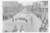
Crowds line the streets of Fincastle as a parade makes it way through town.
PCS 13.0
Participants in Bowman's Kiddie Club, a radio show for children broadasted on WRBX.
PCS 12.0
A composite of the individuals involved in the Hillsville Massacre: Sidna Allen, Floyd Allen, Claud Allen, Friel Allen, Wesley Edwards, Victor Allen, Bird Marion.
PCS11.0
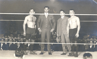
"The largest crowd ever to witness a wrestling bout in Roanoke gave what many regard as the greatest boxing champion that ever lived, Jack Dempsey, a tremendous ovation as he crawled through the ropes to referee the Dan O'Connor-'Father' Lumpkin bout…
PCS10.0
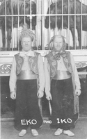
George and Willie Muse were born with albanism resulting in the exploitation in circuses and sideshows with the stage names Eiko and Iko. George and Willie's story is detailed in 'Truevine: Two Brothers, a Kidnapping, and a Mother's Quest' by Beth…
PCS 9.0
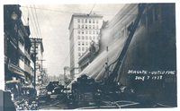
The Schulte-United department store afire as firemen try to contain the blaze.
PCS 8.1
S.H. Kress Five & Dime was located at 302 S. Jefferson Street.
PCS 8.0
"Commencing yesterday the delivery of ice to consumers by Roanoke Ice Corp. Recently organized to take over the plants of the Consumers Ice Company and the Griggs Packing Company."
PCS 7.0
Home located on Campbell Avenue. Address unknown.
PCS 6.4
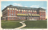
Hill Crest Hall was the female dormitory for employees of American Viscose.
PCS 6.3
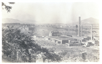
Birds-eye view of American Viscose. American Viscose, once the world's largest producer of artificial silk, opened in 1917. By the 1920s, the plant employed more than 5,000 people. American Viscose remained in business until 1948. Hill Crest Hall, a…
PCS 6.2
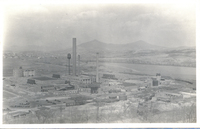
Birds-eye view of American Viscose. American Viscose, once the world's largest producer of artificial silk, opened in 1917. By the 1920s, the plant employed more than 5,000 people. American Viscose remained in business until 1948.
PCS 6.1
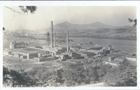
Birds-eye view of American Viscose. American Viscose, once the world's largest producer of artificial silk, opened in 1917. By the 1920s, the plant employed more than 5,000 people. American Viscose remained in business until 1948.
PCS 6.0
Trolley tracks wind in front of Hill Crest Hall, the female dormitory for American Viscose.
PCS 5.4
The parsonage of St. James Methodist Episcopal Church was located in the 300 block of 5th Street NW.
PCS 5.3
First Methodist Episcopal Church parsonage. The church and parsonage were located on the corner of Gilmer Avenue and Commonwealth Avenue NE.
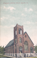
PCS 5.2
Progressive Brethren Church was located at 620 Salem Avenue SW.
PCS 5.1
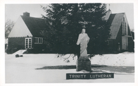
Trinity Lutheran Church is located at 4040 Williamson Road.
PCS 5.0
Enon Baptist Church is one of the oldest Baptist churches in the Roanoke Valley. Built in 1855 across from the entrance of present-day Hollins University, the church was established by Charles Cocke, president of Hollins Institute.
PCS 4.0
Sealtest Varieties' boys, left to right: Buster Wingfield, Tommy Pendleton, Roy Hardy, and Jimmy English.
PCS 3.20
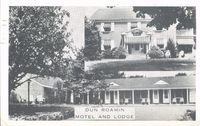
The Dun Roamin' Motel and Lodge was located at 1803 Williamson Road NE.
PCS 3.19
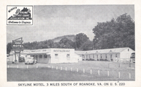
The Skyline Motel is located at 5458 Franklin Road.
PCS 3.18
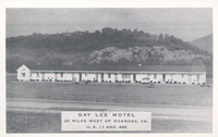
The Gay Lee Motel was located 20 miles west of Roanoke on US 460.
PCS 3.17
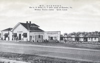
Mt. Scenery Tourist Court was located at 3111 Williamson Road NW.
PCS 3.16
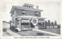
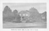
Rest Haven Tourist Home was located 2 miles north of Roanoke on Route 11.
PCS 3.15
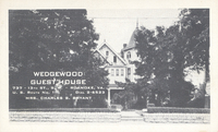
Wedgewood Guesthouse was located at 737 13th Street SW.
PCS 3.14
The 220 Motel was located 2 miles south of Roanoke on US 220.
PCS 3.13
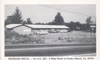
The Redwood Motel is located at 18021 Virgil H Goode Highway in Rocky Mount.
PCS 3.12
Woodhaven Tourst Home was located at 2802 Williamson Road.
PCS 3.11
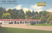
Lee-Hy Auto Court was located west of Roanoke on Route 11.
PCS 3.10
Michigan Tourist Court was located two miles east of Salem on Route 11.
PCS 3.9
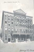
The Hotel Stratford was located at 102-106 N. Jefferson Street.
PCS 3.8
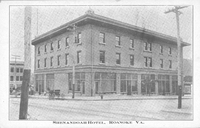
The Shenandoah Hotel opened on 5 November 1909. Originally consisting of two buildings, separated by an 8-foot alley, the Salem Avenue facing building seen here would later become the Hotel Lee followed by the Hotel Earle. The building was destroyed…
PCS 3.7
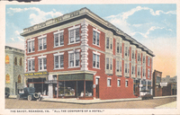
The Savoy was located at 518 2nd Street SW, currently 450 2nd Street SW.
PCS 3.6
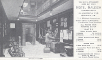
Interior of Hotel Raleigh office and lobby. Hotel Raleigh was located at 126 Campbell Avenue SW.
PCS 3.5
Air Castle Tourist Court was located at 7121 Williamson Road.
PCS 3.4
Air Castle Tourist Court was located at 7121 Williamson Road.
PCS 3.3
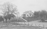
The Mountain View Inn was located in Natural Bridge.
PCS 3.2
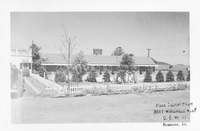
Plaza Tourist Court was located at 3011 Williamson Road. NE
PCS 3.1
Silver Gables Tourist Court was located at 3404 Brandon Avenue SW.
PCS 3.0
Silver Gables Tourist Court was located at 3404 Brandon Avenue SW.
PCS 2.0
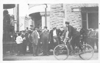
Crowd surrounds a Vinton-bound trolley. Location unknown.
PCS 1.0

Daughers of Liberty members seated in a parade float.
Medi Cen, 1964
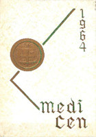
Medi Cen was the annual for Roanoke Memorial Hospital Nursing School.
The Dragon Legend, 1978
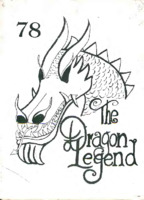
The Dragon Legend was the annual for Roanoke County Occupational School.
The Dragon Legend, 1977
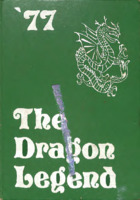
The Dragon Legend was the annual for Roanoke County Occupational School.
The Key 1982
The Key is the annual for Roanoke Catholic High School.
The Key 1981
The is the annual for Roanoke Catholic High School.
The Talon 1957
The Talon was the annual for National Business College.
National Business College 1930
Yearbook for National Business College.
National Business College 1929
Yearbook for National Business College.
The Pin 1972
The Pin was the annual for Burrell Hospital-Lucy Addison High School of Nursing.
Preston Park Elementary School 2018
Yearbook for Preston Park Elementary School.
The Key 1980
The Key is the annual for Roanoke Catholic High School.
Morningside Elementary School 2017
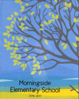
Yearbook for Morningside Elementary School.
Norsemen 1998
The Norsemen is the annual for Northside Middle School.
A Guide to the Gainsboro Neighborhood Organization Collection

The Gainsboro Neighborhood Organization Collection consists of two (2) record storage boxes, consisting of two hundred and thirty two (232) folders altogether. The collection includes various documents including meeting minutes, agendas, membership…
Oak Leaves 1988
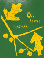
Oak Leaves is the annual for Oak Grove Elementary School.
The Gale 1965
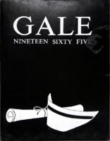
The Gale was the annual for Lewis-Gale School of Nursing.
Cornett 1948
The Cornett was the annual for the Cornett School of Business.
The Colonel 1940

The Colonel was the annual for Colonial High School.
Animo 2010

The Animo is the annual for Franklin County High School.
The Squire 1993
The Squire is the annual for Cave Spring Middle School.
Pioneer 2005

The Pioneer is the annual for Andrew Lewis Middle School.
Crystal Spring Elementary School
Annual for Crystal Spring Elementary School.
Crystal Spring Elementary School 2009
Annual for Crystal Spring Elementary School.
Crystal Spring Elementary School 1995
Annual for Crystal Spring Elementary School.
North Star 1973
The North Star is the annual for Northside High School.
Eagle 1952
The Eagle was the annual for Carver High School.
Eagle 1950
The Eagle was the annual for Carver High School.
TR Map

TR's Map of a portion of Roanoke.
RT Map
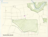
RT's Map of Special Places.
CW Map
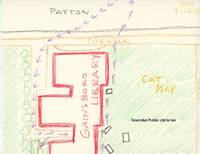
A cat map of the Gainsboro Library.
EP921
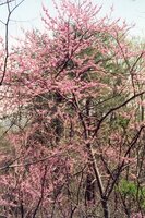
Redbud tree. Date on back is 10 April 1995.
EP920
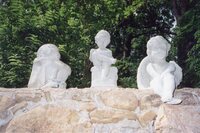
Three statues on stone wall. From left to right: child with arms around knees, child sitting on stand with book in lap, cherubim. Date on back is 14 June 1994.
EP919
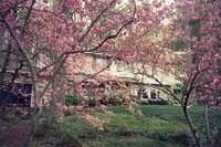
Pink spring trees in front of home. Date on back is 10 April 1995.
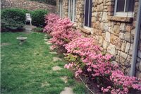
EP917

Close up of Rhododendron flowers. Date on back is 14 June 1994.
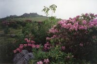
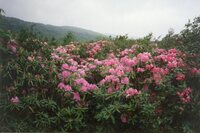
EP918
Rhododendron plant with hill in background. Date on back is 14 June 1994.
EP916

Close up of Rhododendron flowers. Date on back is 14 June 1994.
EP915
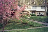
Spring trees in front of home with driveway to home in background. Date on back is 10 April 1995.
EP914
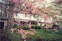
Rhododendron tree in front of home. Date on back is 10 April 1995.
EP913
Rhododendron flowers surrounding siding of home. Date on back is 10 April 1995.
EP912
Rhododendron plant with mountain in background. Date on back is 24 June 1994.
EP911
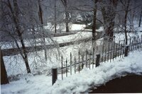
Snow on yard with ice on fence. Date on back is 11 February 1993 .
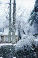
EP910
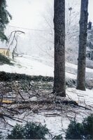
Branches on ground with snow covered trees in the background. Date on back is 11 February 1993.
EP909
Front yard of home with snow on the ground, road plowed. Date on back is 11 February 1993.
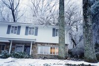
EP908
Powerline with ice on line. Home in background and snow on the ground. Date on back is 11 February 1993.
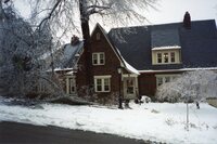
EP907
Front of home with snow on the ground. Date on back is 11 February 1993.
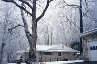
EP906
Trees in front yard of home with snow covering the ground. Date on back is 11 February 1993.
EP905
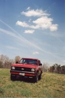
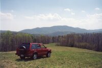
Rupert Cutler’s vehicle parked in field. Date on back is 10 April 1995.
EP904
Rupert Cutler’s vehicle parked in field with Blue Ridge mountains in the background. Date on back is 10 April 1995.
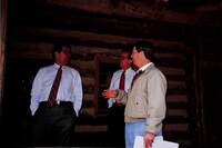
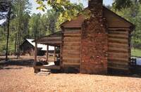
EP903
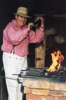
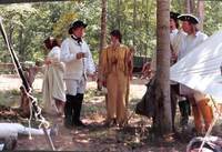
Daniel Young in historical attire on the left with fire and blacksmith tools on the right. Writing on the back says “Virginia’s Explore Park interpreter Daniel Young demonstrates the black-smithing skills that were so important to settlers. This…
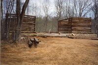
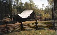
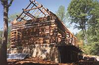
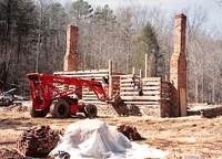
EP902
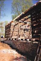
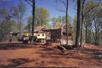
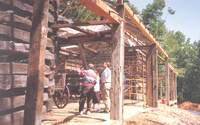
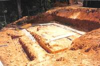
Houtz Barn under construction with roof unconstructed. Date on back is 15 April 1994.
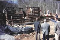
EP901
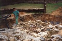
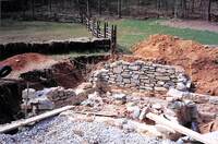
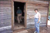
Man walking out of underground construction with stone and gravel surrounding the area for building next to Wray Barn and Hofauger house. Date on back is 15 April 1994.
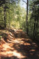
EP900
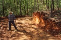
Man on left standing in dirt trail. Date on back is 28 April 1994.
EP899
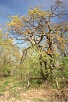
Tree with unique shaped branches. Date on back is 24 May 1994.
EP898
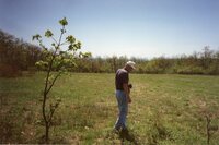
Man with camera around neck standing in field next to small tree that is on the left. Date on back is 24 May 1994.
EP897
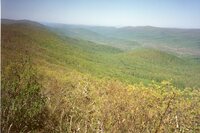
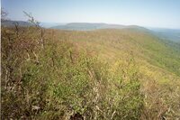
Overlook in Jefferson National Forest with mountains in background. Date on back is 24 May 1994.
EP896
Overlook in Jefferson National Forest. Date on back is 24 May 1994.
EP895
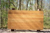
Sign that says“Minie Ball Hill: On May 12, 1864, An infantry column commmanded by General George Cook (U.S.A) traveled this road following the battle of Cloyd’s Mountain. The road became almost impassable due to heavy rains and with the confederates…
EP894
From Jefferson National forest, individual on right and in background looking out towards mountains. Date on back is 24 May 1994.
EP893
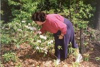
Woman bending over smelling flowers in forest. Date on back is 24 May 1994.
EP892
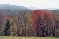
From hill, trees with mountains in background. Date on back is 10 April 1995.
EP891
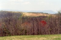
Hill top with mountains in background. Date on back is 10 April 1995.
EP890
Bern Ewart gesturing to building next to Hofauger Farmstead with two men. Date on back is 08 February 1993.
EP889
Three individuals on left looking at abandoned, weathered building.
EP888
Old building with deteriorating siding.
EP887
Machine on right with individuals on left on foundation of building under construction. Date on back is 11 February 1993.
EP886
Bern Ewart on right holding map in hands speaking to two men. Tractor in background. Date on back is 11 February 1993.
EP885
Bern Ewart on right speaking with two men in glasses on Hofauger House porch. Date on back is 08 February 1993.
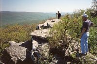
EP884
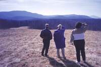
Three individuals looking past field towards Blue Ridge mountains. Date on back is 08 February 1993.
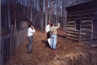
EP883
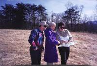
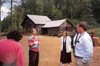
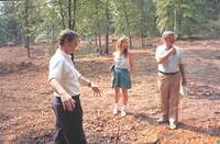
Three individuals looking at map in woman on the right’s hands who is pointing to map. Date on back is 08 February 1993.
EP882
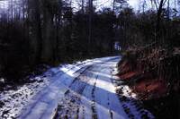
Road with snow on the ground. Date on back is 08 February 1993.
EP881
Road with snow on ground. Date on back is 08 February 1993.
EP880
Man smiling at camera with camera around his neck. In front of Wray Barn in the snow. Date on back is 08 February 1993.
EP879
Foundation/stables of Houtz Barn with snow on the ground. Date on back is 08 February 1993.
EP878
Foundation/stables of Houtz Barn completed with snow on the ground. Date on back is 08 February 1993.
EP877
Foundation of Houtz Barn during construction in the snow. Date on back is 08 February 1993.
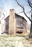
EP876
From outside of fence, Brugh Tavern (original site) with snow melting. Date on back is 04 February 1993.
EP875
From road, Brugh Tavern (original site) in the snow. Date on back is 04 February 1993.
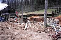
EP874
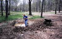
Woman with shovel in hand digging up dirt around small area with water. Wheel barrow on the right. Date on back is 15 April 1994.
EP873
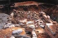
Underground stone siding of building next to Hofauger House and Wray Barn. Date on back is 15 April 1994.
EP872
Foundation of building next to Hofauger House with stone being laid down underground. Individual on left with wheelbarrow. Stone and materials surrounding area. Wray Barn in background on left. Date on back is 15 April 1994.
EP871
Foundation of building with stone and brick in disarray. Date on back is 15 April 1994.
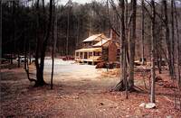
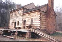
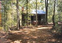
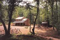
EP870
Hofauger House from distance with porch constructed but not painted. Vehicles in background.
EP869
Hofauger House before porch is finished. Logs laying against porch. Date on back is 23 November 1992.
EP868
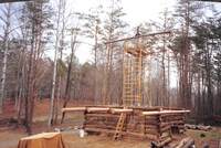
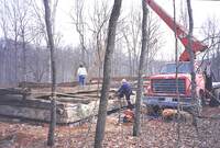
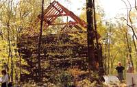
Wray Barn with metal structure in middle supporting top beam and attached to rest of barn. Construction materials surrounding scene. Date on back is 30 November 1992.
EP867
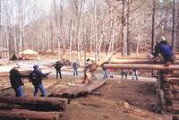
People laying down logs by raising it with rope for construction of Wray Barn. Date on back is 05 December 1992.
EP866
Houtz Barn under construction with machine on right. Date on back is 28 April 1994.
EP865
Dirt trail dug out surrounding by trees. Date on back is 28 April 1994.
EP864
Front of Houtz Barn under construction with incomplete stone siding on bottom. Date on back is 28 April 1994.
EP863
Houtz Barn from the side with incomplete roof and siding. Date on back is 28 April 1994.
EP862
Houtz Barn under construction taken from front angle. Construction materials and machine in frame on the right. Date on back is 28 April 1994.
EP861
Houtz Barn under construction with incomplete roof and windows. Machine on left. Date on back is 28 April 1994.
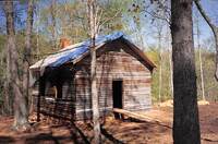
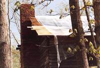
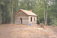
EP860
Kemp’s Ford School house with tarp on roof. Wooden ramp leading to doorway. Date on back is 28 April 1994.
EP859
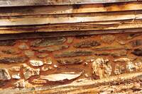
Underground area of building showing brick and cement foundation. Date on back is 15 April 1994.
EP858
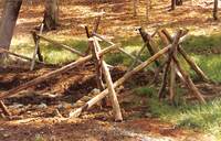
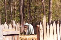
Stick fencing surrounding dug out area.
EP857
Two women in historical attire (Laurie Spangler on right) in historical attire walking away from Hofauger House.
EP856
Woman in historical attire plowing garden in fenced area behind Hofauger House.
EP855
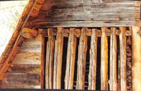
Bottom stone foundation for Houtz Barn.
EP854
Siding of roof for Houtz Barn.
EP853
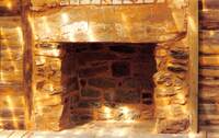
Fireplace of Hofauger House.
EP852
Chimney of Kemp’s Ford Schoolhouse with tarp on roof.
EP851
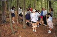
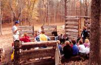
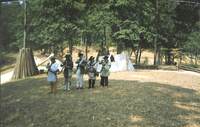
From trail, group of people with children walking along trail to Kemp’s Ford Schoolhouse. Tent/pavilion set up in background.
EP850
Through trees, side profile of Houtz Barn with unfinished roof and exterior. People on the right..
EP849
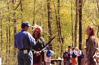
On left, Rupert Cutler speaking to Dan Abbott who is in Native American attire. On the right, another Native American interpreter is watching scene. Children in background. .
EP848
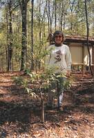
Woman smiling at camera posing behind small tree. Date on back is 28 April 1994.
EP847
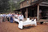
Tables with food and people in line for food in front of Hofauger House. Date on back is 28 April 1994.
EP846
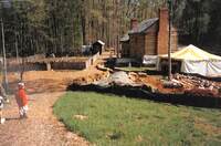
Along trail leading to back of Hofauger House, garden on left and Hofauger house on right. Construction materials blocked off on right with tent on right. Sign that says “Appalachian Power” Date on back is 28 April 1994.
EP845
From outside of fence, Wray Barn. Date on back is 28 April 1994.
EP844
Taken from overhead, a trail behind Wray Barn. Wray Barn in distance. Date on back is 28 April 1994.
EP843
People surrounding narrow vehicle. On the left, poster with details. Date on back is 28 April 1994.
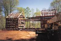
EP842
Clearing with trees cut down. Wray Barn and Hogauger house in background. Tents set up near buildings. Date on back is 28 April 1994.
EP841
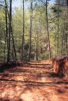
Dirt path with trees surrounding path. Date on back is 10 May 1994.
EP840
Side view of Kemp’s Ford Schoolhouse under construction. Date on back is 10 May 1994.
EP839
Side view of Houtz Barn unfinished. Date on back is 10 May 1994.
EP838
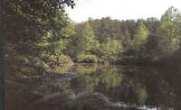
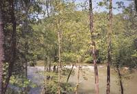
Trees alongside body of water. Taken from bank of lake. Date on back is 10 May 1994.
EP837
Side view of Hofauger House with Wray Barn in background on left. Date on back is 10 May 1994.
EP836
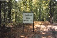
Sign that says “Site of Future Regional Information Center” with yellow tape in background. Date on back is 10 May 1994.
EP835
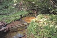
Foliage surrounding stream. Date on back is 10 May 1994.
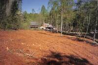
EP834
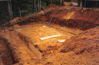
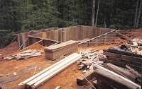
Ground dug out for construction of building. Foundation already in progress. Date on back is 17 May 1994.
EP833
Ground dug out behind Houtz Barn with foundation already in progress. Date on back is 17 May 1994.
EP832
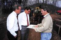
Ground dug out for construction of building. Foundation already in progress. Date on back is 17 May 1994.
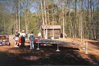
EP831
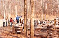
Man on left speaking to group of people on the right with construction materials in background. Date on back is 17 May 1994.
EP830
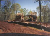
Unfinished Houtz Barn with people standing in front of it. Date on back is 17 May 1994.
EP829
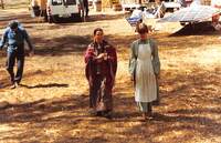
Side view of group of people looking to right of the camera. Date on back is 17 May 1994.
EP828
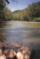
From the bank, Roanoke river with trees in the background. Date on back is 17 May 1994.
EP827
Through trees, Roanoke River in background. Date on back is 17 May 1994.
EP826
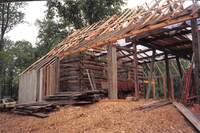
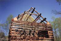
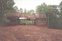
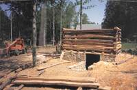
Houtz Barn with roof and back wall unfinished. Date on back is 26 May 1994.
EP825
Bern Ewart with group of people in unfinished Houtz Barn. Date on back is 24 May 1994.
EP824
Bern Ewart on left speaking to a group of people in front of Wray Barn. Date on back is 24 May 1994.
EP823
Through trees, Hofauger House in background. Date on back is 24 May 1994.
EP822
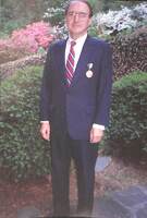
Rupert Cutler standing in front of bushes with medal pinned to suit. Date on back is 20 May 1994.
EP821
Rupert Cutler with medal pinned to suit on right standing next to portrait of himself. Date on back is 20 May 1994.
EP820
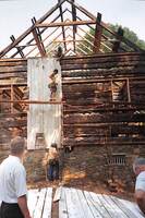
Houtz Barn with unfinished roof and walls. People inside barn. Date on back is 20 May 1994.
EP819
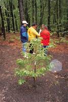
Small tree in forest with group of people huddled around another tree in background. Date on back is 20 May 1994.
EP818
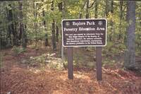
Sign that says “Explore Park Forestry Education Area (with badge that says Society of American Foresters 1900) this trail was created by volunteers from the Blue Ridge Chapter of the Society of American Foresters, the national scientific and…
EP817
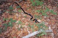
Black snake slithering on forest ground. Date on back is 26 May 1994.
EP816
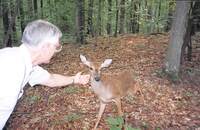
Man on left holding out palm for deer. Date on back is 26 May 1994.
EP815
Bern Ewart on right holding hand out for deer who is coming towards Ewart. Man on right walking towards deer. Date on back is 26 May 1994.
EP814
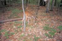
Deer grazing in forest. Date on back is 26 May 1994.
EP813
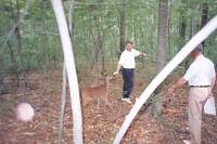
Bern Ewart on left gesturing towards dirt trail below them with man on right. Woman going down to dirt trail. Date on back is 26 May 1994.
EP812
In clearing, Bern Ewart on left gesturing to ground with woman and man on the right looking to the right. Date on back is 26 May 1994.
EP811
Building under construction with beams and wood paneling surrounding site. Date on back is 26 May 1994.
EP810
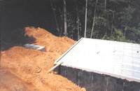
Underground foundation of building being constructed with tractor in background on left and two men working on concrete. Date on back is 24 May 1994.
EP809
Underground foundation of building being constructed. Date on back is 24 May 1994.
EP808
Siding of Houtz Barn being put up by construction workers. Date on back is 26 May 1994.
EP807
Houtz Barn under construction. Group of people in background looking at interior construction of barn. Date on back is 24 May 1994.
EP806
Man on left posing next to sign on cobblestone that says “Minie Ball Hill: On May 12, 1864, An infantry column commmanded by General George Cook (U.S.A) traveled this road following the battle of Cloyd’s Mountain. The road became almost impassable…
EP805
Sign that says “Mountain Lake Wilderness Area Hiking Trails. Wheeled vehicles and motorized equipment prohibited. Chestnut Trai (with smaller print details) War Branch Trail (with smaller print details) (and a map of trails.) Jefferson National…
EP804
Backside of Administrative offices. Date on back is 26 May 1994.
EP803
Administrative offices. Date on back is 26 May 1994.
EP802
Dug out path with water flowing in forest. Date on back is 21 March 1991.
EP801
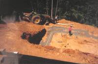
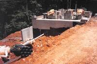
Building with completed foundation and pipes attached. Dirt piles on the left. Taken from an overhead view. Date on back is 21 June 1994.
EP800
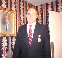
Bern Ewart on left against porch of Hofauger House with man writing in notepad sitting on porch on the right. Date on back is 21 June 1994.
EP799
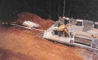
Side view of building under construction. Foundation with concrete bricks on top of it in background on the right. Pipes and dirt dug out on the left. Date on back is 27 June 1994.
EP798
Building with concrete foundation with concrete bricks on top of foundation on right. Pipes next to dirt hill on left. Taken from overhead view. Date on back is 27 June 1994.
EP797
Building with concrete foundation with concrete bricks on top of foundation. Taken from overhead view. Date on back is 27 June 1994.
EP796
Underground section of unfinished building being supported by beams. Date on back is 31 May 1994.
EP795
Woman on right, pointing to ground. Clearing with wooden logs bordering in background. Date on back is 31 May 1994.
EP794
In forest, children looking at tree with adults behind them. Date on back is 31 May 1994.
EP793
Standing in Wray Barn while under construction, man on left speaking to children surrounding walls of barn. Date on back is 10 December 1991.
EP792
Man elevated amid crowd pointing to the right. Wray Barn under construction behind him. Date on back is 06 November 1991.
EP791
Building under construction with materials surrounding site. Wray Barn in the background on the left. Date on back is 21 June 1994.
EP790
On the left, a Skytrak machine. On the right, building under construction with materials surrounding site. Date on back is 21 June 1994.
EP789
On the right, men in suits looking at Hofauger House under construction. Man in plaid standing with them pointing to house. Date on back is 05 February 1992.
EP788
Hofauger House being built. Skytrak Machine in front of house. Bricks in front.
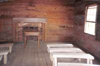
EP787
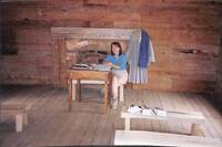
Woman seated at front desk in Kemp’s Ford Schoolhouse with books opened on desk. Fireplace and historical attire behind her. Clipboards on bench in front of her. Date on back is 27 June 1994.
EP786
Interior of Kemp’s Ford schoolhouse taken from back of building. Fireplace and front desk in center front with benches along the side. Date on back is 27 June 1994.
EP785
Woman on the right smiling touching exterior of Kemp’s Ford Schoolhouse. Man inside of building with back to camera. Date on back is 27 June 1994.
EP784
Kemp’s Ford Schoolhouse with window gutted out and old roof on ground. Date on back is 31 May 1994.
EP783
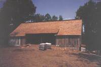
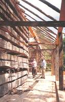
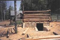
Houtz Barn with completed roof. Wrapped materials in front on barn. Date on back is 27 June 1994.
EP782
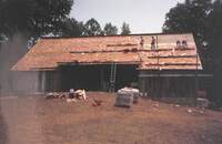
People working on roof of Houtz Barn with most of roof done. Date on back is 27 June 1994.
EP781
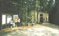
On the right, New Mountain Mercantile. On the left, people putting up signs with images and caption. Middle sign says “Welcome to Virginia’s Explore Park” Date on back is 06 July 1994.
EP780
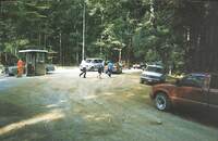
Vehicles along gravel road. Ticket booth on the left. Three individuals walking to the right. Date on back is 06 July 1994.
EP779
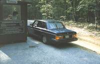
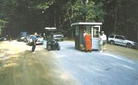
From behind, Volvo on right at ticket booth entrance on left. Sign on booth says “Tickets” and “Admission Charges Adults: $4.00 Students (6-18 years old) $2.50 Children Free. $20.00 Minimum on VISA & MasterCard. Special rates available for groups of…
EP778
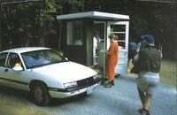
White Chevrolet at Ticket booth. People surrounding booth. Date on back is 06 July 1994.
EP777
Cars lined up along gravel road with ticket booth in center. Group of people huddled around ticket booth. Man to the side of the road on the left. Date on back is 06 July 1994.
EP776
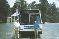
Two men posing with bus that says “Virginia Museum of Transportation” “Shuttle” sign at top and “Explore Park” sign in window of shuttle. Church in background on the left. Date on back is 06 July 1994.
EP775
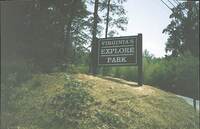
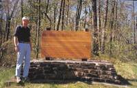
Close up of sign that says “Virginia’s Explore Park” Date on back is 06 July 1994.
EP774
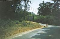
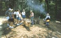
Sign on hillside that says “Virginia’s Explore Park” with road in background on the right. Date on back is 06 July 1994.
EP773
Daniel Young on the left in historical attire speaking to group of people with tools in front of him on a bench. Man in historical attire at outdoor grill on the right. Date on back is 06 July 1994.
EP772
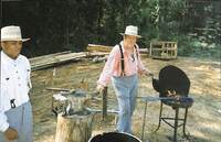
Daniel Young in historical attire working outdoor grill with anvil on the left. Man on left in historical attire. Wooden beams in background. Date on back is 06 July 1994.
EP771
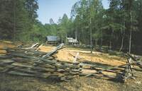
Fence surrounding Hofauger Homestead. Wray Barn and Hofauger house in background. Date on back is 06 July 1994.
EP770
Trails of Explore Park. Houtz Barn in the Background on the left. Date on back is 06 July 1994.
EP769
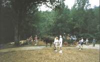
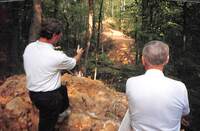
People walking along trail with horse drawn carriage carrying people in background. Date on back is 06 July 1994.
EP768
Individuals in horse drawn carriage. Woman with back to camera on the left waving to riders. Man on the right looking at woman. Date on back is 06 July 1994.
EP767
Group of people with backs to camera watching presentation being putting on by Scott Sarver. British flag hoisted up in background. Date on back is 06 July 1994.
EP766
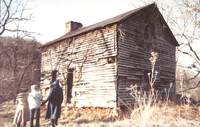
In front of New Mountain Mercantile, Rupert Culter (on the right) posing with three men. Man on left of Cutler has arm in sling. Date on back is 06 July 1994.
EP765
In Kemp’s Ford Schoolhouse, woman on the right in historical attire holding chalkboard with child in historical attire on the left. Girl in historical attire at front desk, with individuals watching presentation on the right. Date on back is 06 July…
EP764
People in historical attire walking along trail with children in back of line. Date on back is 06 July 1994.
EP763
Men lined up in historical attire pointing guns to the right in front of them. Date on back is 06 July 1994.
EP762
Men lined up in historical attire loading guns with huts and tents in background. Date on back is 06 July 1994.
EP761
Men lined up in historical attire loading guns with huts and tents in background. Date on back is 06 July 1994.
EP760
Man sitting on stool on the right playing a stringed instrument. Three individuals surrounding him, on on the left holding a camera. Date on back is 06 July 1994.
EP759
Group of people surrounding Kimberly Burnette at spinning wheel on porch of Hofauger House. Date on back is 06 July 1994.
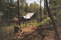
EP758
Trees in forest with Houtz Barn in background up the hill. Date on back is 06 July 1994.
EP757
Family with young children seated on bench smiling for camera. Date on back is 06 July 1994.
EP756
Dan Abbott in Native American attire on the right standing on blanket with artifacts, tools, and weapons. Group of people to the left watching him. Date on back is 06 July 1994.
EP755
Group of people standing around side of Kemp’s Ford Schoolhouse.
EP754
Group of people in historical attire chatting with one another. . Wagon in background on the right.
EP753
Men in historical attire seated against hut. Crowds of people in background with pavilion tent in background.
EP752
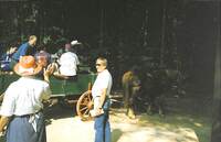
Horse drawn wagon with individuals riding in wagon. Individuals in group outside of wagon on road.
EP751
Woman on left speaking to Mayor Noel Taylor on left with Houtz Barn in background. People surrounding the area.
CSE067.15

Photo of a photo. Women posing in Order of the Eastern Star apparel.
CSE067.14

Photo of a photo. Women posing in Order of the Eastern Star apparel.
CSE067.13

Photo of a photo. Women posing in Order of the Eastern Star apparel.
CSE067.12

Photo of a photo. Women posing in Order of the Eastern Star apparel.
CSE067.10

Photo of a photo. Group of women in Order of the Eastern Star apparel posed for a photograph.
CSE067.9

Man posed for his portrait in front of a plain backdrop. Assumedly taken in Clark Studio or other home. William D. Coleman, principal of Loudon Elementary School.
CSE067.8

Photo of a photo. Group of women in Order of the Eastern Star apparel posed for a photograph.
CSE067.7

Photo of a photo. Women posing in Order of the Eastern Star apparel.
CSE067.6

Photo of a photo. Women posing in Order of the Eastern Star apparel.
CSE067.5

Photo of a photo. Women posing in Order of the Eastern Star apparel.
CSE067.4

Photo of a photo. Women posing in Order of the Eastern Star apparel.
CSE067.1

Photo of a photo. Group of four women standing together.
EP750
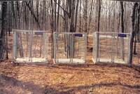
Three animal cages with woods in background. Date on back is 03 April 1995.
EP749
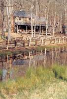
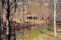
Close up of pond in front of fence surrounding Hofauger Farmstead. Hofauger House in background. Date on back is 03 April 1995.
EP748
Taken from a farther distance, pond in front of fence surrounding Hofauger Farmstead. Hofauger House in background. Date on back is 03 April 1995.
EP747
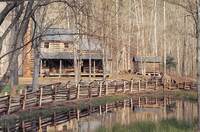
Pond in front of fence surrounding Hofauger Farmstead. Hofauger House in background. Date on back is 03 April 1995.
EP746
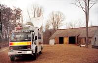
News 7 van on left with Houtz Barn on the left in background. Date on back is 03 April 1995.
EP745
“News 7” van in front of Houtz Barn. Date on back is 03 April 1995.
EP744
Wood grinder machine in clearing. Named “Industrial Grinder” Date on back is 03 April 1995.
EP743
Road sign on the right that says “Mill Mountain Zoo and Star” with arrow pointing to the right. Another sign that says “Explore Park” with arrow pointing straight ahead. “Mill Mountain Park” sign in background on the right with road leading to Mill…
EP742
Road sign that says “Mill Mountain Zoo and Star” with arrow pointing to the right. Another sign that says “Explore Park” with arrow pointing straight ahead. “Mill Mountain Park” sign in background with road leading to Mill mountain. Date on back is…
EP741
Another close up of Rupert Cutler posing for picture with Blacksmith shop under construction in background.
EP740

Close up of Rupert Cutler posing for picture with Blacksmith shop under construction in background.
EP739
Rupert Cutler sitting on wooden roofing with Blacksmith shop under construction in background.
EP738
Close up of wooden slats in building. Date on back is 28 March 1994.
EP737
Rupert Cutler smiling with arm against post.
EP736
Woman on left standing on rocks surrounding creek in forest. Date on back is 28 March 1994.
EP735
Front view of original Brugh Tavern with street on left and fencing surrounding house on right. Snow on the ground. Date on back is 04 February 1993.
EP734

Man sitting down at desk smiling with little girl in lap, arms around each other.
EP733
Side view of Blacksmith shop under construction with materials surrounding the building. Two individuals in the background on the left.
EP732
Trail leading up a hill on the left with train tracks on the right. Date on back is 28 March 1994.
EP731
Dan Abbott laying down material on miniature sweat lodge on table. With map behind him.
EP730
Original Brugh Tavern in the snow with silos in background. Date on back is 04 February 1993.
EP729
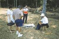
Dan Abbott holding materials for replica miniature sweat lodge that is on table in front of him with individuals listening seated around table. Map of Virginia’s Explore Park in background.
EP727
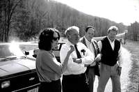
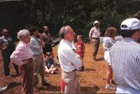
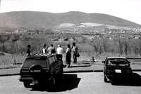
From left to right, Faye Cooper, Robert Dennis, Bob Hope, Bob Fetzer parked near outlook on Blue Ridge Parkway. Writing on back says “From Left: Faye Cooper, Exec. Director, Valley Conserv. Council, Staunton. Rob’t T. Dennis, Pres. Piedmont…
EP728
From behind, individuals looking at view of mountains at outlook off of Blue Ridge Parkway. From left to right, woman, Bob Fetzer, Bob Hope, Robert Dennis, Faye Cooper, and individual holding camera taking picture. Writing on back says "Parkway near…