
Browse Items (195 total)
Sort by:
PCS 85.0
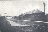
For many years, Salem had also benefited from passenger service provided by the Virginian Railroad. Virginian passenger service in Salem ended in 1954, five years prior to its merger with the N&W.
PCS 84.0
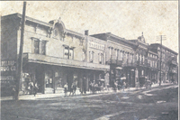
Prominent on the left is a sign for W.B. Dillard Drug Co., Prescription Druggists, Soda and Mineral Waters. Watts Dillard was a prominent Salem business man involved in numerous civic projects. His drugstore, at the corner of Main and College, got a…
RVNH5039

Lakeside Amusement Park. The Wildcat roller coaster was replaced by the Shooting Star in 1968.
RVNH5029

Judy Holladay was crowned as Salem's Sesquicentennial Queen.
MIC8 Rowe Furniture

Rowe Furniture Company was located at 239 Rowan Street in Salem before moving to Elliston.
MIC7 Yale & Towne

Yale & Towne Manufacturing Company. Located at 1242 S. Colorado Street, the building is now used by Graham-White.
MIC5 General Electric

General Electric, located at 1531 Roanoke Boulevard in Salem.
UCT22

The Crawford Hotel stood on Main Street and was erected by W.D.F. Duval in 1871. It contained 40 to 50 rooms with bath tubs and running water. For a few years, the hotel was owned by the Chapman family and renamed the Lucerne.
RVNH5016

A montage of attractions at Lakeside Amusement Park.
RVNH5014

A view of the midway at Lakeside Amusement Park.
MP 5.41 Lakeside

Ferris wheel and Scrambler at Lakeside Park
MP 5.4 Lakeside

The Sky-Tram at Lakeside Park.
MP 50.3 Crystal Spring Laundry

Crystal Spring Laundry and Cleaners, formerly located at 2049 E. Main Street in Salem.
RVNH40268 Our Lady of Perpetual Help

First chapel of Our Lady of Perpetual Help Catholic Church in Salem.
RVNH40267 Fort Lewis

Ruins of Fort Lewis mansion after it was destroyed by fire on 25 July 1949.
RVNH40150 College and Fourth

Intersection of College Avenue and Fourth Street in front of Andrew Lewis High School.
RVNH40149 Mary Brand

Mary H. Brand and an unidentified student on the lawn of Andrew Lewis High School.
RVNH40148 David McClung

A Jeep, driven by David McClung, II is nearly driven in to Andrew Lewis High School.
CS 014

Salem Baptist Church service.
FE270 Main Street
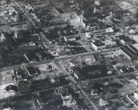
Aerial viewing showing Main Street in Salem near the intersection with Union Street and Academy Street.
TNC 58.2 Richfield
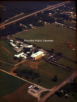
Aerial view of Richfield Living. View shows nursing care center built in 1971 located at 3615 W Main Street in Salem.
TNC 58.1 Richfield
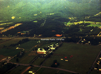
Aerial view of Richfield Living. View shows nursing care center built in 1971 located at 3615 W Main Street in Salem.
TNC 58.0 Richfield
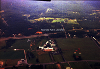
Aerial view of Richfield Living. View shows nursing care center built in 1971 located at 3615 W. Main Street in Salem.
HNWR155
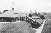
A postcard image of the N&W depot at Salem, Virginia. The depot still remains, although the shed at the tracks was dismantled many years ago. During the 1930s, depots like this dotted the lines of the N&W. Few remain today, either abandoned or in…
SR174 Veterans Administration

The VA facility erected structures such as the nurses’ home to house medical staff. The first patients were admitted on April 23, 1935. Some of the patients, as a form of therapy, actually conducted farming operations on the grounds of the…
SR170 Roanoke College

The Class of 1933 contributed funds for the landscaping and drive that made the “High Street Gateway.” The entrance and subsequent drive were made necessary at the time by the large number of students possessing automobiles as well as increasing…
SR168 Roanoke College

The gymnasium shown here was built in 1930 for a total cost of $138,354. The gym was but one component of a large master plan to expand the college’s facilities. Unfortunately, only the gymnasium was completed on time as the Depression stopped…
SR167 Roanoke College

Smith Hall, named for a past president of the college, was erected in 1941. Designed by the firm of Eubank and Caldwell in Roanoke, the structure (originally a residence hall for forty women) was built and equipped for a total cost of $50,174.
SR162 Bittle Library

Bittle Memorial Library was named for Roanoke College’s early president, Dr. David Bittle. Bittle led the college through its move to Salem and during the Civil War. Bittle was one of three Salem leaders who officially surrendered Salem to the…
SR155 Farmers National Bank

The Farmers National Bank was organized May 8, 1871, with capital of $75,000. Through the leadership of Salem’s prominent businessmen, the bank weathered successfully economic turbulence that put other banks under during the latter part of the 18th…
SR154 Salem Civic Center

Dedicated in 1967 and financed through the sale of bond proceeds, the Salem-Roanoke Valley Civic Center opened as a recreational and cultural center for Salem. Noted historian Norwood Middleton termed this as “the single most talked-about project in…
SR153 Salem Filtration Plant

The filtration plant was an early element in Salem’s water supply infrastructure, but the water supply system itself dated to the 18th century. In 1874, the first concept for a water supply system was advanced to the town council, and in 1875 Salem…
SR152 Municipal Field

The land on which Municipal Field was located had originally been designed for use as an elementary school site. Further study, however, prompted Salem’s leaders to appreciate its use more for athletics. Thus, in the spring of 1932, Municipal Field…
SR150 Andrew Lewis Monument

One of the most notable citizens in the region’s early history was General Andrew Lewis. Though Lewis died before the town of Salem was officially plotted by James Simpson, his life was spent in its general vicinity. This monument was erected in…
SR149 Pierponts Brick Works

Pierpont's Brick Works was owned and operated by Salem businessman George E. Pierpont. In 1908, Pierpont was named as one of the privileged few in Salem to own an automobile.
SR148 Post Office

The construction of a "new" Federal post office on Main Street was a saga of many years. Land purchased by the government in 1917 went undeveloped until 1922 when construction finally commenced. The post office officially opened in June of 1923.
SR147 Hotel Fort Lewis

In 1927, Salem businessman Henry A. Oakey purchased the former Hotel Salem and changed its name to Hotel Fort Lewis. The structure was demolished in 1974 .
SR146 J.J. Newberry

One of the more contemporary establishments was J.J. Newberry Company. The card boasts, “Completely air-conditioned on two large selling floors, approximately ¾ mile counter space carrying over 30,000 separate items of merchandise. A modern…
SR145 Glass Plant

In 1911, the Piedmont Glass Company purchased and resurrected the old glass plant. During the early years, the plant employed some 125 workers who produced glass bottles for a variety of uses. The plant was closed for two months each summer due to…
SR144 Sherwood Burial Park

The Sherwood Burial Park, named for the old “Sherwood” estate that was near the property, was developed on a 35-acre tract in 1928 by C.B. Strickler.
SR137 Lake Spring

The purchaser of this card sent the following message to his brothers: “Your letter received this morning…Father is working for the Virginian R.R. at present…I expect to take an examination for a R.R. mail clerk sometime this fall.” His brothers…
SR136 Homestead Hotel

The Homestead Hotel has a long history. Built by David Wade in 1802, it was formerly known as the Old Globe Tavern with five huge fireplaces and 27-inch thick walls. At the time this card was published, it was the only original stage coach tavern…
SR135 Methodist Episcopal South

This was the sanctuary of the First United Methodist Church congregation from 1904 until 1953. It was located on the northeast corner of College and Clay Avenues.
SR134 Pentecostal Holiness

The congregation of Pentecostal Holiness Church was organized in 1915. Their present sanctuary, shown here, on North Bruffey Street was dedicated in April 1953.
SR133 College Lutheran

College Lutheran Church – This collage shows the various structures associated with College Lutheran. The congregation first met in the Roanoke College chapel (top left) from 1852 until 1858; then they built their first sanctuary (top right) which…
SR132 First Presbyterian

While termed “First” church here, the sanctuary is known as home to the Salem Presbyterian Church located on Main Street. Salem Presbyterian was organized in 1831 and dedicated this sanctuary in 1852. Additions were made in 1914 and 1958.
SR131 Central Methodist

Known originally as the First Methodist Episcopal Church when organized in 1908, the congregation later was called Second Methodist (1939) and then Central Methodist (1954). The sanctuary shown here was consecrated on June 26, 1955.
SR130 Bethel Methodist Episcopal

The Bethel African Methodist Episcopal Church was started in 1870 and at the date of this card’s printing (1912), it stood on the corner of Water Street and Calhoun.
SR128 St. Pauls Episcopal

St. Paul's Episcopal congregation was organized around 1867. The congregation moved a few times before erecting this sanctuary on Main Street in 1911 There have since been numerous acquisitions and additions to the facility.
SR127 Baptist Church

The Salem Baptist Church was organized in 1870 and dedicated their sanctuary at the corner of North Broad Street and College Avenue in 1873. An educational building was added in 1952. The new sanctuary seen today was erected in 1967.
SR126 G.W. Carver

– The George Washington Carver School was opened in the fall of 1940. The construction cost was $125,000. This new school was in response to the deterioration of the Water Street school
SR122 Salem High School

The architectural drawing gracing this card was done by G.R. Ragan. The new high school, built on Broad Street, opened in 1912, relieving the overcrowded Academy Street school. Additions followed in 1920 and 1923, but the school was heavily damaged…
SR122 Salem High School

What is now known as the Academy Street School served Salem’s students for many years. The building on the right was constructed in 1890 with an addition (left) coming in 1895. The original portion served the lower grades and the addition became…
SR121 Mount Regis

Tuberculosis sanatoriums were numerous in the first half of the last century. By the late 1960s, tuberculosis was controllable and facilities, such as Mount Regis, were converted to other uses usually health related.
SR120 Mount Regis

Mount Regis was built on Development Hill in South Salem. Mount Regis closed its doors as a sanitorium in 1939. The building was then taken over by the Youth Administration to provide housing for nurses aids in hospitals. After World War II, the…
SR119 Salem

In 1952, residents of South Salem started a petition drive to incorporate a new town, Mount Regis. This was countered by residents desiring annexation into Salem. With some legal maneuverings and posturing, the “Mount Regis” citizens settled down,…
SR117 Fort Lewis

The local chapter of the Daughters of the American Revolution erected in 1927 a monument marking the location of Fort Lewis which had been built by General Andrew Lewis.
SR114 Crawford Hotel

This hotel stood on Main Street and was erected by W.D.F. Duval in 1871. It contained 40 to 50 rooms with bath tubs and running water. For a few years, the hotel was owned by the Chapman family and renamed the Lucerne.
SR113 N&W Passenger Station

For many years, Salem had also benefited from passenger service provided by the Virginian Railroad. Virginian passenger service in Salem ended in 1954, five years prior to its merger with the N&W.
SR112 N&W Passenger Station

Passenger service at the Salem depot ended on April 30, 1965. On that day, YWCA kindergartners boarded the Powhatan Arrow for a trip to Christiansburg. That same year, the N&W donated the station to the town of Salem.
SR111 N&W Passenger Station

The N&W Railway donated and created a park near the passenger station in 1933 at College Avenue and 8th Street. The park was one of several that were developed in Salem during that time period.
SR110 N&W Passenger Station

The passenger station hosted a prominent visitor on October 19, 1934, when President Franklin Roosevelt came to dedicate the new Veterans’ Hospital. After the ceremony, the President came to Salem where he was escorted by Salem’s mayor and a cadre…
SR109 Strouse Home

The impressive home of Salem lawyer Demetrius B. Strouse on Broad Street was built around the turn of the last century. Strouse was involved in numerous civic and religious projects in the Roanoke Valley.
SR108 Ridgewood Farm

The Ridgewood farm land is today a developed retail corridor, known as the Ridgewood Village Center. The center opened in 1985 with a variety of stores and restaurants. The home, shown here, remains.
SR104 Lutheran Orphanage

The Lutheran Orphanage sold much of its land holdings in the 1960s to Salem for the purpose of erecting what is now the Salem Civic Center. The buildings were sold in 1985 to Roanoke College.
SR102 Lutheran Orphanage

The Lutheran Orphanage arrived in Salem in May of 1896, occupying a brick home on five acres at the corner of present-day Florida Avenue and Boulevard. The orphanage eventually bought the former Hotel Salem on College Avenue (shown here), which it…
SR101 Baptist Orphanage

Life at the orphanage often paralleled the events within Salem. Some of those were not positive. In 1918, a severe outbreak of the Spanish flu closed Salem’s schools, churches, and businesses for over a month. Sixty children at the Baptist…
SR100 Baptist Orphanage

The residence for the superintendent was constructed within the first decade of the orphanage’s operation. The residence allowed the superintendent to not only live on the campus but to host visitors and families.
SR099 Baptist Orphanage

This second cottage to be built for the orphanage was named for the institution’s first superintendent, the Reverend George J. Hobday, who served from 1891 until 1906.
SR098 Baptist Orphanage

The original 16 acres on which the orphanage sat was donated by businessman John M. Evans. The very first cottage to be built, which was completed on July 1, 1892, was named for the philanthropist.
SR097 Baptist Orphanage

By 1905, the Baptist Orphanage, which was just a decade old, was caring for 165 orphans. Some were placed in the institution’s care due to loss of parents, while others came to live because their families were impoverished. All needs of the…
SR096 Baptist Orphanage

The hill-top Baptist Orphanage prided itself on being self-sustaining in its early years. A generous donation of an additional 87 acres in 1897 allowed the orphanage to even operate a full-scale farm and dairy herd.
SR095 Baptist Orphanage

The cornerstone on the Administration Building was laid on July 4, 1901, becoming occupied in 1902. It’s red-brick castle-like structure was an imposing piece of architecture on the campus. The Administration Building was razed in 1965.
SR094 Baptist Orphanage

Before the advent of modern medicine, quarantine was often the best strategy to avoid the spread of disease. Salem, like all communities, had to impose its fair share of them. In 1905, the Baptist Orphanage was quarantined for two weeks due to an…
SR093 Baptist Orphanage

As a measure of Salem’s hospitality, many of the local churches, regardless of denomination, became involved with both the Baptist and Lutheran orphanages. In fact, Roanoke College offered free tuition to qualified students from both orphanages.
SR092 Baptist Orphanage

The Baptist Orphanage often brought visiting Baptists from around the state to Salem, who, according to the early Salem newspapers, would bring the children into town for entertainment and recreation.
SR090 Courthouse

Judge William Moffett convened the first session of Circuit Court in the new court room on April 1, 1910, and dedicated the day “for the hearing of matters and reading of papers of local historical interest.”
SR088 Courthouse

This photo postcard shows the old county courthouse. The structure was built in 1841 on a lot purchased by Roanoke County from John Gray of Missouri for $400. The courthouse was constructed by Salem hotelier William C. Williams. During the Civil…
SR086 Broad Street

Business leaders in Salem and Roanoke sought to promote their respective communities through a variety of promotional pamphlets. Scenes, such as the one above, were often included to demonstrate progress and prosperity. Salem was labeled as the…
SR085 The Boulevard

For a few years, Salem’s residential streets were segregated. In 1913, Salem created racially segregated residential districts which were permitted by state law. District No. 1 (centered around Water Street) was for blacks, and District No. 2 was…
SR084 College Avenue

Good streets have always been one of the basic services provided by any municipality to its citizens. In 1909, a Salem newspaper headline read, “Good Streets Coming.” The editor was congratulating Salem leaders for applying crushed limestone to the…
SR083 High Street

Salem’s first major population and economic boom occurred between 1880 and 1890 with the development of the railroad. The population during that decade nearly doubled. The Roanoke Collegian reported in 1891, “Building continues, High Street is…
SR082 Main Street

Main Street has become the setting for one of Salem’s most successful civic and commercial events – Olde Salem Days. The event began in 1981 with an estimated 12,000 visitors. By 1985, under the sponsorship of the Jaycees, “Days” drew some 40,000…
SR081 East Main

After much discussion, Salem’s city fathers agreed to a streetcar route on Main Street (the tracks can be seen in this card) in 1894. The system served Salem and connected riders to the Roanoke line that crossed over Masons Creek. The streetcars…
SR080 East Main

On the back of this postcard was written the following message: “Dear Mama – Does this look like home? Not much, I guess you would like it down here because people are so easy going and don’t believe in working all the time…” Home, by the way, was…
SR079 Main Street

Prominent on the left is a sign for W.B. Dillard Drug Co., Prescription Druggists, Soda and Mineral Waters. Watts Dillard was a prominent Salem business man involved in numerous civic projects. His drugstore, at the corner of Main and College, got…
SR076 Main Street

W.G. Ronk took the picture that produced this card of turn-of-the-century Main Street, which James Simpson originally called Roanoke Street. The street was only a few blocks long when first developed, running from present-day Colorado Street to…
SR075 Main Street

Dirt streets and horse carriages marked town living one hundred years ago. In the foreground, one can see the outline of a crosswalk, probably brick, that allowed pedestrians to maneuver across streets avoiding ankle-deep mud that often plagued…
SR073 Water Street

Water Street, later South Broad Street, was one of the earliest streets laid out in the 1802 plot of Salem. Water Street became the dominant center for Salem’s African-American community.
SR072 Pennsylvania Avenue

This early street scene illustrates the stately residential developments that marked Salem’s development at the turn of the last century.
SR071 Salem

This century-old view of Salem showed the development of the town since its inception in 1802 by James Simpson when he created 40 lots on 16 acres. The lots fronted one main road which Simpson named “Roanoke Street.” The lots were two sizes,…
SR069 Lakeside

Lakeside survived for over six decades, but the competition brought on by other more major theme parks took its toll. By 1983, the park was in financial trouble. Bought by Charles Fox in 1984, the park was struck by the Flood of 1985. The flood…
SR068 Lakeside

Aunt Katherine wrote her nephew in Salisbury, Maryland, using this card, the following: “How would you like to go in bathing here? Uncle Frank and the boys are in now. It is fresh water. They have slides and swings and acting bars and every kind…
SR067 Lakeside

Lakeside was for many decades the most popular draw for Valley residents and tourists in the region. Offering rides, amusements, recreation, and concerts, Lakeside was complimented by Dixie Caverns, the Blue Ridge Parkway, and being at the…
SR066 Lakeside

This card shows how much the park had developed under the ownership of the Roberts family. This card advertises, “South’s Finest Swimming Pool, Joy Rides for Children and Adults, Beautiful Picnic Grounds.”
SR065 Lakeside

Like most public venues in the South, Lakeside was not integrated until 1964. At about this same time, park owners closed the pool, filled it over, and the park expanded.
SR064 Lakeside

Lakeside survived the Depression by offering low admission prices and cheap entertainment. During World War II, the USO provided servicemen complimentary tickets. There was even a movement in 1958 by nearby residents to constitute themselves as the…
SR062 Lakeside

In 1936, Lakeside was purchased by H.L. Roberts, and his family owned and operated Lakeside for the next fifty years. When the amusement park opened it was described as “the largest pool anyone had ever seen,” complimented by a beach of imported…
SR061 Lakeside

Lakeside was opened in 1920 by Robert Lynn, Sr., and featured a public swimming pool, roller coaster and one additional ride. The original 50-acre tract on which Lakeside was built was an orchard owned by John Bower.
SR044 Twelve O'Clock Knob

One of the most prominent geographical features in the Roanoke Valley is Twelve O’Clock Knob with an altitude of 2,707 feet. According to local tradition, the mountain received its name prior to the Civil War when slaves, working west of Salem,…
SR014 Windsor Court Motel

Windsor Court Motel was at 1908 W. Main Street, Salem. Effie Snead was the owner and, at the time the card was published, Charles Snead was the manager.
SR013 Poole's Motor Court

This motor court was managed by H.R. Poole, who mailed this particular card to Joseph Lang of West Hempstead, NY, with the simple message, “You’re welcome in Virginia.” The establishment lured visitors by claiming “no truck or railroad noise.” Its…
SR012 Goodwin's Motel

The Goodwin Motel’s postcard boasted “approved drinking water.” The motel was located west of Salem on Route 11, which served for many years as the modern-day equivalent of the interstate.
SR011 Fort Lewis Tourist Court

The sender of this postcard wrote, “Will spend New Years Eve here, rained all day, having a good time. This motel is very comfortable. See you in San Francisco.” The Fort Lewis Tourist Courts was ½ mile west of Salem on Route 11.
Davis 13.14 Roanoke County Courthouse

The old Roanoke County Courthouse, located at 301 E. Main Street in Salem was completed in 1910. Offices moved to a new building in 1985. The building is now owned by Roanoke College.
PC 139.18n Elizabeth College

"Elizabeth College, Salem, Virginia"
PC 139.18m Langhorne Home

"Langhorne Home, Salem, Virginia"
PC 139.18l Mount Regis

"Mount Regis Sanatorium, Salem, Virginia"
PC 139.18k McVitty Home

"McVitty Home, Salem, Virginia"
PC 139.18j Baptist Orphanage

"Baptist Orphanage, Salem, Virginia"
PC 139.18i Lutheran Orphanage

"Lutheran Orphanage, Salem, Virginia"
PC 139.18g Fort Lewis

"Poff Home, Salem, Virginia" Better known as Fort Lewis Mansion.
PC 139.18e College Avenue

"College Avenue, Salem, Virginia"
PC 139.18d Academy Street School

"High School, Salem, Virginia"
PC 139.18b Main Street

"Main Street, Salem, Virginia"
PC 139.18a Longwood

"Cooper Home, Salem, Virginia"
PC 140.11 Lakeside

"Concrete swimming lake, Lakeside, Roanoke, Virginia. Two million gallons fresh water changing constantly."
PC 140.1 Lakeside

"Concrete swimming lake, Lakeside", Roanoke, Virginia. Two million gallons fresh water changing constantly."
PC 140.0 Lakeside

"Lakeside Amusement Park, Route No. 11, Salem, Virginia. Just one of many rides at the park, Lakeside's famous Sky-lift, taking people on a 9 minute, 1800 ft. panoramic trip high above the park."
PC 139.16 Camp Fort Lewis

"Tourist Camp Fort Lewis Courts. Steam heat, tile private baths, innerspring mattresses, closed garages. One of the best in the east, 8 miles west of Roanoke, Virginia. One-half mile west of Salem, Virginia. US Route No. 11. Open all year. Mr. and…
PC 139.15 Langhorne Place

"Entrance to Langhorne Place, Salem, Virginia."
PC 139.10 Lutheran Children's Home

"Lutheran Children's Home of the South, Salem, Virginia."
PC 139.9 Lutheran Orphanage

"Lutheran Orphan Home, Salem Virginia. J.T. Crabtree, Supt."
PC 139.81 Roanoke County Courthouse

"Roanoke County Courthouse, Salem, Virginia. Roanoke County was established on March 230, 1838. The first courthouse was erected in 1841 (on site of the present courthouse). The present courthouse was built in 1909, added onto in 1949 and partially…
PC 139.8 Roanoke County Courthouse

"Roanoke County Courthouse, Salem, Virginia."
PC 139.7 Roanoke Women's College

"Roanoke Women's College, Salem, Virginia."
PC 139.41 Downtown Salem

"Main Street at night looking west, Salem, Virginia."
PC 139.4 Downtown Salem

"Main Street, looking west. Salem, Virginia."
PC 139.34 VA Hospital

" Sunrise scene, US Veterans Administration Facility, showing Buildings 1 and 2. Roanoke, Virginia, near Salem."
PC 139.33 VA Hospital

"Recreation building, Veterans Administration Hospital, near Salem, Virginia."
PC 139.32 VA Hospital

"Main Building, US Veterans Administration Hospital, Salem, Virginia, near Roanoke."
PC 139.31 VA Hospital

"Veterans Administration Hospital Roanoke-Salem, Virginia. In the foreground is the grandstand and patient recreational area. In the rear center is shown the general medical and surgical ward building and to the right, the administration building."
PC 139.3 VA Hospital

" Veterans Administration Hospital, Roanoke, Virginia near Salem."
PC 139.2 Salem Post Office

" Post Office, Salem, Virginia"
PC 139.1 Andrew Lewis

"Andrew Lewis High School, Salem, Virginia"
PC 132.1117 Roanoke College

"Administration Building, Roanoke College, Salem"
PC 132.1116 Longwood

"Longwood Salem Community Center, Salem"
PC 132.1115 Lutheran Orphanage

"Administration Building, Lutheran Orphanage of the South, Salem"
PC 132.1114 Lake Spring Park

"Lake Spring Park, Salem"
PC 132.1113 GW Carver

"Carver School, Salem. Roanoke County consolidated high school for negroes."
PC 132.1112 Roanoke County Courthouse

"Roanoke County Courthouse and confederate monument, Salem."
PC 132.1111 Andrew Lewis

"Andrew Lewis High School, Salem"
PC 132.1110 VA Hospital

"Main building, US Veterans Administration Hospital, near Salem, Roanoke."
Davis 7.213 Elizabeth Heights
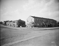
Elizabeth Heights Apartments from the corner of Idaho Street and Elizabeth Avenue in Salem.
Davis 7.212 Elizabeth Heights
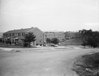
Elizabeth Heights Apartments, located from the corner of Idaho Street and Illinois Avenue in Salem.
Davis2 7.22 Downtown Salem
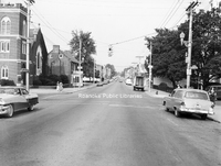
A view of E. Main Street from the Market Street intersection in Downtown Salem.
Davis 11.8 Andrew Lewis High
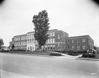
Andrew Lewis High School, (now Middle School) is located at 616 S. College Avenue in Salem.
Davis2 36.1a Kimball Acres
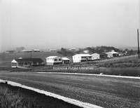
Newly constructed homes along the 500 block of Moran Avenue in the Kimball Acres subdivision.
Davis2 36.1b Kimball Acres

Newly constructed homes along the 500 block of Moran Avenue in the Kimball Acres subdivision.
Davis2 36.1c Kimball Acres
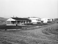
Newly constructed homes along the 500 block of Moran Avenue in the Kimball Acres subdivision.
Davis2 36.1d Kimball Acres
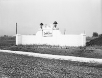
Sign at the entrance of the Kimball Acres subdivision.
Davis2 39 337 Parkwood Avenue
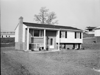
Home located at 337 Parkwood Avenue in Salem.
Davis2 48.38 Tom Huston Peanut
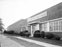
Tom Huston Peanut Company, formerly located at 1340 W. Main Street in Salem.
Davis2 11.96 Roanoke College
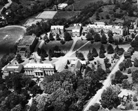
An aerial view of Roanoke College.
UC95 1400 Gratton Street
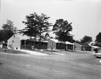
Homes in the 1400 block of Gratton Street in Salem.
Davis2 48.33 Associated Grocers
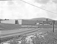
Associated Grocers, formerly located at 359 Kessler Mill Road.
Davis2 46.333 Fort Lewis Esso
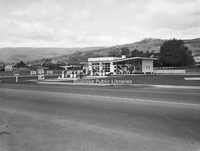
Fort Lewis Esso Servicenter, formerly located at 1905 W. Main Street in Salem.
RAC67 Trussmark Field
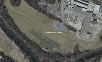
The current Trussmark field in Salem. The field is located along the Roanoke River adjacent to an industrial complex. This was the early location for the Salem auxiliary field used by naval aviation cadets enrolled at Roanoke College. The shorter…
RAC66 Trussmark Field
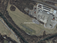
The current Trussmark field in Salem. The field is located along the Roanoke River adjacent to an industrial complex. This was the early location for the Salem auxiliary field used by naval aviation cadets enrolled at Roanoke College. The shorter…
MP 3.3 A&U Mobile Homes
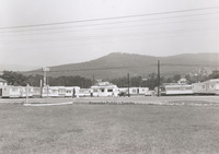
A&U Mobile Homes, formerly located at 1827 W. Main Street in Salem
Underwood 46 Salem
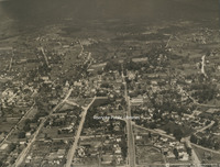
Aerial view of Salem
Underwood 38 Roanoke College
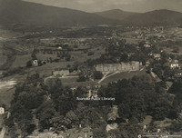
Aerial view of Roanoke College.
Underwood 35 Lakeside
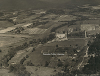
Aerial view of Lakeside Amusement Park.
UC 80 Cycle Center

Cycle Center, formerly located at 406 E. 4th Street.
UC 25 Billys Barn
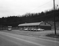
Billy's Barn, located at 1790 Thompson Memorial Drive.
CPC 60 Ridgewood
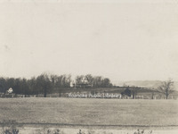
Ridgewood Manor House, was built by industrialist Samuel H. McVitty. It is located at 1900 South Clearing Road just above Ridgewood Farms Shopping Center.
Davis2 66.827 Colorado Street Bridge
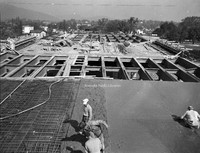
Construction of the bridge on South Colorado Street over the railroad tracks in Salem.
Davis2 47.5 Thaden-Jordan Furniture
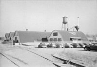
Thaden-Jordan Furniture Company, formerly located at 312 Kessler Mill Road.
Davis2 39f 40 Sawyer Drive
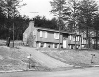
House located at 40 Sawyer Drive in the West Club Forest subdivision in Salem.
Davis2 23.5 Salem Presbyterian
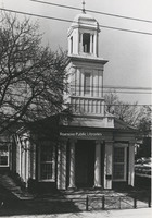
Salem Presbyterian Church, located at 41 E. Main Street.
Davis2 13.2 Roanoke County Courthouse
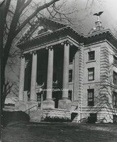
The old Roanoke County Courthouse, located at 305 E. Main Street in Salem.
Davis 75.81 Oakey Salem Chapel
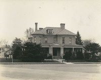
Built in 1901 as the home of Theophilus J. Shickel, the home was conveyed to John M. Oakey and Son Funeral Home in 1936.
Davis 7.21 Elizabeth Heights Apartments
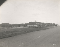
Elizabeth Heights apartment complex, located on Idaho and Illinois Streets in Salem.
Davis 46.412 Boyle Swecker Tire Company
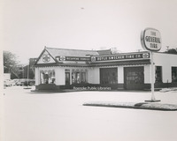
Boyle-Swecker Tire Company formerly located at 104 W. Main Street in Salem.
Davis 45.62 Yale & Towne

Yale & Towne Manufacturing Company. Located at 1242 S. Colorado Street, the building is now used by Graham-White.
Davis 45.613 General Electric

Female workers at General Electric.
Davis 45.612 General Electric

Interior of General Electric.
Davis 45.611 General Electric

General Electric, located at 1531 Roanoke Boulevard in Salem.
Davis 45.61 General Electric

General Electric, located at 1531 Roanoke Boulevard in Salem.
Davis 44.711 Kroger Office

The exterior of the Kroger office building.
Davis 44.71 Kroger office

Kroger Company office building in Salem.
Davis 43.391 Bank of Salem

The Bank of Salem formerly located at 100 E. Main Street.
Davis 41.22 Kesler's Mill

Kesler's Mill
Davis2 30.1n Queen Anne Style House
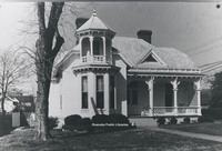
Located at 103 Union Street, this home is reflective of the Queen Anne style. It was built in 1901 by M.G. McClung, an editor of the Salem Sentinel.
Davis2 30.1l Evans House
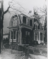
Located at 213 N. Broad Street in Salem, the Evans house was built around 1882 by John M. Evans in the Second Empire style.
Davis2 30.1i Pleasant Grove
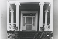
Located at 4377 W. Main Street, Pleasant Grove was built in 1853 for Joseph Deyerle. This photo depicts a close-up of the front door of the Georgian style home.
Davis2 30.1g Monterey
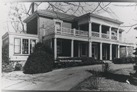
Located at 110 High Street, Monterey was built around 1855 by Benjamin Deyerle. It is one of many houses built by Deyerle in the valley and reflects his Greek Revival architectural style.
Davis2 30.1f Brown House Store
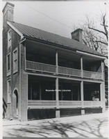
Located at 801 E. Main Street in Salem, Williams-Brown House-Store was built around 1845 by tradesman William Williams. The structure was used as both a home and a store. It is now the home of the Salem Museum and Historical Society.
Davis 17.12a Roanoke College Faculty

The faculty of Roanoke College pose for a group portrait in front of the Administration Building.
Davis 17.121b H. Sherman Oberly

Sixth President of Roanoke College, Dr. H. Sherman Oberly, is pictured on the right next to an unidentitifed faculty member.
Davis 17.11 Alumni Gymnasium

A rendering by Frye and Stone Architects of the Alumni Gymnasium at Roanoke College.
Davis 15.721 Fintel Library

Fintel Library at Roanoke College.
Davis 15.72 Fintel Library

Fintel Library at Roanoke College.
Davis2 11.953 Administration Building
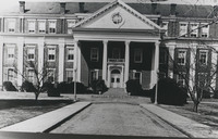
Central to the campus of Roanoke College, the Administration Building was the first structure on campus, completed in 1848. Over the years, East and West wings were added.
Davis 11.951 Roanoke College
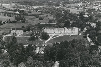
Aerial view of Roanoke College.