

Browse Items (54 total)
- Collection: Roanoke Negatives
Sort by:
RNC 10 Fire Station 7
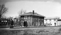
The original Fire Station 7, located at 1742 Memorial Avenue.
RNC 101 Jefferson Street
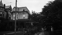
Home formerly located at 815 S. Jefferson Street.
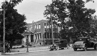
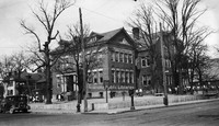
RNC 11 Roanoke High School
Roanoke High School was formerly located on the northeast corner of Church Avenue and 3rd Street where the Noel C. Taylor Municipal building stands today.
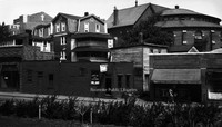
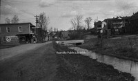
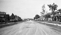
RNC 117 Woodlawn Avenue
Woodlawn Avenue at the intersection with Montgomery Avenue.
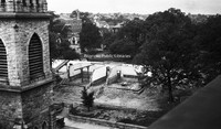
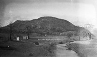
RNC 118 Mill Mountain
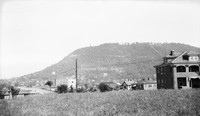
A view of Mill Mountain from Old Southwest.
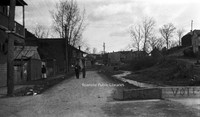
RNC 120 6th Street SE
Looking north on 6th Street SE from Tazewell Avenue.
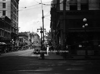
RNC 130 2nd Street
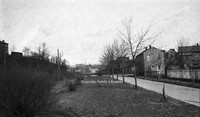
Looking north on 2nd Street NE.
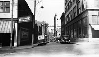
RNC 132 Church and 2nd
Buildings once located at 2nd Street and Church Avenue where the Commonwealth Building stands today.
RNC 139 Commerce Street School
Demolition of the Commerce Street School, also known as the First Ward School.
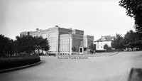
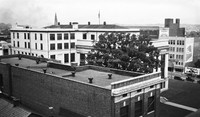
RNC 146 Municipal Building
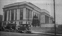
View of the Municipal Building from 2nd Street and Campbell Avenue.
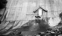
RNC 147 Carvins Cove Dam
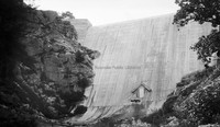
Carvins Cove Dam Shortly after completion. The reservoir would not be complete until the 1940s.
RNC 148 Carvins Cove Dam
Carvins Cove Dam Shortly after completion. The reservoir would not be complete until the 1940s.
RNC 15 Norfolk Avenue
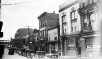
A view of Norfolk Avenue includes Bannister's Place (a boarding house) and HC Barnes Pharmacy. Buildings were located roughly where the Wells-Fargo Tower is today.
RNC 150 Orange Avenue
Orange Avenue, exact location unknown.
RNC 152 WWI Monument
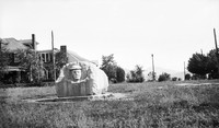
This monument was erected in 1925 by the Margaret Lynn Lewis Chapter of the DAR to honor Roanoke soldiers who served in World War I. It is located in Argonne Circle on King George Avenue.
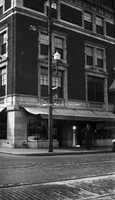
RNC 16 Heironimus
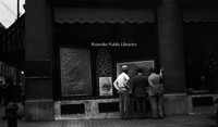
John Nolen's plans for the City of Roanoke on display in the windows of Heironimus.
RNC 17 Windsor Apartments
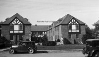
Apartments located at 2049 Windsor Avenue at the corner of Brunswick Street.
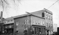
RNC 18 Quick Way
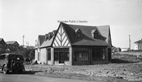
Quick Way convenience store, located at 2209 Brandon Avenue.
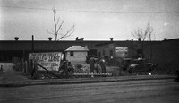
RNC 2 Highland Park School
Highland Park Elementary School, located at 1212 5th Street.
RNC 24 Memorial Avenue
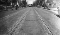
Streetcar tracks on the 700 block of Memorial Avenue.
RNC 29 GW Copenhaver
Vacant storefront on Williamson Road between Church Avenue and Kirk Avenue. The building was once occupied by blacksmith G.W. Copenhaver. The site is now a parking lot.
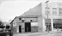
RNC 3 N&W Salvage
Norfolk & Western Salvage Warehouse, formerly located at 201 Campbell Avenue SE.
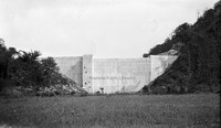
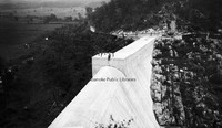
RNC 37 Carvins Cove Dam
Carvins Cove Dam shortly after completion. The reservoir would not be complete until the 1940s.
RNC 38 Carvins Cove Dam
Carvins Cove Dam shortly after completion. The reservoir would not be complete until the 1940s.
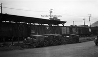
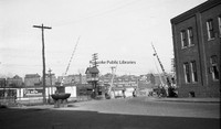
RNC 39 N&W Freight Station
Lots for sale in front of the Norfolk & Western freight station on Norfolk Avenue.
RNC 4 Shenandoah
Austin & Martin Auto Repair, formerly located at 223 Shenandoah Avenue NW.
RNC 40 Commerce Street School
Commerce Street School, also called First Ward School, was located at the corner of Church Avenue and 2nd (Commerce) Street. Built in 1890, it was razed in 1929 to make room for the post office.
RNC 41 Big Oak Filling Station
Big Oak Filling Station was located around the 2500 block of Williamson Road.
RNC 42 Jefferson Street
Looking north on Jefferson Street from Elmwood Park.
RNC 47 Monticello
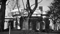
Side view of Monticello.
RNC 5 Mick or Mack
Mick or Mack, formerly located at 310 2nd Street.
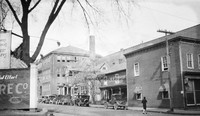
RNC 50 Franklin Road
A view of the 200 block of Franklin Road, where the Verizon building sits today. First Baptist Church can be seen over the buildings at left. The building on the right with the round portion was the original First Baptist Church.
RNC 51 Municipal Building
A view of the municipal building from the YMCA.
RNC 52 Church Avenue
Commerce Street School being razed to make room for the post office. Greene Memorial United Methodist Church can be seen in background.
RNC 54 Jefferson Theatre
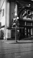
Jefferson Theatre, formerly located at 417 S. Jefferson Street.
RNC 55 Patrick Henry
The Patrick Henry Hotel.
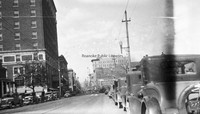
RNC 56 Jefferson Street
Looking north on Jefferson Street from Campbell Avenue.
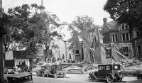
RNC 60 Church Avenue
Demolition of St. John's Episcopal and a house on Church Avenue to make way for the post office.
RNC 63 Commerce Street School Site
A nearly gone Commerce Street or First Ward School. The school stood at Church Avenue and 2nd Street and was razed to make way for the post office.
RNC 64 Commerce Street School Site
A nearly gone Commerce Street or First Ward School. The school stood at Church Avenue and 2nd Street and was razed to make way for the post office.
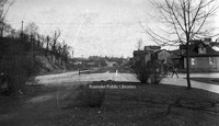
RNC 65 2nd Street
Looking north on 2nd Street NE. Lick Run is the stream at right. Extreme right is the location of I581.
RNC 66 2nd Street
Looking north on 2nd Street NE at the intersection with Patton Avenue.
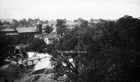
RNC 70 Tinker Creek

A view of Tinker Creek.
RNC 72 2nd Street
Looking north on 2nd Street just beyond Patton Avenue..
RNC 73 N&W Underpass
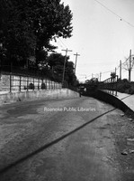
One-lane road under a Norfolk & Western underpass through which traffic accessing 460 East would pass.
RNC 8 Wilson & Company
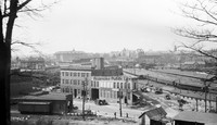
Wilson & Company, seen in the foreground, was a wholesale meat company. It was located at 312 Campebell Avenue SE. Hotel Roanoke and N&W General Offices can be seen in background.
RNC 80 WWI Monument
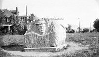
This monument was erected in 1925 by the Margaret Lynn Lewis Chapter of the DAR to honor Roanoke soldiers who served in World War I. It is located in Argonne Circle on King George Avenue.
RNC 81 Church Avenue
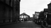
Looking east on Church Avenue from the 100 block.
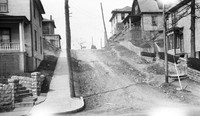
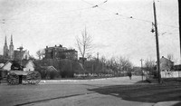
RNC 84 Gregory Avenue
Gregory Avenue at the intersection with 2nd Street NE.
RNC 85 Tinker Mountain
A view of Tinker Mountain.
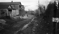
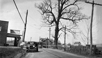
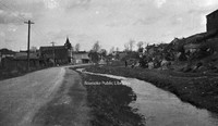
RNC 86 Orange Avenue
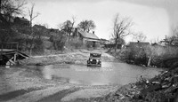
Driving could be a challenge on Orange Avenue in its early days. View is looking west near Gainsboro Road.
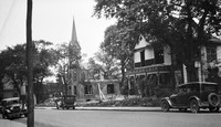
RNC 9 St. Andrews
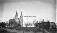
St. Andrews Catholic Church.
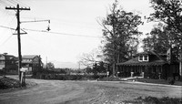
RNC 94 Avon Road
Looking north on Avon Road at the intersection with Sherwood Avenue.