

Browse Items (51 total)
- Collection: Underwood Aerial Photographs
Sort by:
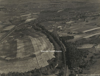
Underwood 52 New London
Aerial view of New London in Campbell County, Virginia.
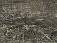
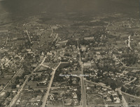
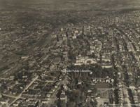
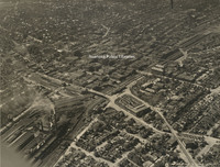
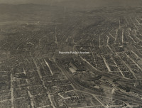
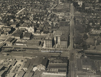
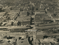
Underwood 9 Downtown Looking Southeast
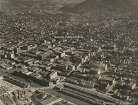
Aerial view of downtown Roanoke looking southeast
Underwood 8 Colonial Heights
Aerial view of Roanoke from Colonial Heights
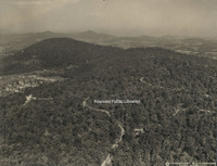
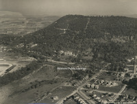
Underwood 7 Roanoke from Stone Mountain
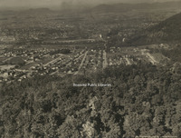
Aerial view of Roanoke from Stone Mountain
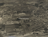
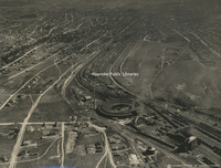
Underwood 6 N&W Shops
Aerial view of the Norfolk & Western Railway shops
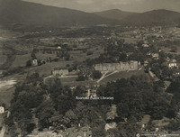
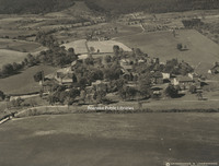
Underwood 50 Fincastle
Aerial view of Fincastle.
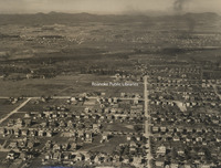
Underwood 5 North on Jefferson
Aerial view looking north on Jefferson Street.
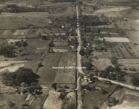
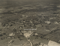
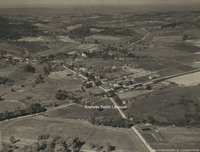
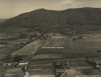
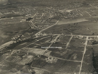
Underwood 49 Troutville
Aerial view of Troutville.
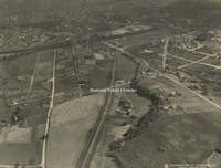
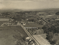
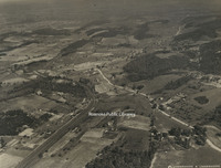
Underwood 48 Cloverdale
Aerial view of Cloverdale.
Underwood 47 Vinton
Aerial view of Vinton.
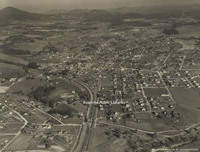
Underwood 46 Salem
Aerial view of Salem
Underwood 45 Falling Creek Reservoir
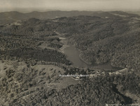
Aerial view of Falling Creek Reservoir.
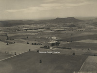
Underwood 44 South of Roanoke
Aerial view of mountains at the south edge of Roanoke.
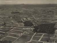
Underwood 43 Orchards
Aerial view of orchards near Roanoke.
Underwood 42 Andrews Farm
Aerial view of the Andrews farm, near Roanoke.
Underwood 41 Roanoke from South
Aerial view of Roanoke from the south. The road entering the photo at bottom right is Starkey Road heading north. The Shell country store is currently located where Starkey veers right in this photo. This section of the road is now the path of…
Underwood 40 Norwich
Aerial view of the Norwich neighborhood.
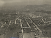
Underwood 4 East on Campbell
Aerial view looking east on Campbell Avenue.
Underwood 39 North of Roanoke
Aerial view looking north of Roanoke. Williamson Road can be seen bisecting the photo from top to bottom. At the bottom left, the first street left of Williamson is Sycamore Avenue. The street above Sycamore is Thurston Avenue. The entire block…
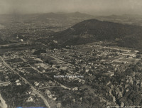
Underwood 38 Roanoke College
Aerial view of Roanoke College.
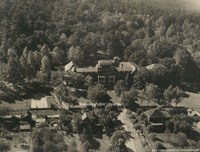
Underwood 37 Hollins College
Aerial View of Hollins College, now Hollins University.
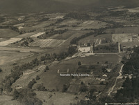
Underwood 36 Virginia College
Aerial view of Virginia College.
Underwood 35 Lakeside
Aerial view of Lakeside Amusement Park.
Underwood 34 Roanoke Country Club
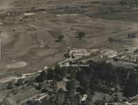
Aerial view of Roanoke Country Club.
Underwood 33 Mountain View
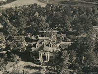
Aerial view of Mountain View, the J.B. Fishburn home.
Underwood 32 St Andrews
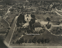
Aerial view of St. Andrews Catholic Church.
Underwood 31 Roanoke Railway & Electric
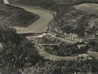
Aerial view of Roanoke Railway & Electric Company's hydroelectric plant
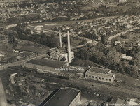
Underwood 30 Roanoke Railway & Electric
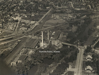
Aerial view of Roanoke Railway & Electric Company's power station, substation, car barn and shops.
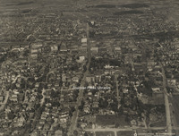
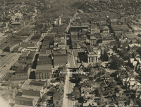
Underwood 3 Downtown Looking Southwest
Aerial view of downtown Roanoke looking southwest
Underwood 29 Roanoke Railway & Electric
Aerial view of Roanoke Railway & Electric Company's power station, substation, car barn and shops.
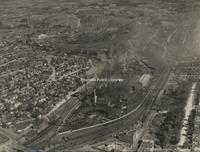
Underwood 28 Crozer Iron Furnace
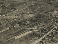
Aerial view of the Iron Furnace and Pyrites plant
Underwood 27 Virginia Bridge & Iron
Aerial view of Virginia Bridge & Iron Company.tif
Underwood 26 N&W Shops
Aerial view of the Norfolk & Western Railway shops
Underwood 25 American Viscose
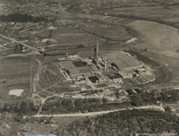
Aerial view of American Viscose Corporation.
Underwood 24 Raleigh Court
Aerial view of Raleigh Court
Underwood 23 South Roanoke
Aerial view of South Roanoke.
Underwood 22 Northwest of Roanoke
Aerial view of northeast Roanoke
Underwood 21 West Roanoke
Aerial view of northwest Roanoke
Underwood 20 Virginia Heights
Aerial view of Virginia Heights
Underwood 2 Roanoke Looking West
Aerial view of Roanoke looking west
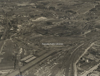
Underwood 19 N&W Yards
Aerial view of the Norfolk & Western Railway yards.
Underwood 18 Mill Mountain
Aerial view of Mill Mountain, including the Mill Mountain Incline and Roanoke Hospital.
Underwood 17 Athletic Field
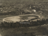
Aerial view of athletic field that would become the location of Victory Stadium and Maher Field.
Underwood 16 Highland Park School
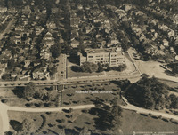
Aerial view of Highland Park Elementary School, known as Park Street School at the time of this photo.
Underwood 15 Jefferson High
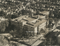
Aerial view of Jefferson High School
Underwood 14 N&W Offices
Aerial view of Norfolk & Western General Offices.
Underwood 13 Hotel Roanoke
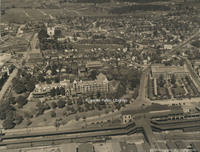
Aerial view of Hotel Roanoke and Roanoke Auditorium.
Underwood 12 Municipal Building
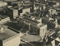
Aerial view of the Municipal Building
Underwood 11 West on Campbell
Aerial view looking west on Campbell Avenue
Underwood 10 East on Campbell
Aerial view looking east down Campbell Avenue
Underwood 1 Roanoke from 13500
Aerial view of Roanoke from 13500 feet.