

Browse Items (136 total)
Sort by:
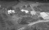
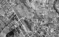
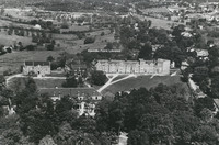
PCS 55.2
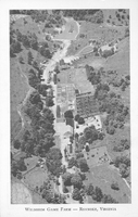
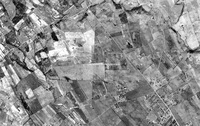
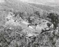
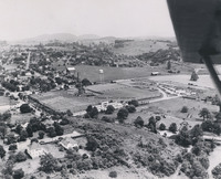
An aerial view of Wildheim Game Farm, a private zoo owned by J.J. Bower on Peters Creek Road. The zoo contained thousands of birds and small animals from all over the world.
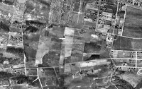
PCS 23.0
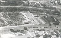
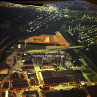
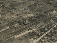
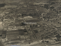
Aerial view of Harris Hardwood Company. Harrs Hardwood was located in Norwich.
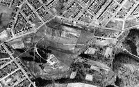
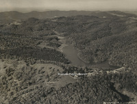
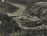
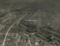
MIC33 Carvins Cove

Aerial view of Carvins Cove.
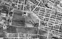
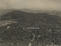
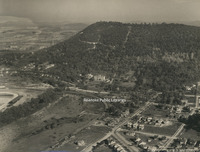
MIC32 Carvins Cove

Aerial view of Carvins Cove.
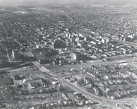
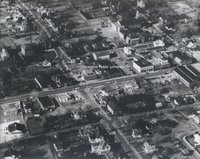
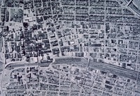
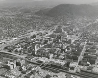
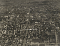
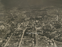
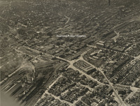
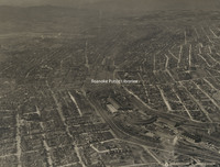
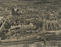
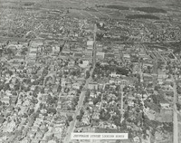
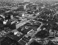
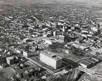
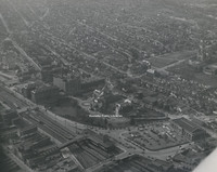
MIC31 Downtown Aerial

Aerial view of Downtown Roanoke.
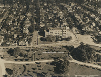
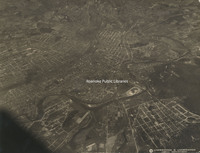
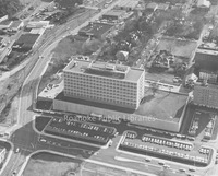
RVNH5010
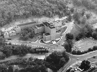
Aerial view of Roanoke Memorial Hospital.
MP 2.12 Roanoke Aerial
Aerial view of Downtown Roanoke looking west.
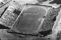
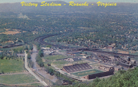
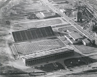
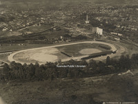
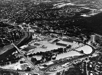
MP 2.32 Victory Stadium
An aerial view of Victory Stadium. Victory Stadium was built in 1942 and razed in 2006.
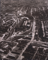
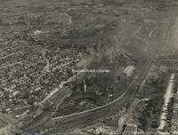
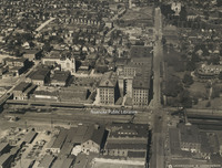
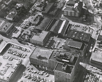
RVNH40407 N&W Shops
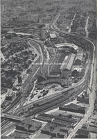
An aerial view looking east on the Norfolk & Western Shops.
RVNH40287 Victory Stadium
Aerial view of Victory Stadium during a Jefferson High School football game.
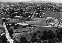
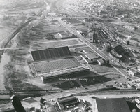
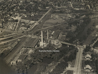
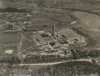
RVNH40212 American Viscose
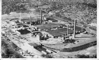
Aerial view of American Viscose.
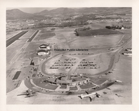
RVNH4036 Woodrum Field
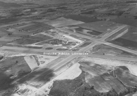
Aerial view of Woodrum Field showing A-configuration of runways.
RVNH4035 Woodrum Field
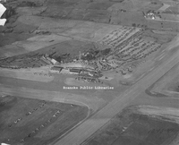
Aerial view of Woodrum Field taken during its dedication weekend. The photographer was Lambert Martin of the Roanoke World-News.
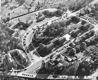
FE270 Main Street
Aerial viewing showing Main Street in Salem near the intersection with Union Street and Academy Street.
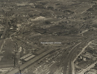
FE236 N&W Shops
Aerial view of Norfolk & Western east end shops.
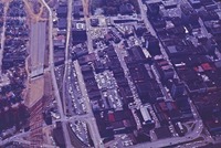
TNC 58.4 AEP Construction
Aerial view showing site of future Appalachian Power Service Center, located at 803 River Avenue, SE. Roanoke Industrial Center in the foreground.
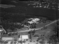
TNC 58.2 Richfield
Aerial view of Richfield Living. View shows nursing care center built in 1971 located at 3615 W Main Street in Salem.
TNC 58.1 Richfield
Aerial view of Richfield Living. View shows nursing care center built in 1971 located at 3615 W Main Street in Salem.
TNC 58.0 Richfield
Aerial view of Richfield Living. View shows nursing care center built in 1971 located at 3615 W. Main Street in Salem.
RRHA481
Commonwealth
RRHA479
Commonwealth
RRHA478
Commonwealth
RRHA477
Commonwealth
RRHA472
Downtown
RRHA468
Downtown
RRHA467
Downtown
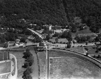
BM 379 Cave Spring High
Aerial view of Cave Spring High School and Cave Spring Baptist Church.
BM 292 Reeds Orchard
Aerial view of Reed’s Orchard, located at the intersection of Poor Mountain Road and Tinsley Lane. The house was built by the Woodrum Family, bought by Homer Reed in 1948 and closed as a commercial orchard in 1995.
BM 252 Starkey Speedway
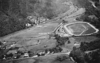
Aerial view of Starkey Speedway.
BM 145 Route 419
Aerial view to the northeast of current Route 419 at intersection with Ogden Road. Ogden Road is seen at the top of the photo. At top, right is Ogden Elementary School. The area to the right of the railroad tracks is Cox Communications and Old…
BM 144 Green Valley
Aerial view showing Green Valley Elementary School, upper right.
BM 143 Route 419
Aerial view looking north at Route 419 construction. The house and barn were located at the current site of the Roanoke County Administrative Offices on Bernard Drive. The earth moving equipment is at the current intersection of Route 419 and…
BM 142 Route 419
Aerial view of Route 419 under construction at Chaparral Drive; Penn Forest Boulevard at bottom.
RC19 Grandin and Memorial
Aerial view of the intersection of Grandin Road and Memorial Avenue.
RC16 Memorial Bridge
Aerial view of Memorial Bridge.
RC15 Virginia Heights
Aerial view of Virginia Heights. Evergreen Cemetery is visible in the foreground; Memorial Bridge is visible in the lower right.
PC 130.0 Victory Stadium
"Victory Stadium, Roanoke, Virginia, as seen from atop Mill Mountain. With a seating capacity of 25,000, which can be increased to 29,000 with the use of bleachers, is where the Thanksgiving Day Classic Football Game is held each year between (VMI)…
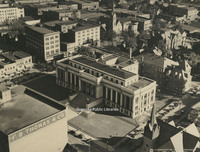
PC 101.0 Civic Center
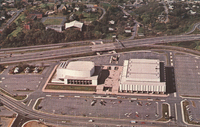
" Roanoke's beautiful new Civic Center. The coliseum, seating 11,000, and the auditorium seating 2,475, are separated by an open plaza which forms the roof of the Exhibit Hall. This $15 million Civic Center attracts sports events and conventions, as…
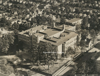
Davis2 5.21 Aerial of RMH
Aerial view of Roanoke Memorial Hospital.
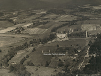
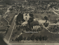
Davis2 11.96 Roanoke College
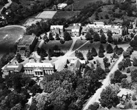
An aerial view of Roanoke College.
Davis2 47.7 Vinton Weaving
Vinton Weaving Company, now Precision Fabrics Group, is located at 323 West Virginia Avenue.
Davis2 43.714 Shenadoah Life
An aerial view of Shenandoah Life Insurance, located at 2301 Brambleton Avenue SW.
Davis2 43.713 Shenandoah Life
An aerial view of Shenandoah Life Insurance Company, located at 2301 Brambleton Avenue SW.
Davis2 19.815 Terrace Apartments
An aerial view of Terrace Apartments with surrounding streets identified.
Underwood 52 New London
Aerial view of New London in Campbell County, Virginia.
RAC76 Woodrum Aerial
A south-facing aerial view of Woodrum Field. In the upper left of this photo, Crossroads Mall can be seen under construction.
RAC75 Woodrum Aerial
This west-facing photograph shows the configuration of runways. There is construction work at right, indicating the extension of runway 5/23. Still noticeable are the rural surroundings of Woodrum Field. Visible at the bottom is the internal road…
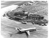
RAC74 Woodrum Aerial
This aerial photograph shows the separation of private aviation (left) and commercial aviation at the front of the terminal. Note the layout of the new parking lot behind the terminal. More passengers began leaving their cars at the airport for…
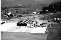
RAC67 Trussmark Field
The current Trussmark field in Salem. The field is located along the Roanoke River adjacent to an industrial complex. This was the early location for the Salem auxiliary field used by naval aviation cadets enrolled at Roanoke College. The shorter…
RAC66 Trussmark Field
The current Trussmark field in Salem. The field is located along the Roanoke River adjacent to an industrial complex. This was the early location for the Salem auxiliary field used by naval aviation cadets enrolled at Roanoke College. The shorter…
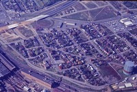
RAC38 Cook Field
This photograph shows the location of the Appalachian Power substation adjacent to the rail line where Cook Field was formerly located. Cook Field was leased by Frank Reynolds and Clayton Lemon to provide an airstrip for local fliers in the late…
RAC36 2013 Aerial
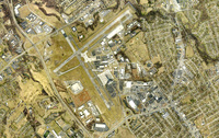
An aerial view of Roanoke Regional Airport.
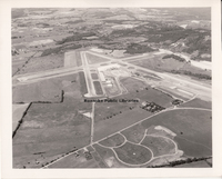
RAC35 1967 Aerial
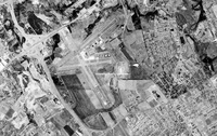
An aerial view of Woodrum Field. I-581 opened in 1965 and can been seen at left of the airport.
RAC34 1953 Aerial
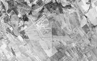
An aerial view of Woodrum Field.
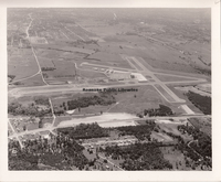
RAC33 1947 Aerial
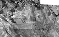
An aerial view of Woodrum Field.
RAC32 Williamson Road
In this aerial photograph, Williamson Road runs along the left side. The small structure in the open space at center is the present-day location of Breckenridge Middle School, formerly William Fleming High School. In 1921, the federal government…
RAC31 Trout Field
Trout Field is directly in the center of this aerial photograph. Fairview Cemetery is the rectangular area at top with the teardrop-shaped driveway in its center. This view illustrates why a cemetery served as a good navigational point for early…
RAC30 Shrine Hill
This aerial photograph shows the area where Patrick Henry High School is located today. During the 1920s, the pasturelands served as an early airfield known as Shrine Field. The land was owned by the Shriners in hopes of erecting a large Masonic…
RAC29 Horton Field
This 1937 aerial photograph shows the location of Horton Field, which was on the Horton Farm near the present-day intersection of 24th Street and Melrose Avenue. It is believed that the first plane to land at Horton Field in 1919 was a barnstormer…
RAC28 1937 Aerial
Aerial view of Roanoke Municipal Airfield.
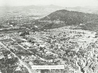
RAC15 Roanoke Municipal Airport
An aerial view of Roanoke Municipal Airport.
RAC11 Woodrum Field
The progress made at Woodrum Field is seen here in 1971. Among the facilities shown are the terminal dedicated in 1953, the nose-in hangar (left of center, top), general aviation hangars and the service hangar for Piedmont Airlines (upper right).…
MP 2.31 Victory Stadium
An aerial view of Victory Stadium. Victory Stadium was built in 1942 and razed in 2006.
MP 2.3 Victory Stadium
An aerial view of Victory Stadium. Victory Stadium was built in 1942 and razed in 2006.
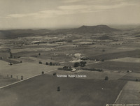
MP 2.2 Mill Mountain Zoo
An aerial view of Mill Mountain Zoo. The zoo opened in 1952.
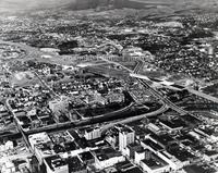
MP 2.1 Roanoke Aerial
An aerial view looking toward Mill Mountain. I581 can be seen under construction on the left .
MP 2.0 Roanoke Aerial
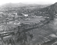
General view of Roanoke from 8000 ft.
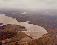
VF5 Smith Mountain Lake
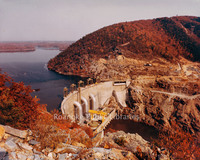
Aerial view of Smith Mountain Lake Dam.
VF4 Smith Mountain Lake
Aerial view of Smith Mountain Lake.
VF2 Smith Mountain Lake
Aerial view of Smith Mountain Lake.
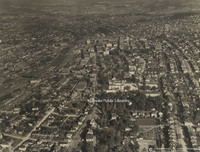
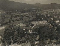
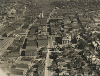
Underwood 9 Downtown Looking Southeast
Aerial view of downtown Roanoke looking southeast
Underwood 8 Colonial Heights
Aerial view of Roanoke from Colonial Heights
Underwood 7 Roanoke from Stone Mountain
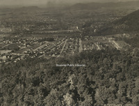
Aerial view of Roanoke from Stone Mountain
Underwood 6 N&W Shops
Aerial view of the Norfolk & Western Railway shops
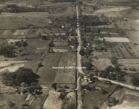
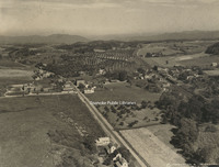
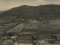
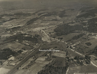
Underwood 50 Fincastle
Aerial view of Fincastle.
Underwood 5 North on Jefferson
Aerial view looking north on Jefferson Street.
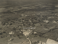
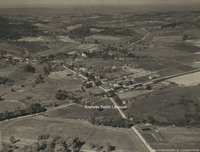
Underwood 49 Troutville
Aerial view of Troutville.
Underwood 48 Cloverdale
Aerial view of Cloverdale.
Underwood 47 Vinton
Aerial view of Vinton.
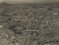
Underwood 46 Salem
Aerial view of Salem
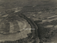
Underwood 45 Falling Creek Reservoir
Aerial view of Falling Creek Reservoir.
Underwood 44 South of Roanoke
Aerial view of mountains at the south edge of Roanoke.
Underwood 43 Orchards
Aerial view of orchards near Roanoke.
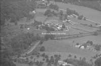
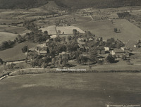
Underwood 42 Andrews Farm
Aerial view of the Andrews farm, near Roanoke.
Underwood 41 Roanoke from South
Aerial view of Roanoke from the south. The road entering the photo at bottom right is Starkey Road heading north. The Shell country store is currently located where Starkey veers right in this photo. This section of the road is now the path of…
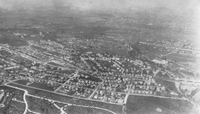
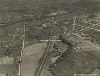
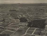
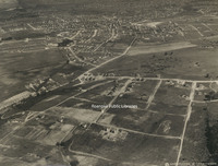
Underwood 40 Norwich
Aerial view of the Norwich neighborhood.
Underwood 4 East on Campbell
Aerial view looking east on Campbell Avenue.
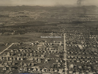
Underwood 39 North of Roanoke
Aerial view looking north of Roanoke. Williamson Road can be seen bisecting the photo from top to bottom. At the bottom left, the first street left of Williamson is Sycamore Avenue. The street above Sycamore is Thurston Avenue. The entire block…
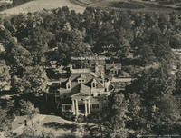
Underwood 38 Roanoke College
Aerial view of Roanoke College.
Underwood 37 Hollins College
Aerial View of Hollins College, now Hollins University.
Underwood 36 Virginia College
Aerial view of Virginia College.
Underwood 35 Lakeside
Aerial view of Lakeside Amusement Park.
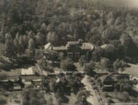
Underwood 34 Roanoke Country Club
Aerial view of Roanoke Country Club.
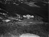
Underwood 33 Mountain View
Aerial view of Mountain View, the J.B. Fishburn home.
Underwood 32 St Andrews
Aerial view of St. Andrews Catholic Church.
Underwood 31 Roanoke Railway & Electric
Aerial view of Roanoke Railway & Electric Company's hydroelectric plant
Underwood 30 Roanoke Railway & Electric
Aerial view of Roanoke Railway & Electric Company's power station, substation, car barn and shops.
Underwood 3 Downtown Looking Southwest
Aerial view of downtown Roanoke looking southwest
Underwood 29 Roanoke Railway & Electric
Aerial view of Roanoke Railway & Electric Company's power station, substation, car barn and shops.
Underwood 28 Crozer Iron Furnace
Aerial view of the Iron Furnace and Pyrites plant
Underwood 27 Virginia Bridge & Iron
Aerial view of Virginia Bridge & Iron Company.tif
Underwood 26 N&W Shops
Aerial view of the Norfolk & Western Railway shops
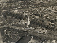
Underwood 25 American Viscose
Aerial view of American Viscose Corporation.
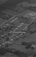
Underwood 24 Raleigh Court
Aerial view of Raleigh Court
Underwood 23 South Roanoke
Aerial view of South Roanoke.
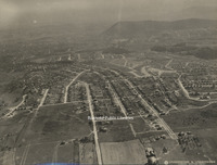
Underwood 22 Northwest of Roanoke
Aerial view of northeast Roanoke
Underwood 21 West Roanoke
Aerial view of northwest Roanoke
Underwood 20 Virginia Heights
Aerial view of Virginia Heights
Underwood 2 Roanoke Looking West
Aerial view of Roanoke looking west
Underwood 19 N&W Yards
Aerial view of the Norfolk & Western Railway yards.
Underwood 18 Mill Mountain
Aerial view of Mill Mountain, including the Mill Mountain Incline and Roanoke Hospital.
Underwood 17 Athletic Field
Aerial view of athletic field that would become the location of Victory Stadium and Maher Field.
Underwood 16 Highland Park School
Aerial view of Highland Park Elementary School, known as Park Street School at the time of this photo.
Underwood 15 Jefferson High
Aerial view of Jefferson High School
Underwood 14 N&W Offices
Aerial view of Norfolk & Western General Offices.
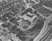
Underwood 13 Hotel Roanoke
Aerial view of Hotel Roanoke and Roanoke Auditorium.
Underwood 12 Municipal Building
Aerial view of the Municipal Building
Underwood 11 West on Campbell
Aerial view looking west on Campbell Avenue
Underwood 10 East on Campbell
Aerial view looking east down Campbell Avenue
Underwood 1 Roanoke from 13500
Aerial view of Roanoke from 13500 feet.
Davis GL 7 Jefferson Street Looking North
Aerial view of Jefferson Street looking north.
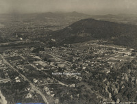
Davis GL 4 Mill Mountain and Roanoke Valley
View of Mill Mountain and the surrounding Roanoke Valley
UC 65 Flood Aerial
Aerial view showing flood damage brought on by Hurricane Camille.
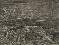
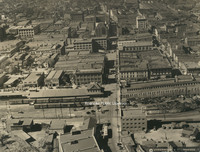
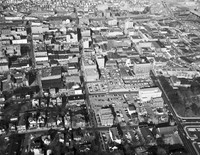
UC 22 Aerial of Downtown
Aerial view of Downtown Roanoke.
UC 21 Aerial of Downtown
Aerial view of Downtown Roanoke.
Davis 5.4 Franklin Road
An aerial view of Franklin Road at 1st and 2nd Street. The building in the upper right corner is Lee Junior High School, which was razed to build the Poff Federal Building.
Davis 5.12 Aerial View of Roanoke
Aerial View of Roanoke. I-581 construction underway. Interstate can be seen bisecting photograph.
Davis 5.1 Community Hospital
Aerial view of Downtown and Community Hospital
Davis 47.21 Harris Hardwood
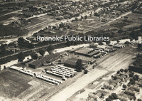
Aerial view of Harris Hardwood Company, formerly located in the Norwich neighborhood.
Davis 45.72 Roanoke Industrial Center
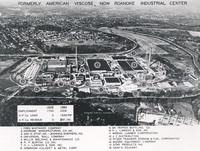
Aerial view of Roanoke Industrial Center, formerly American Viscose, including a listing of the businesses who occupied each building. American Viscose, once the world's largest producer of artificial silk, opened in 1917. By the 1920s, the plant…
Davis 45.71 Blue Ridge Industrial Park
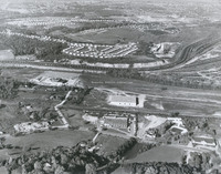
Aerial view of Blue Ridge Industrial Park between Brandon Avenue and Shenandoah Avenue. The park is now located on Aerial Way Drive. Brandon Avenue is the road bisecting the lower portion of the photo. Roanoke Electric Steel can be seen above the…
Davis 45.63 Burlington Mills
Aerial view of Burlington Mills Corporation. Located on West Virginia Avenue in Vinton, the building is now used by Precision Fabrics Group, Inc.
Davis 16.2091 Hotel Roanoke
An aerial view of the Hotel Roanoke. Roanoke Auditorium visible in upper right corner.
Davis 16.209 Hotel Roanoke Aerial
An aerial view of the Hotel Roanoke.
Davis 14.7 Community Hospital
Aerial view of Community Hospital. Orchard Hill is in the background.
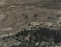
Davis 11.951 Roanoke College
Aerial view of Roanoke College.