

Browse Items (85 total)
- Collection: George C. Davis Glass Lantern Slides
Sort by:
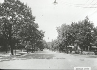
Davis GL 10 Rorer Avenue
View of buildings along Rorer Avenue.
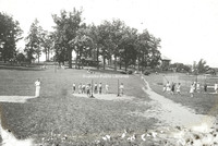
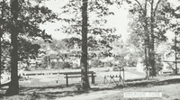
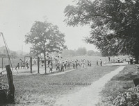
Davis GL 100 Playground in Norwich
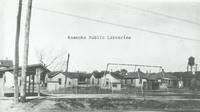
PLayground in Norwich neighborhood.
Davis GL 104 Maiden Lane
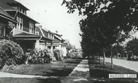
Houses on Maiden Lane.
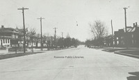
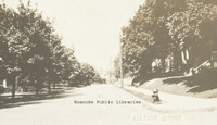
Davis GL 105 Melrose Avenue
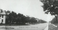
Melrose Avenue. Exact location unknown.
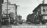
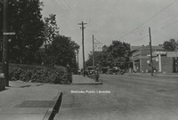
Davis GL 108 Salem Avenue
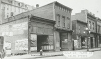
Vacant store fronts in the 100 block of Salem Avenue.
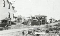
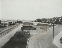
Davis GL 11 Staunton Avenue
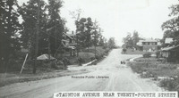
View of Staunton Avenue near 24th Street.
Davis GL 110 Campbell Avenue
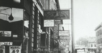
Various business signs along E. Campbell Avenue.
Davis GL 111 Fire Escape Diagram
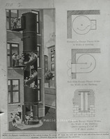
Fire Escape diagram depicting a "state-of-the-art" fire escape containing a slide.
Davis GL 12 Watts Springs
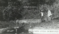
View of two men standing beside Watts Springs.
Davis GL 13 Church Avenue
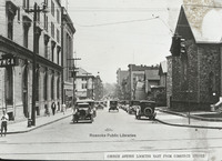
View of Church Avenue looking east from Commerce Street (now 2nd Street). Greene Memorial UMC visible on right, old YMCA visible on left.
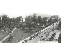
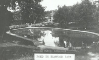
Davis GL 14 Pond in Elmwood Park
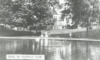
View of pond in Elmwood Park.
Davis GL 16 Neighborhood
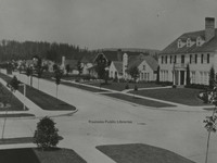
Though not in Roanoke, this Longview, Washington neighborhood scene was used as an example in John Nolen's plan for Roanoke.
Davis GL 165 GN Natural Bridge
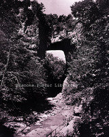
Natural Bridge
Davis GL 17 Unidentified Building
Unidentified building near downtown.
Davis GL 172 Hotel Patrick Henry
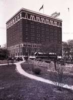
View of Hotel Patrick Henry from Elmwood Park
Davis GL 18 Windsor Avenue
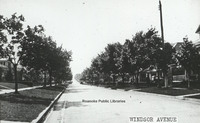
Windsor Avenue in Raleigh Court
Davis GL 19 Campbell Avenue
Looking west on Campbell Avenue at intersection with Jefferson Street.
Davis GL 2 Scene in Elmwood Park
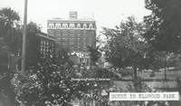
Scene in Elmwood Park with a view of Patrick Henry Hotel.
Davis GL 2.1 Scene in Elmwood Park
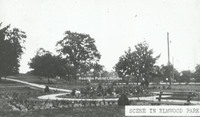
Scene in Elmwood Park viewing the rose garden.
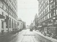
Davis GL 20 Salem Avenue
View of Salem Avenue east from Second Street, SW. Buildings lines street with painted advertisements.
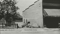
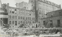
Davis GL 21 Terry Building
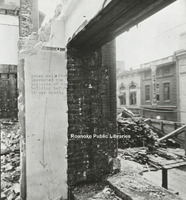
Image of a building being demolished.
Davis GL 21.1 Terry Building
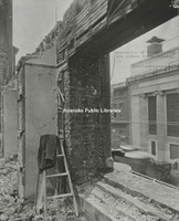
Image of a building being demolished with coat laying on ladder.
Davis GL 22 Single Family Dwelling
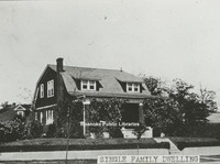
View of a single family dwelling made of brick.
Davis GL 222 Patrick Henry Hotel
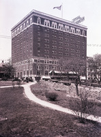
View of Patrick Henry Hotel from Elmwood Park.
Davis GL 23 Jefferson Street
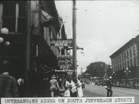
View of advertisement signs hanging from the front of buildings along South Jefferson Street.
Davis GL 232 Northeast
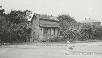
Derelict home in Northeast. Exact location unknown.
Davis GL 237 Walnut Avenue Bridge
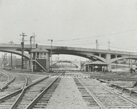
Side view of the Walnut Avenue and Jefferson Street bridges.
Davis GL 241 10th Street
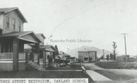
A view of 10th Street NW at Williamson Road and the Oakland School.
Davis GL 242 Shaffers Crossing
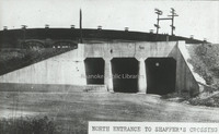
North entrance to Shaffer's Crossing.
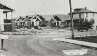
Davis GL 25 Southeast
View of several homes in Southeast.
Davis GL 26 State and City Bank
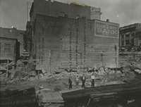
Side view of State & City Bank, once located at approximately 206 Jefferson Street. This photo was taken after a building was razed.
Davis GL 269 Jefferson Street
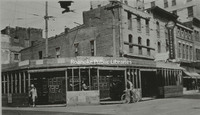
Northwest corner at the intersection of Jefferson Street and Campbell Avenue.
Davis GL 29 Truck
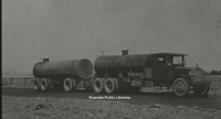
Image of a tanker style truck.
Davis GL 3 Melrose Park
View of people playing recreational games in Melrose Park.
Davis GL 30 Campbell Avenue
View of West Campbell Avenue at 8th Street intersection, 1928.
Davis GL 31 Patterson Avenue
A view of Patterson Avenue.
Davis GL 32 Play Day
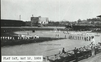
"Play Day" at Maher field 12 May 1928.
Davis GL 33 Motor Routes to Roanoke
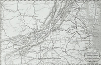
Chamber of Commerce map showing roads to Roanoke.
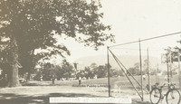
Davis GL 34 Tennis Courts at Elmwood
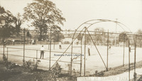
The tennis courts once in Elmwood Park.
Davis GL 35 Panoramic View from Mill Mountain
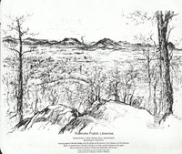
A panoramic sketch from Mill Mountain by Louis Ruyl of New York for the Chamber of Commerce. Caption reads, "Showing spurs of the Blue Ridge with the Alleghany Mountains in the distance, and the Roanoke bowl or amphitheater, McAfee's Knob at left,…
Davis GL 36 Roanoke Hospital
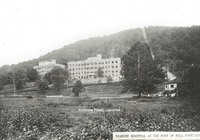
Roanoke Hospital at the foot of Mill Mountain. The Mill Mountain incline can be seen to the right.
Davis GL 37 Dog Mouth Fountain
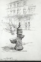
Sketch of the Dog Mouth Fountain. The fountain was acquired by the city in 1898. It stands at the corner of Salem Avenue and Market Street.
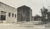
Davis GL 38 Public Library in Elmwood Park
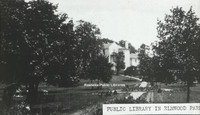
View of the first Roanoke Public Library in Elmwood Park. The library was located in the Terry House, a gift to the city from the Terry Family.
Davis GL 4 Mill Mountain and Roanoke Valley
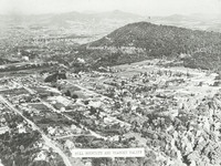
View of Mill Mountain and the surrounding Roanoke Valley
Davis GL 40 Railway Station
View from Williamson Road of Virginia Railway Station. Jefferson Street bridge in background.
Davis GL 41 Ponce De Leon Hotel
View of the rear of the Hotel Ponce De Leon, with the remainder of a building's foundation visible in foreground.
Davis GL 42 Elmwood Park
View of Elmwood Park from the Patrick Henry Hotel.
Davis GL 43 Church Avenue
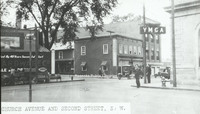
View of the intersection of Church Avenue and Second Street SW with the sign for the YMCA on the right.
Davis GL 44 Highland Park
Recreation in Highland Park
Davis GL 46 Spring in Weaver Heights Park
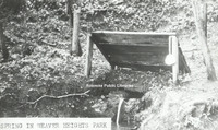
View of the spring once located in Weaver Heights Park.
Davis GL 47 Route 460
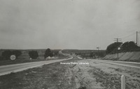
View of Route 460 east of Roanoke.
Davis GL 48 Ponce de Leon
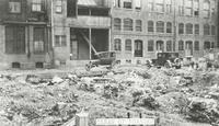
View of debris behind original Hotel Ponce de Leon.
Davis GL 49 9th Street
View of 9th Street from the intersection with Jamison Avenue.
Davis GL 5 Montrose Avenue Jog End
View of the 600 block Montrose Avenue lined with houses.
Davis GL 52 Old Episcopal Church
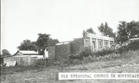
Ruins of an episcopal church in Northeast Roanoke.
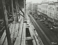
Davis GL 55 Downtown Construction
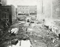
View of men working on construction downtown. Totz Department Store can be seen in the background. Totz was located at 117-119 Salem Avenue SW.
Davis GL 57 Mayors Momument
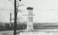
Mayor's Monument in its original location in Woodland Park at Church Avenue and Sixth Street SE, overlooking the Norfolk and Western Shops. The Mayor
Davis GL 58 Lynchburg Avenue
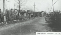
Unknown location on Orange (Lynchburg) Avenue.
Davis GL 59 Panorama
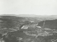
Panoramic view of Roanoke Valley from Route 221 on Bent Mountain at the top of the climb up the mountain just before it reaches the top.
Davis GL 6 Highland Park School
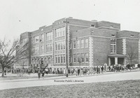
View of Highland Park Elementary School, located at 1212 5th Street.
Davis GL 64 Salem Avenue

Approximately 132 Salem Avenue.
Davis GL 66 Melrose Park
Melrose Park on Melrose Avenue between 14th and 15th Streets.
Davis GL 68 Allison Avenue
A view of the 300 block of Allison Avenue.
Davis GL 69 Pond in Elmwood Park
View of pond in Elmwood Park .
Davis GL 7 Jefferson Street Looking North
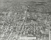
Aerial view of Jefferson Street looking north.
Davis GL 71 Zone Plan City of Roanoke
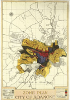
Map of City of Roanoke's Zone Plan used in Nolen Plan.
Davis GL 72 Fairacres
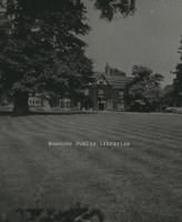
Fairacres, located at 2713 Avenham Avenue, was built in 1912 by W.C. Stephenson. It remained in the Stephenson Family until 1963, when it was purchased by the Roanoke Council of Garden Clubs. The club kept the home until 2003. It is now a private…
Davis GL 75 Map of Roanoke
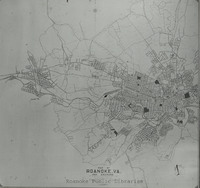
Map of City of Roanoke and Environs used in the Nolen plan.
Davis GL 76 Existing Conditions of Roanoke
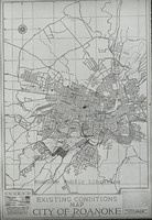
Existing Conditions Map of City of Roanoke used in Nolen plan
Davis GL 77 Traffic Congestion Flyer
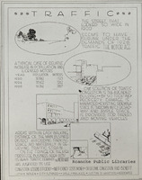
Traffic Congestion Flyer circa 1928.
Davis GL 79 Jamison Bakery
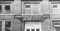
Jamison Company Bakery, formerly located at 541 Salem Avenue.
Davis GL 8 Stone Bridge
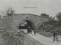
Children play under stone bridge. Location unknown.
Davis GL 80 Giles Brothers Furniture
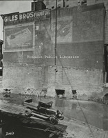
Giles Brothers Furniture, formerly located at 108 Campbell Avenue.
Davis GL 81 Schulte United Building
Campbell Avenue as seen from the Schulte United building, formerly located at 16 Campbell Avenue.
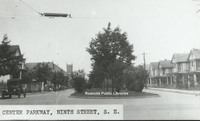
Davis GL 84 Center Parkway
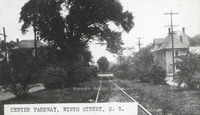
Center Parkway, 9th Street SE.
Davis GL 85 FNEB Detail
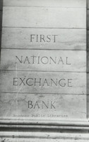
Stonework etched with First National Exchange Bank.
Davis GL 86 Washington Park
Washington Park, located at 1610 Burrell Street.
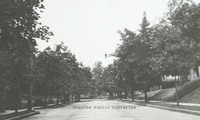
Davis GL 87 Grandin Road
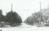
Looking north on Grandin Road from Sherwood Avenue.
Davis GL 88 Wasena Terrace
Looking east on Wasena Terrace.
Davis GL 89 Comprehensive Plan
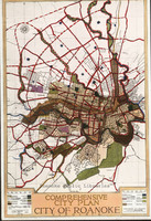
Map included in John Nolen's Comprehensive Plan for the City of Roanoke.
Davis GL 9 Scene in Highland Park
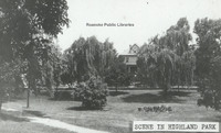
Scene in Highland Park.
Davis GL 90 Mountain Avenue
Looking east on Mountain Avenue at 4th Street intersection.
Davis GL 92 Eleventh Street
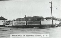
Billboards lining Eleventh Street at Moorman Avenue intersection.
Davis GL 94 Market Street
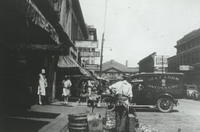
Looking north on Market Street.
Davis GL 98 Pitzer Transfer
Pitzer Transfer Storage Warehouse, formerly located at the corner of Franklin Road and 2nd Street.