
Browse Items (9249 total)
Sort by:
GB07

“Harry A. White.” Photographer: Johnhoite (?) Studio
GB06 Burrell Memorial Hospital

Groundbreaking for the new Burrell Memorial Hospital 2 August 1953. Photographer: Steve Brody.
GB05

Aladdin Temple #34 on parade, Patton Avenue in front of St. Andrew’s Catholic Church.. “Miss Bertha White, Ill. Commandress, Roanoke, VA.”
GB04 Lucy Addison High School Girls' Basketball Team

Lucy Addison High School Girls' basketball team.
GB03 Lucy Addison High School Majorettes

Lucy Addison High School Majorettes in front of the Gainsboro Library.
GB02
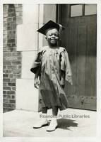
Young boy wearing a graduation cap and gown in front of the Gainsboro Library. “Hugh Ennis.”
GB01 Dr. Lawrence E. Paxton

Dr. Lawrence E. Paxton operated a dental practice on Wells Avenue.
GB 144

“Ricardo C. Stovall & Bike on Patton Ave. N.E (Claytor House in Background) about 1959” (Reprint, library owns digital copy only, not original.)
GB 142

“Old First Baptist Church & St. Andrews Catholic Church, November 3,1990-Roanoke Va.” (Reprint, library owns digital copy only, not original.)
Gainsboro Library Vertical Files and Surname Files Index
The Vertical Files and Surname Files Index is an alphabetical list of over 250 topical files. Vertical files may include pamphlets, news clippings and other materials that do not merit a call number, but are arranged for ready reference on a given…
Gainsboro Library Funeral Program and Obituaries Index
The Funeral Program and Obituary Index includes funeral programs, in memoriam articles and obituaries that are housed at the Gainsboro Branch of Roanoke Public Libraries.
Floyd Press Obituary Index: 1944-1990

This document is an alphabetical listing of nearly 10,000 obituaries printed in the Floyd Press from 1944-1990. The Floyd Press is available on microfilm in the Virginia Room for these years.
FE305 Roanoke Country Club

Greens and fairways at Roanoke Country Club. The clubhouse is just visible in the background.
FE304 Observation Tower

The first observation tower on Mill Mountain was constructed in 1910 and destroyed by a violent wind storm in 1914. It was replaced shortly thereafter by another observation tower, which burned in 1936.
FE303 Prospect Road

Mill Mountain’s Prospect Road, commonly called the Loop Road or Old Toll Road, still has the same basic design when it originated as a graded carriage road in 1891. Today, the road is part of the Roanoke Valley’s greenway system within Mill Mountain…
FE302 Melrose Baseball

Melrose Athletic Club baseball team and mascot.
FE301 Market Square

In the days before trucks were ubiquitous, farmers brought their goods to the City Market in buckboards, carts, and Conestoga wagons.
FE300 Roanoke Auditorium

Roanoke Auditorium was located along Wells Avenue NE, between Williamson Road and 2nd Street. Built in 1916, it was purchased in 1947 by the American Legion and thence called the American Legion Auditorium. It served the city well as an all-purpose…
FE299 Buena Vista

Buena Vista was contructed by Colonel George P. Tayloe around 1840.
FE298 Coulter Building

Built in 1926, the Coulter Building is located at 601 S. Jefferson Street.
FE297 Jackson Ferry Shot Tower

Jackson Ferry Shot Tower in Wythe County. The tower is 75 feet tall and was used for manufacturing lead shot. Construction began shortly after the American Revolution and was completed in 1802. The shot tower is now Shot Tower State Park.
FE296 McGuire Building

The McGuire Building and Market Square.
FE295 Peoples Bank

People's Bank building located at 201 S. Pollard Street in Vinton.
FE294 Shenandoah Building

The Shenandoah Building is located at 305 1st Street.
FE293 Jefferson Apartments

The Jefferson Apartments, formerly located at 820 S. Jefferson Street. This view looks west on Mountain Avenue.
FE292 Crystal Spring

A view of Crystal Spring Park, pump house, and reservoir. Crystal Spring was one of the city's earliest landscaped parks. It was designed and managed by Roanoke Gas and Water Works.
FE291 School Administration

Roanoke High School was built in 1898 on the northeast corner of Church Avenue and 3rd Street SW. It became the school administration building in 1924 after Jefferson High School opened. It was razed in 1968 for construction of the Municipal…
FE290 City Hotel

City Hotel was built in 1886 on the southeast corner of Jefferson Street and Salem Avenue.
FE289 Medical Arts Building

Located at 30 Franklin Road, the Professional (or Medical) Arts Building was built in 1929.
FE288 McBain Building

The McBain building, located at 34 Campbell Avenue.
FE287 Roanoke High School

Roanoke High School was built in 1898 on the northeast corner of Church Avenue and 3rd Street SW. It became the school administration building in 1924 after Jefferson High School opened. It was razed in 1968 for construction of the Municipal…
FE286 Roanoke Auditorium

Roanoke Auditorium was located along Wells Avenue NE, between Williamson Road and 2nd Street. Built in 1916, it was purchased in 1947 by the American Legion and thence called the American Legion Auditorium. It served the city well as an all-purpose…
FE285 Colonial Bank Building

Colonial National Bank building, located at 202 S. Jefferson Street.
FE284 Roanoke Lodge #197

Roanoke Lodge #197 of the Benevolent and Protective Order of Elks. The lodge stood on the southeast corner of Jefferson Street and Franklin Road
FE283 Post Office

Roanoke's second federally funded post office was constructed on the same site as the first, the corner of Church Avenue and 1st Street. It was built in 1914 and replaced in 1933.
FE281 Phelps & Armistead

Phelps & Armistead Furniture, formerly located at 312 2nd Street SW. The building would later be occupied by Grand Piano.
FE280 Hammond Printing

Hammond's Printing and Litho Works, formerly located on the southeast corner of Jefferson Street and Luck Avenue,
FE279 McBain Building

The McBain building, located at 34 Campbell Avenue.
FE278 Prospect Road

Mill Mountain’s Prospect Road, commonly called the Loop Road or Old Toll Road, still has the same basic design when it originated as a graded carriage road in 1891. Today, the road is part of the Roanoke Valley’s greenway system within Mill Mountain…
FE277 Municipal Building

The Municipal Building at night.
FE276 Municipal Building

The Municipal Building was built in 1915.
FE275 Victory Stadium

Athletic field and grandstands at Victory Stadium. The stadium was built in 1942 and razed in 2006.
FE274 Victory Stadium

Athletic field and grandstands at Victory Stadium. The stadium was built in 1942 and razed in 2006.
FE273 Market Building

The Market Building appears largely unchanged today from when it was built in 1922.
FE272 Ponce de Leon Hotel

The original Ponce de Leon Hotel located at 131 Campbell Avenue SW. The elegant verandas are gone by the time this photograph was taken. In December 1930, the building was totally destroyed by fire, killing one resident and injuring others. It was…
FE271 Roanoke Public Warehouse

Roanoke Public Warehouse was located at 403 Salem Avenue.
FE270 Main Street
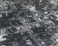
Aerial viewing showing Main Street in Salem near the intersection with Union Street and Academy Street.
FE269 Roanoke Knitting Mills

Roanoke Knitting Mills began operations in 1903 at 306 Elm Avenue SE. It closed by 1909.
FE268 Lorraine Apartments

Shown under construction are the Lorraine Apartments, located at 1221 S. Jefferson Street. This view shows the rear of the building from Maple Avenue SW.
FE267 Williamson Building

Intersection showing the Williamson Building on the northwest corner of Church Avenue and Jefferson Street. At the time of this photo it was occupied by the Sportsman, Deb Fashions, Thom McCann Shoes. The building was razed in 1977.
FE266 Lorraine Apartments

Shown under construction are the Lorraine Apartments, located at 1221 S. Jefferson Street.
FE265 Mill Mountain
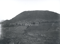
A view of Mill Mountain showing a relatively undeveloped foreground.
FE263 Day & Night Bank
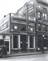
Built in 1905, the building located at 116 Campbell Avenue SW was home to two banks in its early years, Day & Night Bank in this photograph and State & City Bank.
FE261 Christ Episcopal
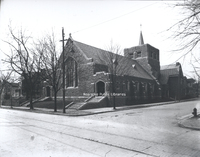
Christ Episcopal Church, located at 1101 Franklin Road SW.
FE260 Jefferson Street
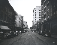
Looking north on Jefferson Street from the 300 block.
FE258 Jefferson Street
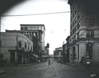
Looking south on Jefferson Street from Salem Avenue.
FE257 Lee Junior High
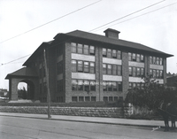
Lee Junior High School was built in 1912 at the intersection of Franklin Road and 2nd Street SW. It was razed in 1973 to clear the site for construction of the Richard H. Poff Federal Building.
FE256 Stone Printing
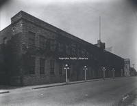
Stone Printing Company began doing business at this location in 1891. The stone veneer was added to the building, located at 116 N. Jefferson Street, in 1907.
FE255 Jefferson Hospital
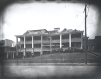
Jefferson Hospital, founded in 1907 by Dr. Hugh Trout, was the predecessor of Carilion Roanoke Community Hospital. Formerly located at 1313 Franklin Road SW, the hospital closed in 1967 and was later razed.
FE250 Police Car
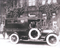
Parked in front of the city jail, is this blue and white, fifty horsepower Cadillac patrol wagon. It could carry as many as eight prisoners in its enclosed compartment, while the policeman had to ride exposed to the elements.
FE241 Blue Ridge Springs
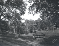
Blue Ridge Springs was one of a number of summer resorts in Southwestern Virginia. It boasted the healing powers of dyspepsia in its natural spring. Like many resorts of its kind, Blue Ridge Springs fell into disrepair during the Great Depression. …
FE239 Grandin Road

Looking northeast on Grandin Road at the intersection with Shirley Avenue.
FE236 N&W Shops
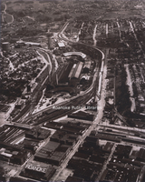
Aerial view of Norfolk & Western east end shops.
FE226 Maiden Lane
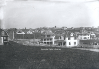
Looking west from the 1900 block of Maiden Lane. The neighborhood is still under development at the time of this photograph.
FE225b Maiden Lane
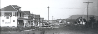
Looking east on the 2000 block of Maiden Lane SW. The neighborhood is still under development at the time this photograph was taken.
FE225a Westover Avenue
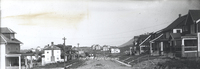
Looking east on the 2000 block of Westover Avenue SW. The neighborhood is still under development at the time of this photograph.
FE224 Grandin Road
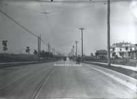
Looking south on Grandin Road from the 1700 block.
FE222 Primitive Dentistry
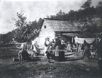
Onlookers in Ballyhack watch as the seated gentleman in this photograph is having a tooth extracted by the lady in front of him, while the one behind him holds his head still.
FE214 Campbell Avenue
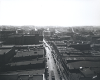
Looking west on Campbell Avenue.
FE211 Witten-Martin Furniture
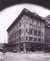
Located at 213 1st Street SW, the Masonic temple was constructed in 1911. For many years, the first floor was occupied by various retail establishments, as evidenced in this photograph when Witten-Martin Furniture Company occupied the space.
FE208 Crockett Springs
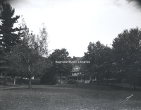
Crockett Springs Resort, near Shawsville, was one of a number of summer resorts in Southwestern Virginia that boasted the healing powers of its spring waters. The resort opened in 1889 and closed shortly before 1940. The hotel was razed in 1966.
FE206 Mountain Lake
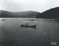
Canoers on Mountain Lake. The second Mountain Lake Lodge, built in 1875, can be seen in the distance. The current stone lodge replaced this structure in 1936.
FE205 Police Switchboard
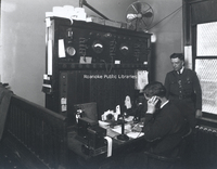
Switchboard at Police headquarters. Sargeant Dick Arnold uses the phone as motorcycle officer John Lemon looks on.
FE203 Virginia College
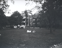
The Virginia College for Young Women was located in the South Roanoke neighborhood at the end of Rosalind Avenue. The college closed in 1933.
FE202 Blue Ridge Springs
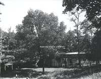
Blue Ridge Springs was one of a number of summer resorts in Southwestern Virginia. It boasted the healing powers of dyspepsia in its natural spring. Like many resorts of its kind, Blue Ridge Springs fell into disrepair during the Great Depression. …
FE201 State & City Building
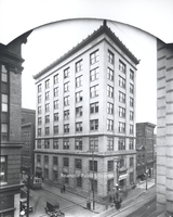
State & City Building, located at 102 Campbell Avenue SW.
FE200 WDBJ Radio
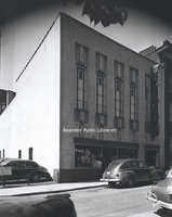
Virginia's second commercial radio station, WDBJ-AM, had been broadcasting for twelve and a half years when it moved to its new quarters at 124 Kirk Avenue SW in January 1937.
FE199 Terra Alta
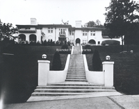
"Terra Alta" located at 1348 Prospect Road SE.
FE198 Mountain Trust Bank
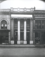
The temporary quarters of Mountain Trust Bank, formerly located at 34 W. Church Avenue.
FE196 Roanoke Baseball
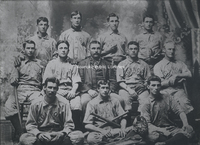
Roanoke Baseball Team. Front row, left to right: Dusty Coons, ? Wrigley, ? Lynch; middle row, L to R: unidentfied, unidentfied, Pop Tate (manager), G. McGann, ? Hill; back row, L to R: Ed McGinnis, unidentified, unidentified, and ? Williams.
FE195 Campbell Avenue
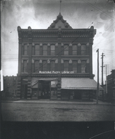
Lyle's Drugstore occupied the right half of this building, located at 101 Campbell Avenue SW.
FE189 Fenton China
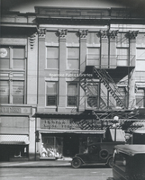
Fenton China and House Furniture, formerly located at 306 S. Jefferson Street.
FE188 Burrell Memorial
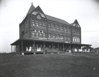
Roanoke's first African American hospital, Burrell Memorial, was founded in 1915 in a small cottage on Henry Street. It soon outgrew the Henry Street location and moved into the former Alleghany Institute, a school for boys located at 611 McDowell…
FE185 Campbell Avenue
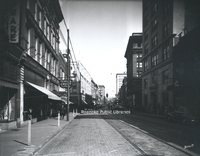
Looking east from the 100 block of Campbell Avenue.
FE182 Jefferson Street
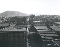
Looking south on Jefferson Street from the Colonial Bank building.
FE178 Elmwood Park
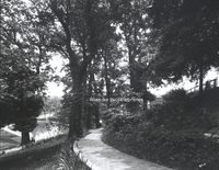
A scene in Elmwood Park.
FE175 Roanoke High School
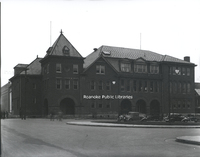
Roanoke High School was built in 1898 on the northeast corner of Church Avenue and 3rd Street SW. It became the school administration building in 1924 after Jefferson High School opened. It was razed in 1968 for construction of the Municipal…
FE171 Roanoke Photo Finishing
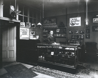
An interior view of Roanoke Photo Finishing Company with George Davis behind counter.
FE162 N&W General Offices
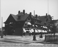
Completed in 1883 by the Shenandoah Valley Railroad, the general office building housed the offices for Norfolk & Western after they were moved from Lynchburg. The building was located on the northwest corner of Jefferson Street and Shenandoah…
FE159 Mountain View
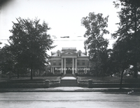
Mountain View, a 40 room elegant turn-of-the-century mansion, was built in 1907 by Junius B. Fishburn. Mr. Fishburn donated Mountain View to the City in 1955 with the stipulation that it be used solely and exclusively for public recreation purposes.…
FE157 Ole Monterey
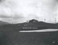
Built in 1920, Ole Monterey Golf Course is the second oldest golf course in the City of Roanoke.
FE156 Crystal Spring Laundry
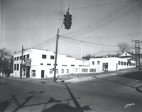
Crystal Spring Laundry was located at 720 Franklin Road SW.
FE153 Roanoke Country Club
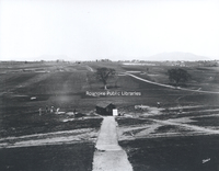
Roanoke Country Club, located at 3360 Old Country Club Road NW.
FE151 Wasena Elementary
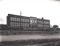
Wasena Elementary School is located at 1125 Sherwood Avenue SW.
FE150 Jefferson High School
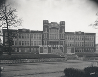
Originally constructed in 1922, Jefferson High School was Roanoke's largest high school for half a century.
FE147 State & City Bank
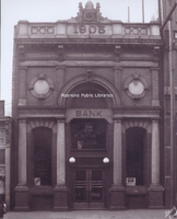
Built in 1905, the building located at 116 Campbell Avenue SW was home to two banks in its early years, State & City Bank in this photograph and Day & Night Bank.
FE146 Roanoke Hospital
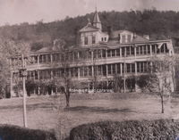
Roanoke Hospital was built in 1893 with the aid of Norfolk & Western and the Roanoke Gas and Water Company. Carilion Roanoke Memorial now occupies the site of the old hospital.
FE144 Highland Park Elementary
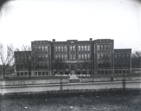
Built in 1920, Highland Park Elementary School is located at 1212 5th Street SW.
FE142 Roanoke Printing Company
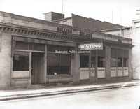
Roanoke Printing Company occupies the Bolling Building, formerly located on the southwest corner of Church Avenue and 1st Street SW.
FE140 Stonewall Jackson Middle
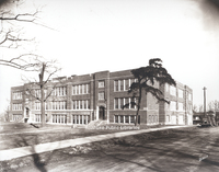
Stonewall Jackson Middle School located at 1004 Montrose Avenue SE. The school's name was changed to John P. Fishwick Middle School in 2018.
FE139 Lucy Addison High
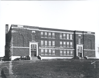
Lucy Addison High School opened in 1928. Located at 40 Douglass Avenue NW, the building now houses Roanoke City Public Schools Administrative Offices.
FE138 Jamison School
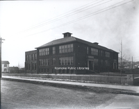
Jamison Elementary School was located on the southwest corner of Jamison Avenue and 14th Street SE. The school was built in 1916 and razed in 1975.
FE137 Stonewall Jackson Middle
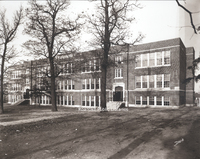
Stonewall Jackson Middle School located at 1004 Montrose Avenue SE shortly after completion. The school's name was changed to John P. Fishwick Middle School in 2018.
FE136 Morningside Elementary
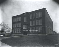
Morningside Elementary School, located at 1716 Wilson Street SE.
FE131 Boggs & Havnaer
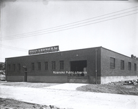
Boggs & Havnaer Laundry and Dry Cleaning supplies and equipment, formerly located at 912 3 1/2 Street SE.
FE130 Morice Twine Mills
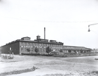
The Morice (formerly Roanoke) Twine Mill in Norwich. Built to house the Norwich Lock Company in 1891, the lock company was a short-lived enterprise. In 1901, the Roanoke Cotton Mill moved into the abandoned building.
FE128 Sherwood Forest
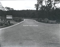
Entrance to Sherwood Forest subdivision, located at Yellow Mountain Road and Nottingham Road.
FE126 Harrison School
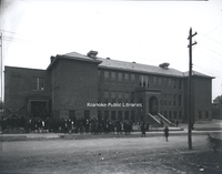
The Harrison School was completed in 1916. Two years later, the first high school classes for African American students began at Harrison School. Three students graduated in 1924, due largely to the persistence of Harrison's principal, Lucy…
FE124 Commerce Street School
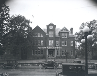
Commerce Street School, also called First Ward School, was located at the corner of Church Avenue and 2nd (Commerce) Street. Built in 1890, it was razed in 1929 to make room for the post office.
FE123 Ponce de Leon Hotel
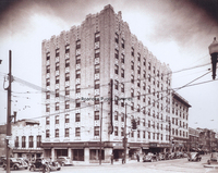
The second Ponce de Leon Hotel located at 131 Campbell Avenue SW.
FE121 Belmont School
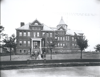
Belmont Elementary School was located on Dale Avenue in southeast Roanoke. The school was built in 1891 and remained in operation until 1974 when Fallon Park Elementary School was completed.
FE120 N&W General Offices
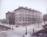
Norfolk & Western General Offices, located at 8 N. Jefferson Street, replaced the old General Offices after they were destroyed by fire in 1896. This building would be used in this capacity until 1932 when the new office building was completed.
FE117 Salvation Army Hotel
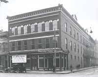
Salvation Army Hotel, formerly located at 201 2nd Street SW.
FE116 Roanoke Country Club
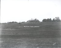
Roanoke Country Club, located at 3360 Old Country Club Road NW, shortly after completion of the clubhouse.
FE112 First Presbyterian
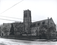
First Presbyterian Church, located at 2101 Jefferson Street SW.
FE111 Hancock-Clay
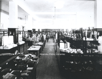
In the Coulter Building, the Hancock-Clay Company opened a department store in 1926. This interior view shows some of the dry goods and notions sold by Hancock-Clay. The firm became bankrupt in the early 1930s.
FE109 Spanish-American Vets
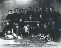
Spanish-American War United States Veterans, Company G, 2nd Virginia Volunteers, Dewey Mess. Pictured are : H.H. Zink, E.M. Carr, Pat Sullivan, A.T. Day, F.M. Moore, C.W. Rolen, J.T. Donnelly, G.D. Black, J.L. Bonavita, G.W. Misel, R.L. Tremain,…
FE107 Roanoke Bankers
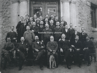
Group portrait of Roanoke bankers in front of the Terry Building.
FE103 Natural Tunnel
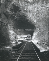
Natural Tunnel in Scott County. The massive naturally formed cave is so large, it is used as a railroad tunnel.
FE098 Pythian Castle
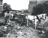
Groundbreaking for Pythian Castle Hall, Osceola Lodge No. 47 on Franklin Road. Shown are George Davis, Stuart A. Barbour, Frank N. Smith, and Charles D. Keffer.
FE094 Old 97
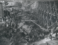
The wreck of the "Old 97" was an American rail disaster involving the Southern Railway mail train, officially known as the Fast Mail, while en route from Monroe, Virginia, to Spencer, North Carolina, on September 27, 1903. Due to excessive speed in…
FE093 Mill Mountain
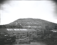
A view of Mill Mountain. Building in foreground was the Adams, Payne, Gleaves, Livery Stable No. 2. Abandoned by the time of this photograph, it is used to promote the purchase of war bonds.
FE092 Neal Tavern
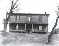
Armistead Neal tavern and boarding house was located on Shenandoah Avenue. For many years, it served the town of Big Lick as a hotel.
FE091 Roanoke Country Club
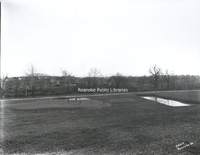
Golf Course at Roanoke Country Club.
FE090 Red Mens Band

Hiawatha Tribe Number 66, Red Men's Band at Hotel Roanoke.
FE089 Old 97
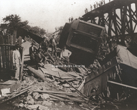
The wreck of the "Old 97" was an American rail disaster involving the Southern Railway mail train, officially known as the Fast Mail, while en route from Monroe, Virginia, to Spencer, North Carolina, on September 27, 1903. Due to excessive speed in…
FE088 Machine Works Band
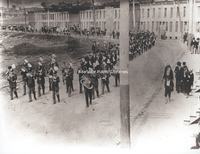
Led by the Roanoke Machine Works band, the funeral procession of William Nolty winds slowly past "Brick Row" on E. Campbell Avenue. "Brick Row" was built as a low-rent housing area for mostly less skilled workers at Roanoke Machine Works. The…
FE086 Old 97
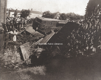
The wreck of the "Old 97" was an American rail disaster involving the Southern Railway mail train, officially known as the Fast Mail, while en route from Monroe, Virginia, to Spencer, North Carolina, on September 27, 1903. Due to excessive speed in…
FE085 Webster Brick
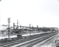
Webster Brick Company (now General Shale), located at 2351 Webster Road.
FE084 Muse Family
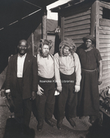
Calvin and Harriet Muse stand with their sons, George and Willie, after the family is reunited in 1927. George and Willie's story is detailed in 'Truevine: Two Brothers, a Kidnapping, and a Mother's Quest' by Beth Macy.
FE083 Natural Bridge Hotel
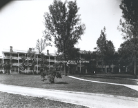
The original Natural Bridge Hotel. The hotel burned in 1963 and was replaced by the current hotel in 1964.
FE082 Almshouse
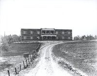
The Almshouse or "poor house" was built in 1925. The building is now part of Virginia Western Community College.
FE081 Carvins Cove
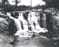
Waterfall at Carvins Cove.
FE080 Poages Mill
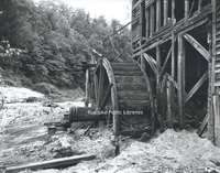
Close-up view of Poage's Mill waterwheel on Back Creek.
FE079 RHS Gymnasts
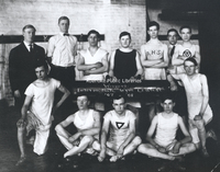
Roanoke High School gymnasts. Caption reads, "Winners Intermediate Gym Contest, '07-'08".
FE077 City Market
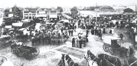
A bustling Market Square.
FE075 Alleghany Institute Students
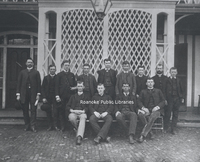
Group portrait of students and faculty of the Alleghany Institute. Front row, left ot right: Ott Coleman, Jack Airheart, William ?; back row, left to right: B.S. Brooke, Eugene Turner, Ernest B. Fishburn, Billy Malone, D. Thomas Taylor, Romeo…
FE073 Jefferson High School
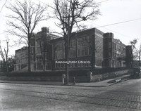
Jefferson High School
FE072 Jefferson Hospital

Jefferson Hospital, founded in 1907 by Dr. Hugh Trout, was the predecessor of Carilion Roanoke Community Hospital. Formerly located at 1313 Franklin Road SW, the hospital closed in 1967 and was later razed. The two-story porches no longer exist…
FE071 Ponce de Leon Hotel
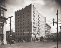
The second Ponce de Leon Hotel located at 131 Campbell Avenue SW.
FE069 Ponce de Leon Hotel
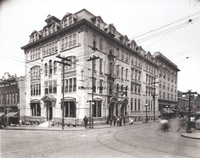
The original Ponce de Leon Hotel located at 131 Campbell Avenue SW. The elegant verandas are gone by the time this photograph was taken. In December 1930, the building was totally destroyed by fire, killing one resident and injuring others. It was…
FE068 Greene Memorial
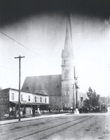
Greene Memorial United Methodist Church at the corner of Church Avenue and 2nd Street. In this photograph, a crowd is gathered to watch as the new La France Fire Engine was hauled to the corner to see if it could throw water as high as the steeple…
FE066 Observation Tower
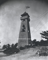
The second observation tower once atop Mill Mountain. The first observation tower was destroyed in a wind storm in 1914. This tower replaced it until 1936, when it was destroyed by fire. George Davis at left.
FE065 WDBJ
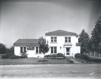
WDBJ station at its third location on the corner of Colonial Avenue and Brandon Avenue.
FE064 View from Mill Mountain
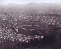
A view of Roanoke from Mill Mountain with the Riverland neighborhood in the foreground.
FE062 Natural Bridge Hotel
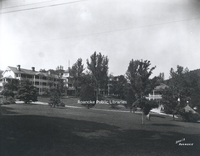
The original Natural Bridge Hotel. The hotel burned in 1963 and was replaced by the current hotel in 1964.
FE061 UCT Carnival
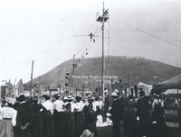
Spectators watch the highwire act, part of the Order of United Commercial Travelers of American carnival.
FE058 Campbell Avenue
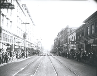
Crowds gather along Campbell Avenue to watch the Armistice Day Parade.
FE057 1st Street
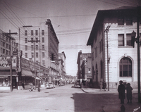
Looking north on 1st Street from Church Avenue.
FE056 Downtown Roanoke
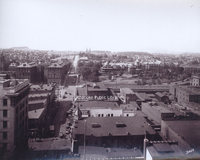
Looking north on Jefferson Street from the Colonial National Bank building.
FE055 Lewis-Gale
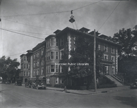
Lewis-Gale Hospital was built in 1909 as a partnership between Dr. Sparrell Gale and Dr. J.N. Lewis. The original hospital stood at the northwest corner of 3rd Street and Luck Avenue.
FE054 Dog Mouth Fountain
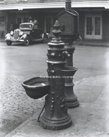
Th Dog Mouth Fountain stands on the northwest corner of Salem Avenue and Market Street. Legend has it that those who drink from the fountain will always return to Roanoke.
FE052 Mill Mountain
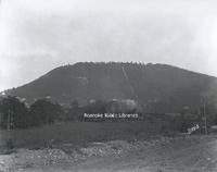
A view of Mill Mountain. Roanoke Hospital, the Mill Mountain Incline, and the observation tower are all visible.
FE050 Patrick Henry Hotel
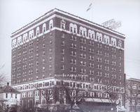
Patrick Henry Hotel
FE049 1st Street
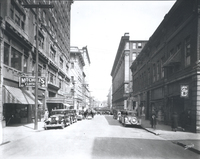
Looking north on 1st Street from Church Avenue.
FE048 FNEB
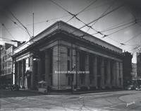
The First National Exchange Bank building is located at 201 S. Jefferson Street.
FE047 Market Building
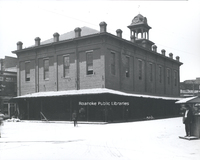
Roanoke's first Market Building. Built in 1886, it was replaced by the current Market Building in 1922.
FE046 Patrick Henry Lobby
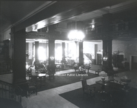
Interior view of the Patrick Henry Hotel lobby.
FE045 Elmwood Pond
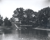
The pond once in Elmwood Park.
FE044 Civil War Veterans
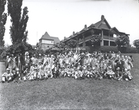
Civil War veterans reunion at Hotel Roanoke.
FE041 Almshouse
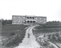
The Almshouse or "poor house" was built in 1925. The building is now part of Virginia Western Community College.
FE038 Mill Mountain Incline
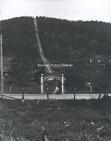
Mill Mountain Incline.
FE037 Jefferson Street
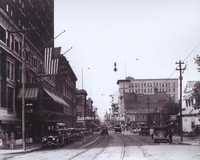
Looking north on Jefferson Street.
FE036 Hotel Roanoke
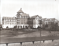
Hotel Roanoke
FE034 Horton Livery
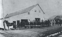
Horton and Roberts Livery Stable stood on Henry Street (now 1st Street SW) just north of the northeast corner of Henry Street and Church Avenue.
FE033 Big Lick Livery
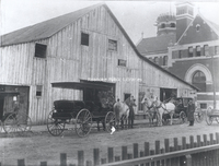
In 1898, the Big Lick Livery Stable stood on Henry Street (1st Street SW) just north of Roanoke's first federally funded post office (located on the NE corner of Henry (1st) Street and Church Avenue) which can be seen in the background. In 1890 this…
FE032 Post Office
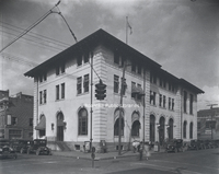
Roanoke's second federally funded post office was constructed on the same site as the first, the corner of Church Avenue and 1st Street. It was built in 1914 and replaced in 1933.
FE029 Fire Station #1
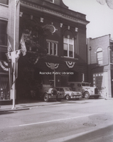
Fire Station No. 1, located at 13 Church Avenue SE.
FE028 Fire Ladder
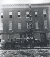
Firemen pose on a ladder pulled by horses. The building in the background was on the corner of 1st Street and Church Avenue.
FE027 Title Guarantee
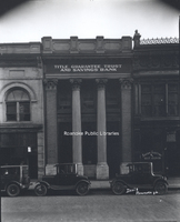
Title Guarantee Trust and Savings Bank, formerly located at 34 Church Avenue SW.
FE024 Jefferson Street
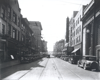
Looking south on Jefferson Street. American Theatre on right.
FE023 Big Lick Hotel
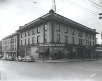
Formerly located on the southwest corner of Williamson Road and Salem Avenue, the Big Lick Hotel would go through several iterations, including a portion of the Shenandoah Hotel, the Lee Hotel and Hotel Earle. The building was gutted by fire in 1991…
FE022 Church and Jefferson
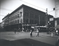
Intersection showing the Williamson Building on the northwest corner of Church Avenue and Jefferson Street. At the time of this photo, the building housed T.L. Deyerle Company. It would later be home to the Sportsman. The building was razed in…
FE019 Lakeside
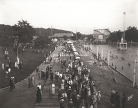
Lakeside Amusement Park was built in 1920 on Mason's Creek. The "lake" seen here was the area's first public swimming pool, complete with sand beach. Also visible is the "Thriller" roller coaster and the bumper car pavilion.
FE017 Mountain Trust
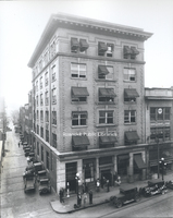
Mountain Trust Bank was located in the Strickland Building at 302 S. Jefferson Street.
FE015 Municipal Building
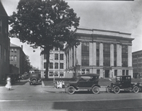
The Municipal Building from 2nd Street.
FE014 Campbell Avenue
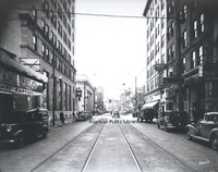
Looking west on Campbell Avenue. The Rialto Theatre is visible at left.
FE013 McGuire Building
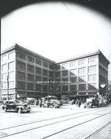
The McGuire Building, located at 1 Market Square, was built in 1914 and housed W. E. McGuire’s Farmers’ Supply Co. that sold buggies, wagons, fertilizer, seed, and other farm-related equipment and supplies. Tenants in this photo include A&P…
FE012 Alleghany Institute Students
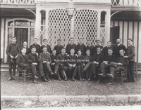
Group portrait of Alleghany Institute students. Individuals unidentifed.
FE011 McGuire Building
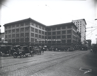
The McGuire Building, located at 1 Market Square, was built in 1914 and housed W. E. McGuire’s Farmers’ Supply Co. that sold buggies, wagons, fertilizer, seed, and other farm-related equipment and supplies.
FE010 Campbell Avenue
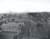
Looking east on Campbell Avenue toward the Market Building from the roof of the Colonial American National Bank building.
FE009 Union Lunch
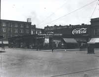
Union Lunch, formerly located in the area where the Market Building is today.
FE007 Armistice Day Parade
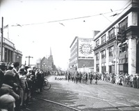
A contingent of veterans march in the Armistice Day Parade on Campbell Avenue.
FE006 JE Bernards
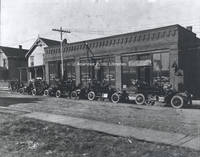
J.E. Bernard's Machine Shop, formerly located at 109-111 Church Avenue SW. Roanoke Automobile Company is located next door, specializing in the sale of Ramblers.
FE005 Carolina Cotton Mills
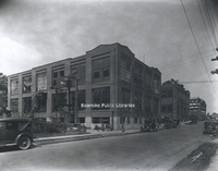
Carolina Cotton and Woolen Mills, formerly located at 505 6th Street SW.
FE003 Grand Piano
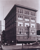
Grand Piano Furniture was located at 312 2nd Street SW.
FE001 First Auto
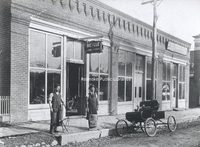
Roanoke's first automobile parked in front of a bicycle shop at 109-111 Church Avenue SW. The first auto was believed to have been owned by T.T. Fishburn. In two years, in 1906, this building would become Roanoke Automobile Company selling Rambler…
FE00 GW Sisler
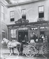
G.W. Sisler Funeral Home, formerly located at 23 First (Salem) Avenue.
FC014 Willis High School
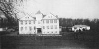
Willis High School. The agricultural building is at right.
FC013 Mountain Normal School
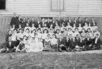
Mountain Normal School students posing in front of the dormitory building.
FC012 Floyd Esso
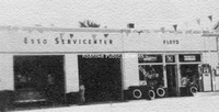
Floyd Esso Service Center in Floyd County.
FC011 Rollie Phillips Store
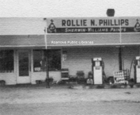
Rollie N. Phillips store and gas station, located in the Indian Valley area of Floyd County. Phillips opened his service station in 1927.
FC010 Willis Elementary School
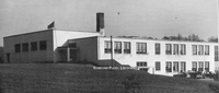
Willis Elementary School.
FC008 Willis High School
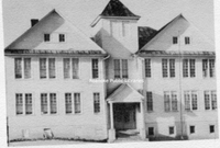
Willis High School after the addition was completed.
FC007 Willis High School
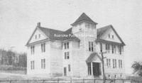
Willis High School shortly after opening.
FC005 WHS Cornerstone
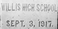
The cornerstone of Willis High School.
FC004 Willis High School
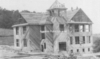
Willis High School under construction.
FC003 Old Mountain Normal
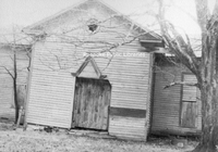
The long abandoned old Mountain Normal School at Willis in Floyd County, VA. The Normal School opened in 1893.
FC002 Mountain Normal School
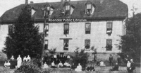
Mountain Normal School dormitory at Willis in Floyd County, VA.
FC001 Willis High School
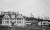
Willis High School in Floyd County, VA. The school closed after the 1961-62 school year.
Family Tracings, 1714-1894
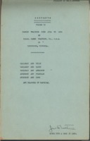
Family tracings of the Callaway, Tilly, Early, Anderson, Franklin and Cook Families of the counties of Amherst, Appomattox, Bedford and Campbell.
Eyrie 1988

The Eyrie is the annual for Hidden Valley Middle School.
Eyrie 1986
The Eyrie is the annual for Hidden Valley Middle School.
Eyrie 1985
The Eyrie is the annual for Hidden Valley Middle School.
Eyrie 1980
The Eyrie is the annual for Hidden Valley Middle School.
Eyrie 1977
The Eyrie is the annual for Hidden Valley Middle School.
Eyrie 1975
The Eyrie is the annual for Hidden Valley Middle School.
ET4 Elkhorn Tunnel

Employees stand inside the Elkhorn Tunnel during construction. The 7,100 foot tunnel opened to rail traffic in June 1950, replacing a single-track tunnel constructed in 1887.
ET3 Elkhorn Tunnel

Construction of the Elkhorn Tunnel in Mercer County, West Virginia. The 7,100 foot tunnel opened to rail traffic in June 1950, replacing a single-track tunnel constructed in 1887.
ET2 Haley, Chisolm, & Morris

Employees of Haley, Chisolm, and Morris pose next to company trucks. The company was contracted by Norfolk & Western to build the Elkhorn Tunnel.
ET1 Elkhorn Tunnel

Two workers stand inside the Elkhorn Tunnel during construction in Mercer County, West Virginia. The 7,100 foot tunnel opened to rail traffic in June 1950, replacing a single-track tunnel constructed in 1887.

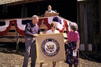
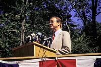
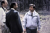
EP921
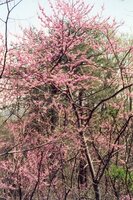
Redbud tree. Date on back is 10 April 1995.
EP920
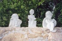
Three statues on stone wall. From left to right: child with arms around knees, child sitting on stand with book in lap, cherubim. Date on back is 14 June 1994.
EP919
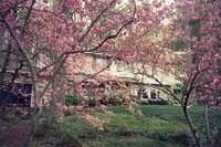
Pink spring trees in front of home. Date on back is 10 April 1995.
EP918
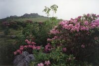
Rhododendron plant with hill in background. Date on back is 14 June 1994.
EP917
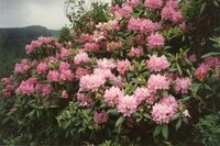
Close up of Rhododendron flowers. Date on back is 14 June 1994.
EP916
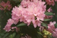
Close up of Rhododendron flowers. Date on back is 14 June 1994.
EP915
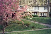
Spring trees in front of home with driveway to home in background. Date on back is 10 April 1995.
EP914
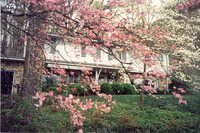
Rhododendron tree in front of home. Date on back is 10 April 1995.
EP913
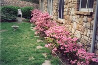
Rhododendron flowers surrounding siding of home. Date on back is 10 April 1995.
EP912
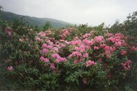
Rhododendron plant with mountain in background. Date on back is 24 June 1994.
EP911
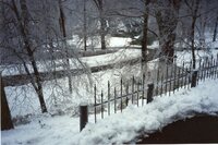
Snow on yard with ice on fence. Date on back is 11 February 1993 .
EP910
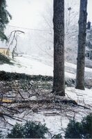
Branches on ground with snow covered trees in the background. Date on back is 11 February 1993.
EP909
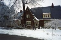
Front yard of home with snow on the ground, road plowed. Date on back is 11 February 1993.
EP908
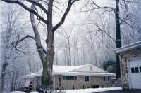
Powerline with ice on line. Home in background and snow on the ground. Date on back is 11 February 1993.
EP907
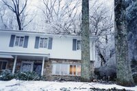
Front of home with snow on the ground. Date on back is 11 February 1993.
EP906
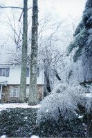
Trees in front yard of home with snow covering the ground. Date on back is 11 February 1993.
EP905
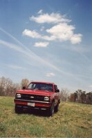
Rupert Cutler’s vehicle parked in field. Date on back is 10 April 1995.
EP904
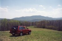
Rupert Cutler’s vehicle parked in field with Blue Ridge mountains in the background. Date on back is 10 April 1995.
EP903
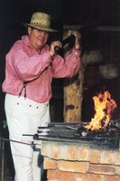
Daniel Young in historical attire on the left with fire and blacksmith tools on the right. Writing on the back says “Virginia’s Explore Park interpreter Daniel Young demonstrates the black-smithing skills that were so important to settlers. This…
EP902
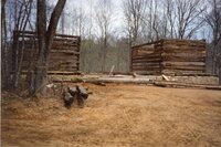
Houtz Barn under construction with roof unconstructed. Date on back is 15 April 1994.
EP901
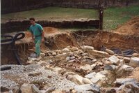
Man walking out of underground construction with stone and gravel surrounding the area for building next to Wray Barn and Hofauger house. Date on back is 15 April 1994.
EP900
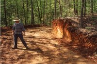
Man on left standing in dirt trail. Date on back is 28 April 1994.
EP899
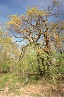
Tree with unique shaped branches. Date on back is 24 May 1994.
EP898
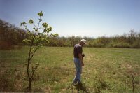
Man with camera around neck standing in field next to small tree that is on the left. Date on back is 24 May 1994.
EP897
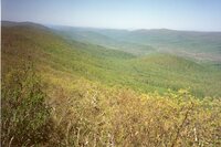
Overlook in Jefferson National Forest with mountains in background. Date on back is 24 May 1994.
EP896
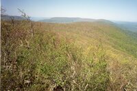
Overlook in Jefferson National Forest. Date on back is 24 May 1994.
EP895
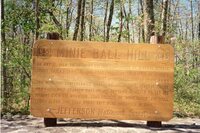
Sign that says“Minie Ball Hill: On May 12, 1864, An infantry column commmanded by General George Cook (U.S.A) traveled this road following the battle of Cloyd’s Mountain. The road became almost impassable due to heavy rains and with the confederates…
EP894
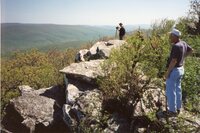
From Jefferson National forest, individual on right and in background looking out towards mountains. Date on back is 24 May 1994.
EP893
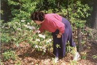
Woman bending over smelling flowers in forest. Date on back is 24 May 1994.
EP892
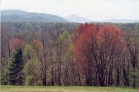
From hill, trees with mountains in background. Date on back is 10 April 1995.
EP891
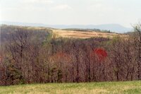
Hill top with mountains in background. Date on back is 10 April 1995.
EP890
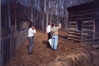
Bern Ewart gesturing to building next to Hofauger Farmstead with two men. Date on back is 08 February 1993.
EP889
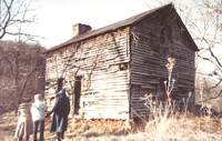
Three individuals on left looking at abandoned, weathered building.
EP888
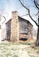
Old building with deteriorating siding.
EP887
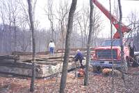
Machine on right with individuals on left on foundation of building under construction. Date on back is 11 February 1993.
EP886
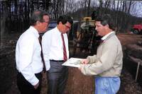
Bern Ewart on right holding map in hands speaking to two men. Tractor in background. Date on back is 11 February 1993.
EP885
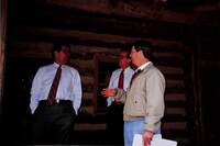
Bern Ewart on right speaking with two men in glasses on Hofauger House porch. Date on back is 08 February 1993.
EP884
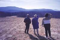
Three individuals looking past field towards Blue Ridge mountains. Date on back is 08 February 1993.
EP883
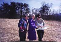
Three individuals looking at map in woman on the right’s hands who is pointing to map. Date on back is 08 February 1993.
EP882
Road with snow on the ground. Date on back is 08 February 1993.
EP881
Road with snow on ground. Date on back is 08 February 1993.
EP880
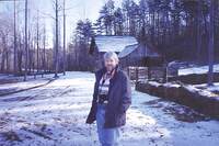
Man smiling at camera with camera around his neck. In front of Wray Barn in the snow. Date on back is 08 February 1993.
EP879
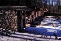
Foundation/stables of Houtz Barn with snow on the ground. Date on back is 08 February 1993.
EP878
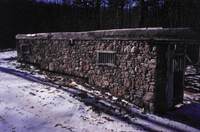
Foundation/stables of Houtz Barn completed with snow on the ground. Date on back is 08 February 1993.
EP877
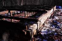
Foundation of Houtz Barn during construction in the snow. Date on back is 08 February 1993.
EP876
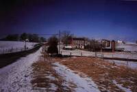
From outside of fence, Brugh Tavern (original site) with snow melting. Date on back is 04 February 1993.
EP875
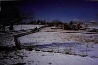
From road, Brugh Tavern (original site) in the snow. Date on back is 04 February 1993.
EP874
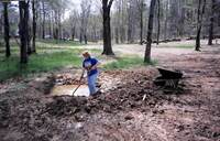
Woman with shovel in hand digging up dirt around small area with water. Wheel barrow on the right. Date on back is 15 April 1994.
EP873
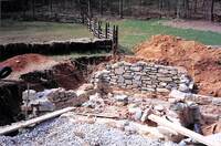
Underground stone siding of building next to Hofauger House and Wray Barn. Date on back is 15 April 1994.
EP872
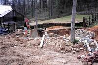
Foundation of building next to Hofauger House with stone being laid down underground. Individual on left with wheelbarrow. Stone and materials surrounding area. Wray Barn in background on left. Date on back is 15 April 1994.
EP871
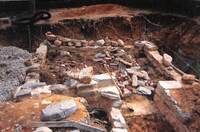
Foundation of building with stone and brick in disarray. Date on back is 15 April 1994.
EP870
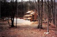
Hofauger House from distance with porch constructed but not painted. Vehicles in background.
EP869
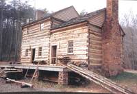
Hofauger House before porch is finished. Logs laying against porch. Date on back is 23 November 1992.
EP868
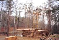
Wray Barn with metal structure in middle supporting top beam and attached to rest of barn. Construction materials surrounding scene. Date on back is 30 November 1992.
EP867
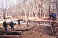
People laying down logs by raising it with rope for construction of Wray Barn. Date on back is 05 December 1992.
EP866
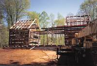
Houtz Barn under construction with machine on right. Date on back is 28 April 1994.
EP865
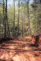
Dirt trail dug out surrounding by trees. Date on back is 28 April 1994.
EP864
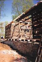
Front of Houtz Barn under construction with incomplete stone siding on bottom. Date on back is 28 April 1994.
EP863
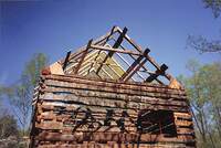
Houtz Barn from the side with incomplete roof and siding. Date on back is 28 April 1994.
EP862
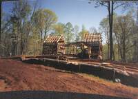
Houtz Barn under construction taken from front angle. Construction materials and machine in frame on the right. Date on back is 28 April 1994.
EP861
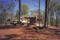
Houtz Barn under construction with incomplete roof and windows. Machine on left. Date on back is 28 April 1994.
EP860
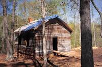
Kemp’s Ford School house with tarp on roof. Wooden ramp leading to doorway. Date on back is 28 April 1994.
EP859
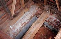
Underground area of building showing brick and cement foundation. Date on back is 15 April 1994.
EP858
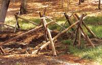
Stick fencing surrounding dug out area.
EP857
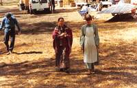
Two women in historical attire (Laurie Spangler on right) in historical attire walking away from Hofauger House.
EP856
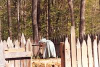
Woman in historical attire plowing garden in fenced area behind Hofauger House.
EP855
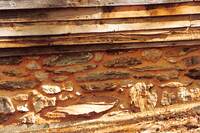
Bottom stone foundation for Houtz Barn.
EP854
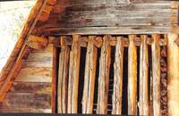
Siding of roof for Houtz Barn.
EP853
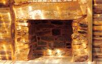
Fireplace of Hofauger House.
EP852
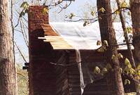
Chimney of Kemp’s Ford Schoolhouse with tarp on roof.
EP851
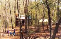
From trail, group of people with children walking along trail to Kemp’s Ford Schoolhouse. Tent/pavilion set up in background.
EP850
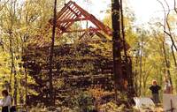
Through trees, side profile of Houtz Barn with unfinished roof and exterior. People on the right..
EP849
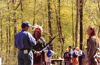
On left, Rupert Cutler speaking to Dan Abbott who is in Native American attire. On the right, another Native American interpreter is watching scene. Children in background. .
EP848
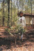
Woman smiling at camera posing behind small tree. Date on back is 28 April 1994.
EP847
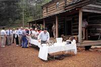
Tables with food and people in line for food in front of Hofauger House. Date on back is 28 April 1994.
EP846
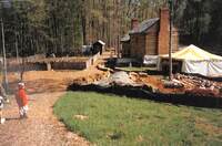
Along trail leading to back of Hofauger House, garden on left and Hofauger house on right. Construction materials blocked off on right with tent on right. Sign that says “Appalachian Power” Date on back is 28 April 1994.
EP845
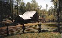
From outside of fence, Wray Barn. Date on back is 28 April 1994.
EP844
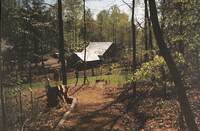
Taken from overhead, a trail behind Wray Barn. Wray Barn in distance. Date on back is 28 April 1994.
EP843
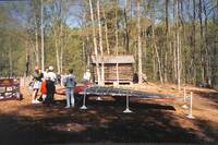
People surrounding narrow vehicle. On the left, poster with details. Date on back is 28 April 1994.
EP842
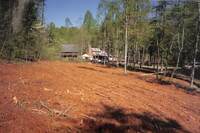
Clearing with trees cut down. Wray Barn and Hogauger house in background. Tents set up near buildings. Date on back is 28 April 1994.
EP841
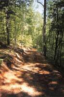
Dirt path with trees surrounding path. Date on back is 10 May 1994.
EP840
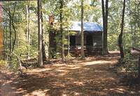
Side view of Kemp’s Ford Schoolhouse under construction. Date on back is 10 May 1994.
EP839
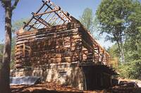
Side view of Houtz Barn unfinished. Date on back is 10 May 1994.
EP838
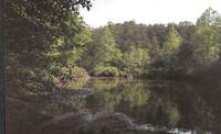
Trees alongside body of water. Taken from bank of lake. Date on back is 10 May 1994.
EP837
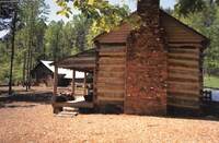
Side view of Hofauger House with Wray Barn in background on left. Date on back is 10 May 1994.
EP836
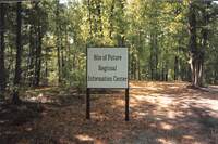
Sign that says “Site of Future Regional Information Center” with yellow tape in background. Date on back is 10 May 1994.
EP835
Foliage surrounding stream. Date on back is 10 May 1994.
EP834
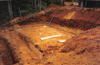
Ground dug out for construction of building. Foundation already in progress. Date on back is 17 May 1994.
EP833
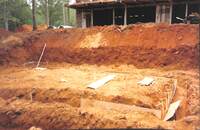
Ground dug out behind Houtz Barn with foundation already in progress. Date on back is 17 May 1994.
EP832
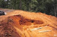
Ground dug out for construction of building. Foundation already in progress. Date on back is 17 May 1994.
EP831
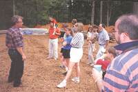
Man on left speaking to group of people on the right with construction materials in background. Date on back is 17 May 1994.
EP830
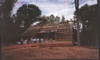
Unfinished Houtz Barn with people standing in front of it. Date on back is 17 May 1994.
EP829
Side view of group of people looking to right of the camera. Date on back is 17 May 1994.
EP828
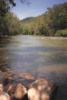
From the bank, Roanoke river with trees in the background. Date on back is 17 May 1994.
EP827
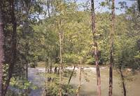
Through trees, Roanoke River in background. Date on back is 17 May 1994.
EP826
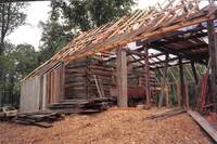
Houtz Barn with roof and back wall unfinished. Date on back is 26 May 1994.
EP825
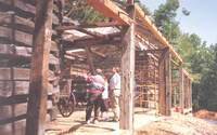
Bern Ewart with group of people in unfinished Houtz Barn. Date on back is 24 May 1994.
EP824
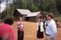
Bern Ewart on left speaking to a group of people in front of Wray Barn. Date on back is 24 May 1994.
EP823
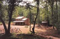
Through trees, Hofauger House in background. Date on back is 24 May 1994.
EP822
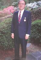
Rupert Cutler standing in front of bushes with medal pinned to suit. Date on back is 20 May 1994.
EP821
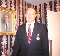
Rupert Cutler with medal pinned to suit on right standing next to portrait of himself. Date on back is 20 May 1994.
EP820
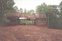
Houtz Barn with unfinished roof and walls. People inside barn. Date on back is 20 May 1994.
EP819
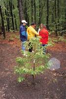
Small tree in forest with group of people huddled around another tree in background. Date on back is 20 May 1994.
EP818
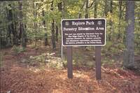
Sign that says “Explore Park Forestry Education Area (with badge that says Society of American Foresters 1900) this trail was created by volunteers from the Blue Ridge Chapter of the Society of American Foresters, the national scientific and…
EP817
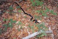
Black snake slithering on forest ground. Date on back is 26 May 1994.
EP816
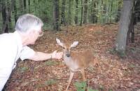
Man on left holding out palm for deer. Date on back is 26 May 1994.
EP815
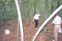
Bern Ewart on right holding hand out for deer who is coming towards Ewart. Man on right walking towards deer. Date on back is 26 May 1994.
EP814
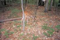
Deer grazing in forest. Date on back is 26 May 1994.
EP813
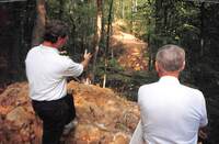
Bern Ewart on left gesturing towards dirt trail below them with man on right. Woman going down to dirt trail. Date on back is 26 May 1994.
EP812
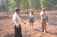
In clearing, Bern Ewart on left gesturing to ground with woman and man on the right looking to the right. Date on back is 26 May 1994.
EP811
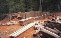
Building under construction with beams and wood paneling surrounding site. Date on back is 26 May 1994.
EP810
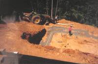
Underground foundation of building being constructed with tractor in background on left and two men working on concrete. Date on back is 24 May 1994.
EP809
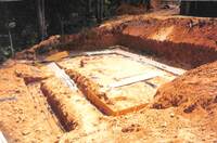
Underground foundation of building being constructed. Date on back is 24 May 1994.
EP808
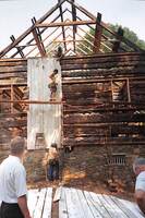
Siding of Houtz Barn being put up by construction workers. Date on back is 26 May 1994.
EP807
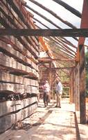
Houtz Barn under construction. Group of people in background looking at interior construction of barn. Date on back is 24 May 1994.
EP806
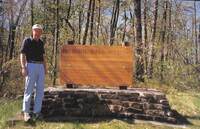
Man on left posing next to sign on cobblestone that says “Minie Ball Hill: On May 12, 1864, An infantry column commmanded by General George Cook (U.S.A) traveled this road following the battle of Cloyd’s Mountain. The road became almost impassable…
EP805
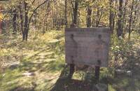
Sign that says “Mountain Lake Wilderness Area Hiking Trails. Wheeled vehicles and motorized equipment prohibited. Chestnut Trai (with smaller print details) War Branch Trail (with smaller print details) (and a map of trails.) Jefferson National…
EP804
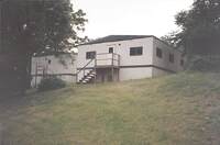
Backside of Administrative offices. Date on back is 26 May 1994.
EP803
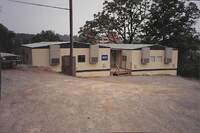
Administrative offices. Date on back is 26 May 1994.
EP802
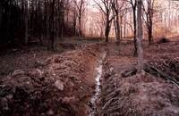
Dug out path with water flowing in forest. Date on back is 21 March 1991.
EP801
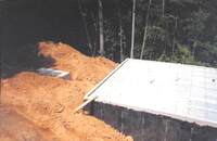
Building with completed foundation and pipes attached. Dirt piles on the left. Taken from an overhead view. Date on back is 21 June 1994.
EP800
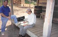
Bern Ewart on left against porch of Hofauger House with man writing in notepad sitting on porch on the right. Date on back is 21 June 1994.
EP799
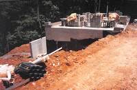
Side view of building under construction. Foundation with concrete bricks on top of it in background on the right. Pipes and dirt dug out on the left. Date on back is 27 June 1994.
EP798
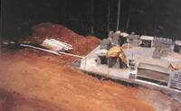
Building with concrete foundation with concrete bricks on top of foundation on right. Pipes next to dirt hill on left. Taken from overhead view. Date on back is 27 June 1994.
EP797
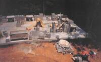
Building with concrete foundation with concrete bricks on top of foundation. Taken from overhead view. Date on back is 27 June 1994.
EP796
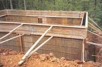
Underground section of unfinished building being supported by beams. Date on back is 31 May 1994.
EP795
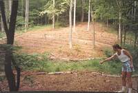
Woman on right, pointing to ground. Clearing with wooden logs bordering in background. Date on back is 31 May 1994.
EP794
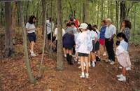
In forest, children looking at tree with adults behind them. Date on back is 31 May 1994.
EP793
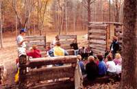
Standing in Wray Barn while under construction, man on left speaking to children surrounding walls of barn. Date on back is 10 December 1991.
EP792
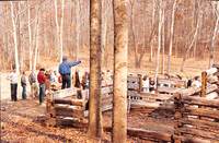
Man elevated amid crowd pointing to the right. Wray Barn under construction behind him. Date on back is 06 November 1991.
EP791
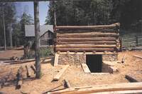
Building under construction with materials surrounding site. Wray Barn in the background on the left. Date on back is 21 June 1994.
EP790
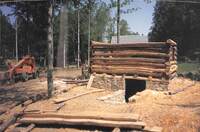
On the left, a Skytrak machine. On the right, building under construction with materials surrounding site. Date on back is 21 June 1994.
EP789
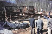
On the right, men in suits looking at Hofauger House under construction. Man in plaid standing with them pointing to house. Date on back is 05 February 1992.
EP788
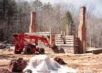
Hofauger House being built. Skytrak Machine in front of house. Bricks in front.
EP787
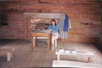
Woman seated at front desk in Kemp’s Ford Schoolhouse with books opened on desk. Fireplace and historical attire behind her. Clipboards on bench in front of her. Date on back is 27 June 1994.
EP786
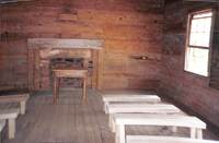
Interior of Kemp’s Ford schoolhouse taken from back of building. Fireplace and front desk in center front with benches along the side. Date on back is 27 June 1994.
EP785
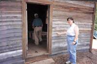
Woman on the right smiling touching exterior of Kemp’s Ford Schoolhouse. Man inside of building with back to camera. Date on back is 27 June 1994.
EP784
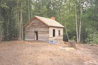
Kemp’s Ford Schoolhouse with window gutted out and old roof on ground. Date on back is 31 May 1994.
EP783
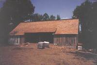
Houtz Barn with completed roof. Wrapped materials in front on barn. Date on back is 27 June 1994.
EP782
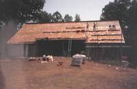
People working on roof of Houtz Barn with most of roof done. Date on back is 27 June 1994.
EP781
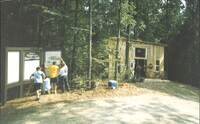
On the right, New Mountain Mercantile. On the left, people putting up signs with images and caption. Middle sign says “Welcome to Virginia’s Explore Park” Date on back is 06 July 1994.
EP780
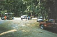
Vehicles along gravel road. Ticket booth on the left. Three individuals walking to the right. Date on back is 06 July 1994.
EP779
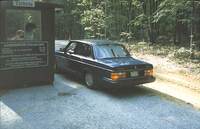
From behind, Volvo on right at ticket booth entrance on left. Sign on booth says “Tickets” and “Admission Charges Adults: $4.00 Students (6-18 years old) $2.50 Children Free. $20.00 Minimum on VISA & MasterCard. Special rates available for groups of…
EP778
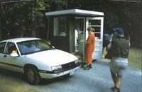
White Chevrolet at Ticket booth. People surrounding booth. Date on back is 06 July 1994.
EP777
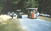
Cars lined up along gravel road with ticket booth in center. Group of people huddled around ticket booth. Man to the side of the road on the left. Date on back is 06 July 1994.
EP776
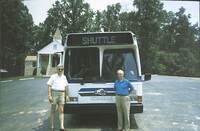
Two men posing with bus that says “Virginia Museum of Transportation” “Shuttle” sign at top and “Explore Park” sign in window of shuttle. Church in background on the left. Date on back is 06 July 1994.
EP775
Close up of sign that says “Virginia’s Explore Park” Date on back is 06 July 1994.
EP774
Sign on hillside that says “Virginia’s Explore Park” with road in background on the right. Date on back is 06 July 1994.
EP773
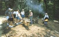
Daniel Young on the left in historical attire speaking to group of people with tools in front of him on a bench. Man in historical attire at outdoor grill on the right. Date on back is 06 July 1994.
EP772
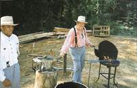
Daniel Young in historical attire working outdoor grill with anvil on the left. Man on left in historical attire. Wooden beams in background. Date on back is 06 July 1994.
EP771
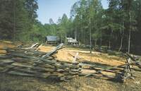
Fence surrounding Hofauger Homestead. Wray Barn and Hofauger house in background. Date on back is 06 July 1994.
EP770
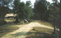
Trails of Explore Park. Houtz Barn in the Background on the left. Date on back is 06 July 1994.
EP769
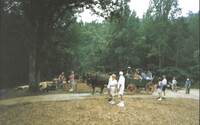
People walking along trail with horse drawn carriage carrying people in background. Date on back is 06 July 1994.
EP768
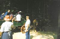
Individuals in horse drawn carriage. Woman with back to camera on the left waving to riders. Man on the right looking at woman. Date on back is 06 July 1994.
EP767
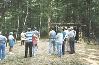
Group of people with backs to camera watching presentation being putting on by Scott Sarver. British flag hoisted up in background. Date on back is 06 July 1994.
EP766
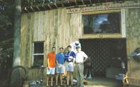
In front of New Mountain Mercantile, Rupert Culter (on the right) posing with three men. Man on left of Cutler has arm in sling. Date on back is 06 July 1994.
EP765
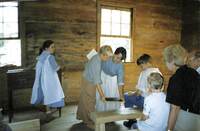
In Kemp’s Ford Schoolhouse, woman on the right in historical attire holding chalkboard with child in historical attire on the left. Girl in historical attire at front desk, with individuals watching presentation on the right. Date on back is 06 July…
EP764
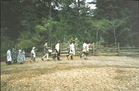
People in historical attire walking along trail with children in back of line. Date on back is 06 July 1994.
EP763
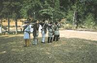
Men lined up in historical attire pointing guns to the right in front of them. Date on back is 06 July 1994.
EP762
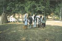
Men lined up in historical attire loading guns with huts and tents in background. Date on back is 06 July 1994.
EP761
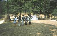
Men lined up in historical attire loading guns with huts and tents in background. Date on back is 06 July 1994.
EP760
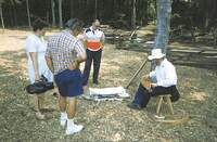
Man sitting on stool on the right playing a stringed instrument. Three individuals surrounding him, on on the left holding a camera. Date on back is 06 July 1994.
EP759
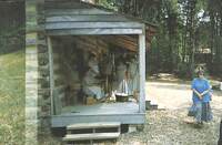
Group of people surrounding Kimberly Burnette at spinning wheel on porch of Hofauger House. Date on back is 06 July 1994.
EP758
Trees in forest with Houtz Barn in background up the hill. Date on back is 06 July 1994.
EP757
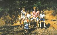
Family with young children seated on bench smiling for camera. Date on back is 06 July 1994.
EP756
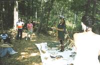
Dan Abbott in Native American attire on the right standing on blanket with artifacts, tools, and weapons. Group of people to the left watching him. Date on back is 06 July 1994.
EP755
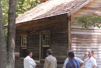
Group of people standing around side of Kemp’s Ford Schoolhouse.
EP754
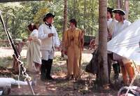
Group of people in historical attire chatting with one another. . Wagon in background on the right.
EP753
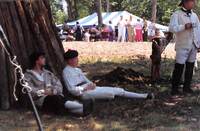
Men in historical attire seated against hut. Crowds of people in background with pavilion tent in background.
EP752
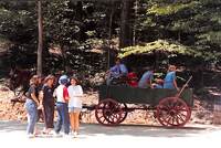
Horse drawn wagon with individuals riding in wagon. Individuals in group outside of wagon on road.
EP751
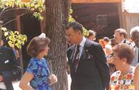
Woman on left speaking to Mayor Noel Taylor on left with Houtz Barn in background. People surrounding the area.
EP750
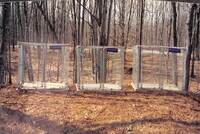
Three animal cages with woods in background. Date on back is 03 April 1995.
EP749
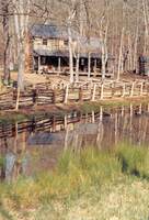
Close up of pond in front of fence surrounding Hofauger Farmstead. Hofauger House in background. Date on back is 03 April 1995.
EP748
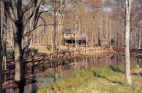
Taken from a farther distance, pond in front of fence surrounding Hofauger Farmstead. Hofauger House in background. Date on back is 03 April 1995.
EP747
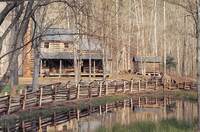
Pond in front of fence surrounding Hofauger Farmstead. Hofauger House in background. Date on back is 03 April 1995.
EP746
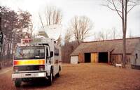
News 7 van on left with Houtz Barn on the left in background. Date on back is 03 April 1995.
EP745
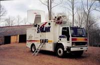
“News 7” van in front of Houtz Barn. Date on back is 03 April 1995.
EP744
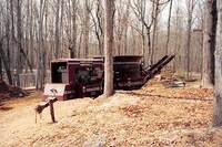
Wood grinder machine in clearing. Named “Industrial Grinder” Date on back is 03 April 1995.
EP743
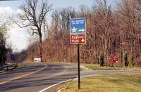
Road sign on the right that says “Mill Mountain Zoo and Star” with arrow pointing to the right. Another sign that says “Explore Park” with arrow pointing straight ahead. “Mill Mountain Park” sign in background on the right with road leading to Mill…
EP742
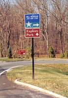
Road sign that says “Mill Mountain Zoo and Star” with arrow pointing to the right. Another sign that says “Explore Park” with arrow pointing straight ahead. “Mill Mountain Park” sign in background with road leading to Mill mountain. Date on back is…
EP741
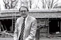
Another close up of Rupert Cutler posing for picture with Blacksmith shop under construction in background.
EP740
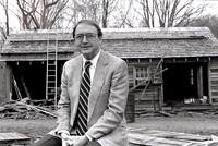
Close up of Rupert Cutler posing for picture with Blacksmith shop under construction in background.
EP739
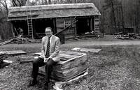
Rupert Cutler sitting on wooden roofing with Blacksmith shop under construction in background.
EP738
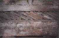
Close up of wooden slats in building. Date on back is 28 March 1994.
EP737
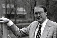
Rupert Cutler smiling with arm against post.
EP736
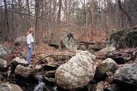
Woman on left standing on rocks surrounding creek in forest. Date on back is 28 March 1994.
EP735
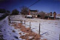
Front view of original Brugh Tavern with street on left and fencing surrounding house on right. Snow on the ground. Date on back is 04 February 1993.
EP734
Man sitting down at desk smiling with little girl in lap, arms around each other.
EP733
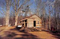
Side view of Blacksmith shop under construction with materials surrounding the building. Two individuals in the background on the left.
EP732
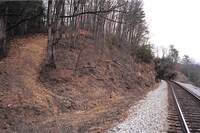
Trail leading up a hill on the left with train tracks on the right. Date on back is 28 March 1994.
EP731
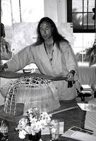
Dan Abbott laying down material on miniature sweat lodge on table. With map behind him.
EP730
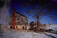
Original Brugh Tavern in the snow with silos in background. Date on back is 04 February 1993.
EP729
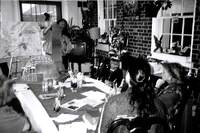
Dan Abbott holding materials for replica miniature sweat lodge that is on table in front of him with individuals listening seated around table. Map of Virginia’s Explore Park in background.
EP728
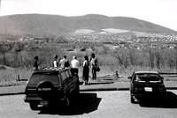
From behind, individuals looking at view of mountains at outlook off of Blue Ridge Parkway. From left to right, woman, Bob Fetzer, Bob Hope, Robert Dennis, Faye Cooper, and individual holding camera taking picture. Writing on back says "Parkway near…
EP727
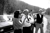
From left to right, Faye Cooper, Robert Dennis, Bob Hope, Bob Fetzer parked near outlook on Blue Ridge Parkway. Writing on back says “From Left: Faye Cooper, Exec. Director, Valley Conserv. Council, Staunton. Rob’t T. Dennis, Pres. Piedmont…
EP726
Sign that says “Virginia’s Explore Park”
EP725
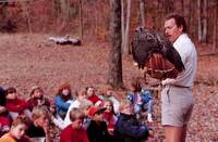
On the right, man holding red tailed hawk speaking to group of children seated on the left. Date on back is 10 December 1991.
EP724
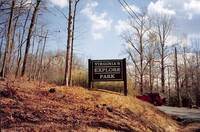
Sign on hill that says “Virginia’s Explore Park”. Red vehicle parked on road in background.
EP723
Flowers on dining table, with plants on bench near window in background.
EP722
Plants on bookcase with stairs in background.
EP721
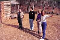
From left to right: two men and two women. Woman on right is pointing past camera to the right. Hofauger House in background on the left.
EP720
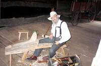
Man sitting at woodworking machine smiling at camera. Toolbox next to him and wagon in background on the right. Date on back is 27 July 1994.
EP719
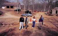
Five individuals walking away from Houtz Barn (on left) and Blacksmith shop (on right and under construction) vehicles parked in background.
EP718
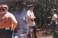
Scott Sarver in historical attire speaking to young boy. Woman with back to camera on the left. Behind Sarver is replica of artifacts and shelter of home from era he is representing.
EP717
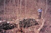
Cobblestone wall in forest with man in camo pants and hat in background on the right.
EP716
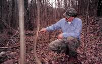
Man in camo pants and hat pointing to tree in forested area.
EP715
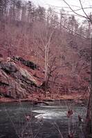
Hillside along Roanoke River with river in frame.
EP714
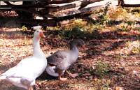
Close up of geese in fenced in area.
EP713
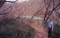
Man on right along trail leading to Roanoke River with river in background.
EP712
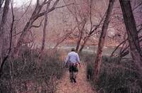
Man walking along dirt path towards Roanoke River.
EP711
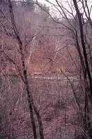
Trees along bank of Roanoke River with the river in the background.
EP710
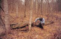
Individual crouched down examining destroyed boat in woods.
EP709
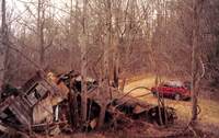
Building destroyed in forest. Red vehicle in background on the right.
EP708
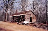
Blacksmith shop with roof beginning to be worked on. Sign is put up and says “Blacksmith and Wheelwright Shop.”
EP707
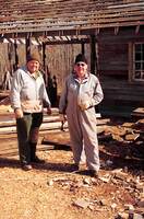
Two men in jumpsuits standing in front of unfinished Blacksmith shop.
EP706
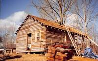
Man working on roof of blacksmith shop with ladders and other construction materials surrounding the area.
EP705
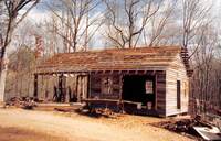
Blacksmith shop under construction with roof unfinished.
EP704
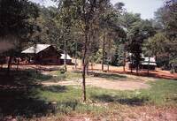
Small tree. Hofauger House and Wray Barn in background.
EP703
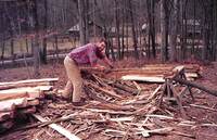
Man smiling at camera working at shaving down felled trees. Hofauger House and Wray Barn in background.
EP702
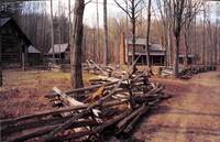
Hofauger House and Wray Barn from outside of fence.
EP701
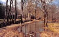
Pond from excess water along trail leading to Hofauger Farmstead. Hofauger House and Wray Barn in background.
EP700
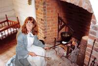
Laurie Spangler in historical attire making food in cast iron pot and pan in fireplace. Date on back is 09 October 1992.
EP699
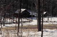
Wray Barn in the snow.
EP698
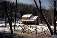
Hofauger House in the snow.
EP697
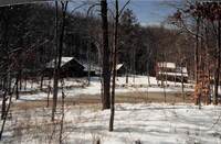
Hofauger House and Wray Barn in background after snowfall.
EP696
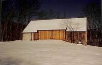
Houtz Barn in the snow.
EP695
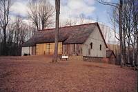
Houtz Barn.
EP694
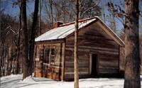
Kemp’s Ford School house in the snow.
EP693
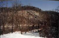
Roanoke River and surrounding area after snowfall.
EP692
Roanoke river in the snow.
EP691
Geese and rams in fenced in clearing. Date on back is 06 July 1994.
EP690
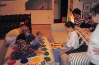
In someone's home, children and woman playing the game “Twister” while others leaned against back of couch watch. Girl sitting on couch is spinning the gameboard wheel. Date on back is 28 November 1994.
EP689
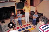
In someone's home, children and woman playing the game “Twister” while others watch. Date on back is 28 November 1994.
EP688
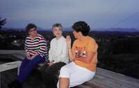
Three women sitting on deck with valley and mountains in background around dusk. Date on back is 28 November 1994.
EP687
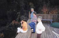
Woman seated on edge of deck with man, and two woman standing behind her looking to the left of camera. Date on back is 28 November 1994.
EP686
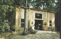
New Mountain Mercantile building with furniture on the porch. Date on back is 06 July 1994.
EP685
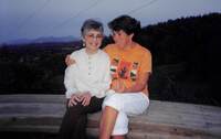
Two women sitting on bench with valley and mountains in the background during dusk. Date on back is 28 November 1994.
EP684
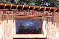
Sign on building that says “New Mountain Mercantile” with window below holding stained glass piece that is the sun rising over the mountains with rainbow bordering image.
EP683
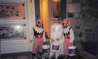
Three children dressed up for costumes with baskets in hand. On left and right, children dressed up as pirates, in the middle girl dressed up in white dress and veil. Date on back is 28 November 1994.
EP682
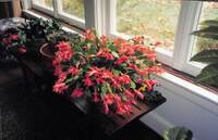
Christmas Cactus on bench in front of window. Date on back is 28 November 1994.
EP681
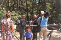
Camera-man capturing men in suits sawing log in half with people in background watching event.
EP680
Gladys Cutler on right with woman and Bern Ewart on left posing in front of market street walkway. Date on back is 05 October 1992.
EP679
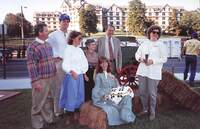
From left to right: Richard Burrow, Martin Skilly, Virginia Laubinger, Gladys Cutler, Rupert Cutler, Laurie Spangler, Penny Lloyd standing or sitting on bales of hay in front of Hotel Roanoke.
EP678
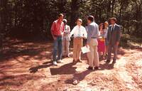
Bern Ewart holding posterboard pointing down at it while speaking to group of people in forest clearing. Date on back is 08 May 1991.
EP677
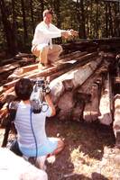
Bern Ewart crouching on pile of logs with both arms extended to the right. Man crouched down in front of him with camera. Date on back is 08 May 1991.
EP676
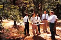
Bern Ewart holding posterboard speaking to group of men in white shirts and ties in forest. Date on back is 07 June 1991.
EP675
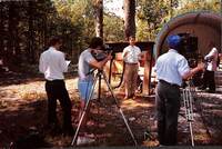
Camera crew capturing Bern Ewart speaking in front of construction pieces of building. Date on back is 08 May 1991.
EP674
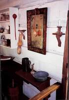
Historical kitchenware along the wall of a preserved historical home.
EP673
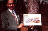
Noel Taylor holding a picture depicting a historical town. Date on back is 22 March 1991.
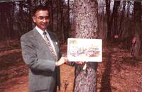
EP672
Noel Taylor holding a picture depicting a historical town. Date on back is 22 March 1991.
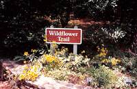
EP671
Sign that says “Wildflower Trail” with flowers in front of it.
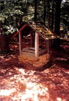
EP670
Boarded up well in forest.
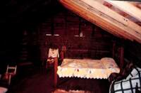
EP669
In an attic, a bedroom with bed (on the right), small chairs (on the left), and spinning wheel on back wall.
EP668
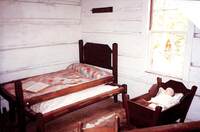
On the left, a bed with pull out trundle. On the right, a cradle holding baby doll.
EP667
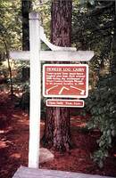
Sign post that says “Pioneer Log Cabin: Constructed from hand-hewn longleaf pine logs. Built around 1800 during the settlement of Troup County, Georgia. Moved to its present location in 1959. Open Daily 9 a.m.- 6 p.m.” With images of tools on bottom…
EP666
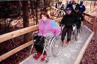
Woman smiling at camera in wheelchair. Behind her, Bern Ewart and others are in wheelchairs getting across newly constructed bridge/walkway. Date on back is 09 December 1991.
EP665
Picnic table. Date on back is 07 June 1991.
EP664
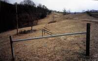
Split rail fencing with road in background.
EP663
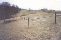
Split Rail fencing.
EP662
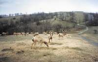
Elk grazing on field.
EP661
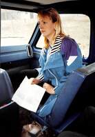
Woman seated in passenger seat of blue van holding sheet of paper looking towards the left.
EP660
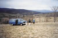
Individuals looking out towards farmland with mountains in background. Blue van on the left.
EP659
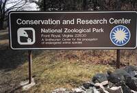
Sign that says, “Conservation and Research Center. National Zoological Park. Front Royal, Virginia 22630. A Smithsonian Center for the propagation of endangered animal species.” With Smithsonian Badge on right and animal badge on left.
EP658
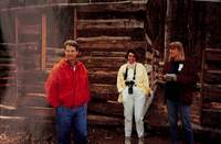
Bern Ewart on left with two women to the right. They are looking off camera to the left. Wray Barn under construction behind them.
EP657
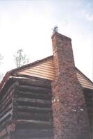
Chiminy of Hofauger house.
EP656
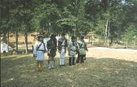
Men lined up in historical attire holding guns. Date on back is 06 July 1994.
EP655
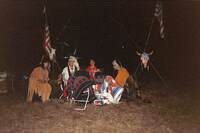
Group of people in Native American attire. American flags behind them on left and right. Taken at night.
EP654
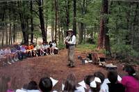
Man in historical attire playing guitar to group of children in forest seated in semi circle. Instruments on ground behind man. Date on back is 17 May 1993.
EP653
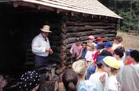
Daniel Young in blacksmith shop holding metal tool speaking to group of children surrounding the shop. Date on back is 12 May 1993.
EP652
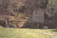
Slone’s Mill with wooden trestle. Two red vehicles parked in background on left. Date on back is 20 May 1994.
EP651
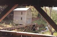
From a bridge, Slone’s Mill with Trestle. Stream in background. Date on back is 20 May 1994.
EP650
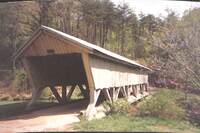
Bridge with covering along trail. Red vehicle in background on right. Date on back is 20 May 1994.
EP649
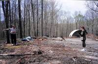
Man on left pointing off camera looking at woman on right who is looking at clipboard. Trees cut down around them with branches and other debris around. Date on back is 15 April 1994.
EP648
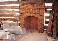
Interior fireplace of Hofauger Hosue not yet finished with walls not completely filled in.
EP647
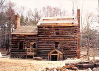
Back of Hofauger house under construction. Framing complete, with remaining features not yet added.
EP646
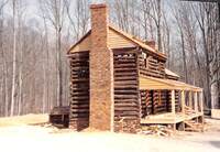
Side profile of Hofauger House coming from Wray Barn. Almost completely built. Framing is finished with no windows or doors added.
EP645
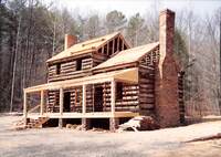
Side profile of Hofauger house almost completely built. Framing is finished with no windows or doors added.
EP644
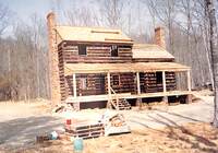
Hofauger House almost complete with construction materials in front of house.
EP643
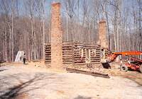
Hofauger House under construction with first level being built. Machine on right.
EP642
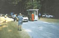
Cars lined up at Ticket booth. People with cameras are standing off to the side taking pictures. News vehicle in background on right. Date on back is 06 July 1994.
EP641
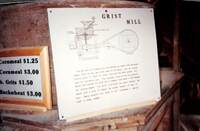
Sign on left that says “Cornmeal $1.25… Cornmeal $3.00…lb. Grits $1.50… Buckwheat $3.00” Next to it on the right is a sign that says “Grist Mill. The two grist mills before you are operated by power from the water wheel, much as they did in the days…
EP640
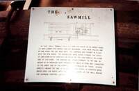
Sign that says “The Sawmill. In this small sawmill uncle Ed used the power of his water wheel to saw lumber for himself and his neighbors. Logs were rolled, one by one, from the log deck onto the carriage and “dogged” in place with the iron hooks.…