
Browse Items (9249 total)
Sort by:
Davis2 31.11b Fort Greenridge
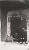
Fireplace located inside Fort Greenridge. Fort Greenridge was located on the west branch of Carvins Creek near Kingstown. In addition to Fort Greenridge, the structure was also called Garst's Fort and Schwarz's Fort as it was owned by Frederick…
Davis2 31.11a Fort Greenridge
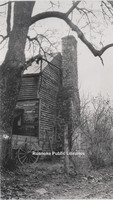
Fort Greenridge was located on the west branch of Carvins Creek near Kingstown. In addition to Fort Greenridge, the structure was also called Garst's Fort and Schwarz's Fort as it was owned by Frederick Garst and Chris Schwarz. Fort Greenridge was…
Davis2 30.1u Shaffers Crossing Roundhouse
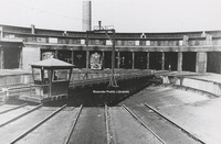
This 115 foot roundhouse was constructed in sections by J.P. Pettyjohn and Company with the first 21 stalls on July 1, 1918. The first stalls and turntable were put into service on September 15, 1919. The turntable was erected by Norfolk and Western…
Davis2 30.1s The Morris House
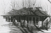
Built in 1963 by Jim Yeatts, the Morris House is located at 2831 Wilton Road.
Davis2 30.1r Bungalow Style House
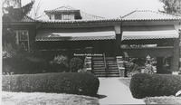
Located at 2607 Rosalind Avenue, this home was built in 1931 and is an example of Bungalow-Style architecture.
Davis2 30.1p Colonial Revival House

Located at 101 27th Street SE in South Roanoke, this Colonial Revival-Style House was designed by architect Robert Allen.
Davis2 30.1o Queen Anne Style House
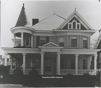
Located at 414 Walnut Avenue, this home was built by J.H. Gibboney, a chemist at Norfolk & Western. One of many examples of the Queen Anne style of Architecture in the Roanoke Valley.
Davis2 30.1n Queen Anne Style House
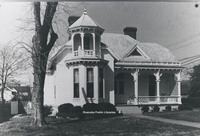
Located at 103 Union Street, this home is reflective of the Queen Anne style. It was built in 1901 by M.G. McClung, an editor of the Salem Sentinel.
Davis2 30.1m Gothic Revival Style House
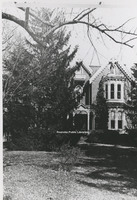
This home was once located at 5415 Plantation Road. A casuality of urban sprawl, this home was an example of Gothic Revival architecture.
Davis2 30.1l Evans House
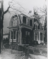
Located at 213 N. Broad Street in Salem, the Evans house was built around 1882 by John M. Evans in the Second Empire style.
Davis2 30.1k Row Houses
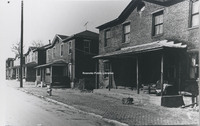
Row Houses like those pictured were an important part of Roanoke's architectural growth. The houses in this photo were once located on Rutherford Avenue Northeast.
Davis2 30.1j Virginia Farm House
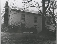
Formerly located at 2801 Brandon Place, this house was typical of Virginia Farm Houses of the 19th Century.
Davis2 30.1i Pleasant Grove
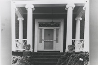
Located at 4377 W. Main Street, Pleasant Grove was built in 1853 for Joseph Deyerle. This photo depicts a close-up of the front door of the Georgian style home.
Davis2 30.1h Belle Aire
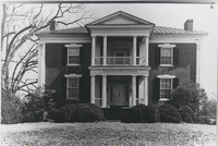
Located at 3820 Belle Air Circle, Belle Aire was built around 1849 by Benjamin Deyerle for Madison Pitzer.
Davis2 30.1g Monterey
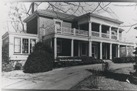
Located at 110 High Street, Monterey was built around 1855 by Benjamin Deyerle. It is one of many houses built by Deyerle in the valley and reflects his Greek Revival architectural style.
Davis2 30.1f Brown House Store
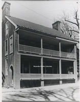
Located at 801 E. Main Street in Salem, Williams-Brown House-Store was built around 1845 by tradesman William Williams. The structure was used as both a home and a store. It is now the home of the Salem Museum and Historical Society.
Davis2 30.1e Monterey
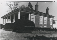
Located of of Tinker Creek Lane in Northeast, Monterey was built around 1845. The home is an example of Greek Revival architecture most commonly found in the Gulf Coast States.
Davis2 30.1d Speedwell
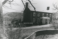
Located at 6135 Merriman Road in Roanoke County, Speedwell was built around 1831 by Lewis Harvey. The house contains elements of Greek Revival style architecture.
Davis2 30.1c Sun Valley
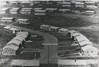
Located just off of Williamson Road, this photo depicts the Sun Valley subdivision where Tampa Drive intersects Orlando Avenue.
Davis2 30.1b Fishburn House
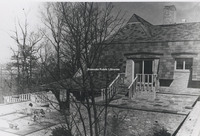
Located at 3542 Peakwood Drive, this home was constructed for Robert Fishburn in 1968. Its unique construction was meant to blend with its natural surroundings.
Davis2 30.1a Garst Log House
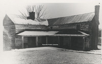
Once located just off of Garst MIll Road at the intersection of Grandin Road Extension, Garst Log Cabin is believed to be one of the earliest homes in the area. It was built around 1800.
Davis2 3.41 City Market
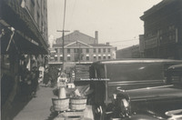
August 1938.
Davis2 3.15 Cows on Market
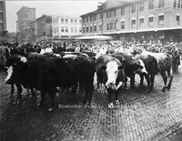
Cows on market for a livestock auction.
Davis2 3.14 Cows on Market
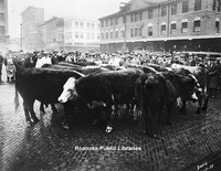
Cows on market for a livestock auction.
Davis2 3.13 1927 Roanoke Flood
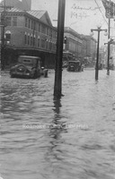
Cars drive through water on Campbell Avenue in front of the Market Building.
Davis2 29d Calvary Baptist
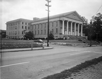
Calvary Baptist Church, located at 608 Campbell Avenue SW.
Davis2 29c Calvary Baptist
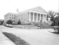
Calvary Baptist Church, located at 608 Campbell Avenue SW.
Davis2 28.3 Christ Lutheran
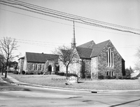
Christ Lutheran Church, located at 2011 Brandon Avenue SW.
Davis2 28.01b Old Lutheran Church
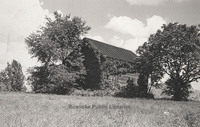
Now the site of Brandon Oaks Lifecare Retirement Home, tradition has it that this structure was the first Lutheran Church in the area. A historical marker is located in the area where the church once stood.
Davis2 28.01a Old Lutheran Church Sign
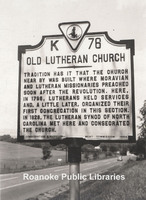
Located on Brandon Avenue near the entrance to Brandon Oaks Lifecare Retirement Home, this historical marker makes note of the first Lutheran congregation in the area.
Davis2 27d Holy Trinity
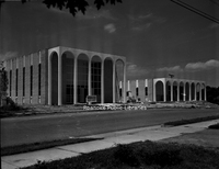
Construction of Holy Trinity Greek Orthodox Church, located at 30 Huntington Boulevard NE.
Davis2 27.61 Evangelical Foursquare
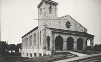
Evangelical Foursquare Church, located at 612 Bullitt Avenue. Building is now used by New Beginnings Pentecostal Church
Davis2 27.55 Hott Bishop Memorial
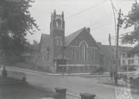
Hott Bishop Memorial United Brethren Church, formerly located on Tazewell Avenue.
Davis2 25.313 Our Lady of Nazareth
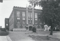
Our Lady of Nazareth Catholic Church. Formerly located at 820 Campbell Avenue, this structure was the first church, completed in 1926. It was used by the church until 1978 when the current structure was completed on Electric Road. The structure in…
Davis2 25.16 St. Andrews
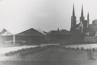
St. Andrews.
Davis2 24.12 St Johns Episcopal
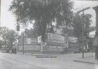
The old St. John's Episcopal Church was once located at the corner of Church Avenue and 2nd Street. In this photo, the vacant building's lawn is being used for billboards. The signs include: Jamison's Chain Grocery Stores, Colonial National Bank,…
Davis2 24.1 St Johns Episcopal
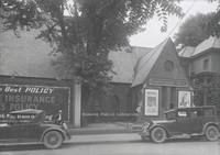
St. John's Espiscopal Church at its Church Avenue and 2nd Street location. The building was not being used by the church at the time this photo was taken. General Outdoor Adventure Co. was using the building.
Davis2 23.5 Salem Presbyterian
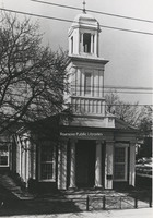
Salem Presbyterian Church, located at 41 E. Main Street.
Davis2 23.44 First Presbyterian
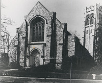
First Presbyterian Church, located at 2101 Jefferson Street.
Davis2 23.43 First Presbyterian
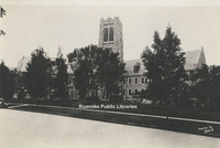
First Presbyterian Church, located at 2101 Jefferson Street.
Davis2 23.35 Belmont Presbyterian
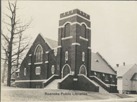
Belmont Presbyterian Church, located at 1005 9th Street SE.
Davis2 22.623 Trinity Methodist
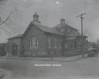
Trinity Methodist Church, located at 305 Mountain Avenue.
Davis2 22.4 Woodlawn Methodist
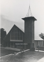
Woodlawn United Methodist Church, located at 2922 Corbieshaw Road.
Davis2 21.61 Pastors of Enon Baptist
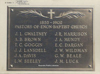
Plaque listing pastors of Enon Baptist Church in Hollins from 1855 -1902.
Davis2 21.554 Villa Heights Baptist
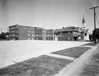
Villa Heights Baptist Church, formerly located at 1026 Lafayette Boulevard NW.
Davis2 21.553 Villa Heights Baptist
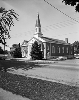
Villa Heights Baptist Church, formerly located at 1026 Lafayette Boulevard NW.
Davis2 2.2491 Melrose Lodge
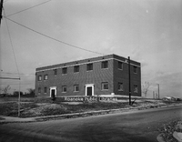
Exterior view of the former Melrose Lodge #139 of the Freemasons, formerly located at 21st Street and Carroll Avenue NW. The building is now part of Williams Memorial Baptist Church.
Davis2 2.15 Welcome
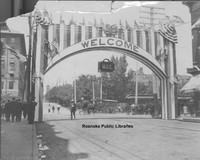
United Council of Travelers Welcome banner for a conference in Roanoke.
Davis2 2.137b Campbell Avenue
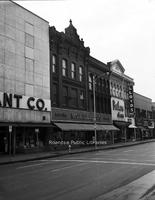
Storefronts in the 10 block of Campbell Avenue SW.
Davis2 2.137a Campbell Avenue
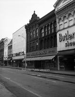
Storefronts on the 10 block of Campbell Avenue SW.
Davis2 2.1342 W.T. Grant Company
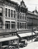
W.T. Grant Company and McClellan Stores, formerly located 17-23 Campbell Avenue SW.
Davis2 2.1341 David Kohen
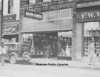
David Kohen Clothing and Apparel, formerly located at 24 Campbell Avenue SW.
Davis2 2.133 Hardy Shoes
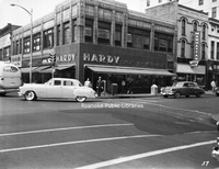
Hardy Shoes for Men and Boys, formerly located at the corner of Campbell Avenue and Jefferson Street.
Davis2 2.13 Campbell and Jefferson
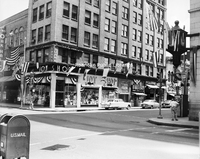
The Rosenberg Building, formerly located on the corner of Campbell Avenue and Jefferson Street, was once the home of the Joy Shop, Barr Brothers Jewelers and Oak Hall Clothing.
Davis2 2.1116a East on Campbell
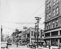
Looking east on Campbell Avenue at the intersection with Jefferson Street.
Davis2 19.9c Briarwood Apartments
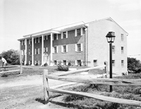
Briarwood Apartments, located at 826 Hardy Road in Vinton.
Davis2 19.9b Briarwood Apartments
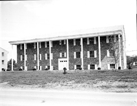
Briarwood Apartments, located at 826 Hardy Road in Vinton.
Davis2 19.9a Briarwood Apartments
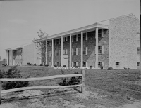
Briarwood Apartments, located at 826 Hardy Road in Vinton.
Davis2 19.815 Terrace Apartments
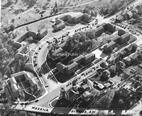
An aerial view of Terrace Apartments with surrounding streets identified.
Davis2 19.6 Colonial Yorktown
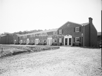
Colonial Yorktown Apartments, located at 2918 Brandon Avenue SW.
Davis2 19.5 SR Apartment Village
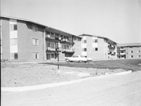
South Roanoke Apartment Village, located at 3727 Parliament Road SW.
Davis2 19.11 YMCA
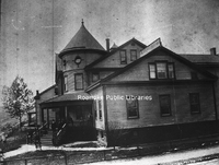
The Railroad Department YMCA, formerly located at 1201 Shenandoah Avenue NW.
Davis2 19.1 YMCA Pool
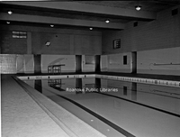
View of the pool inside the old YMCA building, formerly located at 425 Church Avenue, now the Locker Room Lofts.
Davis2 18.51d CC Water Treatment Facility
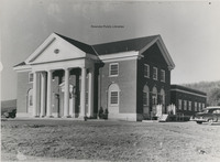
Carvins Cove Water Treatment Facility.
Davis2 18.21c Civic Center
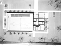
An interior view of a three dimensional architectural model of the Roanoke Civic Center.
Davis2 18.21b Civic Center
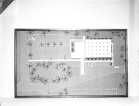
Top view of three dimensional architectural model of Roanoke Civic Center.
Davis2 18.21a Civic Center
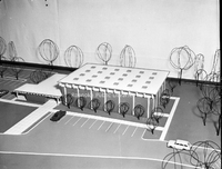
Three dimensional architectural model of the Roanoke Civic Center.
Davis2 17.41 Washington & Lee
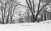
Washington and Lee University in Lexington, Virginia.
Davis2 16.89 NB Hotel FIre
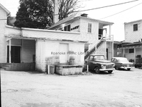
Damage to Natural Bridge Hotel after fire on 23 April 1963.
Davis2 16.88 NB Hotel Fire
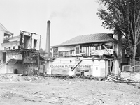
Damage to Natural Bridge Hotel after fire on 23 April 1963.
Davis2 16.87 NB Hotel Fire
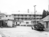
Damage to Natural Bridge Hotel after fire on 23 April 1963.
Davis2 16.86 NB Hotel Fire
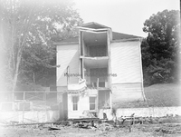
Damage to Natural Bridge Hotel after fire on 23 April 1963.
Davis2 16.85 NB Hotel Fire
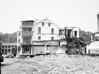
Damage to Natural Bridge Hotel after fire on 23 April 1963.
Davis2 16.84 NB Hotel Fire
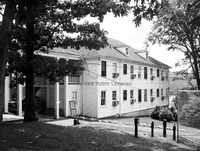
Damage to Natural Bridge Hotel after fire on 23 April 1963.
Davis2 16.83 NB Hotel Fire
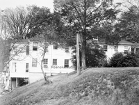
Damage to Natural Bridge Hotel after fire on 23 April 1963.
Davis2 16.82 NB Hotel Fire
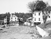
Damage to Natural Bridge Hotel from fire on 23 April 1963.
Davis2 16.812 NB Hotel Fire
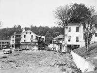
Damage to Natural Bridge Hotel after fire on 23 April 1963.
Davis2 16.811 NB Hotel Fire
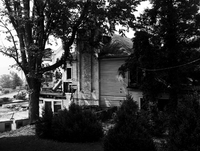
Damage to Natural Bridge Hotel after fire on 23 April 1963.
Davis2 16.810 NB Hotel Fire
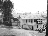
Damage to Natural Bridge Hotel after fire on 23 April 1963.
Davis2 16.81 NB Hotel Fire
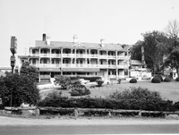
Damage to Natural Bridge Hotel after fire on 23 April 1963.
Davis2 16.8 NB Hotel Fire
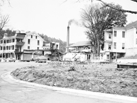
Damage to Natural Bridge Hotel from fire on 23 April 1963.
Davis2 16.7414 Archie's House of Beef
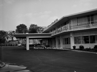
Archie's House of Beef was located in the Holiday Inn that once stood at the corner of Orange Avenue and Williamson Road.
Davis2 16.7412 Holiday Inn
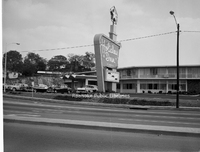
Holiday Inn formerly located at the corner of Orange Avenue and Williamson Road.
Davis2 16.423 Patrick Henry
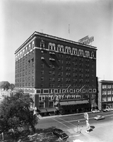
The Patrick Henry Hotel as seen from Roanoke Public Library.
Davis2 16.203 Hotel Roanoke
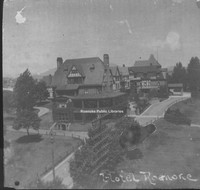
Hotel Roanoke
Davis2 16.2 Hotel Roanoke
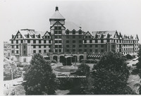
The Hotel Roanoke.
Davis2 15.1 Roanoke Public Library Celebration
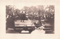
Opening day celebration of Roanoke Public Libraries. Sarah Caldwell Butler speaking at event in Elmwood Park.
Davis2 14.76 Roanoke Memorial Rehab
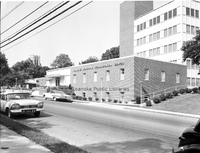
Roanoke Memorial Rehabilitation Center, located at 2017 S. Jefferson Street.
Davis2 14.75 Community Hospital
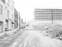
Community Hospital during construction.
Davis2 14.74 Community Hospital
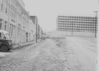
Community Hospital during construction. Roanoke Chemical Company visible at left.
Davis2 14.73 Community Hospital
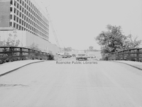
Community Hosptial during construction.
Davis2 14.72 Community Hospital
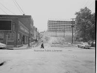
Community Hospital during construction. Roanoke Engraving is visible on the left.
Davis2 13.21 Surface Law
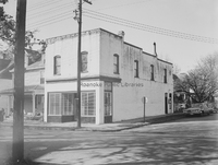
Law Office of Thomas Surface, formerly located at 501 13th Street SW.
Davis2 13.2 Roanoke County Courthouse
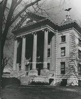
The old Roanoke County Courthouse, located at 305 E. Main Street in Salem.
Davis2 13.13 Courthouse and Jail
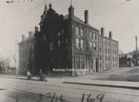
The City of Roanoke's first courthouse and jail, formerly located at 2nd Street and Campbell Avenue.
Davis2 12.5 Narrows Post Office
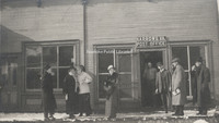
Unidentfied individuals in front of the Narrows Post Office.
Davis2 12.3 Big Lick Post Office
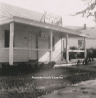
Big Lick Post Office was located on the corner of Lynchburg Road (Orange Avenue) and Williamson Road.
Davis2 11039 Stewartsville Road
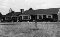
Home located at 11035 Stewartsville Road.
Davis2 11.96 Roanoke College
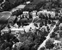
An aerial view of Roanoke College.
Davis2 11.959d duPont Chapel
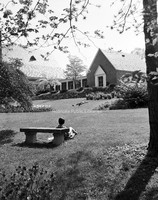
duPont Chapel on the campus of Hollins College
Davis2 11.959c duPont Chapel
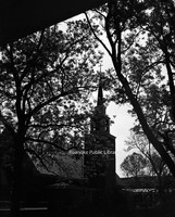
duPont Chapel on the campus of Hollins College
Davis2 11.959b duPont Chapel
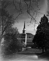
duPont Chapel on the campus of Hollins College
Davis2 11.959a duPont Chapel
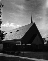
duPont Chapel on the campus of Hollins College
Davis2 11.9591 Hollins College
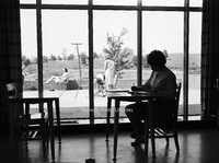
An unidentified student studies on the campus of Hollins College.
Davis2 11.958 Hollins Tennis
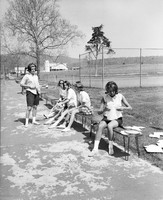
Unidentified students prepare to play tennis on the campus of Hollins College.
Davis2 11.957 Hollins College
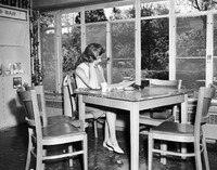
An unidentified student studies on the campus of Hollins College.
Davis2 11.956 Hollins College
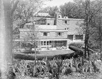
A view of the campus of Hollins College.
Davis2 11.955 Hollins College
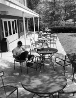
Students study on the campus of Hollins College.
Davis2 11.954 Dana Science Building
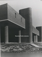
The Dana Science Building on the campus of Hollins University.
Davis2 11.953 Administration Building
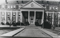
Central to the campus of Roanoke College, the Administration Building was the first structure on campus, completed in 1848. Over the years, East and West wings were added.
Davis2 11.952 East Building
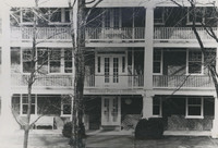
East Building on the Hollins University campus. Built in 1856, It is the oldest building in use at Hollins.
Davis2 11.921 Lord Botetourt High
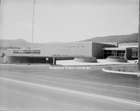
Lord Botetourt High School, located at 1435 Roanoke Road in Daleville.
Davis2 11.92 Lord Botetourt
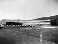
Lord Botetourt High School, located at 1435 Roanoke Road, Daleville.
Davis2 11.811 Southview Elementary School
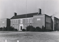
Southview Elementary School, located on Peters Creek Road. The building is now used for Roanoke County administrative offices.
Davis2 11.7 Patrick Henry High
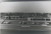
Patrick Henry High School.
Davis2 11.694 Greenvale School
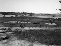
The playground at Greenvale Nursery School, located at 627 Westwood Boulevard NW.
Davis2 11.693 Greenvale School
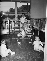
Children in the nursery of Greenvale School, located at 627 Westwood Boulevard Northwest.
Davis2 11.692 Greenvale School
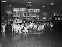
A teacher reads to children at the Greenvale Nursery School, located at 627 Westwood Boulevard.
Davis2 11.691 Greenvale School
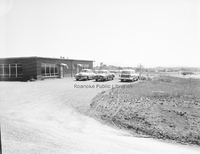
Greenvale Nursery School., located at 627 Westwood Boulevard NW.
Davis2 11.69 Greenvale School
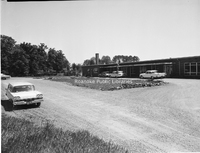
Greenvale Nursery School., located at 627 Westwood Boulevard NW.
Davis2 11.6524 JHS Football
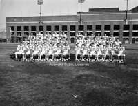
Jefferson High School football team at Victory Stadium.
Davis2 11.6523 Jefferson High

Jefferson High School.
Davis2 11.651 Jefferson High School
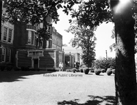
Jefferson High School.
Davis2 11.64 Lucy Addison High Class
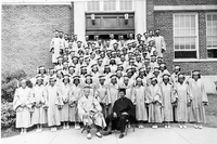
Lucy Addison High School Class of 1941.
Davis2 11.63 Addison High Class
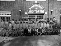
Lucy Addison High School Class of 1943 in front of Roanoke Auditorium.
Davis2 11.43 Monroe Junior High
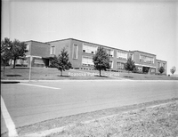
Monroe Junior High School, formerly located at 1122 19th Street NW.
Davis2 11.37 Lincoln Terrace
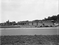
Lincoln Terrace Elementary School, located at 1802 Liberty Road NW.
Davis2 11.3 Pleasant View School
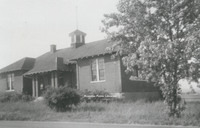
Pleasant View School, often called Moomaw School, which stood on Moomaw land on the corner of Cove and Hershberger Roads.
Davis2 11.03 Virginia College
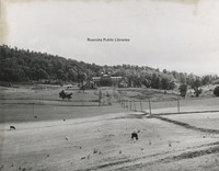
The Virginia College for Young Women under construction. The school was formerly located in the South Roanoke neighborhood at the end of Rosalind Avenue.
Davis2 106a Roanoke Gas Display
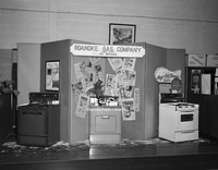
Roanoke Gas Company display featuring gas appliances at an unidentfied event.
Davis2 105.1 Diamond Jubilee
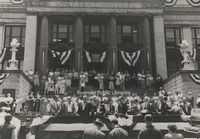
Roanoke's Diamond Jubilee celebration kicks off at the 1915 municipal building.
Davis2 105 Diamond Jubilee
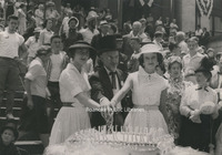
Cutting the birthday cake during Roanoke's Diamond Jubilee are Miss Diamond Jubilee, Barbara Boitnott, Mayor Walter L. Young and Miss Shenandoah Valley, Edwina Wertz.
Davis2 100.2 Etzler Signs
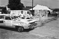
Etzler Magnetic Signs displayed at an unidentified event
Davis2 1.98 Aerial view of Elmwood
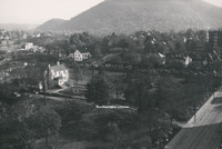
An aerial view of Elmwood Park.
Davis2 1.96B Snow in Elmwood
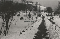
Snow in Elmwood Park with view of the Terry House.
Davis2 1.96A Snow in Elmwood
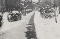
Snow in Elmwood Park.
Davis2 1.96 Snow in Elmwood
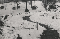
Snow in Elmwood Park.
Davis2 1.952 Japanese Magnolia
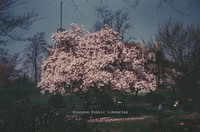
Japanese Magnolia tree in Elmwood Park.
Davis2 1.3 Grand Piano Billboard
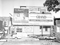
Billboard advertisement for Grand Piano located at Jefferson Street and Franklin Road.
Davis2 1.255 First and Franklin
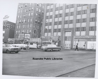
1st Street intersection with Franklin Road in front of AEP.
Davis2 1.254 Franklin Road
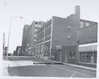
Looking toward intersection with 1st Street and Franklin Road.
Davis2 1.252 1st and Franklin

Parking lot in front of AEP's Roanoke office at the corner of Franklin Road and 1st Street.
Davis2 1.251 1st & Day
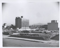
Looking northeast from 1st Street and Day Avenue.
Davis2 1.25 1st & Day
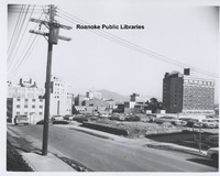
Looking northeast from 1st Street and Day Avenue.
Davis Portrait Inventory
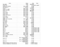
This is an alphabetical inventory of portraits included in the Davis Photographic Collection. Group portraits of companies and organizations are included, but individuals in group portraits are not identified. Dates were provided where known. …
Davis GL 98 Pitzer Transfer
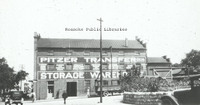
Pitzer Transfer Storage Warehouse, formerly located at the corner of Franklin Road and 2nd Street.
Davis GL 94 Market Street
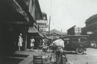
Looking north on Market Street.
Davis GL 92 Eleventh Street
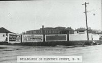
Billboards lining Eleventh Street at Moorman Avenue intersection.
Davis GL 90 Mountain Avenue
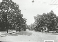
Looking east on Mountain Avenue at 4th Street intersection.
Davis GL 9 Scene in Highland Park
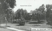
Scene in Highland Park.
Davis GL 89 Comprehensive Plan
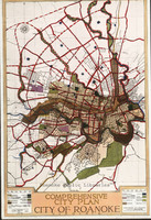
Map included in John Nolen's Comprehensive Plan for the City of Roanoke.
Davis GL 88 Wasena Terrace
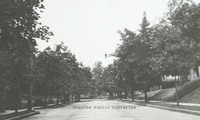
Looking east on Wasena Terrace.
Davis GL 87 Grandin Road
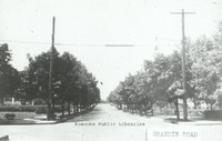
Looking north on Grandin Road from Sherwood Avenue.
Davis GL 86 Washington Park
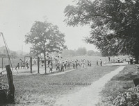
Washington Park, located at 1610 Burrell Street.
Davis GL 85 FNEB Detail
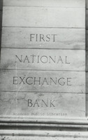
Stonework etched with First National Exchange Bank.
Davis GL 84 Center Parkway
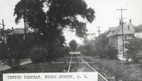
Center Parkway, 9th Street SE.
Davis GL 81 Schulte United Building
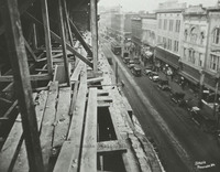
Campbell Avenue as seen from the Schulte United building, formerly located at 16 Campbell Avenue.
Davis GL 80 Giles Brothers Furniture
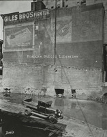
Giles Brothers Furniture, formerly located at 108 Campbell Avenue.
Davis GL 8 Stone Bridge
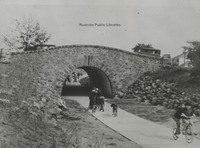
Children play under stone bridge. Location unknown.
Davis GL 79 Jamison Bakery
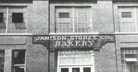
Jamison Company Bakery, formerly located at 541 Salem Avenue.
Davis GL 77 Traffic Congestion Flyer
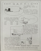
Traffic Congestion Flyer circa 1928.
Davis GL 76 Existing Conditions of Roanoke
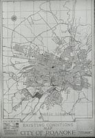
Existing Conditions Map of City of Roanoke used in Nolen plan
Davis GL 75 Map of Roanoke
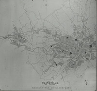
Map of City of Roanoke and Environs used in the Nolen plan.
Davis GL 72 Fairacres
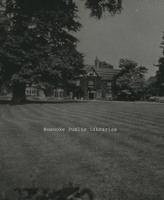
Fairacres, located at 2713 Avenham Avenue, was built in 1912 by W.C. Stephenson. It remained in the Stephenson Family until 1963, when it was purchased by the Roanoke Council of Garden Clubs. The club kept the home until 2003. It is now a private…
Davis GL 71 Zone Plan City of Roanoke
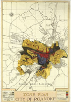
Map of City of Roanoke's Zone Plan used in Nolen Plan.
Davis GL 7 Jefferson Street Looking North
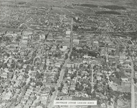
Aerial view of Jefferson Street looking north.
Davis GL 69 Pond in Elmwood Park
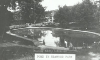
View of pond in Elmwood Park .
Davis GL 68 Allison Avenue
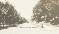
A view of the 300 block of Allison Avenue.
Davis GL 66 Melrose Park
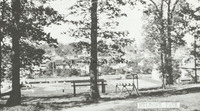
Melrose Park on Melrose Avenue between 14th and 15th Streets.
Davis GL 64 Salem Avenue
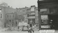
Approximately 132 Salem Avenue.
Davis GL 6 Highland Park School
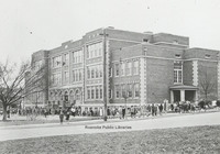
View of Highland Park Elementary School, located at 1212 5th Street.
Davis GL 59 Panorama
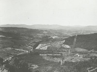
Panoramic view of Roanoke Valley from Route 221 on Bent Mountain at the top of the climb up the mountain just before it reaches the top.
Davis GL 58 Lynchburg Avenue
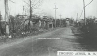
Unknown location on Orange (Lynchburg) Avenue.
Davis GL 57 Mayors Momument
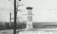
Mayor's Monument in its original location in Woodland Park at Church Avenue and Sixth Street SE, overlooking the Norfolk and Western Shops. The Mayor
Davis GL 55 Downtown Construction
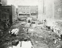
View of men working on construction downtown. Totz Department Store can be seen in the background. Totz was located at 117-119 Salem Avenue SW.
Davis GL 52 Old Episcopal Church
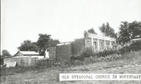
Ruins of an episcopal church in Northeast Roanoke.
Davis GL 5 Montrose Avenue Jog End
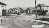
View of the 600 block Montrose Avenue lined with houses.
Davis GL 49 9th Street
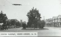
View of 9th Street from the intersection with Jamison Avenue.
Davis GL 48 Ponce de Leon
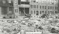
View of debris behind original Hotel Ponce de Leon.
Davis GL 47 Route 460
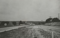
View of Route 460 east of Roanoke.
Davis GL 46 Spring in Weaver Heights Park
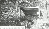
View of the spring once located in Weaver Heights Park.
Davis GL 44 Highland Park
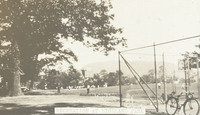
Recreation in Highland Park
Davis GL 43 Church Avenue
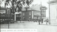
View of the intersection of Church Avenue and Second Street SW with the sign for the YMCA on the right.
Davis GL 42 Elmwood Park
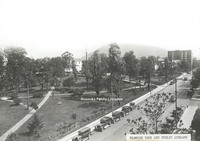
View of Elmwood Park from the Patrick Henry Hotel.
Davis GL 41 Ponce De Leon Hotel
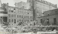
View of the rear of the Hotel Ponce De Leon, with the remainder of a building's foundation visible in foreground.
Davis GL 40 Railway Station
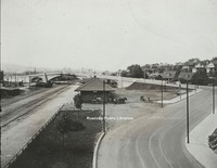
View from Williamson Road of Virginia Railway Station. Jefferson Street bridge in background.
Davis GL 4 Mill Mountain and Roanoke Valley
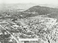
View of Mill Mountain and the surrounding Roanoke Valley
Davis GL 38 Public Library in Elmwood Park
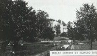
View of the first Roanoke Public Library in Elmwood Park. The library was located in the Terry House, a gift to the city from the Terry Family.
Davis GL 37 Dog Mouth Fountain
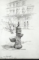
Sketch of the Dog Mouth Fountain. The fountain was acquired by the city in 1898. It stands at the corner of Salem Avenue and Market Street.
Davis GL 36 Roanoke Hospital
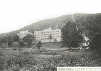
Roanoke Hospital at the foot of Mill Mountain. The Mill Mountain incline can be seen to the right.
Davis GL 35 Panoramic View from Mill Mountain
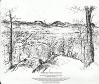
A panoramic sketch from Mill Mountain by Louis Ruyl of New York for the Chamber of Commerce. Caption reads, "Showing spurs of the Blue Ridge with the Alleghany Mountains in the distance, and the Roanoke bowl or amphitheater, McAfee's Knob at left,…
Davis GL 34 Tennis Courts at Elmwood
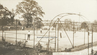
The tennis courts once in Elmwood Park.
Davis GL 33 Motor Routes to Roanoke
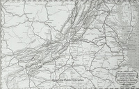
Chamber of Commerce map showing roads to Roanoke.
Davis GL 32 Play Day
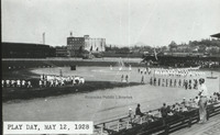
"Play Day" at Maher field 12 May 1928.
Davis GL 31 Patterson Avenue
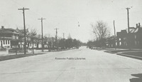
A view of Patterson Avenue.
Davis GL 30 Campbell Avenue
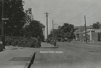
View of West Campbell Avenue at 8th Street intersection, 1928.
Davis GL 3 Melrose Park
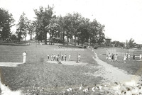
View of people playing recreational games in Melrose Park.
Davis GL 29 Truck
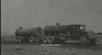
Image of a tanker style truck.
Davis GL 269 Jefferson Street
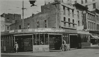
Northwest corner at the intersection of Jefferson Street and Campbell Avenue.
Davis GL 26 State and City Bank
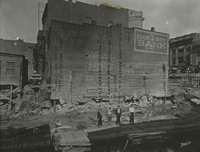
Side view of State & City Bank, once located at approximately 206 Jefferson Street. This photo was taken after a building was razed.
Davis GL 25 Southeast
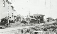
View of several homes in Southeast.
Davis GL 242 Shaffers Crossing
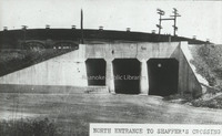
North entrance to Shaffer's Crossing.
Davis GL 241 10th Street
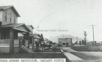
A view of 10th Street NW at Williamson Road and the Oakland School.
Davis GL 237 Walnut Avenue Bridge
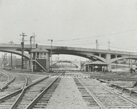
Side view of the Walnut Avenue and Jefferson Street bridges.
Davis GL 232 Northeast
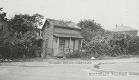
Derelict home in Northeast. Exact location unknown.
Davis GL 23 Jefferson Street
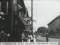
View of advertisement signs hanging from the front of buildings along South Jefferson Street.
Davis GL 222 Patrick Henry Hotel
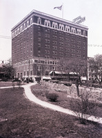
View of Patrick Henry Hotel from Elmwood Park.
Davis GL 22 Single Family Dwelling
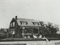
View of a single family dwelling made of brick.
Davis GL 21.1 Terry Building
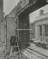
Image of a building being demolished with coat laying on ladder.
Davis GL 21 Terry Building
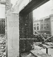
Image of a building being demolished.
Davis GL 20 Salem Avenue
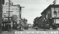
View of Salem Avenue east from Second Street, SW. Buildings lines street with painted advertisements.
Davis GL 2.1 Scene in Elmwood Park
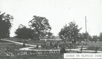
Scene in Elmwood Park viewing the rose garden.
Davis GL 2 Scene in Elmwood Park
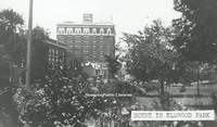
Scene in Elmwood Park with a view of Patrick Henry Hotel.
Davis GL 19 Campbell Avenue
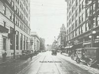
Looking west on Campbell Avenue at intersection with Jefferson Street.
Davis GL 18 Windsor Avenue
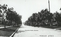
Windsor Avenue in Raleigh Court
Davis GL 172 Hotel Patrick Henry
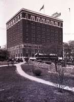
View of Hotel Patrick Henry from Elmwood Park
Davis GL 17 Unidentified Building
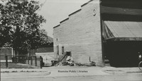
Unidentified building near downtown.
Davis GL 165 GN Natural Bridge
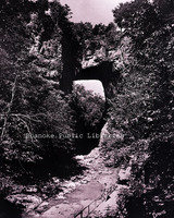
Natural Bridge
Davis GL 16 Neighborhood
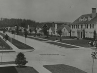
Though not in Roanoke, this Longview, Washington neighborhood scene was used as an example in John Nolen's plan for Roanoke.
Davis GL 14 Pond in Elmwood Park
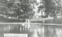
View of pond in Elmwood Park.
Davis GL 13 Church Avenue
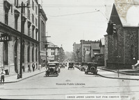
View of Church Avenue looking east from Commerce Street (now 2nd Street). Greene Memorial UMC visible on right, old YMCA visible on left.
Davis GL 12 Watts Springs
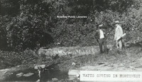
View of two men standing beside Watts Springs.
Davis GL 111 Fire Escape Diagram
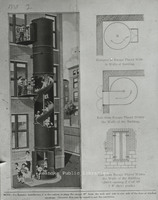
Fire Escape diagram depicting a "state-of-the-art" fire escape containing a slide.
Davis GL 110 Campbell Avenue
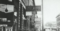
Various business signs along E. Campbell Avenue.
Davis GL 11 Staunton Avenue
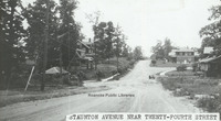
View of Staunton Avenue near 24th Street.
Davis GL 108 Salem Avenue
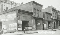
Vacant store fronts in the 100 block of Salem Avenue.
Davis GL 105 Melrose Avenue
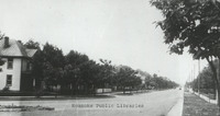
Melrose Avenue. Exact location unknown.
Davis GL 104 Maiden Lane
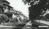
Houses on Maiden Lane.
Davis GL 100 Playground in Norwich
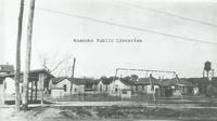
PLayground in Norwich neighborhood.
Davis GL 10 Rorer Avenue
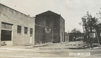
View of buildings along Rorer Avenue.
Davis 9C Outskirts of Roanoke
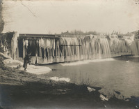
Ice on the Niagara Dam, four miles east of Roanoke on the Blue Ridge Parkway.
Davis 9B Outskirts of Roanoke
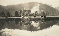
Cows grazing next to pond on the outskirts of Roanoke. Exact location unknown
Davis 91.1c Union Tunnel
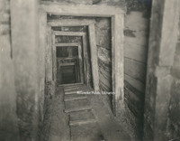
A view of the interior of the Union tunnel beneath the Crater, constructed by the 48th Pennsylvania Regiment under Colonel Pleasants. It was here that a four ton charge of powder was placed and exploded between Elliot's Salient.
Davis 91.1b Confederate Tunnels
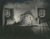
Confederate Tunnels beneath supporting works to Fort Mahone at Pine Gardens. The purpose of the tunnels was to detect any mining that might be attempted by the Union and they were used as storage for ammunition and refuge during heavy cannonading.
Davis 91.1a The Crater
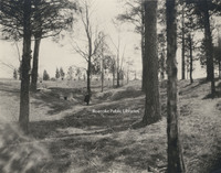
The Crater is the scene of the Battle of the Crater that occurred on 30 July 1864 as part of the Siege on Petersburg. Pennsylvania miners dug a 511 foot tunnel and placed a four ton charge of powder under Pegram's Confederate battery. The explosion…
Davis 9.21 Big Lick Signpost
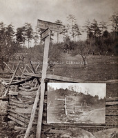
Sign for Big Lick, 7 miles, and Botetourt Springs, 6 miles. An inset of the sign from another angle is included.
Davis 9.12 Auto parade
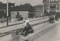
Roanoke's first auto parade on Campbell Ave. in front of present Municipal Building. United Commercial Travelers Grand Council parade. Ponce De Leon Hotel in right background.
Davis 88.8 Ku Klux Klan
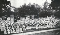
Ku Klux Klan convention. Photograph taken in front of the Colonial Club, formerly located at 602 Day Avenue SW.
Davis 83.21 Great Southern Mail Route
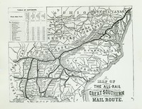
Map showing the Great Southern Mail Route.
Davis 8.6 View of the Narrows
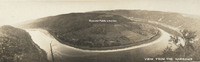
Panoramic view of Narrows, Virginia.
Davis 8.3 Fincastle Presbyterian Church
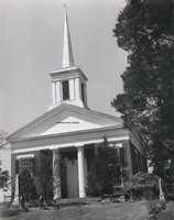
Fincastle Presbyterian Church located at 108 E. Back Street in Fincastle, Virginia
Davis 75.861b Rader Chapel
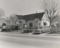
Rader Funeral Home is located at 630 Roanoke Road in Daleville. This building was replaced with the current building in 1996.
Davis 75.861a Radar Chapel
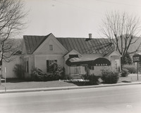
Rader Funeral Home is located at 630 Roanoke Road in Daleville. This building was replaced with the current building in 1996.
Davis 75.81 Oakey Salem Chapel
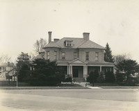
Built in 1901 as the home of Theophilus J. Shickel, the home was conveyed to John M. Oakey and Son Funeral Home in 1936.
Davis 71.255 Craig Healing Springs
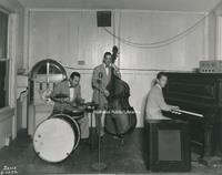
The Roy Lemon trio performs at Craig Healing Springs.
Davis 71.2524 Craig Healing Springs
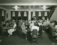
Guests play cards at Craig Healing Springs
Davis 71.2523 Craig Healing Springs
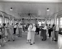
The dance floor in full swing at Craig Healing Springs.
Davis 71.2522 Craig Healing Springs
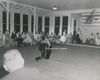
Guests enjoy a performance at Craig Healing Springs.
Davis 71.2521 Craig Healing Springs
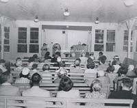
Guests attend a church service held in the Glass House at Craig Healing Springs.
Davis 71.24 Craig Healing Springs
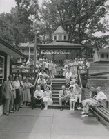
An unidentified group poses in front of the spring house at Craig Healing Springs.
Davis 71.224 Craig Healing Springs
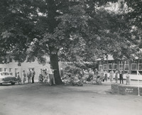
An unidentified group next to the Glass House at Craig Healing Springs. The brick building the the Oak Lodge.
Davis 71.223 Craig Healing Springs
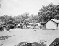
A view of the grounds and guest cottages at Craig Healing Springs.
Davis 71.214 Craig Healing Springs
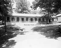
The Salem Cottage at Craig Healing Springs.
Davis 71.212 Craig Healing Springs
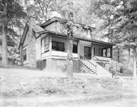
J.W. Ould Cottage at Craig Healing Springs.
Davis 71.185 Craig Healing Springs
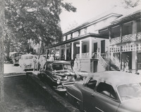
The central office of Craig Healing Springs.
Davis 71.184 Craig Healing Springs
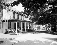
The central office at Craig Healing Springs.
Davis 71.182 Craig Healing Springs
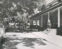
The central office of Craig Healing Springs.
Davis 71.17 Craig Healing Springs
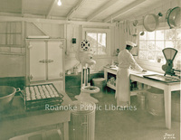
A chef prepares biscuits in the Craig Healing Springs kitchen.
Davis 71.16 Craig Healing Springs
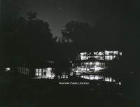
A night view of Craig Healing Springs Resort.
Davis 71.14 Craig Healing Springs
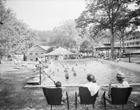
Guests in the swimming pool at Craig Healing Springs.
Davis 71.131 Craig Healing Springs
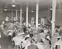
Guests dine in the dining hall at Craig Healing Springs.
Davis 71.13 Craig Healing Springs
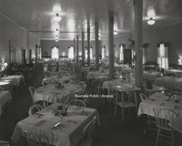
Interior view of the dining hall at Craig Healing Springs.
Davis 71.12 Craig Healing Springs
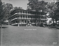
The Jefferson at Craig Healing Springs was built in 1910. Though some of the buildings still exist, the Jefferson was razed in 1970.
Davis 71.112 Craig Healing Springs
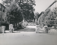
Main entrance to Craig Healing Springs
Davis 71.11 Craig Healing Springs
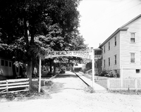
Entrance gate at Craig Healing Springs.
Davis 71.101 Craig Healing Springs
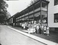
An unidentified group stands in front of the dining hall and central office of Craig Healing Springs.
Davis 70.11 Roaring Run Furnace
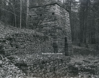
Built circa 1832, Roaring Run Furnace was a hot-blast iron furnace. Located in the Jefferson National Forest, the furnace was listed on the National Register of Historic Places in 1983.
Davis 7.213 Elizabeth Heights
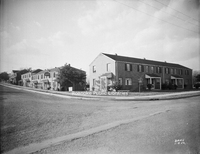
Elizabeth Heights Apartments from the corner of Idaho Street and Elizabeth Avenue in Salem.
Davis 7.212 Elizabeth Heights
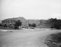
Elizabeth Heights Apartments, located from the corner of Idaho Street and Illinois Avenue in Salem.
Davis 7.21 Elizabeth Heights Apartments
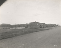
Elizabeth Heights apartment complex, located on Idaho and Illinois Streets in Salem.
Davis 68.91 Philpott Dam
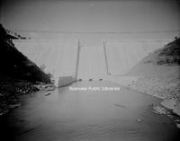
Philpott Dam on the Smith River.
Davis 68.9 Philpott Dam
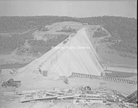
The Philpott Dam on the Smith River during construction.
Davis 68.32 Cascade Falls
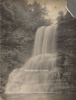
Cascade Falls in Pembroke, Virginia.
Davis 68.31 Cascade Falls
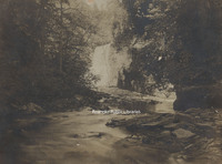
Cascade Falls in Pembroke, Virginia.
Davis 68.221 Mill Mountain Observation Tower
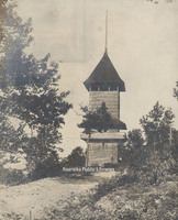
The first observation tower on Mill Mountain was built circa 1892 along with Rockledge Inn. The tower was destroyed during a violent wind storm in 1914. Another tower was constructed to replace it shortly thereafter.
Davis 68.22 Mill Mountain Star
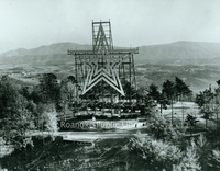
Mill Mountain Star was constructed in 1949 by the Roanoke Merchants Association to kick off the 1949 holiday shopping season. Though at first the star was not meant to be lit all year, it became popular enough with citizens that it was decided to…
Davis 68.21a Dixie Caverns
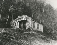
Entrance to Dixie Caverns.
Davis 68.2182 Dixie Caverns
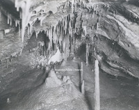
"The Musical Room" at Dixie Caverns.
Davis 68.2181 Dixie Caverns
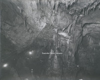
An interior view of Dixie Caverns.
Davis 68.218 Dixie Caverns

The "Magic Mirror" reflecting pool at Dixie Caverns.
Davis 68.216 Dixie Caverns
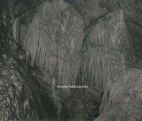
Stalactite formation known as the "Cascades" at Dixie Caverns.
Davis 68.215 Dixie Caverns
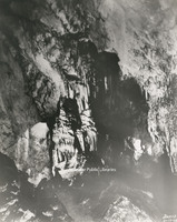
Stalactite formation known as the "Organ Screen" st Dixie Caverns
Davis 68.213b Dixie Caverns
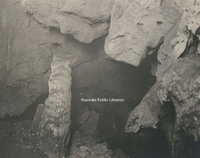
Stalagmite formation known as "The Leaning Tower" at Dixie Caverns
Davis 68.212a Dixie Caverns
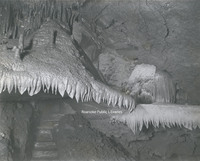
Flowstone formation known at the "Wedding Bell" at Dixie Caverns.
Davis 68.21 Dixie Caverns Sign
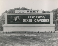
Billboard sign for Dixie Caverns.
Davis 68.1 Natural Bridge
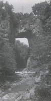
Natural Bridge
Davis 67.7 Roanoke Country Club
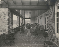
The terrace overlooking the golf course at Roanoke Country Club, located at 3360 Country Club Drive. The club saw its beginnings in South Roanoke in 1899. The club moved to its current location in 1908. This clubhouse was the second to be…
Davis 67.6 Roanoke Country Club
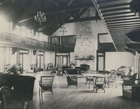
Interior view of the Roanoke Country Club clubhouse, located at 3360 Country Club Drive. The club saw its beginnings in South Roanoke in 1899. The club moved to its current location in 1908. This clubhouse was the second to be constructed at the…
Davis 67.5 Roanoke Country Club
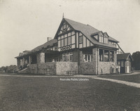
Exterior view from the golf course of the Roanoke Country Club, located at 3360 Country Club Drive. The club saw its beginnings in South Roanoke in 1899. The club moved to its current location in 1908. This clubhouse was the second to be…
Davis 67.4 Roanoke Country Club
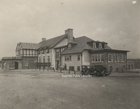
Exterior view of the Roanoke Country Club, located at 3360 Country Club Drive. The club saw its beginnings in South Roanoke in 1899. The club moved to its current location in 1908. This clubhouse was the second to be constructed at the current…
Davis 67.3 Roanoke Country Club
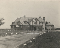
Exterior view of the Roanoke Country Club, located at 3360 Country Club Drive. The club saw its beginnings in South Roanoke in 1899. The club moved to its current location in 1908. This clubhouse was the second to be constructed at the current…
Davis 67.2c Roanoke Country Club
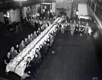
Roanoke Country Club Christmas dinner and dance
Davis 67.2b Roanoke Country Club
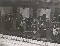
Couples enjoy dancing at a Christmas party at Roanoke Country Club.
Davis 67.2a Roanoke Country Club
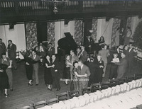
Couples enjoy dancing at a Christmas party at Roanoke Country Club.
Davis 67.2 Roanoke Country Club
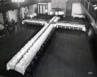
Banquet table set up for Christmas party at the Roanoke Country Club.
Davis 67.1 Roanoke Country Club
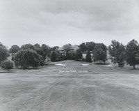
Roanoke Country Club as seen from the fairway. The club saw its beginnings in South Roanoke in 1899. The club moved to its current location in 1908. This clubhouse was the second to be constructed at the current location; it was completed in 1924.
Davis 66i Buchanan Bridge
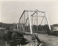
New concrete bridge built to replace the steel bridge at left. Though the steel bridge was removed, a swinging bridge was erected in its place.
Davis 66h Buchanan Bridge
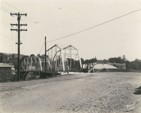
Old bridge over the James River in Buchanan. The new concrete bridge seen at right. The steel bridge stood in the location of the current swinging bridge.
Davis 66g Franklin Road Bridge
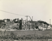
Franklin Road Bridge under construction.
Davis 66c BRPW Bridge
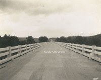
Bridge over the Roanoke River on the Blue Ridge Parkway.
Davis 66b Wasena Bridge
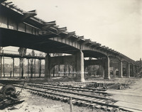
Wasena Bridge under construction. The old Wasena Bridge can be seen paralleling the new one. The new bridge was completed in 1940.
Davis 66.91 Robert F. Craft Memorial Bridge
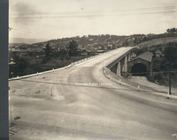
Robert F. Craft Memorial Bridge over the Jackson River. This bridge, replaced the covered bridge next to it.
Davis 66.826 Franklin Road Bridge
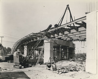
Franklin Road Bridge under construction.
Davis 66.825 Franklin Road Bridge
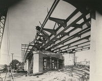
Franklin Road Bridge under construction.
Davis 66.823 Franklin Road Bridge
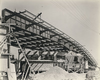
Franklin Road Bridge under construction.
Davis 66.822 Franklin Road Bridge
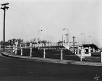
A view of Franklin Road Bridge as seen from Reserve Avenue.
Davis 66.821 Franklin Road Bridge
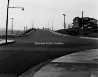
Franklin Road Bridge.
Davis 66.815 Walnut Avenue Bridge
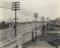
Walnut Avenue Bridge.
Davis 66.811 Franklin Road RW Bridge
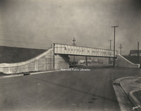
Norfolk & Western railway bridge over Franklin Road.
Davis 66.81 Franklin Road RW Bridge
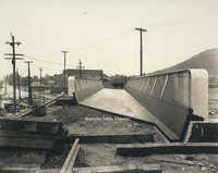
Railway bridge over Franklin Road under construction.
Davis 66.412 Walnut Avenue Bridge
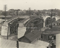
Walnut Avenue Bridge under construction.
Davis 66.411 Walnut Avenue Bridge
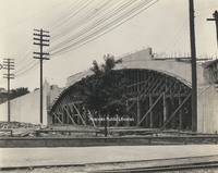
Walnut Avenue Bridge under construction.
Davis 66.41 Walnut Avenue Bridge
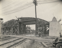
Walnut Avenue Bridge under construction.
Davis 66.3a Jefferson Street Bridge
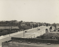
Jefferson Street Bridge was built in 1926
Davis 66.321 Memorial Bridge Plaque
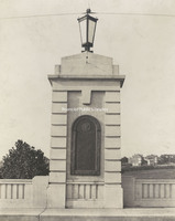
Plaque on Memorial Bridge listing all of the Roanoke area soldiers who were killed serving in World War I.
Davis 66.32 Memorial Bridge Plaque
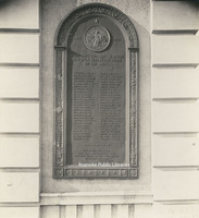
Plaque on Memorial Bridge listing all of the Roanoke area soldiers who were killed serving in World War I.
Davis 66.31 Memorial Bridge
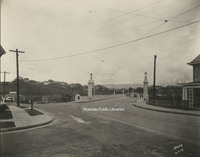
Memorial Bridge was built in 1926 by the WW Boxley Company. The bridge stands as a monument to veterans of World War I.
Davis 66.301 Memorial Bridge
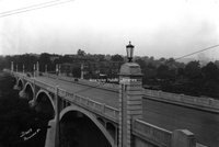
Crossing into Raleigh Court, the Memorial Bridge was dedicated on 30 August 1926. It was named to honor World War I veterans.
Davis 66.3 Memorial Bridge
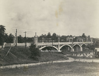
Memorial Bridge was built in 1926 by the WW Boxley Company. The bridge stands as a monument to veterans of World War I.
Davis 66.219 Wasena Bridge
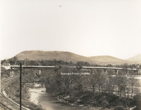
Wasena Bridge.
Davis 66.216 Wasena Bridge

Wasena Bridge shortlyafter completion. Roanoke Ice and Cold Storage visible in background.
Davis 66.213 Wasena Bridge
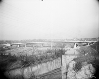
Wasena Bridge shortly after completion.
Davis 66.212 Wasena Bridge
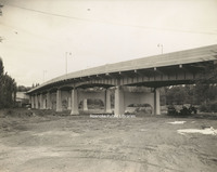
Wasena Bridge under construction.
Davis 66.211 Wasena Bridge
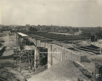
Wasena Bridge under construction. The new bridge was completed in 1940.
Davis 66.21 Wasena Bridge
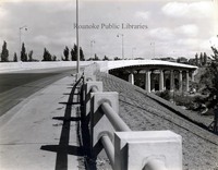
Wasena Bridge shortly after completion.
Davis 66.11 Jefferson Street Bridge
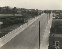
Jefferson Street Bridge was built in 1926.
Davis 65.941 Norfolk and Western Office Fire
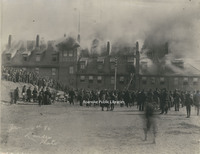
A fire broke out at the Norfolk & Western General Offices on 4 January 1896. N&W employees salvaged some furnishings and supplies as fire swept through the building. Unfortunately, the building was a total loss.
Davis 65.94 Norfolk and Western Office Fire
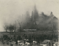
A fire broke out at the Norfolk & Western General Offices on 4 January 1896. N&W employees salvaged some furnishings and supplies as fire swept through the building. Unfortunately, the building was a total loss.
Davis 65.938 Phillip Levy Store Fire
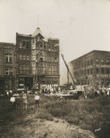
The Philip Levy Exchange Store alarm was struck at 1:21pm on 31 August 1928. This photo was taken not long after the fire started. Both city ladder trucks were on the scene to combat the fire in the top floors of the four story building.
Davis 65.937 Phillip Levy Store Fire
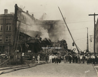
Despite the efforts of Roanoke firemen, the Philip Levy Exchange store could not be saved. After burning for two hours, the building collapsed.
Davis 65.936 Phillip Levy Store Fire
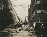
Ladder trucks 1 and 2 were utilized to fight the fire at the Philip Levy Exchange Store, which was burning on the top floors of the four story building.
Davis 65.935 Phillip Levy Store Fire
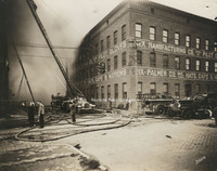
Firemen attempt to extinguish the fire at the Philip Levy Exchange Store at 118 Salem Avenue.
Davis 65.934 Phillip Levy Store Fire
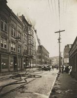
The Philip Levy and Company furniture store caught fire for the second time on 31 August 1928. Philip Levy was located at 118 Salem Avenue. Both city ladder trucks were utilized in an attempt to extinguish the fire, which was burning on the top…
Davis 65.933 Phillip Levy Store Fire
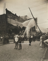
Even after the building's collapse, firemen continue to hose down the smoldering rubble that was once the Philip Levy Exchange Store.
Davis 65.932 Phillip Levy Store Fire
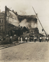
Despite the efforts of Roanoke firemen, the Philip Levy Exchange store could not be saved. After burning for two hours, the building collapsed.
Davis 65.931 Phillip Levy Store Fire
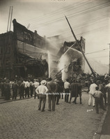
Despite the efforts of Roanoke firemen, the Philip Levy Exchange store could not be saved. After burning for two hours, the building collapsed.
Davis 65.93 Phillip Levy Store Fire
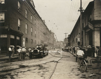
The Philip Levy and Company furniture store caught fire for the second time on 31 August 1928. Philip Levy was located at 118 Salem Avenue.
Davis 65.921 NW Pugh Fire
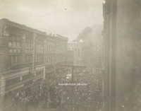
The NW Pugh Department Store caught fire on 3 February 1935. The store was located at 35 Campbell Avenue. Spectators watch as Roanoke Fire Department extinguishes the fire.
Davis 65.92 NW Pugh Fire
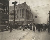
The NW Pugh Department Store caught fire on 3 February 1935. The store was located at 35 Campbell Avenue. Spectators watch as Roanoke Fire Department extinguishes the fire.
Davis 65.91 Fire on Campbell
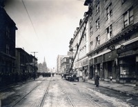
The Ponce de Leon Hotel caught fire on 28 December 1928. All nine Roanoke engines and two ladder trucks were on the scene, including a hose truck from Vinton and an engine from Salem. The original 5 story portion of the hotel was destroyed and would…
Davis 65.86 Steamer #2
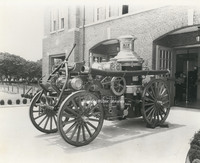
Steamer #2 was purchased by Norfolk & Western and placed into service in September 1907. It is shown here stored at Station #9.
Davis 65.81 Fire Equipment Test
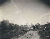
Testing of fire fighting equipment by the river.
Davis 65.8 Fire Station 7
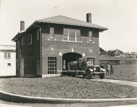
Fire Station #7 opened on 13 December 1922. It is located at 1742 Memorial Avenue.
Davis 65.7 Fire Station #9
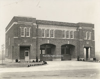
Fire Station #9 opened on 2 October 1929. It is located at 514 24th Street.
Davis 65.64 Fire Station #8
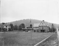
Located at 2328 Crystal Spring Avenue, Fire Station #8 opened on 23 January 1929 and still serves the community today.
Davis 65.63 Fire Station #8
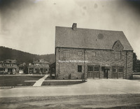
Located at 2328 Crystal Spring Avenue, Fire Station #8 opened on 23 January 1929 and still serves the community today.
Davis 65.6 Fire Station #8
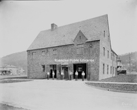
Fireman of Firestation #8. Located at 2328 Crystal Spring Avenue, Station #8 opened on 23 January 1929 and still serves the community today.
Davis 65.52 Fire Station #6
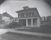
Fire Station #6 opened on 5 September 1911 at 1015 Jamison Avenue. It ceased operation as a fire station in 1979. It is now used as a police substation. Fire Station #6 was added to the Virginia Landmarks Register in 1990 and the National Register…
Davis 65.511 Fire Station #5
Firemen of Fire Station #5. Station #5 opened in 1911. While no longer used as a fire station, the building still stands at 216 12th Street NW.
Davis 65.51 Fire Station #5
Fire Station #5 opened on 5 September 1911. While no longer used as a fire station, the building remains at 216 12th Street.
Davis 65.5 Fire Station #5
Fire Station #5 opened on 5 September 1911. While no longer used as a fire station, the building remains at 216 12th Street.
Davis 65.412 Booster Club
Booster trip. Men and location unidentified.
Davis 65.4 Fire Station #4
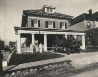
Fire Station #4 opened on 5 September 1911. It was located at 323 Highland Avenue in Old Southwest. The station closed in 1965 and the building was purchased by Beth Israel Synagogue. The building was razed in 1967.
Davis 65.31 Fire Station #3
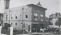
Fire Station #3, located at 301 6th Street. Though the building still exists, it is not longer used as a fire station.
Davis 65.3 Fire Station #3
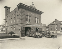
The building that housed Fire Station #3 still exists at 301 6th Street, but is now privately owned. Shown here at left is Engine #3, a Seagrave Brasshead next to Ladder #2, also a Seagrave.
Davis 65.2 Fire Station #11
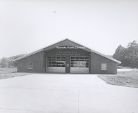
Fire Station #11, located at 1502 Riverland Road. Station #11 opened on 14 March 1964.
Davis 65.12 Fire Station #1
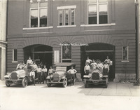
Ladder #1 (left), a 1918 Seagrave, sits next to the Chief's car, a Hudson, and Engine #1 (right) at Fire Station #1. Fireman on Ladder #1, from L to R: Elsie J. Knowles, __Shillins, James E. Updike, Harry Grubb, Raymond N. Wills, Harry J. Daniels…
Davis 65.11 Fire Station #1
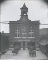
Fire Station #1, located at 13 Church Avenue, was completed in 1907. The building, now on the National Register of Historic Places, was in service as a fire station for 100 years. A horse-drawn hose wagon (left) and ladder truck are seen in front of…
Davis 65.1 Firemen at Station #1
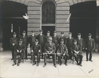
Fireman in front of Station #1 on Church Avenue. 1st row, L to R: "Pop" Smith, Adam Arnold, Chief James F. McFalls, Joe Bowman and Cleveland Carper Meador. 2nd row, L to R: James W. Nichols, George Witt, O.C. Craft, Clarence Short, Charlie Boone,…
Davis 65.023 Vinton Fire Department
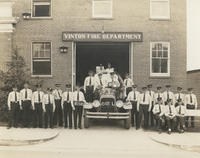
Members of the Vinton Fire Department.
Davis 65.022 Junior Hose Company #2
Members of the Vigilante Steam Fire Company #1 and the Junior Hose Company #2 stand in front of Vigilante Fire Station #1 shortly before escorting the body of Mayor William Carr to his burial in City Cemetery.
Davis 65.021 Vigilante Fire Station #1
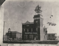
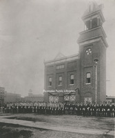
Vigilante Fire Station #1 stood on the northeast corner of Jefferson Street and Kirk Avenue. Shown here shortly before completion in 1888, the fire station remained in use until 1907 when the "new" Station #1 was built on Church Avenue. Prior to the…
Davis 65.02 Vigilante Steam Fire Company #1
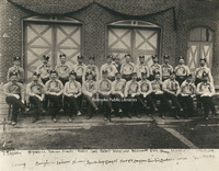
Firemen from the Vigilante Steam Fire Company #1 post in front of the original Fire Station #1 (formerly located at Campbell Avenue and 1st Street) prior to the funeral of Mayor William Carr. 1st row, L to R: Thomas Engleby, __ Harris, __ Shank, __…
Davis 65.012 Friendship Fire Company #3
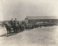
Roanoke firefighters line up for a Labor Day parade at the present corner of Jefferson Street and Church Avenue. W.P. Mundy livery stable is in the background.
Davis 65.01 Friendship Fire Company #3
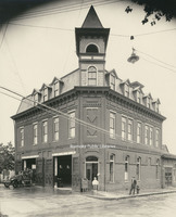
Friendship Fire Company Station #3 once stood roughly where the main post office is today in the 400 block of Rutherford Avenue. The company was formed to protect the northeast quadrant of the city. It was an active fire station until 1951. The…
Davis 65 Warrenton Fire Truck
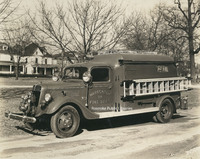
A fire truck from Warrenton, Virginia on Washington Avenue in Old Southwest. The houses in the background are in the 500 block of Washington Avenue.
Davis 645 Virginian 700
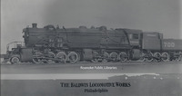
The Virginian 700 steam locomotive built by Baldwin Locomotive Works.
Davis 641 Roanoke Police Department
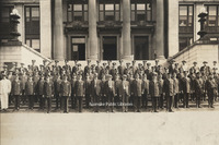
Roanoke Police Department on the steps of the Municipal Building.
Davis 64.5 Roanoke Life Saving Crew
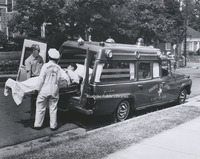
This staged photograph shows two unidentified members of Roanoke Life Saving and First Aid Crew loading a "patient" into an ambulance.
Davis 63.22 Streetcar
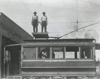
Two unidentified employees of Roanoke Railway and Electric stand atop a streetcar at terminal.
Davis 63.21 Streetcar
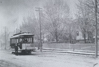
Unidentified man stands next to a streetcar on Jefferson Street.
Davis 63.1 Greyhound Bus Depot
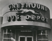
Roanoke Greyhound Bus Depot, formerly located at the corner of Williamson Road and Bullitt Avenue.
Davis 622 Commerce Street School
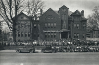
Students of Commerce Street School. Commerce Street School or First Ward School stood at the corner of Church Avenue and 2nd Street (Commerce). The school was built in 1890 and razed in 1929 to make way for the post office.
Davis 62.18 Roanoke Municipal Airfield
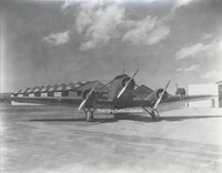
Plane at Roanoke Municipal Airfield.
Davis 62.17 Roanoke Municipal Airfield
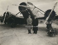
Mayor Sidney F. Small (left) and pilot B.A. Carpenter at the inauguration of Roanoke's passenger air service by American Airlines.
Davis 62.1631 William Stribling
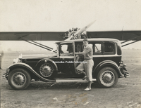
William Stribling (1904-1933) was a professional heavyweight boxer from Georgia. Seen here at Roanoke Municipal Airfield, Stribling was also an avid and accomplished aviator.
Davis 62.161 Baltimore Airways
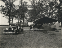
An unidentified couple poses next to a Baltimore Airways plane in front of the Cannaday Farm. The Cannaday Farm would become Roanoke Municipal Airfield, then in 1941 Woodrum Field. It is the current location of Roanoke-Blacksburg Regional Airport. …
Davis 62.16 Roanoke Municipal Airfield
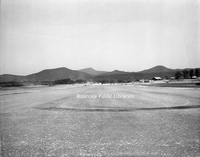
Grading improvements being made to the runway at Roanoke Municipal Airfield.
Davis 62.15 Roanoke Municipal Airfield
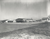
View of Roanoke Municipal Airfield.
Davis 62.143 Reynolds, Frank
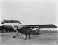
Frank Reynolds with his plane.
Davis 62.1401 Anchor Post Fence
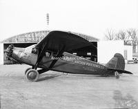
Anchor Post Fence Company plane at Roanoke Municipal Airfield.
Davis 62.14 Roanoke Municipal Airfield
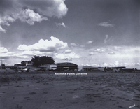
View of Roanoke Municipal Airfield.
Davis 62.134 AA Mail Plane
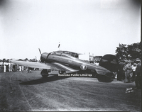
American Airlines Airmail plane at Roanoke Municipal Airfield.
Davis 62.133 AA Mail Plane
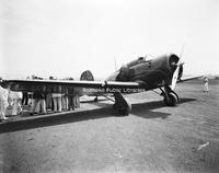
American Airlines airmail plane at Roanoke Municipal Airfield.
Davis 62.1312 VPA Biplane
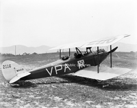
Volunteer Pilots Association Waco biplane at Roanoke Municipal Airfield.
Davis 62.124 Biplane
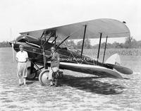
Clayton Lemon (left) and an unidentified man stand next to a Waco aircraft.
Davis 62.123 Biplane
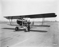
An unidentified man poses next to a biplane at Roanoke Municipal Airfield.
Davis 62.121 Biplane
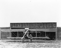
Clayton Lemon poses next to a biplane.
Davis 62.1 Modern Air Transport
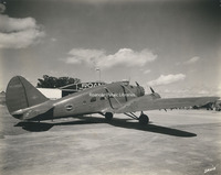
Modern Air Transport plane parked at Woodrum Field. Modern Are Transport commenced commerical operations in 1946.
Davis 62 Izaak Walton League
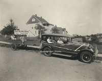
Roanoke Chapter of the Izaak Walton League. George Davis is seen in the backseat of the car. The Izaak Walton League was formed in 1922 and is one of the Nation's oldest and most respected conservation organizations.
Davis 61d N&W General Offices
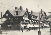
Original Norfolk & Western General Offices, formerly located at the corner of Jefferson Street and Shenandoah Avenue. The building was destroyed by fire on 4 January 1896.
Davis 61b N&W Rails
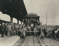
Member of the Travelers Protective Association prepare to leave for Denver.
Davis 61a N&W Rails
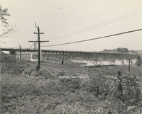
View of Norfolk & Western rails. Southwest Virginia Memorial Bridge crossing the New River in background is under construction.
Davis 619 Masons
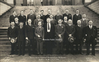
Unidentified members of the Daniel Henry Carmines Memorial Class 32
Davis 618 Masons
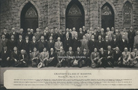
Grayson Class 32
Davis 617a Masons
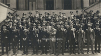
Old Dominion Class 32
Davis 615 Masons
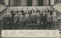
Sparrell Simmons Gale Memorial Class 32
Davis 614a Masons
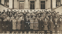
Appalachian Class 32
Davis 612 Masons
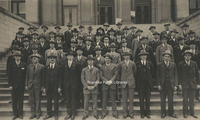
J.W. Keys Memorial Class 32
Davis 611 Masons
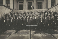
Clinchfield Class Scottish Rite Masons
Davis 610 Travelers Protective Association
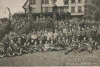
Unidentified members of the Travelers Protective Association on the Virginia State Convention at Hotel Roanoke.
Davis 61.95 Summer Train Schedule
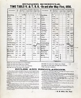
Summer train schedule and timetable for the Virginia & Tennessee Railroad.
Davis 61.811 Mill Mountain Incline
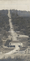
Mill Mountain Incline shortly after completion.
Davis 61.71 Thaxton Train Wreck
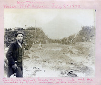
Train wreck on the Norfolk and Western railroad. Twenty one wounded and the number of killed unknown, as the records were destroyed. Man in foreground unidentified
Davis 61.31 N&W Bridge Construction
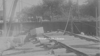
American Bridge and Iron Company constructs a Norfolk & Western bridge over the south branch of the Elizabeth River near Gilmerton.
Davis 61.24 Powhatan Arrow #4
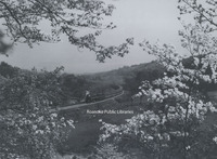
Norfolk & Western Powhatan Arrow Locomotive #4 east of Vinton.
Davis 61.23 N&W Class N Locomotive
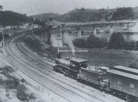
Norfolk and Western Class N passenger locomotive near Radford.
Davis 61.22 N&W Class S1A #244
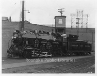
N&W Class S1a #244 locomotive at Roanoke Shops. This was the last locomotive built in Roanoke and the last standard gauge locomotive built in the United States.
Davis 61.2 NW Class Y6b #2189
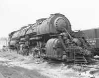
Norfolk & Western Class Y6b #2189 locomotive shown shortly before scrapping at United Scrap Iron and Metal Company.
Davis 61.11 N&W Railroad
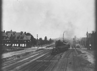
N&W Railroad - View looking east down tracks - N&W General Offices, Hotel Roanoke, and depot at Jefferson Street crossing all visible.
Davis 61.01 N&W Passenger Station
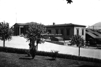
The Norfolk & Western Passenger Station was built in 1907. It is now home to the O. Winston Link Museum and History Museum of Western Virginia.
Davis 609 Elks Convention
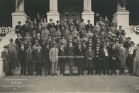
Unidentified members of the Benevolent and Protective Order of Elks during the Virginia State Convention on the steps of the Elks Lodge formerly located on the corner of Jefferson Street and Franklin Road.
Davis 608 Masons
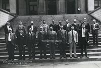
C. C. Bassett Memorial Class 32
Davis 607 Masons
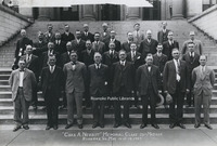
Charles A. Nesbitt Memorial Class 32
Davis 60.1 Interstate 81 Construction
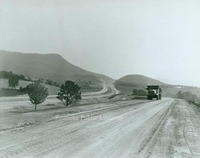
Construction of Interstate 81 in Roanoke County.
Davis 6.91 View of Valley
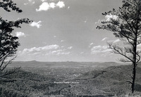
View of the Roanoke Valley from Mill Mountain
Davis 6.81 Old PO Foundation
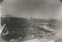
Looking SE at the intersection of Church Street and Henry Street (1st) at the Old Post Office Foundation.
Davis 6.41 Roanoke from Mill Mountain 1974
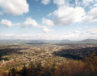
Roanoke as it looked in 1974 from Mill Mountain overlook.
Davis 6.4 View from Mill Mountain
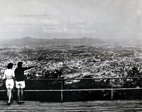
Two unidentified women look at Roanoke from Mill Mountain overlook.
Davis 6.32 Mill Mountain
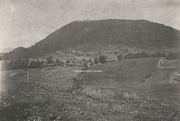
Early view of Mill Mountain
Davis 6.31d Virginia College
Virginia College, formerly located at the end of Rosalind Avenue in South Roanoke.
Davis 6.31c South Roanoke
Early views of South Roanoke
Davis 6.31b Roanoke Country Club
Roanoke Country Club clubhouse and tennis courts, formerly located in South Roanoke.
Davis 6.31a South Roanoke
Early views of South Roanoke. The house on the right is located at 2811 Rosalind Avenue.
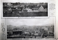
Davis 6.1 Roanoke from Mill Mountain
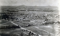
View of the Roanoke Valley from Mill Mountain
Davis 59.16 Ox Cart
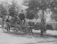
Unidentified men on an ox cart. Hotel Roanoke visible in background.
Davis 59.15 Booster Club
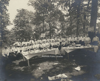
Unidentified members of the Roanoke Booster Club at a picnic.
Davis 59.13 Horseshoe Bend Spring Company
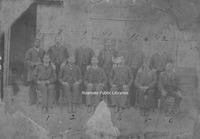
Employees of Horseshoe Bed Spring Company. 1. C.A. Campbell, 2. John R. Tobin, 3. H.S. Jordan, 4. T.B. McKinney, 5. J.W. Tilson, 6. Joseph Bean, 7. George Denton, 8. S.H. Turner, 9. T.R. Turner, 10. J.H. Walls, 11. H.S. Henderson, 12. Charles N.…
Davis 59.111 View of Roanoke Valley
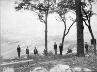
A group of unidentified men on Mill Mountain. Roanoke Valley in background.
Davis 58.1 First Ward School
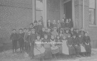
Fourth grade class from First Ward or Commerce Street School.
Davis 57.42 Stone Printing Band
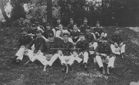
The Stone Printing Company band at a company picnic at Coyner Springs in 1898. Band members unknown.
Davis 57.41 Mundy Family Stringband
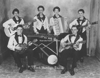
Began by patriarch A.P. Mundy, the Mundy Family Stringband was popular on local radio during the 1920s. Seated, L to R: Cline Mundy, Fred Mundy. Standing, L to R: Mildred Mundy, Mildred Mundy (Mrs. A.P.), Lois Mundy and Janice Mundy.
Davis 57.381 Booster Club
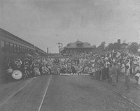
Members of the Roanoke Booster Club.
Davis 57.31 RHS Basketball Team
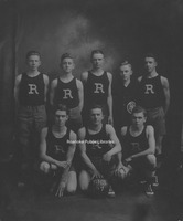
Roanoke High School basketball team. 1st row, L to R: Philip Powell, James Yates and Warren Koontz. 2nd row, L to R: Fred Garis, William Atkinson, Courtley Motley, Fay Yost and Arthur Rankin.
Davis 57.21 Roanoke Baseball Team
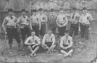
Roanoke's first baseball team. Seated, L to R: George Desmond, E. Wiggins and Willie Quarles. Standing, L to R: Harry Keffer, Gene Ford, Steve Wigman, Everett Sproul, Edward C. Webb, Jack Hayes, George Hart and Edward Dolan.
Davis 57.2 Alleghany Institute Baseball Team
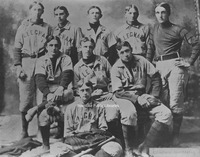
Unidentified members of the Alleghany Institute baseball team.
Davis 57.1 RHS Football Team
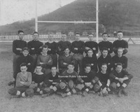
Roanoke High School football team. 1st row, L to R: Claude Kerlin, Wilbur Price, __ Adamson, Herbert Gettle, R. Surface, ___ Richardson and ___ Gleaves. 2nd row, L to R: unknown, unknown, Harry Hock, ___Penn, Athal Price, Forrest McConnell. 3rd row,…
Davis 56.92 Girl Scouts
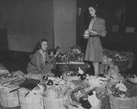
Among the Girl Scouts who assembled and tagged Christmas baskets for delivery to needy families of Roanoke through the Christmas Basket Bureau were Betty Jane Neathawk (left) and Peggy Jo Argenbright.
Davis 56.91 Girl Scouts
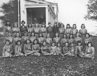
Roanoke Girl Scout Troop in front of Buena Vista. Beatrice Bell (center) was the scout leader
Davis 56.9 Roanoke Police Department
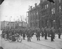
Roanoke Police Department group photo taken in front of the original courthouse and jail on Campbell Avenue.
Davis 56.832 Red Cross
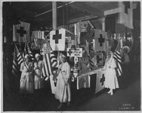
Red Cross volunteers at drive for WWI war fund.
Davis 56.823 Salvation Army Baseball Team
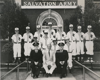
Salvation Army Baseball Team in front of the Salvation Army building, located at 821 Salem Avenue. Team members unidentified.
Davis 56.813 Greene Memorial Banner Class
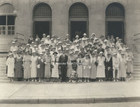
Greene Memorial Methodist Church Banner Class on steps of Post Office.
Davis 56.74 1947 Roanoke Police Force
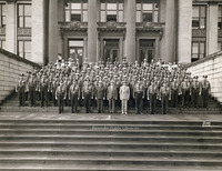
Roanoke Police Force on the steps of the Municipal Building.
Davis 56.73 Mayor and Council
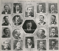
Roanoke Mayor and City Council. Center: Mayor W.K Andrews. Top row, L to R: B.O. Mays, James Newton, Arthur Lescure, J.C. Page, Wilmer Hodgson. 2nd row, L to R: J.H. Cutchin, J. R. Terry, H. D. Guy, M. Minahan. 3rd row, L to R: Levi Witt, P. A.…
Davis 56.669 Viscose Life Saving Crew
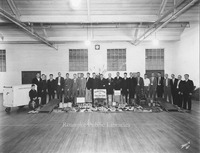
Members of the American Viscose Life Saving Crew and First Aid.
Davis 56.667 Viscose Life Saving Crew
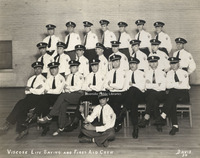
Members of American Viscose Life Saving Crew and First Aid.
Davis 56.6661 Viscose Life Saving Crew
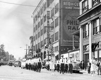
American Viscose Life Saving Crew marches in a World War II victory parade.
Davis 56.666 Viscose Life Saving Crew
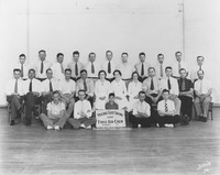
Members of the American Viscose Life Saving Crew & First Aid.
Davis 56.665 Viscose Award Winners
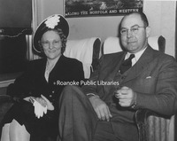
Winners of the first salvage award for the American Viscose Life Saving Crew, Bessie Mills and R. Nelson Sibold, aboard train bound for awards presentation in New York.
Davis 56.664 Viscose Life Saving Crew Officers
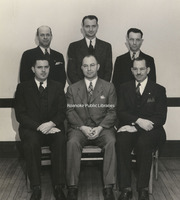
Officers of the American Viscose Life Saving Crew. Seated, L to R: Roy Martin, R. Nelson Sibold, L.W. Overstreet. Standing, L to R: Vic Angel, George Hash and L. Monroe.
Davis 56.663 Viscose 1900 Club
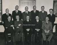
Members of the American Viscose 1900 Club. Seated, L to R: Tot Reynolds, Rawie Moomaw, George Boone, L. Whitenack, unknown. Extreme right is Marshall Garst. All others unknown.
Davis 56.662 Viscose Life Saving Crew Board
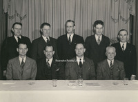
Members of the American Viscose Life Saving Crew Board. 1st row, L to R: George Hash, L.W. Overstreet, R. Nelson Sibold and William Barton. 2nd row, L to R: Guy Campbell, Frank Lackey, Otey P. Shillings, George Fore and William Franklin.
Davis 56.661 Viscose Life Saving Crew
Viscose Life Saving Crew members. Seated from L to R: L.W. Overstreet, __ Monroe, Walter Otey, Leroy Smith, R. Nelson Sibold, William Barton, Donald Thompson and unknown. All others uknown.
Davis 56.66 Viscose Life Saving Crew Board
Board members of the Viscose Life Saving Crew. 1st row, L to R: Donald Thompson, William Barton, Leroy Smith, John Cadden and Walter Otey. 2nd row, L to R: William Franklin, L.W. Overstreet, R. Nelson Sibold, ? Booker, George Hash and ? Monroe.
Davis 56.522 Travelers Protective Association
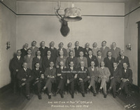
Unidentified members of the Travelers Protective Association.
Davis 56.521 Travelers Protective Association
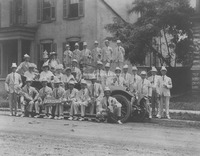
Unidentified members of the Travelers Protective Association.
Davis 56.52 Travelers Protective Association
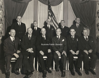
Officers of the Travelers Protective Association at a meeting of the Lynchburg Post. 1st row, L to R: George Davis, G.F. Guse, Theodore C. Abele, E.M. Shaner, E.L. Haskins and J.O. Baker. 2nd row, L to R: W.H. Bullard, A.B. Chewning, C.T. Yancey,…
Davis 56.511 Elks Club
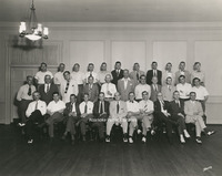
Unidentified Elks Club members
Davis 56.51 Elks Club

Members of the Elks Club pictured at Rockledge Inn on Mill Mountain.
Davis 56.50 Kazim Temple Band
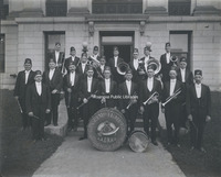
Unidentified members of the Kazim Temple Band.
Davis 56.421 Firemen's Convention
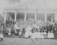
Firemen's convention at Mountain Park. Group stands on the steps of the casino.
Davis 56.413 Booster Club
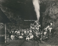
Unidentified members of the Roanoke Booster Club surround a steam locomotive for a group photo.
Davis 56.411 Booster Club

Roanoke Booster Club members on Booster Club trip. J.B. Fishburn 3rd from left; all others unidentified.
Davis 56.41 CA Woodrum
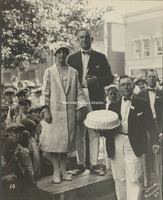
Clifton A. Woodrum and an unidentified woman are presented a cake during festivities at a Booster Club trip. Location unknown.
Davis 56.31 Railway Carmen of America
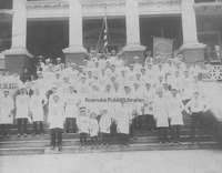
Brotherhood of the Railway Carmen of America, White Ash Lodge No. 253 group photo.
Davis 56.3 RR Equipment Painters
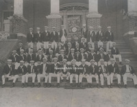
Union of the Railroad Equipment Painters Numer 440 on the steps of the Elk's Club.
Davis 56.2 American Business Club
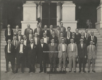
Group photo of the American Business Club
Davis 56.12 USV Company G
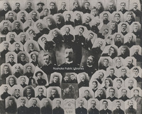
United States Volunteers, 2nd Regiment, Company G of Roanoke
Davis 56.11 Roanoke Military Company F
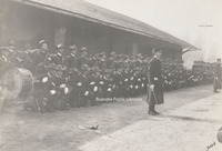
Servicemen from Company F of the Roanoke Military who served in the Spanish-American War
Davis 56.1 Roanoke Military Company G
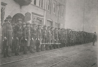
Servicemen from Company G of the Roanoke Military who served in the Spanish-American War
Davis 56 Rev. James and Parishioners-2
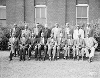
Reverend A.L. James (fourth from right) of First Baptist Church and parishioners.
Davis 56 Rev. James and Parishioners
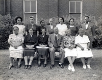
Reverend A.L. James of First Baptist Church (Front row, 3rd from right) and parishioners.
Davis 56 Mayo-Forbes Wedding Party
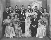
Wedding party of James Mayo and Lelia Forbes. Seated, L to R: Virginia Mundy Cassell, Lois Mundy Firestone, Mr. and Mrs. Forbes. 2nd row, L to R: Al Mayo, Lois Forbes, groom James Mayo, bride Lelia Forbes, Helen Ferguson Robertson, Roy Beamer and…
Davis 55.72 Capture of Sidna Allen and Wesley Edwards
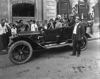
Capture and jail transport of Sidney Allen and Wesley Edwards. Both men were members of the infamous Allen clan that opened fire on the Carroll County Courthouse in 1912 and subsequently led Baldwin-Felts Detective Agents (of Roanoke, VA) on a…
Davis 55.71 Allen and Edwards
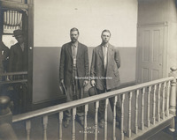
Sidna Allen and Wesley Edwards after capture in Iowa by the Baldwin-Felts Detective Agency. Billy Baldwin can be seen in doorway.
Davis 55.62f Norfolk & Western Play
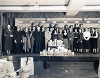
Employee-actors of Norfolk and Western
Davis 55.62e Norfolk & Western Play
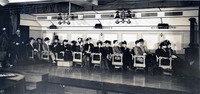
Stage play performed by Norfolk and Western employees.
Davis 55.62d Norfolk & Western Play
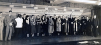
Employee-actors of Norfolk and Western
Davis 55.62c Norfolk & Western Play
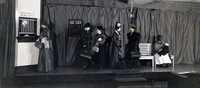
Stage play performed by Norfolk and Western employees.
Davis 55.62b Norfolk & Western Employees
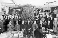
Unidentified Norfolk and Western employees during office Christmas party.
Davis 55.62a Norfolk & Western Employees
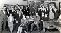
Unidentified Norfolk and Western employees during office Christmas party.
Davis 55.62 Norfolk & Western Employees
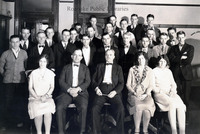
Unidentified office employees of Norfolk & Western
Davis 55.61 Stone Printing Employees
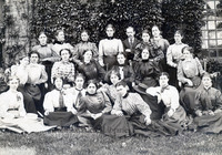
Unidentified female employees of Stone Printing Company.
Davis 55.42 Virginia Bar Association
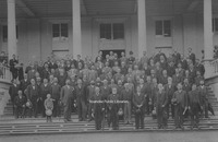
First annual meeting of the Virginia State Bar Association at White Sulphur Springs, West Virginia.
Davis 55.41 Roanoke Bankers
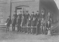
Roanoke Bankers. First Row (from left) : S.D. Ferguson, Harry Trout, J.W. Coon, Peyton L. Terry, T.T. Fishburn, J.T. Engleby, C. Markley & Chester Markley (boy hiding in front row). 2nd Row (from left) J.T. Meadows, J.W. Shields, J.W. Jamison, H.M.…
Davis 55.33 N&W Freight Station Employees
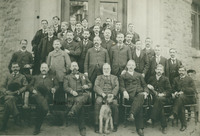
Norfolk & Western Freight Station Employees. 1st row, L to R: Charles Cecil, Luke Garrett, D.L. Armistead, H.D. Guy, B.D. Mayo, Harry Groves, Ray Jones and Stephen Chafin. 2nd row L to R: P. Stuart, O.W. Stover, Benjamin G. Jones, J.P. Flippo, G.J.…
Davis 55.321 Confederate Veterans in front of Hotel Roanoke
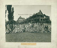
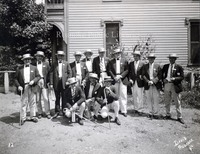
Confederate veterans reunion at the Hotel Roanoke.
Davis 55.32 Confederate Generals at White Sulphur Springs
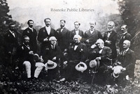
Confederate Generals at White Sulphur Springs, West Virginia. 1. General Conner (South Carolina) 2. General Gary 3. General Magruder (1810 - 1871) 4. General Lilly (Virginia) 5. General Beauregard (Louisiana, 1818-1893) 6. General Lawton (Georgia,…
Davis 5.4 Franklin Road
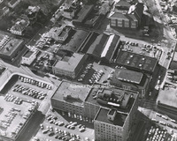
An aerial view of Franklin Road at 1st and 2nd Street. The building in the upper right corner is Lee Junior High School, which was razed to build the Poff Federal Building.
Davis 5.3 Roanoke from Mill Mountain
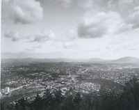
View of the Roanoke Valley from Mill Mountain
Davis 5.12 Aerial View of Roanoke
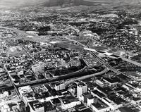
Aerial View of Roanoke. I-581 construction underway. Interstate can be seen bisecting photograph.
Davis 5.1 Community Hospital
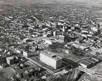
Aerial view of Downtown and Community Hospital
Davis 49.51 Barber Shop
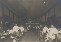
Unidentified barber shop.
Davis 49.473 Howard Johnson Restaurant
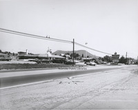
Howard Johnson's Motel and Restaurant, formerly located at 7656 Williamson Road.
Davis 49.31 Shimchocks Litho Service
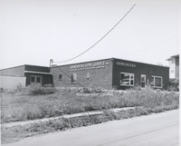
Shimchock's Litho Service, located at 121 Sycamore Avene NE.
Davis 49.121 Crossroads Mall

Crossroads Mall, located at the intersection of Williamson Road and Hershberger Road. Built in 1961, Crossroads was the first enclosed shopping center in Virginia.
Davis 49.12 Crossroads Mall
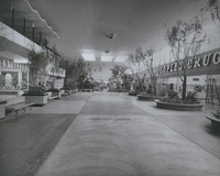
Interior view of Crossroads Mall. When it was built in 1961, Crossroads was the first enclosed mall in Virginia.
Davis 49.112 Towers Mall
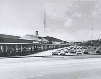
Lower level of Towers Shopping Center.