

Browse Items (8431 total)
Sort by:
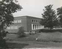
IRB 45 Fire Station 9

This is a two story and part basement brick building of semi-fire resistive construction with composition roof on a concrete slab; Plastered interior finish with exception of basement which is open; concrete basement, terrazzo first floor, wood…
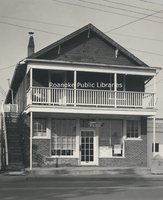
IRB 46 Fire Station 10

This is a one-two story and part basement of brick veneer, frame and cinder block, ordinary joisted construction with approved roof. Part of first floor concrete, stove heat; indifferent repair. Occupancy: 1617 - Life Saving Station. 1619-21 - Fire…
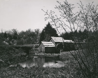
IRB 47 Rockledge

A large two story and basement building, frame clapboard and wood shingle construction, wood shingle roof, board floors, wood board interior finish, electric lighting, heat from stoves and fireplaces; in poor condition. Occupancy: First floor - dance…
IRB 48 Caretakers Dwelling
A one story frame, approved roof dwelling, electric lighting, stove heat; no basement and in fair repair. Valuation: The sound value of this building is approximately $3K.
IRB 49 Elmwood Club Rooms

A two story building of brick and stone stuccoed construction with composition shingle roof, wood board floors, plastered interior finish, electric lights, coal-fired Arcola heat. Approximately 50 years old and in good condition. Valuation: The…
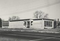
IRB 5 Office Building

This is a two story and basement brick building with slate roof, wood floors with the exception of the basement which is concrete, plastered walls with the exception of the basement which is open, electric lights and low pressure steam heat. This…
IRB 51 Bandstand

A one story octagonal shaped open pavilion with wood shingle roof, wood floors. Valuation: The sound value of this building is approximately $4500.
IRB 52 Gish House

A two story frame clapboard building with composition shingle roof, wood floors with exception of basement which is concrete, plastered interior finish with exception of basement which is open finish, one stairs basement to first floor and one stairs…
IRB 53 Bandstand

A one storage octagonal shaped open pavilion with wood shingle roof, wood floors. Valuation: The sound value of this building is approximately $500.
IRB 65 Tenant Dwelling

A one story frame stuccoed building with concrete shingle roof, wood floors, plastered interior finish, electric lighting, stove heat. Building in good condition. Valuation: The sound valuation of this building is approximately $2.4K
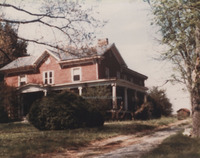
IRB 66 Buena Vista

A two story and part basement brick building with metal roof, wood floors, plastered interior finish, three stairs first to second floor, one stairs basement to first floor. Electric lighting and low pressure steam heat. About 100 years old and in…
IRB 75 Keepers Dwelling

A one and a half story part basement building of frame construction with metal roof, wood floors, plastered interior finish, electric lighting and stove heat. About 150 years old. Valuation: The salvage value of this building is approximately $3K.
IRB 83 Keepers Dwelling

A two story brick building with frame addition and approved roof, wood floors, plastered interior finish, stove heat and electric lighting. Building in fair condition. Valuation: The sound value of this building is approximately $3.5K.
IRB 85 Shelter House

A one story and basement frame, approved roof building, with wood floor. Valuation: The sound value of this building is approximately $4K.
IRB 93 General Office

A two story brick building with composition roof, first floor is concrete and second floor wood boards, plastered interior finish, electric lights, hot water heat (heating equipment cut off in fireproof room). Approximately fifty years old in good…
IRB 94 Meter Shop

A three story brick building with a metal roof, wood floors with the exception of first floor which is concrete, wood lath and plaster interior finish, electric lighting, stove heat. Approximately 50 years old and in poor condition. The building is…
IRB 97 Pump Station

A one story brick building, composition roof, open interior finish, concrete and wood floors, electric lighting; fire resistive addition. Building in good condition. Occupancy: Steam reciprocating pumps and boilers. Valuation: The sound value of…
IRB1 Municipal Building

This is a large five story building of fire resistive construction erected in 1916, having a built-up roof, concrete and terrazzo floors, and direct plaster interior finish. There are two open stairs from the first to the the third floor, one…
IRB2 Municipal Annex

This is a two story building and basement brick building with metal roof, plank floors with the exception of the basement floor which is concrete, plastered interior finish and one open stairs from basement to second floor, electric lights and low…
IRB7 Church

One story part basement frame building, new composition roof, plastered interior finish, wood floors, electric lighting, hot air heat. Building in good condition. Occupancy: Church of Christ. Valuation: The sound value of this building is…
It Seems As If Everyone in Roanoke, Virginia Visits Children's Zoo

Article written by Robert P. Hunter, then Parks and Recreation manager for the City of Roanoke. Published in the July 1956 edition of Park Maintenance magazine.
J. Randolph Bryan

Date of Birth: January 9, 1868
Mayor from July 1, 1900 to February 13, 1902
Date of Death: August 1, 1909
Mayor from July 1, 1900 to February 13, 1902
Date of Death: August 1, 1909
James A. Bear

Date of Birth: March 25, 1881
Mayor from June 2, 1938 to August 31, 1938
Other offices held: City County, 1934-1940; Virginia House of Delegates, 1924-1929 and 1946-1947
Date of Death: September 4, 1956
Mayor from June 2, 1938 to August 31, 1938
Other offices held: City County, 1934-1940; Virginia House of Delegates, 1924-1929 and 1946-1947
Date of Death: September 4, 1956
James P. Woods

Date of Birth: February 4, 1868
Mayor from July 1, 1898 to June 30, 1900
Other offices held: City Council, November 10, 1896 to July 1, 1898; U.S. House of Representatives, Virginia's 6th District, February 25, 1919 to March 3, 1923
Date of…
Mayor from July 1, 1898 to June 30, 1900
Other offices held: City Council, November 10, 1896 to July 1, 1898; U.S. House of Representatives, Virginia's 6th District, February 25, 1919 to March 3, 1923
Date of…
JLSB1 J.L. Stern Battalion

Jo Lane Stern Battalion, Company B, in front of the Roanoke Auditorium. Col. Jo Lane Stern, inspector general of the State, mustered in the Jo Lane Stern Battalion of Virginia volunteers in Roanoke, composed of four full companies, numbering 267 men…
Joel H. Cutchin

Date of Birth: February 2, 1846
Mayor from July 1, 1902 to April 9, 1912
Other offices held: City Council, July 1, 1898 to July 1, 1902
Date of Death: September 20, 1917
Mayor from July 1, 1902 to April 9, 1912
Other offices held: City Council, July 1, 1898 to July 1, 1902
Date of Death: September 20, 1917
John H. Dunstan

Date of Birth: c. 1839
Mayor from July 1, 1884 to June 30, 1885
Date of Death: September 21, 1902
Mayor from July 1, 1884 to June 30, 1885
Date of Death: September 21, 1902
John W. Woods

Date of Birth: July 27, 1858
Mayor from July 1, 1912 to December 23, 1912
Other offices held: Virginia House of Delegates, 1889-1900
Date of Death: December 23, 1912
Mayor from July 1, 1912 to December 23, 1912
Other offices held: Virginia House of Delegates, 1889-1900
Date of Death: December 23, 1912
Journal of the Historical Society of Western Virginia
2001
Volume 14, Number 2

Articles in this issue include: Vice Presidential Candidate had Carvins Cove Summer Home Emma Comer, First Graduate of Roanoke City High School, 1894 Celebrating the Millennium, 1901Mrs. Breckinridge's BreweryGrowing Up and Having Fun in South…
Journal of the Historical Society of Western Virginia
2002
Volume 15, Number 1

Articles in this issue include: Railroads and Their PeopleThe Virginia & Tennessee Railroad 150 Years AgoWorking with Winston Link at the End of Steam PowerThe Turnpikes of Southwest VirginiaThe Harris Family ArchivesWhat Do We Leave…
Journal of the Historical Society of Western Virginia
2003
Volume 15, Number 2

Articles in this issue include: The Legend of Benjamin Deyerle RevisitedLest We Forget: A Vinton LandmarkThe New River on Mid-Eighteenth Century MapsThe Craft Revival in Appalachia, 1896-1937And The Mountains Sing with Joy: White Top MusicThe Great…
Journal of the Historical Society of Western Virginia
2004
Volume 16, Number 1

Articles in this issue include: No Contract Too Large or Too Small for C. Markley and SonThey Go Quietly: Agricultural Change in Franklin CountyMy Memories of Carvins Cove: A Long, Peaceful ValleyAfrican Americans Have a Proud AncestryGainsboro and…
Journal of the Historical Society of Western Virginia
2005
Volume 16, Number 2

Articles in this issue include: The Progressive Reform Movement in Roanoke, 1900-1912The Victoria Courtship of Miss Emma and Mr. TinsleyLife in 1905Roanoke Families Built Many Roads from 1950-2005Bob Childress and His Six Rock ChurchesThe Early…
Journal of the Historical Society of Western Virginia
2006-2007
Volume 17, Number 1

Articles in this issue include: Historical Society Journal is 43Roanoke County and Valley: The Lessons of HistoryThe Past is Right Here for the ArchaeologistThe Great FloodSeeing Virginia in 1797Roanoke County in the 1840sHow the Mother County…
Journal of the Historical Society of Western Virginia
2008
Volume 17, Number 2

Articles in this issue include: A Personal History of the Hotel RoanokeDust-Clad Motorcars Arrive in Roanoke in 1909Lincoln's Virginia RootsColonel J. Sinclair Brown: Hard to BeatWhat is it about the Civil War?Images from the Old BeltResidential…
Journal of the Historical Society of Western Virginia
2009
Volume 18, Number 1

Articles in this issue include:A New Way of Looking at Old ThingsThe Career of Henry H. FowlerCol. John Smith: Unsung Hero of Virginia's Colonial FrontierOld County Courthouse is 100 Years Old16th Century Spanish Invasions of Southwest VirginiaThe…
Journal of the Historical Society of Western Virginia
2010
Volume 19, Number 2

Articles in this issue include: Defining and Dating Log Buildings in Southwest Virginia Lewis Miller: Folk Artist and Chronicler of the 19th Century Roanoke's Social Life in 1912: The Diary of Nina Quinn Blue Ridge Parkway: A Graceful Mountain Drive…
Journal of the Historical Society of Western Virginia
2011
Volume 20, Number 1

Articles in this issue include:An Interview with Carter BurgessWhere was Totera Town? A ReviewS.H. McVitty's Collection of Presidential SignaturesS.H. McVitty: Industrialist, Philanthropist, CollectorThe Late, Great Cattle BattleThe Two Michael…
Journal of the Historical Society of Western Virginia
2012
Volume 20, Number 2

Articles in this issue include:The New Day at AppomattoxRare Lee Letter Tells of "Thinning Ranks"George S. Bernard on the Causes of the Civil WarAn Army of Many Colors Trains in Salem in 1863Hollins Institute Prepares for a New Civilization in…
Journal of the Historical Society of Western Virginia
2013
Volume 21, Number 1

Articles in this issue include:Two Roads Diverged: Architectural History and Historic Preservation in the 21st CenturyCotton to Silk: An Oral HistoryHow Lyman Draper Saved HistoryDown on the MarketFurniture and Aviation History Reside in Fogotten…
Journal of the Historical Society of Western Virginia
2014
Volume 21, Number 2

Articles in this issue include:Growing Up in Roanoke in the 1920s to 1930sO. Winston Link's 100th Birthday PartyBedford BarnsFrances Benjamin Johnston, Renowned Photographer, and the George Trout Farm in NW RoanokeRunaway Slaves: Mindset of Negroes,…
Journal of the Historical Society of Western Virginia
2015
Volume 22, Number 1

Articles in this issue include: Roanoke Jews: A HistoryCrossing Roanoke Valley in Chains and HandcuffsOld Chapel Church is 247 Years OldLong Stained Glass Window is Coming to the Link MuseumRoanoke's First FlightNatural Bridge, A Landmark for the…
Journal of the Historical Society of Western Virginia
2016
Volume 22, Number 2

Articles in this issue include:Virginia's Western Counties and the Making of AmericaA New Road to be Opened: The Poplar Forest ParkwayRecalling Poplar Forest After Mr. JeffersonSegregated Souls in the Star CityThe Photographs of George Newton Wertz,…
Journal of the Historical Society of Western Virginia
2018
Volume 23, Number 1

Articles in this issue include:Armistice Ended "Greatest War in History" a Century AgoThe Humilitation of Lord BotetourtRoanoke Cotton MillsSunday Trouble on Back CreekThe Legacies of Junteenth 150 Years RunningBob Angell: An Early Mover and Shaker…
Journal of the Historical Society of Western Virginia
2019
Volume 23, Number 2

Articles in this issue include:How the Mother County BeganThe Virginia Brewing Company: Roanoke's First BreweryTrees Provide Clues to Construction of Greenfield Kitchen and Slave QuartersTrouts, Father and Son, Were Early MayorsFrom the Front Porch…
Journal of the Historical Society of Western Virginia
2020
Volume 24, Number 1

Articles in this issue include:Roanoke and the Southwest in Virginia HistoryThe Enigmatic Stone Structures of Western VirginiaOrchard HillN&W, WWIIN&W ShopsLost ColonySlavery as America's "Peculiar" InstitutionRoanoke-Norfolk Photographer,…
Journal of the Roanoke Historical Society
1971?
Volume 7, Number 2

Articles in this issue include: General James Breckinridge, Frontier Man for All Seasons Botetourt's Three CourthousesA Disastrous ConflagrationFire Remedy is 1,400 Years OldRoanoke's 300th AnniversaryEarly Lightning DevicesMontgomery Men in…
Journal of the Roanoke Historical Society
Summer 1964
Volume 1, Number 1

Articles in this issue include: Treasure TroveSome Phases of the Civil War in the Roanoke AreaThe Case of the Warrantless PrisonersTwo Ladies of the MuseumNewspaper Days, 1790The Borden Patent
Journal of the Roanoke Historical Society
Summer 1965
Volume 2, Number 1

Articles in this issue include: The South Western Turnpike RoadToll Gates in this CenturyBoyhood Collection is Remembrance of PastThomas and Tasker ToshLone Oak-1767?-1964Founding of Patrick CountyPeaks of OtterBeginnings of the Virginia Historical…
Journal of the Roanoke Historical Society
Summer 1966
Volume 3, Number 1

Articles in this issue include: Shot Tower at Jackson's FerryHome Life in Virginia, 1776-1835Big Lick Home Front, 1816-1865The Society Circles Franklin CountyMountain Lake; Historic Preservation-A Challenge to Virginians
Journal of the Roanoke Historical Society
Summer 1967
Volume 4, Number 1

Articles in this issue include: The Pennsylvania Dutch Culture of the Shenandoah Valley Interstate Interchange Covers Town of GainsboroBell Mont-the Fleming PlantationLet's All Make WhiskeyLocust LevelEarly Lutherans in Western Virginia
Journal of the Roanoke Historical Society
Summer 1968
Volume 5, Number 1

Articles in this issue include: Montgomery White, 19th Century Social CenterVirginia's Neglected Soldiers28th Regiment, Virginia VolunteersSamuel Rader, 1801-1891, Botetourt Brick MasonHistory Grows in BotetourtPennsylvania Dutch Fashions and Early…
Journal of the Roanoke Historical Society
Summer 1969
Volume 6, Number 1

Articles in this issue include: Lewis Miller, Folk ArtistJohnny Rebs from Virginia and the Fairer SexThe Four Anderson BrothersRoanoke River: Once Called Saponi, Round Oak, Goose CreekSt. Mark's Fincastle Has Roots 200 Years OldAppalachian Dialect:…
Journal of the Roanoke Historical Society
Summer 1970
Volume 7, Number 1

Articles in this issue include: The Great Flood of 1749Roanoke County in the 1840sA Misty Tour of HenryThe Town of NewbernOn Campus 70 Years AgoWoolen Mill, a Major Botetourt IndustryCivil War Draft Problems in the Shenandoah ValleyHales Ford…
Journal of the Roanoke Historical Society
Winter 1964-1965
Volume 1, Number 2

Articles in this issue include: Forgotten Graveyards of the Roanoke ValleyThree-Layer Cake of Prehistoric VirginiaFincastle Springs, Resort of the '80sCivil War Comes to BuchananA Key Which Stayed HomeBuena Vista-Roanoke PlantationWilliam Fleming's…
Journal of the Roanoke Historical Society
Winter 1965-1966
Volume 2, Number 2

Articles in this issue include:John Nolen's Roanoke City Plan of 1907Southwest Virginia Turnpikes1753-Saga of Pioneer Pilgrimage Through the Roanoke Region You Could Take a Legal Gamble in 1796Butler in RichmondMachine Age 1832Fort Vause-The Site and…
Journal of the Roanoke Historical Society
Winter 1967
Volume 3, Number 2

Articles in this issue include: Hollins College and the Civil WarHenry Ford and Friends on TourSearching for Your AncestorsRoanoke Valley's Early Iron MinesRecollections of Bent Mountain
Journal of the Roanoke Historical Society
Winter 1968
Volume 4, Number 2

Articles in this issue include: 28th Regiment, Virginia Volunteers, 1861-1865Roanoke at the BeginningNew River: First of the Western WatersThe Teays: Ancestral River of Mid-AmericaA New Brick House for $105 and a Horse Critter Walled in by the…
Journal of the Roanoke Historical Society
Winter 1969
Volume 5, Number 2

Articles in this issue include: Collectors' Items Span Four CenturiesSaving Virginia's TreasuresEdward William Johnston and Roanoke Female SeminaryIs There an Older Roanoker?Five Rivers Flow WestLongwood was Salem's CastleRoanoke's Cows in 1898
Journal of the Roanoke Historical Society
Winter 1970
Volume 6, Number 2

Articles in this issue include: How the Mother County BeganFincastle-More Than a County SeatEarly CraftsmenMary Johnston, Writer of the PastCherry Tree BottomFire Destroys LandmarksThe Turnpike Through BotetourtWestern Inhabitants-An Incumbrance?The…
Journal of the Roanoke Historical Society
Winter 1972
Volume 8, Number 1

Articles in this issue include: The Past is Right Here for the ArchaeologistThe 51st Virginia Infantry: Farmers Turned SoldiersTurner's Creek Valley-the Land that Time ForgotLog Buildings in the Valley of VirginiaMary Harvey Trigg, an Unusual…
Journal of the Roanoke Valley Historical Society
1973-1974
Volume 9, Number 1

Articles in this issue include: Old Barns of AppalachiaMontane Virginia in the RevolutionRoanoke Valley MedicineRecollections of Ballad CollectingEphraim Vause was RobbedWilliam Preston, Frontier Public ServantAlexander-Withrow BuildingCherry Tree…
Journal of the Roanoke Valley Historical Society
1975
Volume 9, Number 2

Articles in this issue include: Government by Families in Botetourt CountyIndians Retreat from Virginians at Battle of Point PleasantThe Fincastle Resolutions, Southwest Virginia's CommitmentThe ResolutionsWho the 15 Signers WereSettlement, Defense…
Journal of the Roanoke Valley Historical Society
1978
Volume 10, Number 2

Articles in this issue include: Seeing Virginia in 1797The Big FortCures From Mountain HerbsWhat They Owned in the 1840sLexington ArchitectureThe Washington Iron WorksThe National Register of Historic PlacesBringing an Old Pump to Life
Journal of the Roanoke Valley Historical Society
1980
Volume 11, Number 1

Articles in this issue include:Clifton A. Woodrum, Congressman with a FlairColonel James P. Woods, Lawyer, CongressmanJohn Hook, New London MerchantHow We BeganSpinning and Weaving in Montgomery County
Journal of the Roanoke Valley Historical Society
1984
Volume 12, Number 1

Articles in this issue include: Farmers Supply Transformed into Center in the SquareRoanoke's First Dairy was on Orange AvenueVinton's BeginningHow Dr. Hart Lost His SightDr. William Fleming Made House CallsBenjamin Keagy's HomeDr. Landon Cabell…
Journal of the Roanoke Valley Historical Society
1988
Volume 12, Number 2

Articles in this issue include: First County Courthouse Stood from 1841-1909Fleming Backed ConstitutioRoanoke's First JudgesA Tale of Two HousesRoanoke Catholic ChurchesLetters from SchoolSalem MillsA Roanoke Visit in 1762Roanoke Fast Becoming Known…
Journal of the Roanoke Valley Historical Society
1989
Volume 13, Number 1

Articles in this issue include: Roanoke County and the Valley: the Lessons of HistoryRoanoke County Communities Started Between the Mountains The Early Economy of Roanoke CountyOld City Point Railroad was N&W Forerunner in 1838Overlooked…
Journal of the Roanoke Valley Historical Society
1996
Volume 13, Number 2

Articles in this issue include: Threading a Parkway through the Blue RidgeHotel Roanoke, "Large and Well-Equipped"The Railroad OfficesTotera Town ReconsideredColonel William Fleming's OriginsKentland Farm, a New River PlantationArchitecture of…
Journal of the Roanoke Valley Historical Society
Centennial Issue, 1982
Volume 11, Number 2

Articles in this issue include: Roanoke History as Recorded in 1912Where We Were in 1864When Knights Were BoldA Jefferson Street StrollRoanoke's First Fire StationHow a Railway Clerk Saw the New CenturyLife on Highland Avenue in the Early 1900sHorace…
Journal of the Roanoke Valley Historical Society
Summer 1972
Volume 8, Number 2

Articles in this issue include: Benjamin Deyerle, Builder of Fine HomesRoanoke County Barns of the 19th CenturyColonel George Plater Tayloe, a Builder of Hollins CollegeWhere the Brethren SettledDigging at Looney's FerryNo. 1 Fire Station is…
KH1 Kinsey Home

Thomas A. Kinsey home, formerly located at 1510 Franklin Road SW.
KH2 Kinsey Home

Thomas A. Kinsey home, formerly located at 1510 Franklin Road SW.
KH3 Thomas & Josephine Kinsey

Thomas A. and Josephine Kinsey in front of their home at 1510 Franklin Road, SW.
KH4 Kinsey Family

The Thomas A. Kinsey family on front porch of the home at 1510 Franklin Road, SW.
LDW1 Loebl, Josef

Josef Loebl stands next to a Vorclone drying tumbler in Loebl Dye Works, formerly located at 350 Salem Avenue.
LDW10 Staging Area

William Staples, Iva Staples and an unknown woman prepare garments for cleaning and alterations at Loebl Dye Works.
LDW11 Cleaning Area

Unidentified Loebl employees in the cleaning area.
LDW12 Dyeing Area

Unidentified Loebl employees in the dyeing area.
LDW13 Cleaning Area

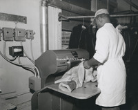
Robert Loebl (left) inspects the work of unidentified employees on the Hoffman Pressing Machine.
LDW14 Cleaning Area

Robert Loebl (left) and two unidentfied men in the next to the cleaning tumblers.
LDW15 Loebl Dye Works

As seen here, Loebl Dye Works once filled a row of buildings on Salem Avenue.
LDW16 Package

This package illustrates just how well known Loebl Dye Works was, not just locally, but globally. This was sent from a dry cleaner in New Zealand for dye work. Among other clients of Loebl were the White House, the Greenbrier, New York designers…
LDW17 Loebl Dye Works

After the explosion of synthetic fabrics in the 1970s, Loebl Dye Works went out of business in 1981. The building was razed in 2001. The buildings at left in this photograph were also once used by the business and still stand today.
LDW2 Loebl Dye Works

Left to Right: Josef Loebl, Robert Loebl, Julia Loebl, _____, and Roy Hargraves in front of Loebl Dye Works, formerly on Salem Avenue.
LDW3 Dyeing Vats

Left to right: Roy Hargraves, Josef Loebl and Robert Loebl in a dyeing room of Loebl Dye Works, formerly located on Salem Avenue.
LDW4 Cleaning and Alterations

In addition to dyeing, Loebl also provided dry cleaning and alteration services. Photo is labeled with the following names, though their order as they appear is unclear: Minnie Duncan, Gertrude Gentry, Mrs. Flippen, Stella Taylor, and Miss Sandberg
LDW5 Loebl, Josef

Hungarian born, Josef Loebl grew up in Austia. He set up his dyeing and cleaning shop on Salem Avenue in the 1920s.
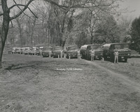
LDW6 Loebl Fleet

A fleet of four Loebl Dye Works dry cleaning trucks parked in front of Loebl Dye Works on Salem Avenue.
LDW7 Loebl Fleet

Loebl Dye Works dry cleaning trucks parked in front of Loebl Dye Works on Salem Avenue.
LDW8 Customer Counter

Robert Loebl, Hattie Mae Beck and Iva M. Spangler in the pick-up and drop-off area of Loebl Dye Works.
LDW9 Loebl Interior

Josef Loebl (center) and two unidentified men in "storefront" of Loebl Dye Works
Leo F. Henebry

Date of Birth: October 31, 1894
Mayor from October 15, 1943 to August 31, 1946
Date of Death: November 14, 1974
Mayor from October 15, 1943 to August 31, 1946
Date of Death: November 14, 1974
LSC1 Julian S. Wise

Julian Stanley Wise founded the Roanoke Life Saving and First Aid Crew in 1928. Wise had witnessed a drowning in the Roanoke River as a child. This incident greatly impacted his life, resulting in the formation of the first volunteer rescue squad…
LSC2 Roanoke Life Saving Crew

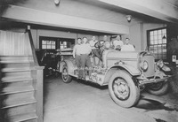
Roanoke Life Saving and First Aid Crew equipment display, including the crew's first ambulance, a Cadillac donated by John M. Oakey and Sons Funeral Home.
LSC3 Roanoke Life Saving Crew

Roanoke Life Saving and First Aid Crew purchased it first ambulance in 1932, a Ford panel truck.
LSC4 Roanoke Life Saving Crew

Roanoke Life Saving and First Aid Crew equipment display arranged for the public.
LSC5 Roanoke Life Saving Crew

Some equipment, including an "iron lung" and 1947 Oldsmobile 78 emergency vehicle on display at Roanoke Life Saving and First Aid Crew.
LSC6 Oakey & Sons

John M. Oakey and Sons garage, located at 321 Luck Avenue SW, provided the first ambulance and garage for Roanoke Life Saving and First Aid Crew.
Marshall Waid

Marshall Waid
Date of Birth: 1841
Mayor, Town of Big Lick from July 1, 1880 to February 3, 1882, and Town of Roanoke, February 3, 1882 to June 30, 1882
Date of Death: March 7, 1887
Date of Birth: 1841
Mayor, Town of Big Lick from July 1, 1880 to February 3, 1882, and Town of Roanoke, February 3, 1882 to June 30, 1882
Date of Death: March 7, 1887
Matador 1971

The Matador is the annual for James Madison Middle School.
Matador 1973

The Matador is the annual for James Madison Middle School.
Matador 1974

The Matador is the annual for James Madison Middle School.
Matador 1975

The Matador is the annual for James Madison Middle School.
Matador 1976

The Matador is the annual for James Madison Middle School. Pages 16 and 17 partially missing.
Matador 1977

The Matador is the annual for James Madison Middle School.
Matador 1978

The Matador is the annual for James Madison Middle School.
Matador 1979

The Matador is the annual for James Madison Middle School.
Matador 1980

The Matador is the annual for James Madison Middle School.
Matador 1981

The Matador is the annual for James Madison Middle School.
Matador 1982

The Matador is the annual for James Madison Middle School.
Matador 1983

The Matador is the annual for James Madison Middle School.
Matador 1984

The Matador is the annual for James Madison Middle School.
Matador 1985
The Matador is the annual for James Madison Middle School.
Matador 1986
The Matador is the annual for James Madison Middle School.
Matador 1987

The Matador is the annual for James Madison Middle School.
Matador 1988

The Matador is the annual for James Madison Middle School.
Matador 1989

The Matador is the annual for James Madison Middle School.
Matador 1990

The Matador is the annual for James Madison Middle School.
Matador 1991

The Matador is the annual for James Madison Middle School.
Matador 1992

The Matador is the annual for James Madison Middle School.
Matador 1993

The Matador is the annual for James Madison Middle School.
Matador 1994

The Matador is the annual for James Madison Middle School.
Matador 1995

The Matador is the annual for James Madison Middle School.
Matador 1996

The Matador is the annual for James Madison Middle School.
Matador 1997

The Matador is the annual for James Madison Middle School.
Matador 1998

The Matador is the annual for James Madison Middle School.
Matador 1999

The Matador is the annual for James Madison Middle School.
Matador 2000

The Matador is the annual for James Madison Middle School.
Matador 2001

The Matador is the annual for James Madison Middle School.
Matador 2002-2003

The Matador is the annual for James Madison Middle School.
Matador 2003-2004

The Matador is the annual for James Madison Middle School.
Matador 2004-2005

The Matador is the annual for James Madison Middle School.
Matador 2005-2006

The Matador is the annual for James Madison Middle School.
Matador 2006-2007

The Matador is the annual for James Madison Middle School.
Matador 2007-2008

The Matador is the annual for James Madison Middle School.
Matador 2008-2009

The Matador is the annual for James Madison Middle School.
Matador 2009-2010

The Matador is the annual for James Madison Middle School.
Matador 2010-2011

The Matador is the annual for James Madison Middle School.
Matador 2011-2012

The Matador is the annual for James Madison Middle School.
Matador 2013

The Matador is the annual for James Madison Middle School.
Matador 2014

The Matador is the annual for James Madison Middle School.
Matador 2015

The Matador is the annual for James Madison Middle School.
Matador 2016

The Matador is the annual for James Madison Middle School.
Matador 2019

The Matador is the annual for James Madison Middle School.
Matador 2020

The Matador is the annual of James Madison Middle School.
Matador 2021

The Matador is the annual for James Madison Middle School.
Matador 2022

The Matador is the annual for James Madison Middle School.
McCain1 Medical Complex

This medical complex on Henry Street at Centre Avenue NW included (top left) Community Drug Store, where Dr. Beverly Adams (bottom left) was a pharmacist. Also in the building was the dental office of Dr. H.T. Penn (on right).
McCain2 Lynhaven Smoke Shop

Gathering for a 1942 postcard at the Lynhaven Smoke Shop, formerly located at 125 N. Henry Street are from left: Mr. Roberts, Lorenzo Redd, Hobart Eggleston, Dr. George A. Moore, owner Bill Marshall and his son, James "Anse" Marshall.
McCain3 Lincoln Theatre

Group photo of Norfolk & Western Veterans Association Colored Division in front of the Lincoln Theatre. Originally built as the Strand Theatre (circa 1920). The Strand Theater took a new name “The Lincoln Theater”. The theater eventually became the…
Medi Cen, 1964
Medi Cen was the annual for Roanoke Memorial Hospital Nursing School.
MIC1 Roanoke Sign

Sign for Roanoke Metropolitan Area noting population as 160,0000.
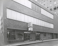
MIC10 First Federal Savings & Loan

A newly constructed First Federal Savings and Loan. The building is located on the corner of Church Avenue and 1st Street.
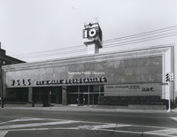
MIC11 Sears Town

Sears Town, formerly located at 1502 Williamson Road NE.
MIC12 Miller & Rhoads

Crowds gather for the grand opening of the new Miller & Rhoads. The department store was located at 32-38 Campbell Avenue SW.
MIC13 Heironimus

Heironimus was located at 401 S. Jefferson Street.
MIC14 Parking Garages

Two 500 space parking garages were constructed on the corner of Bullitt Avenue and Jefferson Street to provide greater accessibility to downtown shopping facilities.
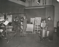
MIC15 WSLS

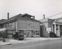
Shenandoah Life was affiliated with WSLS radio and TV services. The building is located at 401 3rd Street.
MIC16 WDBJ

The Times-World building was home to Roanoke's two newspapers and the CBS affiliate, WDBJ radio and television.
MIC17 N&W Passenger Station

The Norfolk & Western Passenger Station is located at 101 Shenandoah Avenue NE. The building now houses the Visit Blue Ridge Visitor's Center, O. Winston Link Museum, and History Museum of Western Virginia.
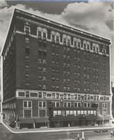
MIC18 Hotel Roanoke

Hotel Roanoke
MIC19 Woodrum Field

A crowd gathers for the dedication of the new terminal at Woodrum Field.
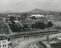
MIC2 Roanoke from Mill Mountain

Panoramic view of Roanoke from Mill Mountain.
MIC20 Main Branch

The Main Branch of Roanoke Public Libraries, located at 706 S, Jefferson Street.
MIC21 YMCA

A new YMCA building was completed in 1958 at 425 Church Avenue SW.
MIC22 Lucy Addison High

The second Lucy Addison High School was built in 1951. Located at 1220 5th Street NW, the high school was in operation until 1973. The building now houses Lucy Addison Middle School.
MIC24 Roanoke Memorial

Roanoke Memorial Hospital
MIC25 2524 Cornwallis Avenue

Home located at 2524 Cornwallis Avenue SE.
MIC26 2652 Cornwallis Avenue

Home located at 2652 Cornwallis Avenue.
MIC27 4102 Mudlick Road

Home located at 4102 Mudlick Road.
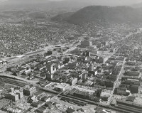
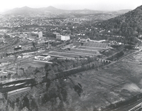
MIC3 Roanoke Aerial

Aerial view of Downtown Roanoke.
MIC30 3612 Troutland Avenue

Home located at 3612 Troutland Avenue.
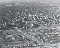
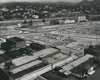
MIC31 Downtown Aerial

Aerial view of Downtown Roanoke.
MIC32 Carvins Cove

Aerial view of Carvins Cove.
MIC33 Carvins Cove

Aerial view of Carvins Cove.
MIC4 N&W Offices

The former general office building of Norfolk and Western, located at 108 N. Jefferson Street, now houses the Roanoke Higher Education Center.
MIC5 General Electric

General Electric, located at 1531 Roanoke Boulevard in Salem.
MIC6 ITT

ITT Exelis is located at 7635 Plantation Road.
MIC7 Yale & Towne

Yale & Towne Manufacturing Company. Located at 1242 S. Colorado Street, the building is now used by Graham-White.
MIC8 Rowe Furniture

Rowe Furniture Company was located at 239 Rowan Street in Salem before moving to Elliston.
MIC9 Shenandoah Life

Shenandoah Life Insurance Company, formerly located at 2301 Brambleton Avenue.
Morningside Elementary School 2017
Yearbook for Morningside Elementary School.
MP 1.1 Fortune, William D.
William D. Fortune as an infant. Fortune was born 24 September 1908 to George E. Fortune and Mara Ophelia Blanton.
MP 1.2 Fortune, Frances C.
Frances Elvira Fortune as an infant. She was born 31 December 1909 to George E. and Mara Ophelia Blanton.
MP 1.3 Fortune, Roberta B.
Roberta Blanton Fortune as an infant. She was born 6 August 1913 to George E. Fortune and Mara Ophelia Blanton.
MP 1.4 Wood, Molly W.
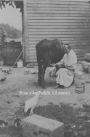
Molly W. Wood milking a cow at her son Jessie's farm in Cave Spring.
MP 1.5 Fortune, George E.
George Fortune as a child. Born in Rocky Mount, 22 February 1879, to Charles McDonald Fortune and Cleopatra Board Gill.
MP 1.6 Fortune, George E.
George Fortune poses next to a car. Location unknown.
MP 1.7 Fortune, George E.
Portrait of George Fortune.
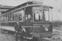
MP 1.8 Streetcar
Unidentified streetcar employees pose next to a streetcar in Richmond. Destination sign reads Oakwood and Broad Street.
MP 1.9 Streetcar
Unidentified streetcar employees pose next to a streetcar. Location unknown.
MP 10.0 Holdren's Service Van

Unidentified service employee of Holdren's stands next to service van at 2272 Westover Avenue.
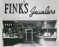
MP 11.0 Fink's Jewelers
Fink's Jewelers, at its former 310 S. Jefferson Street location.
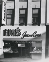
MP 11.1 Fink's Jewelers
Fink's Jewelers, at its former 310 S. Jefferson Street location.
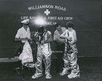
MP 12.0 Roanoke EMS
Unidentified members of Williamson Road Life Saving and First Aid Crew suiting up.
MP 14.0 Natural Bridge
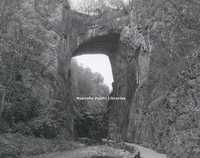
Natural Bridge
MP 15.0 State Capitol
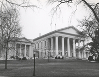
Virginia State Capitol Building.
MP 15.1 State Capitol
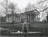
Virginia State Capitol Building.
MP 16 Kenmore Plantation
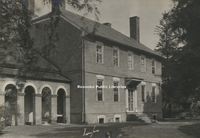
Kenmore Plantation, the home of Fielding and Betty Washington Lewis. Betty was the sister of George Washington.
MP 17.0 Steve Brody
Portrait of Steve Brody
MP 18 East Building
East Building on the campus of Hollins University.
MP 19 Cannaday House
Cannaday House, also known as Waverly Plantation was purchased by Woodrum Airport in 1934. The house was used as a weather station and terminal for the remainder of the 1928s. It was razed in 1955 to make room for growth of the airport.
MP 2.0 Roanoke Aerial
General view of Roanoke from 8000 ft.
MP 2.1 Roanoke Aerial
An aerial view looking toward Mill Mountain. I581 can be seen under construction on the left .
MP 2.12 Roanoke Aerial
Aerial view of Downtown Roanoke looking west.
MP 2.2 Mill Mountain Zoo
An aerial view of Mill Mountain Zoo. The zoo opened in 1952.
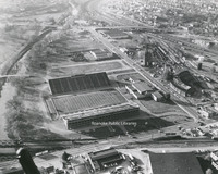
MP 2.3 Victory Stadium
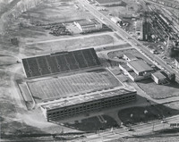
An aerial view of Victory Stadium. Victory Stadium was built in 1942 and razed in 2006.
MP 2.31 Victory Stadium
An aerial view of Victory Stadium. Victory Stadium was built in 1942 and razed in 2006.
MP 2.32 Victory Stadium
An aerial view of Victory Stadium. Victory Stadium was built in 1942 and razed in 2006.
MP 2.4 Roanoke City Mills

An aerial view of the Roanoke City Mills, once located at 1750 Jefferson Street. The mill facility was razed in 2009.
MP 2.5 Hotel Roanoke
Hotel Roanoke. Civic Center and I581 can be seen to the right. First Baptist Church, destroyed by fire in 1995, and St. Andrews can be seen at left.
MP 2.6 Franklin and Williamson
Looking south toward the intersection of Franklin Road and Williamson Road. The parking lots visible here became the Norfolk Southern building, Franklin Plaza, and a parking garage.
MP 2.7 Elliott Buick
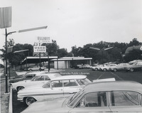
Elliott Buick, formerly located at 4721 Melrose Avenue NW.
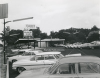
MP 2.71 Elliott Buick
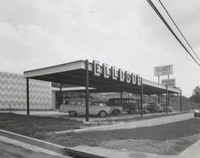
Elliott Buick, formerly located at 4721 Melrose Avenue NW.
MP 2.72 Elliott Buick
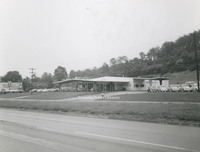
Elliott Buick, formerly located at 4721 Melrose Avenue NW.
MP 2.8 Roanoke Valley Motors
Roanoke Valley Motors, formerly located at 2239 Franklin Road.
MP 2.9 Roanoke Industrial Loan
Roanoke Industrial Loan and Thrift, formerly located at 20 Franklin Road.
MP 20.0 LAWS Children
Lawrence Augustine Washington Society Children of the American Revolution at the Daughters of the American Revolution state conference. Members: Holding flag - Charles F. Massey, Junior Vice President, Walter P. Massey, Helen Price Hotoler, Retha…
MP 20.1 LAWS Children
See MP 20.0
MP 21.0 USS Roanoke

USS Roanoke
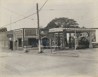
MP 22.0 Riverside Filling Station
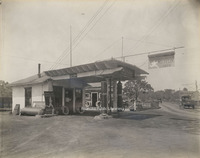
Riverside Filling Station, formerly located at 13th Street next to Woodrum Bridge, which would be replaced by Memorial Bridge.
MP 22.1 Waverly Filling Station
Waverly Filling Station, formerly located at the corner of 14th Street and Jamison Avenue.
MP 22.2 Marathon Filling Station
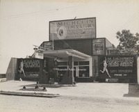
Marathon Filling Station, formerly located at 824 3rd Street.
MP 23.0 Bike Ride
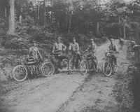
George Davis, far left, poses for a photo during a bike ride up the old Mill Mountain road.
MP 24.0 Bedford School
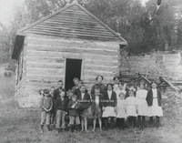
Students from an unknown private school in Bedford. According to notes on photo, "This is a private school in Bedford at Mrs. Witt's house. Miss Amelia Buck, in center, is the teacher.
MP 24.1 Shawsville School
Unidentified students and teachers in front of school in Shawsville in Montgomery County.
MP 24.2a Shawsville School
Unidentified students and teachers in front of school in Shawsville in Montgomery County.
MP 24.2b Shawsville School
Unidentified students and teachers in front of school in Shawsville in Montgomery County.
MP 24.3 Shiloh School
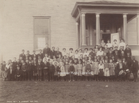
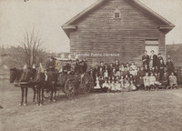
Students in front of Shiloh School in Catawba Valley. 1st row, L to R: Hortense Deeds, Eva Reed, Gladys Grisso, Edna Wright, Mary Garman, Paris Wright, Roy Hall, Claude Garman, Nelson Alls, John Garman, Kermit Garman, Roy Brillhart, Clyde Brillhart,…
MP 24.4 Narrows School
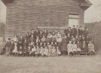
Students in front of Narrows School in the Catawba Valley. 1st row, L to R: Students in front of Narrows School in the Catawba Valley. 1st row, L to R: Hubert Brillhart, Kyle Shelor, Clovis Garman, ? Bennett, ? Bennett, Edna Brillhart, Hazel…
MP 24.5 Mt. Pleasant School

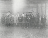
Unidentified students in front of Mt. Pleasant School in Roanoke County.
MP 25.0 Roanoke Fire Department
Unidentified Roanoke firemen pose on fire truck.
MP 26.0 Equipment Painters
Group photo of the Roanoke Chapter of the Union of Railroad Equipment Painters.
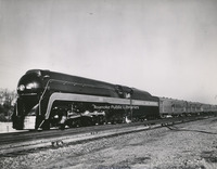
MP 27.0 Engine 2151
Engine 2151 of Norfolk & Western Railway.
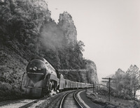
MP 27.1 Engine 601
Engine 601 of the Norfolk & Western Railway.
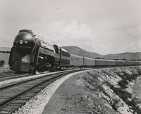
MP 27.2 Engine 604
Engine 604 of the Norfolk & Western Railway.
MP 27.3 Engine 609
Engine 609 of the Norfolk & Western Railway.
MP 28.1 Bryan Home
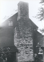
William Bryan's homestead at the Great Spring west of Salem was known as Bryan's On Roanoke, according to F.B. Kegley's Virginia Frontier. Photo depicts detail of stone chimney.
MP 28.2 Bryan Home
Unidentified group of men pose on the steps of a school or church(?) presumably on the Bryan Homestead property. Photo was included with Bryan Home photos.
MP 28.3 Bryan, Robert C.
Presumed photo of Robert C. Bryan, a descendant of William Bryan, owner of the Bryan Home. Photo was included with Bryan Home photos.
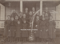
MP 29.0 School Group
Unidentified group of children pose in Elmwood Park. Terry House in background.
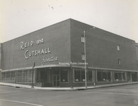
MP 3.0 Reid and Cutshall
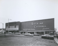
Reid and Cutshall Furniture, formerly located at 301 3rd Street.
MP 3.1 Reid and Cutshall
Reid and Cutshall Furniture, formerly located at 301 3rd Street.
MP 3.11 Reid and Cutshall
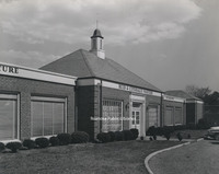
Reid and Cutshall Furniture Wayside, formerly located at 3441 Brandon Avenue.
MP 3.12 Reid and Cutshall
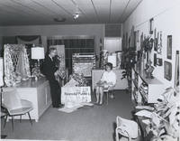
Interior view of Reid and Cutshall Furniture. This photo is believed to have been taken in the Brandon Avenue location. Individuals unidentified.
MP 3.13 Reid and Cutshall
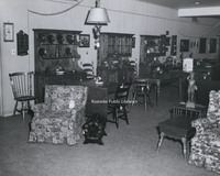
Interior view of Reid and Cutshall Furniture. This photo is believed to have been taken in the Brandon Avenue location.
MP 3.2 Hallmark Shop
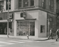
Hallmark Hall of Cards store, formerly located at 301 S. Jefferson Street.
MP 3.21 Hallmark Shop
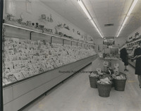
Interior view of Hallmark Hall of Cards, formerly located at 301 S. Jefferson St.
MP 3.3 A&U Mobile Homes
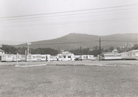
A&U Mobile Homes, formerly located at 1827 W. Main Street in Salem
MP 3.4 Roanoke Salem Plaza
Roanoke Salem Plaza opened in 1962. It was the third largest shopping center to open in the valley, with Crossroads being the first and Towers, the second.
MP 3.41 Roanoke Salem Plaza
Roanoke Salem Plaza opened in 1962. It was the third largest shopping center to open in the valley, with Crossroads being the first and Towers, the second.
MP 3.42 Roanoke Salem Plaza
Two unidentified women pose next to Christmas decorations at the Roanoke Salem Plaza.
MP 3.5 Towers Mall
Towers Mall under construction. Towers opened in 1961 at 2207 Colonial Avenue. At the time, it was reported in the Roanoke Times that Towers was the largest shopping center in the state. This photo depicts the upper level.
MP 3.6 Peters Creek Brethren
Peters Creek Church of the Brethren, located in the 5300 block of Cove Road.
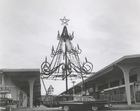
MP 3.7 Mill Mountain Star
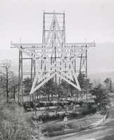
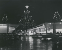
Mill Mountain Star was constructed in 1949 by the Roanoke Merchants Association to kick off the 1949 holiday shopping season. Though at first the star was not meant to be lit all year, it became popular enough with citizens that it was decided to…
MP 3.8 Hut Restaurant
Hut Restaurant in Collinsville, Virginia.
MP 3.81 Hut Restaurant
Hut Restaurant in Collinsville, Virginia.
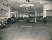
MP 3.9 Hotel Roanoke Garage
Garage under the Hotel Roanoke.
MP 30.0 The Barrens
The Barrens was built between 1865 and 1870 by Dr. Francis and Letitia Watts Sorrel. The home was sold to PC Huff in 1900. It stood on the present site of Valley View Mall.
MP 31.0 American Theatre
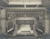
The American Theatre once stood on the corner of Jefferson Street and Kirk Avenue. Built in 1928, the theatre remained in operation until 1971; it was razed in 1973. This interior view is of the stage from the balcony.
MP 31.1 American Theatre
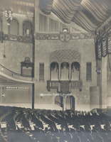
The American Theatre once stood on the corner of Jefferson Street and Kirk Avenue. Built in 1928, the theatre remained in operation until 1971; it was razed in 1973. This view shows the loge, just above the orchestra pit.
MP 31.2 American Theatre
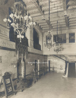
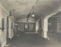
The American Theatre once stood on the corner of Jefferson Street and Kirk Avenue. Built in 1928, the theatre remained in operation until 1971; it was razed in 1973. This view shows the ornately appointed foyer. The placard at left advertises the…
MP 31.3 American Theatre

The American Theatre once stood on the corner of Jefferson Street and Kirk Avenue. Built in 1928, the theatre remained in operation until 1971; it was razed in 1973. This view shows paintings in the foyer as seen from the mezzanine.
MP 31.4 American Theatre
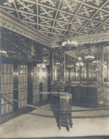
The American Theatre once stood on the corner of Jefferson Street and Kirk Avenue. Built in 1928, the theatre remained in operation until 1971; it was razed in 1973. This view is of the mezzanine.
MP 31.5 American Theatre
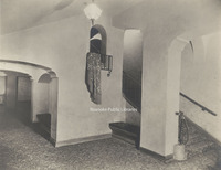
The American Theatre once stood on the corner of Jefferson Street and Kirk Avenue. Built in 1928, the theatre remained in operation until 1971; it was razed in 1973. This view is of a staircase from the mezzanine to the upper balcony and loges.
MP 31.6 American Theatre
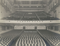
The American Theatre once stood on the corner of Jefferson Street and Kirk Avenue. Built in 1928, the theatre remained in operation unitl 1971; it was razed in 1973. This is a view of the auditorium and balcony as seen from the stage.
MP 31.7 American Theatre
The American Theatre once stood on the corner of Jefferson Street and Kirk Avenue. Built in 1928, the theatre remained in operation until 1971; it was razed in 1973. This view shows the theatre's main entrance with marble walls and brass doors.
MP 31.8 American Theatre

The original American Theatre building was located at 217 S. Jefferson Street. Built by the Young Men's Christian Association in 1902, it would later be sold to an investment group and converted into a theatre in 1913. This building was razed in…
MP 31.9 American Theatre

The American Theatre once stood on the corner of Jefferson Street and Kirk Avenue. Built in 1928, the theatre remained in operation until 1971; it was razed in 1973.
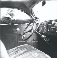
MP 32.1 Fork Ridge Massacre
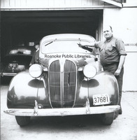
An unidentified man points to bullet holes in the windshield of a car involved in the Fork Ridge Mine shootout on 15 April 1941. The shootout was a result of a strike between mine workers and non-union mines operated in Mingo Hollow on the…
MP 32.2 Fork Ridge Massacre
An unidentified man points to bullet holes in the windshield of a car involved in the Fork Ridge Mine shootout on 15 April 1941. The shootout was a result of a strike between mine workers and non-union mines operated in Mingo Hollow on the…
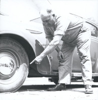
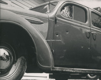
MP 32.3 Fork Ridge Massacre
Bullet holes in the windshield of a car involved in the Fork Ridge Mine shootout on 15 April 1941. The shootout was a result of a strike between mine workers and non-union mines operated in Mingo Hollow on the Tennessee-Kentucky border. The…
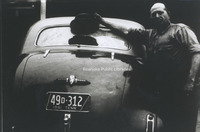
MP 32.4 Fork Ridge Massacre
An unidentified man points to bullet holes in the wheel of a car involved in the Fork Ridge Mine shootout on 15 April 1941. The shootout was a result of a strike between mine workers and non-union mines operated in Mingo Hollow on the…
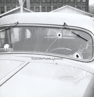
MP 32.5 Fork Ridge Massacre
Bullet holes seen from the interior of a car involved in the Fork Ridge Mine shootout on 15 April 1941. The shootout was a result of a strike between mine workers and non-union mines operated in Mingo Hollow on the Kentucky-Tennessee border. The…
MP 32.6 Fork Ridge Massacre
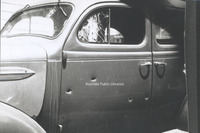
Bullet holes riddle the side of a car involved in the Fork Ridge Mine shootout on 15 April 1941. The shootout was a result of a strike between mine workers and non-union mines operated in Mingo Hollow on the Kentucky-Tennessee border. The massacre…
MP 32.7 Fork Ridge Massacre
Bullet holes riddle the side of a car involved in the Fork Ridge Mine shootout on 15 April 1941. The shootout was a result of a strike between mine workers and non-union mines operated in Mingo Hollow on the Kentucky-Tennessee border. The massacre…
MP 33.0 Barn Dinner Theatre
An interior view of the Barn Dinner Theatre. The theatre was created by Roanoker Howard Wolfe as a franchise in 1961. The chain grew to 27 theatres throughout the country. They were characterized by barn inspired architecture and included…
MP 34.0 Garlands Drugstore
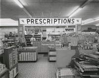
Interior view of Garland's Drugstore, formerly located 1327 Grandin Road.
MP 35.0 Police Inspection
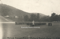
Roanoke Police inspection at Maher Field.
MP 38.0 Rivinus Room
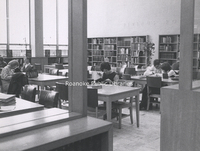
Patrons use reference materials in the Rivinus Room at the Main Branch of Roanoke Public Libraries
MP 38.01 Time Capsule
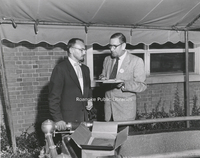
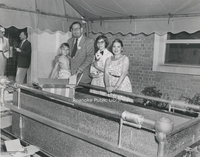
Contents are placed into the time capsule in front of the Main Library during the Diamond Jubilee Time Capsule Ceremony. The time capsule is not to be opened until 2032 for Roanoke's 150th Anniversary. Claude Settlemire, City Librarian, on left.
MP 38.02 Time Capsule
Contents are placed into the time capsule in front of the Main Library during the Diamond Jubilee Time Capsule Ceremony. The time capsule is not to be opened until 2032 for Roanoke's 150th Anniversary.
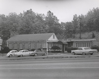
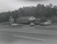
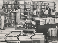
MP 38.1 Williamson Road Branch
Staff members prepare the Williamson Road Branch for opening.
MP 38.11 Williamson Road Branch
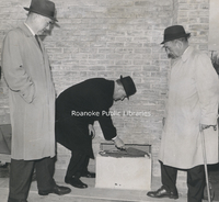
Unidentified men set the cornerstone at the Williamson Road Branch Library.
MP 38.12 Williamson Road Branch
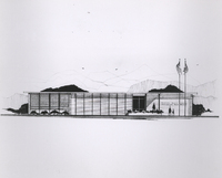
Architectural rendering of the Williamson Road Branch of Roanoke Public Libraries.
MP 38.13 Williamson Road Branch
A newly completed Williamson Road Branch Library.
MP 38.14 Williamson Road Book Station
The Williamson Road Branch found its beginnings as the Williamson Road Book Station, formerly located at 2919 Williamson Road NE.
MP 4.0 Home on Franklin
Home formerly located on the southwest corner of Franklin Road and Broadway Avenue.
MP 4.1 Terry House
The Terry House, formerly located in Elmwood Park, was the first library in the city.
MP 4.2 Mabry Mill
Mabry Mill was built by Edwin Boston Mabry. E.B. Mabry returned to Floyd County in 1903 and began the construction of the mill. It was first a blacksmith and wheelwright shop, then became a sawmill. By 1905 it was in operation as a gristmill. By…
MP 4.3 Roanoke Country Club
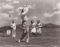
Promotional shot of golfers at Roanoke Country Club. The club had its beginnings in South Roanoke in 1899, It relocated to its current location in the early 1920s.
MP 4.4 Salem Avenue
Looking west on Salem Avenue toward the intersection with Jefferson Street.
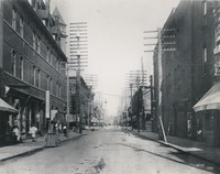
MP 4.41 Jefferson Street
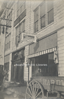
Looking north on Jefferson Street from the Church Avenue intersection. Construction of the Liberty Trust Building can be seen in background. Sign advertises J.H. Marsteller's (a car enthusiast and businessman) "Model Garage", formerly located at 16…
MP 4.42 Campbell Avenue
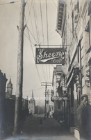
Looking west on Campbell Avenue. Sheen's Cafe was located at 119 Campbell Avenue SW. The building in the right background with balconies was the original Ponce de Leon Hotel.
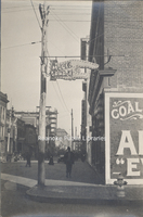
MP 4.421 Campbell Avenue

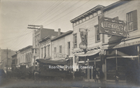
Looking east on Campbell Avenue from 1st Street during paving. People's Drugstore, Standard Drug, Krees & Co. and Lerner Shops were several of the businesses along this block.
MP 4.422 Campbell Avenue

Looking east on busy Campbell Avenue from 1st Street. People's Drugstore, Standard Drug, Kress & Co. and Lerner Shops were several of the businesses along this block.
MP 4.423 1st Street

Looking south on 1st Street from the 1st Street Bridge. The bridge connected Henry Street to Downtown Roanoke. The bridge was renamed in honor of Dr. Martin Luther King, Jr. in 2003.
MP 4.43 Salem Avenue
Looking west at saloons along Salem Avenue. The Silver Moon Quick Lunch, Raleigh Cafe and Brady's were located at approximately 20 Salem Avenue SW.
MP 4.44 Salem Avenue
Looking west from the 100 block of Salem Avenue SE. A horse takes a drink from the Dog's Mouth Fountain, visible at right.
MP 4.45 Church Avenue
Boyd-Sweeney Company Hardware and National Business College, formerly located at 9-11 Church Avenue SW.
MP 4.5 Roanoke Memorial

Rear view of Roanoke Memorial Hospital
MP 4.6 Fishburn Library
Fishburn Library at Hollins University
MP 4.7 Patrick Henry Hotel
Superimposed image of the Patrick Henry Hotel.
MP 4.71 Patrick Henry Hotel
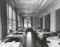
Dining room of the Patrick Henry Hotel.
MP 4.8 Henri Kessler
An unidentified employee works with a fur coat at Henri Kessler Furriers, formerly located at 117 Campbell Avenue.
MP 4.9 Noble's Flowers
Nobel's Flowers, formerly located at 430 Church Avenue.
MP 5.0 Lady Byrd Johnson
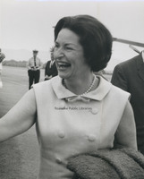
Lady Byrd Johnson greets the press and spectators at Roanoke Regional Airport during the Landscape-Landmark Tour. This tour led to the Highway Beautification Act of 1965
MP 5.01 Lady Byrd Johnson
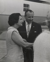
Lady Byrd Johnson greets the press and spectators at Roanoke Regional Airport during the Landscape-Landmark Tour. This tour led to the Highway Beautification Act of 1965. She stands with Director of the National Park Service, George Harzog.
MP 5.2 WSLS Channel 10
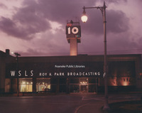
WSLS Channel 10 News station, located at 401 3rd Street.
MP 5.21 WSLS Channel 10
WSLS Channel 10 News station, located at 401 3rd Street.
MP 5.22 Election Returns
Staff of WSLS Channel 10 await results of the 1967 elections in the newsroom.
MP 5.23 Election Returns
Staff of WSLS Channel 10 await results of the 1967 elections in the newsroom.
MP 5.24 WSLS Channel 10
Advertising displays in the windows of WSLS Channel 10, located at 401 3rd Street.
MP 5.25 WSLS Channel 10
Inside the WSLS Channel 10 studio during merchandising promotion.
MP 5.3 Advertising Clinic
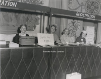
Unidentified women sit at registration desk of an Advertising Clinic held at the Hotel Roanoke to promote the Valley's businesses and industries.
MP 5.31 Advertising Clinic
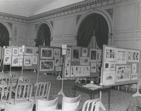
Advertising displays at an advertising clinic held at the Hotel Roanoke.
MP 5.32 Finks Advertisement
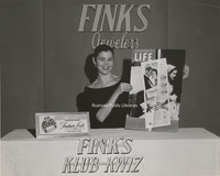
Marcia Fink woman holds a copy of an advertisement for Fink's Jewelers printed in Life Magazine at an advertising clinic
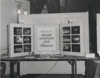
MP 5.35 Roanoke Advertising Club
Display at an ad clinic for the Roanoke Advertising Club.
MP 5.36 Oakeys Downtown

Interior of Oakey's Downtown chapel.
MP 5.37 528 Marshall Avenue

Home located at 528 Marshall Avenue SW.
MP 5.38 Virginia Heights Elementary

Virginia Heights Elementary School is located at 1210 Amherst Street SW.
MP 5.381 William Ruffner Middle

William Ruffner Middle School, formerly located at 3601 Ferncliff Avenue NW. The school opened in 1970 and closed in 2009. The building is used as an operations center by Roanoke City Public Schools.
MP 5.39 McNease Shoe Company

McNease Shoe Company, formerly located at 14 Campbell Avenue SE. At left is the owner, Wallace M. McNease. Others unidentified.
MP 5.4 Lakeside

The Sky-Tram at Lakeside Park.
MP 5.41 Lakeside

Ferris wheel and Scrambler at Lakeside Park
MP 50.1 Crystal Spring Laundry

Crystal Spring Laundry and Cleaners, formerly located at 720 Franklin Road SW.
MP 50.2 Crystal Spring Laundry

Crystal Spring Laundry and Cleaners, formerly located at 3008 Williamson Road NW.
MP 50.3 Crystal Spring Laundry

Crystal Spring Laundry and Cleaners, formerly located at 2049 E. Main Street in Salem.
MP 57.0 Roanoke Police Department
Roanoke Police Department in front of the Municipal Building.
MP 58.0 Ole 97
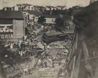
The aftermath of the wreck of the "Ole 97". Due to excessive speed in an attempt to maintain schedule, the train derailed at the Stillhouse Trestle near Danville, Virginia where the train careened off the side of the bridge, killing eleven personnel…
MP 6.0 Heironimus Rendering
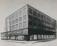
Artist rendering of Heironimus. Artist unknown. Location is 401 S, Jefferson Street.
MP 60.1 Peaks of Otter Lodge

Peaks of Otter Lodge in the latter part of construction.
MP 60.2 Peaks of Otter Lodge

Peaks of Otter Lodge
MP 7.0 Crystal Clear Ice
Crystal Clear Ice Cubes vending machine.
MP 8.0 Andrews-Pitzer-Butler
Drivers of Andrews-Pitzer-Butler Fuel Oil Corporation pose next to their trucks in Highland Park.
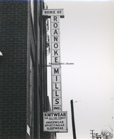
MP 9.0 Roanoke Mills Sign
Marquee sign for Roanoke Mills.
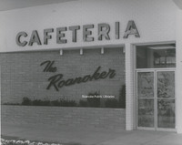
MP 9.1 Roanoker Cafeteria Sign
The Roanoker Cafeteria, formerly located at 4142 Melrose Avenue.
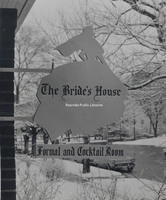
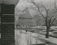
MP 9.2 Bride's House Sign
Sign for The Bride's House, formerly located at 2223 Crystal Spring Avenue
MP 9.21 Bride's House Sign
Sign for The Bride's House, formerly located at 2223 Crystal Spring Avenue
MPO 30 Roanoke Motor Car Company
Roanoke Motor Car Company, formerly located at 503 S. Jefferson Street. The company sold Chevrolets.
MPO 34 Huntingdon
Huntingdon, located at 320 Huntington Boulevard, was built circa 1820 by Elisha Betts. The home underwent extensive renovations in the late 1980s and was added to the National Register of Historic Places in 1991. It now operates as a bed and…
Murray A. Stoller

Date of Birth: March 16, 1919
Ex-Officio Mayor from September 1, 1962 to August 31, 1964
Other offices held: City Council, September 1, 1962 to August 31, 1966
Date of Death: July 4, 2002
Ex-Officio Mayor from September 1, 1962 to August 31, 1964
Other offices held: City Council, September 1, 1962 to August 31, 1966
Date of Death: July 4, 2002
National Business College 1929
Yearbook for National Business College.
National Business College 1930
Yearbook for National Business College.
National Business College: A School of Merit

Descriptive book for National Business College.
Neighborhood History Interview with A. Byron Smith

Neighborhood History Interview with A. Byron Smith
Interviewer: Kellie Thomas
Date: 29 August 2007
Location: Gainsboro Branch Library
Total Duration: 42:41
Transcription prepared by: unknown
Interviewer: Kellie Thomas
Date: 29 August 2007
Location: Gainsboro Branch Library
Total Duration: 42:41
Transcription prepared by: unknown
Neighborhood History Interview with A. Gordon Thornton, Jr.
Neighborhood History Interview with Andrew Gordon Thornton, Jr.
Interviewer: unknown
Date: 20 May 2006
Location: Greater Raleigh Court Civic League Block Party
Total Duration: 40:14
Interviewer: unknown
Date: 20 May 2006
Location: Greater Raleigh Court Civic League Block Party
Total Duration: 40:14
Neighborhood History Interview with Alice Johnson
Neighborhood History Interview with Alice Johnson
Interviewer: Tanya Weigel
Date: 23 February 2008
Location: Jerusalem Baptist Church
Total Duration: 27:16
Interviewer: Tanya Weigel
Date: 23 February 2008
Location: Jerusalem Baptist Church
Total Duration: 27:16
Neighborhood History Interview with Alphonzo L. Holland, Sr.
Neighborhood History Interview with Alphonzo L. Holland, Sr.
Interviewer: Arleen Ollie
Date: 19 October 2006
Location: Gainsboro Branch Library
Total Duration: 56:02
Transcription prepared by: Andrew Sterling
Interviewer: Arleen Ollie
Date: 19 October 2006
Location: Gainsboro Branch Library
Total Duration: 56:02
Transcription prepared by: Andrew Sterling
Neighborhood History Interview with Ann C. Keffer
Neighborhood History Interview with Ann C. Keffer
Interviewer: Kellie Thomas
Date: 29 March 2007
Location: Main Library
Total Duration: 46:29
Transcription prepared by: Andrew Sterling
Interviewer: Kellie Thomas
Date: 29 March 2007
Location: Main Library
Total Duration: 46:29
Transcription prepared by: Andrew Sterling
Neighborhood History Interview with Antinette Beane
Neighborhood History Interview with Antinette Beane
Interviewer: C.L. Bohannon
Date: 5 November 2009
Location: Main Library
Total Duration: 38:42
Transcription prepared by: Andrew Sterling
Interviewer: C.L. Bohannon
Date: 5 November 2009
Location: Main Library
Total Duration: 38:42
Transcription prepared by: Andrew Sterling
Neighborhood History Interview with B. Ray Phanelson
Neighborhood History Interview with B. Ray Phanelson
Interviewer: Pam Young
Date: 23 February 2008
Location: Jerusalem Baptist Church
Total Duration: 49:09
Transcription prepared by: Andrew Sterling
Interviewer: Pam Young
Date: 23 February 2008
Location: Jerusalem Baptist Church
Total Duration: 49:09
Transcription prepared by: Andrew Sterling
Neighborhood History Interview with Beatrice Burwell
Neighborhood History Interview with Beatrice Burwell
Interviewer: Alicia Sell
Date: 8 November 2006
Location: Elm Park Estates
Total Duration: 1:03:34
Transcription prepared by: Andrew Sterling
Interviewer: Alicia Sell
Date: 8 November 2006
Location: Elm Park Estates
Total Duration: 1:03:34
Transcription prepared by: Andrew Sterling
Neighborhood History Interview with Caralene Mathis Lewis
Neighborhood History Interview with Caralene Mathis Lewis
Interviewer: Nick Potts
Date: 15 March 2010
Location: Lucy Addison Middle School
Total Duration: 29:19
Interviewer: Nick Potts
Date: 15 March 2010
Location: Lucy Addison Middle School
Total Duration: 29:19
Neighborhood History Interview with Carolyn Ann Johnson Jones

Neighborhood History Interview with Carolyn Ann Johnson Jones
Interviewer: Sarah Lavender
Date: 11 June 2008
Location: Main Library
Total Duration: 1:37:02
Transcription prepared by: Andrew Sterling
Interviewer: Sarah Lavender
Date: 11 June 2008
Location: Main Library
Total Duration: 1:37:02
Transcription prepared by: Andrew Sterling
Neighborhood History Interview with Cecil "Duke" Brown
Neighborhood History Interview with Cecil "Duke" Brown
Interviewer: Alicia Sell
Date: 25 June 2009
Location: Melrose Branch Library
Total Duration: 55:07
Transcription prepared by: Krissy Price
Interviewer: Alicia Sell
Date: 25 June 2009
Location: Melrose Branch Library
Total Duration: 55:07
Transcription prepared by: Krissy Price
Neighborhood History Interview with Charles Anderson
Neighborhood History Interview with Charles Anderson
Interviewers: Peter Townsend; Alijah Webb; Elijah Williams
Date: 10 March 2010
Location: Lucy Addison Middle School
Total Duration: 43:08
Interviewers: Peter Townsend; Alijah Webb; Elijah Williams
Date: 10 March 2010
Location: Lucy Addison Middle School
Total Duration: 43:08
Neighborhood History Interview with Charles Wesley Day
Neighborhood History Interview with Charles Wesely Day
Interviewer: Dr. Reginald Shareef
Date: 5 October 2006
Location: Gainsboro Branch Library
Total Duration: 1:00:51
Transcription prepared by: Andrew Sterling
Interviewer: Dr. Reginald Shareef
Date: 5 October 2006
Location: Gainsboro Branch Library
Total Duration: 1:00:51
Transcription prepared by: Andrew Sterling
Neighborhood History Interview with Charlotte and Evelyn Clements
Neighborhood History Interview with Charlotte and Evelyn Clements
Interviewer: Cheryl Ramsey
Date: 23 February 2008
Location: Jerusalem Baptist Church
Total Duration: 36:38
Interviewer: Cheryl Ramsey
Date: 23 February 2008
Location: Jerusalem Baptist Church
Total Duration: 36:38
Neighborhood History Interview with Christine Payne
Neighborhood History Interview with Christine Payne
Interviewer: Carla Lewis
Date: 10 January 2007
Location: Private residence of Christine Payne
Total Duration: 25:13
Transcription prepared by: Andrew Sterling
Interviewer: Carla Lewis
Date: 10 January 2007
Location: Private residence of Christine Payne
Total Duration: 25:13
Transcription prepared by: Andrew Sterling
Neighborhood History Interview with Claudia Akers
Neighborhood History Interview with Claudia Akers
Interviewer: Brian Clark
Date: 17 September 2007
Location: Our Lady of the Valley
Total Duration: 1:04:07
Transcription prepared by: Brian Clark
Interviewer: Brian Clark
Date: 17 September 2007
Location: Our Lady of the Valley
Total Duration: 1:04:07
Transcription prepared by: Brian Clark
Neighborhood History Interview with Claudia Whitworth
Neighborhood History Interview with Claudia Whitworth
Interviewer: Dr. Reginald Shareef
Date: 5 October 2006
Location: Gainsboro Branch Library
Total Duration: 1:20:51
Transcription prepared by: Andrew Sterling
Interviewer: Dr. Reginald Shareef
Date: 5 October 2006
Location: Gainsboro Branch Library
Total Duration: 1:20:51
Transcription prepared by: Andrew Sterling
Neighborhood History Interview with Corbin Wilson
Neighborhood History Interview with Corbin Wilson
Interviewer: Brian Clark
Date: 17 December 2007
Location: Gainsboro Branch Library
Total Duration: 1:03:15
Interviewer: Brian Clark
Date: 17 December 2007
Location: Gainsboro Branch Library
Total Duration: 1:03:15
Neighborhood History Interview with Delois C. Broady
Neighborhood History Interview with Delois C. Broady
Interviewer: Robert Dulin
Date: 15 March 2010
Location: Lucy Addison Middle School
Total Duration: 30:24
Transcription prepared by: Chelsea Seddon
Interviewer: Robert Dulin
Date: 15 March 2010
Location: Lucy Addison Middle School
Total Duration: 30:24
Transcription prepared by: Chelsea Seddon
Neighborhood History Interview with Delvis "Mac" McCadden
Neighborhood History Interview with Delvis "Mac" McCadden
Interviewer: Arleen Ollie
Date: 30 October 2006
Location: Gainsboro Branch Library
Total Duration: 42:46
Transcription prepared by: unknown
Interviewer: Arleen Ollie
Date: 30 October 2006
Location: Gainsboro Branch Library
Total Duration: 42:46
Transcription prepared by: unknown
Neighborhood History Interview with Dian Tapscott
Neighborhood History Interview with Dian Tapscott
Interviewer: Brian Clark
Date: 3 October 2007
Location: Private residence of Dian Topscott
Total Duration: 26:17
Transcription prepared by: Brian Clark
Interviewer: Brian Clark
Date: 3 October 2007
Location: Private residence of Dian Topscott
Total Duration: 26:17
Transcription prepared by: Brian Clark
Neighborhood History Interview with Dr. Reginald Shareef
Neighborhood History Interview with Dr. Reginald Shareef
Interviewer: Anne Beckett
Date: 19 October 2016
Location: Gainsboro Branch Library
Total Duration: 59:17
Transcription prepared by: Andrew Sterling
Interviewer: Anne Beckett
Date: 19 October 2016
Location: Gainsboro Branch Library
Total Duration: 59:17
Transcription prepared by: Andrew Sterling
Neighborhood History Interview with Dr. Walter Claytor
Neighborhood History Interview with Dr. Walter Claytor
Interviewer: Carla Lewis
Date: 16 December 2006
Location: Harrison Museum of African American Culture
Total Duration: 59:49
Transcription prepared by: Andrew Sterling
Interviewer: Carla Lewis
Date: 16 December 2006
Location: Harrison Museum of African American Culture
Total Duration: 59:49
Transcription prepared by: Andrew Sterling
Neighborhood History Interview with E. Elizabeth Spoelma
Neighborhood History Interview with E. Elizabeth Spoelma
Interviewer: Alicia Sell
Date: 7 February 2007
Location: Friendship Manor
Total Duration: 42:19
Transcription prepared by: Andrew Sterling
Interviewer: Alicia Sell
Date: 7 February 2007
Location: Friendship Manor
Total Duration: 42:19
Transcription prepared by: Andrew Sterling
Neighborhood History Interview with Earl B. Reynolds, Jr.
Neighborhood History Interview with Earl B. Reynolds, Jr.
Interviewer: Carla Lewis
Date: 12 October 2006
Location: Gainsboro Branch Library
Total Duration: 1:00:39
Transcription prepared by: Andrew Sterling
Interviewer: Carla Lewis
Date: 12 October 2006
Location: Gainsboro Branch Library
Total Duration: 1:00:39
Transcription prepared by: Andrew Sterling
Neighborhood History Interview with Edward T. Burton
Neighborhood History Interview with Edward T. Burton
Interviewer: Arleen Ollie
Date: 19 October 2006
Location: Gainsboro Branch Library
Total Duration: 18:59
Transcription prepared by: Andrew Sterling
Interviewer: Arleen Ollie
Date: 19 October 2006
Location: Gainsboro Branch Library
Total Duration: 18:59
Transcription prepared by: Andrew Sterling
Neighborhood History Interview with Emerson Lamb
Neighborhood History Interview with Emerson Lamb
Interviewer: Brian Clark
Date: 26 November 2007
Location: Our Lady of the Valley
Total Duration: 1:07:04
Transcription prepared by: Andrew Sterling
Interviewer: Brian Clark
Date: 26 November 2007
Location: Our Lady of the Valley
Total Duration: 1:07:04
Transcription prepared by: Andrew Sterling
Neighborhood History Interview with Ernell Glasby
Neighborhood History Interview with Ernell Glasby
Interviewer: Hazel Law
Date: 6 November 2006
Location: Gainsboro Branch Library
Total Duration: 31:22
Transcription prepaperd by: Andrew Sterling
Interviewer: Hazel Law
Date: 6 November 2006
Location: Gainsboro Branch Library
Total Duration: 31:22
Transcription prepaperd by: Andrew Sterling
Neighborhood History Interview with Evelyn Bethel and Helen Davis
Neighborhood History Interview with Evelyn Bethel and Helen Davis
Interviewer: Carla Lewis
Date: 15 March 2007
Location: Gainsboro Branch Library
Total Duration: 1:16:44
Transcription prepared by: Andrew Sterling
Interviewer: Carla Lewis
Date: 15 March 2007
Location: Gainsboro Branch Library
Total Duration: 1:16:44
Transcription prepared by: Andrew Sterling
Neighborhood History Interview with Florence Farley
Neighborhood History Interview with Florence Farley
Interviewer: Carla Lewis
Date: 26 February 2007
Location: Gainsboro Branch Library
Total Duration: 1:12:42
Transcription prepared by: Andrew Sterling
Interviewer: Carla Lewis
Date: 26 February 2007
Location: Gainsboro Branch Library
Total Duration: 1:12:42
Transcription prepared by: Andrew Sterling
Neighborhood History Interview with Francis J. Gill
Neighborhood History Interview with Francis J. Gill
Interviewer: Theresa Gill-Walker
Date: 9 March 2009
Location: Gainsboro Branch Library
Total Duration: 42:54
Transcription prepared by: Andrew Sterling
Interviewer: Theresa Gill-Walker
Date: 9 March 2009
Location: Gainsboro Branch Library
Total Duration: 42:54
Transcription prepared by: Andrew Sterling
Neighborhood History Interview with Frederick Douglas Hairston, Jr.
Neighborhood History Interview with Frederick Douglas Hairston
Interviewer: Carla Lewis
Date: 4 May 2008
Location: Gainsboro Branch Library
Total Duration: 28:53
Transcription prepared by: Andrew Sterling
Interviewer: Carla Lewis
Date: 4 May 2008
Location: Gainsboro Branch Library
Total Duration: 28:53
Transcription prepared by: Andrew Sterling
Neighborhood History Interview with Freeland O. Pendleton, Sr.
Neighborhood History Interview with Freeland O. Pendleton, Sr.
Interviewer: Laura Wickstead
Date: 12 October 2006
Location: Gainsboro Branch Library
Total Duration: 1:00:17
Transcription prepared by: Andrew Sterling
Interviewer: Laura Wickstead
Date: 12 October 2006
Location: Gainsboro Branch Library
Total Duration: 1:00:17
Transcription prepared by: Andrew Sterling
Neighborhood History Interview with George E. Rogers
Neighborhood History Interview with George E. Rogers
Interviewer: Mary Bishop
Date: 12 October 2006
Location: Gainsboro Branch Library
Total Duration: 1:05:27
Transcription prepared by: Andrew Sterling
Interviewer: Mary Bishop
Date: 12 October 2006
Location: Gainsboro Branch Library
Total Duration: 1:05:27
Transcription prepared by: Andrew Sterling
Neighborhood History Interview with Gilmore Perry, Jr. with Lawrence Mitchell
Neighborhood History Interview with Gilmore Perry, Jr. with Lawrence Mitchell
Interviewer: Cheryl Ramsey
Date: 23 February 2008
Location: Jerusalem Baptist Church
Total Duration: 36:35
Transcription prepared by: Andrew Sterling
Interviewer: Cheryl Ramsey
Date: 23 February 2008
Location: Jerusalem Baptist Church
Total Duration: 36:35
Transcription prepared by: Andrew Sterling
Neighborhood History Interview with Gladys Hilton Buckner
Neighborhood History Interview with Gladys Hilton Buckner
Interviewer: Tanya Weigel
Date: 23 February 2008
Location: Jerusalem Baptist Church
Total Duration: 28:48
Transcription prepared by: Krissy Price
Interviewer: Tanya Weigel
Date: 23 February 2008
Location: Jerusalem Baptist Church
Total Duration: 28:48
Transcription prepared by: Krissy Price
Neighborhood History Interview with Gloria A. Dowe
Neighborhood History Interview with Gloria A. Dowe
Interviewer: Chris Fetterman
Date: 17 March 2010
Location: Lucy Addison Middle School
Total Duration: 35:52
Interviewer: Chris Fetterman
Date: 17 March 2010
Location: Lucy Addison Middle School
Total Duration: 35:52
Neighborhood History Interview with Gloria Jean Coan
Neighborhood History Interview with Gloria Jean Coan
Interviewer: Michael Blankenship
Date: 30 September 2006
Location: Gainsboro Branch Library
Total Duration: 1:02:00
Transcription prepared by: Andrew Sterling
Interviewer: Michael Blankenship
Date: 30 September 2006
Location: Gainsboro Branch Library
Total Duration: 1:02:00
Transcription prepared by: Andrew Sterling
Neighborhood History Interview with Gloria Jean Wilson

Neighborhood History Interview with Gloria Jean Wilson
Interviewer: Alicia Sell
Date: 23 February 2008
Location: Jerusalem Baptist Church
Total Duration: 29:05
Transcription prepared by: Andrew Sterling
Interviewer: Alicia Sell
Date: 23 February 2008
Location: Jerusalem Baptist Church
Total Duration: 29:05
Transcription prepared by: Andrew Sterling
Neighborhood History Interview with Harold Bowman
Neighborhood History Interview with Harold Bowman
Interviewer: Alicia Sell
Date: 8 June 2007
Location: Mountain View Recreation Center
Total Duration: 36:21
Transcription prepared by: Andrew Sterling
Interviewer: Alicia Sell
Date: 8 June 2007
Location: Mountain View Recreation Center
Total Duration: 36:21
Transcription prepared by: Andrew Sterling
Neighborhood History Interview with James Atkinson
Neighborhood History Interview with James Atkinson
Interviewer: Claire Hunter
Date: 20 May 2006
Location: Greater Raleigh Court Civic League Block Party
Transcription prepared by: Susan Hensley
Interviewer: Claire Hunter
Date: 20 May 2006
Location: Greater Raleigh Court Civic League Block Party
Transcription prepared by: Susan Hensley
Neighborhood History Interview with James Beverly Keeling
Neighborhood History Interview with James Beverly Keeling
Interviewer: Arleen Ollie
Date: 19 October 2006
Location: Gainsboro Branch Library
Total Duration: 19:06
Transcription prepared by: Andrew Sterling
Interviewer: Arleen Ollie
Date: 19 October 2006
Location: Gainsboro Branch Library
Total Duration: 19:06
Transcription prepared by: Andrew Sterling
Neighborhood History Interview with James Bullington
Neighborhood History Interview with James Bullington
Interviewer: Ashley Maynor and Pam Young
Date: 5 February 2008
Location: Private residence of James Bullington
Total Duration: 59:75 (in two parts)
Interviewer: Ashley Maynor and Pam Young
Date: 5 February 2008
Location: Private residence of James Bullington
Total Duration: 59:75 (in two parts)
Neighborhood History Interview with Janice Hale
Neighborhood History Interview with Janice Hale
Interviewer: Alicia Sell
Date: 8 June 2007
Location: Gainsboro Branch Library
Total Duration: 31:14
Transcription prepared by: Andrew Sterling
Interviewer: Alicia Sell
Date: 8 June 2007
Location: Gainsboro Branch Library
Total Duration: 31:14
Transcription prepared by: Andrew Sterling
Neighborhood History Interview with Katherine Pullens
Neighborhood History Interview with Katherine Pullens
Interviewer: Carla Lewis
Date: 24 March 2008
Location: Private residence of Katherine Pullens
Total Duration: 57:40
Interviewer: Carla Lewis
Date: 24 March 2008
Location: Private residence of Katherine Pullens
Total Duration: 57:40
Neighborhood History Interview with Laura Toliver
Neighborhood History Interview with Laura Toliver
Interviewer: Alicia Sell
Date: 23 February 2008
Location: Jerusalem Baptist Church
Total Duration: 12:52
Transcription prepared by: Andrew Sterling
Interviewer: Alicia Sell
Date: 23 February 2008
Location: Jerusalem Baptist Church
Total Duration: 12:52
Transcription prepared by: Andrew Sterling
Neighborhood History Interview with Lawrence Mitchell
Neighborhood History Interview with Lawrence Mitchell with Gilmore Perry
Interviewer: Cheryl Ramsey
Date: 23 February 2008
Location: Jerusalem Baptist Church
Total Duration: 36:42
Transcription prepared by: Andrew Sterling
Interviewer: Cheryl Ramsey
Date: 23 February 2008
Location: Jerusalem Baptist Church
Total Duration: 36:42
Transcription prepared by: Andrew Sterling
Neighborhood History Interview with Lewis Peery
Neighborhood History Interview with Lewis Peery
Interviewer: Mary Bishop
Date: 12 October 2006
Location: Gainsboro Branch Library
Total Duration: 57:13
Transcription prepared by: Andrew Sterling
Interviewer: Mary Bishop
Date: 12 October 2006
Location: Gainsboro Branch Library
Total Duration: 57:13
Transcription prepared by: Andrew Sterling
Neighborhood History Interview with Lular Ree Clark Lucky
Neighborhood History Interview with Lular Ree Clark Lucky
Interviewer: Ashley Maynor
Date: 26 June 2008
Location: Private residence of Ms. Lucky
Total Duration: 1:20:36
Transcription prepared by: Andrew Sterling
Interviewer: Ashley Maynor
Date: 26 June 2008
Location: Private residence of Ms. Lucky
Total Duration: 1:20:36
Transcription prepared by: Andrew Sterling
Neighborhood History Interview with Madeleine Daniels
Neighborhood History Interview with Madeleine Daniels
Interviewer: Brenda Finley
Date: 23 February 2008
Location: Jerusalem Baptist Church
Total Duration: 8:22 (in two parts)
Transcription prepared by: Sarah Lavender
Interviewer: Brenda Finley
Date: 23 February 2008
Location: Jerusalem Baptist Church
Total Duration: 8:22 (in two parts)
Transcription prepared by: Sarah Lavender
Neighborhood History Interview with Marcus and Danielle Preston
Neighborhood History Interview with Marcus and Danielle Preston
Interviewer: Kellie Thomas
Date: 23 October 2007
Location: Main Library
Total Duration: 37:31
Interviewer: Kellie Thomas
Date: 23 October 2007
Location: Main Library
Total Duration: 37:31
Neighborhood History Interview with Marie McGeorge
Neighborhood History Interview with Marie McGeorge
Interviewer: Kellie Thomas
Date: 21 August 2007
Location: Jackson Park Branch Library
Total Duration: 25:20
Interviewer: Kellie Thomas
Date: 21 August 2007
Location: Jackson Park Branch Library
Total Duration: 25:20
Neighborhood History Interview with Mary Divers Hackley
Neighborhood History Interview with Mary Divers Hackley
Interviewer: Alicia Sell
Date: 14 February 2007
Location: Gainsboro Branch Library
Total Duration: 56:24
Transcription prepared by: Andrew Sterling
Interviewer: Alicia Sell
Date: 14 February 2007
Location: Gainsboro Branch Library
Total Duration: 56:24
Transcription prepared by: Andrew Sterling
Neighborhood History Interview with Mary Jane Callahan
Neighborhood History Interview with Mary Jane Callahan
Interviewer: Alicia Sell
Date: 10 January 2007
Location: Gainsboro Branch Library
Total Duration: 35:08
Transcription prepared by: Andrew Sterling
Interviewer: Alicia Sell
Date: 10 January 2007
Location: Gainsboro Branch Library
Total Duration: 35:08
Transcription prepared by: Andrew Sterling
Neighborhood History Interview with Maxine N. Hunt
Neighborhood History Interview with Maxine N. Hunt
Interviewer: Dr. Reginald Shareef
Date: 5 October 2006
Location: Gainsboro Branch Library
Total Duration: 1:08:00
Transcription prepared by Andrew Sterling
Interviewer: Dr. Reginald Shareef
Date: 5 October 2006
Location: Gainsboro Branch Library
Total Duration: 1:08:00
Transcription prepared by Andrew Sterling
Neighborhood History Interview with Michael Franklin
Neighborhood History Interview with Michael Franklin
Interviewer: Brian Clark
Date: 14 April 2008
Location: Mountain View Recreation Center
Total Duration: 34:05
Transcription prepared by: Andrew Sterling
Interviewer: Brian Clark
Date: 14 April 2008
Location: Mountain View Recreation Center
Total Duration: 34:05
Transcription prepared by: Andrew Sterling
Neighborhood History Interview with Peggy Sue Mason
Neighborhood History Interview with Peggy Sue Mason
Interviewer: Mary Blitz
Date: 16 March 2010
Location: Lucy Addison Middle School
Total Duration: 41:56
Interviewer: Mary Blitz
Date: 16 March 2010
Location: Lucy Addison Middle School
Total Duration: 41:56
Neighborhood History Interview with Perneller Chubb-Wilson
Neighborhood History Interview with Perneller Chubb-Wilson
Interviewer: Carla Lewis
Date: 18 June 2009
Location: Gainsboro Branch Library
Total Duration: 1:22:12
Interviewer: Carla Lewis
Date: 18 June 2009
Location: Gainsboro Branch Library
Total Duration: 1:22:12
Neighborhood History Interview with Rebecca Raper Austin

Neighborhood History Interview with Rebecca Raper Austin
Interviewer: Arleen Ollie
Date: 23 March 2007
Location: Main Library
Total Duration: 55:47
Transcription prepared by: Andrew Sterling
Interviewer: Arleen Ollie
Date: 23 March 2007
Location: Main Library
Total Duration: 55:47
Transcription prepared by: Andrew Sterling
Neighborhood History Interview with Regina Holmes Peeks
Neighborhood History Interview with Regina Holmes Peeks
Interviewer: Cheryl Ramsey
Date: 23 February 2008
Location: Jerusalem Baptist Church
Total Duration: 43:02
Transcription prepared by: Andrew Sterling
Interviewer: Cheryl Ramsey
Date: 23 February 2008
Location: Jerusalem Baptist Church
Total Duration: 43:02
Transcription prepared by: Andrew Sterling
Neighborhood History Interview with Rev. Carl Tinsley
Neighborhood History Interview with Rev. Carl Tinsley
Interviewer: Kellie Thomas
Date: 22 March 2007
Location: Private residence of Carl Tinsley
Total Duration: 1:29:25
Transcription prepared by: Andrew Sterling
Interviewer: Kellie Thomas
Date: 22 March 2007
Location: Private residence of Carl Tinsley
Total Duration: 1:29:25
Transcription prepared by: Andrew Sterling
Neighborhood History Interview with Richard Chubb
Neighborhood History Interview with Richard Chubb
Interviewer: Alicia Sell
Date: 19 October 2006
Location: Gainsboro Branch Library
Total Duration: 53:41
Interviewer: Alicia Sell
Date: 19 October 2006
Location: Gainsboro Branch Library
Total Duration: 53:41
Neighborhood History Interview with Robert Garland
Neighborhood History Interview with Robert Garland
Interviewer: Alicia Sell
Date: 12 June 2007
Location: Private residence of Robert Garland
Total Duration: 1:36:18
Transcription prepared by: Andrew Sterling
Interviewer: Alicia Sell
Date: 12 June 2007
Location: Private residence of Robert Garland
Total Duration: 1:36:18
Transcription prepared by: Andrew Sterling
Neighborhood History Interview with Robert Hale
Neighborhood History Interview with Robert Hale
Interviewer: Mary Bishop
Date: 16 December 2006
Location: Harrison Museum of African American Culture
Total Duration: 48:47
Transcription prepared by: Andrew Sterling
Interviewer: Mary Bishop
Date: 16 December 2006
Location: Harrison Museum of African American Culture
Total Duration: 48:47
Transcription prepared by: Andrew Sterling
Neighborhood History Interview with Rodolph Wakim
Neighborhood History Interview with Rodolph Wakim
Interviewer: Alicia Sell
Date: 8 June 2007
Location: St. Elias Church
Total Duration: 26:43
Transcription prepared by: Andrew Sterling
Interviewer: Alicia Sell
Date: 8 June 2007
Location: St. Elias Church
Total Duration: 26:43
Transcription prepared by: Andrew Sterling
Neighborhood History Interview with Ruth Bennett
Neighborhood History Interview with Ruth Bennett
Interviewer: Brent Weigel
Date: 23 February 2008
Location: Jerusalem Baptist Church
Total Duration: 27:35
Transcription prepared by: Chelsea Seddon
Interviewer: Brent Weigel
Date: 23 February 2008
Location: Jerusalem Baptist Church
Total Duration: 27:35
Transcription prepared by: Chelsea Seddon
Neighborhood History Interview with Sandra Smith Jordan
Neighborhood History Interview with Sandra Smith Jordan
Interviewer: Carla Lewis
Date: 9 March 2009
Location: Gainsboro Branch Library
Total Duration: 1:26:54
Interviewer: Carla Lewis
Date: 9 March 2009
Location: Gainsboro Branch Library
Total Duration: 1:26:54
Neighborhood History Interview with Sarah Showalter

Neighborhood History Interview with Sarah Showalter
Interviewer: Pam Young
Date: 23 February 2008
Location: Jerusalem Baptist Church
Total Duration: 23:14
Transcription prepared by: Andrew Sterling
Interviewer: Pam Young
Date: 23 February 2008
Location: Jerusalem Baptist Church
Total Duration: 23:14
Transcription prepared by: Andrew Sterling
Neighborhood History Interview with Sheila Anderson
Neighborhood History Interview with Sheila Anderson
Interviewer: Cheryl Ramsey
Date: 23 February 2008
Location: Jerusalem Baptist Church
Total Duration: 23:17
Transcription prepapred by: Amy Burns
Interviewer: Cheryl Ramsey
Date: 23 February 2008
Location: Jerusalem Baptist Church
Total Duration: 23:17
Transcription prepapred by: Amy Burns
Neighborhood History Interview with Shirley Hudgins
Neighborhood History Interview with Shirley Hudgins
Interviewer: Alicia Sell
Date: 18 June 2007
Location: Main Library
Total Duration: 23:41
Interviewer: Alicia Sell
Date: 18 June 2007
Location: Main Library
Total Duration: 23:41
Neighborhood History Interview with Virginia M. Chubb-Hale
Neighborhood History Interview with Virginia M. Chubb-Hale
Interviewer: Carla Lewis
Date: 11 January 2007
Location: Gainsboro Branch Library
Total Duration: 28:20
Interviewer: Carla Lewis
Date: 11 January 2007
Location: Gainsboro Branch Library
Total Duration: 28:20
Neighborhood History Interview with Virginia Mignon Chubb-Hale
Neighborhood History Interview with Virginia Mignon Chubb-Hale
Interviewer: Chris Boucher
Date: 16 March 2010
Location: Lucy Addison Middle School
Total Duration: 35:24
Interviewer: Chris Boucher
Date: 16 March 2010
Location: Lucy Addison Middle School
Total Duration: 35:24
Neighborhood History Interview with Virginia Wolfe
Neighborhood History Interview with Virginia Wolfe
Interviewer: Kellie Thomas
Date: 29 August 2007
Location: Gainsboro Branch Library
Total Duration: 1:02:18
Interviewer: Kellie Thomas
Date: 29 August 2007
Location: Gainsboro Branch Library
Total Duration: 1:02:18
Neighborhood History Interview with Vivian Woody
Neighborhood History Interview with Vivian Woody
Interviewer: Arleen Ollie
Date: 23 February 2008
Location: Jerusalem Baptist Church
Total Duration: 29:16
Transcription prepared by: Andrew Sterling
Interviewer: Arleen Ollie
Date: 23 February 2008
Location: Jerusalem Baptist Church
Total Duration: 29:16
Transcription prepared by: Andrew Sterling
Neighborhood History Interview with Walter Melvin Bryant
Neighborhood History Interview with Walter Melvin Bryant
Interviewer: Kellie Thomas
Date: 20 March 2007
Location: Private residence of Walter Bryant
Total Duration: 55:52
Transcription prepared by: Andrew Sterling
Interviewer: Kellie Thomas
Date: 20 March 2007
Location: Private residence of Walter Bryant
Total Duration: 55:52
Transcription prepared by: Andrew Sterling
Neighborhood History Interview with Westley Rogers
Neighborhood History Interview with Westley Rogers
Interviewer: Arleen Ollie
Date: 2 July 2007
Location: Gainsboro Branch Library
Total Duration: 1:49:29
Interviewer: Arleen Ollie
Date: 2 July 2007
Location: Gainsboro Branch Library
Total Duration: 1:49:29
Neighborhood History Interview with William Highfill, III
Neighborhood History Interview with William Highfill, III
Interviewer: Brian Clark
Date: 19 November 2007
Location: Private residence of William Highfill
Total Duration: 1:07:05
Transcription prepared by: Andrew Sterling
Interviewer: Brian Clark
Date: 19 November 2007
Location: Private residence of William Highfill
Total Duration: 1:07:05
Transcription prepared by: Andrew Sterling
Neighborhood History Interview with Wilma Warren
Neighborhood History Interview with Wilma Warren
Interviewer: Brian Clark
Date: 17 September 2007
Location: Our Lady of the Valley
Total Duration: 1:21:30
Transcription prepared by: Brian Clark
Interviewer: Brian Clark
Date: 17 September 2007
Location: Our Lady of the Valley
Total Duration: 1:21:30
Transcription prepared by: Brian Clark
Neighborhood Oral History Interview with Ann Turner
Neighborhood Oral History Interview with Ann Turner
Interviewer: Kerri Taylor
Date: 6 April 2017
Location: Ms. Taylor's residence
Duration: 45:26
Interviewer: Kerri Taylor
Date: 6 April 2017
Location: Ms. Taylor's residence
Duration: 45:26
Neighborhood Oral History Interview with English Showalter
Neighborhood Oral History Interview with English Showalter
Interviewer: Kerri Taylor
Date: 13 May 2017
Location: Mr. Showalter's residence in Chevy Chase, Maryland
Duration: 1:05:26
Interviewer: Kerri Taylor
Date: 13 May 2017
Location: Mr. Showalter's residence in Chevy Chase, Maryland
Duration: 1:05:26
Neighborhood Oral History Interview with Jeanette Willis
Neighborhood Oral History Interview with Jeanette Willis
Interviewer: Arleen Ollie
Date: 30 October 2006
Location: Gainsboro Branch Library
Total Duration: 41:03
Transcription prepared by: Andrew Sterling
Interviewer: Arleen Ollie
Date: 30 October 2006
Location: Gainsboro Branch Library
Total Duration: 41:03
Transcription prepared by: Andrew Sterling
Neighborhood Oral History Interview with Stephen Niamke
Neighborhood Oral History Interview with Stephen Niamke
Interviewer: Kerri Taylor
Date: 19 April 2017
Location: Melrose-Rugby Center
Duration: 54:18
Interviewer: Kerri Taylor
Date: 19 April 2017
Location: Melrose-Rugby Center
Duration: 54:18
Norsemen 1973

The Norsemen is the annual for Northside Middle School.
Norsemen 1975

The Norsemen is the annual for Northside Middle School.
Norsemen 1976

The Norsemen is the annual for Northside Middle School.
Norsemen 1977

The Norsemen is the annual for Northside Middle School.
Norsemen 1978

The Norsemen is the annual for Northside Middle School.
Norsemen 1979

The Norsemen is the annual for Northside Middle School.
Norsemen 1980

The Norsemen is the annual for Northside Middle School.
Norsemen 1998
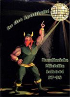
The Norsemen is the annual for Northside Middle School.
North Star 1962
The North Star is the annual for Northside High School.
North Star 1963

The North Star is the annual for Northside High School.
North Star 1964
The North Star is the annual for Northside High School.
North Star 1966
The North Star is the annual for Northside High School.
North Star 1969

The North Star is the annual for Northside High School.
North Star 1971

The North Star is the annual for Northside High School
North Star 1973
The North Star is the annual for Northside High School.
North Star 1976

The North Star is the annual for Northside High School.
North Star 1977

The North Star is the annual for Northside High School.
North Star 1978

The North Star is the annual for Northside High School.
North Star 1979

The North Star is the annual for Northside High School.
North Star 1981

The North Star is the annual for Northside High School.
Oak Leaves 1988
Oak Leaves is the annual for Oak Grove Elementary School.
Oral History Interview with Amanda Ervin
Oral History Interview with Amanda Ervin
Interviewer: Vanessa Dotson and Miu Iwasaki
Date: 2 October 2019
Location: Salvation Army
Duration: 45:22
Transcription prepared by: Kierra Burda
Interviewer: Vanessa Dotson and Miu Iwasaki
Date: 2 October 2019
Location: Salvation Army
Duration: 45:22
Transcription prepared by: Kierra Burda
Oral History Interview with Anonymous1
Oral History Interview with Anonymous1
Interviewers: Roanoke College students
Date: 24 February 2017
Location: Downtown Roanoke
Duration: 52:17
Interviewers: Roanoke College students
Date: 24 February 2017
Location: Downtown Roanoke
Duration: 52:17
Oral History Interview with Anton Black
Interviewer: Caitlyn Lewis; Kitty Bridgewater
Interviewee: Anton Black
Date: 22 February 2018
Duration: 66:22
Transcription prepared by: Caitlyn Lewis
Interviewee: Anton Black
Date: 22 February 2018
Duration: 66:22
Transcription prepared by: Caitlyn Lewis
Oral History Interview with Ashley Rhame
Oral History Interview with Ashley Rhame
Interviewer: Julian Edwards
Interviewee: Ashley Rhame
Date: 23 February 2020
Location: Fintel Library, Roanoke College, Salem, Virginia
Total Duration: 66:45
Transcription prepared by: Julian Edwards,…
Interviewer: Julian Edwards
Interviewee: Ashley Rhame
Date: 23 February 2020
Location: Fintel Library, Roanoke College, Salem, Virginia
Total Duration: 66:45
Transcription prepared by: Julian Edwards,…
Oral History Interview with Barbara Maberry
Interviewer: Zacch Wooten
Interviewee: Barbara Maberry
Date: 5 October 2016
Duration: 58:59
Transcription prepared by: Amelia Woodworth and Joshua Bailey
Interviewee: Barbara Maberry
Date: 5 October 2016
Duration: 58:59
Transcription prepared by: Amelia Woodworth and Joshua Bailey
Oral History Interview with Carolyn Sue Wilson
Interviewer: Kitty Bridgewater
Interviewee: Carolyn Sue Wilson
Date: 25 February 2018
Duration: 1:22:48
Transcription prepared by: Kitty Bridgewater
Interviewee: Carolyn Sue Wilson
Date: 25 February 2018
Duration: 1:22:48
Transcription prepared by: Kitty Bridgewater
Oral History Interview with Catina Lowery
Oral History Interview with Catina Lowery
Interviewee: Catina Lowery
Interviewer: Alexis Mattson
Date: 24 March 2021
Location: Online via Zencastr
Duration: 59:49
Transcription prepared by: Lucy Perry
Interviewee: Catina Lowery
Interviewer: Alexis Mattson
Date: 24 March 2021
Location: Online via Zencastr
Duration: 59:49
Transcription prepared by: Lucy Perry
Oral History Interview with Daddy Sam
Oral History Interview with Daddy Sam
Interviewer: Marlee Wertz
Interviewee: Daddy Sam
Date: 24 February 2016
Location: Interviewee’s private residence, Roanoke, VA
Total Duration: 60:07
Transcription prepared by: Micheala McDonald, Rachel…
Interviewer: Marlee Wertz
Interviewee: Daddy Sam
Date: 24 February 2016
Location: Interviewee’s private residence, Roanoke, VA
Total Duration: 60:07
Transcription prepared by: Micheala McDonald, Rachel…
Oral History Interview with Daniel Jones
Oral history interview with Dan Jones
Interviewer: Gregory Rosenthal
Interviewee: Daniel Jones
Date: 20 February 2016
Location: Roanoke College History Department, 223 E. Main Street, Salem
Total Duration: 95:28
Transcription prepared by:…
Interviewer: Gregory Rosenthal
Interviewee: Daniel Jones
Date: 20 February 2016
Location: Roanoke College History Department, 223 E. Main Street, Salem
Total Duration: 95:28
Transcription prepared by:…
Oral History Interview with Don Muse
Oral History Interview with Don Muse
Interviewer: Sasha Roberts, Brooke Thacker, Victoria Preston
Interviewee: Don Muse
Date: 19 February 2017
Location: Home of Don Muse
Total Duration: 1:01:18
Transcription prepared by: Victoria Preston,…
Interviewer: Sasha Roberts, Brooke Thacker, Victoria Preston
Interviewee: Don Muse
Date: 19 February 2017
Location: Home of Don Muse
Total Duration: 1:01:18
Transcription prepared by: Victoria Preston,…
Oral History Interview with Dr. Gregory Samantha Rosenthal
Oral History Interview with Dr. Gregory Samantha Rosenthal
Interviewer: Catherine Jessee
Interviewer: Dr. Gregory Samantha Rosenthal
Date: 6 April 2021
Location: Online via Zencastr
Duration: 1:29:39
Interviewer: Catherine Jessee
Interviewer: Dr. Gregory Samantha Rosenthal
Date: 6 April 2021
Location: Online via Zencastr
Duration: 1:29:39
Oral History Interview with Edna Whittier
Oral History Interview with Edna Whittier
Interviewer:Tessa Pleban
Interviewee: Edna Whittier
Date: 2 March 2016
Location: Floyd Public Library, Floyd,VA
Total Duration: 1:37:59
Transcription prepared by: Mahmoud El-‐Hazzouri and Jessica…
Interviewer:Tessa Pleban
Interviewee: Edna Whittier
Date: 2 March 2016
Location: Floyd Public Library, Floyd,VA
Total Duration: 1:37:59
Transcription prepared by: Mahmoud El-‐Hazzouri and Jessica…
Oral History Interview with Erika Joyner
Interviewers: Rebecca Proctor, Kalyn Fowler
Interviewee: Erika Joyner
Date: 29 September 2016
Duration: 57:17
Transcription prepared by: Kalyn Fowler and Sarah Groft
Interviewee: Erika Joyner
Date: 29 September 2016
Duration: 57:17
Transcription prepared by: Kalyn Fowler and Sarah Groft
Oral History Interview with Gail Burruss
Oral History Interview with Gail Burruss
Interviewers: Michelle Eimen
Interviewee: Gail Burruss
Date: February 18, 2019
Location: Fintel Library, Roanoke College
Total Duration: 59:20
Transcription prepared by: Katie Thaxton, Michelle Eimen,…
Interviewers: Michelle Eimen
Interviewee: Gail Burruss
Date: February 18, 2019
Location: Fintel Library, Roanoke College
Total Duration: 59:20
Transcription prepared by: Katie Thaxton, Michelle Eimen,…
Oral History Interview with Garland Gravely
Oral History Interview with Garland Gravely
Interviewer: Madison Pinckes, Erik Weed
Interviewee: Garland Gravely
Date: 19 February 2017
Location: Home of Garland Gravely
Total Duration: 50:15
Transcription prepared by: Dacotah McGaffic, J.T.…
Interviewer: Madison Pinckes, Erik Weed
Interviewee: Garland Gravely
Date: 19 February 2017
Location: Home of Garland Gravely
Total Duration: 50:15
Transcription prepared by: Dacotah McGaffic, J.T.…
Oral History Interview with Gerry Jennings
Oral History Interview with Gerry Jennings
Interviewer: Gregory Rosenthal
Interviewee: Gerry Jennings
Date: February 23, 2016
Location: Gerry Jennings’s home, Roanoke, Virginia
Total Duration: 1:15:59
Transcription prepared by Erin Hannon
Interviewer: Gregory Rosenthal
Interviewee: Gerry Jennings
Date: February 23, 2016
Location: Gerry Jennings’s home, Roanoke, Virginia
Total Duration: 1:15:59
Transcription prepared by Erin Hannon
Oral History Interview with J
Oral History Interview with J
Interviewer: Samantha Meyer
Date: 25 October 2019
Location: Salvation Army
Duration: 40:42
Transcription prepared by: Liz Lee and Megan Reynolds
Interviewer: Samantha Meyer
Date: 25 October 2019
Location: Salvation Army
Duration: 40:42
Transcription prepared by: Liz Lee and Megan Reynolds
Oral History Interview with James Best
Oral History Interview with James Best
Interviewers: Caitlyn Allen (Madison Kunstman also
present)
Interviewee:James Ernest Best
Date: February 21, 2016
Location: Roanoke College, Miller Hall, 221 College Lane Salem, VA
Total Duration:…
Interviewers: Caitlyn Allen (Madison Kunstman also
present)
Interviewee:James Ernest Best
Date: February 21, 2016
Location: Roanoke College, Miller Hall, 221 College Lane Salem, VA
Total Duration:…
Oral History Interview with Joe Cobb
Oral History Interview with Joe Cobb
Interviewer: Eve Allen
Interviewee: Joe Cobb
Date: 21 February 2020
Location: Fintel Library, Roanoke College, Salem, Virginia
Total Duration: 82:58 (in four parts)
Transcription prepared by: Miranda…
Interviewer: Eve Allen
Interviewee: Joe Cobb
Date: 21 February 2020
Location: Fintel Library, Roanoke College, Salem, Virginia
Total Duration: 82:58 (in four parts)
Transcription prepared by: Miranda…
Oral History Interview with Kathryn L. Beranich
Oral History Interview with Kathryn L. Beranich
Interviewer: Julia Greider
Interviewee: Kathryn L. Beranich
Date: 17 January 2017
Location: Fintel Library, Roanoke College
Duration: 1:37:03
Transcription prepared by: Kerri Taylor
Interviewer: Julia Greider
Interviewee: Kathryn L. Beranich
Date: 17 January 2017
Location: Fintel Library, Roanoke College
Duration: 1:37:03
Transcription prepared by: Kerri Taylor