
Browse Items (9249 total)
Sort by:
Davis 16.77 Roanoker Motor Lodge

The Roanoker Motor Lodge, formerly located at 7645 Williamson Road.
Davis 16.76 Roanoke Shangri La Motel

View of the Shangri La Motel and Sign, once located at 5125 Williamson Road.
Davis 16.7411 Holiday Inn

The sign for the Holiday Inn of America in Roanoke, formerly located at 7120 Williamson Road.
Davis 16.731 Hitching Post Motel

The sign for the Hitching Post Motel, which was located at 7656 Williamson Road.
Davis 16.72 Big Oak Motel

Big Oak Motel was located at 2501 Williamson Road.
Davis 16.71 Monticello Motel

Monticello Motel was located at 5046 Williamson Road.
Davis 16.5 Raleigh Tavern

Raleigh Tavern, Roanoke's first hotel, was located on Lynchburg (Orange) Avenue NE. Built in the early 1800s and long known as Pate's Tavern, it was a popular stopping-place on the north-south stages or on the road from Lynchburg west to Seven Mile…
Davis 16.4375 Dining Room

Waitstaff poses next to table prepared for a banquet in the Patrick Henry Hotel.
Davis 16.4371 Pastry Display

Pastry chef and Kazim Shriner pose next to a pastry display for the Shriners at the Patrick Henry.
Davis 16.431 Patrick Henry Hotel Display

Display in the coffee shop window for the VMI/VPI game.
Davis 16.43 PH Ballroom

Patrick Henry Hotel ballroom prepared for a banquet.
Davis 16.421 Patrick Henry Hotel

The Patrick Henry is seen from Elmwood Park.
Davis 16.41a Patrick Henry

The Patrick Henry as seen from Elmwood Park.
Davis 16.414 Patrick Henry Hotel

View of the Patrick Henry from Elmwood Park.
Davis 16.411 Patrick Henry

Patrick Henry Hotel.
Davis 16.31 Rorer Park Hotel

Rorer Park Hotel. The hotel was purchased by the citizens of Roanoke and presented to the Alleghany Institute, a school for boys. The Institute used this structure for three years.
Davis 16.28 Hotel Roanoke

Looking north at Hotel Roanoke.
Davis 16.2791 Writing Room

The Writing Room in Hotel Roanoke. This space is now an extension of the Pine Room Pub.
Davis 16.279 Hotel Lobby

The lobby of Hotel Roanoke.
Davis 16.278 Private Dining Room

A private dining room in Hotel Roanoke.
Davis 16.277 Regency Room

The Regency Room, Hotel Roanoke's main dining room.
Davis 16.276 Guest Room

A typical guest room in Hotel Roanoke.
Davis 16.275 Ballroom

The ballroom in Hotel Roanoke.
Davis 16.274 Private Parlor

A view of one of the private parlors in Hotel Roanoke.
Davis 16.273 English Lounge

English Lounge in Hotel Roanoke. This space is now called the Pine Room.
Davis 16.272 Cigar Counter

Cigar Counter in Hotel Roanoke.
Davis 16.271 Palm Court

Palm Court in Hotel Roanoke.
Davis 16.2690 Hotel Roanoke

West entrance of the Hotel Roanoke
Davis 16.269 Hotel Roanoke

West entrance of the Hotel Roanoke.
Davis 16.268 Hotel Roanoke

Main entrance of Hotel Roanoke.
Davis 16.267 Hotel Roanoke

Main entrance of Hotel Roanoke.
Davis 16.266 Hotel Roanoke

Exterior of garage at Hotel Roanoke.
Davis 16.265 Hotel Roanoke

Hotel Roanoke
Davis 16.264 Hotel Roanoke

Hotel Roanoke
Davis 16.263 Hotel Roanoke

Entrance of the Hotel Roanoke.
Davis 16.262 Hotel Roanoke

Hotel Roanoke
Davis 16.261 Hotel Roanoke

Hotel Roanoke
Davis 16.26 Hotel Roanoke

Night scene of the Hotel Roanoke.
Davis 16.251 Hotel Roanoke

Hotel Roanoke
Davis 16.25 Hotel Roanoke

Hotel Roanoke
Davis 16.24 Hotel Roanoke Construction

The Hotel Roanoke during the construction of an addition by the Virginia Bridge Company.
Davis 16.23 Hotel Roanoke Construction

The Hotel Roanoke under construction. Construction by the Virginia Bridge Company.
Davis 16.22 Hotel Roanoke Construction

The Hotel Roanoke under construction. Construction by the Virginia Bridge Company.
Davis 16.2102 Hotel Roanoke Construction

Hotel Roanoke shown during contruction of addition.
Davis 16.2101 Hotel Roanoke

The Hotel Roanoke.
Davis 16.21 Hotel Roanoke

The Hotel Roanoke has gone through mulitple renovations, due to fire and to increase its size. This undated photo depicts the hotel in one of its many "phases". Despite the renovations, the hotel has maintained its distinctive style.
Davis 16.210 Hotel Roanoke Sign

Sign for the Hotel Roanoke.
Davis 16.2091 Hotel Roanoke
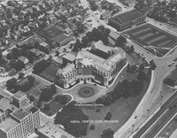
An aerial view of the Hotel Roanoke. Roanoke Auditorium visible in upper right corner.
Davis 16.209 Hotel Roanoke Aerial
An aerial view of the Hotel Roanoke.
Davis 16.207 Hotel Roanoke

Hotel Roanoke.
Davis 16.206 Hotel Roanoke

Hotel Roanoke
Davis 16.205 Hotel Roanoke

Hotel Roanoke
Davis 16.204 Hotel Roanoke

Hotel Roanoke.
Davis2 16.203 Hotel Roanoke
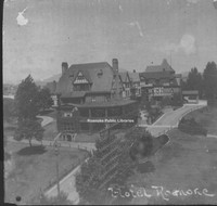
Hotel Roanoke
Davis 16.2022 Hotel Roanoke

Bird's eye view of Hotel Roanoke. Spires of St. Andrew's Cathedral can be seen in upper left corner.
Davis 16.2021 Hotel Roanoke

An early view of the Hotel Roanoke.
Davis 16.202 Hotel Roanoke

Hotel Roanoke was built in 1882 by the Norfolk and Western Railway.
Davis 16.2011 Hotel Roanoke, 1886

The Hotel Roanoke in 1886.
Davis 16.201 Hotel Roanoke Fire

In July 1898, a fire started in the kitchen of the hotel. This photo makes the fire appear worse than it actually was, as the hotel was only closed for several months. Notice the furniture on the lawn; hotel guests and employees removed what they…
Davis2 16.2 Hotel Roanoke
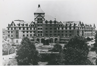
The Hotel Roanoke.
Davis 16.1 Ponce de Leon

The Ponce de Leon Hotel at 131 Campbell Avenue. This building was constructed in 1931 on the foundation of the previous Ponce de Leon which burned in 1931.
Davis 15.721 Fintel Library

Fintel Library at Roanoke College.
Davis 15.72 Fintel Library

Fintel Library at Roanoke College.
Davis 15.711 Fishburn Library

Interior view of the reading room in the Fishburn Library at Hollins College.
Davis 15.71 Fishburn Library

The Fishburn Library at Hollins College.
Davis 15.631 Virginia Heights Book Station

Interior view of the Virginia Heights Book Station. The Virginia Heights Book Station was a precursor to the Raleigh Court Branch Library. It was located in the Masonic Lodge building at Grandin Road and Memorial Avenue.
Davis 15.63 Raleigh Court Library

The Raleigh Court Library was located at 1916 Memorial Avenue. The building is now used by Pop's Ice Cream.
Davis 15.625-3 Melrose Branch Library

The Melrose Branch Library was constructed in 1947 at a cost of $19,947.00
Davis 15.625-2 Melrose Branch Library

The newly constructed Melrose Branch Library at 2318 Melrose Avenue. The sign reads, "New Library constructed for your convenience and assistance by the City of Roanoke".
Davis 15.625-1 Melrose Branch Library

Roanoke Librarian Pearl Hinesley stands in front of the newly constructed Melrose Branch.
Davis 15.621 Melrose Branch Library

Interior view of Melrose Branch Library after it was relocated from 15th Street and Melrose to the basement of Melrose School at 1100 Melrose Avenue.
Davis 15.62 Melrose Branch Library

The Melrose Book Station, located at Melrose Avenue and 15th Street. In 1929, the "Book Station" was moved to the basement of Melrose School at 1100 Melrose Avenue. In 1933 it was moved to a vacant store at 1801 Melrose Avenue. In 1948, the branch…
Davis 15.615 Gainsboro Branch Library

Early view of the Gainsboro Branch Library. The building was completed in 1941 at a cost of $23,970.24.
Davis 15.612-2 Library Shelving

Basement storage shelving at the Gainsboro Branch.
Davis 15.612 Library Shelving

Basement storage shelving at the Gainsboro Branch.
Davis 15.611 Gainsboro Branch Library

Interior of the Gainsboro Branch Roanoke Public Library.
Davis 15.61 Gainsboro Library Interior

Roanoke Public Library's Gainsboro Branch found its beginnings in the Odd Fellows Hall, formerly located at the corner of Patton Avenue and Gainsboro Road. It would relocate to the current building in 1942.
Davis 15.23 Patrons in Reference

The reference room in the old library about 1947.
Davis 15.222 Reading & Reference Room

Interior view of Main Library reading and reference rooms when it was located in the Terry House.
Davis 15.221 Main Library Interior

Roanoke Public Library. Circulation desk and main room.
Davis 15.22 Main Library Interior

Interior view of the first library. The desk in this photo is currently used in the Virginia Room.
Davis 15.212 Patrons in Reference

Ladies in the reference room.
Davis 15.211 Storytime at Roanoke Public Libraries

Children gather for storytime at the Main Library.
Davis 15.21 RPL Storytime

Roanoke Public Library auditorium of the first public library in Terry home during children's book week story hour.
Davis 15.15 Roanoke City Library

The Main branch of Roanoke Public Libraries.
Davis 15.14 Old Library Building

Roanoke Public Library as seen from across Jefferson Street.
Davis 15.13 Library & Elmwood Park

Terry home in Elmwood Park shortly after its conversion to the first library.
Davis 15.121 Terry House

A view of the Terry House from the driveway on Jefferson Street. The Terry House would become Roanoke's first public library in 1921.
Davis 15.12 Library Entrance

Jefferson Street entrance to the first Roanoke Public Library.
Davis 15.112 Library Float

Roanoke Public Library float in a parade.
Davis 15.11 Roanoke Public Library

View of the first Roanoke Public Library from across Elmwood Park. The building, known as the Terry House, was purchased with Elmwood Park by the city in 1911 for $150,000.
Davis2 15.1 Roanoke Public Library Celebration
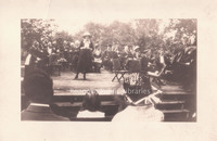
Opening day celebration of Roanoke Public Libraries. Sarah Caldwell Butler speaking at event in Elmwood Park.
Davis 15.02 Library Opening Day

A band plays at the Roanoke Public Library's opening day celebration in Elmwood Park.
Davis 15.01 Pearl Hinesley

Roanoke Public Library's first Librarian, Pearl Hinesley. Miss Hinesley served 30 years in Roanoke Public Libraries, from 1921-1951.
Davis 14.83 Nurse's Room

Interior view of a typical room in the nurses' building at Catawba Sanatorium. The sanatorium was established in 1908 to quarantine and treat individuals with tuberculosis. Today, Catawba Hospital provides psychiatric and geriatric care.
Davis 14.82 Catawba Sanatorium

Nurses relax in the living room of the nurses' building at Catawba Sanatorium. The sanatorium was established in 1908 to quarantine and treat individuals with tuberculosis. Today, Catawba Hospital provides psychiatric and geriatric care.
Davis 14.81 Nurses' Building

Nurses' building at Catawba Sanatorium. The sanatorium was established in 1908 to quarantine and treat individuals with tuberculosis. Today, Catawba Hospital provides psychiatric and geriatric care.
Davis 14.7 Community Hospital
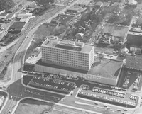
Aerial view of Community Hospital. Orchard Hill is in the background.
Davis 14.6 Gill Memorial

Gill Memorial Hospital was built in 1926. It was the first hospital in Virginia exclusively providing treatment for eye, ear, nose and throat conditions. It remained in independent operation until 1976, when it was acquired by Roanoke Memorial.
Davis 14.481 Lewis-Gale Hospital Nursing Class

Nursing graduate class of 1941. Lewis Gale Hospital.
Davis 14.42 Lewis-Gale Hospital

Lewis-Gale Hospital was built in 1909 as a partnership between Dr. Sparrell Gale and Dr. JN Lewis. The original hospital stood at the corner of 3rd Street and Luck Avenue. This photo was taken before the completion of the 1938 addition. The photo…
Davis 14.41 Lewis-Gale Hospital

Lewis-Gale Hospital was built in 1909 as a partnership between Dr. Sparrell Gale and Dr. JN Lewis. The original hospital stood at the corner of 3rd Street and Luck Avenue. This photo was taken before the completion of the 1938 addition. This photo…
Davis 14.35 Jefferson Hospital

Jefferson Hospital is structure on the left. It was located on Franklin Road; view looking at intersection with Walnut Avenue.
Davis 14.33 Jefferson Hospital Nursing Class

The nursing class of 1947 on the steps of Jefferson Hospital.
Davis 14.32 Jefferson Hospital

Jefferson Hospital, which was founded in 1907 by Dr. Hugh Trout, was a predecessor to Carilion Roanoke Community Hospital. Formerly located at 1313 Franklin Road SW, the hospital closed in 1967 and was later razed.
Davis 14.21 Shenandoah Hospital

Shenandoah Hospital, formerly located at 712 Campbell Avenue. Built in 1912, the 65-bed hospital closed in 1974. The building was razed in 1976.
Davis 14.2 Shenandoah Hospital

Shenandoah Hospital, formerly located at 712 Campbell Avenue. Built in 1912, the 65-bed hospital closed in 1974. The building was razed in 1976.
Davis 14.11 Burrell Hospital Staff

Doctor and nursing staff standing in front of first Burrell Memorial Hospital. This building is the former Alleghany Boys Institute. Burrell was the only African American hospital in Roanoke during segregation. Individuals unidentified.
Davis 14.1 Burrell Memorial Hospital

Roanoke's first African-American hospital, Burrell Memorial, was founded in 1915 in a small cottage on Henry Street. It soon outgrew the Henry Street location and moved into the former Alleghany Institute, a school for boys located at 611 McDowell…
Davis 13.11 Courthouse and Jail

Courthouse and jail on Campbell Avenue and 2nd Street.
Davis2 12.3 Big Lick Post Office
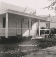
Big Lick Post Office was located on the corner of Lynchburg Road (Orange Avenue) and Williamson Road.
Davis 12.2 Post Office

Roanoke's first post office as seen from the east side of Henry Street (now 1st Street) looking toward Campbell Avenue.
Davis 12.1 Roanoke Post Office

Roanoke Post Office was located on the northeast corner of Church Avenue and 1st Street.
Davis2 11.954 Dana Science Building
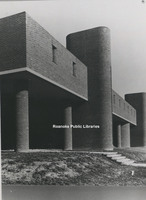
The Dana Science Building on the campus of Hollins University.
Davis2 11.953 Administration Building
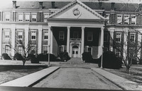
Central to the campus of Roanoke College, the Administration Building was the first structure on campus, completed in 1848. Over the years, East and West wings were added.
Davis2 11.952 East Building
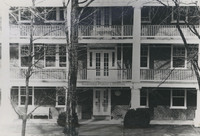
East Building on the Hollins University campus. Built in 1856, It is the oldest building in use at Hollins.
Davis 11.951 Roanoke College
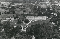
Aerial view of Roanoke College.
Davis 11.95 Roanoke Technical Institute

Roanoke Technical Institute, now called Virginia Western Community College.
Davis2 11.811 Southview Elementary School
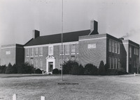
Southview Elementary School, located on Peters Creek Road. The building is now used for Roanoke County administrative offices.
Davis 11.711 Preston Park Elementary

Preston Park Elementary School.
Davis2 11.7 Patrick Henry High
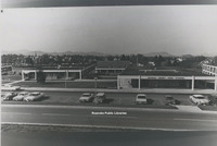
Patrick Henry High School.
Davis 11.671 Roanoke Catholic School

Roanoke Catholic School.
Davis 11.67 Roanoke Catholic School

Roanoke Catholic School.
Davis 11.66-2 Patrick Henry High School

Patrick Henry High School under construction.
Davis 11.66 Patrick Henry High School

Patrick Henry High School under construction.

Davis 11.6521 Jefferson High School Students

Jefferson High School junior class.
Davis 11.65 Jefferson High School

Jefferson High School from Campbell Avenue.
Davis 11.62 Lucy Addison High

Lucy Addison High School, shortly after completion of the addition.
Davis 11.61 Lucy Addison High School

Lucy Addison High School after completion of the addition.
Davis 11.6 Lucy Addison High School

Lucy Addison High School shortly after construction
Davis 11.51 Stonewall Jackson Middle

Stonewall Jackson Middle School, located at 1004 Montrose Avenue. The school's name was changed to John P. Fishwick Middle School in 2018.
Davis 11.5 Stonewall Jackson Middle School

Stonewall Jackson Middle School, located at 1004 Montrose Avenue. The school name was changed to John P. Fishwick Middle School in 2018.
Davis 11.4 Lee Junior High

Lee Junior High School, formerly located at Franklin Road and 2nd Street.
Davis 11.363 Raleigh Court Elementary

Raleigh Court Elementary School
Davis 11.362 Raleigh Court Elementary

Raleigh Court Elementary School
Davis 11.361 Raleigh Court Elementary School

Raleigh Court Elementary School
Davis 11.36 Raleigh Court Elementary School

Raleigh Court Elementary School
Davis 11.351 Hurt Park Elementary

Hurt Park Elementary, located at 1525 Salem Avenue.
Davis 11.35 Hurt Park Elementary School

Hurt Park Elementary School, located at 1525 Salem Avenue.
Davis 11.341 Westside Elementary

Westside Elementary School
Davis 11.34 Westside Elementary School

Westside Elementary School
Davis 11.331 Fairview Elementary

Fairview Elementary School
Davis 11.33 Fairview Elementary School

Fairview Elementary School
Davis 11.32 Monterey Elementary School

Monterey Elementary School
Davis2 11.3 Pleasant View School
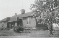
Pleasant View School, often called Moomaw School, which stood on Moomaw land on the corner of Cove and Hershberger Roads.
Davis 11.23 Gilmer School

Gilmer School once stood on Gilmer Avenue in the general area of the Roanoke Civic Center.
Davis 11.211 West End School

Rear of West End School, formerly located at 912 Campbell Avenue.
Davis 11.21 West End School

West End Elementary School, formerly located at 918 Campbell Avenue. In this photo, the school is nearing completion.
Davis 11.2 West End Elementary

West End Elementary school.
Davis 11.15 Melrose Class

Students of Melrose School.
Davis 11.12 Belmont Elementary

Belmont Elementary School was located on Dale Avenue in southeast Roanoke. The school was built in 1891 and remained in operation until 1974 when Fallon Park Elementary School was completed.
Davis 11.1 Belmont Elementary

Belmont Elementary School was located on Dale Avenue in southeast Roanoke. The school was built in 1891 and remained in operation until 1974 when Fallon Park Elementary School was completed.
Davis2 11.03 Virginia College
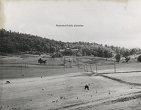
The Virginia College for Young Women under construction. The school was formerly located in the South Roanoke neighborhood at the end of Rosalind Avenue.
Davis 11.01 Class of Alleghany Institute

Class of the Alleghany Institute. Burrell Memorial Hospital took it over and built the hospital.
Davis2 105.1 Diamond Jubilee
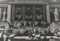
Roanoke's Diamond Jubilee celebration kicks off at the 1915 municipal building.
Davis2 105 Diamond Jubilee
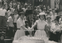
Cutting the birthday cake during Roanoke's Diamond Jubilee are Miss Diamond Jubilee, Barbara Boitnott, Mayor Walter L. Young and Miss Shenandoah Valley, Edwina Wertz.
Davis 102.1 Heironimus and Brugh Float

Float decorated by Heironimus and Brugh Department Store for the Roanoke Decennial Parade.
Davis 101.22 Glidden Tour

Glidden Tour cars parked in Marstellar's garage on Church Avenue.
Davis 101.21 Labor Day Picnic

Labor Day, 1891
Davis 101.12 Liberty Bell Reception

Soldiers guarding the Liberty Bell in Roanoke. Hotel Roanoke is visible in the background. The Liberty Bell stopped in Roanoke during its tour through the United States in 1895.
Davis 101.1 Liberty Bell

Soldiers guarding the Liberty Bell in Roanoke. Hotel Roanoke is visible in the background. The Liberty Bell stopped in Roanoke during its tour through the United States in 1895.
Davis 100 General Outdoor Advertising

General Outdoor Advertising Company was located in the old St. John's Episcopal Church on the corner of Church Avenue and 2nd Street. The church is hardly visible due to the billboard display surrounding it.
Davis2 1.98 Aerial view of Elmwood
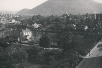
An aerial view of Elmwood Park.
Davis 1.97 Springtime in Elmwood

Spring in Elmwood Park with a view of St. John's Episcopal Church.
Davis2 1.96B Snow in Elmwood
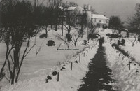
Snow in Elmwood Park with view of the Terry House.
Davis2 1.96A Snow in Elmwood
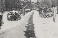
Snow in Elmwood Park.
Davis2 1.96 Snow in Elmwood
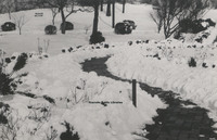
Snow in Elmwood Park.
Davis2 1.952 Japanese Magnolia
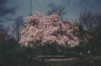
Japanese Magnolia tree in Elmwood Park.
Davis 1.951 Japanese Magnolia at night

A nighttime view of the Japanese Magnolia in Elmwood Park.
Davis 1.95 Japanese Magnolia

Japanese Magnolia in Elmwood Park.
Davis 1.94 Elmwood Park

A view of Elmwood Park from the northwest corner of Bullitt Avenue and Jefferson Street.
Davis 1.93 Elmwood Park

View of Elmwood Park from the corner of Jefferson Street and Elm Avenue. Tennis courts visible at right.
Davis 1.921 Elmwood Park

View of Elmwood Park looking from southwest corner of Elm Avenue and Jefferson Street. Terry home and tennis courts visible.
Davis 1.92 Elmwood Park

View from Elmwood Park looking toward southwest corner of Jefferson Street and Elm Avenue.
Davis 1.91 Elmwood Park

A view of Elmwood Park from the corner of Jefferson Street and Bullitt Avenue.
Davis 1.822 N&W freight station

Norfolk & Western freight station. Looking southwest toward downtown. View of buildings on Norfolk Avenue. St. James Hotel in background.
Davis 1.8 Memorial Bridge Playground

Children in sandbox at playgound under Memorial Bridge.
Davis 1.414 Crystal Spring gazebo & house

Crystal Spring showing gazebo and house on hill above.
Davis 1.413 McClanahan's Mill

Built in the 1750s, this flume and waterwheel were all that remained when this photo was taken sometime before 1890. The flume and waterwheel were demolished in 1890. This mill lended its name to Mill Mountain.
Davis 1.41 Crystal Spring

"Crystal Spring as it looked in the early days of Roanoke." Engraving of photo.
Davis 1.323 Carlton Terrace Building

Carlton Terrace Apartments, formerly located in the 900 block of Jefferson Street.
Davis 1.312 Roanoke heaviest snowfall

Roanoke's heaviest snowfall. Shown is Knepp & Company, formerly located at Jefferson Street and Church Avenue. Men shovel snow off of roof. View looking south.
Davis 1.311 Knepp & Co.

Knepp & Company Livery Stable, formerly located on the northwest corner of Jefferson Street and Church Avenue.
Davis2 1.255 First and Franklin
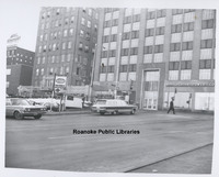
1st Street intersection with Franklin Road in front of AEP.
Davis2 1.254 Franklin Road
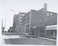
Looking toward intersection with 1st Street and Franklin Road.
Davis 1.253 2nd and Day

The northeast corner of 2nd Street and Day Avenue.
Davis2 1.252 1st and Franklin

Parking lot in front of AEP's Roanoke office at the corner of Franklin Road and 1st Street.
Davis2 1.251 1st & Day
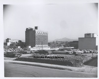
Looking northeast from 1st Street and Day Avenue.
Davis2 1.25 1st & Day
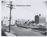
Looking northeast from 1st Street and Day Avenue.
Davis 1.21 Elks Carnival High Wire Act

Elks Carnival high wire act, looking west toward 3rd Street. St. Mark's Lutheran Church and Rorer Hall in visible in background.
Davis 1.12 View from McBain building.

View from the roof of the McBain building. Post office tower in foreground.
Davis 1.1 Franklin Road Bridge

Franklin Road bridge over Roanoke River.
Davis 1.01 Big Lick 1881-82

Looking northwest from Elmwood Park. This is the earliest known photo of what would become the City of Roanoke.
RNC 117 Woodlawn Avenue
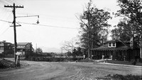
Woodlawn Avenue at the intersection with Montgomery Avenue.
RNC 8 Wilson & Company
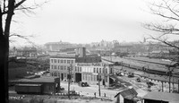
Wilson & Company, seen in the foreground, was a wholesale meat company. It was located at 312 Campebell Avenue SE. Hotel Roanoke and N&W General Offices can be seen in background.
RNC 85 Tinker Mountain
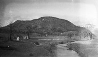
A view of Tinker Mountain.
RNC 70 Tinker Creek

A view of Tinker Creek.
RNC 54 Jefferson Theatre
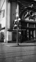
Jefferson Theatre, formerly located at 417 S. Jefferson Street.
RNC 9 St. Andrews
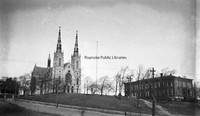
St. Andrews Catholic Church.
RNC 4 Shenandoah
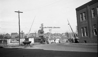
Austin & Martin Auto Repair, formerly located at 223 Shenandoah Avenue NW.
RNC 41 Big Oak Filling Station
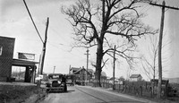
Big Oak Filling Station was located around the 2500 block of Williamson Road.
RNC 11 Roanoke High School
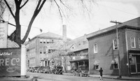
Roanoke High School was formerly located on the northeast corner of Church Avenue and 3rd Street where the Noel C. Taylor Municipal building stands today.
RNC 2 Highland Park School
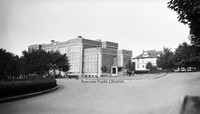
Highland Park Elementary School, located at 1212 5th Street.
RNC 63 Commerce Street School Site
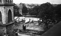
A nearly gone Commerce Street or First Ward School. The school stood at Church Avenue and 2nd Street and was razed to make way for the post office.
RNC 64 Commerce Street School Site
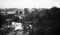
A nearly gone Commerce Street or First Ward School. The school stood at Church Avenue and 2nd Street and was razed to make way for the post office.
RNC 40 Commerce Street School
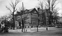
Commerce Street School, also called First Ward School, was located at the corner of Church Avenue and 2nd (Commerce) Street. Built in 1890, it was razed in 1929 to make room for the post office.
RNC 18 Quick Way
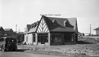
Quick Way convenience store, located at 2209 Brandon Avenue.
RNC 24 Memorial Avenue
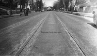
Streetcar tracks on the 700 block of Memorial Avenue.
RNC 150 Orange Avenue
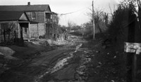
Orange Avenue, exact location unknown.
RNC 86 Orange Avenue
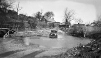
Driving could be a challenge on Orange Avenue in its early days. View is looking west near Gainsboro Road.
RNC 15 Norfolk Avenue
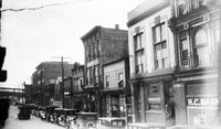
A view of Norfolk Avenue includes Bannister's Place (a boarding house) and HC Barnes Pharmacy. Buildings were located roughly where the Wells-Fargo Tower is today.
RNC 3 N&W Salvage
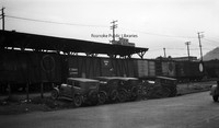
Norfolk & Western Salvage Warehouse, formerly located at 201 Campbell Avenue SE.
RNC 39 N&W Freight Station
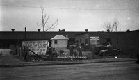
Lots for sale in front of the Norfolk & Western freight station on Norfolk Avenue.
RNC 73 N&W Underpass
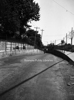
One-lane road under a Norfolk & Western underpass through which traffic accessing 460 East would pass.
RNC 51 Municipal Building
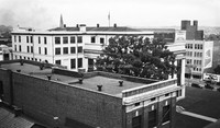
A view of the municipal building from the YMCA.
RNC 146 Municipal Building
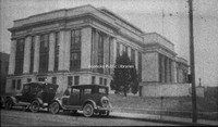
View of the Municipal Building from 2nd Street and Campbell Avenue.
RNC 80 WWI Monument
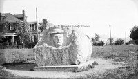
This monument was erected in 1925 by the Margaret Lynn Lewis Chapter of the DAR to honor Roanoke soldiers who served in World War I. It is located in Argonne Circle on King George Avenue.
RNC 152 WWI Monument
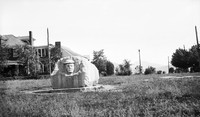
This monument was erected in 1925 by the Margaret Lynn Lewis Chapter of the DAR to honor Roanoke soldiers who served in World War I. It is located in Argonne Circle on King George Avenue.
RNC 47 Monticello
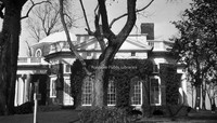
Side view of Monticello.
RNC 118 Mill Mountain
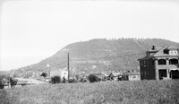
A view of Mill Mountain from Old Southwest.
RNC 5 Mick or Mack
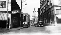
Mick or Mack, formerly located at 310 2nd Street.
RNC 101 Jefferson Street
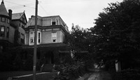
Home formerly located at 815 S. Jefferson Street.
RNC 42 Jefferson Street
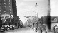
Looking north on Jefferson Street from Elmwood Park.
RNC 56 Jefferson Street
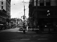
Looking north on Jefferson Street from Campbell Avenue.
RNC 55 Patrick Henry
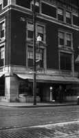
The Patrick Henry Hotel.
RNC 16 Heironimus
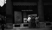
John Nolen's plans for the City of Roanoke on display in the windows of Heironimus.
RNC 84 Gregory Avenue
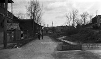
Gregory Avenue at the intersection with 2nd Street NE.
RNC 50 Franklin Road
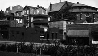
A view of the 200 block of Franklin Road, where the Verizon building sits today. First Baptist Church can be seen over the buildings at left. The building on the right with the round portion was the original First Baptist Church.
RNC 10 Fire Station 7
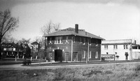
The original Fire Station 7, located at 1742 Memorial Avenue.
RNC 139 Commerce Street School
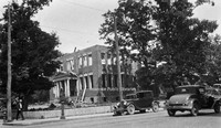
Demolition of the Commerce Street School, also known as the First Ward School.
RNC 52 Church Avenue
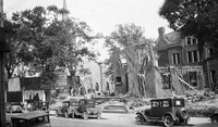
Commerce Street School being razed to make room for the post office. Greene Memorial United Methodist Church can be seen in background.
RNC 60 Church Avenue
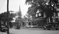
Demolition of St. John's Episcopal and a house on Church Avenue to make way for the post office.
RNC 81 Church Avenue
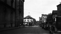
Looking east on Church Avenue from the 100 block.
RNC 132 Church and 2nd
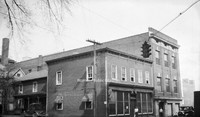
Buildings once located at 2nd Street and Church Avenue where the Commonwealth Building stands today.
RNC 148 Carvins Cove Dam
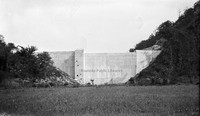
Carvins Cove Dam Shortly after completion. The reservoir would not be complete until the 1940s.
RNC 147 Carvins Cove Dam
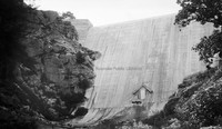
Carvins Cove Dam Shortly after completion. The reservoir would not be complete until the 1940s.
RNC 38 Carvins Cove Dam
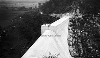
Carvins Cove Dam shortly after completion. The reservoir would not be complete until the 1940s.
RNC 37 Carvins Cove Dam
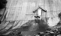
Carvins Cove Dam shortly after completion. The reservoir would not be complete until the 1940s.
RNC 29 GW Copenhaver
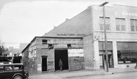
Vacant storefront on Williamson Road between Church Avenue and Kirk Avenue. The building was once occupied by blacksmith G.W. Copenhaver. The site is now a parking lot.
RNC 94 Avon Road
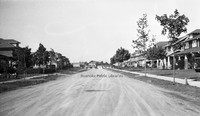
Looking north on Avon Road at the intersection with Sherwood Avenue.
RNC 17 Windsor Apartments
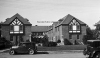
Apartments located at 2049 Windsor Avenue at the corner of Brunswick Street.
RNC 120 6th Street SE
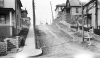
Looking north on 6th Street SE from Tazewell Avenue.
RNC 66 2nd Street
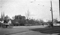
Looking north on 2nd Street NE at the intersection with Patton Avenue.
RNC 130 2nd Street
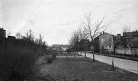
Looking north on 2nd Street NE.
RNC 72 2nd Street
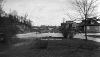
Looking north on 2nd Street just beyond Patton Avenue..
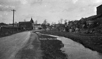
RNC 65 2nd Street
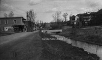
Looking north on 2nd Street NE. Lick Run is the stream at right. Extreme right is the location of I581.