
Browse Items (9249 total)
Sort by:
PC 92.3 Fan Tail Falls

Fan Tail Falls northeast of Lexington, Virginia.
GB69 Harrison School

Harrison School Faculty 1948/1950.
Harrison School was built in 1916 for the cost of $31,818 and opened in the winter of 1917. Lucy Addison served as the school’s first principal. Addison was responsible for gradually expanding the curriculum to…
Harrison School was built in 1916 for the cost of $31,818 and opened in the winter of 1917. Lucy Addison served as the school’s first principal. Addison was responsible for gradually expanding the curriculum to…
GB68 Harrison School

Mr. Thomas Payne's first class.
Harrison School was built in 1916 for the cost of $31,818 and opened in the winter of 1917. Lucy Addison served as the school’s first principal. Addison was responsible for gradually expanding the curriculum to…
Harrison School was built in 1916 for the cost of $31,818 and opened in the winter of 1917. Lucy Addison served as the school’s first principal. Addison was responsible for gradually expanding the curriculum to…
GB67.6 Harrison School

Students playing on the basketball court at Harrison School.
Harrison School was built in 1916 for the cost of $31,818 and opened in the winter of 1917. Lucy Addison served as the school’s first principal. Addison was responsible for gradually…
Harrison School was built in 1916 for the cost of $31,818 and opened in the winter of 1917. Lucy Addison served as the school’s first principal. Addison was responsible for gradually…
GB67.5

Students playing on the basketball court at Harrison School.
Harrison School was built in 1916 for the cost of $31,818 and opened in the winter of 1917. Lucy Addison served as the school’s first principal. Addison was responsible for gradually…
Harrison School was built in 1916 for the cost of $31,818 and opened in the winter of 1917. Lucy Addison served as the school’s first principal. Addison was responsible for gradually…
GB67.4 Harrison School

Students playing on the basketball court at Harrison School.
Harrison School was built in 1916 for the cost of $31,818 and opened in the winter of 1917. Lucy Addison served as the school’s first principal. Addison was responsible for gradually…
Harrison School was built in 1916 for the cost of $31,818 and opened in the winter of 1917. Lucy Addison served as the school’s first principal. Addison was responsible for gradually…
GB67.3 Harrison School

Students playing on the basketball court at Harrison School.
Harrison School was built in 1916 for the cost of $31,818 and opened in the winter of 1917. Lucy Addison served as the school’s first principal. Addison was responsible for gradually…
Harrison School was built in 1916 for the cost of $31,818 and opened in the winter of 1917. Lucy Addison served as the school’s first principal. Addison was responsible for gradually…
GB67.2 Harrison School

Students playing on the basketball court at Harrison School.
Harrison School was built in 1916 for the cost of $31,818 and opened in the winter of 1917. Lucy Addison served as the school’s first principal. Addison was responsible for gradually…
Harrison School was built in 1916 for the cost of $31,818 and opened in the winter of 1917. Lucy Addison served as the school’s first principal. Addison was responsible for gradually…
GB67.1 Harrison School

Students playing on the basketball court at Harrison School.
Harrison School was built in 1916 for the cost of $31,818 and opened in the winter of 1917. Lucy Addison served as the school’s first principal. Addison was responsible for gradually…
Harrison School was built in 1916 for the cost of $31,818 and opened in the winter of 1917. Lucy Addison served as the school’s first principal. Addison was responsible for gradually…
GB67 Harrison School

Students playing on the basketball court at Harrison School.
Harrison School was built in 1916 for the cost of $31,818 and opened in the winter of 1917. Lucy Addison served as the school’s first principal. Addison was responsible for gradually…
Harrison School was built in 1916 for the cost of $31,818 and opened in the winter of 1917. Lucy Addison served as the school’s first principal. Addison was responsible for gradually…
GB61 Rev. E. E. Ricks

Rev. E. E. Ricks was served as pastor of First Baptist Church Gainsboro from 1915 to 1918.
GB60 First Baptist Church Gainsboro, Bible School

First Baptist Church Gainsboro can trace its origins back to September 30, 1867, when a small congregation held service, led by Rev. Edmond Johnson, in a dwelling on Hart Avenue, establishing the Big Lick Colored Baptist Church. As membership…
GB58 First Baptist Church Gainsboro, interior

First Baptist Church Gainsboro can trace its origins back to September 30, 1867, when a small congregation held service, led by Rev. Edmond Johnson, in a dwelling on Hart Avenue, establishing the Big Lick Colored Baptist Church. As membership…
Deacons and Trustees of First Baptist Church Gainsboro

First Baptist Church Gainsboro can trace its origins back to September 30, 1867, when a small congregation held service, led by Rev. Edmond Johnson, in a dwelling on Hart Avenue, establishing the Big Lick Colored Baptist Church. As membership…
GB45 Dr. Elwood Downing

Dr. Ellwood Davis Downing was prominent dentist and civic leader. Downing was born September 9, 1891. He was the son of Rev. Lylburn L. Downing, pastor of Fifth Avenue Presbyterian Church. Downing served as an officer in WWI and WWII and was an…
GB44 Bings Social Club

Bings Social Club
GB43 Dr. Ellwood Downing and Mrs. Della Downing

Dr. Ellwood Davis Downing was prominent dentist and civic leader. Downing was born September 9, 1891. He was the son of Rev. Lylburn L. Downing, pastor of Fifth Avenue Presbyterian Church. Downing served as an officer in WWI and WWII and was an…
GB33 Dr. F. W. Claytor

Dr. Frank William Claytor was born April 8, 1913 in Roanoke, Virginia. He was the oldest son of Dr. John B. Claytor Sr. and Roberta M. Woodfin Claytor. After graduating from Knoxville College in 1933, Claytor earned his medical degree from Meharry…
GB32 Dr. John B. Claytor Sr.

Dr. John B. Claytor Sr. was born April 2, 1878 in Floyd County, Virginia. In 1907 Claytor began a medical practice in Roanoke, Virginia. Claytor was a founder of Burrell Memorial Hospital and was Emeritus Chief of the hospital’s department of…
GB31 Dr. John B. Claytor Sr.

Dr. John B. Claytor Sr. was born April 2, 1878 in Floyd County, Virginia. In 1907 Claytor began a medical practice in Roanoke, Virginia. Claytor was a founder of Burrell Memorial Hospital and was Emeritus Chief of the hospital’s department of…
GB30 Daisy Schley

Daisy Schley was a nurse at Burrell Memorial Hospital.
GB25 Virginia Y. Lee

Virginia Y. Lee was the Gainsboro Library's fourth librarian (1928 – 1971). She was born on November 22, 1906 in McComas, West Virginia and raised in Roanoke, Virginia. She graduated Valedictorian from Lucy Addison High School in 1924 and earned her…
GB24 Virginia Y. Lee

Virginia Y. Lee was the Gainsboro Library's fourth librarian (1928 – 1971). She was born on November 22, 1906 in McComas, West Virginia and raised in Roanoke, Virginia. She graduated Valedictorian from Lucy Addison High School in 1924 and earned her…
GB23 Freemasons Group

African American Freemasons group.
GB21 First Baptist Church Gainsboro, interior

Interior of the original sancuary of the First Baptist Church in Gainsboro. The building was designed by architect Henry Harwell Huggins and was located at 407 North Jefferson Street. A cornerstone for the church was laid and ground was broken in…
GB18 Oliver Hill

Civil rights attorney Oliver W. Hill in front of his childhood home at 401 Gilmer Avenue, now the Oliver Hill House.
GB16 African American Railroad Workers

African American railroad workers.
GB13 C. C. Williams

Christopher Chamberlin Williams of Williams Funeral Home, now Serenity Funeral Home. Mr. Williams served on the Board of Trustees for both the Gainsboro Library and the William A. Hunton YMCA.
GB12 Dr. J. H. Roberts

Dr. James H. Roberts was a co-founder of Burrell Memorial Hospital, Magic City Medical Society, and the William A. Hunton YMCA.
GB08 W. F. Hughes

W. F. Hughes of Hughes Funeral Home.
GB01 Dr. Lawrence E. Paxton

Dr. Lawrence E. Paxton operated a dental practice on Wells Avenue.
Roanoke Times Obituary Index: 1923-1950

Partial obituary index for the Roanoke Times from 1923-1950. Also includes limited listings from the Roanoke Daily News beginning in 1890.
The Addisonian 1953

The Addisonian was the annual for Lucy Addison High School.
MP 58.0 Ole 97
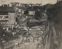
The aftermath of the wreck of the "Ole 97". Due to excessive speed in an attempt to maintain schedule, the train derailed at the Stillhouse Trestle near Danville, Virginia where the train careened off the side of the bridge, killing eleven personnel…
MP 57.0 Roanoke Police Department
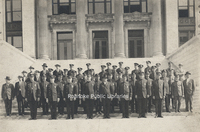
Roanoke Police Department in front of the Municipal Building.
MP 35.0 Police Inspection
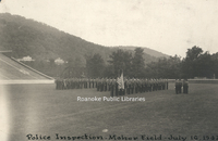
Roanoke Police inspection at Maher Field.
MP 4.41 Jefferson Street
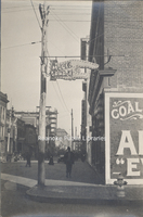
Looking north on Jefferson Street from the Church Avenue intersection. Construction of the Liberty Trust Building can be seen in background. Sign advertises J.H. Marsteller's (a car enthusiast and businessman) "Model Garage", formerly located at 16…
MP 4.42 Campbell Avenue
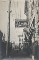
Looking west on Campbell Avenue. Sheen's Cafe was located at 119 Campbell Avenue SW. The building in the right background with balconies was the original Ponce de Leon Hotel.
MP 4.43 Salem Avenue
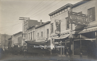
Looking west at saloons along Salem Avenue. The Silver Moon Quick Lunch, Raleigh Cafe and Brady's were located at approximately 20 Salem Avenue SW.
MP 4.44 Salem Avenue
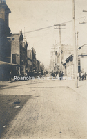
Looking west from the 100 block of Salem Avenue SE. A horse takes a drink from the Dog's Mouth Fountain, visible at right.
MP 4.45 Church Avenue
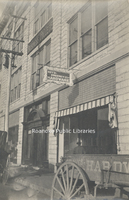
Boyd-Sweeney Company Hardware and National Business College, formerly located at 9-11 Church Avenue SW.
MP 38.02 Time Capsule
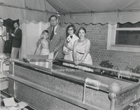
Contents are placed into the time capsule in front of the Main Library during the Diamond Jubilee Time Capsule Ceremony. The time capsule is not to be opened until 2032 for Roanoke's 150th Anniversary.
MP 38.01 Time Capsule
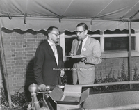
Contents are placed into the time capsule in front of the Main Library during the Diamond Jubilee Time Capsule Ceremony. The time capsule is not to be opened until 2032 for Roanoke's 150th Anniversary. Claude Settlemire, City Librarian, on left.
MP 38.14 Williamson Road Book Station
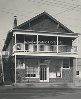
The Williamson Road Branch found its beginnings as the Williamson Road Book Station, formerly located at 2919 Williamson Road NE.
Souvenir: A Brief Reflection of Points of Interest About Roanoke, Vicinity and Valley of Virginia
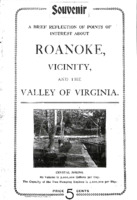
Issued as a promotional souvenir for the German Baptist Association Annual Conference.
UC119 Boyle-Swecker
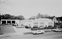
Boyle-Swecker Tire Company, formerly located at 715 Patterson Avenue SW.
UC115 3607 Bond Street
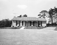
Home located at 3607 Bond Street in Cave Spring
UC114 3718 London Circle
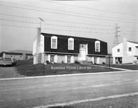
Home located at 3718 London Circle in Cave Spring.
UC104 1843 Dorset Drive
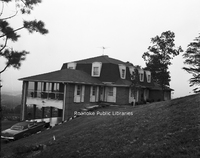
Home located at 1843 Dorset Drive in Cave Spring.
UC95 1400 Gratton Street
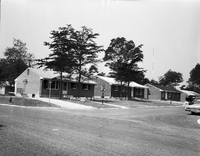
Homes in the 1400 block of Gratton Street in Salem.
UC83 3459 Meadowlark Road
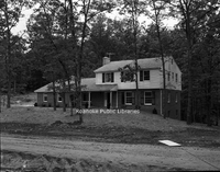
Home located at 3459 Meadowlark Road SW.
MP 24.4 Narrows School
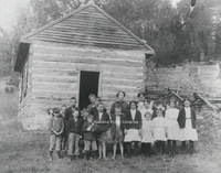
Students in front of Narrows School in the Catawba Valley. 1st row, L to R: Students in front of Narrows School in the Catawba Valley. 1st row, L to R: Hubert Brillhart, Kyle Shelor, Clovis Garman, ? Bennett, ? Bennett, Edna Brillhart, Hazel…
MP 24.3 Shiloh School
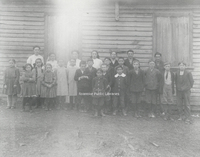
Students in front of Shiloh School in Catawba Valley. 1st row, L to R: Hortense Deeds, Eva Reed, Gladys Grisso, Edna Wright, Mary Garman, Paris Wright, Roy Hall, Claude Garman, Nelson Alls, John Garman, Kermit Garman, Roy Brillhart, Clyde Brillhart,…
Star7 - David Bowers
Mayor Bowers describes hikes on Mill Mountain with his family, visiting with travel writers and bloggers at the Star, and his dog Catcher's "one trick." Multiple recordings - the transcript is from the first recording.
Star6 - David Denham
Story describes grandchildren from out of town visiting the Star.
Index to the Roanoker Magazine
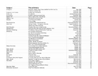
This document is an index to the Roanoker Magazine arranged alphabetically by subject. from 1974-present.
RAC77 VANG Ad
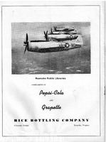
An advertisement for the Rice Bottling Company depicting the Virginia Air National Guard Fighter Squadron.Organized in 1946, the Virginia Air National Guard flew the P-47 Thuderbolt.
RAC76 Woodrum Aerial
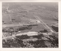
A south-facing aerial view of Woodrum Field. In the upper left of this photo, Crossroads Mall can be seen under construction.
RAC75 Woodrum Aerial
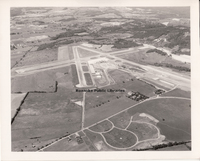
This west-facing photograph shows the configuration of runways. There is construction work at right, indicating the extension of runway 5/23. Still noticeable are the rural surroundings of Woodrum Field. Visible at the bottom is the internal road…
RAC74 Woodrum Aerial
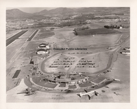
This aerial photograph shows the separation of private aviation (left) and commercial aviation at the front of the terminal. Note the layout of the new parking lot behind the terminal. More passengers began leaving their cars at the airport for…
RAC73 Control Tower
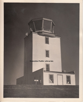
The first freestanding control tower at Woodrum Field, completed in 1943, is seen here. The tower was critical to the airport's operations. In 1943, due to the training of Army and Navy pilots at Woodrum Field, the total number of official…
RAC72 Woodrum Field
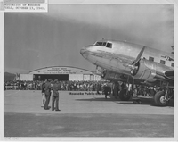
Roanoke Municipal Airport became Woodrum Field at a dedication ceremony on 13 October 1941. The new airport received a class 3-A rating and American Airlines reestablished passenger service, which had been abandoned in 1937.
RAC71 Marine Corps
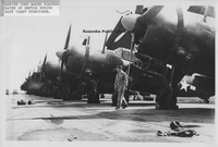
Aircraft from the Marine Corps Air Station at Cherry Point , North Carolina are lined up at Woodrum Field during the hurricane evacuation in September 1945.
RAC70 Piedmont Airlines
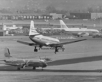
This unusual photograph illustrates the increased traffic of Piedmont Airlines in and out of Roanoke and the transition from propeller aircraft to jets. The prop aircraft landing is a Martin 4-0-4; the aircraft at lower left is a Nihon YS-11; and the…
RAC69 RRA Terminal
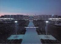
Postcard depicting the current terminal at Roanoke-Blackburg Regional Airport. The terminal opened on 13 September 1989.
RAC68 Woodrum Field
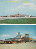
Postcard depicting Woodrum Field.
RAC67 Trussmark Field
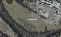
The current Trussmark field in Salem. The field is located along the Roanoke River adjacent to an industrial complex. This was the early location for the Salem auxiliary field used by naval aviation cadets enrolled at Roanoke College. The shorter…
RAC66 Trussmark Field
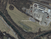
The current Trussmark field in Salem. The field is located along the Roanoke River adjacent to an industrial complex. This was the early location for the Salem auxiliary field used by naval aviation cadets enrolled at Roanoke College. The shorter…
RAC65 RRA Tower
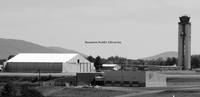
This photograph shows the control tower at Roanoke Regional Airport that wsa commissioned in 2004. The large hangar at left was built bby Piedmont Airlines in the 1960s, and the emergency services facility (foreground) was placed into service in…
RAC64 1944 Map
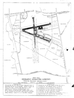
This blueprint of the Roanoke Municipal Airport shows its phases of development in 1944.
RAC63 1942-43 Map
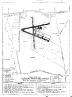
This blueprint of the Roanoke Municipal Airport shows its phases of development from 1942 through 1943.
RAC62 1940-41 Map
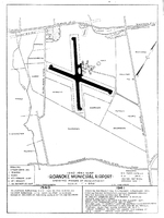
By 1941, the Roanoke Municipal Airport had seen tremendous development, as evidenced by this 1940-1941 map.
RAC61 1938-39 Map
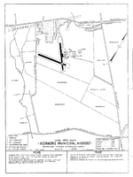
This blueprint of the Roanoke Municipal Airport shows its phases of development from 1938 through 1939.
RAC60 1936-37 Map
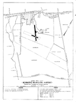
Development of the Roanoke Municipal Airport by 1937 is seen in this blueprint.
RAC59 1934-35 Map
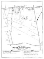
This blueprint of the Roanoke Municipal Airport shows its phases of development from 1934 through 1935.
RAC58 1930-33 Map
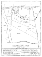
This blueprint of the Roanoke Municipal Airport illustrates its development between 1930 and 1933. According to data on the blueprint, the Cannaday farm was recommended as the site for a municipal airport by the Department of Commerce in February…
RAC57 1928 Map
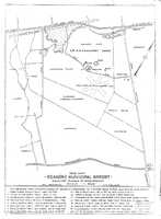
This 1928 city map shows the area where the airport would be located, noting the location of the airfields. With the development of a municipal airport, particularly under the management of Frank Reynolds and Clayton Lemon, interest in aviation…
RAC56 Air Show
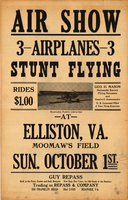
George Mason, like many early aviators, conducted air shows as a means to both entertain and earn income. This undated poster promotes an air show at Moomaw Field in Elliston, Virginia, with Mason billed as the "Nationally Known Flying Salesman and…
RAC55 Plaque
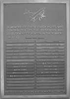
Mounted inside the Roanoke Regional Airport terminal is a plaque placed in the airport as a tribute to those aviation pioneers and advocates who had the vision and fortitude to make air service a reality in the Roanoke area. The names upon the…
RAC54 Landmark Aviation
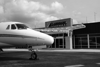
This building houses the fixed-base operation (FBO) of Landmark Aviation at the Roanoke Regional Airport. FBOs have evolved from very simple operations to full-service onces that provide fuel, maintenance, pilot support services and more. The…
RAC53 Virginia Airmotive
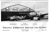
This is an advertisement for Virginia Airmotive Service and Supply, a business owned and operated by W. Clayton Lemon at Woodrum Field. The aircraft are identified as a Beechcraft (left) and a Stinson (right).
RAC52 Terminal Snow
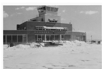
The airport engages in regular winter activity for Southwestern Virginia, snow removal. In the early days of the airport, snow would cause major delays in operations, measured in days, not hours. In later years, airports, including Woodrum Field,…
RAC50 Woodrum Flying Service
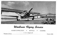
An advertisement for Woodrum Flying Service, which offered flying lessons, charters, and rentals.
RAC49 USAF C97
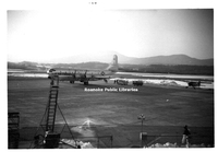
This photograph shows a US Air Force Boeing C-97 Stratofreighter parked on the ramp at Woodrum Field. Only sixty of these planes were built. The Roanoke airport has been and remains important to the military subce World War II, either for training,…
RAC48 American Airlines
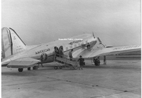
American Airlines restored air service, notably passenger and airmail, to Woodrum Field in the 1940s. This photograph appears to have been taken at Woodrum during World War II. The statement painted on the rudder of this DC-3 reads, "Buy War…
RAC47 Wind Indicator
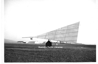
This is a close-up view of the tetrahedron wind-direction indicator installed at Woodrum Field. The device allowed pilots to visually determine the wind direction prior to landing in order to choose the best runway. The device became obsolete as…
RAC46 Woodrum Field
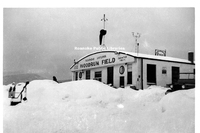
Woodrum Field buried under snow.
RAC45 Jeep Crash Truck
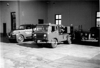
Seen here is a Jeep Forward Control crash truck that was added to the emergency fleet at Woodrum Field.
RAC44 Landmark Aviation
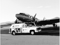
This photograph shows a privately owned, fully restored DC-3 being refueled by Landmark Aviation at Roanoke Regional Airport. The appearance of such a vintage aircraft in restored, flying condition has become increasingly rare with limited air shows…
RAC43 Playboy
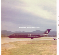
This DC-9 was purchased by Hugh Heffner in 1970 as the Playboy airplane, known as Hare Force One.
RAC42 Eastern DC3
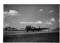
An Eastern Airlines DC-3, part of the "Great Silver Fleet" takes off from Woodrum Field.
RAC41 Fire Trucks
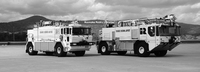
These huge vehicles represent the evolution of fire-fighting and emergency service equipment needed by airports as the number of flights increased and the size of the aircraft became larger. Both trucks are shown at Roanoke Regional Airport. They…
RAC40 Entrance Sign
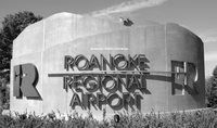
The main entrance sign for the Roanoke Regional Airport off of Aviation Drive. The innovative sign, designed by URS of Baltimore, Maryland, incorporates the mountains, the Mill Mountain Star and a very unique 'R' to the left, the center of which is…
RAC39 Lifeguard
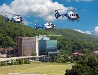
A recent promotional photograph depicting Carillion Roanoke Memorial Lifeguard 10, 11 and 12 in front of Carillion Roanoke Memorial Hospital.
RAC38 Cook Field
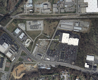
This photograph shows the location of the Appalachian Power substation adjacent to the rail line where Cook Field was formerly located. Cook Field was leased by Frank Reynolds and Clayton Lemon to provide an airstrip for local fliers in the late…
RAC37 Civil Air Patrol
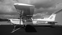
A Cessna 172, one of 500 Cessna aircraft owned by the Civil Air Patrol (CAP) is seen here. These aircraft are rotated periodically among active stations, including Roanoke Regional Airport. The CAP was established in 1941 to serve as a civilian…
RAC36 2013 Aerial
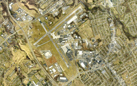
An aerial view of Roanoke Regional Airport.
RAC35 1967 Aerial
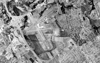
An aerial view of Woodrum Field. I-581 opened in 1965 and can been seen at left of the airport.
RAC34 1953 Aerial
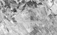
An aerial view of Woodrum Field.
RAC33 1947 Aerial
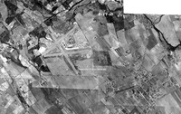
An aerial view of Woodrum Field.
RAC32 Williamson Road
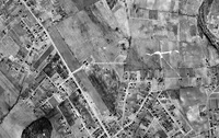
In this aerial photograph, Williamson Road runs along the left side. The small structure in the open space at center is the present-day location of Breckenridge Middle School, formerly William Fleming High School. In 1921, the federal government…
RAC31 Trout Field
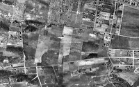
Trout Field is directly in the center of this aerial photograph. Fairview Cemetery is the rectangular area at top with the teardrop-shaped driveway in its center. This view illustrates why a cemetery served as a good navigational point for early…
RAC30 Shrine Hill
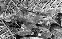
This aerial photograph shows the area where Patrick Henry High School is located today. During the 1920s, the pasturelands served as an early airfield known as Shrine Field. The land was owned by the Shriners in hopes of erecting a large Masonic…
RAC29 Horton Field
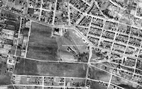
This 1937 aerial photograph shows the location of Horton Field, which was on the Horton Farm near the present-day intersection of 24th Street and Melrose Avenue. It is believed that the first plane to land at Horton Field in 1919 was a barnstormer…
RAC28 1937 Aerial
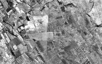
Aerial view of Roanoke Municipal Airfield.
RAC26 Cannaday, Charles
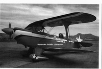
This photo is of Charles "Chuck" Cannaday, grandson of Dr. A.A. Cannaday who once owned the land where the Roanoke Regional Airport is located today. He is pictured in his Pitts special "Cloud Dancer". This airplane was the star of the movie by the…
RAC25 Rotorway Executive
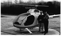
Warren and Hassie Gilbert are pictured beside their Rotorway Executive helicopter that was assembled by Warren Gilbert at their home. The aircraft was registered with the Federal Aviation Administration around the time this photo was taken.
RAC24 Airport Managers
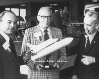
The first three managers of the airport are shown in this image from the 1970s. From right to left is Bob Dunahoe, manager from 1937-1945; Marshall L. Harris, manager from 1945-1974; and Bob Poole, manager from 1974-1991. In 1991, Jacqueline L.…
RAC23 Military Aircraft
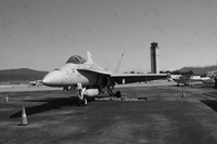
Unknown military aircraft.
RAC22 Stearman
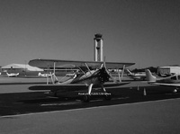
A 1942 Stearman bi-plane is parked on the south ramp at Roanoke Regional Airport. The tower stands in the background. Restoration of these vintage planes has allowed new generations to relive aviation history. Such planes used to be seen regularly…
RAC21 Air Force One
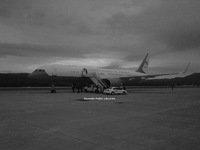
Roanoke Regional Airport was host to this Boeing 757, and on that date the aircraft was designated as "Air Force One" because President Barack Obama was on board. Air Force One pilots have often used Roanoke Regional Airport as a site for "touch and…
RAC20 C-17 Globemaster
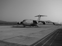
With Tinker Mountain as a backdrop, a C-17 Globemaster sits on the north ramp at Roanoke Regional Airport. This aircraft, one of the US Air Force's largest transport planes, has significant operational flexibility.
RAC19 Private Aircraft
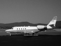
Unknown private aircraft
RAC18 Woodrum Field
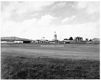
The main facilities at Woodrum Field are seen here as they existed during much of the 1940s. From left to right are Clayton Lemon's hangar, the hangar leased to Martin O'Brien Flying Service (which trained naval cadets until 1944), the terminal…
RAC17 Piedmont Airlines
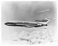
This promotional photograph shows a Piedmont Airlines Boeing 727. Piedmont began using the 727 in January of 1967 in Roanoke. The following year, Piedmont placed the Boeing 737 into service in Roanoke.
RAC16 Terminal Construction
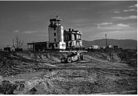
Starting in the fall of 1950, construction began on the first modern terminal facility at Woodrum Field. It was designed to house commercial air service, administrative functions and government services such as weather and air-traffic control. …
RAC15 Roanoke Municipal Airport
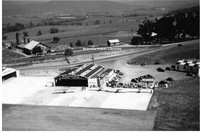
An aerial view of Roanoke Municipal Airport.
RAC14 Woodrum Field
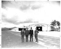
This photograph was taken three days before the dedication and renaming of Roanoke Municipal Airport to Woodrum Field. The airport is receiving a final inspection, having just undergone a $400,000 multifaceted construction project as a WPA Certified…
RAC13 Hillman, Wes
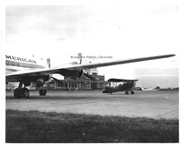
Wes Hillman sits in his Waco "F" in front of the terminal at Woodrum Field. At left is a Pan American DC-4 (most likely a charter, as Pan Am did not serve Roanoke). A Piedmont Airlines DC-3 can be seen in the distance at right.
RAC12 Piedmont Airlines
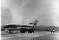
January 1967 saw the introduction of the Boeing 727 by Piedmont Airlines to its routes. The first 727 to visit Woodrum Field is seen here. Just a few months earlier, in November 1966, Piedmont Airlines had opened routes through Roanoke to New York.…
RAC11 Woodrum Field
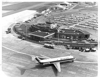
The progress made at Woodrum Field is seen here in 1971. Among the facilities shown are the terminal dedicated in 1953, the nose-in hangar (left of center, top), general aviation hangars and the service hangar for Piedmont Airlines (upper right).…
RAC10 Airport Terminal
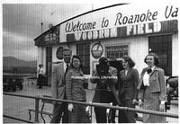
Customers at Woodrum Field pose in front of the soon-to-be-demolished terminal building. Shown here, from left are Mike Davis, June Carr, Parker Smith (behind the scope), Lou Urquhart, and Jo Hambrick. Note the American Airlines and Piedmont logos…
RAC9 Airport Dedication
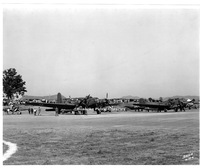
Many types of military aircraft were present in Roanoke at the dedication of the airport. Among them were the Douglas B-23 Dragon (left) and the Douglas B-18 (right).
RAC8 First Flight

The first flight of an aeroplane in the Roanoke Valley occurred at the Great Roanoke Fair, when aviator Eugene Ely flew his Curtiss Pusher biplane from a hill in South Roanoke. Ely flew across the Roanoke River and circled the fairgrounds, where he…
RAC7 Lemon, Clayton
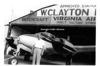
This image shows Clayton Lemon standing in front of the hangar that housed his company, Virginia Airmotive, at the time. Lemon was one of the first pilots in Roanoke to fully understand the "business" of aviation and had a long career at Woodrum…
RAC4 Woodrum, Martha
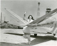
Martha Anne Woodrum displays her trophy for winning a trancontinental air race in 1950. She and her Beechcraft Bonanza were sponsered by Johnson-Carper Furniture of Roanoke.
RAC1 Mason, George H.
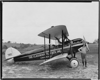
An early Roanoke aviator who used flight for commercial success was George H. Mason, shown here in 1929 with his Waco. Mason sold textbooks throughout Virginia, the Carolinas, George and Florida. He would circle a town, drawing attention, and then…
MPO 34 Huntingdon
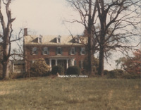
Huntingdon, located at 320 Huntington Boulevard, was built circa 1820 by Elisha Betts. The home underwent extensive renovations in the late 1980s and was added to the National Register of Historic Places in 1991. It now operates as a bed and…
MPO 30 Roanoke Motor Car Company
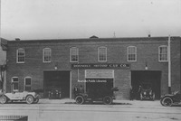
Roanoke Motor Car Company, formerly located at 503 S. Jefferson Street. The company sold Chevrolets.
MP 34.0 Garlands Drugstore
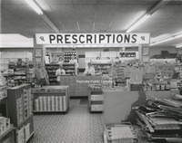
Interior view of Garland's Drugstore, formerly located 1327 Grandin Road.
MP 33.0 Barn Dinner Theatre
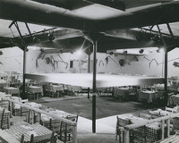
An interior view of the Barn Dinner Theatre. The theatre was created by Roanoker Howard Wolfe as a franchise in 1961. The chain grew to 27 theatres throughout the country. They were characterized by barn inspired architecture and included…
MP 32.7 Fork Ridge Massacre
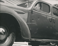
Bullet holes riddle the side of a car involved in the Fork Ridge Mine shootout on 15 April 1941. The shootout was a result of a strike between mine workers and non-union mines operated in Mingo Hollow on the Kentucky-Tennessee border. The massacre…
MP 32.6 Fork Ridge Massacre
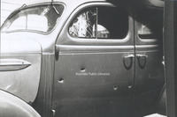
Bullet holes riddle the side of a car involved in the Fork Ridge Mine shootout on 15 April 1941. The shootout was a result of a strike between mine workers and non-union mines operated in Mingo Hollow on the Kentucky-Tennessee border. The massacre…
MP 32.5 Fork Ridge Massacre
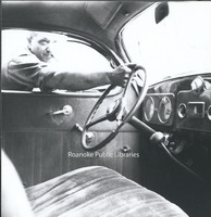
Bullet holes seen from the interior of a car involved in the Fork Ridge Mine shootout on 15 April 1941. The shootout was a result of a strike between mine workers and non-union mines operated in Mingo Hollow on the Kentucky-Tennessee border. The…
MP 32.4 Fork Ridge Massacre
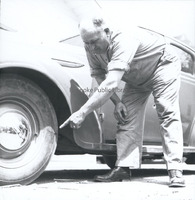
An unidentified man points to bullet holes in the wheel of a car involved in the Fork Ridge Mine shootout on 15 April 1941. The shootout was a result of a strike between mine workers and non-union mines operated in Mingo Hollow on the…
MP 32.3 Fork Ridge Massacre
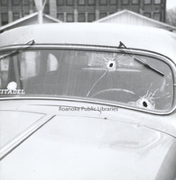
Bullet holes in the windshield of a car involved in the Fork Ridge Mine shootout on 15 April 1941. The shootout was a result of a strike between mine workers and non-union mines operated in Mingo Hollow on the Tennessee-Kentucky border. The…
MP 32.2 Fork Ridge Massacre
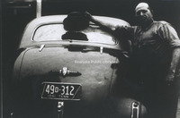
An unidentified man points to bullet holes in the windshield of a car involved in the Fork Ridge Mine shootout on 15 April 1941. The shootout was a result of a strike between mine workers and non-union mines operated in Mingo Hollow on the…
MP 32.1 Fork Ridge Massacre
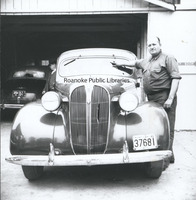
An unidentified man points to bullet holes in the windshield of a car involved in the Fork Ridge Mine shootout on 15 April 1941. The shootout was a result of a strike between mine workers and non-union mines operated in Mingo Hollow on the…
MP 31.7 American Theatre
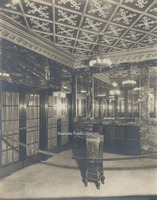
The American Theatre once stood on the corner of Jefferson Street and Kirk Avenue. Built in 1928, the theatre remained in operation until 1971; it was razed in 1973. This view shows the theatre's main entrance with marble walls and brass doors.
MP 31.6 American Theatre
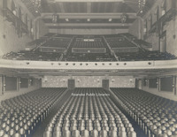
The American Theatre once stood on the corner of Jefferson Street and Kirk Avenue. Built in 1928, the theatre remained in operation unitl 1971; it was razed in 1973. This is a view of the auditorium and balcony as seen from the stage.
MP 31.5 American Theatre
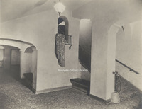
The American Theatre once stood on the corner of Jefferson Street and Kirk Avenue. Built in 1928, the theatre remained in operation until 1971; it was razed in 1973. This view is of a staircase from the mezzanine to the upper balcony and loges.
MP 31.4 American Theatre
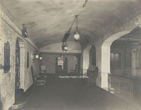
The American Theatre once stood on the corner of Jefferson Street and Kirk Avenue. Built in 1928, the theatre remained in operation until 1971; it was razed in 1973. This view is of the mezzanine.
MP 31.3 American Theatre
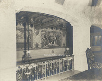
The American Theatre once stood on the corner of Jefferson Street and Kirk Avenue. Built in 1928, the theatre remained in operation until 1971; it was razed in 1973. This view shows paintings in the foyer as seen from the mezzanine.
MP 31.2 American Theatre
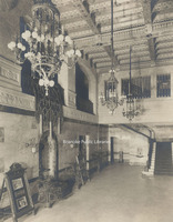
The American Theatre once stood on the corner of Jefferson Street and Kirk Avenue. Built in 1928, the theatre remained in operation until 1971; it was razed in 1973. This view shows the ornately appointed foyer. The placard at left advertises the…
MP 31.1 American Theatre
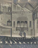
The American Theatre once stood on the corner of Jefferson Street and Kirk Avenue. Built in 1928, the theatre remained in operation until 1971; it was razed in 1973. This view shows the loge, just above the orchestra pit.
MP 31.0 American Theatre
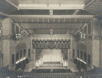
The American Theatre once stood on the corner of Jefferson Street and Kirk Avenue. Built in 1928, the theatre remained in operation until 1971; it was razed in 1973. This interior view is of the stage from the balcony.
MP 30.0 The Barrens
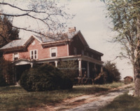
The Barrens was built between 1865 and 1870 by Dr. Francis and Letitia Watts Sorrel. The home was sold to PC Huff in 1900. It stood on the present site of Valley View Mall.
MP 29.0 School Group
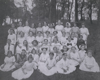
Unidentified group of children pose in Elmwood Park. Terry House in background.
MP 28.3 Bryan, Robert C.
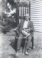
Presumed photo of Robert C. Bryan, a descendant of William Bryan, owner of the Bryan Home. Photo was included with Bryan Home photos.
MP 28.2 Bryan Home
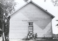
Unidentified group of men pose on the steps of a school or church(?) presumably on the Bryan Homestead property. Photo was included with Bryan Home photos.
MP 28.1 Bryan Home
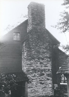
William Bryan's homestead at the Great Spring west of Salem was known as Bryan's On Roanoke, according to F.B. Kegley's Virginia Frontier. Photo depicts detail of stone chimney.
MP 27.3 Engine 609
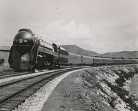
Engine 609 of the Norfolk & Western Railway.
MP 27.2 Engine 604
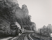
Engine 604 of the Norfolk & Western Railway.
MP 27.1 Engine 601
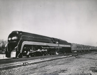
Engine 601 of the Norfolk & Western Railway.
MP 27.0 Engine 2151
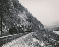
Engine 2151 of Norfolk & Western Railway.
MP 26.0 Equipment Painters
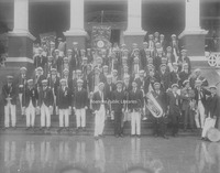
Group photo of the Roanoke Chapter of the Union of Railroad Equipment Painters.
MP 25.0 Roanoke Fire Department
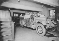
Unidentified Roanoke firemen pose on fire truck.
MP 24.0 Bedford School
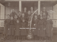
Students from an unknown private school in Bedford. According to notes on photo, "This is a private school in Bedford at Mrs. Witt's house. Miss Amelia Buck, in center, is the teacher.
MP 23.0 Bike Ride
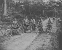
George Davis, far left, poses for a photo during a bike ride up the old Mill Mountain road.
MP 22.2 Marathon Filling Station
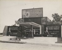
Marathon Filling Station, formerly located at 824 3rd Street.
MP 22.1 Waverly Filling Station
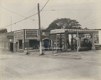
Waverly Filling Station, formerly located at the corner of 14th Street and Jamison Avenue.
MP 22.0 Riverside Filling Station
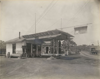
Riverside Filling Station, formerly located at 13th Street next to Woodrum Bridge, which would be replaced by Memorial Bridge.
MP 21.0 USS Roanoke
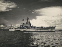
USS Roanoke
MP 20.1 LAWS Children
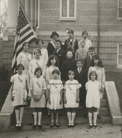
See MP 20.0
MP 20.0 LAWS Children
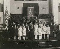
Lawrence Augustine Washington Society Children of the American Revolution at the Daughters of the American Revolution state conference. Members: Holding flag - Charles F. Massey, Junior Vice President, Walter P. Massey, Helen Price Hotoler, Retha…
MP 18 East Building
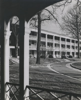
East Building on the campus of Hollins University.
MP 17.0 Steve Brody
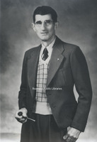
Portrait of Steve Brody
MP 16 Kenmore Plantation
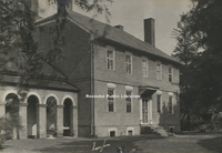
Kenmore Plantation, the home of Fielding and Betty Washington Lewis. Betty was the sister of George Washington.
MP 15.1 State Capitol
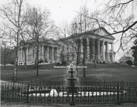
Virginia State Capitol Building.
MP 15.0 State Capitol
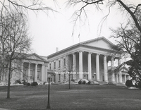
Virginia State Capitol Building.
MP 14.0 Natural Bridge
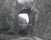
Natural Bridge
MP 12.0 Roanoke EMS
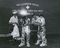
Unidentified members of Williamson Road Life Saving and First Aid Crew suiting up.
MP 11.1 Fink's Jewelers
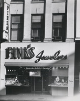
Fink's Jewelers, at its former 310 S. Jefferson Street location.
MP 11.0 Fink's Jewelers
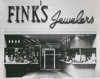
Fink's Jewelers, at its former 310 S. Jefferson Street location.
MP 10.0 Holdren's Service Van

Unidentified service employee of Holdren's stands next to service van at 2272 Westover Avenue.
MP 9.21 Bride's House Sign
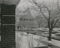
Sign for The Bride's House, formerly located at 2223 Crystal Spring Avenue
MP 9.2 Bride's House Sign
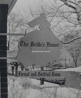
Sign for The Bride's House, formerly located at 2223 Crystal Spring Avenue
MP 9.1 Roanoker Cafeteria Sign
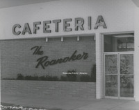
The Roanoker Cafeteria, formerly located at 4142 Melrose Avenue.
MP 9.0 Roanoke Mills Sign
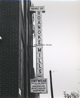
Marquee sign for Roanoke Mills.
MP 8.0 Andrews-Pitzer-Butler
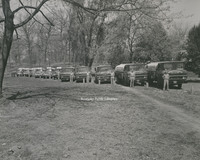
Drivers of Andrews-Pitzer-Butler Fuel Oil Corporation pose next to their trucks in Highland Park.
MP 7.0 Crystal Clear Ice
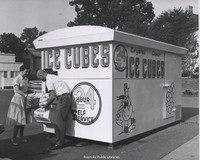
Crystal Clear Ice Cubes vending machine.
MP 6.0 Heironimus Rendering
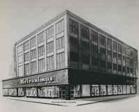
Artist rendering of Heironimus. Artist unknown. Location is 401 S, Jefferson Street.
MP 5.35 Roanoke Advertising Club
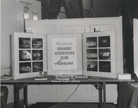
Display at an ad clinic for the Roanoke Advertising Club.
MP 5.32 Finks Advertisement
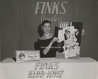
Marcia Fink woman holds a copy of an advertisement for Fink's Jewelers printed in Life Magazine at an advertising clinic
MP 5.31 Advertising Clinic
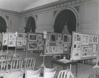
Advertising displays at an advertising clinic held at the Hotel Roanoke.
MP 5.3 Advertising Clinic
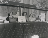
Unidentified women sit at registration desk of an Advertising Clinic held at the Hotel Roanoke to promote the Valley's businesses and industries.
MP 5.25 WSLS Channel 10
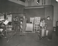
Inside the WSLS Channel 10 studio during merchandising promotion.
MP 5.24 WSLS Channel 10
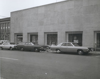
Advertising displays in the windows of WSLS Channel 10, located at 401 3rd Street.
MP 5.23 Election Returns
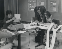
Staff of WSLS Channel 10 await results of the 1967 elections in the newsroom.
MP 5.22 Election Returns
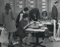
Staff of WSLS Channel 10 await results of the 1967 elections in the newsroom.
MP 5.21 WSLS Channel 10
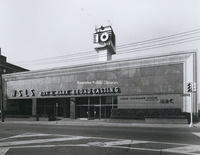
WSLS Channel 10 News station, located at 401 3rd Street.
MP 5.2 WSLS Channel 10
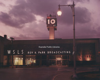
WSLS Channel 10 News station, located at 401 3rd Street.
MP 5.01 Lady Byrd Johnson
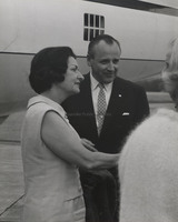
Lady Byrd Johnson greets the press and spectators at Roanoke Regional Airport during the Landscape-Landmark Tour. This tour led to the Highway Beautification Act of 1965. She stands with Director of the National Park Service, George Harzog.
MP 5.0 Lady Byrd Johnson
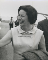
Lady Byrd Johnson greets the press and spectators at Roanoke Regional Airport during the Landscape-Landmark Tour. This tour led to the Highway Beautification Act of 1965
MP 4.9 Noble's Flowers
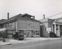
Nobel's Flowers, formerly located at 430 Church Avenue.
MP 4.8 Henri Kessler
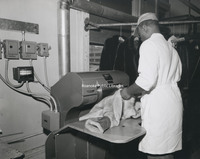
An unidentified employee works with a fur coat at Henri Kessler Furriers, formerly located at 117 Campbell Avenue.
MP 4.71 Patrick Henry Hotel
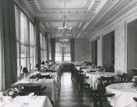
Dining room of the Patrick Henry Hotel.
MP 4.7 Patrick Henry Hotel
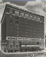
Superimposed image of the Patrick Henry Hotel.
MP 4.6 Fishburn Library
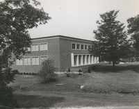
Fishburn Library at Hollins University
MP 4.5 Roanoke Memorial
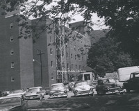
Rear view of Roanoke Memorial Hospital
MP 4.4 Salem Avenue
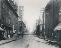
Looking west on Salem Avenue toward the intersection with Jefferson Street.
MP 4.3 Roanoke Country Club
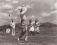
Promotional shot of golfers at Roanoke Country Club. The club had its beginnings in South Roanoke in 1899, It relocated to its current location in the early 1920s.
MP 4.2 Mabry Mill
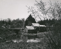
Mabry Mill was built by Edwin Boston Mabry. E.B. Mabry returned to Floyd County in 1903 and began the construction of the mill. It was first a blacksmith and wheelwright shop, then became a sawmill. By 1905 it was in operation as a gristmill. By…
MP 4.1 Terry House
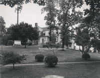
The Terry House, formerly located in Elmwood Park, was the first library in the city.
MP 4.0 Home on Franklin
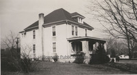
Home formerly located on the southwest corner of Franklin Road and Broadway Avenue.
MP 3.9 Hotel Roanoke Garage
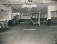
Garage under the Hotel Roanoke.
MP 3.81 Hut Restaurant
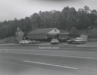
Hut Restaurant in Collinsville, Virginia.
MP 3.8 Hut Restaurant
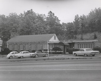
Hut Restaurant in Collinsville, Virginia.
MP 3.7 Mill Mountain Star
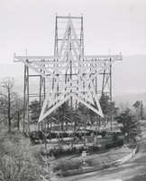
Mill Mountain Star was constructed in 1949 by the Roanoke Merchants Association to kick off the 1949 holiday shopping season. Though at first the star was not meant to be lit all year, it became popular enough with citizens that it was decided to…
MP 3.6 Peters Creek Brethren
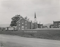
Peters Creek Church of the Brethren, located in the 5300 block of Cove Road.
MP 3.5 Towers Mall
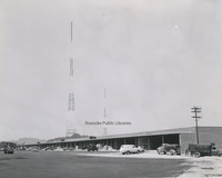
Towers Mall under construction. Towers opened in 1961 at 2207 Colonial Avenue. At the time, it was reported in the Roanoke Times that Towers was the largest shopping center in the state. This photo depicts the upper level.
MP 3.42 Roanoke Salem Plaza
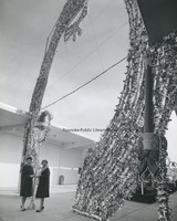
Two unidentified women pose next to Christmas decorations at the Roanoke Salem Plaza.
MP 3.41 Roanoke Salem Plaza
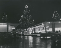
Roanoke Salem Plaza opened in 1962. It was the third largest shopping center to open in the valley, with Crossroads being the first and Towers, the second.
MP 3.4 Roanoke Salem Plaza
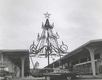
Roanoke Salem Plaza opened in 1962. It was the third largest shopping center to open in the valley, with Crossroads being the first and Towers, the second.
MP 3.3 A&U Mobile Homes
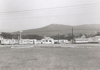
A&U Mobile Homes, formerly located at 1827 W. Main Street in Salem
MP 3.21 Hallmark Shop
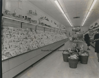
Interior view of Hallmark Hall of Cards, formerly located at 301 S. Jefferson St.
MP 3.2 Hallmark Shop
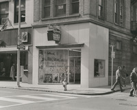
Hallmark Hall of Cards store, formerly located at 301 S. Jefferson Street.
MP 3.13 Reid and Cutshall
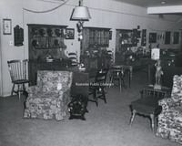
Interior view of Reid and Cutshall Furniture. This photo is believed to have been taken in the Brandon Avenue location.
MP 3.12 Reid and Cutshall
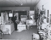
Interior view of Reid and Cutshall Furniture. This photo is believed to have been taken in the Brandon Avenue location. Individuals unidentified.
MP 3.11 Reid and Cutshall
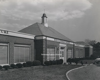
Reid and Cutshall Furniture Wayside, formerly located at 3441 Brandon Avenue.
MP 3.1 Reid and Cutshall
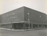
Reid and Cutshall Furniture, formerly located at 301 3rd Street.
MP 3.0 Reid and Cutshall
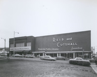
Reid and Cutshall Furniture, formerly located at 301 3rd Street.
MP 2.9 Roanoke Industrial Loan
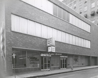
Roanoke Industrial Loan and Thrift, formerly located at 20 Franklin Road.
MP 2.8 Roanoke Valley Motors
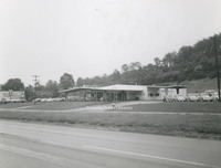
Roanoke Valley Motors, formerly located at 2239 Franklin Road.
MP 2.72 Elliott Buick
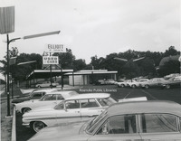
Elliott Buick, formerly located at 4721 Melrose Avenue NW.
MP 2.71 Elliott Buick
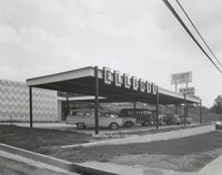
Elliott Buick, formerly located at 4721 Melrose Avenue NW.
MP 2.7 Elliott Buick
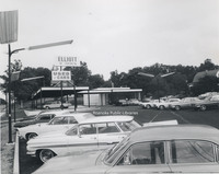
Elliott Buick, formerly located at 4721 Melrose Avenue NW.
MP 2.6 Franklin and Williamson
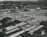
Looking south toward the intersection of Franklin Road and Williamson Road. The parking lots visible here became the Norfolk Southern building, Franklin Plaza, and a parking garage.
MP 2.5 Hotel Roanoke
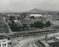
Hotel Roanoke. Civic Center and I581 can be seen to the right. First Baptist Church, destroyed by fire in 1995, and St. Andrews can be seen at left.
MP 2.4 Roanoke City Mills

An aerial view of the Roanoke City Mills, once located at 1750 Jefferson Street. The mill facility was razed in 2009.
MP 2.31 Victory Stadium
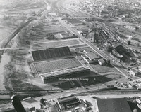
An aerial view of Victory Stadium. Victory Stadium was built in 1942 and razed in 2006.
MP 2.3 Victory Stadium
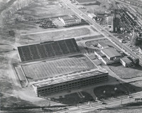
An aerial view of Victory Stadium. Victory Stadium was built in 1942 and razed in 2006.
MP 2.2 Mill Mountain Zoo
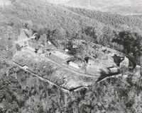
An aerial view of Mill Mountain Zoo. The zoo opened in 1952.
MP 2.1 Roanoke Aerial
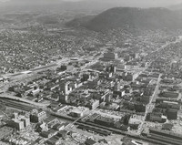
An aerial view looking toward Mill Mountain. I581 can be seen under construction on the left .
MP 2.0 Roanoke Aerial
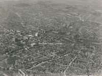
General view of Roanoke from 8000 ft.
MP 1.9 Streetcar
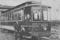
Unidentified streetcar employees pose next to a streetcar. Location unknown.
MP 1.8 Streetcar
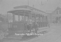
Unidentified streetcar employees pose next to a streetcar in Richmond. Destination sign reads Oakwood and Broad Street.
MP 1.7 Fortune, George E.
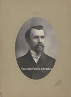
Portrait of George Fortune.
MP 1.6 Fortune, George E.
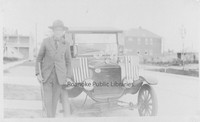
George Fortune poses next to a car. Location unknown.
MP 1.5 Fortune, George E.
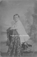
George Fortune as a child. Born in Rocky Mount, 22 February 1879, to Charles McDonald Fortune and Cleopatra Board Gill.
MP 1.4 Wood, Molly W.
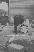
Molly W. Wood milking a cow at her son Jessie's farm in Cave Spring.
MP 1.3 Fortune, Roberta B.
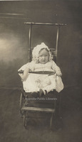
Roberta Blanton Fortune as an infant. She was born 6 August 1913 to George E. Fortune and Mara Ophelia Blanton.
MP 1.2 Fortune, Frances C.
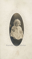
Frances Elvira Fortune as an infant. She was born 31 December 1909 to George E. and Mara Ophelia Blanton.
MP 1.1 Fortune, William D.
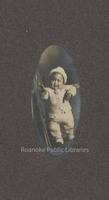
William D. Fortune as an infant. Fortune was born 24 September 1908 to George E. Fortune and Mara Ophelia Blanton.
VF6 Smith Mountain Lake
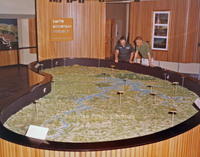
Model of Smith Mountain Lake.
VF5 Smith Mountain Lake
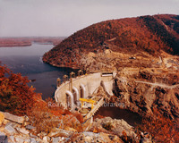
Aerial view of Smith Mountain Lake Dam.
VF4 Smith Mountain Lake
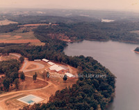
Aerial view of Smith Mountain Lake.
VF3 Smith Mountain Lake Picnic Area
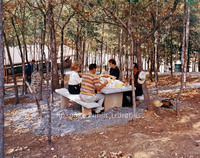
Picnic area at Smith Mountain Lake.
VF2 Smith Mountain Lake
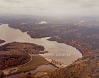
Aerial view of Smith Mountain Lake.
VF1 Smith Mountain Lake Dam
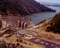
Aerial view of Smith Mountain Lake Dam.
UC 9 Williamson Road Plaza
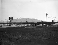
Williamson Road Plaza, located in the 5300 block of Williamson Road.
UC 81 Colonial Avenue Baptist
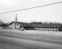
Colonial Avenue Baptist Church, located at 4165 Colonial Avenue.
UC 80 Cycle Center

Cycle Center, formerly located at 406 E. 4th Street.
UC 8 Texaco
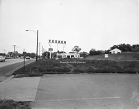
Texaco station formerly located in the 5200 block of Williamson Road.
UC 79 Southampton Model
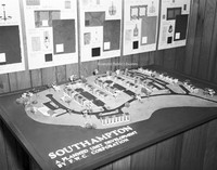
3-dimensional scale model of Southampton Townhomes.
UC 78 Southampton
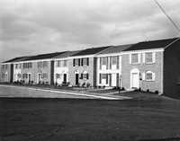
Southampton townhomes, located off of Wyndham Drive in Vinton.
UC 77 Southampton
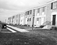
Southampton townhomes, located off of Wyndham Drive in Vinton.
UC 75 Roanoke EMS
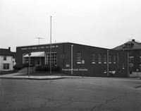
Roanoke Life Saving and First Aid Crew hall, located at 374 Day Avenue.
UC 72 Allied Sales
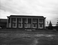
Allied Sales Company, formerly located at 2480 Patterson Avenue.
UC 71 Thomas Rutherfoord
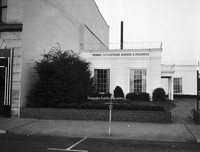
Thomas Rutherfoord Bonding and Insurance, located at 1 S. Jefferson Street.
UC 7 Northview UMC
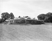
Northview United Methodist Church, located at 521 Ridgecrest Drive.
UC 65 Flood Aerial
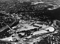
Aerial view showing flood damage brought on by Hurricane Camille.
UC 64 Poff Hauling
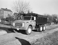
J. Bill Poff Hauling dump truck.
UC 62 Hundleys Market
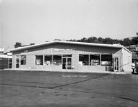
Hundley's Market, formerly located at 3605 Shenandoah Avenue.
UC 58 Gulf Truckstops
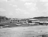
Gulf Truckstops at Troutville.
UC 57 Loyd & Fralin
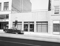
Loyd and Fralin Attorneys, formerly located at 301 Campbell Avenue.
UC 56 Kroger Bakery
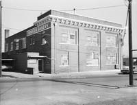
Kroger Bakery, formerly located at 541 Salem Avenue.
UC 55 Crofton
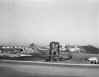
The Crofton subdivision off of Hardy Road in Vinton.
UC 54 Kelleys
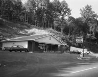
Kelley's Restaurant, formerly located at 4328 Salem Turnpike.
UC 53 Kroger Bakery
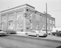
Kroger Bakery, formerly located at 541 Salem Avenue.
UC 51 Magic City Ford
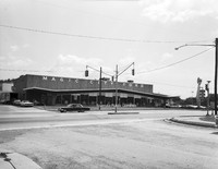
Magic City Ford, located at 809 Williamson Road.
UC 50 Peters Realty
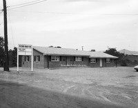
Peters Realty, formerly located at 623 Abney Road.
UC 49 Andys Cards & Candies
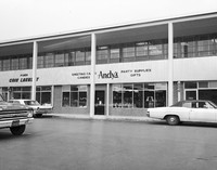
Andy's Cards and Candies, formerly located in Townside Festival Shopping Center.
UC 48 Flora & Martin
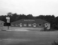
Offices located at 701 Brandon Avenue, including Flora and Martin Insurance, Department of Taxation and Jean Moore Custom Frames.
UC 47 Roanoke Box

Roanoke Box, formerly located at 621 Ashlawn Street.
UC 45 Booth Supply
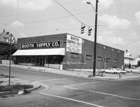
Booth Supply, formerly located at 828 Jamison Avenue.
UC 43 View from MM
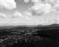
View of the Roanoke Valley from Mill Mountain.
UC 42 Kenneys
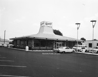
Kenney's, formerly located at 4317 Williamson Road.
UC 41 Chewning Garage
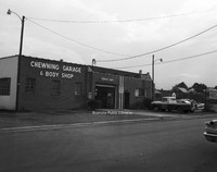
Chewning Garage, formerly located at 3034 Wentworth Avenue.
UC 39 Normandy Knoll
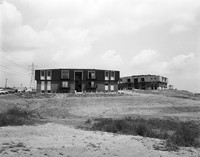
Construction of Normandy Knoll Apartments located at 3513 Normandy Lane. These apartments were built on a former 9-hole golf course called Devil's Elbow.
UC 38 81-43 Restaurant
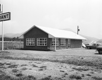
81-43 Restaurant, formerly located at 8131 Plantation Road.
UC 37 81-43 Restaurant
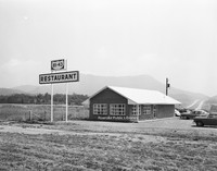
81-43 Restaurant, formerly located at 8131 Plantation Road.
UC 36 81-43 Restaurant Interior
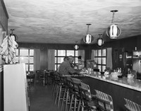
Interior of the 81-43 Restaurant, formerly located at 8131 Plantation Road.
UC 35 Windsor West
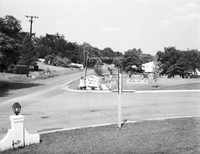
Entrance to the Windsor West neighborhood at the intersection of Grandin Road and Charing Cross Drive.
UC 34 Windsor West
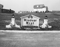
Sign at the entrance of the Windsor West neighborhood, located at the intersection of Grandin Road and Charing Cross Drive.
UC 32 Colonial-American
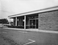
Colonial-American National Bank, formerly located at 1953 Franklin Road.
UC 31 Colonial-American
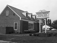
Colonial-American National Bank, formerly located at 2112 Colonial Avenue.
UC 30 American Motor Inns
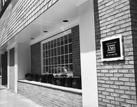
American Motor Inns, formerly located at 103 Campbell Avenue.
UC 3 Harry Dixon
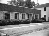
Harry Dixon Insurance, formerly located at 3226 Brambleton Avenue.
UC 29 Bantam Market
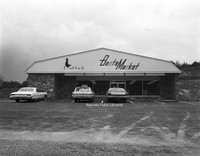
Bantam Market, formerly located at 3515 Franklin Road.
UC 27 Kenneys
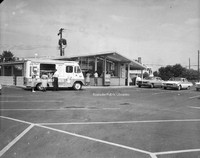
Kenney's, formerly located at 5324 Williamson Road.
UC 25 Billys Barn
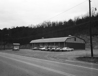
Billy's Barn, located at 1790 Thompson Memorial Drive.
UC 24 Hospital Computer Service
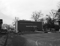
Hospital Computer Service, formerly located at 1147 2nd Street.
UC 22 Aerial of Downtown
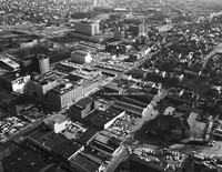
Aerial view of Downtown Roanoke.
UC 21 Aerial of Downtown
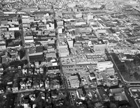
Aerial view of Downtown Roanoke.
UC 20 Colonial-American
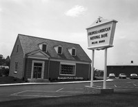
Hollins Branch of Colonial-American National Bank, formerly located at 7337 Williamson Road.
UC 2 Boyle-Swecker
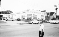
Boyle-Swecker Tire Company, formerly located at 715 Patterson Avenue.
UC 19 Colonial-American
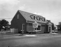
Colonial-American National Bank, formerly located at 210 Washington Street in Vinton..
UC 18 Colonial-American
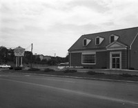
Colonial-American National Bank, formerly located at 3002 Brandon Avenue.
UC 17 Brandon Avenue
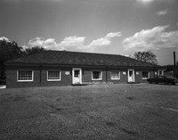
Offices located at 701 Brandon Avenue.
UC 16 Community Hospital
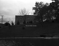
Community Hospital as seen from Elmwood Park.
UC 15 Elmwood Park Pond
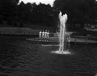
Unidentified nurses pose next the pond once located in Elmwood Park.
UC 14 Humble Esso
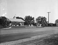
Humble Esso, formerly located at 3611 Brandon Avenue.
UC 13 Humble Esso
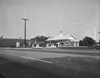
Humble Esso, formerly located at 3611 Brandon Avenue.
UC 12 Magnolia
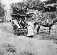
Unidentified individuals with a carriage in front of Magnolia. Magnolia was located at the corner of Orange Avenue and Williamson Road,. Built in 1837 by Zachariah Robinson as a tavern, Magnolia was a popular stop for stagecoach traffic until 1850…
UC 10 Jacks Laundromat
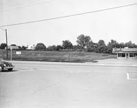
Jack's Laundromat, formerly located at 5312 Williamson Road.
UC 1 Boyle-Swecker
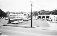
Boyle-Swecker Tire Company, formerly located at 715 Patterson Avenue.
CPC 9e Phillip Levy Fire
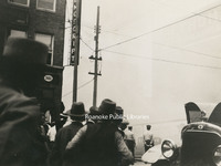
The Philip Levy Exchange Company furniture store caught fire for the second time on 31 August 1928. The first fire occurred the previous year and only caused minor damage. This fire would prove more disastrous. Philip Levy Exchange Company was…
CPC 9d Phillip Levy Fire
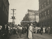
The Philip Levy Exchange Company furniture store caught fire for the second time on 31 August 1928. The first fire occurred the previous year and only caused minor damage. This fire would prove more disastrous. Philip Levy Exchange Company was…
CPC 9c Phillip Levy Fire
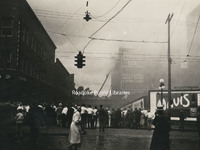
The Philip Levy Exchange Company furniture store caught fire for the second time on 31 August 1928. The first fire occurred the previous year and only caused minor damage. This fire would prove more disastrous. Philip Levy Exchange Company was…
CPC 9b Phillip Levy Fire
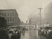
The Philip Levy Exchange Company furniture store caught fire for the second time on 31 August 1928. The first fire occurred the previous year and only caused minor damage. This fire would prove more disastrous. Philip Levy Exchange Company was…
CPC 9a Phillip Levy Fire
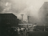
The Philip Levy Exchange Company furniture store caught fire for the second time on 31 August 1928. The first fire occurred the previous year and only caused minor damage. This fire would prove more disastrous. Philip Levy Exchange Company was…
CPC 99 Madison and 2nd
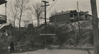
East side of 2nd Street NE and Madison Avenue. I-581 runs through this area today.
CPC 98 Madison Avenue
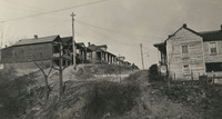
Madison Avenue east from 2nd Street NE. I581 runs through this area today.
CPC 8 Campbell and Chapman
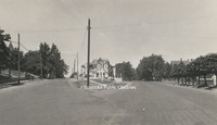
Point where Chapman Avenue forks off of Campbell Avenue
CPC 7e Campbell Avenue
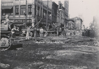
Removal of street railways on Campbell Avenue at the intersection with Jefferson Street.
CPC 7d Campbell Avenue
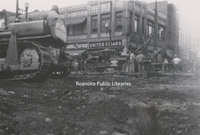
Removal of street railways on Campbell Avenue at the intersection with Jefferson Street.
CPC 7c Campbell Avenue
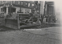
Removal of street railways on Campbell Avenue at the intersection with Jefferson Street.
CPC 7b Campbell Avenue
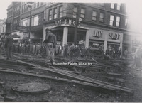
Removal of street railways on Campbell Avenue at the intersection with Jefferson Street.
CPC 7a Campbell Avenue
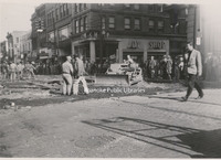
Removal of street railways on Campbell Avenue at the intersection with Jefferson Street.
CPC 65 Highland Park
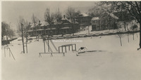
Looking south from Highland Park.
CPC 64 Norfolk Avenue
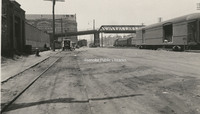
Looking west on Norfolk Avenue.
CPC 62 Shenandoah Avenue
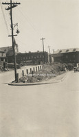
Shenandoah Avenue and Centre Avenue. Norfolk & Western General Offices visible in background.
CPC 60 Ridgewood
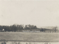
Ridgewood Manor House, was built by industrialist Samuel H. McVitty. It is located at 1900 South Clearing Road just above Ridgewood Farms Shopping Center.
CPC 6 Highland and Franklin
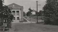
Jog intersection at Highland Avenue and Franklin Road. Beth Israel Synagogue visible.
CPC 59a Bryan McDonald House
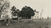
Located near Mt. Union village on the headwaters of Tinker Creek in Botetourt County, the Bryan McDonald house was built in 1766.
CPC 58 Crystal Spring
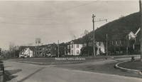
Houses along Richelieu Avenue in Crystal Spring.
CPC 57 Freight Truck
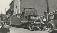
Southern States Motor Freight truck parked on the 100 block of Campbell Avenue.
CPC 54 Elmwood Pond
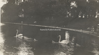
Swans in the pond once located in Elmwood Park.
CPC 53 Terry House
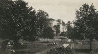
Terry House, formerly located in Elmwood Park. The Terry House was gifted to the City of Roanoke in 1921 for use a library. It operated in this capacity until a new library was built in 1952.
CPC 52 Japanese Magnolia
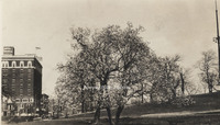
Japanese Magnolia in Elmwood Park.
CPC 5 Church and 5th
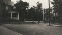
Jog intersection at Church Avenue and 5th Street.
CPC 48 10th Street
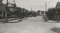
Looking north on 10th Street from Madison Avenue.
CPC 47 2nd Street
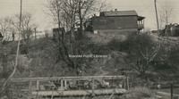
2nd Street NE at the intersection of Lick Run.
CPC 46 Orange Avenue
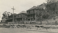
Derelict homes along Lynchburg(Orange) Avenue. Exact location unknown.
CPC 44 Orange Avenue
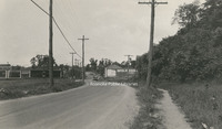
Looking east on Lynchburg (Orange) Avenue.
CPC 43 Elmwood Park
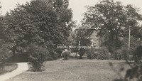
A view in Elmwood Park.
CPC 42 2nd Street
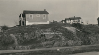
A view of 2nd Street NE between Walker Avenue and Rutherford Avenue.
CPC 41 Rorer Avenue
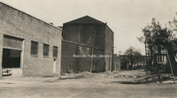
Looking east on Rorer Avenue from 5th Street.
CPC 40 Wells Avenue
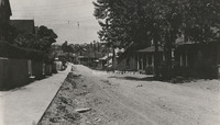
Looking west on Wells Avenue.
CPC 4 Franklin and Mountain
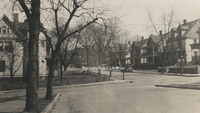
Jog intersection at Franklin Road and Mountain Avenue.
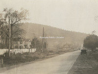
CPC 39 Bullitt Avenue
Looking west at the 500 block of Bullitt Avenue.
CPC 38 Church and 3rd
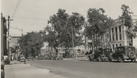
Looking east on Church Avenue from 3rd Street. Post office (now Commonwealth Building) is under construction at right.
CPC 37 Church and 3rd
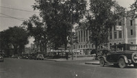
Looking east on Church Avenue from 3rd Street. Post office (now Commonwealth Building) is under construction at right.
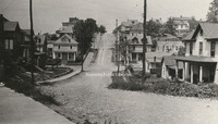
CPC 36 Crystal Spring
Looking up Crystal Spring Avenue from roughly 23rd Street.
CPC 35 2nd and Rutherford
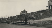
Intersection of 2nd Street and Rutherford Avenue NE.
CPC 3 Stone Home
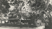
The home of Edward L. Stone of Stone Printing and Manufacturing, formerly located at 210 Mountain Avenue.
CPC 29 2nd Street

2nd Street NE at Lick Run.
CPC 28 Wells Avenue
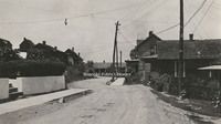
Jog at Wells Avenue NW.
CPC 27 Walker Avenue
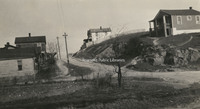
View of Walker Avenue at the intersection with 2nd Street NE.
CPC 26 2nd Street
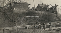
Unidentified children at Lick Run along 2nd Street NE.
CPC 25 Furnace Row
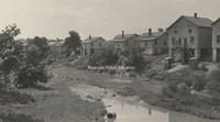
A view of Furnace Row on Tinker Creek, once roughly located at Orange Avenue and Rhodes Avenue.
CPC 24 Albemarle Avenue
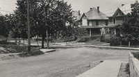
Looking toward Albemarle from the 6th Street intersection.
CPC 23 Albemarle Avenue
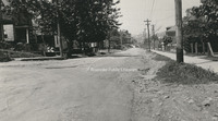
Looking west an Albemarle Avenue SE at the 6th Street intersection.
CPC 22 Hollins Entrance
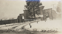
Entrance to Hollins College.
CPC 21b Trout Field
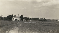
Located adjacent to and east of Fairview Cemetery along Melrose Avenue, Trout Field was Roanoke's first airfield.
CPC 21a Trout Field
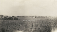
Located adjacent to and east of Fairview Cemetery along Melrose Avenue, Trout Field was Roanoke's first airfield.
CPC 20 Moorman Spring
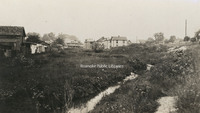
Moorman Spring was located on the Captain Robert B. Mooman property roughly located at the intersection of Moorman Avenue and 10th Street.
CPC 2 SW from YMCA
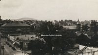
Looking southwest from the top of the YMCA building on 2nd Street. Lee Junior High School is visible in the left background.
CPC 19 Mill Mountain
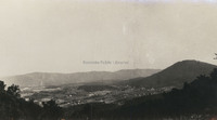
Looking south from atop Mill Mountain.
CPC 18 Dale and 8th
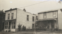
Structures once located at the corner of Dale Avenue and 8th Street.
CPC 17 Wasena Bridge
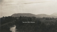
A view of Wasena Bridge from Riverside Boulevard.
CPC 16 Orange Avenue
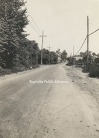
Looking east from about the 1100 block of Lynchburg (Orange) Avenue.
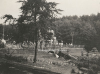
CPC 14a Riverside Park
Pool at Riverside Park
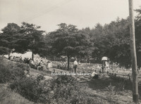
CPC 14b Riverside Park
Pool at Riverside Park
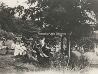
CPC 14c Riverside Park
People sitting on the knoll overlooking the pool in Riverside Park.
CPC 13 2nd Street
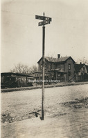
Sign at intersection of 2nd Street NE and unknown cross street.
CPC 128 4th Street
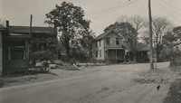
A view of 4th Street NE in the Gilmer School area. Exact location unknown.
CPC 12 Graybar Electric
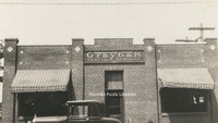
Storefront of Graybar Electric Company, formerly located at 603 Salem Avenue.
CPC 11 Raleigh Tavern
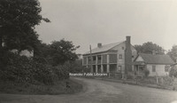
Raleigh Tavern, Roanoke's first hotel, was located on Lynchburg (Orange) Avenue NE. Built in the early 1800s and long known as Pate's Tavern, it was a popular stopping-place on the north-south stages or on the road from Lynchburg west to Seven Mile…
CPC 10d 4th Street
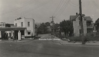
View of 4th Street NE. Northside Filling Station was located at 1201 4th, roughly where the post office is located today.
CPC 10c 4th Street
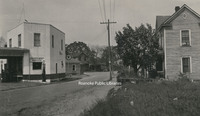
View of 4th Street NE. Northside Filling Station was located at 1201 4th, roughly where the post office is located today.
CPC 10b 4th Street
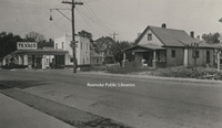
View of 4th Street NE. Northside Filling Station was located at 1201 4th, roughly where the post office is located today.
CPC 10a 4th Street
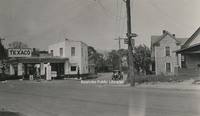
View of 4th Street NE. Northside Filling Station was located at 1201 4th, roughly where the post office is located today.
CPC 100 Hanover Avenue
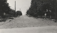
Looking west on Hanover Avenue from 10th Street.
CPC 1 Goodwin Home
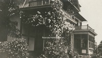
Rose arbor on the porch of the Thompson Goodwin home, once located in Orchard Hill. Orchard Hill, also known as "Official Hill" was located in the area where Community Hospital stands today.
RNC 117 Woodlawn Avenue
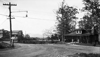
Woodlawn Avenue at the intersection with Montgomery Avenue.
RNC 8 Wilson & Company
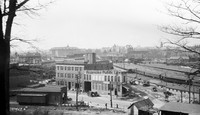
Wilson & Company, seen in the foreground, was a wholesale meat company. It was located at 312 Campebell Avenue SE. Hotel Roanoke and N&W General Offices can be seen in background.
RNC 85 Tinker Mountain
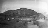
A view of Tinker Mountain.
RNC 70 Tinker Creek

A view of Tinker Creek.
RNC 54 Jefferson Theatre
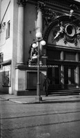
Jefferson Theatre, formerly located at 417 S. Jefferson Street.
RNC 9 St. Andrews
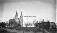
St. Andrews Catholic Church.
RNC 4 Shenandoah
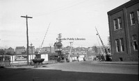
Austin & Martin Auto Repair, formerly located at 223 Shenandoah Avenue NW.
RNC 41 Big Oak Filling Station
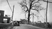
Big Oak Filling Station was located around the 2500 block of Williamson Road.
RNC 11 Roanoke High School
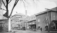
Roanoke High School was formerly located on the northeast corner of Church Avenue and 3rd Street where the Noel C. Taylor Municipal building stands today.
RNC 2 Highland Park School
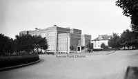
Highland Park Elementary School, located at 1212 5th Street.
RNC 63 Commerce Street School Site
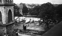
A nearly gone Commerce Street or First Ward School. The school stood at Church Avenue and 2nd Street and was razed to make way for the post office.
RNC 64 Commerce Street School Site
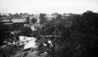
A nearly gone Commerce Street or First Ward School. The school stood at Church Avenue and 2nd Street and was razed to make way for the post office.
RNC 40 Commerce Street School
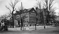
Commerce Street School, also called First Ward School, was located at the corner of Church Avenue and 2nd (Commerce) Street. Built in 1890, it was razed in 1929 to make room for the post office.
RNC 18 Quick Way
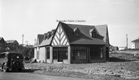
Quick Way convenience store, located at 2209 Brandon Avenue.
RNC 24 Memorial Avenue
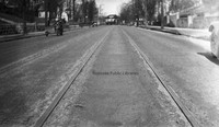
Streetcar tracks on the 700 block of Memorial Avenue.
RNC 150 Orange Avenue
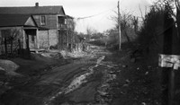
Orange Avenue, exact location unknown.
RNC 86 Orange Avenue
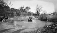
Driving could be a challenge on Orange Avenue in its early days. View is looking west near Gainsboro Road.
RNC 15 Norfolk Avenue
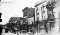
A view of Norfolk Avenue includes Bannister's Place (a boarding house) and HC Barnes Pharmacy. Buildings were located roughly where the Wells-Fargo Tower is today.
RNC 3 N&W Salvage
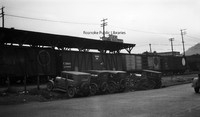
Norfolk & Western Salvage Warehouse, formerly located at 201 Campbell Avenue SE.
RNC 39 N&W Freight Station
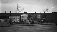
Lots for sale in front of the Norfolk & Western freight station on Norfolk Avenue.
RNC 73 N&W Underpass
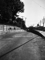
One-lane road under a Norfolk & Western underpass through which traffic accessing 460 East would pass.
RNC 51 Municipal Building
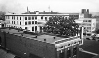
A view of the municipal building from the YMCA.
RNC 146 Municipal Building
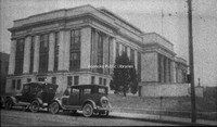
View of the Municipal Building from 2nd Street and Campbell Avenue.
RNC 80 WWI Monument
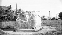
This monument was erected in 1925 by the Margaret Lynn Lewis Chapter of the DAR to honor Roanoke soldiers who served in World War I. It is located in Argonne Circle on King George Avenue.
RNC 152 WWI Monument
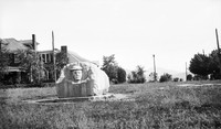
This monument was erected in 1925 by the Margaret Lynn Lewis Chapter of the DAR to honor Roanoke soldiers who served in World War I. It is located in Argonne Circle on King George Avenue.
RNC 47 Monticello
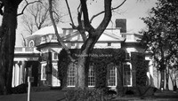
Side view of Monticello.
RNC 118 Mill Mountain
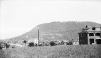
A view of Mill Mountain from Old Southwest.
RNC 5 Mick or Mack
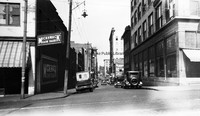
Mick or Mack, formerly located at 310 2nd Street.
RNC 101 Jefferson Street
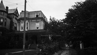
Home formerly located at 815 S. Jefferson Street.
RNC 42 Jefferson Street
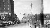
Looking north on Jefferson Street from Elmwood Park.
RNC 56 Jefferson Street
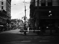
Looking north on Jefferson Street from Campbell Avenue.
RNC 55 Patrick Henry
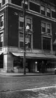
The Patrick Henry Hotel.
RNC 16 Heironimus
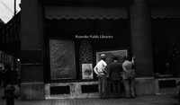
John Nolen's plans for the City of Roanoke on display in the windows of Heironimus.
RNC 84 Gregory Avenue
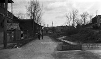
Gregory Avenue at the intersection with 2nd Street NE.
RNC 50 Franklin Road
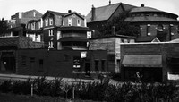
A view of the 200 block of Franklin Road, where the Verizon building sits today. First Baptist Church can be seen over the buildings at left. The building on the right with the round portion was the original First Baptist Church.
RNC 10 Fire Station 7
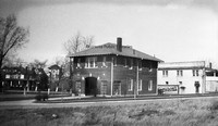
The original Fire Station 7, located at 1742 Memorial Avenue.
RNC 139 Commerce Street School
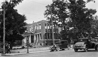
Demolition of the Commerce Street School, also known as the First Ward School.
RNC 52 Church Avenue
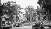
Commerce Street School being razed to make room for the post office. Greene Memorial United Methodist Church can be seen in background.
RNC 60 Church Avenue
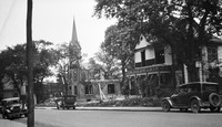
Demolition of St. John's Episcopal and a house on Church Avenue to make way for the post office.
RNC 81 Church Avenue
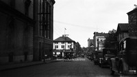
Looking east on Church Avenue from the 100 block.
RNC 132 Church and 2nd
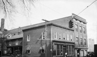
Buildings once located at 2nd Street and Church Avenue where the Commonwealth Building stands today.
RNC 148 Carvins Cove Dam
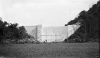
Carvins Cove Dam Shortly after completion. The reservoir would not be complete until the 1940s.
RNC 147 Carvins Cove Dam
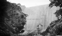
Carvins Cove Dam Shortly after completion. The reservoir would not be complete until the 1940s.
RNC 38 Carvins Cove Dam
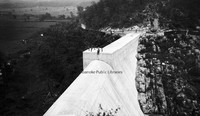
Carvins Cove Dam shortly after completion. The reservoir would not be complete until the 1940s.
RNC 37 Carvins Cove Dam
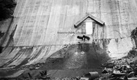
Carvins Cove Dam shortly after completion. The reservoir would not be complete until the 1940s.
RNC 29 GW Copenhaver
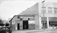
Vacant storefront on Williamson Road between Church Avenue and Kirk Avenue. The building was once occupied by blacksmith G.W. Copenhaver. The site is now a parking lot.
RNC 94 Avon Road
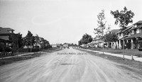
Looking north on Avon Road at the intersection with Sherwood Avenue.
RNC 17 Windsor Apartments
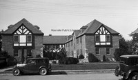
Apartments located at 2049 Windsor Avenue at the corner of Brunswick Street.
RNC 120 6th Street SE
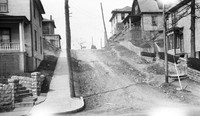
Looking north on 6th Street SE from Tazewell Avenue.
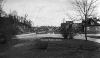
RNC 66 2nd Street
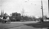
Looking north on 2nd Street NE at the intersection with Patton Avenue.
RNC 130 2nd Street
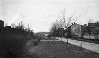
Looking north on 2nd Street NE.
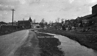
RNC 72 2nd Street
Looking north on 2nd Street just beyond Patton Avenue..
RNC 65 2nd Street
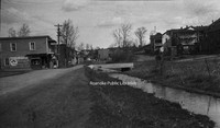
Looking north on 2nd Street NE. Lick Run is the stream at right. Extreme right is the location of I581.
YMCA 065

William A. Hunton Branch YMCA
YMCA 026

William A. Hunton Branch YMCA
Back of Photograph: " Father and Son Banquet, November 19, 1957, Star City Auditorium, 6:30 pm."
Back of Photograph: " Father and Son Banquet, November 19, 1957, Star City Auditorium, 6:30 pm."
YMCA 025

William A. Hunton Branch YMCA
Back of Photograph: "Father and Son Banquet."
Back of Photograph: "Father and Son Banquet."
YMCA 018

William A. Hunton Branch YMCA
YMCA 007

William A. Hunton YMCA
YMCA 101
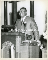
William A. Hunton Branch YMCA
YMCA 096
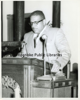
William A. Hunton Branch YMCA
YMCA 095
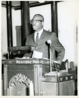
William A. Hunton Branch YMCA
YMCA 083
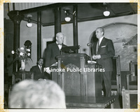
William A. Hunton Branch YMCA
Dr. Harry Penn on right and Dr. F. W. Claytor on far right, seated.
Dr. Harry Penn on right and Dr. F. W. Claytor on far right, seated.
YMCA 082
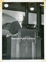
William A. Hunton Branch YMCA
YMCA 080
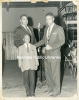
William A. Hunton Branch YMCA
Back of photograph: " Father and Son Banquet."
Back of photograph: " Father and Son Banquet."
YMCA 079
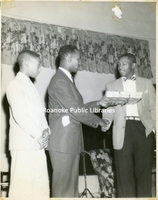
William A. Hunton Branch YMCA
Back of photograph: "1967 Father and Son Banquet, father and son who look alike."
Back of photograph: "1967 Father and Son Banquet, father and son who look alike."
YMCA 073
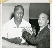
William A. Hunton Branch YMCA
YMCA 072

William A. Hunton Branch YMCA
Dr. Harry T. Penn, third from left.
Dr. Harry T. Penn, third from left.
YMCA 071

William A. Hunton Branch YMCA
Noel C. Taylor, at podium.
Back of photograph: "Golden Anniversary, High Street Baptist Church."
Noel C. Taylor, at podium.
Back of photograph: "Golden Anniversary, High Street Baptist Church."
YMCA 063

William A. Hunton Branch YMCA
YMCA 062

William A. Hunton Branch YMCA
YMCA 059

William A. Hunton Branch YMCA
Group photograph in front of Fifth Avenue Presbyterian Church.
Group photograph in front of Fifth Avenue Presbyterian Church.
YMCA 057

William A. Hunton Branch YMCA
YMCA 056

William A. Hunton Branch YMCA
YMCA 055

William A. Hunton Branch YMCA
YMCA 054

William A. Hunton Branch YMCA
YMCA 053

William A. Hunton Branch YMCA
YMCA 044

William A. Hunton Branch YMCA
YMCA 037

William A. Hunton Branch YMCA
YMCA 036

William A. Hunton Branch YMCA
African American Baseball Team
African American Baseball Team
YMCA 035

William A. Hunton Branch YMCA
Dr. Harry Penn, center, holding glass.
Dr. Harry Penn, center, holding glass.
YMCA 033

William A. Hunton Branch YMCA
Father and Son Banquet
Father and Son Banquet
YMCA 029

William A. Hunton Branch YMCA
YMCA 021

William A. Hunton Branch YMCA
Back of Photograph: "Father and Son Banquet, October 30, 1958."
Back of Photograph: "Father and Son Banquet, October 30, 1958."
YMCA 020

William A. Hunton YMCA
YMCA 019

William A. Hunton Branch YMCA
YMCA 017

William A. Hunton Branch YMCA
YMCA 16

William A. Hunton Branch YMCA
Boys playing table tennis.
Boys playing table tennis.
YMCA 015

William A. Hunton Branch YMCA
Back of Photograph: "With complements of your President, M. H. Means."
Back of Photograph: "With complements of your President, M. H. Means."
YMCA 014

William A. Hunton Branch YMCA
YMCA 013

William A. Huntun Branch YMCA
YMCA 012

William A. Hunton Branch YMCA
YMCA 011

William A. Hunton Branch YMCA
Lucy Addison High School Football game at Victory Stadium.
Lucy Addison High School Football game at Victory Stadium.
YMCA 009

William A. Hunton Branch YMCA
YMCA 008

William A. Hunton Branch YMCA
YMCA 006

William A. Hunton Branch YMCA
Parade to Loudon Avenue Christian Church
Parade to Loudon Avenue Christian Church
YMCA 005

William A. Hunton Branch YMCA
YMCA 004

William A. Hunton Branch YMCA
YMCA 003

William A. Hunton Branch YMCA
YMCA 002

William A. Hunton Branch YMCA
Lucy Addison High School Band at Victory Stadium.
Lucy Addison High School Band at Victory Stadium.
YMCA 001

William A. Hunton Branch YMCA
Loudon Avenue Christian Church
Loudon Avenue Christian Church
A Guide to the Typescripts of the Roanoke District of the Virginia Writer's Project.
This guide of the Works Progress Administration Records consists primarily of typed manuscripts about historical topics of local interest written from 1936 to 1942. While the primary focus is on the city and county of Roanoke, several documents…
SR174 Veterans Administration

The VA facility erected structures such as the nurses’ home to house medical staff. The first patients were admitted on April 23, 1935. Some of the patients, as a form of therapy, actually conducted farming operations on the grounds of the…
PC 139.1 Andrew Lewis

"Andrew Lewis High School, Salem, Virginia"
The Cook Book 1950
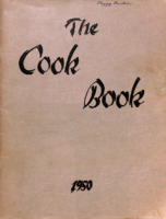
The Cook Book was the annual for Woodrow Wilson Middle School.
Wilsonian 1961

The Wilsonian was the annual for Woodrow Wilson Junior High School. Later editions were called the Presidents.
Wilsonian 1954

The Wilsonian was the annual for Woodrow Wilson Junior High School. Later editions were called the Presidents.
Presidents 1986
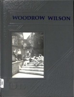
The Presidents is the annual for Woodrow Wilson Junior High School.
Presidents 1985
The Presidents is the annual for Woodrow Wilson Junior High School.
Presidents 1984
The Presidents is the annual for Woodrow Wilson Junior High School.
Presidents 1982-1983
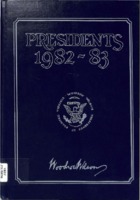
The Presidents is the annual for Woodrow Wilson Junior High School.
Presidents 1981-1982
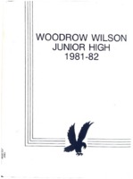
The Presidents is the annual for Woodrow Wilson Junior High School
Presidents 1980-1981
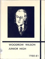
The Presidents is the annual for Woodrow Wilson Junior High School.
Presidents 1979-1980
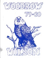
The Presidents is the annual for Woodrow Wilson Junior High School.
Presidents 1978-1979
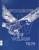
The Presidents is the annual for Woodrow Wilson Junior High School.
Presidents 1977-1978
The Presidents is the annual for Woodrow Wilson Junior High School.
Presidents 1976-1977
The Presidents is the annual for Woodrow Wilson Junior High School.