

Browse Items (374 total)
- Collection: George C. Davis Photographic Records - Series 2
Sort by:
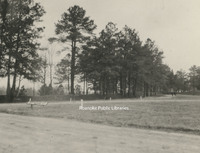
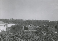
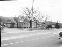
Davis2 1.25 1st & Day
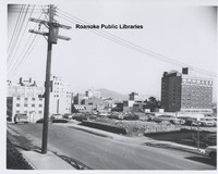
Looking northeast from 1st Street and Day Avenue.
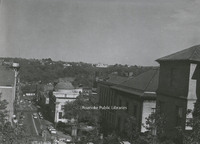
Davis2 1.251 1st & Day
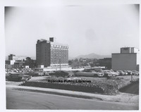
Looking northeast from 1st Street and Day Avenue.
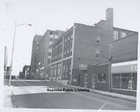
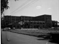
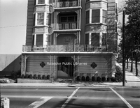
Davis2 1.252 1st and Franklin

Parking lot in front of AEP's Roanoke office at the corner of Franklin Road and 1st Street.
Davis 1.253 2nd and Day

The northeast corner of 2nd Street and Day Avenue.
Davis2 1.254 Franklin Road
Looking toward intersection with 1st Street and Franklin Road.
Davis2 1.952 Japanese Magnolia
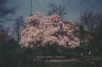
Japanese Magnolia tree in Elmwood Park.
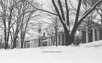
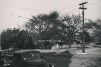
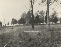
Davis2 1.96 Snow in Elmwood
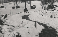
Snow in Elmwood Park.
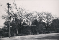
Davis2 1.96A Snow in Elmwood
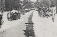
Snow in Elmwood Park.
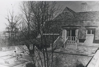
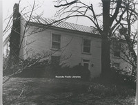
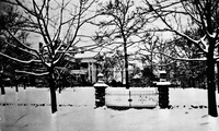
Davis2 1.96B Snow in Elmwood
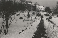
Snow in Elmwood Park with view of the Terry House.
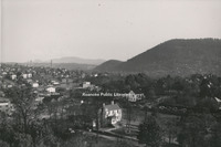
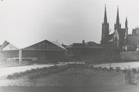
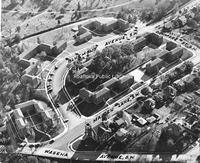
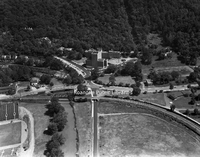
Davis2 1.98 Aerial view of Elmwood
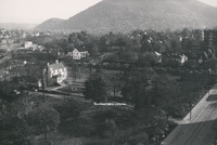
An aerial view of Elmwood Park.
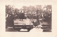
Davis2 105 Diamond Jubilee
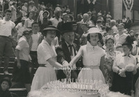
Cutting the birthday cake during Roanoke's Diamond Jubilee are Miss Diamond Jubilee, Barbara Boitnott, Mayor Walter L. Young and Miss Shenandoah Valley, Edwina Wertz.
Davis2 105.1 Diamond Jubilee
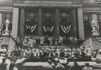
Roanoke's Diamond Jubilee celebration kicks off at the 1915 municipal building.
Davis2 11.03 Virginia College
The Virginia College for Young Women under construction. The school was formerly located in the South Roanoke neighborhood at the end of Rosalind Avenue.
Davis2 11.3 Pleasant View School
Pleasant View School, often called Moomaw School, which stood on Moomaw land on the corner of Cove and Hershberger Roads.
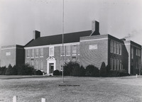
Davis2 11.7 Patrick Henry High
Patrick Henry High School.
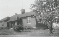
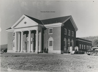
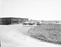
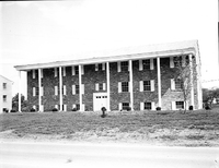
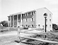
Davis2 11.811 Southview Elementary School
Southview Elementary School, located on Peters Creek Road. The building is now used for Roanoke County administrative offices.
Davis2 11.952 East Building
East Building on the Hollins University campus. Built in 1856, It is the oldest building in use at Hollins.
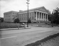
Davis2 11.953 Administration Building
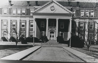
Central to the campus of Roanoke College, the Administration Building was the first structure on campus, completed in 1848. Over the years, East and West wings were added.
Davis2 11.954 Dana Science Building
The Dana Science Building on the campus of Hollins University.
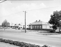
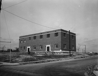
Davis2 12.3 Big Lick Post Office
Big Lick Post Office was located on the corner of Lynchburg Road (Orange Avenue) and Williamson Road.
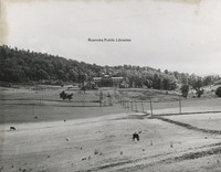
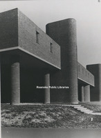
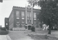
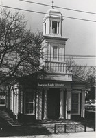
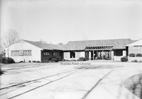
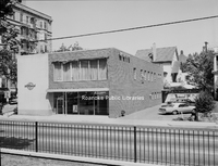
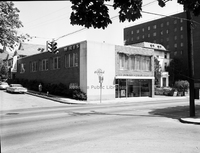
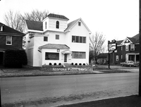
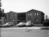
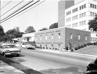
Davis2 15.1 Roanoke Public Library Celebration
Opening day celebration of Roanoke Public Libraries. Sarah Caldwell Butler speaking at event in Elmwood Park.
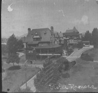
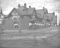
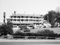
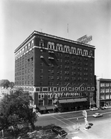
Davis2 16.2 Hotel Roanoke
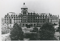
The Hotel Roanoke.
Davis2 16.203 Hotel Roanoke
Hotel Roanoke
Davis2 17.41 Washington & Lee
Washington and Lee University in Lexington, Virginia.
Davis2 18.51d CC Water Treatment Facility
Carvins Cove Water Treatment Facility.
Davis2 2.1341 David Kohen
David Kohen Clothing and Apparel, formerly located at 24 Campbell Avenue SW.
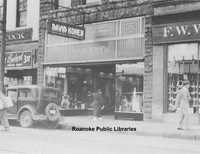
Davis2 2.1342 W.T. Grant Company
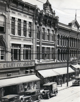
W.T. Grant Company and McClellan Stores, formerly located 17-23 Campbell Avenue SW.
Davis2 2.15 Welcome
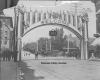
United Council of Travelers Welcome banner for a conference in Roanoke.
Davis2 21.61 Pastors of Enon Baptist
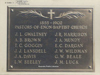
Plaque listing pastors of Enon Baptist Church in Hollins from 1855 -1902.
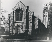
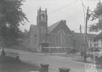
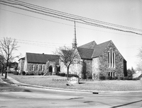
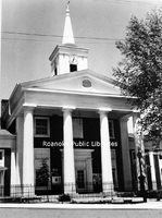
Davis2 22.623 Trinity Methodist
Trinity Methodist Church, located at 305 Mountain Avenue.
Davis2 23.35 Belmont Presbyterian
Belmont Presbyterian Church, located at 1005 9th Street SE.
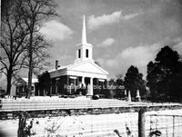
Davis2 23.43 First Presbyterian
First Presbyterian Church, located at 2101 Jefferson Street.
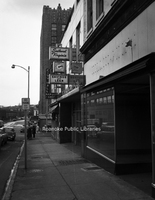
Davis2 24.1 St Johns Episcopal
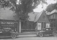
St. John's Espiscopal Church at its Church Avenue and 2nd Street location. The building was not being used by the church at the time this photo was taken. General Outdoor Adventure Co. was using the building.
Davis2 24.12 St Johns Episcopal
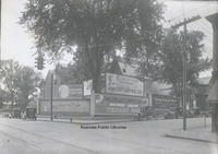
The old St. John's Episcopal Church was once located at the corner of Church Avenue and 2nd Street. In this photo, the vacant building's lawn is being used for billboards. The signs include: Jamison's Chain Grocery Stores, Colonial National Bank,…
Davis2 25.313 Our Lady of Nazareth
Our Lady of Nazareth Catholic Church. Formerly located at 820 Campbell Avenue, this structure was the first church, completed in 1926. It was used by the church until 1978 when the current structure was completed on Electric Road. The structure in…
Davis2 27.61 Evangelical Foursquare
Evangelical Foursquare Church, located at 612 Bullitt Avenue. Building is now used by New Beginnings Pentecostal Church
Davis2 28.01a Old Lutheran Church Sign
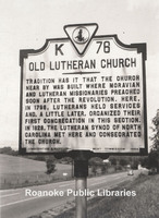
Located on Brandon Avenue near the entrance to Brandon Oaks Lifecare Retirement Home, this historical marker makes note of the first Lutheran congregation in the area.
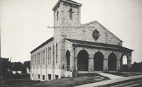
Davis2 28.01b Old Lutheran Church
Now the site of Brandon Oaks Lifecare Retirement Home, tradition has it that this structure was the first Lutheran Church in the area. A historical marker is located in the area where the church once stood.
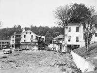
Davis2 3.13 1927 Roanoke Flood
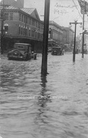
Cars drive through water on Campbell Avenue in front of the Market Building.
Davis2 3.14 Cows on Market
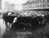
Cows on market for a livestock auction.
Davis2 3.15 Cows on Market
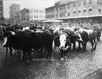
Cows on market for a livestock auction.
Davis2 3.41 City Market
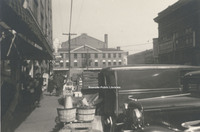
August 1938.
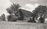
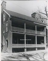
Davis2 30.1a Garst Log House
Once located just off of Garst MIll Road at the intersection of Grandin Road Extension, Garst Log Cabin is believed to be one of the earliest homes in the area. It was built around 1800.
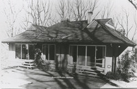
Davis2 30.1b Fishburn House
Located at 3542 Peakwood Drive, this home was constructed for Robert Fishburn in 1968. Its unique construction was meant to blend with its natural surroundings.
Davis2 30.1c Sun Valley
Located just off of Williamson Road, this photo depicts the Sun Valley subdivision where Tampa Drive intersects Orlando Avenue.
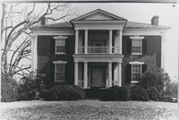
Davis2 30.1d Speedwell
Located at 6135 Merriman Road in Roanoke County, Speedwell was built around 1831 by Lewis Harvey. The house contains elements of Greek Revival style architecture.
Davis2 30.1e Monterey
Located of of Tinker Creek Lane in Northeast, Monterey was built around 1845. The home is an example of Greek Revival architecture most commonly found in the Gulf Coast States.
Davis2 30.1f Brown House Store
Located at 801 E. Main Street in Salem, Williams-Brown House-Store was built around 1845 by tradesman William Williams. The structure was used as both a home and a store. It is now the home of the Salem Museum and Historical Society.
Davis2 30.1g Monterey
Located at 110 High Street, Monterey was built around 1855 by Benjamin Deyerle. It is one of many houses built by Deyerle in the valley and reflects his Greek Revival architectural style.
Davis2 30.1h Belle Aire
Located at 3820 Belle Air Circle, Belle Aire was built around 1849 by Benjamin Deyerle for Madison Pitzer.
Davis2 30.1i Pleasant Grove
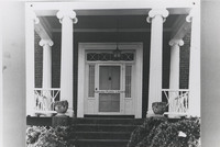
Located at 4377 W. Main Street, Pleasant Grove was built in 1853 for Joseph Deyerle. This photo depicts a close-up of the front door of the Georgian style home.
Davis2 30.1j Virginia Farm House
Formerly located at 2801 Brandon Place, this house was typical of Virginia Farm Houses of the 19th Century.
Davis2 30.1k Row Houses
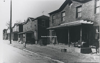
Row Houses like those pictured were an important part of Roanoke's architectural growth. The houses in this photo were once located on Rutherford Avenue Northeast.
Davis2 30.1l Evans House
Located at 213 N. Broad Street in Salem, the Evans house was built around 1882 by John M. Evans in the Second Empire style.
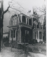
Davis2 30.1m Gothic Revival Style House
This home was once located at 5415 Plantation Road. A casuality of urban sprawl, this home was an example of Gothic Revival architecture.
Davis2 30.1n Queen Anne Style House
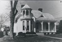
Located at 103 Union Street, this home is reflective of the Queen Anne style. It was built in 1901 by M.G. McClung, an editor of the Salem Sentinel.
Davis2 30.1o Queen Anne Style House
Located at 414 Walnut Avenue, this home was built by J.H. Gibboney, a chemist at Norfolk & Western. One of many examples of the Queen Anne style of Architecture in the Roanoke Valley.
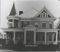
Davis2 30.1p Colonial Revival House

Located at 101 27th Street SE in South Roanoke, this Colonial Revival-Style House was designed by architect Robert Allen.
Davis2 30.1r Bungalow Style House
Located at 2607 Rosalind Avenue, this home was built in 1931 and is an example of Bungalow-Style architecture.
Davis2 30.1s The Morris House
Built in 1963 by Jim Yeatts, the Morris House is located at 2831 Wilton Road.
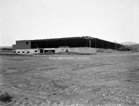
Davis2 30.1u Shaffers Crossing Roundhouse
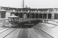
This 115 foot roundhouse was constructed in sections by J.P. Pettyjohn and Company with the first 21 stalls on July 1, 1918. The first stalls and turntable were put into service on September 15, 1919. The turntable was erected by Norfolk and Western…
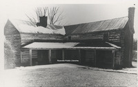
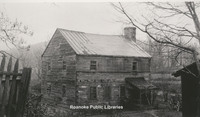
Davis2 31.11a Fort Greenridge
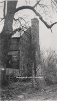
Fort Greenridge was located on the west branch of Carvins Creek near Kingstown. In addition to Fort Greenridge, the structure was also called Garst's Fort and Schwarz's Fort as it was owned by Frederick Garst and Chris Schwarz. Fort Greenridge was…
Davis2 31.11b Fort Greenridge
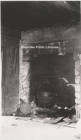
Fireplace located inside Fort Greenridge. Fort Greenridge was located on the west branch of Carvins Creek near Kingstown. In addition to Fort Greenridge, the structure was also called Garst's Fort and Schwarz's Fort as it was owned by Frederick…
Davis2 31.11c Fort Greenridge
Fort Greenridge was located on the west branch of Carvins Creek near Kingstown. In addition to Fort Greenridge, the structure was also called Garst's Fort and Schwarz's Fort as it was owned by Frederick Garst and Chris Schwarz. Fort Greenridge was…
Davis231.11d Fort Greenridge
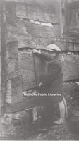
An unidentified boy measures the logs of Fort Greenridge. Fort Greenridge was located on the west branch of Carvins Creek near Kingstown. In addition to Fort Greenridge, the structure was also called Garst's Fort and Schwarz's Fort as it was owned…
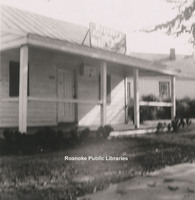
Davis2 33.1 3rd Street Home
House located near the intersection of Luck Avenue and 3rd Street. The fire escape on the left is that of the old Lewis-Gale Hospital which stood on the corner. Both the house and the hospital have long been gone.
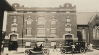
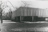
Davis2 43.12 Appalachian Power Company
Rear view of Appalachian Power Company as seen from Bullitt Avenue.
Davis2 43.2-1 N&W Regional Office
Norfolk & Western Regional Offices, once located at the corner of Jefferson Street and 1st Street.
Davis2 43.411 Roanoke Industrial Loan
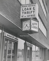
Roanoke Industrial Loan & Thrift, formerly located at 20 Franklin Road.
Davis2 44.17 Thurman & Boone
Thurman & Boone, formerly located at 401 Jefferson Street.
Davis2 44.171 Thurman Property
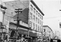
Looking north at 401- 407 Jefferson Street. Herbert's Fine Feminine Footwear, Woolworth and Thurman & Boone occupied these storefronts.
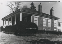
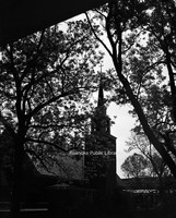
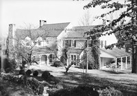
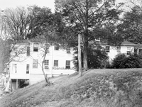
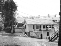
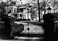
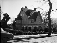
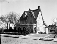
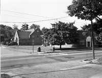
Davis2 6.122 Terry House
View of the Terry House and Elmwood Park from the Patrick Henry Hotel.
Davis2 6.123 Elmwood Corner
Intersection of Jefferson Street and Elm Avenue, looking toward the SW corner of Elmwood Park. Terry House visible through the trees.
Davis2 6.124 Elmwood Corner
Corner of Jefferson Street and Bullitt Avenue, looking toward the SE corner of Elmwood Park.
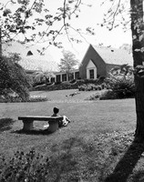
Davis2 6.125 Elmwood Gazebo
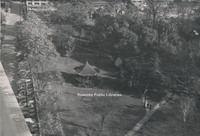
View of gazebo in Elmwood Park from the Patrick Henry Hotel.
Davis2 61.81 Mill Mountain Incline
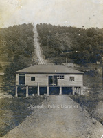
Mill Mountain Incline during construction.
Davis2 61.812 Mill Mountain Incline Tracks
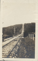
Tracks of the Mill Mountain Incline.
Davis2 68.81 New River Gap
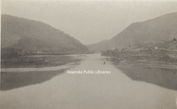
The New River cut a gap between Peters Mountain and East River Mountain at Narrows.
Davis2 75.91 Daniel Boone's Tomb
Tomb of Daniel Boone.
Davis2 8.1 Main Street Baptist
Main Street Baptist Church in Clifton Forge.
Davis2 8.21 Pearisburg
Former medical office of Dr. Harvey Green Johnston. Local tradition holds that it was Rutherford B. Hayes' headquarters while Federal troops accupied Pearisburg during the Civil War. The building is part of Giles County HIstorical Society's museum…
Davis2 8.22 Town House in Chilhowie
Town House in Chilhowie built in 1748 by Col. James Patton to be used as a fort.
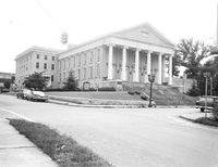
Davis2 8.51 Botetourt County Courthouse
Botetourt County Courthouse
Davis2 91.1d UDC Memorial
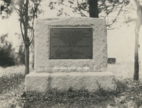
Erected by the South Carolina Division of the United Daughters of the Confederacy as a memorial to Elliott's South Carolina troops who lost their lives in the explosion at The Crater.
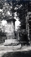
Davis2 91.1e Fort Mahone Monument
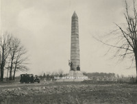
This monument was erected on the spot where Fort Mahone, known as Fort Damnation by the Union, once stood. It was erected by the State of Pennsylvania in honor of the soldiers who served in the Third Division, 9th Corps, Army of the Potomac.
Davis2 91.1f Entrance to Tunnel
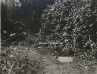
The marker in the right foreground indicates the entrance to the Union tunnel located at the crater.
Davis2 91.1g Woodpile at Pine Gardens
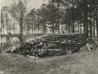
This pile of lumber was the lining placed in the Confederate tunnels at Pine Garden
Davis2 91.1h Confederate Breastworks
Confederate breastworks near Pine Gardens.
Davis2 91.1i The Crater
The Crater as seen from Union lines.
Davis2 91.1j Confederate Tunnels
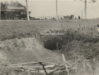
The discovery of the Confederate Tunnels came as a result of a boy chasing a rabbit into this hole. The tunnels were finally discovered after 60 years.
Davis2 100.2 Etzler Signs
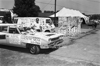
Etzler Magnetic Signs displayed at an unidentified event
Davis2 106a Roanoke Gas Display
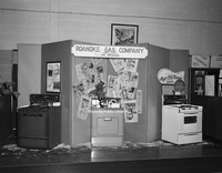
Roanoke Gas Company display featuring gas appliances at an unidentfied event.
Davis2 11.6523 Jefferson High

Jefferson High School.
Davis2 11.955 Hollins College
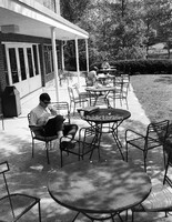
Students study on the campus of Hollins College.
Davis2 11.956 Hollins College
A view of the campus of Hollins College.
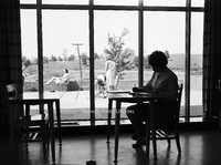
Davis2 11.957 Hollins College
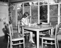
An unidentified student studies on the campus of Hollins College.
Davis2 11.958 Hollins Tennis
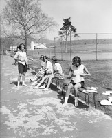
Unidentified students prepare to play tennis on the campus of Hollins College.
Davis2 11.9591 Hollins College
An unidentified student studies on the campus of Hollins College.
Davis2 11.959a duPont Chapel
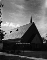
duPont Chapel on the campus of Hollins College
Davis2 11.959b duPont Chapel
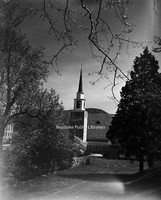
duPont Chapel on the campus of Hollins College
Davis2 11.959c duPont Chapel
duPont Chapel on the campus of Hollins College
Davis2 11.959d duPont Chapel
duPont Chapel on the campus of Hollins College
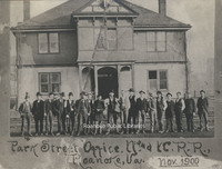
Davis2 12.5 Narrows Post Office
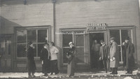
Unidentfied individuals in front of the Narrows Post Office.
Davis2 13.13 Courthouse and Jail
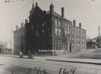
The City of Roanoke's first courthouse and jail, formerly located at 2nd Street and Campbell Avenue.
Davis2 13.2 Roanoke County Courthouse
The old Roanoke County Courthouse, located at 305 E. Main Street in Salem.
Davis2 22.4 Woodlawn Methodist
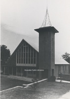
Woodlawn United Methodist Church, located at 2922 Corbieshaw Road.
Davis2 23.44 First Presbyterian
First Presbyterian Church, located at 2101 Jefferson Street.
Davis2 23.5 Salem Presbyterian
Salem Presbyterian Church, located at 41 E. Main Street.
Davis2 25.16 St. Andrews
St. Andrews.
Davis2 27.55 Hott Bishop Memorial
Hott Bishop Memorial United Brethren Church, formerly located on Tazewell Avenue.
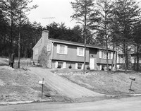
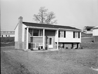
Davis2 39a 3105 Somerset
Home located at 3105 Somerset Street.
Davis2 39b 3112 Somerset-1
Home located at 3112 Somerset Street.
Davis2 39c 3112 Somerset-2
Rear view of home located a 3112 Somerset Street.
Davis2 39d 3358 Peakwood-1
Home located at 3358 Peakwood Drive.
Davis2 39e 3358 Peakwood-2
Home located at 3358 Peakwood Drive.
Davis2 39f 40 Sawyer Drive
House located at 40 Sawyer Drive in the West Club Forest subdivision in Salem.
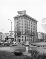
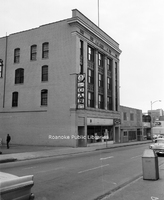
Davis2 43.11 Shenandoah Building
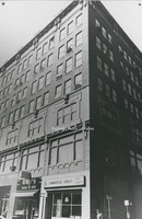
The Shenandoah Building, located at 305 1st Street.
Davis2 43.1263 AEP Truck
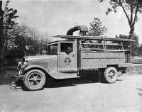
Appalachian Electric Power Company truck.
Davis2 43.1264 AEP Kanawha Plant
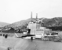
Located near Glasgow, West Virginia, the Kahawha River Plant is a coal-fired power station owned and operated by AEP.
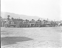
Davis2 43.1265 AEP Truck
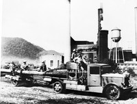
Appalachian Power employees haul an electric pole at an unidentified plant.
Davis2 43.15 General Stone and Materials.
General Stone and Materials Corporation, formerly located at 1401 Franklin Road.
Davis2 43.214 N&W Offices
Railroad employees stand in front of the Norfolk & Western Office building formerly located on 5th Street.
Davis2 43.6 Paul C. Agee Insurance
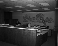
Employees of Paul C. Agee Insurance Company in the office.
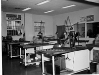
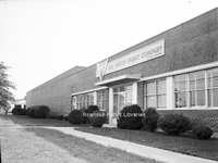
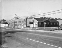
Davis2 44.5a Goodwill Industries
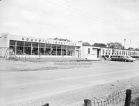
Goodwill Industries workshop, formerly located at 3125 Salem Turnpike.
Davis2 44.5c Goodwill Industries
Unidentified employees work in the Goodwill Industries workshop, formerly located at 3125 Salem Turnpike.
Davis2 44.5d Goodwill Industries
Unidentified employees work in the Goodwill Industries workshop, formerly located at 3125 Salem Turnpike.
Davis2 44.5e Goodwill Industries
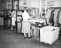
Unidentified employees make repairs to donated clothing at the Goodwill Industries workshop, formerly located at 3125 Salem Turnpike.
Davis2 44.5f Goodwill Industries
An unidentified employee punches the time clock at Goodwill Industries.
Davis2 44.5g Goodwill Industries
An interior view of Goodwill Industries, formerly located at 3125 Salem Turnpike.
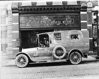
Davis2 45.311 Bowman Bakery
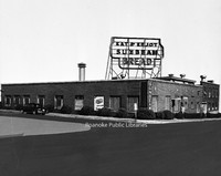
Bowman Bakery, formerly located at 102 5th Street NW.
Davis2 45.64 ITT
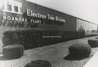
ITT Exelis, located at 7635 Plantation Road.
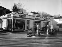
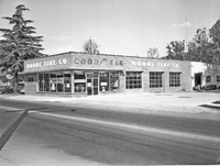
Davis2 46.34a Gulf Station
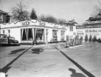
Wasena Gulf Service, formerly located at 1119 Main Street.
Davis2 46.34b Gulf Station
Wasena Gulf Service, formerly located at 1119 Main Street.
Davis2 46.6 Magic City Ford
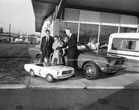
Magic City Ford promotion.
Davis2 46.61 Magic City Ford
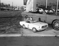
Unidentified girl sits in toy Mustang at Magic City Ford.
Davis2 47.5 Thaden-Jordan Furniture
Thaden-Jordan Furniture Company, formerly located at 312 Kessler Mill Road.
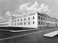
Davis2 47.51 Johnson-Carper
Architectural rendering of Johnson-Carper Furniture Company, formerly located at 3322 Hollins Road NE.
Davis2 48.7 Archway Cookies
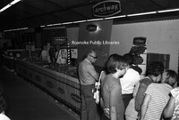
An Archway Cookies booth at an unidentified event.
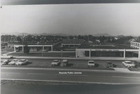
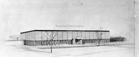
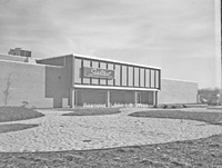
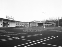
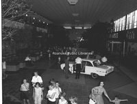
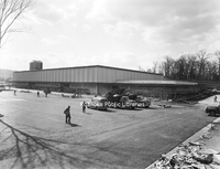
Davis2 49.122 Crossroads Mall
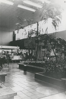
An interior view of Crossroads Mall.
Davis2 56 Waverly Church Choir
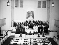
Unidentified members of the Waverly Place Baptist Church Choir.
Davis2 57.5a Viking Lanes
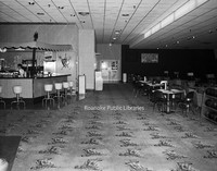
Interior view of Viking Lanes Bowling Alley, formerly located at 2727 Franklin Road.
Davis2 57.5b Viking Lanes
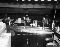
Interior view of Viking Lanes Bowling Alley, formerly located at 2727 Franklin Road.
Davis2 57.5c Viking Lanes
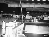
Interior view of Viking Lanes Bowling Alley, formerly located at 2727 Franklin Road.
Davis2 61.25 Virginian #104
An unidentified group stands in front of Virginian #104, a class EL-#3A electric locomotive.
Davis2 66 SML Dam
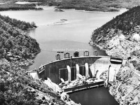
Smith Mountain Lake Dam.
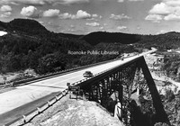
Davis2 66.827 Colorado Street Bridge
Construction of the bridge on South Colorado Street over the railroad tracks in Salem.
Davis2 66.92 Cornelius Charlton Bridge
Also known as the Bluestone River Bridge, the Sergeant Cornelius H. Charlton Bridge crosses the Bluestone River in Mercer County, West Virginia. Charlton received the Metal of Honor for his heroic acts in the Korean War.
Davis2 8.4 Lynchburg
A view of Downtown Lynchburg from Courthouse hill.
Davis2 8.41 Lynchburg
A view of Downtown Lynchburg from Courthouse hill.
Davis2 8.42 Lynchburg
A view of Downtown Lynchburg from Courthouse hill.
Davis2 8.43 Kingsport Utilities
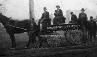
Unidentified men with a Kingsport Utilities wagon.
Davis2 91.2 Memorial Tunnel
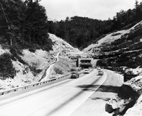
The Memorial Tunnel opened in 1954 to carry traffic through the Paint Creek Mountain on the West Virginia Turnpike. Closed to traffic in 1987, the tunnel is now used for military training.
Davis2 1.3 Grand Piano Billboard
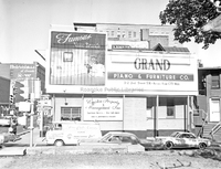
Billboard advertisement for Grand Piano located at Jefferson Street and Franklin Road.
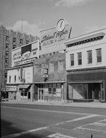
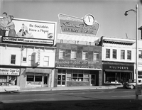
Davis2 2.137a Campbell Avenue
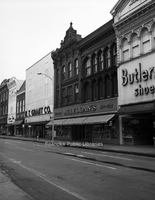
Storefronts on the 10 block of Campbell Avenue SW.
Davis2 2.137b Campbell Avenue
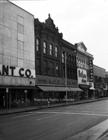
Storefronts in the 10 block of Campbell Avenue SW.
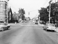
Davis2 2.1116a East on Campbell
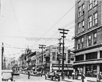
Looking east on Campbell Avenue at the intersection with Jefferson Street.
Davis2 11.63 Addison High Class
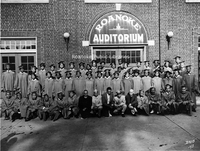
Lucy Addison High School Class of 1943 in front of Roanoke Auditorium.
Davis2 11.64 Lucy Addison High Class
Lucy Addison High School Class of 1941.
Davis2 11.69 Greenvale School
Greenvale Nursery School., located at 627 Westwood Boulevard NW.
Davis2 11.92 Lord Botetourt
Lord Botetourt High School, located at 1435 Roanoke Road, Daleville.
Davis2 11.691 Greenvale School
Greenvale Nursery School., located at 627 Westwood Boulevard NW.
Davis2 11.692 Greenvale School
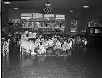
A teacher reads to children at the Greenvale Nursery School, located at 627 Westwood Boulevard.
Davis2 11.693 Greenvale School
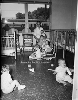
Children in the nursery of Greenvale School, located at 627 Westwood Boulevard Northwest.
Davis2 11.694 Greenvale School
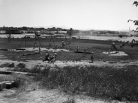
The playground at Greenvale Nursery School, located at 627 Westwood Boulevard NW.
Davis2 11.6524 JHS Football
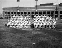
Jefferson High School football team at Victory Stadium.
Davis2 13.21 Surface Law
Law Office of Thomas Surface, formerly located at 501 13th Street SW.
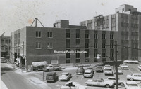
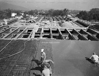
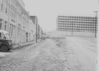
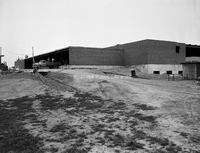
Davis2 14.72 Community Hospital
Community Hospital during construction. Roanoke Engraving is visible on the left.
Davis2 14.73 Community Hospital
Community Hosptial during construction.
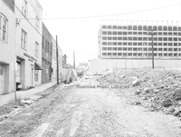
Davis2 14.74 Community Hospital
Community Hospital during construction. Roanoke Chemical Company visible at left.
Davis2 14.75 Community Hospital
Community Hospital during construction.
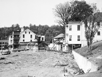
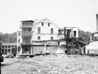
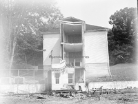
Davis2 16.8 NB Hotel Fire
Damage to Natural Bridge Hotel from fire on 23 April 1963.
Davis2 16.81 NB Hotel Fire
Damage to Natural Bridge Hotel after fire on 23 April 1963.
Davis2 16.82 NB Hotel Fire
Damage to Natural Bridge Hotel from fire on 23 April 1963.
Davis2 16.83 NB Hotel Fire
Damage to Natural Bridge Hotel after fire on 23 April 1963.
Davis2 16.84 NB Hotel Fire
Damage to Natural Bridge Hotel after fire on 23 April 1963.
Davis2 16.85 NB Hotel Fire
Damage to Natural Bridge Hotel after fire on 23 April 1963.
Davis2 16.86 NB Hotel Fire
Damage to Natural Bridge Hotel after fire on 23 April 1963.
Davis2 16.87 NB Hotel Fire
Damage to Natural Bridge Hotel after fire on 23 April 1963.
Davis2 16.88 NB Hotel Fire
Damage to Natural Bridge Hotel after fire on 23 April 1963.
Davis2 16.89 NB Hotel FIre
Damage to Natural Bridge Hotel after fire on 23 April 1963.
Davis2 16.810 NB Hotel Fire
Damage to Natural Bridge Hotel after fire on 23 April 1963.
Davis2 16.811 NB Hotel Fire
Damage to Natural Bridge Hotel after fire on 23 April 1963.
Davis2 16.812 NB Hotel Fire
Damage to Natural Bridge Hotel after fire on 23 April 1963.
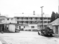
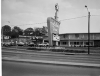
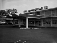
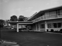
Davis2 16.7412 Holiday Inn
Holiday Inn formerly located at the corner of Orange Avenue and Williamson Road.
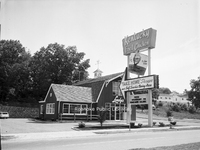
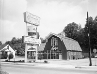
Davis2 74.13 Archie's House of Beef
Archie's House of Beef was located in the Holiday Inn that once stood at the corner of Orange Avenue and Williamson Road.
Davis2 16.7414 Archie's House of Beef
Archie's House of Beef was located in the Holiday Inn that once stood at the corner of Orange Avenue and Williamson Road.
Davis2 18.21a Civic Center
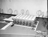
Three dimensional architectural model of the Roanoke Civic Center.
Davis2 18.21c Civic Center
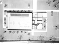
An interior view of a three dimensional architectural model of the Roanoke Civic Center.
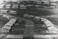
Davis2 19.815 Terrace Apartments
An aerial view of Terrace Apartments with surrounding streets identified.
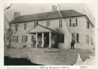
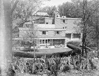
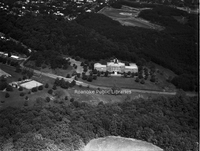
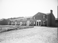
Davis2 31.50 Mountain View
Mountain View, a 40 room elegant turn-of-the-century mansion, was built in 1907 by Junius B. Fishburn. Mr. Fishburn donated Mountain View to the City in 1955 with the stipulation that it be used solely and exclusively for public recreation purposes. …
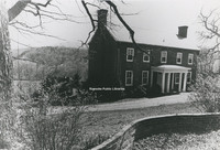
Davis2 31.501 Mountain View
Mountain View, a 40 room elegant turn-of-the-century mansion, was built in 1907 by Junius B. Fishburn. Mr. Fishburn donated Mountain View to the City in 1955 with the stipulation that it be used solely and exclusively for public recreation purposes. …
Davis2 39 1130 2nd Street-1
Home located at 1130 2nd Street SW.
Davis2 39 1130 2nd Street-2
Home located at 1130 2nd Street SW.
Davis2 39 1802 Greenwood Road-1
Home located at 1802 Greenwood Road SW.
Davis2 39 1802 Greenwood Road-2
Home located at 1802 Greenwood Road SW.
Davis2 11039 Stewartsville Road
Home located at 11035 Stewartsville Road.
Davis2 43.7 C&P Telephone Float
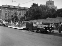
Parade float for C&P Telephone Company.
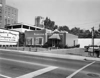
Davis2 43.8 Peoples Federal
People's Federal Savings and Loan, formerly located in the Liberty Trust Building at 101 Jefferson Street.
Davis2 43.61 Allstate Insurance
Allstate Insurance, formerly located at 3517 Brandon Avenue.
Davis2 43.62 Congela Building
Congela Building, located at 2823 Williamson Road.
Davis2 43.63 Motor Finance
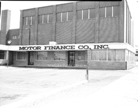
Motor Finance Company, formerly located at 428 Campbell Avenue SW.
Davis2 43.86a SWVA Savings & Loan
Southwest Virginia Savings & Loan, formerly located at 306 2nd Street SW.
Davis2 43.611 Allstate Insurance
Allstate Insurance, formerly located at 3517 Brandon Avenue SW.
Davis2 43.631 Motor Finance
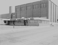
Motor Finance Company, formerly located at 428 Campbell Avenue SW.
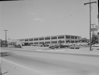
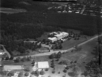
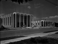
Davis2 43.713 Shenandoah Life
An aerial view of Shenandoah Life Insurance Company, located at 2301 Brambleton Avenue SW.
Davis2 43.714 Shenadoah Life
An aerial view of Shenandoah Life Insurance, located at 2301 Brambleton Avenue SW.
Davis2 43.861 SWVA Savings & Loan
Southwest Virginia Savings & Loan, formerly located at 306 2nd Street SW. View is looking north.
Davis2 43.862 SWVA Savings & Loan
Southwest Virginia Savings & Loan, formerly located at 306 2nd Street SW
Davis2 46.863 SWVA Savings & Loan
Employees inside Southwest Virginia Savings & Loan, formerly located at 306 2nd Street SW.
Davis2 18.21b Civic Center
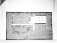
Top view of three dimensional architectural model of Roanoke Civic Center.
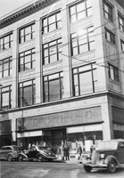
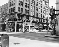
Davis2 44.4 Smartwear Irving-Saks
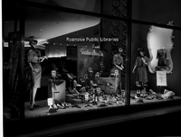
Window display at Smartwear Irving-Saks, formerly located at 210-212 S. Jefferson Street.
Davis2 44.6 Leggetts
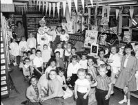
Interior view of the children's department at Leggett's, formerly located 112 Campbell Avenue.
Davis2 44.7 Schulte United
Interior view of Schulte United Millinery, formerly located at 16 Campbell Avenue SW.
Davis2 44.8 Barr's Variety Store
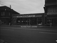
Barr's Variety Store, formerly located at 1318 Grandin Road SW.
Davis2 44.81 Barr's Variety Store
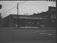
Barr's Variety Store, formerly located at 1318 Grandin Road SW.
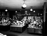
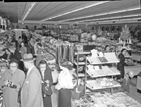
Davis2 44.82a Barr's Variety Store
Shoppers inside Barr's Variety Store, formerly located at 1318 Grandin Road SW.
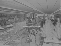
Davis2 44.82c Barr's Variety Store
Shoppers in Barr's Variety Store, formerly located at 1318 Grandin Road SW.
Davis2 44.82d Barr's Variety Store
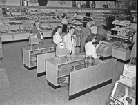
Cash registers at Barr's Variety Store, formerly located at 1318 Grandin Road SW.
Davis2 46.5 Moore Tire
Moore Tire Company, formerly located at 1860 S. Jefferson Street.
Davis2 46.7 Dickerson GMC
Dickerson GMC, formerly located 715 Patterson Avenue SW.
Davis2 46.8 Butterfield's Golf Carts
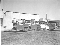
Butterfield's Golf Carts.
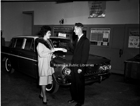
Davis2 46.9 Rutrough Motors
An unidentified customer and employees in front of Rutrough Motors, formerly located at 335 Luck Avenue SW.
Davis2 46.62 Magic City Ford
Magic City Ford, located at 809 Williamson Road NE.
Davis2 46.81 Chewning Garage
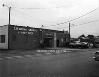
Chewning Garage and Body Shop, formerly located at 3034 Wentworth Avenue NW.
Davis2 46.91 Rutrough Motors
An unidentified customer and employee in the showroom of Rutrough Motors, formerly located at 335 Luck Avenue SW.
Davis2 46.222 Jarrett-Chewning
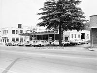
Jarrett-Chewning Company, formerly located at 1854 S. Jefferson Street.
Davis2 46.223 Jarrett-Chewning
Jarrett-Chewning Company, formerly located at 1854 S. Jefferson Street.
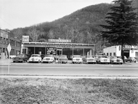
Davis2 46.224 Jarrett-Chewning
Unidentified employees stand in front of Jarrett-Chewning Company, formerly located at 1854 S. Jefferson Street.
Davis2 46.225 Jarrett-Chewning
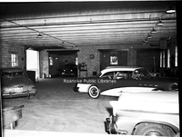
Garage interior of Jarrett-Chewning Company, formerly located at 1854 S. Jefferson Street.
Davis2 46.226 Jarrett-Chewning
Jarrett-Chewning Company, formerly located at 1854 S. Jefferson Street.
Davis2 46.227 Jarrett-Chewning
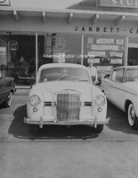
A Mercedes on the sales lot of Jarrett-Chewning Company, formerly located at 1854 S. Jefferson Street.
Davis2 46.228 Jarrett-Chewning
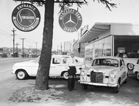
An unidentified employee stands next to a Mercedes on the sales lot of Jarrett-Chewning Company, formerly located at 1854 S. Jefferson Street.
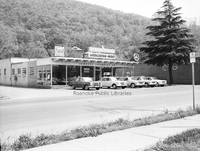
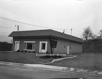
Davis2 46.333 Fort Lewis Esso
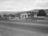
Fort Lewis Esso Servicenter, formerly located at 1905 W. Main Street in Salem.
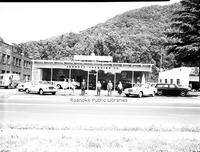
Davis2 46.334 Williamson Esso
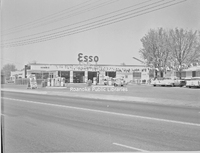
Williamson Road Esso, formerly located at 2715 Williamson Road NE.
Davis2 47.2 Roanoke Sash
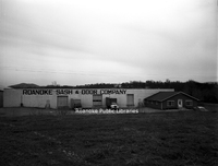
Roanoke Sash & Door Company, formerly located at 999 13th Street SW.
Davis2 47.6 Virginia Brewing
Virginia Brewing Company, formerly located in the 1200 block of Wise Avenue SE.
Davis2 47.7 Vinton Weaving
Vinton Weaving Company, now Precision Fabrics Group, is located at 323 West Virginia Avenue.
Davis2 47.8a National Cash Register
National Cash Register, formerly located at 902 S. Jefferson Street,
Davis2 47.8b National Cash Register
National Cash Register, formerly located at 902 S. Jefferson Street.
Davis2 47.8c National Cash Register
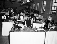
Work stations inside National Cash Register, formerly located at 902 S. Jefferson Street.
Davis2 47.9a Dillard Paper
Dillard Paper Company, formerly located at 2490 Patterson Avenue SW.
Davis2 47.9b Dillard Paper
Dillard Paper Company, formerly located at 2490 Patterson Avenue SW.
Davis2 47.12b McKesson & Robbins
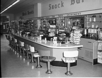
Snack bar inside McKesson & Robbins in Rocky Mount.
Davis2 47.12c McKesson & Robbins
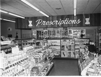
Interior view of McKesson & Robbins Pharmacy in Rocky Mount.
Davis2 47.12d McKesson & Robbins
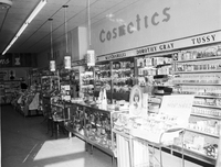
Cosmetics counter in McKesson & Robbins in Rocky Mount.
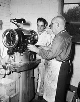
Davis2 47.14 Warren Gilbert Photography
Warren Gilbert Photography, formerly located at 4311 Appleton Avenue NW.
Davis2 47.61 Virginia Brewing
Rear view of Virginia Brewing Company, formerly located in the 1200 block of Wise Avenue SE.
Davis2 47.62 Virginia Brewing
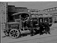
Virginia Brewing Company employees with delivery truck outside of the brewery.
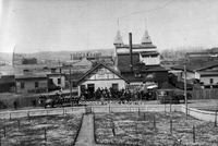
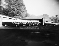
Davis2 47.75 Webster Brick
Employees next to trucks at Webster Brick.
Davis2 48.2 Roanoke Distributing Company
Pabst Blue Ribbon delivery trucks parked at Roanoke Distributing Company, formerly located at 907 3rd Street SE.
Davis2 48.3 Roanoke Grocers
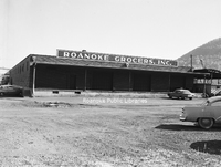
Roanoke Grocers Inc., formerly located at 1131 4th Street SE.
Davis2 48.4 Hampshire Corp
Hampshire Corp., formerly located at 2101 Winston Avenue SW.
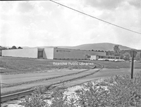
Davis2 48.5 Sealtest Foods
Sealtest Foods, formerly located at 133 Albemarle Avenue SE.
Davis2 48.8 Mayfair Caterers
Mayfair Caterers and Restaurant, formerly located at 1602 Orange Avenue NW. Melrose Seventh Day Adventist Church visible in background.
Davis2 48.9 Roma Restaurant
Roma Restaurant (later Villa Sorrento), formerly located at 1210 Patterson Avenue SW.
Davis2 48.14 Garst Brothers Dairy
Garst Brothers Dairy, formerly located at 1118 Salem Avenue SW.
Davis2 48.33 Associated Grocers
Associated Grocers, formerly located at 359 Kessler Mill Road.
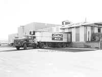
Davis2 48.51 Sealtest Foods
Employee with tractor-trailer at loading dock of Sealtest Foods, formerly located at 133 Albemarle Avenue SE.
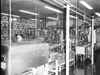
Davis2 48.52 Sealtest Foods
Production equipment in Sealtest Foods, formerly located at 133 Albemarle Avenue SE.
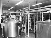
Davis2 48.53 Sealtest Foods
Production equipment in Sealtest Foods, formerly located at 133 Albemarle Avenue SE.
Davis2 48.54 Frigid Freeze
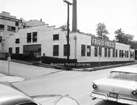
Frigid Freeze Frozen Foods, formerly located at 103 8th Street SE.
Davis2 48.63 O'Briens Van
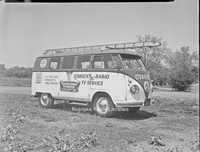
O'Brien's Radio & TV Service van.
Davis2 48.67 Sears Delivery Trucks
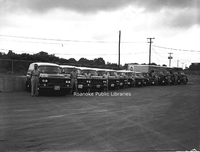
Drivers stand next to Sear's delivery trucks.
Davis2 48.75 Roanoke Ice
Roanoke Ice and Cold Storage, formerly located at 806 Wasena Avenue.
Davis2 48.81 Patty Wagon
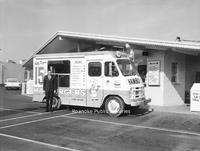
Patty Wagon Hamburgers truck.
Davis2 48.82 Patty Wagon
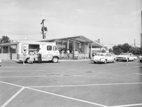
Kenney's Patty Wagon Hamburgers, formerly located at 5320 Williamson Road NW.
Davis2 48.83 Biff Burger Sign
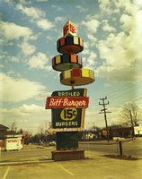
Sign for Biff Burger, formerly located at 4317 Williamson Road NE.
Davis2 48.84 Biff Burger
Order windows at Biff Burger, formerly located at 3323 Melrose Avenue NW.
Davis2 48.95 Mullens Place
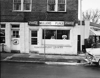
Mullen's Place, formerly located at 307 9th Street SE.
Davis2 48.751 Roanoke Ice
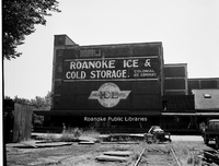
Roanoke Ice and Cold Storage, formerly located at 806 Wasena Avenue.
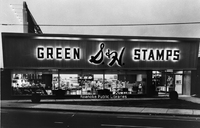
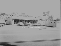
Davis2 48.771 Top Value Stamps
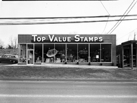
Top Value Stamps, formerly located at 2613 Franklin Road SW.
Davis2 48.772 Top Value Stamps
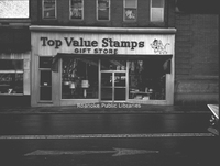
Top Value Stamps, formerly located at 318 2nd Street SW.
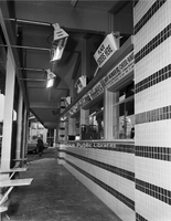
Davis2 48.773 Top Value Stamps
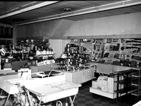
Merchandise inside Top Value Stamps, formerly located at 318 2nd Street SW.
Davis2 48.774 Top Value Stamps
Top Value Stamps, formerly located at 1519 Williamson Road NE.
Davis2 48.6234 Garland's Medical Center
Garland's Medical Center, formerly located at 127 McClanahan Street SW.
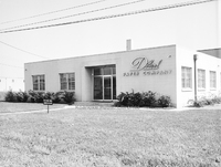
Davis2 48.6235 Garland's Drugstore
Garland's Drugstore on a snowy day, formerly located at 1327 Grandin Road SW.
Davis2 48.6236a Garland's Delivery Fleet
Garland's Delivery Service drivers next to their vehicles on a snowy day.
Davis2 49.2 Roanoke-Salem Plaza
Roanoke-Salem Plaza storefronts, including People's Drug, Miller & Rhoads and Winn-Dixie, formerly located at 4600 Melrose Avenue NW.
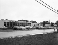
Davis2 49.3 Townside Plaza
Townside Plaza (now Townside Festival), located at 3600 Franklin Road SW.
Davis2 49.21 Lerner Shops
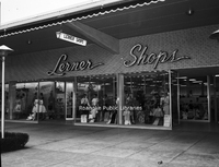
Lerner Shops at Roanoke-Salem Plaza, formerly located at 4142 Melrose Avenue NW.
Davis2 49.31 Townside Plaza
Townside Plaza (now Townside Festival), located at 3600 Franklin Road SW.
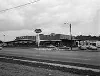
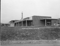
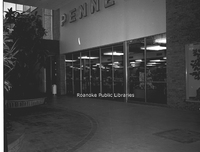
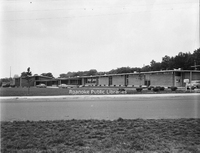
Davis2 49.123 Crossroads Mall
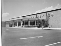
JC Penney at Crossroads Mall, formerly located at 5002 Airport Road NW.
Davis2 49.124a Crossroads Mall
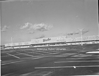
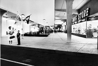
Interior of Crossroads Mall. Crossroads was built in 1961 and was the first enclosed shopping center in Virginia.
Davis2 49.124b Crossroads Mall
Interior entrance of JC Penney at Crossroads Mall.
Davis2 49.124c Crossroads Mall
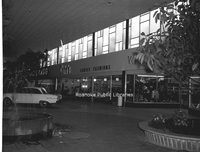
Interior view of Crossroads Mall.
Davis2 49.124d Crossroads Mall
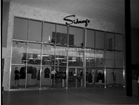
Interior entrance to Sidney's at Crossroads Mall.
Davis2 49.124e Crossroads Mall
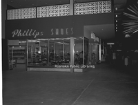
Phillips Shoes in Crossroads Mall.
Davis2 49.124h Crossroads Mall
Interior entrance to Roses at Crossroads Mall.
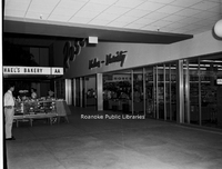
Davis2 49.125 WoolCo
WoolCo Department Store, formerly located at Crossroads Mall, 5002 Airport Road NW. Original anchor stores at Crossroads were J,C. Penney, Roses, Heironimus, Winn-Dixie, People's Drug, Other mall tenants included Fink's Jewelers, Smartwear Irving…
Davis2 63.1 Safety Motor Transit
Safety Motor Transit, formerly located at 12th Street and Campbell Avenue SE.
Davis2 63.12 Safety Motor Transit
Safety Motor Transit, formerly located at 12th Street and Campbell Avenue SE.
Davis2 75.82 JM Oakey Hearse
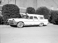
John M. Oakey Funeral Home hearse.
Davis2 75.83 JM Oakey
Hearse in front of John M. Oakey Funeral Home, formerly located at 126 Campbell Avenue SW.
Davis2 75.864 Rader Chapel
Rader Chapel located at 630 Roanoke Road in Daleville. This building was replaced with the current structure in 1996.
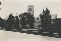
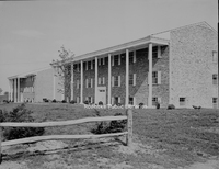
Davis2 11.96 Roanoke College
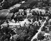
An aerial view of Roanoke College.
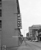
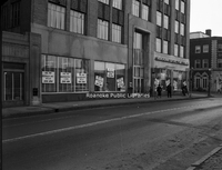
Davis2 45.92 Roanoke Gas
Looking east on Church Avenue in front of Roanoke Gas, formerly located at 123-125 Church Avenue SW. The sign was illuminated by gas burners. Sign panels have been removed as the gas burners are being replaced with electric lights.
Davis2 48.94a Lendys Take Home
Lendy's Take Home Shoppe, formerly located at 4102 Melrose Avenue NW.
Davis2 48.94b Lendys Take Home
Lendy's Take Home Shoppe, formerly located at 4102 Melrose Avenue SW.
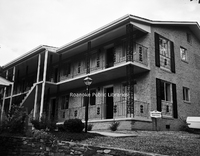
Davis2 35.13 OSW Apartments
Apartments located at 201 Mountain Avenue SW.
Davis2 48.38 Tom Huston Peanut
Tom Huston Peanut Company, formerly located at 1340 W. Main Street in Salem.
Davis2 19.6 Colonial Yorktown
Colonial Yorktown Apartments, located at 2918 Brandon Avenue SW.
Davis2 35.12 OSW Apartments
Apartments located at 110 Mountain Avenue SW.
Davis2 19.5 SR Apartment Village
South Roanoke Apartment Village, located at 3727 Parliament Road SW.
Davis2 39 337 Parkwood Avenue
Home located at 337 Parkwood Avenue in Salem.
Davis2 45.91 Roanoke Gas
Looking east on Church Avenue in front of Roanoke Gas Company, formerly located at 123-125 Church Avenue SW. The sign was illuminated by gas burners.
Davis2 45.9 Roanoke Gas
Main office of Roanoke Gas Company, formerly located at 123-125 Church Avenue SW.
Davis2 43.1271 AEP
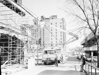
Contruction of Appalachian Power office located at 614 1st Street SW. View looking east on Bullitt Avenue.
Davis2 19.1 YMCA Pool
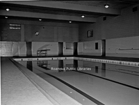
View of the pool inside the old YMCA building, formerly located at 425 Church Avenue, now the Locker Room Lofts.
Davis2 43.127a AEP
Appalachian Power, located at 40 Franklin Road SW.
Davis2 11.37 Lincoln Terrace
Lincoln Terrace Elementary School, located at 1802 Liberty Road NW.
Davis2 47.751 Webster Brick
Webster Brick (now General Shale), located at 2351 Webster Road.
Davis2 45.642 ITT
Construction of ITT Exelis, located at 7635 Plantation Road.
Davis2 45.641 ITT
Construction of ITT Exelis, located at 7635 Plantation Road.
Davis2 45.643 ITT
Construction of ITT Exelis, located at 7635 Plantation Road.
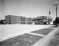
Davis2 14.76 Roanoke Memorial Rehab
Roanoke Memorial Rehabilitation Center, located at 2017 S. Jefferson Street.
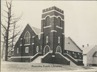
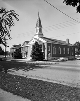
Davis2 29c Calvary Baptist
Calvary Baptist Church, located at 608 Campbell Avenue SW.
Davis2 28.3 Christ Lutheran
Christ Lutheran Church, located at 2011 Brandon Avenue SW.
Davis2 21.553 Villa Heights Baptist
Villa Heights Baptist Church, formerly located at 1026 Lafayette Boulevard NW.
Davis2 21.554 Villa Heights Baptist
Villa Heights Baptist Church, formerly located at 1026 Lafayette Boulevard NW.
Davis2 27d Holy Trinity
Construction of Holy Trinity Greek Orthodox Church, located at 30 Huntington Boulevard NE.
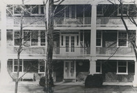
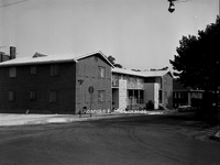
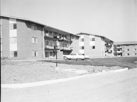
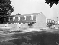
Davis2 19.9a Briarwood Apartments
Briarwood Apartments, located at 826 Hardy Road in Vinton.
Davis2 19.9b Briarwood Apartments
Briarwood Apartments, located at 826 Hardy Road in Vinton.
Davis2 19.9c Briarwood Apartments
Briarwood Apartments, located at 826 Hardy Road in Vinton.
Davis2 63.2 Pitzer Transfer
Pitzer Transfer and Storage, formerly located at 841 Reserve Avenue SW.
Davis2 36.1d Kimball Acres
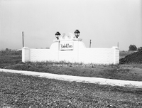
Sign at the entrance of the Kimball Acres subdivision.
Davis2 36.1c Kimball Acres
Newly constructed homes along the 500 block of Moran Avenue in the Kimball Acres subdivision.
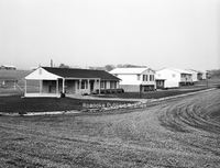
Davis2 36.1b Kimball Acres

Newly constructed homes along the 500 block of Moran Avenue in the Kimball Acres subdivision.
Davis2 36.1a Kimball Acres
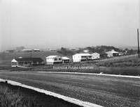
Newly constructed homes along the 500 block of Moran Avenue in the Kimball Acres subdivision.
Davis2 35.2 Grandin Apartments
Apartments located at 1801 Grandin Road SW.
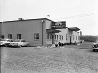
Davis2 47.3 Oren Roanoke
Oren Roanoke Corporation, formerly located at 720 3rd Street in Vinton.
Davis2 47.52 Winston Property
Winston Property Management, formerly located at 930 S. Jefferson Street.
Davis2 35.3 Jefferson Apartments
The Jefferson Apartments, formerly located at 820 S. Jefferson Street.
Davis2 36.2a Wilmont Farms
Looking north on 36th Street NW from Troutland Avenue in the Wilmont Farms neighborhood.
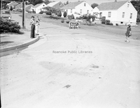
Davis2 36.2b Wilmont Farms
Looking south on 36th Street NW from Troutland Avenue in the Wilmont Farms neighborhood.
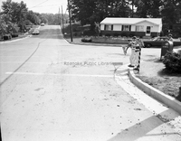
Davis2 36.2c Wilmont Farms
Looking north on 36th Street NW from Troutland Avenue in the Wilmont Farms neighborhood. Safety patrol students from Fairview Elementary School monitor traffic.
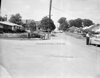
Davis2 36.2d Wilmont Farms
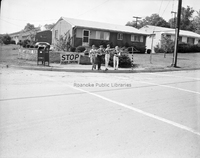
Safety patrol students from Fairview Elementary School on the corner of 36th Street NW and Troutland Avenue in the Wilmont Farms neighborhood.
Davis2 39 2434 Charing Cross
Home located at 2434 Charing Cross Drive.
Davis2 39 3547 Kenwick Trail

Home located at 3547 Kenwick Trail SW.
Davis2 39 1847 Maiden Lane
Home located at 1847 Maiden Lane SW.
Davis2 35.14a OSW Apartments
Apartments located at 217 Mountain Avenue SW.
Davis2 35.14b OSW Apartments
Apartments located at 217 Mountain Avenue SW.
Davis2 2.2491 Melrose Lodge
Exterior view of the former Melrose Lodge #139 of the Freemasons, formerly located at 21st Street and Carroll Avenue NW. The building is now part of Williams Memorial Baptist Church.
Davis2 48.39 Warehouse Row
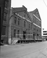
Warehouses along the 100 block of Norfolk Avenue SW, including C.B. Halsey Company and Old Domion.
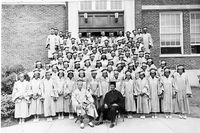
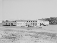
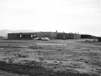
Davis2 44.5h Goodwill Industries
Goodwill Industries workshop and storefront, formerly located at 3125 Salem Turnpike NW.
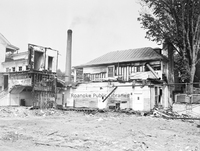
Davis2 47.76 Roanoke Electric Steel
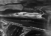
An aerial view of Roanoke Electric Steel, formerly located at 20 30th Street NW.
Davis2 11.921 Lord Botetourt High
Lord Botetourt High School, located at 1435 Roanoke Road in Daleville.
Davis2 11.651 Jefferson High School
Jefferson High School.
Davis2 11.43 Monroe Junior High
Monroe Junior High School, formerly located at 1122 19th Street NW.
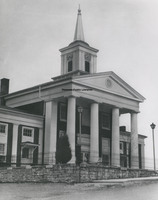
Davis2 8.31 Fincastle Presbyterian
Fincastle Presbyterian Church, located at 108 E. Back Street in Fincastle.
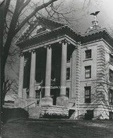
Davis2 8.5 Botetourt County Courthouse
Botetourt County Courthouse, located at 1 W. Main Street in Fincastle.
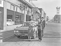
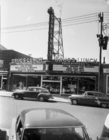
Davis2 7.22 Downtown Salem
A view of E. Main Street from the Market Street intersection in Downtown Salem.
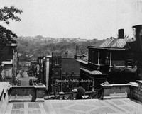
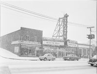
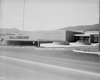
Davis2 16.423 Patrick Henry
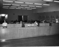
The Patrick Henry Hotel as seen from Roanoke Public Library.
Davis2 19.11 YMCA
The Railroad Department YMCA, formerly located at 1201 Shenandoah Avenue NW.
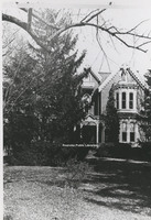
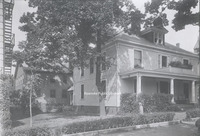
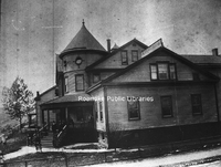
Davis2 33.31 406 Day Avenue
Home located at 406 Day Avenue SW. This was the home of the photographer, George C. Davis.
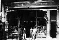
Davis2 44.328
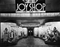
The Joy Shop, formerly located at 27 W. Campbell Avenue. It would later move to the corner of Jefferson Street and Campbell Avenue.
Davis2 62.1521 Frantz, Boots
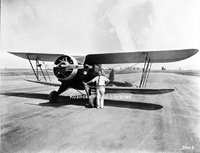
T.E. "Boots" Frantz with his plane.
Davis2 62.152 Roanoke Regional Airport
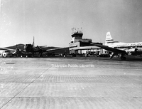
A view of the terminal at Woodrum Field, now Roanoke-Blacksburg Regional Airport.
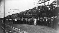
Davis2 62.1342 Airmail Service
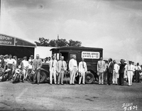
Local officials celebrate the inauguration of airmail service to Roanoke.
Davis2 49.22 Roanoke-Salem Plaza
Roanoke-Salem Plaza, formerly located at 4600 Melrose Avenue.
Davis2 48.621 Garland's Drugstore
Garland's Drugstore, formerly located at 1327 Grandin Road SW.
Davis2 44.7141 Kroger
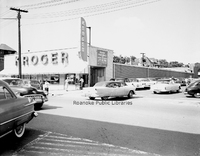
Kroger, formerly located at 1319 Grandin Road SW, now Roanoke Natural Foods Co-op.
Davis2 44.7144 Kroger
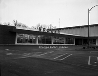
Kroger, formerly located at 1502 Williamson Road NE next to Sears Town.
Davis2 49.412 Sears
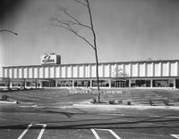
Sears Town, formerly located at 1502 Williamson Road NE.
Davis2 49.41 Sears
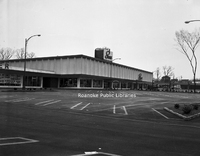
Sears Town, formerly located at 1502 Williamson Road NE.
Davis2 49.4 Sears
Construction nears completion on Sears Town, formerly located at 1502 Williamson Road NE.
Davis2 46.516 B.F. Goodrich
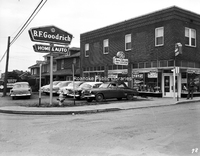
B.F. Goodrich Home and Auto, formerly located at 3520 Williamson Road NW.
Davis2 44.13 Caldwell-Sites Company
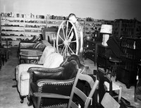
Caldwell-Sites Company Booksellers, formerly located at 105 S. Jefferson Street.
Davis2 43.51 Williamson Building
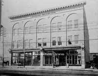
The Williamson Building was located at the corner of Church Avenue and Jefferson Street. The address of Graves-Humphreys Hardware was 311 S. Jefferson Street.
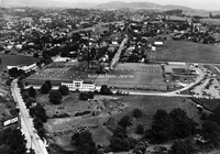
Davis2 5.21 Aerial of RMH
Aerial view of Roanoke Memorial Hospital.
Davis2 2.13 Campbell and Jefferson
The Rosenberg Building, formerly located on the corner of Campbell Avenue and Jefferson Street, was once the home of the Joy Shop, Barr Brothers Jewelers and Oak Hall Clothing.
Davis2 2.133 Hardy Shoes
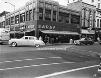
Hardy Shoes for Men and Boys, formerly located at the corner of Campbell Avenue and Jefferson Street.
Davis2 48.34 Tom's Potato Chips
Tom's Potato Chips and Farm Credit Association, formerly located on the corner of Sycamore Avenue and Williamson Road NE.
Davis2 29d Calvary Baptist
Calvary Baptist Church, located at 608 Campbell Avenue SW.