
Browse Items (9249 total)
Sort by:
MP 1.3 Fortune, Roberta B.
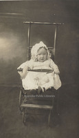
Roberta Blanton Fortune as an infant. She was born 6 August 1913 to George E. Fortune and Mara Ophelia Blanton.
MP 1.2 Fortune, Frances C.

Frances Elvira Fortune as an infant. She was born 31 December 1909 to George E. and Mara Ophelia Blanton.
MP 1.1 Fortune, William D.
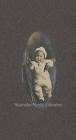
William D. Fortune as an infant. Fortune was born 24 September 1908 to George E. Fortune and Mara Ophelia Blanton.
VF6 Smith Mountain Lake
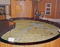
Model of Smith Mountain Lake.
VF5 Smith Mountain Lake
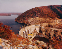
Aerial view of Smith Mountain Lake Dam.
VF4 Smith Mountain Lake
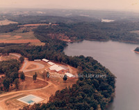
Aerial view of Smith Mountain Lake.
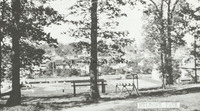
VF3 Smith Mountain Lake Picnic Area
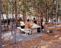
Picnic area at Smith Mountain Lake.
VF2 Smith Mountain Lake
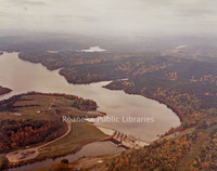
Aerial view of Smith Mountain Lake.
VF1 Smith Mountain Lake Dam
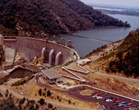
Aerial view of Smith Mountain Lake Dam.
A Guide to the Women's Guild Scrapbook
This is a guide to the Women's Guild Scrapbook. This scrapbook contains ephemera, photographs, brochures, newspaper clippings, and correspondence related to the guild. Contents of the scrapbook are arranged chronologically.
A Guide to the Papers of Julian Wise
This is a guide to the papers of Julian Stanley Wise. This collection contains material directly related to Julian Wise or the Rescue Squad movement in the United States and/or Virginia. Personal correspondence, articles and awards comprise the…
A Guide to the Stephen Warren Collection
This is a guide to the Stephen Warren Collection. The Stephen Warren Collection is a collection of photographs, correspondence, scrapbooks, and miscellaneous items of the Bryant, Mullins, Caldwell, and McManaway families.
A Guide to the Papers of Marguerite Tise
This is a guide to the papers of Marguerite Tise. The collection consists of historical and genealogical materials related to Floyd County, Virginia, and limited research of other localities. The majority of the collection is composed of…
A Guide to the Enrollment Records of St. Andrews Catholic School
This is a guide to the enrollment records of St. Andrews Catholic School. St. Andrew’s School Enrollment Records document the names of students who attended the school circa 1897-1941, 1944-1953. Lists of high school graduates are documented from…
A Guide to the Roanoke Railway & Electric Company Records
This is a guide to the records of the Roanoke Railway & Electric Company. The collection includes correspondence, photographs, general histories and newspaper articles.
A Guide to the Roanoke Area Scouting History Collection
This is a guide to the Roanoke Area Scouting History Collection. This collection contains the papers and personal documents of several notable leaders in the Boy Scouts of America (BSA) from the Roanoke, Virginia area. The bulk of the collection…
A Guide to the Roanoke Drug Company Collection
This is a guide to the Roanoke Drug Company Collection. The Roanoke Drug Company collection contains various articles related to Roanoke Drug Company and the various companies related to it, both before and after the company was known as Roanoke…
A Guide to the Diaries of Mary Louise Riley Harmon and Celia Riley
This is a guide to the diaries of Mary Louise Riley Harmon and Celia Riley. This collection of diaries relates the daily thoughts and actions of Celia Riley and Mary Riley Harmon. Those kept by Celia span the years 1928 through 1933 and 1946 and…
A Guide to the Ernest F. Reynolds Collection
This is a guide to the Ernest F. Reynolds Collection. The collection is comprised of various materials related to coal mining in West Virginia and Virginia and other miscellaneous historical topics of interest to the creator. Originally housed in…
A Guide the Congressman Richard H. Poff Collection
This is a guide to the Congressman Richard H. Poff Collection. This collection contains Virginia’s 6th District US Congressman Richard H. Poff’s “Report from Washington” from 1954 through 1971. These are newsletters sent by the Congressman to…
A Guide to the Pennsylvania Archives Maps
This is a guide to the Virginia Room holdings of the Pennsylvania Archives Maps. The Pennsylvania Archives Maps are comprised of twenty one folded paper maps of the twenty five piece collection and a photocopy of the index entitled, “An index to…
A Guide to the Nathaniel Parrish Manuscript Register
This is a guide to the Nathaniel Parrish Manuscript Register. This manuscript contains a collection of the professional and personal communications of Nathaniel R. Parrish. The documents date from 1916 to 1929. The collection is contained in one box…
A Guide to the Original Letters Collection
This is a guide to the Original Letters Collection. The collection contains various correspondences from numerous authors at different dates. The letters that pertain to Roanoke are those of John Randolph, who resided here in the 1800s, the majority…
A Guide to the Moulse-Huff Genealogy Collection
This is a guide to the Moulse-Huff Genealogy Collection. The Moulse-Huff Genealogy Collection was created and collected in the course of Helen Huff Moulse’s family history research in the 1970s, 80s, and 90s. It contains completed genealogy forms,…
A Guide to the McKendrie-Day Papers, 1920-1930

The documents in the McKendrie Day Family Papers include family history documents and materials relating to Charles and Sarah McKendrie’s four daughters, Grace, Mabel, Jessie “Boots,” and Hilda “Irene.” The majority of the materials focus on Mabel,…
A Guide to the Memoirs of Ora Belle Mayberry McColman
This is a guide to the memoirs of Ora Belle Mayberry McColman. The Ora Belle Mayberry McColman Memoir Manuscripts are comprised of twelve yellow ruled notepads of the thirteen piece collection. The first notepad in the collection was missing at time…
A Guide to the LaRue Mason Collection
This is a guide to the LaRue Mason Collection. This collection consists of genealogical information relating to the Mason and Bowman families. Most of the information is regional, although correspondence regarding the search for genealogical…
A Guide to the Papers of Dr. John Kern
This is a guide to the Papers of Dr. John Kern. The Kern Papers are comprised of documents, photographs, and newspaper articles that are a product of the research done by Kern during his time as Roanoke Regional Director for the Virginia Department…
A Guide to the Records of the Independent Order of Odd Fellows, Lignite Lodge No. 185
This is a guide to record books for the Lignite Lodge #185, based out of Oriskany, VA, and one folder with the original deed for the Lignite Lodge Property in Oriskany, Botetourt County, Virginia.
A Guide to the Contents of the Huff Lane Time Capsule
This is a guide to the contents of the Huff Lane time capsule. The collection is comprised of items that were set in a cornerstone of Huff Lane Intermediate School in the City of Roanoke in 1950. The creator of the collection chose items that…
A Guide to the Papers of Gayle Fisher
This is a guide to the papers of Gayle Fisher. This is a genealogical collection of 49 family names that have been arranged by Mrs. Gayle Fisher. The collection includes computer printouts of Bible records, research by others, obituaries,…
A Guide to the Records of the Elmwood Park Century Project

This is a guide to the records of the Elmwood Park Century Project. In 1978, the City of Roanoke and downtown business community commissioned a $100,000 study to evaluate the development potential of Roanoke’s downtown core area and to prepare a plan…
A Guide to the Ellison Family Papers
This is a guide to the Ellison Family Papers. This collection contains the correspondence of members of the Ellison family, as well as other documents, records, manuscripts, publications and printed materials related to and belonging to family…
A Guide to the Ruth Davis Manuscript Register
This is a guide to the Ruth Davis Manuscript Register. This manuscript is a collection of materials related to Ruth Davis’ enrollment in the Jefferson Hospital School of Nursing from which she graduated in 1926. The collection includes five folders…
A Guide to the Papers of Bruce J. Anderson
This is a guide to the papers of Bruce J. Anderson. This collection contains genealogical research compiled by Bruce J. Anderson on his own family, in particular the Poindexter family. The papers and personal documents of a number of relatives are…
A Guide to the Papers of Steve Brody
This item is a guide to the Papers of Steve Brody. The Brody Papers are comprised of documents, photographs, and artifacts that relate to community work done by Steve Brody in Roanoke from 1935-1978. Documents include a biographical timeline of…
A Guide to the Raymond Barnes Manuscripts
The Raymond Barnes Manuscript Collection consists of Barnes’ research notes and drafts used to compile "A History of Roanoke". Also included are several personal items, including a journal kept by Barnes in 1966, a journal kept by Barnes’ brother,…
A Guide to the Bonnie S. Ball Collection
A guide to the Bonnie S. Ball Collection, which highlights the extensive genealogical research done by Mrs. Bonnie S. Ball, who worked primarily in Southwestern Virginia historical records. Contained in the collection are notes for merely a handful…
A Guide to the Papers of M. Carl Andrews
A guide to the Papers of M. Carl Andrews, which consists of seventeen file folders including typescripts, clippings and photocopies of newspaper articles and columns, letters, invitations, event programs, committee reports, and both personal and…
A Guide to the Association of Fundraising Professionals Records
A guide to the records of the presidents of the First Virginia Chapter of the Association of Fundraising Professionals (AFP), earlier known as the National Society of Fundraising Executives (NSFRE). The collection extends from the founding of the…
A Guide to the 1952 All-America City Award Records
A finding aid for the 1952 All-America City Award Records, which were created and/or collected and compiled by M. Carl Andrews, Editor of the Roanoke Times & World News. Items include correspondence to and from Andrews in reference to the award and…
Vertical Files Index
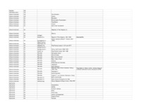
The Vertical File Index is an alphabetical list of over 3300 topical files. Vertical files may include pamphlets, news clippings and other materials that do not merit a call number, but are arranged for ready reference on a given topic.
Surname Files Index
The Surname File Index alphabetically lists all of the roughly 3,000 surnames for which there is a file in the Virginia Room.
Roanoke, Virginia
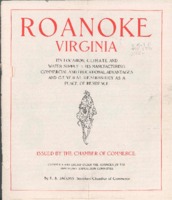
Roanoke, Virginia is a Chamber of Commerce publication that highlights its "location, climate, water supply, manufacturing, commercial and educational advantages, and general desirability as a place of residence."
Picturesque Roanoke
Picturesque Roanoke is "a series of reproductions from photographic views , taken in the City of Roanoke, and the vicinity thereof, especially for this work".
A Synopsis of Roanoke in 1891 and Her Wonderful Prosperity
A synopsis of the City of Roanoke in 1891, including summaries of industries, schools, financial conditions, etc.
Underwood 9 Downtown Looking Southeast
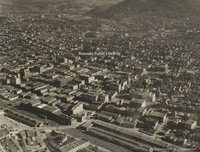
Aerial view of downtown Roanoke looking southeast
Underwood 8 Colonial Heights
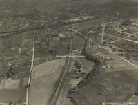
Aerial view of Roanoke from Colonial Heights
Underwood 7 Roanoke from Stone Mountain
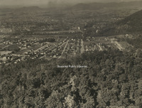
Aerial view of Roanoke from Stone Mountain
Underwood 6 N&W Shops
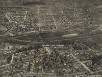
Aerial view of the Norfolk & Western Railway shops
Underwood 50 Fincastle
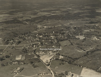
Aerial view of Fincastle.
Underwood 5 North on Jefferson
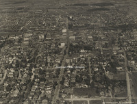
Aerial view looking north on Jefferson Street.
Underwood 49 Troutville
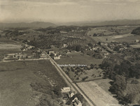
Aerial view of Troutville.
Underwood 48 Cloverdale
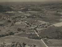
Aerial view of Cloverdale.
Underwood 47 Vinton
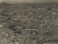
Aerial view of Vinton.
Underwood 46 Salem
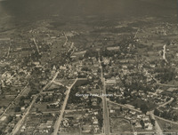
Aerial view of Salem
Underwood 45 Falling Creek Reservoir
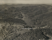
Aerial view of Falling Creek Reservoir.
Underwood 44 South of Roanoke

Aerial view of mountains at the south edge of Roanoke.
Underwood 43 Orchards
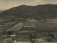
Aerial view of orchards near Roanoke.
Underwood 42 Andrews Farm
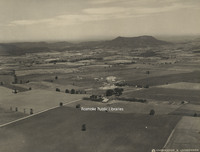
Aerial view of the Andrews farm, near Roanoke.
Underwood 41 Roanoke from South
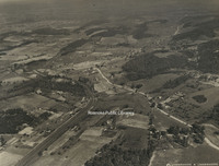
Aerial view of Roanoke from the south. The road entering the photo at bottom right is Starkey Road heading north. The Shell country store is currently located where Starkey veers right in this photo. This section of the road is now the path of…
Underwood 40 Norwich
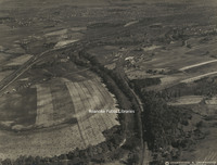
Aerial view of the Norwich neighborhood.
Underwood 4 East on Campbell
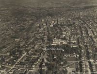
Aerial view looking east on Campbell Avenue.
Underwood 39 North of Roanoke
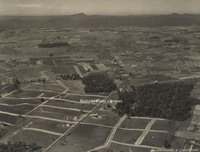
Aerial view looking north of Roanoke. Williamson Road can be seen bisecting the photo from top to bottom. At the bottom left, the first street left of Williamson is Sycamore Avenue. The street above Sycamore is Thurston Avenue. The entire block…
Underwood 38 Roanoke College
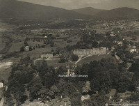
Aerial view of Roanoke College.
Underwood 37 Hollins College
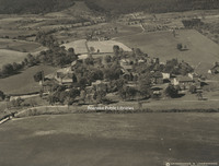
Aerial View of Hollins College, now Hollins University.
Underwood 36 Virginia College
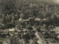
Aerial view of Virginia College.
Underwood 35 Lakeside
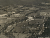
Aerial view of Lakeside Amusement Park.
Underwood 34 Roanoke Country Club
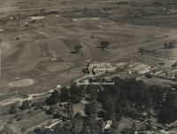
Aerial view of Roanoke Country Club.
Underwood 33 Mountain View
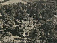
Aerial view of Mountain View, the J.B. Fishburn home.
Underwood 32 St Andrews
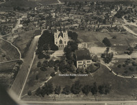
Aerial view of St. Andrews Catholic Church.
Underwood 31 Roanoke Railway & Electric
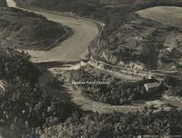
Aerial view of Roanoke Railway & Electric Company's hydroelectric plant
Underwood 30 Roanoke Railway & Electric
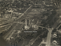
Aerial view of Roanoke Railway & Electric Company's power station, substation, car barn and shops.
Underwood 3 Downtown Looking Southwest
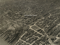
Aerial view of downtown Roanoke looking southwest
Underwood 29 Roanoke Railway & Electric
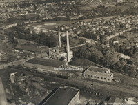
Aerial view of Roanoke Railway & Electric Company's power station, substation, car barn and shops.
Underwood 28 Crozer Iron Furnace
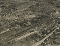
Aerial view of the Iron Furnace and Pyrites plant
Underwood 27 Virginia Bridge & Iron
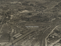
Aerial view of Virginia Bridge & Iron Company.tif
Underwood 26 N&W Shops
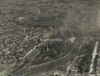
Aerial view of the Norfolk & Western Railway shops
Underwood 25 American Viscose
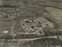
Aerial view of American Viscose Corporation.
Underwood 24 Raleigh Court
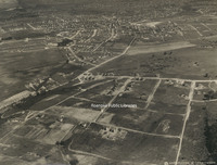
Aerial view of Raleigh Court
Underwood 23 South Roanoke
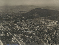
Aerial view of South Roanoke.
Underwood 22 Northwest of Roanoke
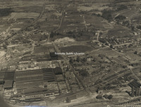
Aerial view of northeast Roanoke
Underwood 21 West Roanoke
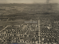
Aerial view of northwest Roanoke
Underwood 20 Virginia Heights
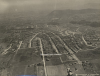
Aerial view of Virginia Heights
Underwood 2 Roanoke Looking West
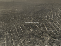
Aerial view of Roanoke looking west
Underwood 19 N&W Yards
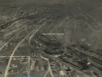
Aerial view of the Norfolk & Western Railway yards.
Underwood 18 Mill Mountain
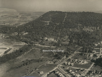
Aerial view of Mill Mountain, including the Mill Mountain Incline and Roanoke Hospital.
Underwood 17 Athletic Field
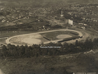
Aerial view of athletic field that would become the location of Victory Stadium and Maher Field.
Underwood 16 Highland Park School
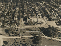
Aerial view of Highland Park Elementary School, known as Park Street School at the time of this photo.
Underwood 15 Jefferson High
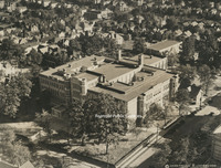
Aerial view of Jefferson High School
Underwood 14 N&W Offices
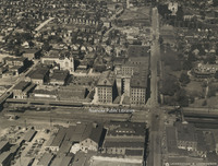
Aerial view of Norfolk & Western General Offices.
Underwood 13 Hotel Roanoke
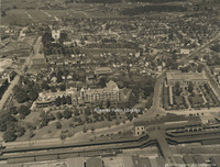
Aerial view of Hotel Roanoke and Roanoke Auditorium.
Underwood 12 Municipal Building
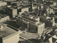
Aerial view of the Municipal Building
Underwood 11 West on Campbell
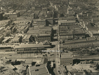
Aerial view looking west on Campbell Avenue
Underwood 10 East on Campbell
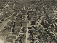
Aerial view looking east down Campbell Avenue
Underwood 1 Roanoke from 13500
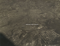
Aerial view of Roanoke from 13500 feet.
Davis GL 98 Pitzer Transfer
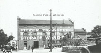
Pitzer Transfer Storage Warehouse, formerly located at the corner of Franklin Road and 2nd Street.
Davis GL 94 Market Street
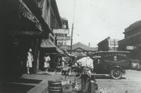
Looking north on Market Street.
Davis GL 92 Eleventh Street
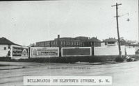
Billboards lining Eleventh Street at Moorman Avenue intersection.
Davis GL 90 Mountain Avenue
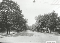
Looking east on Mountain Avenue at 4th Street intersection.
Davis GL 9 Scene in Highland Park
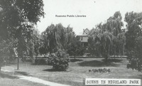
Scene in Highland Park.
Davis GL 89 Comprehensive Plan
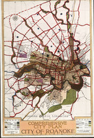
Map included in John Nolen's Comprehensive Plan for the City of Roanoke.
Davis GL 88 Wasena Terrace
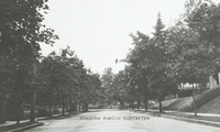
Looking east on Wasena Terrace.
Davis GL 87 Grandin Road
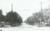
Looking north on Grandin Road from Sherwood Avenue.
Davis GL 86 Washington Park
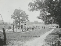
Washington Park, located at 1610 Burrell Street.
Davis GL 85 FNEB Detail
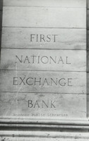
Stonework etched with First National Exchange Bank.
Davis GL 84 Center Parkway
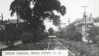
Center Parkway, 9th Street SE.
Davis GL 81 Schulte United Building
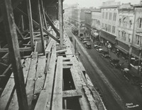
Campbell Avenue as seen from the Schulte United building, formerly located at 16 Campbell Avenue.
Davis GL 80 Giles Brothers Furniture
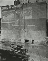
Giles Brothers Furniture, formerly located at 108 Campbell Avenue.
Davis GL 8 Stone Bridge
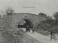
Children play under stone bridge. Location unknown.
Davis GL 79 Jamison Bakery
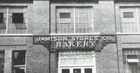
Jamison Company Bakery, formerly located at 541 Salem Avenue.
Davis GL 77 Traffic Congestion Flyer
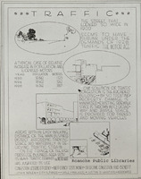
Traffic Congestion Flyer circa 1928.
Davis GL 76 Existing Conditions of Roanoke
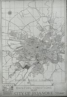
Existing Conditions Map of City of Roanoke used in Nolen plan
Davis GL 75 Map of Roanoke
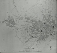
Map of City of Roanoke and Environs used in the Nolen plan.
Davis GL 72 Fairacres
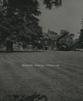
Fairacres, located at 2713 Avenham Avenue, was built in 1912 by W.C. Stephenson. It remained in the Stephenson Family until 1963, when it was purchased by the Roanoke Council of Garden Clubs. The club kept the home until 2003. It is now a private…
Davis GL 71 Zone Plan City of Roanoke
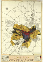
Map of City of Roanoke's Zone Plan used in Nolen Plan.
Davis GL 7 Jefferson Street Looking North
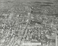
Aerial view of Jefferson Street looking north.
Davis GL 69 Pond in Elmwood Park
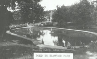
View of pond in Elmwood Park .
Davis GL 68 Allison Avenue
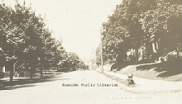
A view of the 300 block of Allison Avenue.
Davis GL 66 Melrose Park
Melrose Park on Melrose Avenue between 14th and 15th Streets.
Davis GL 64 Salem Avenue
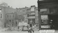
Approximately 132 Salem Avenue.
Davis GL 6 Highland Park School
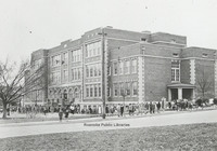
View of Highland Park Elementary School, located at 1212 5th Street.
Davis GL 59 Panorama
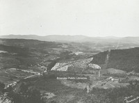
Panoramic view of Roanoke Valley from Route 221 on Bent Mountain at the top of the climb up the mountain just before it reaches the top.
Davis GL 58 Lynchburg Avenue
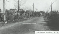
Unknown location on Orange (Lynchburg) Avenue.
Davis GL 57 Mayors Momument
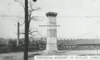
Mayor's Monument in its original location in Woodland Park at Church Avenue and Sixth Street SE, overlooking the Norfolk and Western Shops. The Mayor
Davis GL 55 Downtown Construction
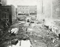
View of men working on construction downtown. Totz Department Store can be seen in the background. Totz was located at 117-119 Salem Avenue SW.
Davis GL 52 Old Episcopal Church
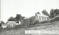
Ruins of an episcopal church in Northeast Roanoke.
Davis GL 5 Montrose Avenue Jog End
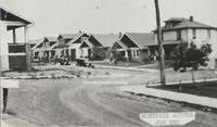
View of the 600 block Montrose Avenue lined with houses.
Davis GL 49 9th Street
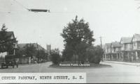
View of 9th Street from the intersection with Jamison Avenue.
Davis GL 48 Ponce de Leon
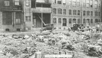
View of debris behind original Hotel Ponce de Leon.
Davis GL 47 Route 460
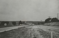
View of Route 460 east of Roanoke.
Davis GL 46 Spring in Weaver Heights Park
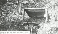
View of the spring once located in Weaver Heights Park.
Davis GL 44 Highland Park
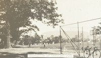
Recreation in Highland Park
Davis GL 43 Church Avenue
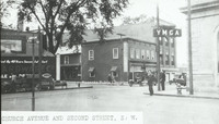
View of the intersection of Church Avenue and Second Street SW with the sign for the YMCA on the right.
Davis GL 42 Elmwood Park
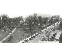
View of Elmwood Park from the Patrick Henry Hotel.
Davis GL 41 Ponce De Leon Hotel
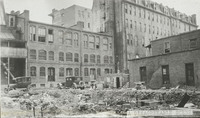
View of the rear of the Hotel Ponce De Leon, with the remainder of a building's foundation visible in foreground.
Davis GL 40 Railway Station
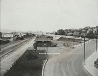
View from Williamson Road of Virginia Railway Station. Jefferson Street bridge in background.
Davis GL 4 Mill Mountain and Roanoke Valley
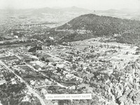
View of Mill Mountain and the surrounding Roanoke Valley
Davis GL 38 Public Library in Elmwood Park
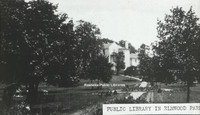
View of the first Roanoke Public Library in Elmwood Park. The library was located in the Terry House, a gift to the city from the Terry Family.
Davis GL 37 Dog Mouth Fountain
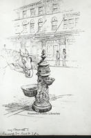
Sketch of the Dog Mouth Fountain. The fountain was acquired by the city in 1898. It stands at the corner of Salem Avenue and Market Street.
Davis GL 36 Roanoke Hospital
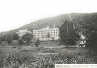
Roanoke Hospital at the foot of Mill Mountain. The Mill Mountain incline can be seen to the right.
Davis GL 35 Panoramic View from Mill Mountain
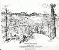
A panoramic sketch from Mill Mountain by Louis Ruyl of New York for the Chamber of Commerce. Caption reads, "Showing spurs of the Blue Ridge with the Alleghany Mountains in the distance, and the Roanoke bowl or amphitheater, McAfee's Knob at left,…
Davis GL 34 Tennis Courts at Elmwood
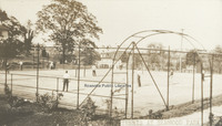
The tennis courts once in Elmwood Park.
Davis GL 33 Motor Routes to Roanoke
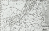
Chamber of Commerce map showing roads to Roanoke.
Davis GL 32 Play Day
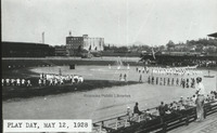
"Play Day" at Maher field 12 May 1928.
Davis GL 31 Patterson Avenue
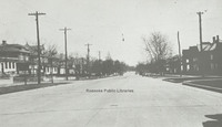
A view of Patterson Avenue.
Davis GL 30 Campbell Avenue
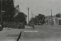
View of West Campbell Avenue at 8th Street intersection, 1928.
Davis GL 3 Melrose Park
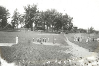
View of people playing recreational games in Melrose Park.
Davis GL 29 Truck
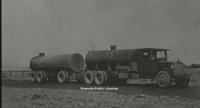
Image of a tanker style truck.
Davis GL 269 Jefferson Street
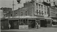
Northwest corner at the intersection of Jefferson Street and Campbell Avenue.
Davis GL 26 State and City Bank
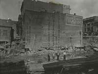
Side view of State & City Bank, once located at approximately 206 Jefferson Street. This photo was taken after a building was razed.
Davis GL 25 Southeast
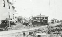
View of several homes in Southeast.
Davis GL 242 Shaffers Crossing
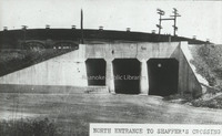
North entrance to Shaffer's Crossing.
Davis GL 241 10th Street
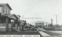
A view of 10th Street NW at Williamson Road and the Oakland School.
Davis GL 237 Walnut Avenue Bridge
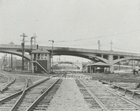
Side view of the Walnut Avenue and Jefferson Street bridges.
Davis GL 232 Northeast
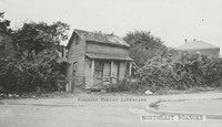
Derelict home in Northeast. Exact location unknown.
Davis GL 23 Jefferson Street
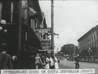
View of advertisement signs hanging from the front of buildings along South Jefferson Street.
Davis GL 222 Patrick Henry Hotel
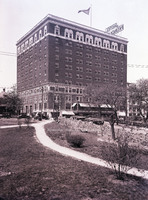
View of Patrick Henry Hotel from Elmwood Park.
Davis GL 22 Single Family Dwelling
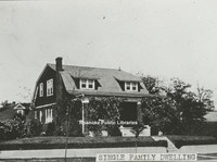
View of a single family dwelling made of brick.
Davis GL 21.1 Terry Building
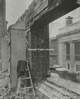
Image of a building being demolished with coat laying on ladder.
Davis GL 21 Terry Building
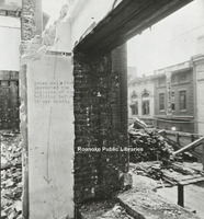
Image of a building being demolished.
Davis GL 20 Salem Avenue
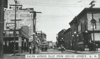
View of Salem Avenue east from Second Street, SW. Buildings lines street with painted advertisements.
Davis GL 2.1 Scene in Elmwood Park
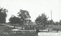
Scene in Elmwood Park viewing the rose garden.
Davis GL 2 Scene in Elmwood Park
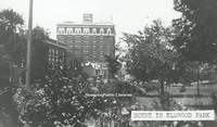
Scene in Elmwood Park with a view of Patrick Henry Hotel.
Davis GL 19 Campbell Avenue
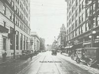
Looking west on Campbell Avenue at intersection with Jefferson Street.
Davis GL 18 Windsor Avenue
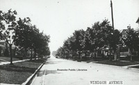
Windsor Avenue in Raleigh Court
Davis GL 172 Hotel Patrick Henry
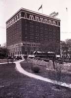
View of Hotel Patrick Henry from Elmwood Park
Davis GL 17 Unidentified Building
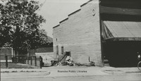
Unidentified building near downtown.
Davis GL 165 GN Natural Bridge
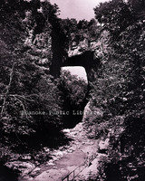
Natural Bridge
Davis GL 16 Neighborhood
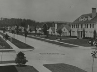
Though not in Roanoke, this Longview, Washington neighborhood scene was used as an example in John Nolen's plan for Roanoke.
Davis GL 14 Pond in Elmwood Park
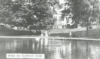
View of pond in Elmwood Park.
Davis GL 13 Church Avenue
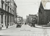
View of Church Avenue looking east from Commerce Street (now 2nd Street). Greene Memorial UMC visible on right, old YMCA visible on left.
Davis GL 12 Watts Springs
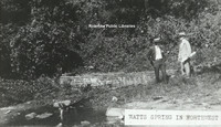
View of two men standing beside Watts Springs.
Davis GL 111 Fire Escape Diagram
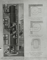
Fire Escape diagram depicting a "state-of-the-art" fire escape containing a slide.
Davis GL 110 Campbell Avenue
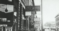
Various business signs along E. Campbell Avenue.
Davis GL 11 Staunton Avenue
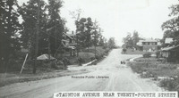
View of Staunton Avenue near 24th Street.
Davis GL 108 Salem Avenue
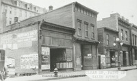
Vacant store fronts in the 100 block of Salem Avenue.
Davis GL 105 Melrose Avenue
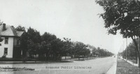
Melrose Avenue. Exact location unknown.
Davis GL 104 Maiden Lane
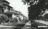
Houses on Maiden Lane.
Davis GL 100 Playground in Norwich
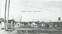
PLayground in Norwich neighborhood.
Davis GL 10 Rorer Avenue
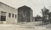
View of buildings along Rorer Avenue.
UC 9 Williamson Road Plaza
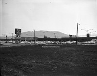
Williamson Road Plaza, located in the 5300 block of Williamson Road.
UC 81 Colonial Avenue Baptist
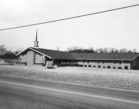
Colonial Avenue Baptist Church, located at 4165 Colonial Avenue.
UC 80 Cycle Center

Cycle Center, formerly located at 406 E. 4th Street.
UC 8 Texaco
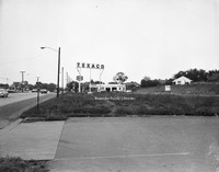
Texaco station formerly located in the 5200 block of Williamson Road.
UC 79 Southampton Model
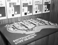
3-dimensional scale model of Southampton Townhomes.
UC 78 Southampton
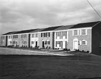
Southampton townhomes, located off of Wyndham Drive in Vinton.
UC 77 Southampton
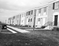
Southampton townhomes, located off of Wyndham Drive in Vinton.
UC 75 Roanoke EMS
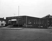
Roanoke Life Saving and First Aid Crew hall, located at 374 Day Avenue.
UC 72 Allied Sales
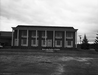
Allied Sales Company, formerly located at 2480 Patterson Avenue.
UC 71 Thomas Rutherfoord
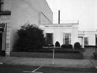
Thomas Rutherfoord Bonding and Insurance, located at 1 S. Jefferson Street.
UC 7 Northview UMC
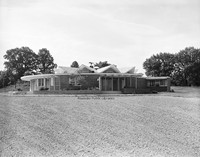
Northview United Methodist Church, located at 521 Ridgecrest Drive.
UC 65 Flood Aerial
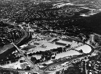
Aerial view showing flood damage brought on by Hurricane Camille.
UC 64 Poff Hauling
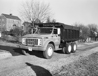
J. Bill Poff Hauling dump truck.
UC 62 Hundleys Market
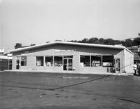
Hundley's Market, formerly located at 3605 Shenandoah Avenue.
UC 58 Gulf Truckstops
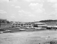
Gulf Truckstops at Troutville.
UC 57 Loyd & Fralin
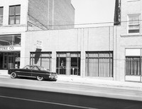
Loyd and Fralin Attorneys, formerly located at 301 Campbell Avenue.
UC 56 Kroger Bakery
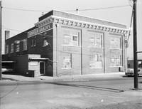
Kroger Bakery, formerly located at 541 Salem Avenue.
UC 55 Crofton
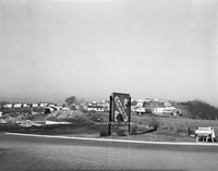
The Crofton subdivision off of Hardy Road in Vinton.
UC 54 Kelleys
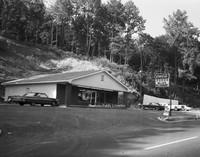
Kelley's Restaurant, formerly located at 4328 Salem Turnpike.
UC 53 Kroger Bakery
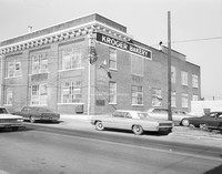
Kroger Bakery, formerly located at 541 Salem Avenue.
UC 51 Magic City Ford
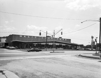
Magic City Ford, located at 809 Williamson Road.
UC 50 Peters Realty
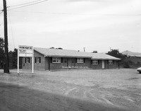
Peters Realty, formerly located at 623 Abney Road.
UC 49 Andys Cards & Candies
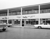
Andy's Cards and Candies, formerly located in Townside Festival Shopping Center.
UC 48 Flora & Martin
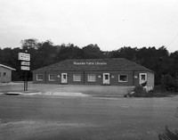
Offices located at 701 Brandon Avenue, including Flora and Martin Insurance, Department of Taxation and Jean Moore Custom Frames.
UC 47 Roanoke Box

Roanoke Box, formerly located at 621 Ashlawn Street.
UC 45 Booth Supply
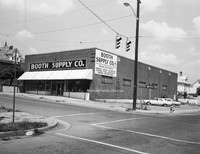
Booth Supply, formerly located at 828 Jamison Avenue.
UC 43 View from MM
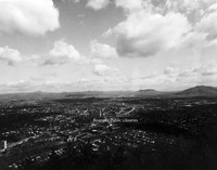
View of the Roanoke Valley from Mill Mountain.
UC 42 Kenneys
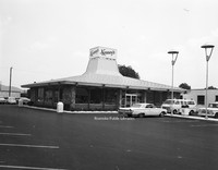
Kenney's, formerly located at 4317 Williamson Road.
UC 41 Chewning Garage
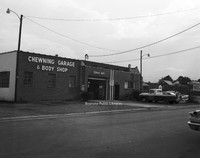
Chewning Garage, formerly located at 3034 Wentworth Avenue.
UC 39 Normandy Knoll
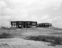
Construction of Normandy Knoll Apartments located at 3513 Normandy Lane. These apartments were built on a former 9-hole golf course called Devil's Elbow.
UC 38 81-43 Restaurant
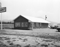
81-43 Restaurant, formerly located at 8131 Plantation Road.
UC 37 81-43 Restaurant
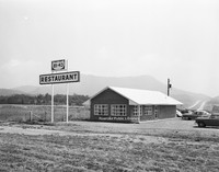
81-43 Restaurant, formerly located at 8131 Plantation Road.
UC 36 81-43 Restaurant Interior
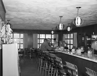
Interior of the 81-43 Restaurant, formerly located at 8131 Plantation Road.
UC 35 Windsor West
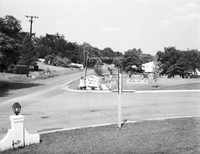
Entrance to the Windsor West neighborhood at the intersection of Grandin Road and Charing Cross Drive.
UC 34 Windsor West
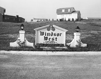
Sign at the entrance of the Windsor West neighborhood, located at the intersection of Grandin Road and Charing Cross Drive.
UC 32 Colonial-American
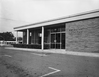
Colonial-American National Bank, formerly located at 1953 Franklin Road.
UC 31 Colonial-American
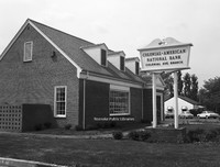
Colonial-American National Bank, formerly located at 2112 Colonial Avenue.
UC 30 American Motor Inns
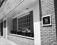
American Motor Inns, formerly located at 103 Campbell Avenue.
UC 3 Harry Dixon
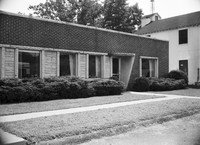
Harry Dixon Insurance, formerly located at 3226 Brambleton Avenue.
UC 29 Bantam Market
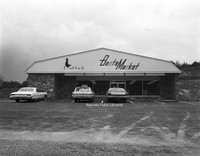
Bantam Market, formerly located at 3515 Franklin Road.
UC 27 Kenneys
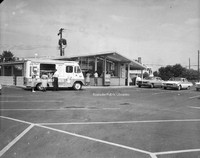
Kenney's, formerly located at 5324 Williamson Road.
UC 25 Billys Barn
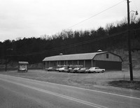
Billy's Barn, located at 1790 Thompson Memorial Drive.
UC 24 Hospital Computer Service
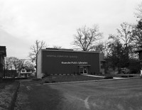
Hospital Computer Service, formerly located at 1147 2nd Street.
UC 22 Aerial of Downtown
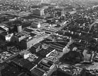
Aerial view of Downtown Roanoke.
UC 21 Aerial of Downtown
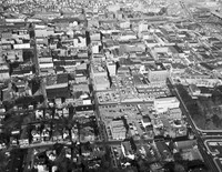
Aerial view of Downtown Roanoke.
UC 20 Colonial-American
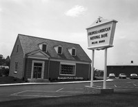
Hollins Branch of Colonial-American National Bank, formerly located at 7337 Williamson Road.
UC 2 Boyle-Swecker
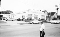
Boyle-Swecker Tire Company, formerly located at 715 Patterson Avenue.
UC 19 Colonial-American
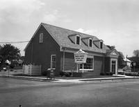
Colonial-American National Bank, formerly located at 210 Washington Street in Vinton..
UC 18 Colonial-American
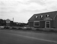
Colonial-American National Bank, formerly located at 3002 Brandon Avenue.
UC 17 Brandon Avenue
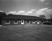
Offices located at 701 Brandon Avenue.
UC 16 Community Hospital
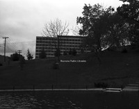
Community Hospital as seen from Elmwood Park.
UC 15 Elmwood Park Pond
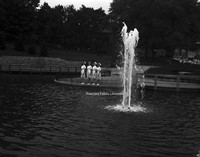
Unidentified nurses pose next the pond once located in Elmwood Park.
UC 14 Humble Esso
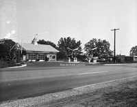
Humble Esso, formerly located at 3611 Brandon Avenue.
UC 13 Humble Esso
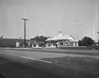
Humble Esso, formerly located at 3611 Brandon Avenue.
UC 12 Magnolia
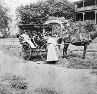
Unidentified individuals with a carriage in front of Magnolia. Magnolia was located at the corner of Orange Avenue and Williamson Road,. Built in 1837 by Zachariah Robinson as a tavern, Magnolia was a popular stop for stagecoach traffic until 1850…
UC 10 Jacks Laundromat
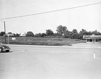
Jack's Laundromat, formerly located at 5312 Williamson Road.
UC 1 Boyle-Swecker
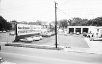
Boyle-Swecker Tire Company, formerly located at 715 Patterson Avenue.
CPC 9e Phillip Levy Fire
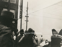
The Philip Levy Exchange Company furniture store caught fire for the second time on 31 August 1928. The first fire occurred the previous year and only caused minor damage. This fire would prove more disastrous. Philip Levy Exchange Company was…
CPC 9d Phillip Levy Fire
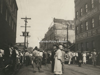
The Philip Levy Exchange Company furniture store caught fire for the second time on 31 August 1928. The first fire occurred the previous year and only caused minor damage. This fire would prove more disastrous. Philip Levy Exchange Company was…
CPC 9c Phillip Levy Fire
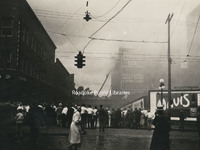
The Philip Levy Exchange Company furniture store caught fire for the second time on 31 August 1928. The first fire occurred the previous year and only caused minor damage. This fire would prove more disastrous. Philip Levy Exchange Company was…
CPC 9b Phillip Levy Fire
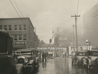
The Philip Levy Exchange Company furniture store caught fire for the second time on 31 August 1928. The first fire occurred the previous year and only caused minor damage. This fire would prove more disastrous. Philip Levy Exchange Company was…
CPC 9a Phillip Levy Fire
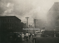
The Philip Levy Exchange Company furniture store caught fire for the second time on 31 August 1928. The first fire occurred the previous year and only caused minor damage. This fire would prove more disastrous. Philip Levy Exchange Company was…
CPC 99 Madison and 2nd
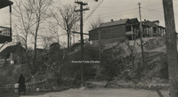
East side of 2nd Street NE and Madison Avenue. I-581 runs through this area today.
CPC 98 Madison Avenue
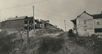
Madison Avenue east from 2nd Street NE. I581 runs through this area today.
CPC 8 Campbell and Chapman
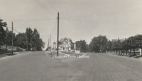
Point where Chapman Avenue forks off of Campbell Avenue
CPC 7e Campbell Avenue
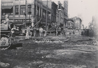
Removal of street railways on Campbell Avenue at the intersection with Jefferson Street.
CPC 7d Campbell Avenue
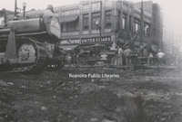
Removal of street railways on Campbell Avenue at the intersection with Jefferson Street.
CPC 7c Campbell Avenue
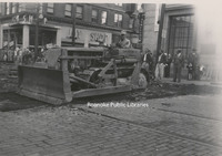
Removal of street railways on Campbell Avenue at the intersection with Jefferson Street.
CPC 7b Campbell Avenue
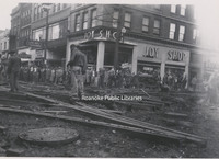
Removal of street railways on Campbell Avenue at the intersection with Jefferson Street.
CPC 7a Campbell Avenue
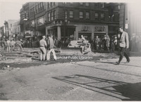
Removal of street railways on Campbell Avenue at the intersection with Jefferson Street.
CPC 65 Highland Park
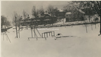
Looking south from Highland Park.
CPC 64 Norfolk Avenue
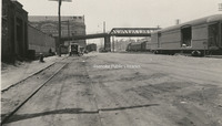
Looking west on Norfolk Avenue.
CPC 62 Shenandoah Avenue
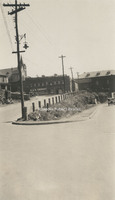
Shenandoah Avenue and Centre Avenue. Norfolk & Western General Offices visible in background.
CPC 60 Ridgewood
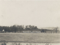
Ridgewood Manor House, was built by industrialist Samuel H. McVitty. It is located at 1900 South Clearing Road just above Ridgewood Farms Shopping Center.
CPC 6 Highland and Franklin
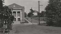
Jog intersection at Highland Avenue and Franklin Road. Beth Israel Synagogue visible.
CPC 59a Bryan McDonald House
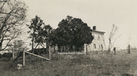
Located near Mt. Union village on the headwaters of Tinker Creek in Botetourt County, the Bryan McDonald house was built in 1766.
CPC 58 Crystal Spring
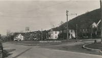
Houses along Richelieu Avenue in Crystal Spring.
CPC 57 Freight Truck
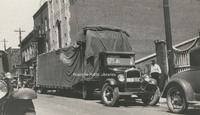
Southern States Motor Freight truck parked on the 100 block of Campbell Avenue.
CPC 54 Elmwood Pond
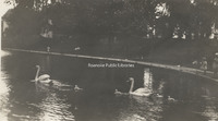
Swans in the pond once located in Elmwood Park.
CPC 53 Terry House
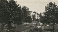
Terry House, formerly located in Elmwood Park. The Terry House was gifted to the City of Roanoke in 1921 for use a library. It operated in this capacity until a new library was built in 1952.
CPC 52 Japanese Magnolia
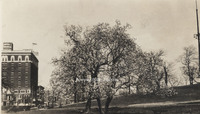
Japanese Magnolia in Elmwood Park.
CPC 5 Church and 5th
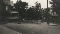
Jog intersection at Church Avenue and 5th Street.
CPC 48 10th Street
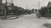
Looking north on 10th Street from Madison Avenue.
CPC 47 2nd Street
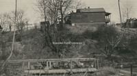
2nd Street NE at the intersection of Lick Run.
CPC 46 Orange Avenue
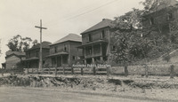
Derelict homes along Lynchburg(Orange) Avenue. Exact location unknown.
CPC 44 Orange Avenue
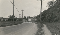
Looking east on Lynchburg (Orange) Avenue.
CPC 43 Elmwood Park
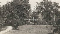
A view in Elmwood Park.
CPC 42 2nd Street
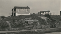
A view of 2nd Street NE between Walker Avenue and Rutherford Avenue.
CPC 41 Rorer Avenue
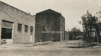
Looking east on Rorer Avenue from 5th Street.
CPC 40 Wells Avenue
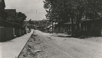
Looking west on Wells Avenue.
CPC 4 Franklin and Mountain
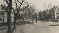
Jog intersection at Franklin Road and Mountain Avenue.
CPC 39 Bullitt Avenue
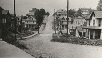
Looking west at the 500 block of Bullitt Avenue.
CPC 38 Church and 3rd
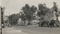
Looking east on Church Avenue from 3rd Street. Post office (now Commonwealth Building) is under construction at right.
CPC 37 Church and 3rd
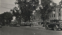
Looking east on Church Avenue from 3rd Street. Post office (now Commonwealth Building) is under construction at right.
CPC 36 Crystal Spring
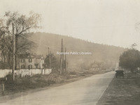
Looking up Crystal Spring Avenue from roughly 23rd Street.
CPC 35 2nd and Rutherford
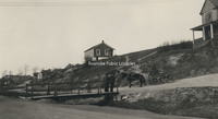
Intersection of 2nd Street and Rutherford Avenue NE.
CPC 3 Stone Home
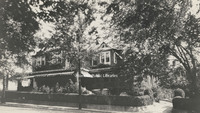
The home of Edward L. Stone of Stone Printing and Manufacturing, formerly located at 210 Mountain Avenue.
CPC 29 2nd Street

2nd Street NE at Lick Run.
CPC 28 Wells Avenue
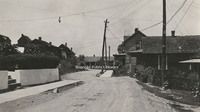
Jog at Wells Avenue NW.
CPC 27 Walker Avenue
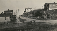
View of Walker Avenue at the intersection with 2nd Street NE.
CPC 26 2nd Street
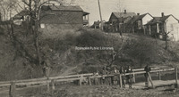
Unidentified children at Lick Run along 2nd Street NE.
CPC 25 Furnace Row
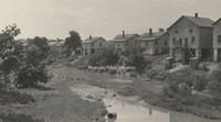
A view of Furnace Row on Tinker Creek, once roughly located at Orange Avenue and Rhodes Avenue.
CPC 24 Albemarle Avenue
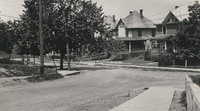
Looking toward Albemarle from the 6th Street intersection.
CPC 23 Albemarle Avenue
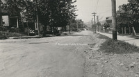
Looking west an Albemarle Avenue SE at the 6th Street intersection.
CPC 22 Hollins Entrance
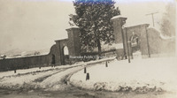
Entrance to Hollins College.
CPC 21b Trout Field
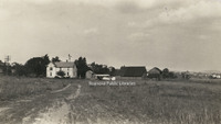
Located adjacent to and east of Fairview Cemetery along Melrose Avenue, Trout Field was Roanoke's first airfield.
CPC 21a Trout Field
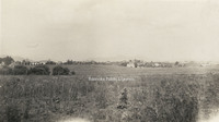
Located adjacent to and east of Fairview Cemetery along Melrose Avenue, Trout Field was Roanoke's first airfield.
CPC 20 Moorman Spring
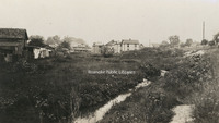
Moorman Spring was located on the Captain Robert B. Mooman property roughly located at the intersection of Moorman Avenue and 10th Street.
CPC 2 SW from YMCA
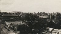
Looking southwest from the top of the YMCA building on 2nd Street. Lee Junior High School is visible in the left background.
CPC 19 Mill Mountain
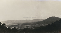
Looking south from atop Mill Mountain.
CPC 18 Dale and 8th
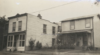
Structures once located at the corner of Dale Avenue and 8th Street.
CPC 17 Wasena Bridge
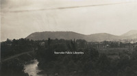
A view of Wasena Bridge from Riverside Boulevard.
CPC 16 Orange Avenue
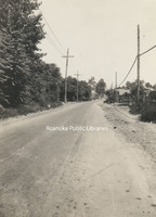
Looking east from about the 1100 block of Lynchburg (Orange) Avenue.
CPC 14a Riverside Park
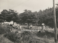
Pool at Riverside Park
CPC 14b Riverside Park
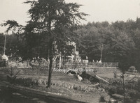
Pool at Riverside Park
CPC 14c Riverside Park
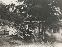
People sitting on the knoll overlooking the pool in Riverside Park.
CPC 13 2nd Street
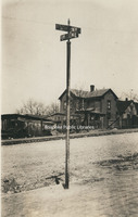
Sign at intersection of 2nd Street NE and unknown cross street.
CPC 128 4th Street
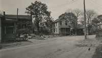
A view of 4th Street NE in the Gilmer School area. Exact location unknown.
CPC 12 Graybar Electric
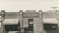
Storefront of Graybar Electric Company, formerly located at 603 Salem Avenue.
CPC 11 Raleigh Tavern
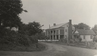
Raleigh Tavern, Roanoke's first hotel, was located on Lynchburg (Orange) Avenue NE. Built in the early 1800s and long known as Pate's Tavern, it was a popular stopping-place on the north-south stages or on the road from Lynchburg west to Seven Mile…
CPC 10d 4th Street
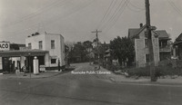
View of 4th Street NE. Northside Filling Station was located at 1201 4th, roughly where the post office is located today.
CPC 10c 4th Street
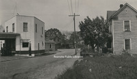
View of 4th Street NE. Northside Filling Station was located at 1201 4th, roughly where the post office is located today.
CPC 10b 4th Street
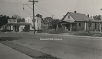
View of 4th Street NE. Northside Filling Station was located at 1201 4th, roughly where the post office is located today.
CPC 10a 4th Street
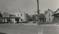
View of 4th Street NE. Northside Filling Station was located at 1201 4th, roughly where the post office is located today.
CPC 100 Hanover Avenue
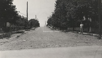
Looking west on Hanover Avenue from 10th Street.
CPC 1 Goodwin Home
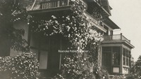
Rose arbor on the porch of the Thompson Goodwin home, once located in Orchard Hill. Orchard Hill, also known as "Official Hill" was located in the area where Community Hospital stands today.
Davis2 91.2 Memorial Tunnel
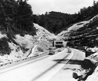
The Memorial Tunnel opened in 1954 to carry traffic through the Paint Creek Mountain on the West Virginia Turnpike. Closed to traffic in 1987, the tunnel is now used for military training.
Davis2 8.43 Kingsport Utilities
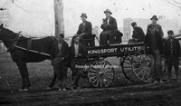
Unidentified men with a Kingsport Utilities wagon.
Davis2 8.42 Lynchburg
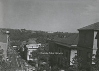
A view of Downtown Lynchburg from Courthouse hill.
Davis2 8.41 Lynchburg
A view of Downtown Lynchburg from Courthouse hill.
Davis2 8.4 Lynchburg
A view of Downtown Lynchburg from Courthouse hill.
Davis2 66.92 Cornelius Charlton Bridge
Also known as the Bluestone River Bridge, the Sergeant Cornelius H. Charlton Bridge crosses the Bluestone River in Mercer County, West Virginia. Charlton received the Metal of Honor for his heroic acts in the Korean War.
Davis2 66.827 Colorado Street Bridge
Construction of the bridge on South Colorado Street over the railroad tracks in Salem.
Davis2 66 SML Dam
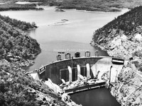
Smith Mountain Lake Dam.
Davis2 61.25 Virginian #104
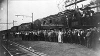
An unidentified group stands in front of Virginian #104, a class EL-#3A electric locomotive.
Davis2 57.5c Viking Lanes
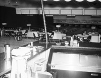
Interior view of Viking Lanes Bowling Alley, formerly located at 2727 Franklin Road.
Davis2 57.5b Viking Lanes
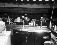
Interior view of Viking Lanes Bowling Alley, formerly located at 2727 Franklin Road.
Davis2 57.5a Viking Lanes
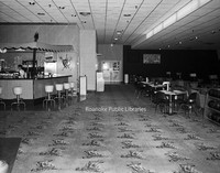
Interior view of Viking Lanes Bowling Alley, formerly located at 2727 Franklin Road.
Davis2 56 Waverly Church Choir
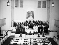
Unidentified members of the Waverly Place Baptist Church Choir.
Davis2 49.122 Crossroads Mall
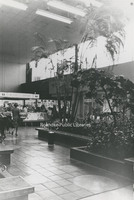
An interior view of Crossroads Mall.
Davis2 48.7 Archway Cookies
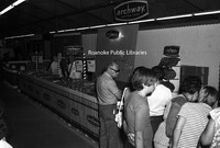
An Archway Cookies booth at an unidentified event.
Davis2 47.51 Johnson-Carper
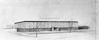
Architectural rendering of Johnson-Carper Furniture Company, formerly located at 3322 Hollins Road NE.
Davis2 47.5 Thaden-Jordan Furniture
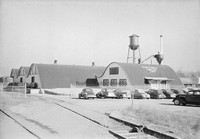
Thaden-Jordan Furniture Company, formerly located at 312 Kessler Mill Road.
Davis2 46.61 Magic City Ford
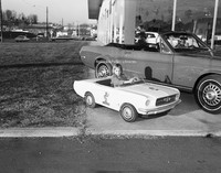
Unidentified girl sits in toy Mustang at Magic City Ford.
Davis2 46.6 Magic City Ford
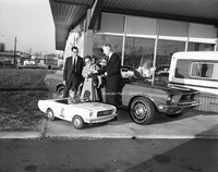
Magic City Ford promotion.
Davis2 46.34b Gulf Station
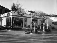
Wasena Gulf Service, formerly located at 1119 Main Street.
Davis2 46.34a Gulf Station
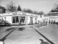
Wasena Gulf Service, formerly located at 1119 Main Street.
Davis2 45.64 ITT
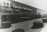
ITT Exelis, located at 7635 Plantation Road.
Davis2 45.311 Bowman Bakery
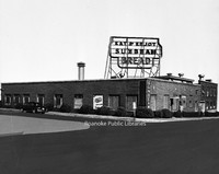
Bowman Bakery, formerly located at 102 5th Street NW.
Davis2 44.5g Goodwill Industries
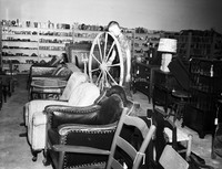
An interior view of Goodwill Industries, formerly located at 3125 Salem Turnpike.
Davis2 44.5f Goodwill Industries
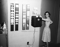
An unidentified employee punches the time clock at Goodwill Industries.
Davis2 44.5e Goodwill Industries
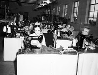
Unidentified employees make repairs to donated clothing at the Goodwill Industries workshop, formerly located at 3125 Salem Turnpike.
Davis2 44.5d Goodwill Industries
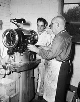
Unidentified employees work in the Goodwill Industries workshop, formerly located at 3125 Salem Turnpike.
Davis2 44.5c Goodwill Industries
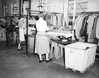
Unidentified employees work in the Goodwill Industries workshop, formerly located at 3125 Salem Turnpike.
Davis2 44.5a Goodwill Industries
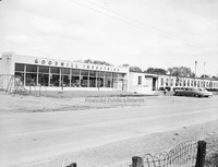
Goodwill Industries workshop, formerly located at 3125 Salem Turnpike.
Davis2 43.6 Paul C. Agee Insurance
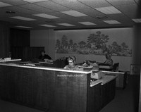
Employees of Paul C. Agee Insurance Company in the office.
Davis2 43.214 N&W Offices
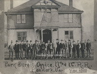
Railroad employees stand in front of the Norfolk & Western Office building formerly located on 5th Street.
Davis2 43.15 General Stone and Materials.
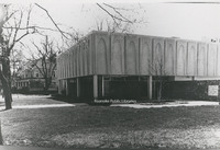
General Stone and Materials Corporation, formerly located at 1401 Franklin Road.
Davis2 43.1265 AEP Truck
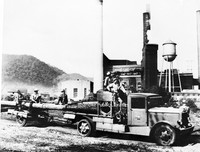
Appalachian Power employees haul an electric pole at an unidentified plant.
Davis2 43.1264 AEP Kanawha Plant
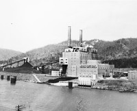
Located near Glasgow, West Virginia, the Kahawha River Plant is a coal-fired power station owned and operated by AEP.
Davis2 43.1263 AEP Truck
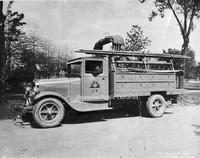
Appalachian Electric Power Company truck.
Davis2 43.11 Shenandoah Building
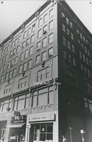
The Shenandoah Building, located at 305 1st Street.
Davis2 39f 40 Sawyer Drive
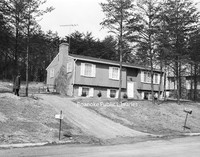
House located at 40 Sawyer Drive in the West Club Forest subdivision in Salem.
Davis2 39e 3358 Peakwood-2
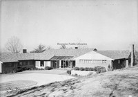
Home located at 3358 Peakwood Drive.
Davis2 39d 3358 Peakwood-1
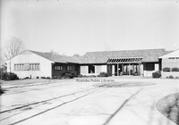
Home located at 3358 Peakwood Drive.
Davis2 39c 3112 Somerset-2
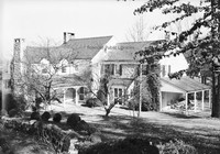
Rear view of home located a 3112 Somerset Street.
Davis2 39b 3112 Somerset-1
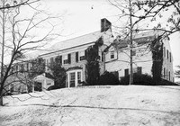
Home located at 3112 Somerset Street.
Davis2 39a 3105 Somerset
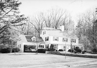
Home located at 3105 Somerset Street.
Davis2 27.55 Hott Bishop Memorial
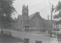
Hott Bishop Memorial United Brethren Church, formerly located on Tazewell Avenue.
Davis2 25.16 St. Andrews
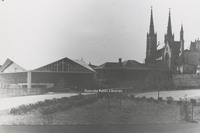
St. Andrews.
Davis2 23.5 Salem Presbyterian
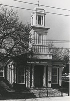
Salem Presbyterian Church, located at 41 E. Main Street.
Davis2 23.44 First Presbyterian
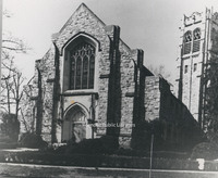
First Presbyterian Church, located at 2101 Jefferson Street.
Davis2 22.4 Woodlawn Methodist
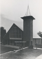
Woodlawn United Methodist Church, located at 2922 Corbieshaw Road.
Davis2 13.2 Roanoke County Courthouse
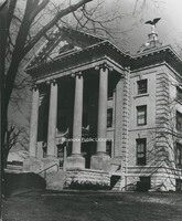
The old Roanoke County Courthouse, located at 305 E. Main Street in Salem.
Davis2 13.13 Courthouse and Jail
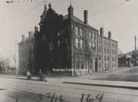
The City of Roanoke's first courthouse and jail, formerly located at 2nd Street and Campbell Avenue.
Davis2 12.5 Narrows Post Office
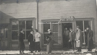
Unidentfied individuals in front of the Narrows Post Office.
Davis2 11.959d duPont Chapel
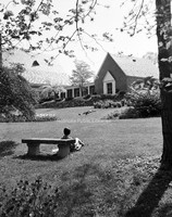
duPont Chapel on the campus of Hollins College
Davis2 11.959c duPont Chapel
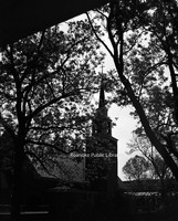
duPont Chapel on the campus of Hollins College
Davis2 11.959b duPont Chapel
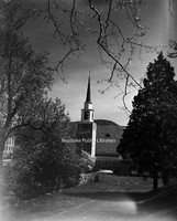
duPont Chapel on the campus of Hollins College
Davis2 11.959a duPont Chapel
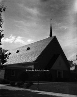
duPont Chapel on the campus of Hollins College
Davis2 11.9591 Hollins College
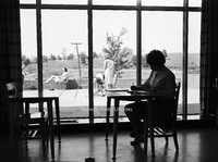
An unidentified student studies on the campus of Hollins College.
Davis2 11.958 Hollins Tennis
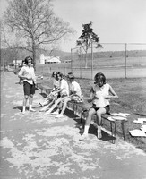
Unidentified students prepare to play tennis on the campus of Hollins College.
Davis2 11.957 Hollins College
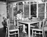
An unidentified student studies on the campus of Hollins College.
Davis2 11.956 Hollins College
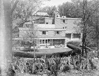
A view of the campus of Hollins College.
Davis2 11.955 Hollins College
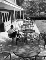
Students study on the campus of Hollins College.
Davis2 11.6523 Jefferson High

Jefferson High School.
Davis2 106a Roanoke Gas Display
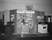
Roanoke Gas Company display featuring gas appliances at an unidentfied event.
Davis2 100.2 Etzler Signs
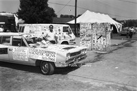
Etzler Magnetic Signs displayed at an unidentified event
Davis 9C Outskirts of Roanoke
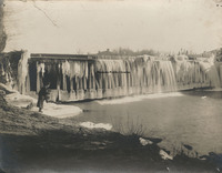
Ice on the Niagara Dam, four miles east of Roanoke on the Blue Ridge Parkway.
Davis 9B Outskirts of Roanoke
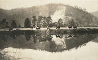
Cows grazing next to pond on the outskirts of Roanoke. Exact location unknown
Davis2 91.1j Confederate Tunnels
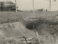
The discovery of the Confederate Tunnels came as a result of a boy chasing a rabbit into this hole. The tunnels were finally discovered after 60 years.
Davis2 91.1i The Crater
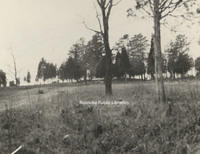
The Crater as seen from Union lines.
Davis2 91.1h Confederate Breastworks
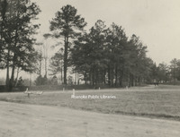
Confederate breastworks near Pine Gardens.
Davis2 91.1g Woodpile at Pine Gardens
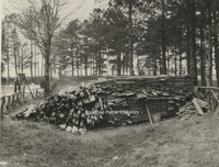
This pile of lumber was the lining placed in the Confederate tunnels at Pine Garden
Davis2 91.1f Entrance to Tunnel
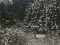
The marker in the right foreground indicates the entrance to the Union tunnel located at the crater.
Davis2 91.1e Fort Mahone Monument
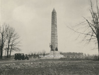
This monument was erected on the spot where Fort Mahone, known as Fort Damnation by the Union, once stood. It was erected by the State of Pennsylvania in honor of the soldiers who served in the Third Division, 9th Corps, Army of the Potomac.
Davis2 91.1d UDC Memorial
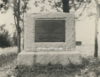
Erected by the South Carolina Division of the United Daughters of the Confederacy as a memorial to Elliott's South Carolina troops who lost their lives in the explosion at The Crater.
Davis 91.1c Union Tunnel
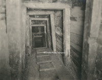
A view of the interior of the Union tunnel beneath the Crater, constructed by the 48th Pennsylvania Regiment under Colonel Pleasants. It was here that a four ton charge of powder was placed and exploded between Elliot's Salient.
Davis 91.1b Confederate Tunnels
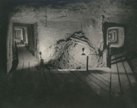
Confederate Tunnels beneath supporting works to Fort Mahone at Pine Gardens. The purpose of the tunnels was to detect any mining that might be attempted by the Union and they were used as storage for ammunition and refuge during heavy cannonading.
Davis 91.1a The Crater
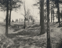
The Crater is the scene of the Battle of the Crater that occurred on 30 July 1864 as part of the Siege on Petersburg. Pennsylvania miners dug a 511 foot tunnel and placed a four ton charge of powder under Pegram's Confederate battery. The explosion…
Davis 9.21 Big Lick Signpost
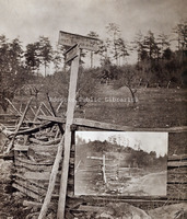
Sign for Big Lick, 7 miles, and Botetourt Springs, 6 miles. An inset of the sign from another angle is included.
Davis 9.12 Auto parade
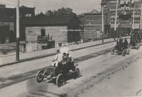
Roanoke's first auto parade on Campbell Ave. in front of present Municipal Building. United Commercial Travelers Grand Council parade. Ponce De Leon Hotel in right background.
Davis 88.8 Ku Klux Klan
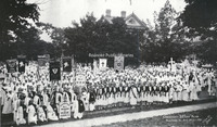
Ku Klux Klan convention. Photograph taken in front of the Colonial Club, formerly located at 602 Day Avenue SW.
Davis 83.21 Great Southern Mail Route
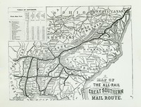
Map showing the Great Southern Mail Route.
Davis 8.6 View of the Narrows
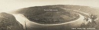
Panoramic view of Narrows, Virginia.
Davis2 8.51 Botetourt County Courthouse
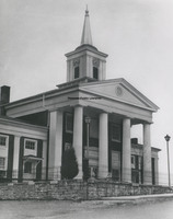
Botetourt County Courthouse
Davis 8.3 Fincastle Presbyterian Church
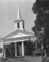
Fincastle Presbyterian Church located at 108 E. Back Street in Fincastle, Virginia
Davis2 8.22 Town House in Chilhowie
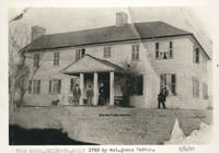
Town House in Chilhowie built in 1748 by Col. James Patton to be used as a fort.
Davis2 8.21 Pearisburg
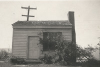
Former medical office of Dr. Harvey Green Johnston. Local tradition holds that it was Rutherford B. Hayes' headquarters while Federal troops accupied Pearisburg during the Civil War. The building is part of Giles County HIstorical Society's museum…
Davis2 8.1 Main Street Baptist
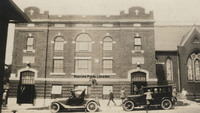
Main Street Baptist Church in Clifton Forge.
Davis2 75.91 Daniel Boone's Tomb
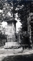
Tomb of Daniel Boone.
Davis 75.861b Rader Chapel
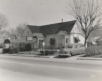
Rader Funeral Home is located at 630 Roanoke Road in Daleville. This building was replaced with the current building in 1996.
Davis 75.861a Radar Chapel
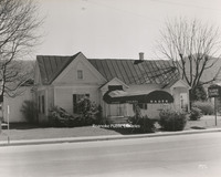
Rader Funeral Home is located at 630 Roanoke Road in Daleville. This building was replaced with the current building in 1996.
Davis 75.81 Oakey Salem Chapel
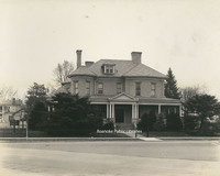
Built in 1901 as the home of Theophilus J. Shickel, the home was conveyed to John M. Oakey and Son Funeral Home in 1936.
Davis 71.255 Craig Healing Springs
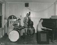
The Roy Lemon trio performs at Craig Healing Springs.
Davis 71.2524 Craig Healing Springs
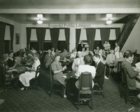
Guests play cards at Craig Healing Springs
Davis 71.2523 Craig Healing Springs
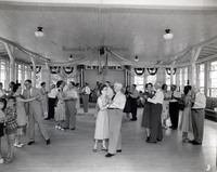
The dance floor in full swing at Craig Healing Springs.
Davis 71.2522 Craig Healing Springs
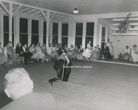
Guests enjoy a performance at Craig Healing Springs.
Davis 71.2521 Craig Healing Springs
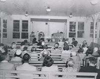
Guests attend a church service held in the Glass House at Craig Healing Springs.
Davis 71.24 Craig Healing Springs
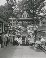
An unidentified group poses in front of the spring house at Craig Healing Springs.
Davis 71.224 Craig Healing Springs
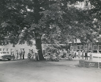
An unidentified group next to the Glass House at Craig Healing Springs. The brick building the the Oak Lodge.
Davis 71.185 Craig Healing Springs
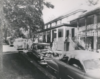
The central office of Craig Healing Springs.
Davis 71.182 Craig Healing Springs
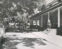
The central office of Craig Healing Springs.
Davis 71.17 Craig Healing Springs
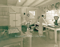
A chef prepares biscuits in the Craig Healing Springs kitchen.
Davis 71.16 Craig Healing Springs
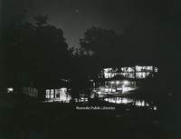
A night view of Craig Healing Springs Resort.
Davis 71.131 Craig Healing Springs
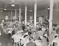
Guests dine in the dining hall at Craig Healing Springs.
Davis 71.13 Craig Healing Springs
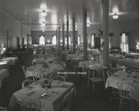
Interior view of the dining hall at Craig Healing Springs.
Davis 71.12 Craig Healing Springs
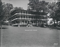
The Jefferson at Craig Healing Springs was built in 1910. Though some of the buildings still exist, the Jefferson was razed in 1970.
Davis 71.112 Craig Healing Springs
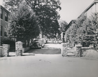
Main entrance to Craig Healing Springs
Davis 71.101 Craig Healing Springs
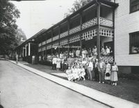
An unidentified group stands in front of the dining hall and central office of Craig Healing Springs.
Davis 70.11 Roaring Run Furnace
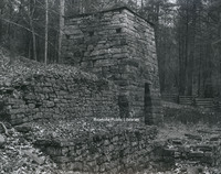
Built circa 1832, Roaring Run Furnace was a hot-blast iron furnace. Located in the Jefferson National Forest, the furnace was listed on the National Register of Historic Places in 1983.
Davis 7.21 Elizabeth Heights Apartments
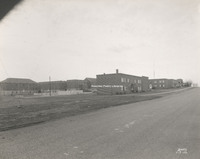
Elizabeth Heights apartment complex, located on Idaho and Illinois Streets in Salem.
Davis2 68.81 New River Gap
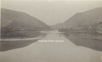
The New River cut a gap between Peters Mountain and East River Mountain at Narrows.
Davis 68.32 Cascade Falls
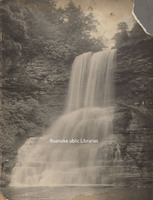
Cascade Falls in Pembroke, Virginia.
Davis 68.31 Cascade Falls
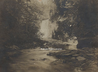
Cascade Falls in Pembroke, Virginia.
Davis 68.221 Mill Mountain Observation Tower
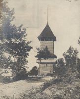
The first observation tower on Mill Mountain was built circa 1892 along with Rockledge Inn. The tower was destroyed during a violent wind storm in 1914. Another tower was constructed to replace it shortly thereafter.
Davis 68.22 Mill Mountain Star
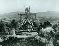
Mill Mountain Star was constructed in 1949 by the Roanoke Merchants Association to kick off the 1949 holiday shopping season. Though at first the star was not meant to be lit all year, it became popular enough with citizens that it was decided to…
Davis 68.21a Dixie Caverns
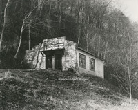
Entrance to Dixie Caverns.
Davis 68.2182 Dixie Caverns
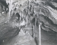
"The Musical Room" at Dixie Caverns.
Davis 68.2181 Dixie Caverns
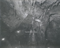
An interior view of Dixie Caverns.
Davis 68.218 Dixie Caverns

The "Magic Mirror" reflecting pool at Dixie Caverns.
Davis 68.216 Dixie Caverns
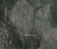
Stalactite formation known as the "Cascades" at Dixie Caverns.
Davis 68.215 Dixie Caverns
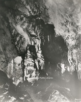
Stalactite formation known as the "Organ Screen" st Dixie Caverns
Davis 68.213b Dixie Caverns
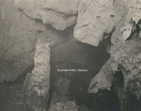
Stalagmite formation known as "The Leaning Tower" at Dixie Caverns
Davis 68.212a Dixie Caverns
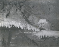
Flowstone formation known at the "Wedding Bell" at Dixie Caverns.
Davis 68.21 Dixie Caverns Sign
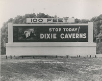
Billboard sign for Dixie Caverns.
Davis 68.1 Natural Bridge
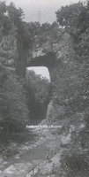
Natural Bridge
Davis 67.7 Roanoke Country Club
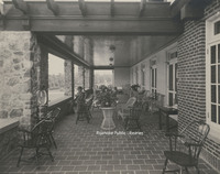
The terrace overlooking the golf course at Roanoke Country Club, located at 3360 Country Club Drive. The club saw its beginnings in South Roanoke in 1899. The club moved to its current location in 1908. This clubhouse was the second to be…
Davis 67.6 Roanoke Country Club
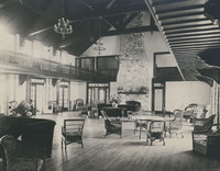
Interior view of the Roanoke Country Club clubhouse, located at 3360 Country Club Drive. The club saw its beginnings in South Roanoke in 1899. The club moved to its current location in 1908. This clubhouse was the second to be constructed at the…
Davis 67.5 Roanoke Country Club
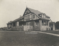
Exterior view from the golf course of the Roanoke Country Club, located at 3360 Country Club Drive. The club saw its beginnings in South Roanoke in 1899. The club moved to its current location in 1908. This clubhouse was the second to be…
Davis 67.4 Roanoke Country Club
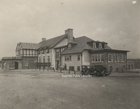
Exterior view of the Roanoke Country Club, located at 3360 Country Club Drive. The club saw its beginnings in South Roanoke in 1899. The club moved to its current location in 1908. This clubhouse was the second to be constructed at the current…
Davis 67.3 Roanoke Country Club
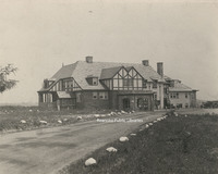
Exterior view of the Roanoke Country Club, located at 3360 Country Club Drive. The club saw its beginnings in South Roanoke in 1899. The club moved to its current location in 1908. This clubhouse was the second to be constructed at the current…
Davis 67.2c Roanoke Country Club
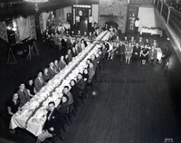
Roanoke Country Club Christmas dinner and dance
Davis 67.2b Roanoke Country Club
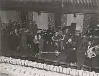
Couples enjoy dancing at a Christmas party at Roanoke Country Club.
Davis 67.2a Roanoke Country Club
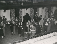
Couples enjoy dancing at a Christmas party at Roanoke Country Club.
Davis 67.2 Roanoke Country Club
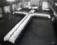
Banquet table set up for Christmas party at the Roanoke Country Club.
Davis 67.1 Roanoke Country Club
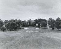
Roanoke Country Club as seen from the fairway. The club saw its beginnings in South Roanoke in 1899. The club moved to its current location in 1908. This clubhouse was the second to be constructed at the current location; it was completed in 1924.
Davis 66i Buchanan Bridge
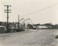
New concrete bridge built to replace the steel bridge at left. Though the steel bridge was removed, a swinging bridge was erected in its place.
Davis 66h Buchanan Bridge
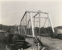
Old bridge over the James River in Buchanan. The new concrete bridge seen at right. The steel bridge stood in the location of the current swinging bridge.
Davis 66g Franklin Road Bridge
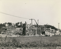
Franklin Road Bridge under construction.
Davis 66c BRPW Bridge
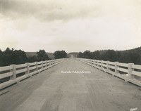
Bridge over the Roanoke River on the Blue Ridge Parkway.
Davis 66b Wasena Bridge
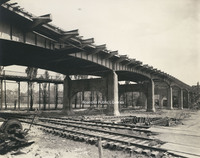
Wasena Bridge under construction. The old Wasena Bridge can be seen paralleling the new one. The new bridge was completed in 1940.
Davis 66.91 Robert F. Craft Memorial Bridge
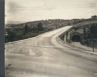
Robert F. Craft Memorial Bridge over the Jackson River. This bridge, replaced the covered bridge next to it.
Davis 66.826 Franklin Road Bridge
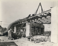
Franklin Road Bridge under construction.
Davis 66.825 Franklin Road Bridge
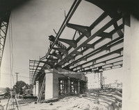
Franklin Road Bridge under construction.
Davis 66.823 Franklin Road Bridge
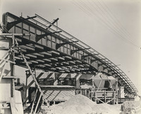
Franklin Road Bridge under construction.
Davis 66.815 Walnut Avenue Bridge
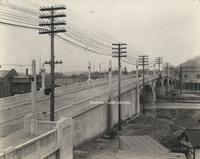
Walnut Avenue Bridge.
Davis 66.811 Franklin Road RW Bridge
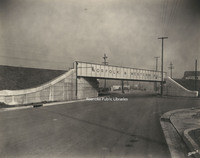
Norfolk & Western railway bridge over Franklin Road.
Davis 66.81 Franklin Road RW Bridge
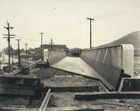
Railway bridge over Franklin Road under construction.
Davis 66.412 Walnut Avenue Bridge
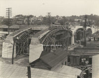
Walnut Avenue Bridge under construction.
Davis 66.411 Walnut Avenue Bridge
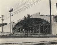
Walnut Avenue Bridge under construction.
Davis 66.41 Walnut Avenue Bridge
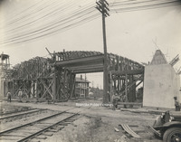
Walnut Avenue Bridge under construction.
Davis 66.3a Jefferson Street Bridge
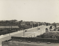
Jefferson Street Bridge was built in 1926
Davis 66.321 Memorial Bridge Plaque
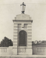
Plaque on Memorial Bridge listing all of the Roanoke area soldiers who were killed serving in World War I.
Davis 66.32 Memorial Bridge Plaque
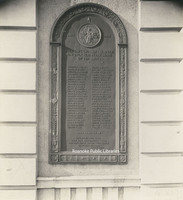
Plaque on Memorial Bridge listing all of the Roanoke area soldiers who were killed serving in World War I.
Davis 66.31 Memorial Bridge
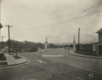
Memorial Bridge was built in 1926 by the WW Boxley Company. The bridge stands as a monument to veterans of World War I.
Davis 66.3 Memorial Bridge
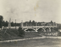
Memorial Bridge was built in 1926 by the WW Boxley Company. The bridge stands as a monument to veterans of World War I.
Davis 66.219 Wasena Bridge
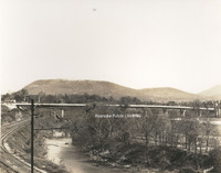
Wasena Bridge.
Davis 66.212 Wasena Bridge
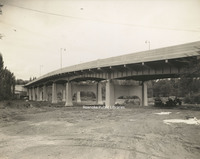
Wasena Bridge under construction.
Davis 66.211 Wasena Bridge
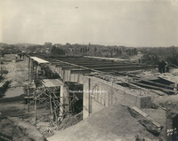
Wasena Bridge under construction. The new bridge was completed in 1940.
Davis 66.21 Wasena Bridge
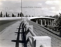
Wasena Bridge shortly after completion.
Davis 66.11 Jefferson Street Bridge
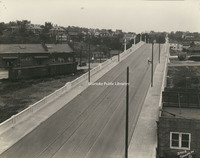
Jefferson Street Bridge was built in 1926.
Davis 65.941 Norfolk and Western Office Fire
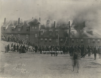
A fire broke out at the Norfolk & Western General Offices on 4 January 1896. N&W employees salvaged some furnishings and supplies as fire swept through the building. Unfortunately, the building was a total loss.
Davis 65.94 Norfolk and Western Office Fire
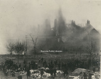
A fire broke out at the Norfolk & Western General Offices on 4 January 1896. N&W employees salvaged some furnishings and supplies as fire swept through the building. Unfortunately, the building was a total loss.
Davis 65.938 Phillip Levy Store Fire
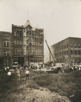
The Philip Levy Exchange Store alarm was struck at 1:21pm on 31 August 1928. This photo was taken not long after the fire started. Both city ladder trucks were on the scene to combat the fire in the top floors of the four story building.
Davis 65.937 Phillip Levy Store Fire
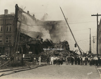
Despite the efforts of Roanoke firemen, the Philip Levy Exchange store could not be saved. After burning for two hours, the building collapsed.
Davis 65.936 Phillip Levy Store Fire
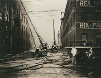
Ladder trucks 1 and 2 were utilized to fight the fire at the Philip Levy Exchange Store, which was burning on the top floors of the four story building.
Davis 65.935 Phillip Levy Store Fire
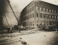
Firemen attempt to extinguish the fire at the Philip Levy Exchange Store at 118 Salem Avenue.
Davis 65.934 Phillip Levy Store Fire
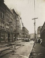
The Philip Levy and Company furniture store caught fire for the second time on 31 August 1928. Philip Levy was located at 118 Salem Avenue. Both city ladder trucks were utilized in an attempt to extinguish the fire, which was burning on the top…
Davis 65.933 Phillip Levy Store Fire
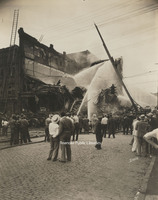
Even after the building's collapse, firemen continue to hose down the smoldering rubble that was once the Philip Levy Exchange Store.
Davis 65.932 Phillip Levy Store Fire
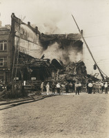
Despite the efforts of Roanoke firemen, the Philip Levy Exchange store could not be saved. After burning for two hours, the building collapsed.
Davis 65.931 Phillip Levy Store Fire
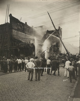
Despite the efforts of Roanoke firemen, the Philip Levy Exchange store could not be saved. After burning for two hours, the building collapsed.
Davis 65.93 Phillip Levy Store Fire
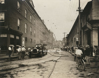
The Philip Levy and Company furniture store caught fire for the second time on 31 August 1928. Philip Levy was located at 118 Salem Avenue.
Davis 65.921 NW Pugh Fire
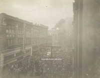
The NW Pugh Department Store caught fire on 3 February 1935. The store was located at 35 Campbell Avenue. Spectators watch as Roanoke Fire Department extinguishes the fire.
Davis 65.92 NW Pugh Fire
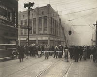
The NW Pugh Department Store caught fire on 3 February 1935. The store was located at 35 Campbell Avenue. Spectators watch as Roanoke Fire Department extinguishes the fire.
Davis 65.91 Fire on Campbell
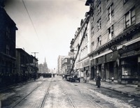
The Ponce de Leon Hotel caught fire on 28 December 1928. All nine Roanoke engines and two ladder trucks were on the scene, including a hose truck from Vinton and an engine from Salem. The original 5 story portion of the hotel was destroyed and would…
Davis 65.86 Steamer #2
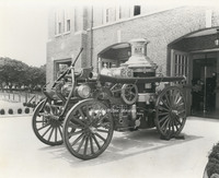
Steamer #2 was purchased by Norfolk & Western and placed into service in September 1907. It is shown here stored at Station #9.
Davis 65.81 Fire Equipment Test
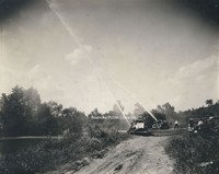
Testing of fire fighting equipment by the river.
Davis 65.8 Fire Station 7
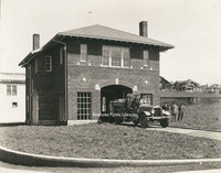
Fire Station #7 opened on 13 December 1922. It is located at 1742 Memorial Avenue.
Davis 65.7 Fire Station #9
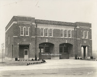
Fire Station #9 opened on 2 October 1929. It is located at 514 24th Street.
Davis 65.63 Fire Station #8
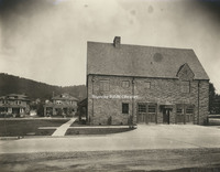
Located at 2328 Crystal Spring Avenue, Fire Station #8 opened on 23 January 1929 and still serves the community today.
Davis 65.52 Fire Station #6
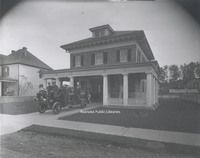
Fire Station #6 opened on 5 September 1911 at 1015 Jamison Avenue. It ceased operation as a fire station in 1979. It is now used as a police substation. Fire Station #6 was added to the Virginia Landmarks Register in 1990 and the National Register…
Davis 65.51 Fire Station #5
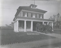
Fire Station #5 opened on 5 September 1911. While no longer used as a fire station, the building remains at 216 12th Street.
Davis 65.5 Fire Station #5
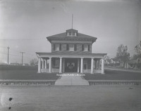
Fire Station #5 opened on 5 September 1911. While no longer used as a fire station, the building remains at 216 12th Street.
Davis 65.412 Booster Club
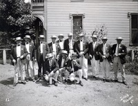
Booster trip. Men and location unidentified.
Davis 65.4 Fire Station #4
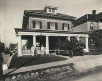
Fire Station #4 opened on 5 September 1911. It was located at 323 Highland Avenue in Old Southwest. The station closed in 1965 and the building was purchased by Beth Israel Synagogue. The building was razed in 1967.
Davis 65.31 Fire Station #3
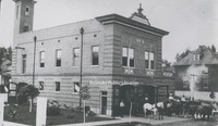
Fire Station #3, located at 301 6th Street. Though the building still exists, it is not longer used as a fire station.
Davis 65.3 Fire Station #3
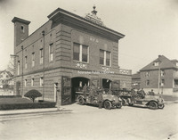
The building that housed Fire Station #3 still exists at 301 6th Street, but is now privately owned. Shown here at left is Engine #3, a Seagrave Brasshead next to Ladder #2, also a Seagrave.
Davis 65.2 Fire Station #11
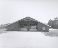
Fire Station #11, located at 1502 Riverland Road. Station #11 opened on 14 March 1964.
Davis 65.12 Fire Station #1
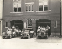
Ladder #1 (left), a 1918 Seagrave, sits next to the Chief's car, a Hudson, and Engine #1 (right) at Fire Station #1. Fireman on Ladder #1, from L to R: Elsie J. Knowles, __Shillins, James E. Updike, Harry Grubb, Raymond N. Wills, Harry J. Daniels…
Davis 65.11 Fire Station #1
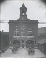
Fire Station #1, located at 13 Church Avenue, was completed in 1907. The building, now on the National Register of Historic Places, was in service as a fire station for 100 years. A horse-drawn hose wagon (left) and ladder truck are seen in front of…
Davis 65.1 Firemen at Station #1
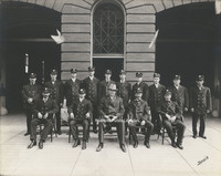
Fireman in front of Station #1 on Church Avenue. 1st row, L to R: "Pop" Smith, Adam Arnold, Chief James F. McFalls, Joe Bowman and Cleveland Carper Meador. 2nd row, L to R: James W. Nichols, George Witt, O.C. Craft, Clarence Short, Charlie Boone,…
Davis 65.022 Junior Hose Company #2
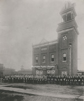
Members of the Vigilante Steam Fire Company #1 and the Junior Hose Company #2 stand in front of Vigilante Fire Station #1 shortly before escorting the body of Mayor William Carr to his burial in City Cemetery.
Davis 65.021 Vigilante Fire Station #1
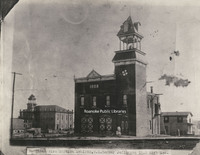
Vigilante Fire Station #1 stood on the northeast corner of Jefferson Street and Kirk Avenue. Shown here shortly before completion in 1888, the fire station remained in use until 1907 when the "new" Station #1 was built on Church Avenue. Prior to the…
Davis 65.02 Vigilante Steam Fire Company #1
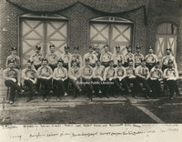
Firemen from the Vigilante Steam Fire Company #1 post in front of the original Fire Station #1 (formerly located at Campbell Avenue and 1st Street) prior to the funeral of Mayor William Carr. 1st row, L to R: Thomas Engleby, __ Harris, __ Shank, __…
Davis 65.012 Friendship Fire Company #3
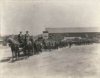
Roanoke firefighters line up for a Labor Day parade at the present corner of Jefferson Street and Church Avenue. W.P. Mundy livery stable is in the background.