
Browse Items (9249 total)
Sort by:
Davis 57.2 Alleghany Institute Baseball Team
Unidentified members of the Alleghany Institute baseball team.
Davis 57.21 Roanoke Baseball Team
Roanoke's first baseball team. Seated, L to R: George Desmond, E. Wiggins and Willie Quarles. Standing, L to R: Harry Keffer, Gene Ford, Steve Wigman, Everett Sproul, Edward C. Webb, Jack Hayes, George Hart and Edward Dolan.
Davis 57.31 RHS Basketball Team
Roanoke High School basketball team. 1st row, L to R: Philip Powell, James Yates and Warren Koontz. 2nd row, L to R: Fred Garis, William Atkinson, Courtley Motley, Fay Yost and Arthur Rankin.
Davis 57.381 Booster Club
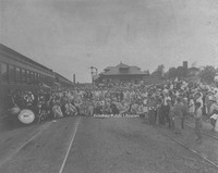
Members of the Roanoke Booster Club.
Davis 57.41 Mundy Family Stringband
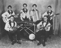
Began by patriarch A.P. Mundy, the Mundy Family Stringband was popular on local radio during the 1920s. Seated, L to R: Cline Mundy, Fred Mundy. Standing, L to R: Mildred Mundy, Mildred Mundy (Mrs. A.P.), Lois Mundy and Janice Mundy.
Davis 57.42 Stone Printing Band
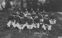
The Stone Printing Company band at a company picnic at Coyner Springs in 1898. Band members unknown.
Davis 58.1 First Ward School
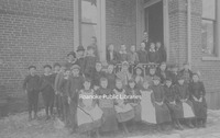
Fourth grade class from First Ward or Commerce Street School.
Davis 59.111 View of Roanoke Valley
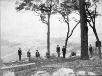
A group of unidentified men on Mill Mountain. Roanoke Valley in background.
Davis 59.13 Horseshoe Bend Spring Company
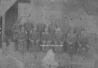
Employees of Horseshoe Bed Spring Company. 1. C.A. Campbell, 2. John R. Tobin, 3. H.S. Jordan, 4. T.B. McKinney, 5. J.W. Tilson, 6. Joseph Bean, 7. George Denton, 8. S.H. Turner, 9. T.R. Turner, 10. J.H. Walls, 11. H.S. Henderson, 12. Charles N.…
Davis 59.15 Booster Club
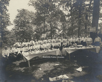
Unidentified members of the Roanoke Booster Club at a picnic.
Davis 59.16 Ox Cart
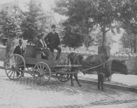
Unidentified men on an ox cart. Hotel Roanoke visible in background.
Davis 6.1 Roanoke from Mill Mountain
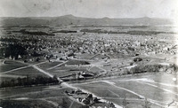
View of the Roanoke Valley from Mill Mountain
Davis2 6.122 Terry House
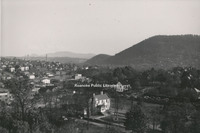
View of the Terry House and Elmwood Park from the Patrick Henry Hotel.
Davis2 6.123 Elmwood Corner
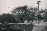
Intersection of Jefferson Street and Elm Avenue, looking toward the SW corner of Elmwood Park. Terry House visible through the trees.
Davis2 6.124 Elmwood Corner
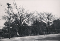
Corner of Jefferson Street and Bullitt Avenue, looking toward the SE corner of Elmwood Park.
Davis2 6.125 Elmwood Gazebo
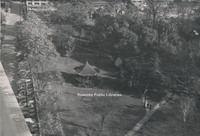
View of gazebo in Elmwood Park from the Patrick Henry Hotel.
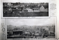
Davis 6.31a South Roanoke
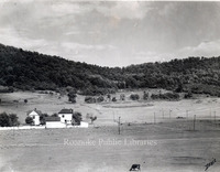
Early views of South Roanoke. The house on the right is located at 2811 Rosalind Avenue.
Davis 6.31b Roanoke Country Club
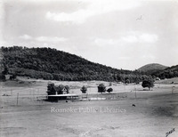
Roanoke Country Club clubhouse and tennis courts, formerly located in South Roanoke.
Davis 6.31c South Roanoke
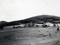
Early views of South Roanoke
Davis 6.31d Virginia College
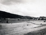
Virginia College, formerly located at the end of Rosalind Avenue in South Roanoke.
Davis 6.32 Mill Mountain
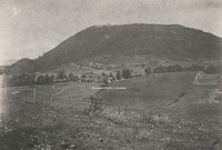
Early view of Mill Mountain
Davis 6.4 View from Mill Mountain
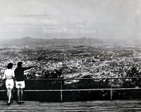
Two unidentified women look at Roanoke from Mill Mountain overlook.
Davis 6.41 Roanoke from Mill Mountain 1974
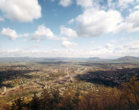
Roanoke as it looked in 1974 from Mill Mountain overlook.
Davis 6.81 Old PO Foundation
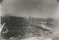
Looking SE at the intersection of Church Street and Henry Street (1st) at the Old Post Office Foundation.
Davis 6.91 View of Valley
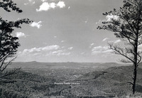
View of the Roanoke Valley from Mill Mountain
Davis 60.1 Interstate 81 Construction
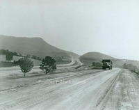
Construction of Interstate 81 in Roanoke County.
Davis 607 Masons
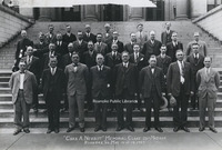
Charles A. Nesbitt Memorial Class 32
Davis 608 Masons
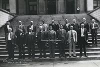
C. C. Bassett Memorial Class 32
Davis 609 Elks Convention
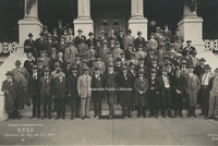
Unidentified members of the Benevolent and Protective Order of Elks during the Virginia State Convention on the steps of the Elks Lodge formerly located on the corner of Jefferson Street and Franklin Road.
Davis 61.11 N&W Railroad
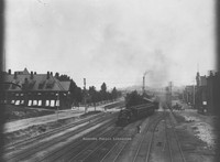
N&W Railroad - View looking east down tracks - N&W General Offices, Hotel Roanoke, and depot at Jefferson Street crossing all visible.
Davis 61.2 NW Class Y6b #2189
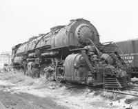
Norfolk & Western Class Y6b #2189 locomotive shown shortly before scrapping at United Scrap Iron and Metal Company.
Davis 61.22 N&W Class S1A #244
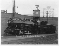
N&W Class S1a #244 locomotive at Roanoke Shops. This was the last locomotive built in Roanoke and the last standard gauge locomotive built in the United States.
Davis 61.23 N&W Class N Locomotive
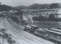
Norfolk and Western Class N passenger locomotive near Radford.
Davis 61.24 Powhatan Arrow #4
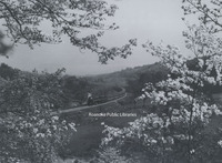
Norfolk & Western Powhatan Arrow Locomotive #4 east of Vinton.
Davis 61.31 N&W Bridge Construction
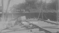
American Bridge and Iron Company constructs a Norfolk & Western bridge over the south branch of the Elizabeth River near Gilmerton.
Davis 61.71 Thaxton Train Wreck
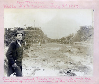
Train wreck on the Norfolk and Western railroad. Twenty one wounded and the number of killed unknown, as the records were destroyed. Man in foreground unidentified
Davis2 61.81 Mill Mountain Incline
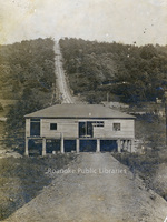
Mill Mountain Incline during construction.
Davis 61.811 Mill Mountain Incline
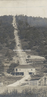
Mill Mountain Incline shortly after completion.
Davis2 61.812 Mill Mountain Incline Tracks
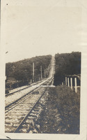
Tracks of the Mill Mountain Incline.
Davis 61.95 Summer Train Schedule
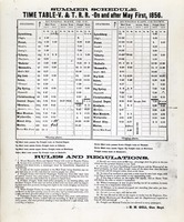
Summer train schedule and timetable for the Virginia & Tennessee Railroad.
Davis 610 Travelers Protective Association
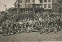
Unidentified members of the Travelers Protective Association on the Virginia State Convention at Hotel Roanoke.
Davis 611 Masons
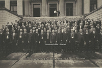
Clinchfield Class Scottish Rite Masons
Davis 612 Masons
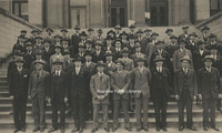
J.W. Keys Memorial Class 32
Davis 614a Masons
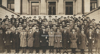
Appalachian Class 32
Davis 615 Masons
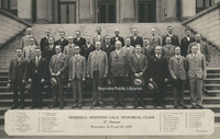
Sparrell Simmons Gale Memorial Class 32
Davis 617a Masons
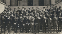
Old Dominion Class 32
Davis 618 Masons
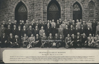
Grayson Class 32
Davis 619 Masons
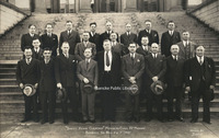
Unidentified members of the Daniel Henry Carmines Memorial Class 32
Davis 61a N&W Rails
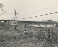
View of Norfolk & Western rails. Southwest Virginia Memorial Bridge crossing the New River in background is under construction.
Davis 61b N&W Rails
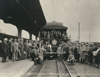
Member of the Travelers Protective Association prepare to leave for Denver.
Davis 61d N&W General Offices
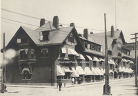
Original Norfolk & Western General Offices, formerly located at the corner of Jefferson Street and Shenandoah Avenue. The building was destroyed by fire on 4 January 1896.
Davis 62 Izaak Walton League
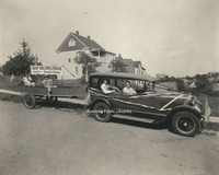
Roanoke Chapter of the Izaak Walton League. George Davis is seen in the backseat of the car. The Izaak Walton League was formed in 1922 and is one of the Nation's oldest and most respected conservation organizations.
Davis 62.1 Modern Air Transport
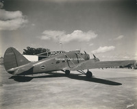
Modern Air Transport plane parked at Woodrum Field. Modern Are Transport commenced commerical operations in 1946.
Davis 62.134 AA Mail Plane
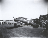
American Airlines Airmail plane at Roanoke Municipal Airfield.
Davis 62.14 Roanoke Municipal Airfield
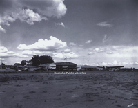
View of Roanoke Municipal Airfield.
Davis 62.15 Roanoke Municipal Airfield
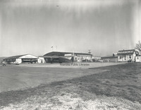
View of Roanoke Municipal Airfield.
Davis 62.161 Baltimore Airways
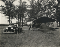
An unidentified couple poses next to a Baltimore Airways plane in front of the Cannaday Farm. The Cannaday Farm would become Roanoke Municipal Airfield, then in 1941 Woodrum Field. It is the current location of Roanoke-Blacksburg Regional Airport. …
Davis 62.1631 William Stribling
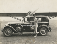
William Stribling (1904-1933) was a professional heavyweight boxer from Georgia. Seen here at Roanoke Municipal Airfield, Stribling was also an avid and accomplished aviator.
Davis 62.17 Roanoke Municipal Airfield
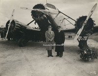
Mayor Sidney F. Small (left) and pilot B.A. Carpenter at the inauguration of Roanoke's passenger air service by American Airlines.
Davis 62.18 Roanoke Municipal Airfield
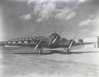
Plane at Roanoke Municipal Airfield.
Davis 622 Commerce Street School
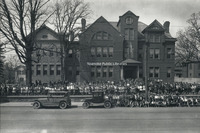
Students of Commerce Street School. Commerce Street School or First Ward School stood at the corner of Church Avenue and 2nd Street (Commerce). The school was built in 1890 and razed in 1929 to make way for the post office.
Davis 63.1 Greyhound Bus Depot
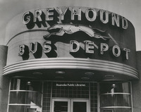
Roanoke Greyhound Bus Depot, formerly located at the corner of Williamson Road and Bullitt Avenue.
Davis 63.21 Streetcar
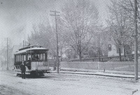
Unidentified man stands next to a streetcar on Jefferson Street.
Davis 63.22 Streetcar
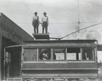
Two unidentified employees of Roanoke Railway and Electric stand atop a streetcar at terminal.
Davis 64.5 Roanoke Life Saving Crew
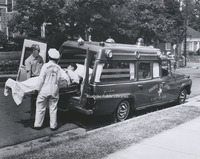
This staged photograph shows two unidentified members of Roanoke Life Saving and First Aid Crew loading a "patient" into an ambulance.
Davis 641 Roanoke Police Department
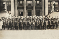
Roanoke Police Department on the steps of the Municipal Building.
Davis 645 Virginian 700
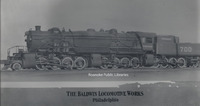
The Virginian 700 steam locomotive built by Baldwin Locomotive Works.
Davis 65 Warrenton Fire Truck
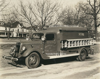
A fire truck from Warrenton, Virginia on Washington Avenue in Old Southwest. The houses in the background are in the 500 block of Washington Avenue.
Davis 65.01 Friendship Fire Company #3
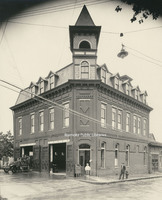
Friendship Fire Company Station #3 once stood roughly where the main post office is today in the 400 block of Rutherford Avenue. The company was formed to protect the northeast quadrant of the city. It was an active fire station until 1951. The…
Davis 65.012 Friendship Fire Company #3
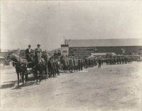
Roanoke firefighters line up for a Labor Day parade at the present corner of Jefferson Street and Church Avenue. W.P. Mundy livery stable is in the background.
Davis 65.02 Vigilante Steam Fire Company #1
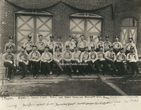
Firemen from the Vigilante Steam Fire Company #1 post in front of the original Fire Station #1 (formerly located at Campbell Avenue and 1st Street) prior to the funeral of Mayor William Carr. 1st row, L to R: Thomas Engleby, __ Harris, __ Shank, __…
Davis 65.021 Vigilante Fire Station #1
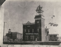
Vigilante Fire Station #1 stood on the northeast corner of Jefferson Street and Kirk Avenue. Shown here shortly before completion in 1888, the fire station remained in use until 1907 when the "new" Station #1 was built on Church Avenue. Prior to the…
Davis 65.022 Junior Hose Company #2
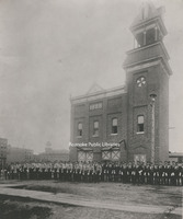
Members of the Vigilante Steam Fire Company #1 and the Junior Hose Company #2 stand in front of Vigilante Fire Station #1 shortly before escorting the body of Mayor William Carr to his burial in City Cemetery.
Davis 65.1 Firemen at Station #1
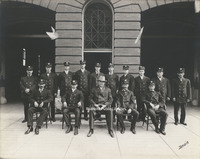
Fireman in front of Station #1 on Church Avenue. 1st row, L to R: "Pop" Smith, Adam Arnold, Chief James F. McFalls, Joe Bowman and Cleveland Carper Meador. 2nd row, L to R: James W. Nichols, George Witt, O.C. Craft, Clarence Short, Charlie Boone,…
Davis 65.11 Fire Station #1
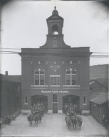
Fire Station #1, located at 13 Church Avenue, was completed in 1907. The building, now on the National Register of Historic Places, was in service as a fire station for 100 years. A horse-drawn hose wagon (left) and ladder truck are seen in front of…
Davis 65.12 Fire Station #1
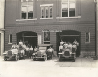
Ladder #1 (left), a 1918 Seagrave, sits next to the Chief's car, a Hudson, and Engine #1 (right) at Fire Station #1. Fireman on Ladder #1, from L to R: Elsie J. Knowles, __Shillins, James E. Updike, Harry Grubb, Raymond N. Wills, Harry J. Daniels…
Davis 65.2 Fire Station #11
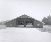
Fire Station #11, located at 1502 Riverland Road. Station #11 opened on 14 March 1964.
Davis 65.3 Fire Station #3
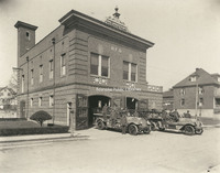
The building that housed Fire Station #3 still exists at 301 6th Street, but is now privately owned. Shown here at left is Engine #3, a Seagrave Brasshead next to Ladder #2, also a Seagrave.
Davis 65.31 Fire Station #3
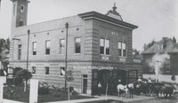
Fire Station #3, located at 301 6th Street. Though the building still exists, it is not longer used as a fire station.
Davis 65.4 Fire Station #4
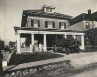
Fire Station #4 opened on 5 September 1911. It was located at 323 Highland Avenue in Old Southwest. The station closed in 1965 and the building was purchased by Beth Israel Synagogue. The building was razed in 1967.
Davis 65.412 Booster Club
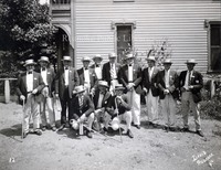
Booster trip. Men and location unidentified.
Davis 65.5 Fire Station #5
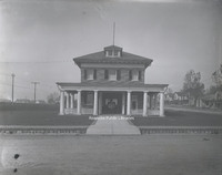
Fire Station #5 opened on 5 September 1911. While no longer used as a fire station, the building remains at 216 12th Street.
Davis 65.51 Fire Station #5
Fire Station #5 opened on 5 September 1911. While no longer used as a fire station, the building remains at 216 12th Street.
Davis 65.52 Fire Station #6
Fire Station #6 opened on 5 September 1911 at 1015 Jamison Avenue. It ceased operation as a fire station in 1979. It is now used as a police substation. Fire Station #6 was added to the Virginia Landmarks Register in 1990 and the National Register…
Davis 65.63 Fire Station #8
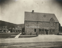
Located at 2328 Crystal Spring Avenue, Fire Station #8 opened on 23 January 1929 and still serves the community today.
Davis 65.7 Fire Station #9
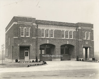
Fire Station #9 opened on 2 October 1929. It is located at 514 24th Street.
Davis 65.8 Fire Station 7
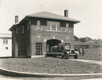
Fire Station #7 opened on 13 December 1922. It is located at 1742 Memorial Avenue.
Davis 65.81 Fire Equipment Test
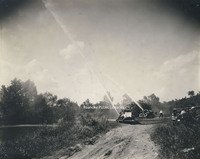
Testing of fire fighting equipment by the river.
Davis 65.86 Steamer #2
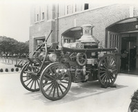
Steamer #2 was purchased by Norfolk & Western and placed into service in September 1907. It is shown here stored at Station #9.
Davis 65.91 Fire on Campbell
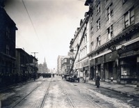
The Ponce de Leon Hotel caught fire on 28 December 1928. All nine Roanoke engines and two ladder trucks were on the scene, including a hose truck from Vinton and an engine from Salem. The original 5 story portion of the hotel was destroyed and would…
Davis 65.92 NW Pugh Fire
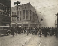
The NW Pugh Department Store caught fire on 3 February 1935. The store was located at 35 Campbell Avenue. Spectators watch as Roanoke Fire Department extinguishes the fire.
Davis 65.921 NW Pugh Fire
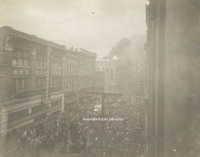
The NW Pugh Department Store caught fire on 3 February 1935. The store was located at 35 Campbell Avenue. Spectators watch as Roanoke Fire Department extinguishes the fire.
Davis 65.93 Phillip Levy Store Fire
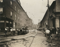
The Philip Levy and Company furniture store caught fire for the second time on 31 August 1928. Philip Levy was located at 118 Salem Avenue.
Davis 65.931 Phillip Levy Store Fire
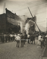
Despite the efforts of Roanoke firemen, the Philip Levy Exchange store could not be saved. After burning for two hours, the building collapsed.
Davis 65.932 Phillip Levy Store Fire
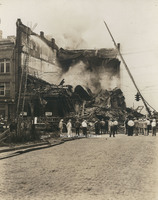
Despite the efforts of Roanoke firemen, the Philip Levy Exchange store could not be saved. After burning for two hours, the building collapsed.
Davis 65.933 Phillip Levy Store Fire
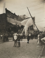
Even after the building's collapse, firemen continue to hose down the smoldering rubble that was once the Philip Levy Exchange Store.
Davis 65.934 Phillip Levy Store Fire
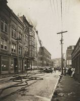
The Philip Levy and Company furniture store caught fire for the second time on 31 August 1928. Philip Levy was located at 118 Salem Avenue. Both city ladder trucks were utilized in an attempt to extinguish the fire, which was burning on the top…
Davis 65.935 Phillip Levy Store Fire
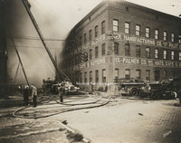
Firemen attempt to extinguish the fire at the Philip Levy Exchange Store at 118 Salem Avenue.
Davis 65.936 Phillip Levy Store Fire
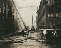
Ladder trucks 1 and 2 were utilized to fight the fire at the Philip Levy Exchange Store, which was burning on the top floors of the four story building.
Davis 65.937 Phillip Levy Store Fire
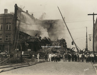
Despite the efforts of Roanoke firemen, the Philip Levy Exchange store could not be saved. After burning for two hours, the building collapsed.
Davis 65.938 Phillip Levy Store Fire
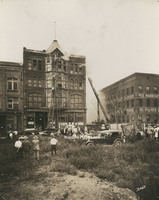
The Philip Levy Exchange Store alarm was struck at 1:21pm on 31 August 1928. This photo was taken not long after the fire started. Both city ladder trucks were on the scene to combat the fire in the top floors of the four story building.
Davis 65.94 Norfolk and Western Office Fire
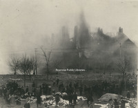
A fire broke out at the Norfolk & Western General Offices on 4 January 1896. N&W employees salvaged some furnishings and supplies as fire swept through the building. Unfortunately, the building was a total loss.
Davis 65.941 Norfolk and Western Office Fire
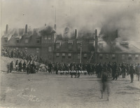
A fire broke out at the Norfolk & Western General Offices on 4 January 1896. N&W employees salvaged some furnishings and supplies as fire swept through the building. Unfortunately, the building was a total loss.
Davis 66.11 Jefferson Street Bridge
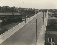
Jefferson Street Bridge was built in 1926.
Davis 66.21 Wasena Bridge
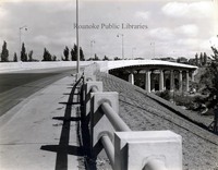
Wasena Bridge shortly after completion.
Davis 66.211 Wasena Bridge
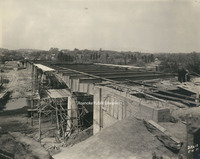
Wasena Bridge under construction. The new bridge was completed in 1940.
Davis 66.212 Wasena Bridge
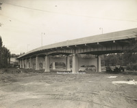
Wasena Bridge under construction.
Davis 66.219 Wasena Bridge
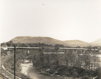
Wasena Bridge.
Davis 66.3 Memorial Bridge
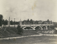
Memorial Bridge was built in 1926 by the WW Boxley Company. The bridge stands as a monument to veterans of World War I.
Davis 66.31 Memorial Bridge
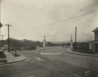
Memorial Bridge was built in 1926 by the WW Boxley Company. The bridge stands as a monument to veterans of World War I.
Davis 66.32 Memorial Bridge Plaque
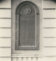
Plaque on Memorial Bridge listing all of the Roanoke area soldiers who were killed serving in World War I.
Davis 66.321 Memorial Bridge Plaque
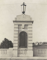
Plaque on Memorial Bridge listing all of the Roanoke area soldiers who were killed serving in World War I.
Davis 66.3a Jefferson Street Bridge
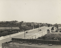
Jefferson Street Bridge was built in 1926
Davis 66.41 Walnut Avenue Bridge
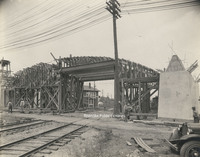
Walnut Avenue Bridge under construction.
Davis 66.411 Walnut Avenue Bridge
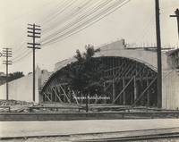
Walnut Avenue Bridge under construction.
Davis 66.412 Walnut Avenue Bridge
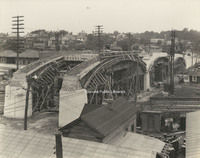
Walnut Avenue Bridge under construction.
Davis 66.81 Franklin Road RW Bridge
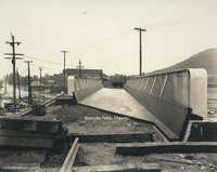
Railway bridge over Franklin Road under construction.
Davis 66.811 Franklin Road RW Bridge
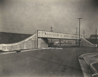
Norfolk & Western railway bridge over Franklin Road.
Davis 66.815 Walnut Avenue Bridge
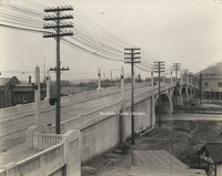
Walnut Avenue Bridge.
Davis 66.823 Franklin Road Bridge
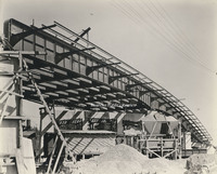
Franklin Road Bridge under construction.
Davis 66.825 Franklin Road Bridge
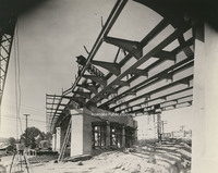
Franklin Road Bridge under construction.
Davis 66.826 Franklin Road Bridge
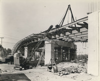
Franklin Road Bridge under construction.
Davis 66.91 Robert F. Craft Memorial Bridge
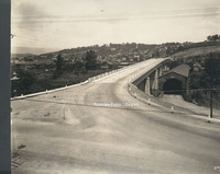
Robert F. Craft Memorial Bridge over the Jackson River. This bridge, replaced the covered bridge next to it.
Davis 66b Wasena Bridge
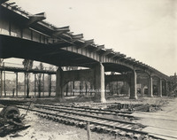
Wasena Bridge under construction. The old Wasena Bridge can be seen paralleling the new one. The new bridge was completed in 1940.
Davis 66c BRPW Bridge
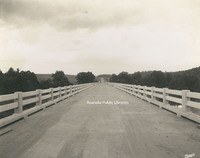
Bridge over the Roanoke River on the Blue Ridge Parkway.
Davis 66g Franklin Road Bridge
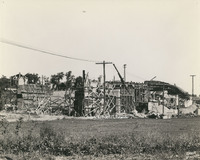
Franklin Road Bridge under construction.
Davis 66h Buchanan Bridge
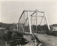
Old bridge over the James River in Buchanan. The new concrete bridge seen at right. The steel bridge stood in the location of the current swinging bridge.
Davis 66i Buchanan Bridge
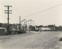
New concrete bridge built to replace the steel bridge at left. Though the steel bridge was removed, a swinging bridge was erected in its place.
Davis 67.1 Roanoke Country Club
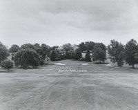
Roanoke Country Club as seen from the fairway. The club saw its beginnings in South Roanoke in 1899. The club moved to its current location in 1908. This clubhouse was the second to be constructed at the current location; it was completed in 1924.
Davis 67.2 Roanoke Country Club
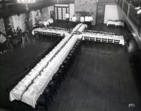
Banquet table set up for Christmas party at the Roanoke Country Club.
Davis 67.2a Roanoke Country Club
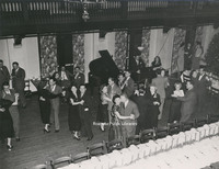
Couples enjoy dancing at a Christmas party at Roanoke Country Club.
Davis 67.2b Roanoke Country Club
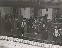
Couples enjoy dancing at a Christmas party at Roanoke Country Club.
Davis 67.2c Roanoke Country Club
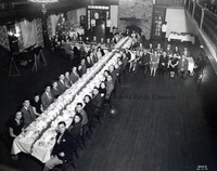
Roanoke Country Club Christmas dinner and dance
Davis 67.3 Roanoke Country Club
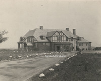
Exterior view of the Roanoke Country Club, located at 3360 Country Club Drive. The club saw its beginnings in South Roanoke in 1899. The club moved to its current location in 1908. This clubhouse was the second to be constructed at the current…
Davis 67.4 Roanoke Country Club
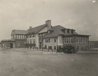
Exterior view of the Roanoke Country Club, located at 3360 Country Club Drive. The club saw its beginnings in South Roanoke in 1899. The club moved to its current location in 1908. This clubhouse was the second to be constructed at the current…
Davis 67.5 Roanoke Country Club
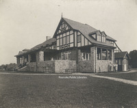
Exterior view from the golf course of the Roanoke Country Club, located at 3360 Country Club Drive. The club saw its beginnings in South Roanoke in 1899. The club moved to its current location in 1908. This clubhouse was the second to be…
Davis 67.6 Roanoke Country Club
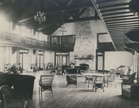
Interior view of the Roanoke Country Club clubhouse, located at 3360 Country Club Drive. The club saw its beginnings in South Roanoke in 1899. The club moved to its current location in 1908. This clubhouse was the second to be constructed at the…
Davis 67.7 Roanoke Country Club
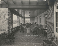
The terrace overlooking the golf course at Roanoke Country Club, located at 3360 Country Club Drive. The club saw its beginnings in South Roanoke in 1899. The club moved to its current location in 1908. This clubhouse was the second to be…
Davis 68.1 Natural Bridge
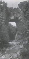
Natural Bridge
Davis 68.21 Dixie Caverns Sign
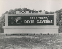
Billboard sign for Dixie Caverns.
Davis 68.212a Dixie Caverns
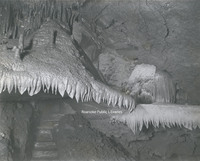
Flowstone formation known at the "Wedding Bell" at Dixie Caverns.
Davis 68.213b Dixie Caverns
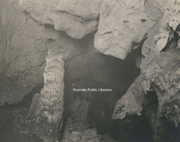
Stalagmite formation known as "The Leaning Tower" at Dixie Caverns
Davis 68.215 Dixie Caverns
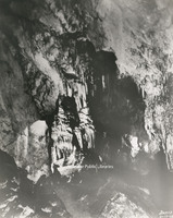
Stalactite formation known as the "Organ Screen" st Dixie Caverns
Davis 68.216 Dixie Caverns
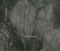
Stalactite formation known as the "Cascades" at Dixie Caverns.
Davis 68.218 Dixie Caverns

The "Magic Mirror" reflecting pool at Dixie Caverns.
Davis 68.2181 Dixie Caverns
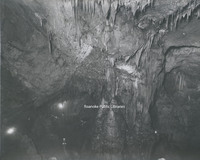
An interior view of Dixie Caverns.
Davis 68.2182 Dixie Caverns
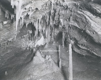
"The Musical Room" at Dixie Caverns.
Davis 68.21a Dixie Caverns
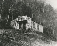
Entrance to Dixie Caverns.
Davis 68.22 Mill Mountain Star
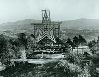
Mill Mountain Star was constructed in 1949 by the Roanoke Merchants Association to kick off the 1949 holiday shopping season. Though at first the star was not meant to be lit all year, it became popular enough with citizens that it was decided to…
Davis 68.221 Mill Mountain Observation Tower
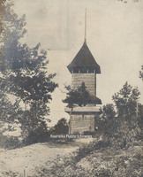
The first observation tower on Mill Mountain was built circa 1892 along with Rockledge Inn. The tower was destroyed during a violent wind storm in 1914. Another tower was constructed to replace it shortly thereafter.
Davis 68.31 Cascade Falls
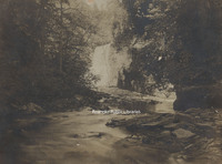
Cascade Falls in Pembroke, Virginia.
Davis 68.32 Cascade Falls
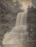
Cascade Falls in Pembroke, Virginia.
Davis2 68.81 New River Gap
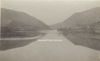
The New River cut a gap between Peters Mountain and East River Mountain at Narrows.
Davis 7.21 Elizabeth Heights Apartments
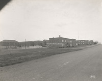
Elizabeth Heights apartment complex, located on Idaho and Illinois Streets in Salem.
Davis 70.11 Roaring Run Furnace
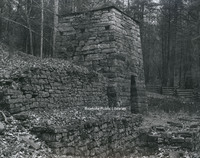
Built circa 1832, Roaring Run Furnace was a hot-blast iron furnace. Located in the Jefferson National Forest, the furnace was listed on the National Register of Historic Places in 1983.
Davis 71.101 Craig Healing Springs
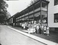
An unidentified group stands in front of the dining hall and central office of Craig Healing Springs.
Davis 71.112 Craig Healing Springs
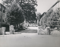
Main entrance to Craig Healing Springs
Davis 71.12 Craig Healing Springs
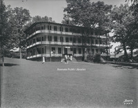
The Jefferson at Craig Healing Springs was built in 1910. Though some of the buildings still exist, the Jefferson was razed in 1970.
Davis 71.13 Craig Healing Springs
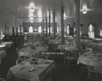
Interior view of the dining hall at Craig Healing Springs.
Davis 71.131 Craig Healing Springs
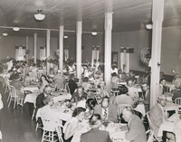
Guests dine in the dining hall at Craig Healing Springs.
Davis 71.16 Craig Healing Springs
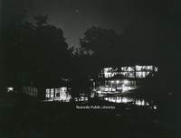
A night view of Craig Healing Springs Resort.
Davis 71.17 Craig Healing Springs
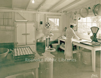
A chef prepares biscuits in the Craig Healing Springs kitchen.
Davis 71.182 Craig Healing Springs
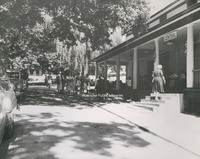
The central office of Craig Healing Springs.
Davis 71.185 Craig Healing Springs
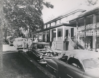
The central office of Craig Healing Springs.
Davis 71.224 Craig Healing Springs
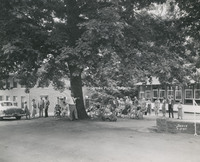
An unidentified group next to the Glass House at Craig Healing Springs. The brick building the the Oak Lodge.
Davis 71.24 Craig Healing Springs
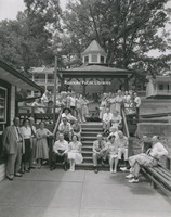
An unidentified group poses in front of the spring house at Craig Healing Springs.
Davis 71.2521 Craig Healing Springs
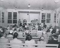
Guests attend a church service held in the Glass House at Craig Healing Springs.
Davis 71.2522 Craig Healing Springs
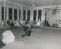
Guests enjoy a performance at Craig Healing Springs.
Davis 71.2523 Craig Healing Springs
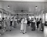
The dance floor in full swing at Craig Healing Springs.
Davis 71.2524 Craig Healing Springs
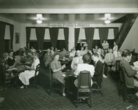
Guests play cards at Craig Healing Springs
Davis 71.255 Craig Healing Springs
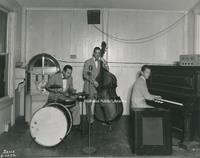
The Roy Lemon trio performs at Craig Healing Springs.
Davis 75.81 Oakey Salem Chapel
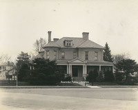
Built in 1901 as the home of Theophilus J. Shickel, the home was conveyed to John M. Oakey and Son Funeral Home in 1936.
Davis 75.861a Radar Chapel
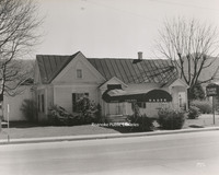
Rader Funeral Home is located at 630 Roanoke Road in Daleville. This building was replaced with the current building in 1996.
Davis 75.861b Rader Chapel
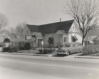
Rader Funeral Home is located at 630 Roanoke Road in Daleville. This building was replaced with the current building in 1996.
Davis2 75.91 Daniel Boone's Tomb
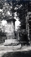
Tomb of Daniel Boone.
Davis2 8.1 Main Street Baptist
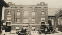
Main Street Baptist Church in Clifton Forge.
Davis2 8.21 Pearisburg
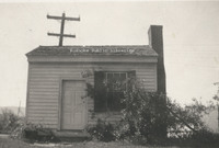
Former medical office of Dr. Harvey Green Johnston. Local tradition holds that it was Rutherford B. Hayes' headquarters while Federal troops accupied Pearisburg during the Civil War. The building is part of Giles County HIstorical Society's museum…
Davis2 8.22 Town House in Chilhowie
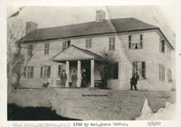
Town House in Chilhowie built in 1748 by Col. James Patton to be used as a fort.
Davis 8.3 Fincastle Presbyterian Church
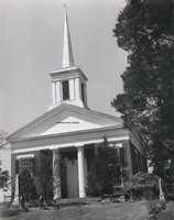
Fincastle Presbyterian Church located at 108 E. Back Street in Fincastle, Virginia
Davis2 8.51 Botetourt County Courthouse
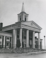
Botetourt County Courthouse
Davis 8.6 View of the Narrows
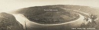
Panoramic view of Narrows, Virginia.
Davis 83.21 Great Southern Mail Route
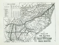
Map showing the Great Southern Mail Route.
Davis 88.8 Ku Klux Klan
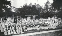
Ku Klux Klan convention. Photograph taken in front of the Colonial Club, formerly located at 602 Day Avenue SW.
Davis 9.12 Auto parade
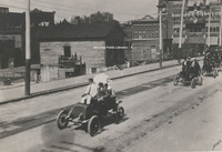
Roanoke's first auto parade on Campbell Ave. in front of present Municipal Building. United Commercial Travelers Grand Council parade. Ponce De Leon Hotel in right background.
Davis 9.21 Big Lick Signpost
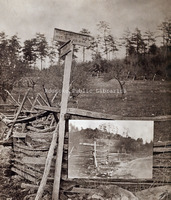
Sign for Big Lick, 7 miles, and Botetourt Springs, 6 miles. An inset of the sign from another angle is included.
Davis 91.1a The Crater
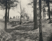
The Crater is the scene of the Battle of the Crater that occurred on 30 July 1864 as part of the Siege on Petersburg. Pennsylvania miners dug a 511 foot tunnel and placed a four ton charge of powder under Pegram's Confederate battery. The explosion…
Davis 91.1b Confederate Tunnels
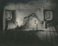
Confederate Tunnels beneath supporting works to Fort Mahone at Pine Gardens. The purpose of the tunnels was to detect any mining that might be attempted by the Union and they were used as storage for ammunition and refuge during heavy cannonading.
Davis 91.1c Union Tunnel
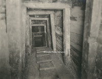
A view of the interior of the Union tunnel beneath the Crater, constructed by the 48th Pennsylvania Regiment under Colonel Pleasants. It was here that a four ton charge of powder was placed and exploded between Elliot's Salient.
Davis2 91.1d UDC Memorial
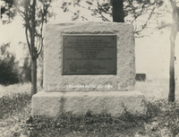
Erected by the South Carolina Division of the United Daughters of the Confederacy as a memorial to Elliott's South Carolina troops who lost their lives in the explosion at The Crater.
Davis2 91.1e Fort Mahone Monument
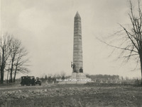
This monument was erected on the spot where Fort Mahone, known as Fort Damnation by the Union, once stood. It was erected by the State of Pennsylvania in honor of the soldiers who served in the Third Division, 9th Corps, Army of the Potomac.
Davis2 91.1f Entrance to Tunnel
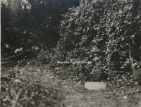
The marker in the right foreground indicates the entrance to the Union tunnel located at the crater.
Davis2 91.1g Woodpile at Pine Gardens
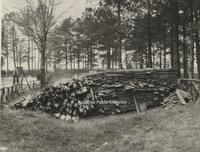
This pile of lumber was the lining placed in the Confederate tunnels at Pine Garden
Davis2 91.1h Confederate Breastworks
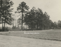
Confederate breastworks near Pine Gardens.
Davis2 91.1i The Crater
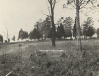
The Crater as seen from Union lines.
Davis2 91.1j Confederate Tunnels
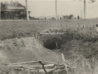
The discovery of the Confederate Tunnels came as a result of a boy chasing a rabbit into this hole. The tunnels were finally discovered after 60 years.
Davis 9B Outskirts of Roanoke
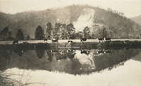
Cows grazing next to pond on the outskirts of Roanoke. Exact location unknown
Davis 9C Outskirts of Roanoke
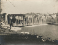
Ice on the Niagara Dam, four miles east of Roanoke on the Blue Ridge Parkway.
Davis2 100.2 Etzler Signs
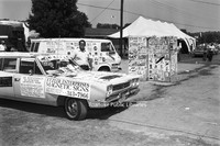
Etzler Magnetic Signs displayed at an unidentified event
Davis2 106a Roanoke Gas Display
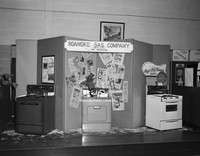
Roanoke Gas Company display featuring gas appliances at an unidentfied event.
Davis2 11.6523 Jefferson High

Jefferson High School.
Davis2 11.955 Hollins College
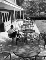
Students study on the campus of Hollins College.
Davis2 11.956 Hollins College
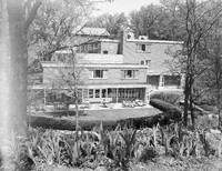
A view of the campus of Hollins College.
Davis2 11.957 Hollins College
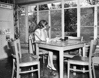
An unidentified student studies on the campus of Hollins College.
Davis2 11.958 Hollins Tennis
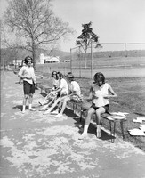
Unidentified students prepare to play tennis on the campus of Hollins College.
Davis2 11.9591 Hollins College
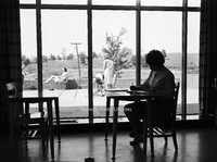
An unidentified student studies on the campus of Hollins College.
Davis2 11.959a duPont Chapel
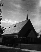
duPont Chapel on the campus of Hollins College
Davis2 11.959b duPont Chapel
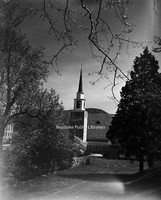
duPont Chapel on the campus of Hollins College
Davis2 11.959c duPont Chapel
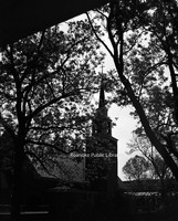
duPont Chapel on the campus of Hollins College
Davis2 11.959d duPont Chapel
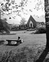
duPont Chapel on the campus of Hollins College
Davis2 12.5 Narrows Post Office
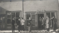
Unidentfied individuals in front of the Narrows Post Office.
Davis2 13.13 Courthouse and Jail
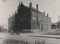
The City of Roanoke's first courthouse and jail, formerly located at 2nd Street and Campbell Avenue.
Davis2 13.2 Roanoke County Courthouse
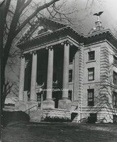
The old Roanoke County Courthouse, located at 305 E. Main Street in Salem.
Davis2 22.4 Woodlawn Methodist
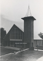
Woodlawn United Methodist Church, located at 2922 Corbieshaw Road.
Davis2 23.44 First Presbyterian
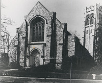
First Presbyterian Church, located at 2101 Jefferson Street.
Davis2 23.5 Salem Presbyterian
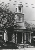
Salem Presbyterian Church, located at 41 E. Main Street.
Davis2 25.16 St. Andrews
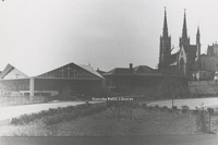
St. Andrews.
Davis2 27.55 Hott Bishop Memorial
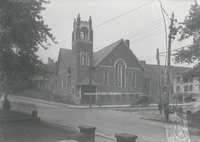
Hott Bishop Memorial United Brethren Church, formerly located on Tazewell Avenue.
Davis2 39a 3105 Somerset
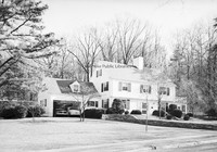
Home located at 3105 Somerset Street.
Davis2 39b 3112 Somerset-1
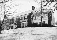
Home located at 3112 Somerset Street.
Davis2 39c 3112 Somerset-2
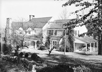
Rear view of home located a 3112 Somerset Street.
Davis2 39d 3358 Peakwood-1
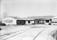
Home located at 3358 Peakwood Drive.
Davis2 39e 3358 Peakwood-2
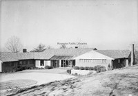
Home located at 3358 Peakwood Drive.
Davis2 39f 40 Sawyer Drive
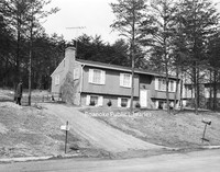
House located at 40 Sawyer Drive in the West Club Forest subdivision in Salem.
Davis2 43.11 Shenandoah Building
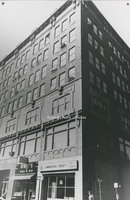
The Shenandoah Building, located at 305 1st Street.
Davis2 43.1263 AEP Truck
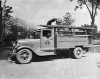
Appalachian Electric Power Company truck.
Davis2 43.1264 AEP Kanawha Plant
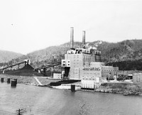
Located near Glasgow, West Virginia, the Kahawha River Plant is a coal-fired power station owned and operated by AEP.
Davis2 43.1265 AEP Truck
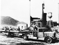
Appalachian Power employees haul an electric pole at an unidentified plant.
Davis2 43.15 General Stone and Materials.
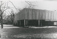
General Stone and Materials Corporation, formerly located at 1401 Franklin Road.
Davis2 43.214 N&W Offices
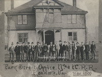
Railroad employees stand in front of the Norfolk & Western Office building formerly located on 5th Street.
Davis2 43.6 Paul C. Agee Insurance
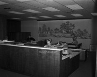
Employees of Paul C. Agee Insurance Company in the office.
Davis2 44.5a Goodwill Industries
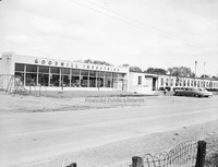
Goodwill Industries workshop, formerly located at 3125 Salem Turnpike.
Davis2 44.5c Goodwill Industries
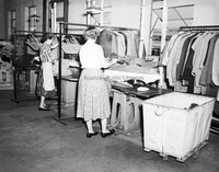
Unidentified employees work in the Goodwill Industries workshop, formerly located at 3125 Salem Turnpike.
Davis2 44.5d Goodwill Industries
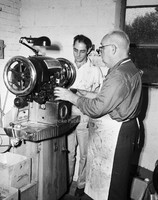
Unidentified employees work in the Goodwill Industries workshop, formerly located at 3125 Salem Turnpike.
Davis2 44.5e Goodwill Industries
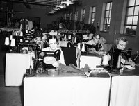
Unidentified employees make repairs to donated clothing at the Goodwill Industries workshop, formerly located at 3125 Salem Turnpike.
Davis2 44.5f Goodwill Industries
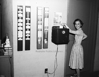
An unidentified employee punches the time clock at Goodwill Industries.
Davis2 44.5g Goodwill Industries
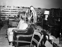
An interior view of Goodwill Industries, formerly located at 3125 Salem Turnpike.
Davis2 45.311 Bowman Bakery
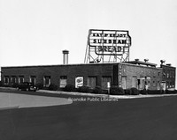
Bowman Bakery, formerly located at 102 5th Street NW.
Davis2 45.64 ITT
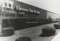
ITT Exelis, located at 7635 Plantation Road.
Davis2 46.34a Gulf Station
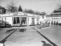
Wasena Gulf Service, formerly located at 1119 Main Street.
Davis2 46.34b Gulf Station
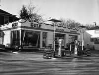
Wasena Gulf Service, formerly located at 1119 Main Street.
Davis2 46.6 Magic City Ford
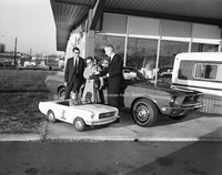
Magic City Ford promotion.
Davis2 46.61 Magic City Ford
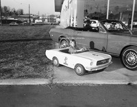
Unidentified girl sits in toy Mustang at Magic City Ford.
Davis2 47.5 Thaden-Jordan Furniture
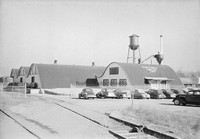
Thaden-Jordan Furniture Company, formerly located at 312 Kessler Mill Road.
Davis2 47.51 Johnson-Carper
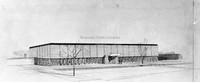
Architectural rendering of Johnson-Carper Furniture Company, formerly located at 3322 Hollins Road NE.
Davis2 48.7 Archway Cookies
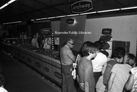
An Archway Cookies booth at an unidentified event.
Davis2 49.122 Crossroads Mall
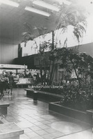
An interior view of Crossroads Mall.
Davis2 56 Waverly Church Choir
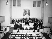
Unidentified members of the Waverly Place Baptist Church Choir.
Davis2 57.5a Viking Lanes
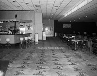
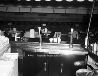
Interior view of Viking Lanes Bowling Alley, formerly located at 2727 Franklin Road.
Davis2 57.5b Viking Lanes
Interior view of Viking Lanes Bowling Alley, formerly located at 2727 Franklin Road.
Davis2 57.5c Viking Lanes
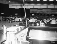
Interior view of Viking Lanes Bowling Alley, formerly located at 2727 Franklin Road.
Davis2 61.25 Virginian #104
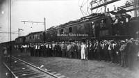
An unidentified group stands in front of Virginian #104, a class EL-#3A electric locomotive.
Davis2 66 SML Dam
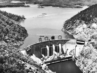
Smith Mountain Lake Dam.
Davis2 66.827 Colorado Street Bridge
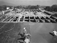
Construction of the bridge on South Colorado Street over the railroad tracks in Salem.
Davis2 66.92 Cornelius Charlton Bridge
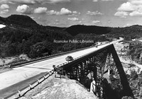
Also known as the Bluestone River Bridge, the Sergeant Cornelius H. Charlton Bridge crosses the Bluestone River in Mercer County, West Virginia. Charlton received the Metal of Honor for his heroic acts in the Korean War.
Davis2 8.4 Lynchburg
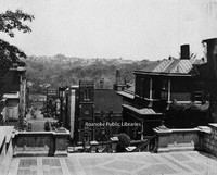
A view of Downtown Lynchburg from Courthouse hill.
Davis2 8.41 Lynchburg
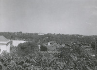
A view of Downtown Lynchburg from Courthouse hill.
Davis2 8.42 Lynchburg
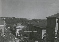
A view of Downtown Lynchburg from Courthouse hill.
Davis2 8.43 Kingsport Utilities
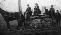
Unidentified men with a Kingsport Utilities wagon.
Davis2 91.2 Memorial Tunnel
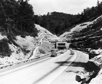
The Memorial Tunnel opened in 1954 to carry traffic through the Paint Creek Mountain on the West Virginia Turnpike. Closed to traffic in 1987, the tunnel is now used for military training.
Davis GL 10 Rorer Avenue
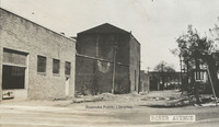
View of buildings along Rorer Avenue.
Davis GL 100 Playground in Norwich
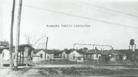
PLayground in Norwich neighborhood.
Davis GL 104 Maiden Lane
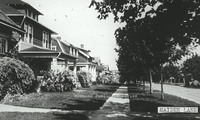
Houses on Maiden Lane.
Davis GL 105 Melrose Avenue
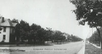
Melrose Avenue. Exact location unknown.
Davis GL 108 Salem Avenue
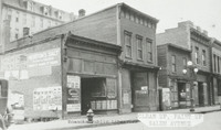
Vacant store fronts in the 100 block of Salem Avenue.
Davis GL 11 Staunton Avenue
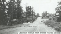
View of Staunton Avenue near 24th Street.
Davis GL 110 Campbell Avenue
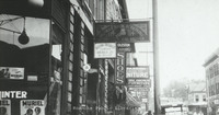
Various business signs along E. Campbell Avenue.
Davis GL 111 Fire Escape Diagram
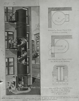
Fire Escape diagram depicting a "state-of-the-art" fire escape containing a slide.
Davis GL 12 Watts Springs
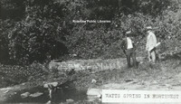
View of two men standing beside Watts Springs.
Davis GL 13 Church Avenue
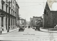
View of Church Avenue looking east from Commerce Street (now 2nd Street). Greene Memorial UMC visible on right, old YMCA visible on left.
Davis GL 14 Pond in Elmwood Park
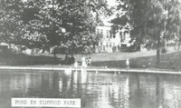
View of pond in Elmwood Park.
Davis GL 16 Neighborhood
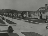
Though not in Roanoke, this Longview, Washington neighborhood scene was used as an example in John Nolen's plan for Roanoke.
Davis GL 165 GN Natural Bridge
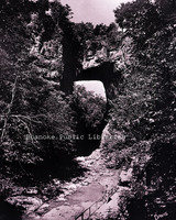
Natural Bridge
Davis GL 17 Unidentified Building
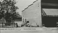
Unidentified building near downtown.
Davis GL 172 Hotel Patrick Henry
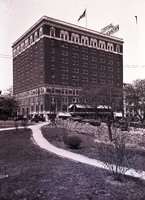
View of Hotel Patrick Henry from Elmwood Park
Davis GL 18 Windsor Avenue
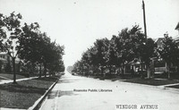
Windsor Avenue in Raleigh Court
Davis GL 19 Campbell Avenue
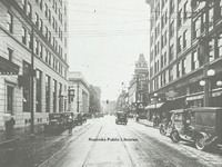
Looking west on Campbell Avenue at intersection with Jefferson Street.
Davis GL 2 Scene in Elmwood Park
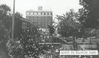
Scene in Elmwood Park with a view of Patrick Henry Hotel.
Davis GL 2.1 Scene in Elmwood Park
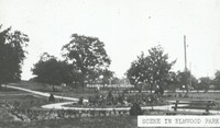
Scene in Elmwood Park viewing the rose garden.
Davis GL 20 Salem Avenue
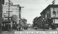
View of Salem Avenue east from Second Street, SW. Buildings lines street with painted advertisements.
Davis GL 21 Terry Building
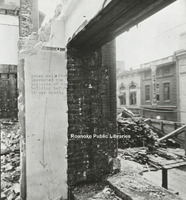
Image of a building being demolished.
Davis GL 21.1 Terry Building
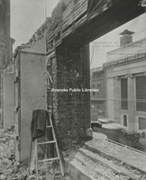
Image of a building being demolished with coat laying on ladder.
Davis GL 22 Single Family Dwelling
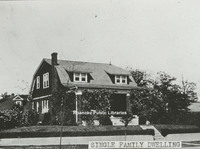
View of a single family dwelling made of brick.
Davis GL 222 Patrick Henry Hotel
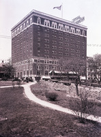
View of Patrick Henry Hotel from Elmwood Park.
Davis GL 23 Jefferson Street
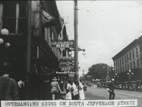
View of advertisement signs hanging from the front of buildings along South Jefferson Street.
Davis GL 232 Northeast
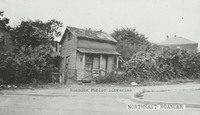
Derelict home in Northeast. Exact location unknown.
Davis GL 237 Walnut Avenue Bridge
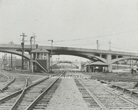
Side view of the Walnut Avenue and Jefferson Street bridges.
Davis GL 241 10th Street
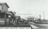
A view of 10th Street NW at Williamson Road and the Oakland School.
Davis GL 242 Shaffers Crossing
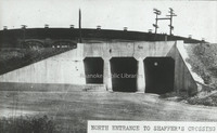
North entrance to Shaffer's Crossing.
Davis GL 25 Southeast
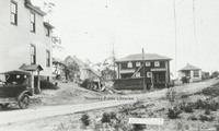
View of several homes in Southeast.
Davis GL 26 State and City Bank
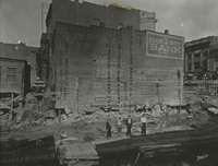
Side view of State & City Bank, once located at approximately 206 Jefferson Street. This photo was taken after a building was razed.
Davis GL 269 Jefferson Street
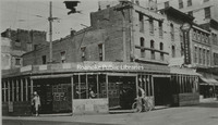
Northwest corner at the intersection of Jefferson Street and Campbell Avenue.
Davis GL 29 Truck
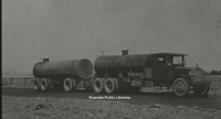
Image of a tanker style truck.
Davis GL 3 Melrose Park
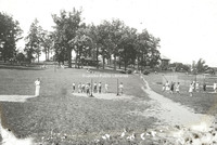
View of people playing recreational games in Melrose Park.
Davis GL 30 Campbell Avenue
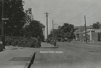
View of West Campbell Avenue at 8th Street intersection, 1928.
Davis GL 31 Patterson Avenue
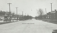
A view of Patterson Avenue.
Davis GL 32 Play Day
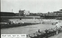
"Play Day" at Maher field 12 May 1928.
Davis GL 33 Motor Routes to Roanoke
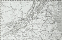
Chamber of Commerce map showing roads to Roanoke.
Davis GL 34 Tennis Courts at Elmwood
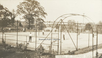
The tennis courts once in Elmwood Park.
Davis GL 35 Panoramic View from Mill Mountain
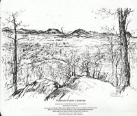
A panoramic sketch from Mill Mountain by Louis Ruyl of New York for the Chamber of Commerce. Caption reads, "Showing spurs of the Blue Ridge with the Alleghany Mountains in the distance, and the Roanoke bowl or amphitheater, McAfee's Knob at left,…
Davis GL 36 Roanoke Hospital
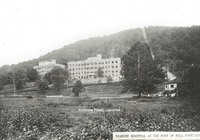
Roanoke Hospital at the foot of Mill Mountain. The Mill Mountain incline can be seen to the right.
Davis GL 37 Dog Mouth Fountain
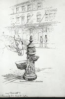
Sketch of the Dog Mouth Fountain. The fountain was acquired by the city in 1898. It stands at the corner of Salem Avenue and Market Street.
Davis GL 38 Public Library in Elmwood Park
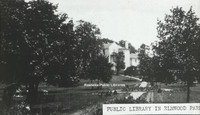
View of the first Roanoke Public Library in Elmwood Park. The library was located in the Terry House, a gift to the city from the Terry Family.
Davis GL 4 Mill Mountain and Roanoke Valley
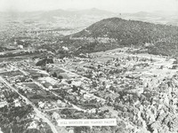
View of Mill Mountain and the surrounding Roanoke Valley
Davis GL 40 Railway Station
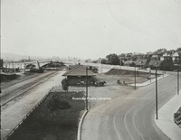
View from Williamson Road of Virginia Railway Station. Jefferson Street bridge in background.
Davis GL 41 Ponce De Leon Hotel
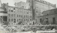
View of the rear of the Hotel Ponce De Leon, with the remainder of a building's foundation visible in foreground.
Davis GL 42 Elmwood Park
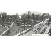
View of Elmwood Park from the Patrick Henry Hotel.
Davis GL 43 Church Avenue
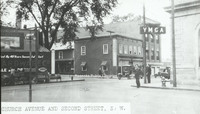
View of the intersection of Church Avenue and Second Street SW with the sign for the YMCA on the right.
Davis GL 44 Highland Park
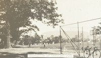
Recreation in Highland Park
Davis GL 46 Spring in Weaver Heights Park
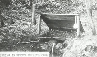
View of the spring once located in Weaver Heights Park.
Davis GL 47 Route 460
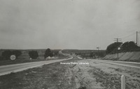
View of Route 460 east of Roanoke.
Davis GL 48 Ponce de Leon
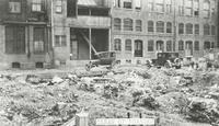
View of debris behind original Hotel Ponce de Leon.
Davis GL 49 9th Street
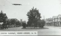
View of 9th Street from the intersection with Jamison Avenue.
Davis GL 5 Montrose Avenue Jog End
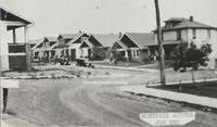
View of the 600 block Montrose Avenue lined with houses.
Davis GL 52 Old Episcopal Church
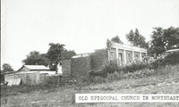
Ruins of an episcopal church in Northeast Roanoke.
Davis GL 55 Downtown Construction
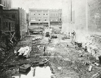
View of men working on construction downtown. Totz Department Store can be seen in the background. Totz was located at 117-119 Salem Avenue SW.
Davis GL 57 Mayors Momument
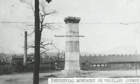
Mayor's Monument in its original location in Woodland Park at Church Avenue and Sixth Street SE, overlooking the Norfolk and Western Shops. The Mayor
Davis GL 58 Lynchburg Avenue
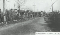
Unknown location on Orange (Lynchburg) Avenue.
Davis GL 59 Panorama
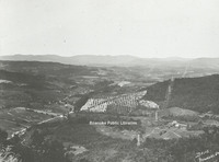
Panoramic view of Roanoke Valley from Route 221 on Bent Mountain at the top of the climb up the mountain just before it reaches the top.
Davis GL 6 Highland Park School
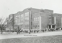
View of Highland Park Elementary School, located at 1212 5th Street.
Davis GL 64 Salem Avenue
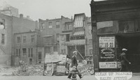
Approximately 132 Salem Avenue.
Davis GL 66 Melrose Park
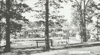
Melrose Park on Melrose Avenue between 14th and 15th Streets.
Davis GL 68 Allison Avenue
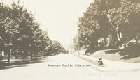
A view of the 300 block of Allison Avenue.
Davis GL 69 Pond in Elmwood Park
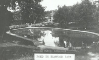
View of pond in Elmwood Park .
Davis GL 7 Jefferson Street Looking North
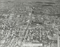
Aerial view of Jefferson Street looking north.
Davis GL 71 Zone Plan City of Roanoke
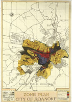
Map of City of Roanoke's Zone Plan used in Nolen Plan.
Davis GL 72 Fairacres
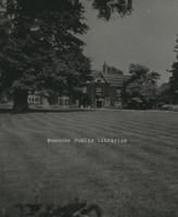
Fairacres, located at 2713 Avenham Avenue, was built in 1912 by W.C. Stephenson. It remained in the Stephenson Family until 1963, when it was purchased by the Roanoke Council of Garden Clubs. The club kept the home until 2003. It is now a private…
Davis GL 75 Map of Roanoke
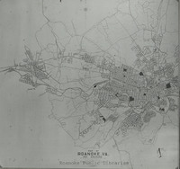
Map of City of Roanoke and Environs used in the Nolen plan.
Davis GL 76 Existing Conditions of Roanoke
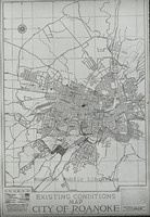
Existing Conditions Map of City of Roanoke used in Nolen plan
Davis GL 77 Traffic Congestion Flyer
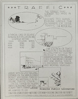
Traffic Congestion Flyer circa 1928.
Davis GL 79 Jamison Bakery
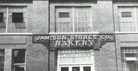
Jamison Company Bakery, formerly located at 541 Salem Avenue.
Davis GL 8 Stone Bridge
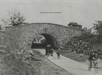
Children play under stone bridge. Location unknown.
Davis GL 80 Giles Brothers Furniture
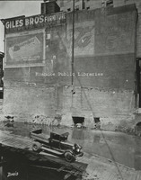
Giles Brothers Furniture, formerly located at 108 Campbell Avenue.
Davis GL 81 Schulte United Building
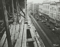
Campbell Avenue as seen from the Schulte United building, formerly located at 16 Campbell Avenue.
Davis GL 84 Center Parkway
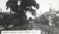
Center Parkway, 9th Street SE.
Davis GL 85 FNEB Detail
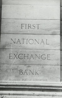
Stonework etched with First National Exchange Bank.
Davis GL 86 Washington Park
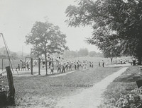
Washington Park, located at 1610 Burrell Street.
Davis GL 87 Grandin Road
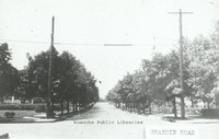
Looking north on Grandin Road from Sherwood Avenue.
Davis GL 88 Wasena Terrace
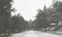
Looking east on Wasena Terrace.
Davis GL 89 Comprehensive Plan
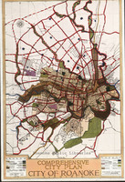
Map included in John Nolen's Comprehensive Plan for the City of Roanoke.
Davis GL 9 Scene in Highland Park
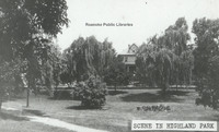
Scene in Highland Park.
Davis GL 90 Mountain Avenue
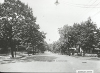
Looking east on Mountain Avenue at 4th Street intersection.
Davis GL 92 Eleventh Street
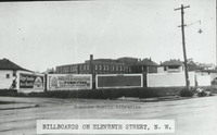
Billboards lining Eleventh Street at Moorman Avenue intersection.
Davis GL 94 Market Street
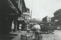
Looking north on Market Street.
Davis GL 98 Pitzer Transfer
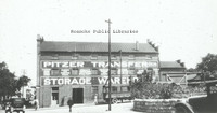
Pitzer Transfer Storage Warehouse, formerly located at the corner of Franklin Road and 2nd Street.
Davis2 1.3 Grand Piano Billboard
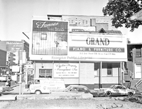
Billboard advertisement for Grand Piano located at Jefferson Street and Franklin Road.
Davis2 2.137a Campbell Avenue
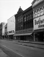
Storefronts on the 10 block of Campbell Avenue SW.
Davis2 2.137b Campbell Avenue
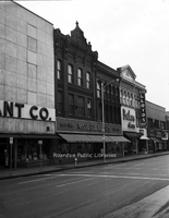
Storefronts in the 10 block of Campbell Avenue SW.
Davis2 2.1116a East on Campbell
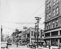
Looking east on Campbell Avenue at the intersection with Jefferson Street.
Davis2 11.63 Addison High Class
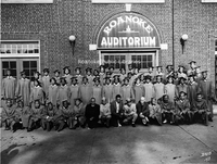
Lucy Addison High School Class of 1943 in front of Roanoke Auditorium.
Davis2 11.64 Lucy Addison High Class
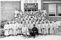
Lucy Addison High School Class of 1941.
Davis2 11.69 Greenvale School
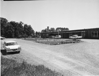
Greenvale Nursery School., located at 627 Westwood Boulevard NW.
Davis2 11.92 Lord Botetourt
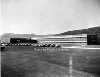
Lord Botetourt High School, located at 1435 Roanoke Road, Daleville.
Davis2 11.691 Greenvale School
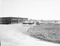
Greenvale Nursery School., located at 627 Westwood Boulevard NW.
Davis2 11.692 Greenvale School
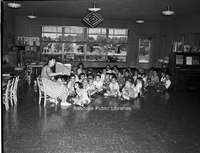
A teacher reads to children at the Greenvale Nursery School, located at 627 Westwood Boulevard.
Davis2 11.693 Greenvale School
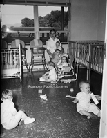
Children in the nursery of Greenvale School, located at 627 Westwood Boulevard Northwest.
Davis2 11.694 Greenvale School
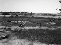
The playground at Greenvale Nursery School, located at 627 Westwood Boulevard NW.
Davis2 11.6524 JHS Football
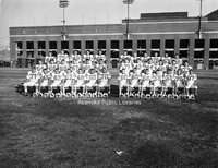
Jefferson High School football team at Victory Stadium.
Davis2 13.21 Surface Law
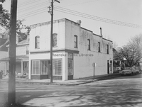
Law Office of Thomas Surface, formerly located at 501 13th Street SW.
Davis2 14.72 Community Hospital
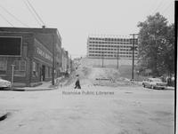
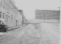
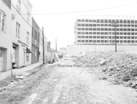
Community Hospital during construction. Roanoke Engraving is visible on the left.
Davis2 14.73 Community Hospital
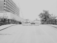
Community Hosptial during construction.
Davis2 14.74 Community Hospital
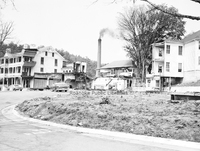
Community Hospital during construction. Roanoke Chemical Company visible at left.
Davis2 14.75 Community Hospital
Community Hospital during construction.
Davis2 16.8 NB Hotel Fire
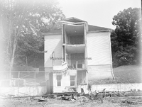
Damage to Natural Bridge Hotel from fire on 23 April 1963.
Davis2 16.81 NB Hotel Fire
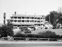
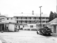
Damage to Natural Bridge Hotel after fire on 23 April 1963.
Davis2 16.82 NB Hotel Fire
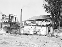
Damage to Natural Bridge Hotel from fire on 23 April 1963.
Davis2 16.83 NB Hotel Fire
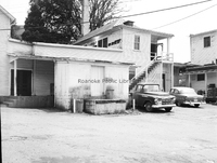
Damage to Natural Bridge Hotel after fire on 23 April 1963.
Davis2 16.84 NB Hotel Fire
Damage to Natural Bridge Hotel after fire on 23 April 1963.
Davis2 16.85 NB Hotel Fire
Damage to Natural Bridge Hotel after fire on 23 April 1963.
Davis2 16.86 NB Hotel Fire
Damage to Natural Bridge Hotel after fire on 23 April 1963.
Davis2 16.87 NB Hotel Fire
Damage to Natural Bridge Hotel after fire on 23 April 1963.
Davis2 16.88 NB Hotel Fire
Damage to Natural Bridge Hotel after fire on 23 April 1963.
Davis2 16.89 NB Hotel FIre
Damage to Natural Bridge Hotel after fire on 23 April 1963.
Davis2 16.810 NB Hotel Fire
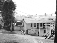
Damage to Natural Bridge Hotel after fire on 23 April 1963.
Davis2 16.811 NB Hotel Fire
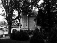
Damage to Natural Bridge Hotel after fire on 23 April 1963.
Davis2 16.812 NB Hotel Fire
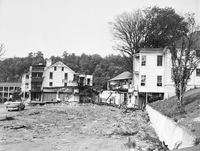
Damage to Natural Bridge Hotel after fire on 23 April 1963.
Davis2 16.7412 Holiday Inn
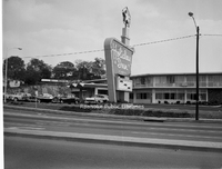
Holiday Inn formerly located at the corner of Orange Avenue and Williamson Road.
Davis2 74.13 Archie's House of Beef
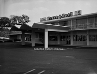
Archie's House of Beef was located in the Holiday Inn that once stood at the corner of Orange Avenue and Williamson Road.
Davis2 16.7414 Archie's House of Beef
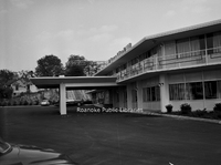
Archie's House of Beef was located in the Holiday Inn that once stood at the corner of Orange Avenue and Williamson Road.
Davis2 18.21a Civic Center
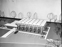
Three dimensional architectural model of the Roanoke Civic Center.
Davis2 18.21c Civic Center
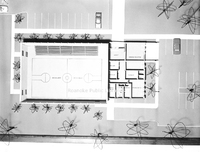
An interior view of a three dimensional architectural model of the Roanoke Civic Center.
Davis2 19.815 Terrace Apartments
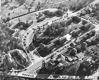
An aerial view of Terrace Apartments with surrounding streets identified.
Davis2 31.50 Mountain View
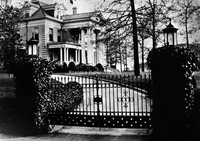
Mountain View, a 40 room elegant turn-of-the-century mansion, was built in 1907 by Junius B. Fishburn. Mr. Fishburn donated Mountain View to the City in 1955 with the stipulation that it be used solely and exclusively for public recreation purposes. …
Davis2 31.501 Mountain View
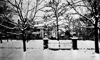
Mountain View, a 40 room elegant turn-of-the-century mansion, was built in 1907 by Junius B. Fishburn. Mr. Fishburn donated Mountain View to the City in 1955 with the stipulation that it be used solely and exclusively for public recreation purposes. …
Davis2 39 1130 2nd Street-1
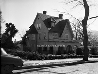
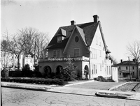
Home located at 1130 2nd Street SW.
Davis2 39 1130 2nd Street-2
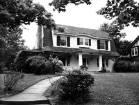
Home located at 1130 2nd Street SW.
Davis2 39 1802 Greenwood Road-1
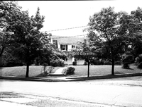
Home located at 1802 Greenwood Road SW.
Davis2 39 1802 Greenwood Road-2
Home located at 1802 Greenwood Road SW.
Davis2 11039 Stewartsville Road
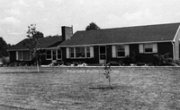
Home located at 11035 Stewartsville Road.
Davis2 43.7 C&P Telephone Float
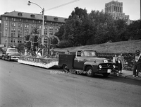
Parade float for C&P Telephone Company.
Davis2 43.8 Peoples Federal
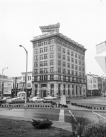
People's Federal Savings and Loan, formerly located in the Liberty Trust Building at 101 Jefferson Street.
Davis2 43.61 Allstate Insurance
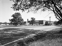
Allstate Insurance, formerly located at 3517 Brandon Avenue.
Davis2 43.62 Congela Building
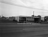
Congela Building, located at 2823 Williamson Road.
Davis2 43.63 Motor Finance
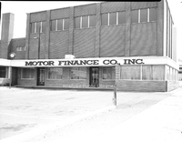
Motor Finance Company, formerly located at 428 Campbell Avenue SW.
Davis2 43.86a SWVA Savings & Loan
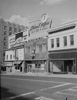
Southwest Virginia Savings & Loan, formerly located at 306 2nd Street SW.
Davis2 43.611 Allstate Insurance
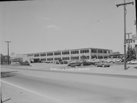
Allstate Insurance, formerly located at 3517 Brandon Avenue SW.
Davis2 43.631 Motor Finance
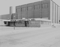
Motor Finance Company, formerly located at 428 Campbell Avenue SW.
Davis2 43.713 Shenandoah Life
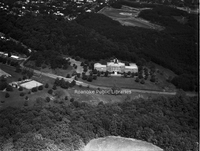
An aerial view of Shenandoah Life Insurance Company, located at 2301 Brambleton Avenue SW.
Davis2 43.714 Shenadoah Life
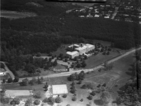
An aerial view of Shenandoah Life Insurance, located at 2301 Brambleton Avenue SW.
Davis2 43.861 SWVA Savings & Loan
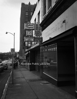
Southwest Virginia Savings & Loan, formerly located at 306 2nd Street SW. View is looking north.
Davis2 43.862 SWVA Savings & Loan
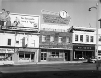
Southwest Virginia Savings & Loan, formerly located at 306 2nd Street SW
Davis2 46.863 SWVA Savings & Loan
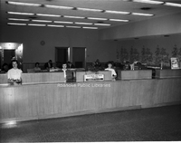
Employees inside Southwest Virginia Savings & Loan, formerly located at 306 2nd Street SW.
Davis2 18.21b Civic Center
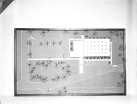
Top view of three dimensional architectural model of Roanoke Civic Center.
Davis2 44.4 Smartwear Irving-Saks
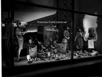
Window display at Smartwear Irving-Saks, formerly located at 210-212 S. Jefferson Street.
Davis2 44.6 Leggetts
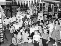
Interior view of the children's department at Leggett's, formerly located 112 Campbell Avenue.
Davis2 44.7 Schulte United
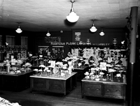
Interior view of Schulte United Millinery, formerly located at 16 Campbell Avenue SW.
Davis2 44.8 Barr's Variety Store
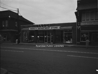
Barr's Variety Store, formerly located at 1318 Grandin Road SW.
Davis2 44.81 Barr's Variety Store
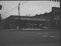
Barr's Variety Store, formerly located at 1318 Grandin Road SW.
Davis2 44.82a Barr's Variety Store
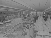
Shoppers inside Barr's Variety Store, formerly located at 1318 Grandin Road SW.
Davis2 44.82c Barr's Variety Store
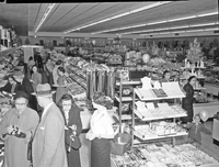
Shoppers in Barr's Variety Store, formerly located at 1318 Grandin Road SW.
Davis2 44.82d Barr's Variety Store
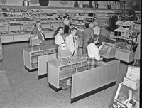
Cash registers at Barr's Variety Store, formerly located at 1318 Grandin Road SW.
Davis2 46.5 Moore Tire
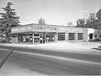
Moore Tire Company, formerly located at 1860 S. Jefferson Street.
Davis2 46.7 Dickerson GMC
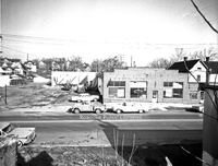
Dickerson GMC, formerly located 715 Patterson Avenue SW.
Davis2 46.8 Butterfield's Golf Carts
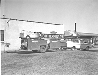
Butterfield's Golf Carts.
Davis2 46.9 Rutrough Motors
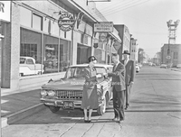
An unidentified customer and employees in front of Rutrough Motors, formerly located at 335 Luck Avenue SW.
Davis2 46.62 Magic City Ford
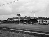
Magic City Ford, located at 809 Williamson Road NE.
Davis2 46.81 Chewning Garage
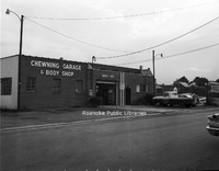
Chewning Garage and Body Shop, formerly located at 3034 Wentworth Avenue NW.
Davis2 46.91 Rutrough Motors
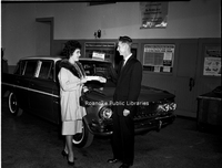
An unidentified customer and employee in the showroom of Rutrough Motors, formerly located at 335 Luck Avenue SW.
Davis2 46.222 Jarrett-Chewning
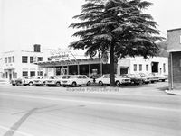
Jarrett-Chewning Company, formerly located at 1854 S. Jefferson Street.
Davis2 46.223 Jarrett-Chewning
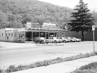
Jarrett-Chewning Company, formerly located at 1854 S. Jefferson Street.
Davis2 46.224 Jarrett-Chewning
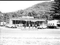
Unidentified employees stand in front of Jarrett-Chewning Company, formerly located at 1854 S. Jefferson Street.
Davis2 46.225 Jarrett-Chewning
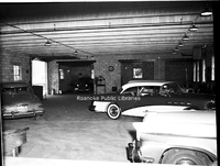
Garage interior of Jarrett-Chewning Company, formerly located at 1854 S. Jefferson Street.
Davis2 46.226 Jarrett-Chewning
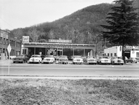
Jarrett-Chewning Company, formerly located at 1854 S. Jefferson Street.
Davis2 46.227 Jarrett-Chewning
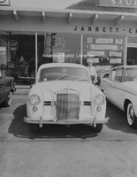
A Mercedes on the sales lot of Jarrett-Chewning Company, formerly located at 1854 S. Jefferson Street.
Davis2 46.228 Jarrett-Chewning
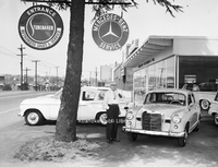
An unidentified employee stands next to a Mercedes on the sales lot of Jarrett-Chewning Company, formerly located at 1854 S. Jefferson Street.
Davis2 46.333 Fort Lewis Esso
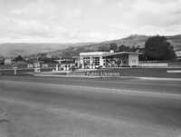
Fort Lewis Esso Servicenter, formerly located at 1905 W. Main Street in Salem.
Davis2 46.334 Williamson Esso
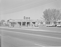
Williamson Road Esso, formerly located at 2715 Williamson Road NE.
Davis2 47.2 Roanoke Sash
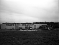
Roanoke Sash & Door Company, formerly located at 999 13th Street SW.
Davis2 47.6 Virginia Brewing
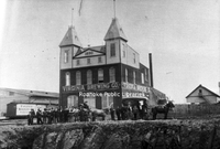
Virginia Brewing Company, formerly located in the 1200 block of Wise Avenue SE.
Davis2 47.7 Vinton Weaving
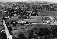
Vinton Weaving Company, now Precision Fabrics Group, is located at 323 West Virginia Avenue.
Davis2 47.8a National Cash Register
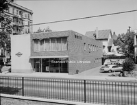
National Cash Register, formerly located at 902 S. Jefferson Street,
Davis2 47.8b National Cash Register
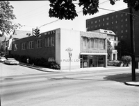
National Cash Register, formerly located at 902 S. Jefferson Street.
Davis2 47.8c National Cash Register
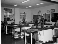
Work stations inside National Cash Register, formerly located at 902 S. Jefferson Street.
Davis2 47.9a Dillard Paper
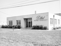
Dillard Paper Company, formerly located at 2490 Patterson Avenue SW.
Davis2 47.9b Dillard Paper
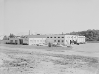
Dillard Paper Company, formerly located at 2490 Patterson Avenue SW.
Davis2 47.12b McKesson & Robbins
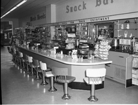
Snack bar inside McKesson & Robbins in Rocky Mount.
Davis2 47.12c McKesson & Robbins
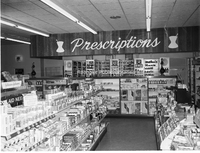
Interior view of McKesson & Robbins Pharmacy in Rocky Mount.
Davis2 47.12d McKesson & Robbins
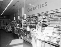
Cosmetics counter in McKesson & Robbins in Rocky Mount.
Davis2 47.14 Warren Gilbert Photography
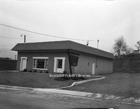
Warren Gilbert Photography, formerly located at 4311 Appleton Avenue NW.
Davis2 47.61 Virginia Brewing
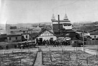
Rear view of Virginia Brewing Company, formerly located in the 1200 block of Wise Avenue SE.
Davis2 47.62 Virginia Brewing
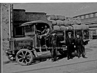
Virginia Brewing Company employees with delivery truck outside of the brewery.
Davis2 47.75 Webster Brick
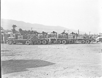
Employees next to trucks at Webster Brick.
Davis2 48.2 Roanoke Distributing Company
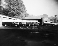
Pabst Blue Ribbon delivery trucks parked at Roanoke Distributing Company, formerly located at 907 3rd Street SE.
Davis2 48.3 Roanoke Grocers
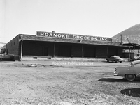
Roanoke Grocers Inc., formerly located at 1131 4th Street SE.
Davis2 48.4 Hampshire Corp
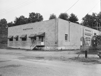
Hampshire Corp., formerly located at 2101 Winston Avenue SW.
Davis2 48.5 Sealtest Foods
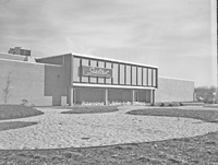
Sealtest Foods, formerly located at 133 Albemarle Avenue SE.
Davis2 48.8 Mayfair Caterers
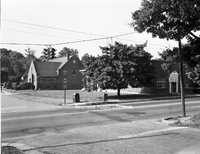
Mayfair Caterers and Restaurant, formerly located at 1602 Orange Avenue NW. Melrose Seventh Day Adventist Church visible in background.
Davis2 48.9 Roma Restaurant
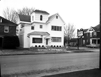
Roma Restaurant (later Villa Sorrento), formerly located at 1210 Patterson Avenue SW.
Davis2 48.14 Garst Brothers Dairy
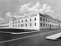
Garst Brothers Dairy, formerly located at 1118 Salem Avenue SW.
Davis2 48.33 Associated Grocers
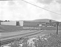
Associated Grocers, formerly located at 359 Kessler Mill Road.
Davis2 48.51 Sealtest Foods
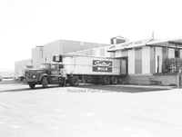
Employee with tractor-trailer at loading dock of Sealtest Foods, formerly located at 133 Albemarle Avenue SE.
Davis2 48.52 Sealtest Foods
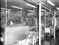
Production equipment in Sealtest Foods, formerly located at 133 Albemarle Avenue SE.
Davis2 48.53 Sealtest Foods
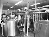
Production equipment in Sealtest Foods, formerly located at 133 Albemarle Avenue SE.
Davis2 48.54 Frigid Freeze
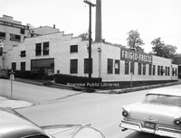
Frigid Freeze Frozen Foods, formerly located at 103 8th Street SE.
Davis2 48.63 O'Briens Van
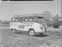
O'Brien's Radio & TV Service van.
Davis2 48.67 Sears Delivery Trucks
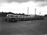
Drivers stand next to Sear's delivery trucks.
Davis2 48.75 Roanoke Ice
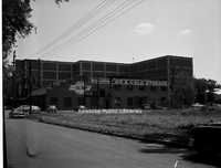
Roanoke Ice and Cold Storage, formerly located at 806 Wasena Avenue.
Davis2 48.81 Patty Wagon
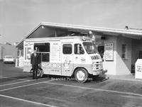
Patty Wagon Hamburgers truck.
Davis2 48.82 Patty Wagon
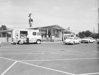
Kenney's Patty Wagon Hamburgers, formerly located at 5320 Williamson Road NW.
Davis2 48.83 Biff Burger Sign
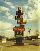
Sign for Biff Burger, formerly located at 4317 Williamson Road NE.
Davis2 48.84 Biff Burger
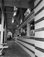
Order windows at Biff Burger, formerly located at 3323 Melrose Avenue NW.
Davis2 48.95 Mullens Place
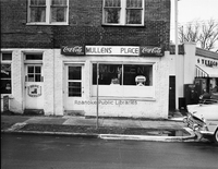
Mullen's Place, formerly located at 307 9th Street SE.
Davis2 48.751 Roanoke Ice
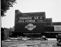
Roanoke Ice and Cold Storage, formerly located at 806 Wasena Avenue.
Davis2 48.771 Top Value Stamps
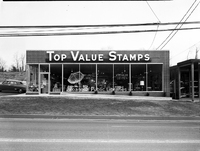
Top Value Stamps, formerly located at 2613 Franklin Road SW.
Davis2 48.772 Top Value Stamps
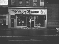
Top Value Stamps, formerly located at 318 2nd Street SW.
Davis2 48.773 Top Value Stamps
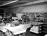
Merchandise inside Top Value Stamps, formerly located at 318 2nd Street SW.
Davis2 48.774 Top Value Stamps
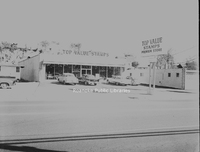
Top Value Stamps, formerly located at 1519 Williamson Road NE.
Davis2 48.6234 Garland's Medical Center
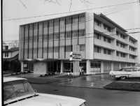
Garland's Medical Center, formerly located at 127 McClanahan Street SW.
Davis2 48.6235 Garland's Drugstore
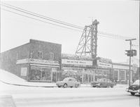
Garland's Drugstore on a snowy day, formerly located at 1327 Grandin Road SW.
Davis2 48.6236a Garland's Delivery Fleet
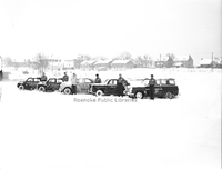
Garland's Delivery Service drivers next to their vehicles on a snowy day.
Davis2 49.2 Roanoke-Salem Plaza
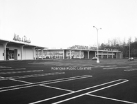
Roanoke-Salem Plaza storefronts, including People's Drug, Miller & Rhoads and Winn-Dixie, formerly located at 4600 Melrose Avenue NW.
Davis2 49.3 Townside Plaza
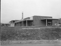
Townside Plaza (now Townside Festival), located at 3600 Franklin Road SW.
Davis2 49.21 Lerner Shops
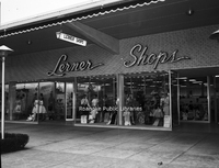
Lerner Shops at Roanoke-Salem Plaza, formerly located at 4142 Melrose Avenue NW.
Davis2 49.31 Townside Plaza
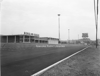
Townside Plaza (now Townside Festival), located at 3600 Franklin Road SW.
Davis2 49.123 Crossroads Mall
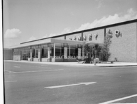
JC Penney at Crossroads Mall, formerly located at 5002 Airport Road NW.
Davis2 49.124a Crossroads Mall
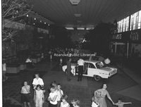
Interior of Crossroads Mall. Crossroads was built in 1961 and was the first enclosed shopping center in Virginia.
Davis2 49.124b Crossroads Mall
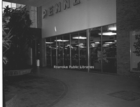
Interior entrance of JC Penney at Crossroads Mall.
Davis2 49.124c Crossroads Mall
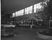
Interior view of Crossroads Mall.
Davis2 49.124d Crossroads Mall
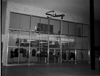
Interior entrance to Sidney's at Crossroads Mall.
Davis2 49.124e Crossroads Mall
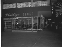
Phillips Shoes in Crossroads Mall.
Davis2 49.124h Crossroads Mall
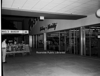
Interior entrance to Roses at Crossroads Mall.
Davis2 49.125 WoolCo
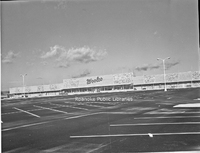
WoolCo Department Store, formerly located at Crossroads Mall, 5002 Airport Road NW. Original anchor stores at Crossroads were J,C. Penney, Roses, Heironimus, Winn-Dixie, People's Drug, Other mall tenants included Fink's Jewelers, Smartwear Irving…
Davis2 63.1 Safety Motor Transit
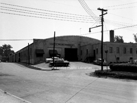
Safety Motor Transit, formerly located at 12th Street and Campbell Avenue SE.
Davis2 63.12 Safety Motor Transit
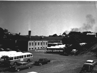
Safety Motor Transit, formerly located at 12th Street and Campbell Avenue SE.
Davis2 75.82 JM Oakey Hearse
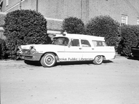
John M. Oakey Funeral Home hearse.
Davis2 75.83 JM Oakey
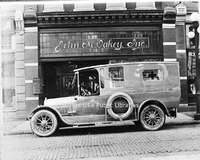
Hearse in front of John M. Oakey Funeral Home, formerly located at 126 Campbell Avenue SW.
Davis2 75.864 Rader Chapel
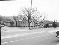
Rader Chapel located at 630 Roanoke Road in Daleville. This building was replaced with the current structure in 1996.
Davis2 11.96 Roanoke College
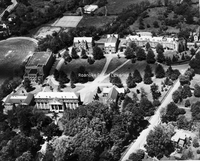
An aerial view of Roanoke College.
Davis2 45.92 Roanoke Gas
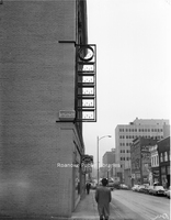
Looking east on Church Avenue in front of Roanoke Gas, formerly located at 123-125 Church Avenue SW. The sign was illuminated by gas burners. Sign panels have been removed as the gas burners are being replaced with electric lights.
Davis2 48.94a Lendys Take Home
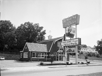
Lendy's Take Home Shoppe, formerly located at 4102 Melrose Avenue NW.
Davis2 48.94b Lendys Take Home
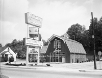
Lendy's Take Home Shoppe, formerly located at 4102 Melrose Avenue SW.
Davis2 35.13 OSW Apartments
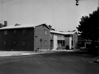
Apartments located at 201 Mountain Avenue SW.
Davis2 48.38 Tom Huston Peanut
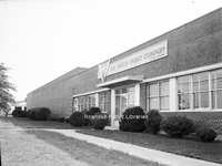
Tom Huston Peanut Company, formerly located at 1340 W. Main Street in Salem.
Davis2 19.6 Colonial Yorktown
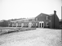
Colonial Yorktown Apartments, located at 2918 Brandon Avenue SW.
Davis2 35.12 OSW Apartments
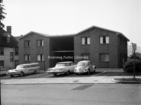
Apartments located at 110 Mountain Avenue SW.
Davis2 19.5 SR Apartment Village
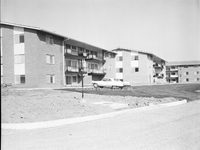
South Roanoke Apartment Village, located at 3727 Parliament Road SW.
Davis2 39 337 Parkwood Avenue
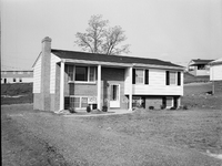
Home located at 337 Parkwood Avenue in Salem.
Davis2 45.91 Roanoke Gas
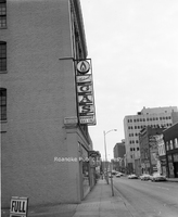
Looking east on Church Avenue in front of Roanoke Gas Company, formerly located at 123-125 Church Avenue SW. The sign was illuminated by gas burners.
Davis2 45.9 Roanoke Gas
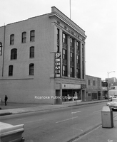
Main office of Roanoke Gas Company, formerly located at 123-125 Church Avenue SW.