
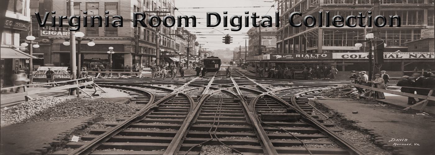
Browse Items (9249 total)
Sort by:
RREC9 Jefferson Street

Looking north on Jefferson Street at the Campbell Avenue Intersection. The Didier Grocers building at right, in earlier days, housed the street railway offices and provided a waiting room for the cars. In the middle of Jefferson Street, a horsecar…
RREC10 9th Street SE

Passengers board and disembark streetcars on 9th Street SE near American Viscose.
RREC11 Line Crew

Line Crew of the Roanoke Railway and Electric Company. From left are: Jim Payne (foreman), unidentified, Stannoke Maxey (lineman), last two unidentified.
RREC12 Mill Mountain

A panoramic view showing Mill Mountain looming over the Walnut Avenue Steam Plant of the Roanoke Railway & Electric Company.
RREC15 Meter Line Crew

Frank Haley (left) and Al Firebaugh of the Meter Cut-In Crew.
RREC16 Carrie

Roanoke Railway & Electric steam dummy Number 2, Carrie, with a Roanoke and Salem coach attached is shown, reportedly on its maiden run in 1890.
RREC19 Number 44

Brill car Number 44 after a collision with a Virginian Railway locomotive under the Walnut Avenue bridge.
RREC20 Number 44

Another view of Brill car Number 44 after a collision with a Virginian Railway locomotive under the Walnut Avenue Bridge.
RREC21 Utility Wagon

A utility wagon of the Roanoke Railway & Electric Company and its companion mule.
Scyphers1 View from Mill Mountain

A view of Roanoke from Mill Mountain.
Scyphers3 Jefferson Street

Looking north on Jefferson Street at the Franklin Road intersection. Visible at left is the Elks Lodge and the Elmwood Diner. Also visible is Hammond Printing and Litho Works.
Scyphers4 1st Street

Looking south on 1st Street.
Scyphers5 Jefferson Street

Looking north on Jefferson Street at the Church Avenue intersection. Visible are The Sportsman Restaurant, Bernard's Menswear, Thomas McAn Shoes, Kann's Apparel, Hoffheimer's Shoes, Holiday's Shoe Store and the American Theatre.
Scyphers6 Jefferson Street

Looking south on Jefferson Street. Visible are Holiday's Shoe Store, Hoffheimer's Shoes, Kann's Apparel, Thomas McAn Shoes, The Sportsman Restaurant and Heironimus.
Scyphers7 Church Avenue

Looking west on Church Avenue from Jefferson Street. Visible are the Sportsman Restaurant, Parker Photo Studio, Junior Achievement of the Roanoke Valley, Kaybee Store and Moskin's Store.
Scyphers8 Franklin Road

Looking west on Franklin Road from Jefferson Street. Visible are the Knights of Pythias building, Star Barber Shop, Roanoke Valley Heart Association, GAC Finance, Riley's Cafe, Thornton & Creasy Drugs, and Holdren's
Scyphers9 Jefferson Street

Looking north on Jefferson Street. Visible are Heironimus, The Sportsman Restaurant, Thomas McAn Shoes, Kann's Apparel, Hoffheimer's Shoes, Holiday's Shoe Store and the American Theatre.
Scyphers11 Japanese Magnolia

The Japanese Magnolia in Elmwood Park.
Scyphers12 Shenandoah Life

Shenandoah Life Insurance Company, formerly located at 2301 Brambleton Avenue.
Scyphers13 Jefferson Street

Looking south on Jefferson Street from Franklin Road. Visible are John Norman Clothing, the Park Theatre, State Office Supplies and Gifts, the Coulter Building, People's Drugstore and the Patrick Henry Hotel.
Scyphers14 Campbell Avenue

Looking west on Campbell Avenue from 1st Street. Visible are Leggett's, George T. Hitch Jewelers, Singer Sewing Machines, Beckner's and Easter's.
Scyphers15 Elmwood Park

A view of the pond in Elmwood Park. The Terry House is visible on the hill.
Scyphers16 Elmwood Park

The pond in Elmwood Park. The Greyhound Bus Station is visible in the background.
Scyphers17 Jefferson Street

Looking north on Jefferson Street. Visible are State Office Supply and Gifts, Hammond's Printing & Litho Works, Johnnie's Steakhouse, Jefferson Theatre, Heironimus, Sidney's and Thornton & Creasy Drugs.
Scyphers18 Jefferson Street

Looking north on Jefferson Street from Franklin Road. Visible are State Office Supply and Gifts, Hammond's Printing & Litho Works, Johnnie's Steakhouse, Jefferson Theatre, Heironimus, Sidney's and Thornton & Creasy Drugs.
Scyphers19 View from Mill Mountain

A view of Roanoke from Mill Mountain.
Scyphers20 Pocahontas

The Norfolk & Western Pocahontas passenger train, possibly on its last excursion. The passenger train ran from November 1926 through May 1971.
Scyphers21 Pocahontas

Passengers aboard the Norfolk & Western Pocahontas, possibly on its last excursion. The passenger train ran from November 1926 through May 1971.
Scyphers23 N&W GP9

Norfolk & Western GP9 #516 locomotive pulling the Pocahontas near the N&W shops.
Scyphers24 Mill Mountain Overlook

Overlook once on Mill Mountain in front of Rockeldge Inn seen at dusk.
Scyphers25 Jefferson Street

A view of the Jefferson Theatre and Heironimus on Jefferson Street.
Scyphers26 Pocahontas

Norfolk & Western employees stand in the doorway of the Pochontas, possibly on its last excursion. The passenger train ran from November 1926 through May 1971.
Scyphers28 Pocahontas

Passengers aboard the Norfolk & Western Pocahontas, possibly on its last excursion. The passenger train ran from November 1926 through May 1971.
Scyphers33 Jefferson Street

Looking north on Jefferson Street at the Church Avenue intersection. Visible are The Sportsman Restaurant, Bernard's Menswear, Thomas McAn Shoes, Kann's Apparel, Hoffheimer's Shoes, Holiday's Shoe Store and the American Theatre.
PC 132.0 Views of Roanoke

"Views of Roanoke"
PC 132.1 View of Roanoke

"View of Roanoke, Virginia"
PC 132.2 View of Roanoke Valley

"Roanoke Valley on the line of the Norfolk & Western Railway, Virginia."
PC 132.8 South Roanoke

"South Roanoke"
PC 132.9 Virginia Heights

"Virginia Heights"
PC 132.91 Virginia Heights

"Virginia Heights Bridge and Roanoke River"
PC 133.03 Virginia College

"Virginia College (Young Ladies), Roanoke, Virginia"
PC 135.0 YMCA

"Central YMCA, Roanoke, Virginia"
PC 139.11 Roanoke College

"Roanoke College, Salem, Virginia"
PC 139.16 Camp Fort Lewis

"Tourist Camp Fort Lewis Courts. Steam heat, tile private baths, innerspring mattresses, closed garages. One of the best in the east, 8 miles west of Roanoke, Virginia. One-half mile west of Salem, Virginia. US Route No. 11. Open all year. Mr. and…
PC 139.17 Browns

"Mr. and Mrs. Sinclair Brown, Rev. G.L. Brown. Salem, Virginia October 20, 1908"
MP 4.421 Campbell Avenue

Looking east on Campbell Avenue from 1st Street during paving. People's Drugstore, Standard Drug, Krees & Co. and Lerner Shops were several of the businesses along this block.
MP 4.422 Campbell Avenue

Looking east on busy Campbell Avenue from 1st Street. People's Drugstore, Standard Drug, Kress & Co. and Lerner Shops were several of the businesses along this block.
MP 4.423 1st Street

Looking south on 1st Street from the 1st Street Bridge. The bridge connected Henry Street to Downtown Roanoke. The bridge was renamed in honor of Dr. Martin Luther King, Jr. in 2003.
MP 24.5 Mt. Pleasant School

Unidentified students in front of Mt. Pleasant School in Roanoke County.
LDW4 Cleaning and Alterations

In addition to dyeing, Loebl also provided dry cleaning and alteration services. Photo is labeled with the following names, though their order as they appear is unclear: Minnie Duncan, Gertrude Gentry, Mrs. Flippen, Stella Taylor, and Miss Sandberg
LDW5 Loebl, Josef

Hungarian born, Josef Loebl grew up in Austia. He set up his dyeing and cleaning shop on Salem Avenue in the 1920s.
LDW6 Loebl Fleet

A fleet of four Loebl Dye Works dry cleaning trucks parked in front of Loebl Dye Works on Salem Avenue.
LDW7 Loebl Fleet

Loebl Dye Works dry cleaning trucks parked in front of Loebl Dye Works on Salem Avenue.
LDW8 Customer Counter

Robert Loebl, Hattie Mae Beck and Iva M. Spangler in the pick-up and drop-off area of Loebl Dye Works.
LDW9 Loebl Interior

Josef Loebl (center) and two unidentified men in "storefront" of Loebl Dye Works
LDW10 Staging Area

William Staples, Iva Staples and an unknown woman prepare garments for cleaning and alterations at Loebl Dye Works.
LDW11 Cleaning Area

Unidentified Loebl employees in the cleaning area.
LDW12 Dyeing Area

Unidentified Loebl employees in the dyeing area.
LDW13 Cleaning Area

Robert Loebl (left) inspects the work of unidentified employees on the Hoffman Pressing Machine.
LDW14 Cleaning Area

Robert Loebl (left) and two unidentfied men in the next to the cleaning tumblers.
LDW15 Loebl Dye Works

As seen here, Loebl Dye Works once filled a row of buildings on Salem Avenue.
LDW17 Loebl Dye Works

After the explosion of synthetic fabrics in the 1970s, Loebl Dye Works went out of business in 1981. The building was razed in 2001. The buildings at left in this photograph were also once used by the business and still stand today.
BM 001 Back Creek School

Students at old Back Creek School on Landmark Circle in Southwest Roanoke County.
BM 023 John Harris Family

Family of John and Sarah (Hayes) Harris. L to R: Sarah Jane, William, Lutie, Susie, Elisha, George, John, Eliza, and Benjamin. The family lived in the Back Creek section of Roanoke County.
BM 024 Martin-Simpson Cemetery

Mountain burial in family cemetery, probably Martin-Simpson cemetery near Martins Creek Road in Southwest Roanoke County.
BM 025 Daniel and Louisa Simpson

Louisa (Martin) and Daniel Simpson. The Simpsons lived on Martins Creek Road in Southwest Roanoke County.
BM 026 Simpson Home

Home and family of Daniel Simpson on Martins Creek in Southwest Roanoke County.
BM 027 William and Mary Grisso

William and Mary Katherine (Poage) Grisso residents of Cave Spring section in Southwest Roanoke County.
BM 028 Grisso Home

Home of John and Susie (Harris) Grisso in Cave Spring, Roanoke County. The home burned in 1946.
BM 029 Cave Spring Baptist

Cave Spring Baptist Church
BM 031 R.T. Fralin

R.T. Fralin, Sr., Ran Lynn Drive in Roanoke County.
BM 032 Fralin Home

Fralin home in Cave Spring.
BM 033 Fralin Barn

Fralin barn on Ran Lynn Drive in Roanoke County.
BM 035 Fralin Home

Fralin home on Ran Lynn Drive in Roanoke County.
BM 036 R.T. Fralin

Riley T. Fralin, Sr, and Jr. at intersection of Ran Lynn Drive and Poage Valley Road.
BM 039 Nadine Henderson

Aunt Nadine Henderson takes nephews and nieces for an afternoon ride in Back Creek. Standing L to R: Bobby, Nadine, David and Charles Ed Henderson; On horse L to R: Paige Riley, Ray Henderson Corky, Barbara & Kay Henderson, Brent Riley.
BM 041 Back Creek School

Back Creek School with "new" addition.
BM 042 Back Creek School

Back Creek School.
BM 043 Back Creek School

Students in front of Back Creek School.
BM 045 Haran Baptist

Haran Baptist Church
BM 046 Haran Baptist

Youth in front of Haran Baptist Church. Front row, L to R: Gaynelle Simpson, Shirley Rierson; Second row, L to R: Preston Webster, Ruby Kirkwood, Nelson Simpson; Back row, L to R: Jimmy Kirkwood, Lorene Simpson, Polly Rierson, Norris Webster
BM 047 Omer Simpson

Omer C. Simpson. Simpson lived on Martins Creek Road.
BM 048 Omer Simpson

Omer C. Simpson
BM 049 Martin Creek Children

First row, L to R: Albert Turner, ? Webster; Second row, L to R: Janette Turner, Nelson Simpson, ?, O.C. Simpson, Jr., Third row, L to R: Francis Simpson, Colleen Grubb, Christine Simpson, Beatrice Peters, ?, Lorene Simpson; Back row, L to R: Vinson…
BM 050 Tinsley and Altis

Hazel Tinsley and Mauvieleen S. Altis in front of Back Creek Elementary School.
BM 051 Back Creek School

W.F. Bolton's 8th grade class at Back Creek School.
BM 052 Altis Group

L to R: Joe Beard, Effie Beard, Mauvieleen Stanley, Nannie Bracy, Edna Altis, Mary Altis, Nannie Altis, Clarence Altis, Clara Altis, Willie Bracy
BM 053 Beard Group

L to R: Joe Beard, Mildred Beard, Charles Altis, Effie Beard, Willie Bracy, Mauvieleen Stanley, Clarence Altis
BM 054 Christley Family

Front row, L to R: William Gilford Christley Jr., Ivy Mae Christley, Louise Christley, William Gilford Christley Sr., Grant Christley; Back row, L to R: Monroe Christley, Elsie Christley, Milan Christley, Glenna Christley, Bertha Christley, Arlen…
BM 056 Christley Family

Front row, L to R: Louise Christley Williams, George Franklin Christley, Iva Mae Christley Ferguson, Elsie Christley, Bertha Christley, ?, Back row, L to R: Bill Christley, Pauline Christley, Monroe Christley, Thora Christley, Milan Christley,…
BM 057 Poage Store

Former Elijah Poage store/warehouse on Old Mill Road in Poages Mill.
BM 058 Christley Family

Photo taken in front of the Christley Homeplace on Mt. Chestnut Road in Roanoke County; Seated L to R: Margaret Powell Christley, Arlen F. “Pete” Christley; Standing, L to R: Keith B. Christley, Warren Christley, Joyce Christley Clowers, Michael…
BM 059 Back Creek School

Back Creek High School. L to R: Gertie Hopper, Glenna Christley, Camile Lavender, Cleda Grisso, Elsie Christley; man at back is Shelton Gates.
BM 065 Reeds Store

Reed’s Store at the intersection of Route 221 and Martins Creek Road.
BM 066 Fats Reed

Marvin P. “Fats” Reed at the counter in Reed's Store at the intersection of Martins Creek Road and Route 221.
BM 067 Riersons Grocery

Rierson’s Grocery on Route 221.
BM 068 Rock Store

Rock store near Poage Farm on Route 221.
BM 069 Back Creek Elementary School

Back Creek Elementary School under re-construction.
BM 070 Martin, Simpson and Day

L to R: Ned Martin, Omer .C. Simpson, Jr., Charles Day and Gordon Willett (background) at Haran Baptist Church.
BM 071 Martins Creek

The woman sitting in the wagon is Annie Blankenship Martin, the man at right is Olvin Martin; American Chestnut in background; photo probably taken in Martins Creek Road area of Roanoke County. All others unidentified.
BM 072 Martin Women

Photo taken at Thelma Willett’s home. Seated front, L to R: Marilyn Givens, Norma Jean Martin; Seated middle, L to R: Mae Austin Martin, Pearl Martin Wertz; Standing, L to R: Edith Martin Filson, Dorothy Martin Bass.
BM 073 Alfonso Martin

Alfonso Martin, a resident of Martins Creek Road.
BM 074 Tilden Martin

Tilden Hendrix Martin, a resident of Martins Creek Road.
BM 075 Simpson Children

Omer C. Simpson, Jr., Christine Simpson, Lorene Simpson, residents of Martins Creek Road.
BM 076 Nelson Simpson

Nelson Simpson, a resident of Martins Creek Road. Photo probably taken at home of his parents O.C. and Mary Simpson.
BM 077 Martin Siblings

L to R: Tilden H. Martin, Gertrude Martin Duling, Alfonso Martin, Otey Martin.
BM 078 Martins Creek

Back row, far left Annie Blankenship Martin, Olvin Martin; far right Louisa Martin, Daniel N. Simpson. Photo taken in front of the Martin-Simpson homeplace on Martins Creek Road. All others unidentified.
BM 080 Martin Home

Olvin Martin home, built in 1877, was located on Martins Creek Road.
BM 081 Martin Barn

Tilden Martin and Lamar Martin barn on Martins Creek Road.
BM 082 Band Saw

Idle band saw at Lamar Martin farm on Martins Creek Road.
BM 083 Sam Hailey

Sam Hailey and his work mules.
BM 084 Spray Engine

Raleigh “Buck” Owens' spray engine for use in orchard.
BM 085 Simpson Barn

Omer Simpson barn on Martins Creek Road.
BM 089 Poage Home

Home of Mary (Mollie) Poage across the creek from the Poage farm on Route 221.
BM 090 Poage Farm

Poage home and farm along Route 221.
BM 091 Poage Deed

1840 deed for 66 acres belonging to Jane Poage as part of land granted to her from her father, John Poage.
BM 092 4-H Club

Back Creek 4-H Club.
BM 093 Rettinger Sisters

Sarah Rettinger Henry (left) and Nannie Rettinger Grisso.
BM 094a Henry Home

Home of Samuel Henry.
BM 094b Henry Family

James and Sarah Henry and three daughters in Poages Mill area.
BM 095 BCS Girls Basketball Team

Back Creek School girls basketball team. Pictured are Margaret Henry Hartman and Mildred Henry Dimond. All others unidentified.
BM 096 BCS 1932 Class

Senior Class at Back Creek School
BM 098

Students at Back Creek School.
BM 100 LDS Chapel

First Mormon chapel in Southwest Roanoke County, located on Bearing Road.
BM 101 Wade Family

W.L. and Icie Wade (seated center) Family.
BM 102 Ferguson Sisters

Ferguson sisters (top) and Christley home on Mt. Chestnut.
BM 103 Ferguson Family

L to R: Rachel Ferguson, Walter Ferguson, Ocieola Ferguson, Isadora Ferguson, Ivie Ferguson, Charles Ferguson, James Ferguson, William H. Ferguson
BM 104 Ferguson Family

Top photo, pictured: Jim Ferguson, Ivie Ferguson, Herbert Henderson, Maggie Ferguson, Margaret Rachel Ferguson, William H. Ferguson, Bertha Wade, Henry Wade . Bottom photo, pictured L to R: Ivie Ferguson, Jim Ferguson, Icie Ferguson, Aunt Paulina,…
BM 105 Margaret and William Ferguson

Margaret Rachel Owens Ferguson and William H. Ferguson.
BM 106 Wade Family

1. Isadora Ferguson Wade, 2. William Lee Wade, 3. Oren Wade, 4. Henry Wade, 5. Barney Owens. Photo was taken at the apple orchard at the Wade home. All others unidentified.
BM 107 Henry Wade

Charcoal drawing of Henry Booker Wade.
BM 110 Henry Wall

Portion of rock wall, built by Ralph Henry’s great grandfather, along Corntassel Lane. The wall still exists today.
BM 115 Bell Label

Packing label for L.D. Bell and T.M. Bell at Poages Mill.
BM 116 Harvey Poage

Harvey Claytor Poage.
BM 117 Poage Family

Poage Family in front of engine on farm. L to R: Harvey Poage, Bill Poage, Lee Poage, Lucy Poage
BM 118 Charlie Poage

Charlie Poage, son of William Poage, with team of horses in front of Poage farmhouse on Route 221.
BM 119 Back Creek Children

Unidentified children at Back Creek School.
BM 123 Back Creek 6th Grade

6th graders in Back Creek School classroom.
BM 124 Ice Cream at Lunch

Miss Annie Bohon sells ice cream during lunch at Back Creek Elementary School. The ice cream cooler was inside the front door of the school.
BM 125 Back Creek Elementary

Back Creek Elementary School.
BM 127 Back Creek School

Students and teachers in front of Back Creek School. Ann Hogan w/tie upper left of group (principal/teacher),
BM 128 Turner Home

Turner home on Martins Creek Road in its final days.
BM 129 Johnnie and Bertha Grubb

Johnnie and Bertha Grubb making apple butter.
BM 130 Ed Sloan

Ed Sloan, auctioneer, with Harold Ferguson in background
BM 131 Poage Men

L to R: Henry Lee Poage (1891-1960), Arthur Seibert “Ott” Poage (1897-1971), Harvey Claytor Poage (1893-1928) in front of Poage farmhouse
BM 132 Poage Men

L to R: Arthur “Ott” Poage, Henry Lee Poage, Charles Claytor Poage (1848-1931), Harvey Claytor Poage, David Meador
BM 134 Wheeler and Bessie Beckner

Wheeler and Bessie Beckner in front of home, presently located at 7041 Cotton Hill Road
BM 135 Wheeler and Bessie Beckner

Wheeler and Bessie Beckner and John Steele (left) at home on Cotton HIll Road. They logged timber for railroad ties.
BM 136 Beckner Home

Beckner homeplace on Cotton Hill Road.
BM 140 Mildred and Roscoe Meador

Mildred and Roscoe Meador wedding photo; Wheeler Beckner on porch.
BM 141 Grandle, Tina, Alice, Buddy

Grandle Meador, Tina, Alice and Buddy Welcher at Beckner home.
BM 142 Route 419
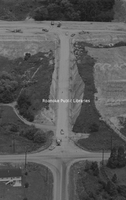
Aerial view of Route 419 under construction at Chaparral Drive; Penn Forest Boulevard at bottom.
BM 143 Route 419
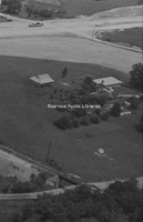
Aerial view looking north at Route 419 construction. The house and barn were located at the current site of the Roanoke County Administrative Offices on Bernard Drive. The earth moving equipment is at the current intersection of Route 419 and…
BM 144 Green Valley
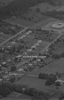
Aerial view showing Green Valley Elementary School, upper right.
BM 145 Route 419
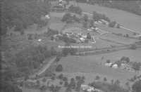
Aerial view to the northeast of current Route 419 at intersection with Ogden Road. Ogden Road is seen at the top of the photo. At top, right is Ogden Elementary School. The area to the right of the railroad tracks is Cox Communications and Old…
BM 147 Arlene Stanley

House owned by Mrs. Saul, who lived at Starkey; torn down in the 1970s; across from Haran Baptist Church. Stanley family moved there in 1943. Arlene Stanley on porch.
BM 148 Clarence Altis and Robert Carroll

House owned by Mrs. Saul, who lived at Starkey; torn down in the 1970s; across from Haran Baptist Church. Stanley family moved there in 1943. Clarence Altis (left) and Robert Carroll.
BM 149 Roma Stanley and Clarence Altis

House owned by Mrs. Saul, who lived at Starkey; torn down in the 1970s; across from Haran Baptist Church. Stanley family moved there in 1943. Photo taken on Easter Sunday shows Roma Stanley (left) and Clarence Altice.
BM 150 Mauvieleen Altis

Mauvieleen Altis in front of house.
BM 151 Mauvieleen, Robert and Arlene

Mauvieleen Altis, Robert Carroll and Arlene Stanley.
BM 152 Clara Altis and Arlene Stanley

Clara Altis and Arlene Stanley.
BM 153 Arlene Stanley and Clara Altis

Arlene Stanley and Clara Altis at Back Creek Elementary School.
BM 154 Back Creek Girls

L to R: Martha Tinsley, Alrene Stanley, ?, Mauvieleen Altis, Hazel Tinsley, Ethel Stump.
BM 157 Altis Home

Charlie and Minnie Altis home, formerly located on road leading into Old Mill Plantation subdivision from Route 221.
BM 158 Charlie and Minnie Altis

Charlie amd Minnie Altis with Forrest and Florence Sloan.
BM 159 Charlie Altis

Charlie Altis in his apple orchard on hill behind Altice home.
BM 160 Ed and Viola Sloan

Ed and Viola Sloan.
BM 161 Altis Family

Bobby, Joyce, Hazel and Robert Altis.
BM 164 Ballard Family

Sarah and Ballard Martin in front of home. Ballard was a carpenter and farmer.
BM 166 Look Out Lodge

Look Out Lodge postcard, Bent Mountain.
BM 167 Hubert Harris

Hubert Earl “Hub” Harris.
BM 169 Ballard and Sarah Martin

Ballard P. and Sarah Martin
BM 170 Hubert and Ola Harris

Hubert Earl Harris & Ola Agee Harris lived where Starkey ball fields are today.
BM 174 Fralin Baptism

James C. Fralin being baptized in Back Creek at Poages Mill in 1925 by Chris Eller, Brethren minister.
BM 175 Lucy, Molly and Jeff

Lucy Dyer Poage, Molly Gregson, Jeff Gregson, making apple butter at home in the Poages Mill area.
BM 176 Haran Baptist

Haran Baptist Church
BM 179 Back Creek School

Students and teachers in front of Back Creek School.
BM 180 Kittinger Chapel

Kittinger Chapel was located on Landmark Circle in Roanoke County. It was razed in the early 2000s.
BM 183 Mary Poage

Mary Catherine Sloan Poage
BM 184 Emily Bohon and Bessie Brown

Emily Bohon and Bessie Brown
BM 185 Ruby Holt

Ruby Holt in front of Holt’s Store on Bent Mountain.
BM 186 Tinsley Home

Home of Dr. E.O. Tinsley on Bent Mountain. The home was called “Sunny Side”. Tinsley’s office was located on right, front corner of porch. The home was on Tinsley Lane. It was razed in the 2000s.
BM 187 Fletcher Holt

Col. Fletcher Holt with a snake around his neck. Holt was a taxidermist on Bent Mountain
BM 188 Clyde Bohon

Clyde Bohon, who bought Holt’s Store on Bent Mountain.
BM189 Fletcher Holt

Col. Fletcher Holt in his store on Bent Mountain.
BM 191 Mount Olivet Baptist

Mount Olivet Baptist Church on Route 221, Bent Mountain.
BM 192 BMHS May Court

May Court at Bent Mountain High School. May Queen (far right) is Carrie Marie Bell; Maid to the Queen (second from right) is Mamie Logan; crown bearer is John Poff, flower girl is Jean Ferguson; Maids are Laura Metz, Bertha Janney, Betty Sisson,…
BM 193 Bent Mountain Marble Players

Marble players at Bent Mountain School. L to R: Hilton King, Herbert Craighead, Namon Conner, Arnold Mills, Melvin Manning (school champion), Harold Thompson, Fletcher Wimmer.
BM 194 Reed's Store

Reed’s Store at the intersection of Route 221 and Martins Creek Road.
BM 195 Reed's Store

Reed’s Store after the 1948 addition of Dairy Diner, located at the intersection of Route 221 and Martins Creek Road.
BM 196 Reed's Store

Interior of Reed's Store, located at the intersection of Route 221 and Martins Creek Road.
BM 198 Reed's Store

Reed’s Store at the intersection of Route 221 and Martins Creek Road.
BM 199 Reed's Store

Reed’s Store at the intersection of Route 221 and Martins Creek Road.
BM 202 Conner Baptism

Baptism of Mary Ann Conner, wife of G.W. Conner, by Elder Leonard Brammer of the Laurel Ridge Primitive Baptist Church, at Fralin home.
BM 203 Laurel Ridge Primitive Baptist

Laurel Ridge Primitive Baptist Church, located on Roselawn Road.
BM 204 Bellview Primitive Baptist

Bellview Primitive Baptist Church, located on Roselawn Road.
BM 205 Lavinder Home

Hezekiah Lavinder (seated) and his family at their home (located at entrance to Bridlewood, home still standing) off of Route 221.
BM 206 Pigg River Primitive Baptist

Elders of Pigg River Primitive Baptist Association at Basham Church in Stewartsville, Virginia.
BM 221 Haran School

Present-day residence that was the former Haran School, located at 7910 Bent Mountain Road.
BM 222 Ralph Henry

Ralph Henry of the Back Creek Baseball Team. Uniform says Finnell’s, as Finnell & Sons sponsored the team.
BM 223 Back Creek Baseball

Spectators at Back Creek Elementary School for Back Creek baseball game.
BM 225 Heading the Barrels

“Heading the Barrels” at Doc Ferguson’s orchard. L to R: George Yates, Ben Owens, Mr. Minnix, A. Bohon, Doc Ferguson, Will Hokles, Wiley Lavinder.
BM 228 Ration Stamps

Gas ration stamps from 1945.
BM 230 Mount Union COB

Mount Union Church of the Brethren on Bent Mountain. The original 1896 church building is seen. Rev. Oscar Fike (right) and his parents are on the front steps.
BM 233 Brethren Baptism

Brethren baptism in a creek in Floyd County.
BM 234 Cave Spring Baptist

Cave Spring Baptist Church.
BM 235 Cave Spring Baptist

Cave Spring Baptist Church
BM 237 Cave Spring Baptist

Cave Spring Baptist Church
BM 238 Reed's Store

Reed's Store at the intersection of Route 221 and Martins Creek Road.
BM 239 Reed's Store

Reed's Store at the intersection of Route 221 and Martins Creek Road.
BM 242 Lula Reed

Lula Cole Reed, mother of Marvin “Fats” Reed, at Reed’s Store.
BM 243 Reed's Store

Two unidentified persons at Reed's Store.
BM 245 Haran School

House across road from Reed's Store on Route 221. The house was formerly the Haran School.
BM 247 Starkey Speedway

Starkey Speedway
BM 248 Fruit Growers Telephone Exchange

Fruit Growers Telephone Exchange (was also Luther Bell’s store) located on Landmark Circle in Roanoke County.
BM 252 Starkey Speedway
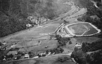
Aerial view of Starkey Speedway.
BM 253 Starkey Speedway

Stock car racing at Starkey Speedway.
BM 254 Starkey Speedway

Stock car racing at Starkey Speedway.
BM 001 Back Creek School

Students at old Back Creek School on Landmark Circle in Southwest Roanoke County.
BM 002 Back Creek School

Back Creek School, back row L to R: Bernice Harmon, Charlie Blankenship, Lonzie Janney, Dempsey Grisso, Dean Dores; Second row, L to R: Buster Webster, Edison Likens, Isaac Sutphin, Grover Sink, Harry Cannaday, Grant Christley; Front row, L to R:…
BM 003 Back Creek School

School group at old Back Creek School on Landmark Circle in Southwest Roanoke County.
BM 004 Back Creek School

School group at old Back Creek School on Landmark Circle in Southwest Roanoke County.
BM 005 Back Creek School

School group at old Back Creek School on Landmark Circle in Southwest Roanoke County.
BM 006 Back Creek School

School group at old Back Creek School on Landmark Circle in Southwest Roanoke County.
BM 007 Back Creek School

Sophomore Class at Back Creek School: L to R: Billy Agee, Jane Coon, Edmund Chamberlain, Douglas Grisso, Louis Grisso, Hazel Henderson, John Jones, Mildred Jones, Lotherine Lavinder, Sara Lee Poage, Evelyn Webster
BM 008 Back Creek School

Back Creek High School, Junior Class, Front row, L to R: Nancy Poage, Pete Christley, Herbert Henderson, Jr., Norman Lavinder, Mary Bowling; Back row, L to R: Bertha Christley, Carl Wade, Bertha Bohon, Martha Jane Henry
BM 009 Back Creek School

May Day at Back Creek School, L to R: Catherine Bowling, Frances Grubb, Frances Gill, Lotherine Lavinder (Queen), Josephine Grisso, Evelyn Webster; in the front is crown-bearer Nadine Henderson
BM 010 Poages Mill

Mill wheel at Poage's Mill
BM 011 Haran School

School – probably the old log school house first used for Haran School before larger facility was built.
BM 012 Back Creek School

Back Creek High School 4-H Club, L to R: Mildred Bohon, Jane Coon, Josephine Grisso, Geraldine Grubb, Hazel Henderson, Mildred Jones, Sue Lane, Nancy Poage, Sara Lee Poage, Emily Rierson, Cornelia Simpson, Evelyn Webster, Irma Wright
BM 013 Haran School

Haran School, front row, L to R: Blanche Ferguson, Robert Ferguson, Billy Bohon, Geneva Poage, Francis Martin, Mae Agee, Mamie Agee, Mina Day, Gladys Bohon, Claude Puckett, Omer Puckett, Floyd Bohon;
Second row, L to R: Lela Jenny, Nellie Ferguson,…
Second row, L to R: Lela Jenny, Nellie Ferguson,…
BM 015 Roland Ferguson School

Roland Ferguson School, located on Twelve O’Clock Knob Road. The teacher was Mildred (Edd) Bell, sister-in-law of Tom and Luther Bell; #1 is Ocie Ferguson, #2 is Icie Ferguson, #3 is Jim Ferguson
BM 016 Haran Baptist

Haran Baptist Church
BM 017 Back Creek School

Students at Back Creek School.
BM 018 Haran Baptist

Haran Baptist Church
BM 021 Kittinger Chapel

Ink sketch of Kittinger Chapel, artist unknown.
BM 255 Sally Lewis

Sally Lewis, resident of Poages Mill area.
BM 256 Ben Lewis

Ben Lewis, resident of Haran area.
BM 259 Woodrum Orchard

Scene at Woodrum Orchard.
BM 262 Elmore Martin

Charcoal drawing of Elmore Martin. Martin served with the 28th Virginia Infantry, CSA. He died in the war.
BM 263 Grisso Family

Grisso Family, L to R: Ellis Grisso, Mary Grisso, Susie (Harris) Grisso, Price Grisso (small child), John H. Grisso.
BM 264 Back Creek

Erecting telephone poles and wire in Back Creek area.
BM 265 J.H. Grisso

Unidentified man examining remnants of splintered oak tree struck by lightning on J.H. Grisso farm, the strike of which killed J.H. Grisso
BM 266 John and Susie Grisso

John Henry and Susie (Harris) Grisso.
BM 267 Back Creek Orchard

Aerial view of Back Creek Orchard Company at foot of Bent Mountain; owned by Woodrum family, R.S. Stearnes, Dr. E.W. Senter, Jack Kefauver and Clinton Craighead
BM 268 Bent Mountain Elementary

Bent Mountain Elementary School
BM 269 Back Creek Elementary

Back Creek Elementary School
BM 270 Dr. Edward Tinsley

Dr. Edward Tinsley ready to start rounds on horseback. His house is in background. Tinsley practiced from 1890 to 1940 in the Bent Mountain area.
BM 271 Cave Spring

Spring at Cave Spring.
BM 272 Reed Family

Enjoying a spin in a Metz car. L to R: Neva, Vera, Elba, Raymond, and Alton Reed.
BM 274 Luther Bell

Luther Bell, board of supervisors member representing Cave Spring.
BM 276 Cave Spring Fire Department

Cave Spring Volunteer Fire Department.
BM 277 Book Mobile

Roanoke County Book Mobile in front of the Roanoke Count Public Library.
BM 278 Grant Plaza

Grant Plaza at Cave Spring, located at 3901 Brambleton Avenue.
BM 279 Ola and Hubert Harris

Ola Agee Harris and Hubert E. Harris lived in the Starkey area.
BM 280 Sarah and Ballard Martin

Sarah and Ballard Martin in front of home. Home is presently located on Shingle Ridge Road, off of Cotton Hill Road. Grandson Damon Martin is in buggy.
BM 281 Lockett Family

L to R: Alonzo Lockett, Callie Harris Lockett, Pattie Martin at home formerly located across from the old Starkey School.
BM 282 Hubert Harris

Hubert Harris on Salem Avenue in Downtown Roanoke.
BM 283 Lockett-Harris Family

Callie Lockett (seated), L to R: Carol Harris, Alonzo Lockett, Hubert Harris, David Harris, Dorothy Harris
BM 284 Callie Lockett

Callie Lockett (nee Harris). She did not cut her hair after age 16, as she thought it sinful to do so.
BM 285 Alonzo Lockett

Alonzo Lockett in “Dokkie” fez.
BM 286 Harris Home

Harris homeplace along Route 221. It was razed when highway was widened.
BM 287 Central Baptist

Central Baptist Church, Vacation Bible School. Rev. Arnold Williams is in suit at far left.
BM 288 Fralins Produce

Fralin’s produce stand along Route 221 on Bent Mountain.
BM 289 Reed Home

Home of Elbe and Essie Reed, located behind Reed’s Store.
BM 290 Bent Mountain High

1936 Graduating Class of Bent Mountain High School; Standing, L to R: Raymond Carr, George Powell, Homer Reed; Seated, L to R: Elois King, Margaret Jamison
BM 291 Reeds Orchard

Reed’s Orchard operation at intersection of Poor Mountain Road and Tinsley Lane. The apple packing shed in photo was built in 1933.
BM 292 Reeds Orchard
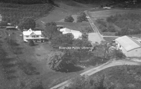
Aerial view of Reed’s Orchard, located at the intersection of Poor Mountain Road and Tinsley Lane. The house was built by the Woodrum Family, bought by Homer Reed in 1948 and closed as a commercial orchard in 1995.
BM 293 Coles Egg Farm

Snow being plowed at Coles Egg Farm after a big snow on Bent Mountain.
BM 294 Reeds Store

Elbe Reed in his store (right) on Route 221. The man at left is unidentified, but possibly a salesman. The store also served as Bent Mountain Post Office.
BM 295 Bent Mountain Faculty

Faculty Group at Bent Mountain School; L to R: Mrs. Lloyd, Mrs. Jones, Mrs. Brook Alderman, ?, Mr. Woods (principal), Ann McGee, Viva Bowles.
BM 296 Bent Mountain School

Student group at Bent Mountain School, mostly unidentified, though it does contain Virginia Walters and Cassie Fralin
BM 297 Bent Mountain School

Group at Bent Mountain School.
BM 298 John Austin

John Philip Austin at his home located across Route 221 from Mt. Union Church of the Brethren. Austin was the first person to have heart by-pass surgery at Roanoke Memorial Hospital.
BM 299 John and Virginia Austin

John and Virginia Walters Austin sitting on front porch of home with grandchildren.
BM 301 Back Creek Elementary

Back Creek Elementary School; L to R: Marie Sloan, ?, ?, Gaynelle Simpson, ?
BM 302 Poages Mill COB

Play at Poages Mill Church of the Brethren; L to R: Eddy Grisso, Curt Mowles, Norvell Hurt, Dick Agee, Daisy Long
BM 303 Lorene Simpson and Polly Rierson

Lorene Simpson and Polly Rierson.
BM 304 Stanley Home

House along Route 221, formerly across from Haran Baptist Church.The Stanley Family moved there in 1943. It was razed in late 1960s.
BM 305 Back Creek School

Back Creek School; L to R: Ethel Stump, Mauvieleen Stanley, Lorene Underwood, Martin Tinsley, Arlene Stanley.
BM 306 Mauvieleen Stanley

Mauvieleen Stanley on Route 221 in area of Haran Baptist Church.
BM 307 Stanley Family

Stanley Family in snow in the Haran area.
BM 308 Altis Family

L to R: Clarence Altis, Mauvieleen Stanley, Ida Stanley, Gaye Stanley. The hill behind them is where the King’s Forest subdivision is today along Route 221.
BM 309 Diane Altis

Diane Altis on pick-up in Back Creak area.
BM 310 Look Out Lodge

Look Out Lodge postcard, Bent Mountain.
BM 311 Reno Restaurant

Reno Restaurant card, formerly located in Starkey area on Crystal Creek Road.
BM 312 Ferguson Family

Roland Ferguson and family in front of their house. The house is located at 5109 Twelve O’Clock Knob Road.
BM 313 40 Acres

“40 Acres” home postcard, Bent Mountain.
BM 314 Back Creek Faculty

Back Creek School faculty photo; L to R: Ella Clark Henry, Rufus Henry, Mary Turner.
BM 315 Hartman Home

Preston Hartman home, Cave Spring.
BM 316 Preston Hartman

Preston Hartman
BM 317 Henry McGuire

Henry P. McGuire of Cave Spring in J.L. Dishong fruit and vegetable wagon.
BM 318 Cave Spring Baptist

Postcard of Cave Spring Baptist Church, showing parsonage and sanctuary.
BM 319 Ott and Lucy Poage

Ott and Lucy Poage at a dance at Back Creek Elementary School.
BM 320 Poffs Garage

Poff’s Garage, Route 221, Bent Mountain.
BM 321 Ruby and Allen Stone

Ruby and Allen Stone, Bent Mountain.
BM 322 Allen Stone

Allen Stone, Bent Mountain.
BM 324 Bent Mountain School

“Old” Bent Mountain School.
BM 325 Christo Evangelical

A vacant Christo Evangelical Wesleyan Church in the Bottom Creek area.
BM 326 Bottom Creek COB

A vacant Bottom Creek Church of the Brethren.
BM 327 Elbe Reed Store

Former Elbe Reed store and Bent Mountain Post Office on Route 221 in process of being razed.
BM 328 Fralins Produce

Fralin's Produce along Route 221 on Bent Mountain.
BM 333 Ruby and Allen Stone

Ruby and Allen Stone at Union 76 Service Station along Route 221 on Bent Mountain.
BM 334 Union 76

Stone’s Union 76 Service Station along Route 221 on Bent Mountain.
BM 335 Fletcher Wimmer

Fletcher Wimmer working on family farm. The Wimmers had large cabbage fields. Their farm bordered the Blue Ridge Parkway near the spur road to Bent Mountain.
BM 336 Will Wimmer

Will Wimmer, a farmer at Bent Mountain.
BM 337 Bent Mountain Hunting Club

Bent Mountain Hunting Club. The old club building was located on Callaway Road, off of Route 221 just past Blue Ridge Parkway overpass. Standing, L to R: Will Wimmer, C.F. Holt, Walter Overfelt, Dewey Holt, Doug Lancaster, ?, Woodrow Reed, Jake…
BM 338 Bent Mountain Hunting Club

Unidentified musicians entertain inside clubhouse of Bent Mountain Hunting Club.
BM 339 Bent Mountain Hunting Club

Bent Mountain Hunting Club cabin on Calloway Road, later burned and was replaced with a cinderblock building. Will Wimmer on far right.
BM 340 Bent Mountain Hunting Club

Bent Mountain Hunting Club members ready for a hunt, location unknown.
BM 341 Apple Shed

Marshal Conner’s Bent Mountain Apple Shed produce stand along Route 221 on Bent Mountain.
BM 342 King Brothers Mill

King Brothers’ saw mill, formerly located in the Bottom Creek area. The mill was powered by steam engine. Logs were hauled to the site by oxen and horses.
BM 343 Starkey Station

Starkey Combination Station.
BM 345 Grisso-Gates School

Grisso-Gates School building, located on property of 5321 S. Roselawn Road in Cave Spring.
BM 346 Tinsley Lane

Haystacks along Tinsley Lane.
BM 348 Laurel Ranch

Vacation cabin at Laurel Ranch.
BM 349 Starkey School

Starkey School
BM 350 Dr. Joseph Gale

Dr. Joseph A. Gale, a physician at Cave Spring in 1880s.
BM 351 Gale Office

Dr. Joseph Gale’s office in Cave Spring.
BM 352 Gale Home

Dr. Joseph Gale’s home in Cave Spring, later owned by Dr. White.
BM 353 Conner Store

Former store of Clem and Mae Conner along Route 221.
BM 355 Omer and Francis Simpson

Omer Simpson (right) with son, Francis, cutting hay. Simpson's farm was located on Martins Creek Road.
BM 356 Simpson Family

L to R: Nelson Simpson, Omer C. Simpson, Omer C. Simpson Jr., Francis Simpson and unidentified man stacking hay in field. Simpson farm was located on Martins Creek Road.
BM 357 Bent Mountain Hunting Club

Bent Mountain Hunting Club. Back row, L to R: Ruben Holt, Dewey Holt, Will Wimmer; Front row, L to R: Ralph Metz, Howard Nichols, Raymond Wimmer
BM 359 Mormon Group

Mormon Church Group at Back Creek.
BM 360 Conner Family

L to R: Marvin, Jesse, and Betty Conner picking apples in Thompson orchard on Bent Mountain.
BM 361 Finnell & Sons

B.G. Finnell & Sons store on Route 221, near foot of Bent Mountain.
BM 362 Finnells Pool

Finnell’s Pool on Route 221, near foot of Bent Mountain.
BM 363 B.G. Finnell

B.G. Finnell, Sr. in front of his store.
BM 365 Belleview Primitive Baptist

Belleview Primitive Baptist Church on Roselawn Road.
BM 366 Riersons Store

Rierson's Store. This was the original store that stood where Back Creek Elementary School stands today on Route 221.
BM 367 Riersons Store

Temporary Rierson's Store that was used after old store was razed and before new store was built.
BM 371 Riersons Store

Rierson’s Store on Route 221.
BM 372 Rierson Family

Maynard Rierson and family.
BM 373 Mr. and Mrs. Rierson

Mr. and Mrs. Maynard Rierson 50th Wedding Anniversary photo.
BM 374 Bent Mountain

Aerial view of Roanoke Look Out Lodge Gift Shop along Route 221 at the top of Bent Mountain.
BM 375 Look Out Gift Shop

Roanoke Look Out Gift Shop on Route 221 at the top of Bent Mountain.
BM 376 George Burris

George M. Burris (right) on a hay wagon, Bent Mountain.
BM 378 Cave Spring High

Cave Spring High School
BM 379 Cave Spring High
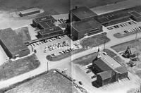
Aerial view of Cave Spring High School and Cave Spring Baptist Church.
BM 380 Marvin Thompson and Guy Conner

Marvin Thompson (sitting on barrel) and Guy Conner in Woodrum Orchard.
BM 381 Poages Mill Baseball

Poages Mill baseball team, #1, R.C. Wertz, #2 O.L. Grisso, #3 John Wertz, #4 Bill Grisso, #5 Ott Wertz, #6 Walt Henry, #7 E.B. Martin, #8 John Bowles, #9 R.C. Henry
BM 138 Bessie and Essie Beckner

Bessie Beckner (left) and Essie Mae Beckner.
BM 190 Holt's Store

Col. Holt’s store and house on Bent Mountain. Dr. Hurt’s car is parked in front.
SR001 Virginia Bridge & Iron

The Virginia Bridge and Iron Works began in 1888 as the American Bridge Works, changing its name in 1893. Other branch plants were located in Memphis, Tennessee, and Atlanta, Georgia. The Roanoke Branch was involved in hundreds of bridge projects…
SR002 Jefferson Apartments

The Jefferson Apartments were built in 1912 on South Jefferson Street. The apartments existed for several decades before being razed in the late 1990s. The site of the apartment building was occupied by a house that was moved across Mountain Avenue…
SR003 Roanoke Times

The Roanoke Times was the first daily paper in Roanoke, having been started by M.A. Claytor in 1886. In 1909, the Times was purchased by J. B. Fishburn, Edward L. Stone, and W.S. Battle and became the Roanoke Times, Incorporated. The Times…
SR004 Calvary Baptist

The Calvary Baptist Church on Campbell Avenue had as its early sanctuary this beautiful building which was located directly across the street from the present-day facility. Needing more space for the growing congregation and with the completion of…
SR005 Martha Washington Candies

This interior view of the Martha Washington Candies store shows what the company considered its “Southern Factory.” Martha Washington Candies Roanoke franchise was started by W.G. Baldwin at 310 S. Jefferson Street in 1914. Mr. Baldwin was of the…
SR006 Shenandoah Hospital

Construction of Shenandoah Hospital commenced in 1912, opening the next year. The hospital was located on West Campbell Avenue between 7th and 8th Streets. Dr. J.H. Dunkley was president and assisted by Dr. Ira Huff, Dr. W.S. Slicer, Dr. J.T.…
SR010 YMCA

The top image is of the Central YMCA and the bottom image is of the Railroad Department YMCA. The Railroad YMCA opened on November 10, 1903. The Young Men’s Christian Association began in Roanoke in 1883.
SR011 View from Incline

The postcard image shows what the vista would have looked like over a century ago atop the famous Mill Mountain Incline. In the bottom foreground is the back side of the old Roanoke Hospital, and in the top distant background one can see the former…
SR012 Jefferson Street

This card shows how Jefferson Street had changed over the years. This view looks north down Jefferson Street from Mountain Avenue, showing a variety of commercial buildings, apartments and hotels.
SR013 Masonic Temple

The Masonic Temple was located on the northwest corner of 1st and Kirk Street. In 1915, the street level was occupied by Reams, Jones and Blankenship furniture store. The store’s slogan was “Marry the girl – we’ll furnish the home.”
SR014 J.H. Marsteller

J.H. Marsteller created ornate marble monuments and headstones. This card was produced for Marsteller in 1907, showing on the left the exhibit of Marsteller at the 1907 Jamestown Exhibition’s Timber and Mineral Building. The image on the right shows…
SR015 Belmont Baptist

Belmont Baptist Church was organized on October 17, 1901. They dedicated their second sanctuary in Southeast Roanoke in 1904. Belmont Baptist continues to worship in the sanctuary depicted on this card.
SR016 First Christian

A member used this card to celebrate her new church sanctuary: “Our new church cost $15,000, pipe organ $2,650, pews $1,100. Expect to dedicate third Sunday in April.” Unfortunately, the church was badly damaged by a fire in 1917, but recovered.
SR017 Belmont Christian

The Belmont section of Roanoke, long-served by the Christian Church there, began as a 40-home development around 1889. The Belmont School opened in 1893 and soon followed street car service (1905), the city’s first automobile fire steamer (1911),…
SR018 Roanoke Sanatorium

This card’s description reads, “One of the bedrooms of the Roanoke Sanitarium, Inc. – Institution for the treatment of Nervous and Mental Diseases, Drug and Alcohol Addictions.”
SR019 St. Charles Hospital

The St. Charles Hospital was located at 533 Mountain Avenue. It opened in March of 1913 under the direction of Dr. J.C. Burke. The hospital closed in 1934, and the building was converted into apartments.
SR011 Fort Lewis Tourist Court

The sender of this postcard wrote, “Will spend New Years Eve here, rained all day, having a good time. This motel is very comfortable. See you in San Francisco.” The Fort Lewis Tourist Courts was ½ mile west of Salem on Route 11.
SR012 Goodwin's Motel

The Goodwin Motel’s postcard boasted “approved drinking water.” The motel was located west of Salem on Route 11, which served for many years as the modern-day equivalent of the interstate.
SR013 Poole's Motor Court

This motor court was managed by H.R. Poole, who mailed this particular card to Joseph Lang of West Hempstead, NY, with the simple message, “You’re welcome in Virginia.” The establishment lured visitors by claiming “no truck or railroad noise.” Its…
SR014 Windsor Court Motel

Windsor Court Motel was at 1908 W. Main Street, Salem. Effie Snead was the owner and, at the time the card was published, Charles Snead was the manager.
SR015 Falls Near Hollins

Elva wrote to Albert Reinhold on the back of this card the following: “Received your postal from Washington, thank you so very much. Tell your dear mother that I will write to her tomorrow. This is a perfectly grand day to take a walk. Wish you…
SR016 Hollins College

The history of Hollins University actually begins in New York with Joshua Bradley, a Baptist minister. Bradley purchased the property of the defunct Roanoke Female Seminary in 1842 for the purpose of forming an education union to “conduct an…
SR020 Hollins College

The “new” bridge shown here was built in 1908, replacing an older one. The bridge was part of an extensive landscape plan developed for the campus at the time that consisted of gardens, boardwalks, bridges and recreational areas.
SR021 Hollins College

Early in Hollins’ history, social life for the students was very structured and limited. For example, in 1925 students could receive “gentlemen callers” only on weekend nights and Sunday afternoons. Dates off campus required a chaperone and…
SR022 Hollins College

The sulphur spring on the Hollins campus was discovered in the early 1800s in the bed of Carvins Creek. The message on this card boasted, “Its water has wonderful curative powers, and many prominent men, among them President Andrew Jackson and…
SR023 Hollins College

When this postcard was sent, Hollins students were on a reinvigorated academic schedule that covered six days. Students could no longer attend for two years and get an “Academic Certificate.” They now must complete all four years. These academic…
SR025 Hollins College

The Main Building is one of the oldest structures on the campus. The building was erected in between 1861 and 1863. The day the building was started was the same day Virginia seceded from the Union. With the onslaught of the Civil War,…
SR027 Hollins College

The 1920s saw the emergence of student leadership in the affairs of the college. In 1920 a student forum was organized for the purpose of providing input on a variety of issues. One reoccurring issue was dress. Could students wear short skirts,…
SR028 Hollins College

The West Building was totally rebuilt in 1890. The left wing contained the infirmary, doctor’s office and faculty living quarters, and the right wing contained two large halls for Hollins’ two early literary societies. The portico, completed in…
SR031 Hollins College

The Little Theater was created largely through the spirited giving of Hollins students who, in the 1920s, raised $45,000 toward the total cost of $65,000 for the structure. The theater was built in 1924, replacing an old auditorium that was in the…
SR032 Hollins College

Construction on East Building began in 1856 and was completed two years later. The East Building, complimenting Main and West, completed the quadrangle courtyard. According to early Hollins historians, East was designed to imitate in appearance the…
SR033 Hollins College

Presser Hall was erected in 1925, a gift of Theodore Presser, music publisher. Presser was a music professor at Hollins from 1880 until 1883. Unfortunately, Presser died before the building was completed. At the time of its dedication, the…
SR034 Hollins College

The Bradley Chapel was built in 1883 but not named until the 1930s for Joshua Bradley. The chapel served as the center for campus religious activities. During the early years, Hollins students were expected to attend chapel services daily after…
SR035 Hollins College

The infirmary, constructed in 1910, was named for Susanna Cocke. Utilizing Georgian and Federal architecture, the infirmary was actually the first building included in part of new quadrangle on the southeast section of the campus.
SR036 Catawba Sanatorium

The Virginia Building of Catawba Sanatorium was constructed in 1913, four years after the Catawba Sanatorium opened. The original property for the sanatorium had been the Red Sulphur Springs.
SR037 Catawba Sanatorium

When Catawba Sanatorium opened in 1909, it consisted of 42 beds located primarily in the old hotel that served the sulphur springs resort area. The sanatorium would expand in both buildings and number of patients significantly over the next few…
SR038 Catawba Sanatorium

By 1937, Catawba Sanatorium was serving some 340 patients and the grounds totaled over 1100 acres, almost double the acreage contained in the original purchase. The many pavilions, such as the one above, were named for Virginia governors.
SR039 Catawba Sanatorium

Catawba Sanatorium became in many ways a self-sustaining community. For many years, the sanatorium operated its own dairy farm. The number of patients and employees were such that the area soon had its own post office, school, chapel, and other…
SR041 Catawba Sanatorium

Catawba Sanatorium developed its own nursing school to train healthcare professionals in the treatment of tuberculosis. Between 1912 and 1954, Catawba School of Nursing graduated 258 Certified Tuberculosis Nurses.
SR042 Catawba Sanatorium

This view of the women’s quarters shows the west end of the lean-to with lounging room in the center. Catawba ceased accepting tuberculosis patients on January 1, 1972. When it did, records indicated that some 25,000 tuberculosis patients had…
SR043 Enon Baptist

Enon Baptist Church is one of the oldest Baptist churches in the Roanoke Valley. Built in 1855 across from the entrance of present-day Hollins University, the church was established by Charles Cocke, president of Hollins Institute.
SR044 Twelve O'Clock Knob

One of the most prominent geographical features in the Roanoke Valley is Twelve O’Clock Knob with an altitude of 2,707 feet. According to local tradition, the mountain received its name prior to the Civil War when slaves, working west of Salem,…
SR045 Twelve O'Clock Knob

Exactly what road this might be cannot be determined. Historic records, however, show that interest in building a road from Salem across Twelve O’Clock Knob to Back Creek and then up Bent Mountain dated back to 1840.
SR046 High Cliffs

The official arrival of the Norfolk and Western Railroad (later Railway) into the Roanoke Valley occurred on June 18, 1882, when an N&W locomotive steamed into the newly-named Town of Roanoke. With the coming of the railroad, the population and…
SR047 Ward Haven Camp

This camp was originally constructed in 1933 by the Civilian Conservation Corps. In 1941, it became an Army mechanical training camp. From 1943 until 1946, the camp housed 150 German POWs who worked in nearby orchards. Today, the camp is owned and…
SR050 Vinton Roller Mill

Vinton Roller Mills, along Glade Creek, grew out of mills originally built by David Gish that pre-dated the Civil War. By the Twentieth Century, the remaining mill was owned and operated by James Bowie and produced three kinds of flour. By 1924,…
SR051 Vinton Baptist

Vinton Baptist Church began in 1892. The building shown in this postcard rendering is one constructed in 1924, replacing the original sanctuary of 1894.
SR053 Vinton War Memorial

The Vinton War Memorial is a tribute to the 29 men of Vinton who gave their lives in military service during World War II and Vietnam. The building, seen here, was dedicated in 1948 as a community center and remains such today.
SR054 JC Cook Home

This fine residence belonged to prominent businessman, J.C. Cook originally of Bonsack. Cook later moved to the Vinton area and owned the land on which the Vinton War Memorial was built.
SR055 Methodist Church

This Methodist Church was an early sanctuary of the present-day Thrasher Memorial United Methodist Church. The present sanctuary was built in 1963. The church was named for Paul and Sallie Thrasher, pioneer Methodists in the Roanoke Valley. The…
SR056 Hanging Rock

The name “Hanging Rock” was given due to the rock formation’s appearance as projecting from the mountainside. In the area of Hanging Rock occurred one of only two Civil War engagements within the bounds of Roanoke County.
SR057 Traveltown

Traveltown, located on Route 11 in Cloverdale, advertised “Every cottage heated with Private Bath.” In the mid-1920s, Route 11 became a link in the Washington-to-San Diego Lee Highway, making it a part of the transcontinental highway system.
SR058 Traveltown

The vast majority of tourist homes, motor courts, motels and other tourist-related businesses dried up after the emergence of President Eisenhower’s interstate highway system. Small towns were bypassed, and routes, such as Route 11, were no longer…
SR059 Camp Powhatan

Camp Powhatan was located in the Natural Bridge National Forest Reserve. Scouting, having reached the States in 1910, has a long history in Roanoke County. The Blue Ridge Mountains Council, No. 599, is headquartered in Roanoke County, having merged…
SR061 Lakeside

Lakeside was opened in 1920 by Robert Lynn, Sr., and featured a public swimming pool, roller coaster and one additional ride. The original 50-acre tract on which Lakeside was built was an orchard owned by John Bower.
SR062 Lakeside

In 1936, Lakeside was purchased by H.L. Roberts, and his family owned and operated Lakeside for the next fifty years. When the amusement park opened it was described as “the largest pool anyone had ever seen,” complimented by a beach of imported…
SR064 Lakeside

Lakeside survived the Depression by offering low admission prices and cheap entertainment. During World War II, the USO provided servicemen complimentary tickets. There was even a movement in 1958 by nearby residents to constitute themselves as the…
SR065 Lakeside

Like most public venues in the South, Lakeside was not integrated until 1964. At about this same time, park owners closed the pool, filled it over, and the park expanded.
SR066 Lakeside

This card shows how much the park had developed under the ownership of the Roberts family. This card advertises, “South’s Finest Swimming Pool, Joy Rides for Children and Adults, Beautiful Picnic Grounds.”
SR067 Lakeside

Lakeside was for many decades the most popular draw for Valley residents and tourists in the region. Offering rides, amusements, recreation, and concerts, Lakeside was complimented by Dixie Caverns, the Blue Ridge Parkway, and being at the…
SR068 Lakeside

Aunt Katherine wrote her nephew in Salisbury, Maryland, using this card, the following: “How would you like to go in bathing here? Uncle Frank and the boys are in now. It is fresh water. They have slides and swings and acting bars and every kind…
SR069 Lakeside

Lakeside survived for over six decades, but the competition brought on by other more major theme parks took its toll. By 1983, the park was in financial trouble. Bought by Charles Fox in 1984, the park was struck by the Flood of 1985. The flood…
SR071 Salem

This century-old view of Salem showed the development of the town since its inception in 1802 by James Simpson when he created 40 lots on 16 acres. The lots fronted one main road which Simpson named “Roanoke Street.” The lots were two sizes,…
SR072 Pennsylvania Avenue

This early street scene illustrates the stately residential developments that marked Salem’s development at the turn of the last century.
SR073 Water Street

Water Street, later South Broad Street, was one of the earliest streets laid out in the 1802 plot of Salem. Water Street became the dominant center for Salem’s African-American community.
SR075 Main Street

Dirt streets and horse carriages marked town living one hundred years ago. In the foreground, one can see the outline of a crosswalk, probably brick, that allowed pedestrians to maneuver across streets avoiding ankle-deep mud that often plagued…
SR079 Main Street

Prominent on the left is a sign for W.B. Dillard Drug Co., Prescription Druggists, Soda and Mineral Waters. Watts Dillard was a prominent Salem business man involved in numerous civic projects. His drugstore, at the corner of Main and College, got…
SR080 East Main

On the back of this postcard was written the following message: “Dear Mama – Does this look like home? Not much, I guess you would like it down here because people are so easy going and don’t believe in working all the time…” Home, by the way, was…
SR081 East Main

After much discussion, Salem’s city fathers agreed to a streetcar route on Main Street (the tracks can be seen in this card) in 1894. The system served Salem and connected riders to the Roanoke line that crossed over Masons Creek. The streetcars…
SR083 High Street

Salem’s first major population and economic boom occurred between 1880 and 1890 with the development of the railroad. The population during that decade nearly doubled. The Roanoke Collegian reported in 1891, “Building continues, High Street is…
SR084 College Avenue

Good streets have always been one of the basic services provided by any municipality to its citizens. In 1909, a Salem newspaper headline read, “Good Streets Coming.” The editor was congratulating Salem leaders for applying crushed limestone to the…
SR085 The Boulevard

For a few years, Salem’s residential streets were segregated. In 1913, Salem created racially segregated residential districts which were permitted by state law. District No. 1 (centered around Water Street) was for blacks, and District No. 2 was…
SR086 Broad Street

Business leaders in Salem and Roanoke sought to promote their respective communities through a variety of promotional pamphlets. Scenes, such as the one above, were often included to demonstrate progress and prosperity. Salem was labeled as the…
SR088 Courthouse

This photo postcard shows the old county courthouse. The structure was built in 1841 on a lot purchased by Roanoke County from John Gray of Missouri for $400. The courthouse was constructed by Salem hotelier William C. Williams. During the Civil…
SR090 Courthouse

Judge William Moffett convened the first session of Circuit Court in the new court room on April 1, 1910, and dedicated the day “for the hearing of matters and reading of papers of local historical interest.”
SR092 Baptist Orphanage

The Baptist Orphanage often brought visiting Baptists from around the state to Salem, who, according to the early Salem newspapers, would bring the children into town for entertainment and recreation.
SR093 Baptist Orphanage

As a measure of Salem’s hospitality, many of the local churches, regardless of denomination, became involved with both the Baptist and Lutheran orphanages. In fact, Roanoke College offered free tuition to qualified students from both orphanages.
SR094 Baptist Orphanage

Before the advent of modern medicine, quarantine was often the best strategy to avoid the spread of disease. Salem, like all communities, had to impose its fair share of them. In 1905, the Baptist Orphanage was quarantined for two weeks due to an…
SR095 Baptist Orphanage

The cornerstone on the Administration Building was laid on July 4, 1901, becoming occupied in 1902. It’s red-brick castle-like structure was an imposing piece of architecture on the campus. The Administration Building was razed in 1965.
SR096 Baptist Orphanage

The hill-top Baptist Orphanage prided itself on being self-sustaining in its early years. A generous donation of an additional 87 acres in 1897 allowed the orphanage to even operate a full-scale farm and dairy herd.
SR097 Baptist Orphanage

By 1905, the Baptist Orphanage, which was just a decade old, was caring for 165 orphans. Some were placed in the institution’s care due to loss of parents, while others came to live because their families were impoverished. All needs of the…
SR098 Baptist Orphanage

The original 16 acres on which the orphanage sat was donated by businessman John M. Evans. The very first cottage to be built, which was completed on July 1, 1892, was named for the philanthropist.
SR099 Baptist Orphanage

This second cottage to be built for the orphanage was named for the institution’s first superintendent, the Reverend George J. Hobday, who served from 1891 until 1906.
SR100 Baptist Orphanage

The residence for the superintendent was constructed within the first decade of the orphanage’s operation. The residence allowed the superintendent to not only live on the campus but to host visitors and families.
SR101 Baptist Orphanage

Life at the orphanage often paralleled the events within Salem. Some of those were not positive. In 1918, a severe outbreak of the Spanish flu closed Salem’s schools, churches, and businesses for over a month. Sixty children at the Baptist…
SR102 Lutheran Orphanage

The Lutheran Orphanage arrived in Salem in May of 1896, occupying a brick home on five acres at the corner of present-day Florida Avenue and Boulevard. The orphanage eventually bought the former Hotel Salem on College Avenue (shown here), which it…
SR104 Lutheran Orphanage

The Lutheran Orphanage sold much of its land holdings in the 1960s to Salem for the purpose of erecting what is now the Salem Civic Center. The buildings were sold in 1985 to Roanoke College.
SR105 Women's Club

The Roanoke County Women’s Club was formed on June 7, 1923, by 28 women. In May of 1929, the club formally dedicated their clubhouse. On year later, the Junior Club added a wing to the main clubhouse and started a library. This effort laid the…
SR107 Monterey

Monterey was the pre-Civil War home of the Chapman family. In later years, the home at the corner of High and Clay served as a hotel, hosting visitors by providing a truly residential flavor.
SR108 Ridgewood Farm

The Ridgewood farm land is today a developed retail corridor, known as the Ridgewood Village Center. The center opened in 1985 with a variety of stores and restaurants. The home, shown here, remains.
SR109 Strouse Home

The impressive home of Salem lawyer Demetrius B. Strouse on Broad Street was built around the turn of the last century. Strouse was involved in numerous civic and religious projects in the Roanoke Valley.
SR110 N&W Passenger Station

The passenger station hosted a prominent visitor on October 19, 1934, when President Franklin Roosevelt came to dedicate the new Veterans’ Hospital. After the ceremony, the President came to Salem where he was escorted by Salem’s mayor and a cadre…
SR111 N&W Passenger Station

The N&W Railway donated and created a park near the passenger station in 1933 at College Avenue and 8th Street. The park was one of several that were developed in Salem during that time period.
SR112 N&W Passenger Station

Passenger service at the Salem depot ended on April 30, 1965. On that day, YWCA kindergartners boarded the Powhatan Arrow for a trip to Christiansburg. That same year, the N&W donated the station to the town of Salem.
SR113 N&W Passenger Station

For many years, Salem had also benefited from passenger service provided by the Virginian Railroad. Virginian passenger service in Salem ended in 1954, five years prior to its merger with the N&W.
SR114 Crawford Hotel

This hotel stood on Main Street and was erected by W.D.F. Duval in 1871. It contained 40 to 50 rooms with bath tubs and running water. For a few years, the hotel was owned by the Chapman family and renamed the Lucerne.
SR115 Longwood

The Victorian mansion, known as “Longwood,” was built by Thomas Henry Cooper around 1904. Unfortunately, this majestic structure was destroyed by fire on November 19, 1968.
SR117 Fort Lewis

The local chapter of the Daughters of the American Revolution erected in 1927 a monument marking the location of Fort Lewis which had been built by General Andrew Lewis.
SR119 Salem

In 1952, residents of South Salem started a petition drive to incorporate a new town, Mount Regis. This was countered by residents desiring annexation into Salem. With some legal maneuverings and posturing, the “Mount Regis” citizens settled down,…
SR120 Mount Regis

Mount Regis was built on Development Hill in South Salem. Mount Regis closed its doors as a sanitorium in 1939. The building was then taken over by the Youth Administration to provide housing for nurses aids in hospitals. After World War II, the…
SR121 Mount Regis

Tuberculosis sanatoriums were numerous in the first half of the last century. By the late 1960s, tuberculosis was controllable and facilities, such as Mount Regis, were converted to other uses usually health related.
SR122 Salem High School

What is now known as the Academy Street School served Salem’s students for many years. The building on the right was constructed in 1890 with an addition (left) coming in 1895. The original portion served the lower grades and the addition became…
SR122 Salem High School

The architectural drawing gracing this card was done by G.R. Ragan. The new high school, built on Broad Street, opened in 1912, relieving the overcrowded Academy Street school. Additions followed in 1920 and 1923, but the school was heavily damaged…
SR124 Graded School A

– The “Graded School A” was erected on Water Street as a six-room frame school in 1890-91 (the same year the Academy Street School opened for white students). By 1895, the school had an enrollment of 258 under the principal John Duckwilder.
SR126 G.W. Carver

– The George Washington Carver School was opened in the fall of 1940. The construction cost was $125,000. This new school was in response to the deterioration of the Water Street school
SR127 Baptist Church

The Salem Baptist Church was organized in 1870 and dedicated their sanctuary at the corner of North Broad Street and College Avenue in 1873. An educational building was added in 1952. The new sanctuary seen today was erected in 1967.
SR128 St. Pauls Episcopal

St. Paul's Episcopal congregation was organized around 1867. The congregation moved a few times before erecting this sanctuary on Main Street in 1911 There have since been numerous acquisitions and additions to the facility.
SR130 Bethel Methodist Episcopal

The Bethel African Methodist Episcopal Church was started in 1870 and at the date of this card’s printing (1912), it stood on the corner of Water Street and Calhoun.
SR131 Central Methodist

Known originally as the First Methodist Episcopal Church when organized in 1908, the congregation later was called Second Methodist (1939) and then Central Methodist (1954). The sanctuary shown here was consecrated on June 26, 1955.
SR132 First Presbyterian

While termed “First” church here, the sanctuary is known as home to the Salem Presbyterian Church located on Main Street. Salem Presbyterian was organized in 1831 and dedicated this sanctuary in 1852. Additions were made in 1914 and 1958.
SR133 College Lutheran

College Lutheran Church – This collage shows the various structures associated with College Lutheran. The congregation first met in the Roanoke College chapel (top left) from 1852 until 1858; then they built their first sanctuary (top right) which…
SR134 Pentecostal Holiness

The congregation of Pentecostal Holiness Church was organized in 1915. Their present sanctuary, shown here, on North Bruffey Street was dedicated in April 1953.
SR135 Methodist Episcopal South

This was the sanctuary of the First United Methodist Church congregation from 1904 until 1953. It was located on the northeast corner of College and Clay Avenues.
SR136 Homestead Hotel

The Homestead Hotel has a long history. Built by David Wade in 1802, it was formerly known as the Old Globe Tavern with five huge fireplaces and 27-inch thick walls. At the time this card was published, it was the only original stage coach tavern…
SR137 Lake Spring

The purchaser of this card sent the following message to his brothers: “Your letter received this morning…Father is working for the Virginian R.R. at present…I expect to take an examination for a R.R. mail clerk sometime this fall.” His brothers…
SR144 Sherwood Burial Park

The Sherwood Burial Park, named for the old “Sherwood” estate that was near the property, was developed on a 35-acre tract in 1928 by C.B. Strickler.
SR145 Glass Plant

In 1911, the Piedmont Glass Company purchased and resurrected the old glass plant. During the early years, the plant employed some 125 workers who produced glass bottles for a variety of uses. The plant was closed for two months each summer due to…
SR146 J.J. Newberry

One of the more contemporary establishments was J.J. Newberry Company. The card boasts, “Completely air-conditioned on two large selling floors, approximately ¾ mile counter space carrying over 30,000 separate items of merchandise. A modern…
SR147 Hotel Fort Lewis

In 1927, Salem businessman Henry A. Oakey purchased the former Hotel Salem and changed its name to Hotel Fort Lewis. The structure was demolished in 1974 .
SR148 Post Office

The construction of a "new" Federal post office on Main Street was a saga of many years. Land purchased by the government in 1917 went undeveloped until 1922 when construction finally commenced. The post office officially opened in June of 1923.
SR149 Pierponts Brick Works

Pierpont's Brick Works was owned and operated by Salem businessman George E. Pierpont. In 1908, Pierpont was named as one of the privileged few in Salem to own an automobile.
SR150 Andrew Lewis Monument

One of the most notable citizens in the region’s early history was General Andrew Lewis. Though Lewis died before the town of Salem was officially plotted by James Simpson, his life was spent in its general vicinity. This monument was erected in…
SR152 Municipal Field

The land on which Municipal Field was located had originally been designed for use as an elementary school site. Further study, however, prompted Salem’s leaders to appreciate its use more for athletics. Thus, in the spring of 1932, Municipal Field…
SR153 Salem Filtration Plant

The filtration plant was an early element in Salem’s water supply infrastructure, but the water supply system itself dated to the 18th century. In 1874, the first concept for a water supply system was advanced to the town council, and in 1875 Salem…
SR154 Salem Civic Center

Dedicated in 1967 and financed through the sale of bond proceeds, the Salem-Roanoke Valley Civic Center opened as a recreational and cultural center for Salem. Noted historian Norwood Middleton termed this as “the single most talked-about project in…
SR155 Farmers National Bank

The Farmers National Bank was organized May 8, 1871, with capital of $75,000. Through the leadership of Salem’s prominent businessmen, the bank weathered successfully economic turbulence that put other banks under during the latter part of the 18th…
SR162 Bittle Library

Bittle Memorial Library was named for Roanoke College’s early president, Dr. David Bittle. Bittle led the college through its move to Salem and during the Civil War. Bittle was one of three Salem leaders who officially surrendered Salem to the…
SR167 Roanoke College

Smith Hall, named for a past president of the college, was erected in 1941. Designed by the firm of Eubank and Caldwell in Roanoke, the structure (originally a residence hall for forty women) was built and equipped for a total cost of $50,174.
SR168 Roanoke College

The gymnasium shown here was built in 1930 for a total cost of $138,354. The gym was but one component of a large master plan to expand the college’s facilities. Unfortunately, only the gymnasium was completed on time as the Depression stopped…
SR170 Roanoke College

The Class of 1933 contributed funds for the landscaping and drive that made the “High Street Gateway.” The entrance and subsequent drive were made necessary at the time by the large number of students possessing automobiles as well as increasing…
SR179 Parkway Motel

The Parkway Motel was located on Route 220, just off the Blue Ridge Parkway, three miles south of Roanoke. The card promoted the motel as having “room telephone, air conditioning, all tile baths, hot water heat, air foam mattresses.” The motel was…
SR180 Memphis Special

“Memphis Special” made its debut through the Roanoke Valley on June 20th, 1909, running between Memphis, Tennessee, and New York City. The Memphis Special remained for years a popular passenger train, being the fastest and most direct route to New…
SR183 Keister Home

Sanatoriums were popular at the turn of the last century in the care and treatment of tuberculosis patients. Often doctors or others in the healthcare profession would establish homes and other institutions with such a purpose. Tuberculosis often…
SR184 Scottie's Tavern

Scottie’s Tavern was three miles north of Roanoke on Route 11 and specialized in country ham, chicken and steak dinners. It even offered curb service. J.S. Scott was the manager.
SR186 Martha Washington Candies

This interior view of the Martha Washington Candies store shows what the company considered its “Southern Factory.” Martha Washington Candies Roanoke franchise was started by W.G. Baldwin at 310 S. Jefferson Street in 1914. Mr. Baldwin was of the…
SR187 Mountain Stroll

This view shows strollers atop Mill Mountain. The top of the mountain had park grounds and trails and was a popular destination with the incline and the watch tower.
SR190 Bell Telephone

The Bell Telephone Company began service in Roanoke on May 19, 1884. In 1895, Bell Telephone introduced long-distance service. That year Roanokers could call Bedford, Lynchburg and Danville.
MP 60.1 Peaks of Otter Lodge

Peaks of Otter Lodge in the latter part of construction.
MP 60.2 Peaks of Otter Lodge

Peaks of Otter Lodge
SHH004 Hara-Kiri Display

Window display at Heironimus for Hara-Kiri robes. Sign reads, "Newest, most popular in Hon. Japanese fashion apparel...authentic ceremonial Hara-robe."
SHH007 Heironimus Float

Heironimus Christmas parade float encouraging children to "Go on the air with Santa" on WSLS.
SHH020 McGregor Displays

Floor displays at Heironimus for McGregor Menswear
SHH024 Heironimus Shoppers

Throngs of Christmas shoppers at Heironimus.
FC001 Willis High School
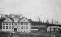
Willis High School in Floyd County, VA. The school closed after the 1961-62 school year.
FC002 Mountain Normal School
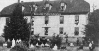
Mountain Normal School dormitory at Willis in Floyd County, VA.
FC003 Old Mountain Normal
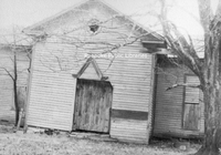
The long abandoned old Mountain Normal School at Willis in Floyd County, VA. The Normal School opened in 1893.
FC004 Willis High School
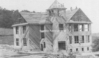
Willis High School under construction.
FC005 WHS Cornerstone
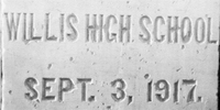
The cornerstone of Willis High School.
FC007 Willis High School
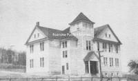
Willis High School shortly after opening.
FC008 Willis High School
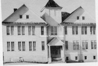
Willis High School after the addition was completed.
FC010 Willis Elementary School
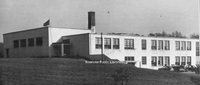
Willis Elementary School.
FC011 Rollie Phillips Store
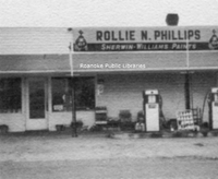
Rollie N. Phillips store and gas station, located in the Indian Valley area of Floyd County. Phillips opened his service station in 1927.
FC012 Floyd Esso
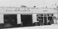
Floyd Esso Service Center in Floyd County.
FC013 Mountain Normal School
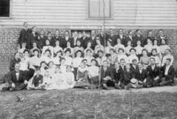
Mountain Normal School students posing in front of the dormitory building.
FC014 Willis High School
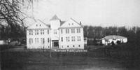
Willis High School. The agricultural building is at right.
PGCC01 Piney Grove Christian Church

Piney Grove Christian Church.The church was located in Roanoke County and was razed in the early 1970s due to the creation/expansion of Route 419. The church was located where the on-ramp is located from 419 to 220 South, near Tanglewood Mall. The…