

Browse Items (8426 total)
Sort by:
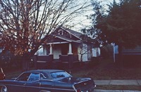
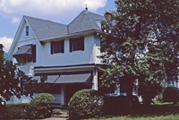
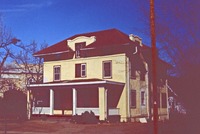
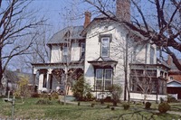
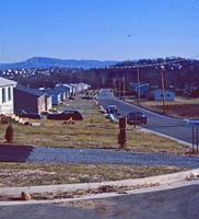
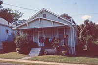
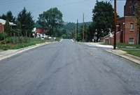
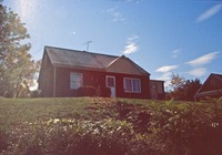
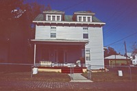
RRHA174
Riverdale
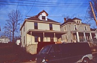
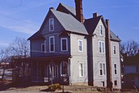
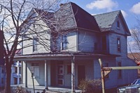
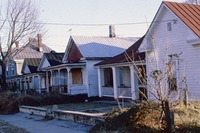
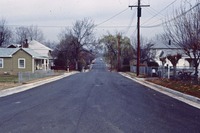
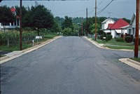
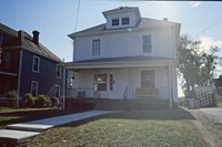
RRHA175
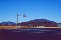
Southwest
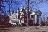
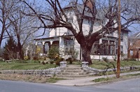
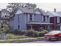
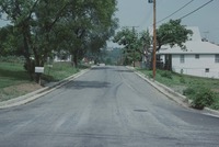
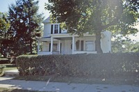
RRHA176
Southwest
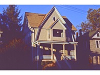
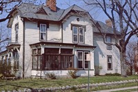
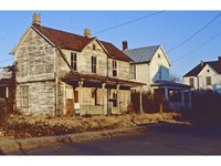
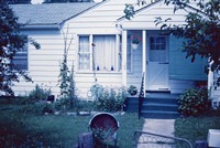
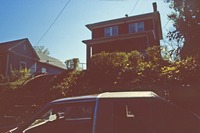
RRHA177

Southwest
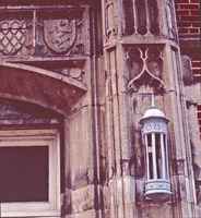
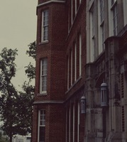
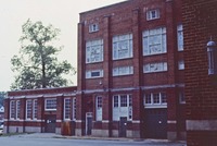
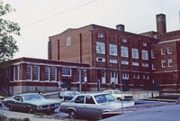
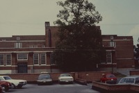
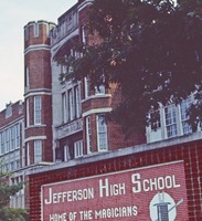
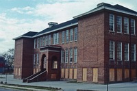
RRHA180
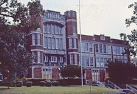
Jefferson High School
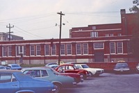
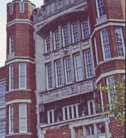
RRHA181
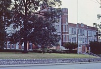
Jefferson High School
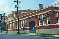
RRHA183
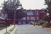
Jefferson High School
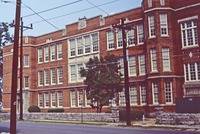
RRHA184
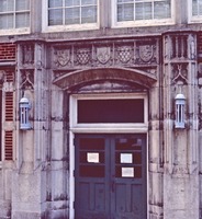
Jefferson High School
RRHA185
Jefferson High School
RRHA186
Jefferson High School
RRHA187
Jefferson High School
RRHA188
Jefferson High School
RRHA189
Jefferson High School
RRHA190
Jefferson High School
RRHA191
Jefferson High School
RRHA192
Jefferson High School
RRHA193
Jefferson High School
RRHA194
Jefferson High School
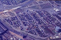
RRHA203
Downtown East
RRHA204
Downtown East
RRHA205
Downtown East
RRHA206
Downtown East
RRHA207
Downtown East
RRHA208
Downtown East
RRHA209
Downtown East
RRHA210
Downtown East
RRHA211
Downtown East
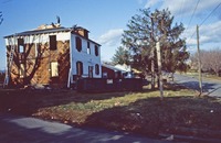
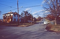
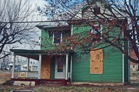
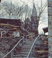
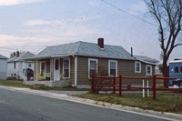
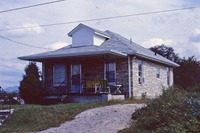
RRHA216
The Stone House, located at 914 13th Street next to Black Dog Salvage.
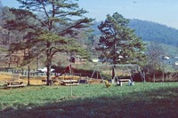
RRHA219
Mountain View
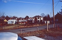
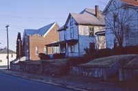
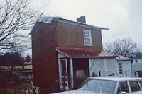
RRHA226
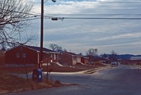
Riverdale
RRHA227

Riverdale
RRHA228

Riverdale


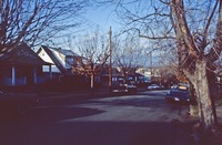
RRHA24
Gilmer


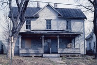
RRHA247

Riverdale
RRHA248

Riverdale


RRHA259

Detail of the entrance to the Stone House, located at 914 13th Street next to Black Dog Salvage.

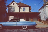
RRHA261

Allison Avenue
RRHA262

Allison Avenue
RRHA263

Allison Avenue
RRHA264

13th Street, Southwest.


RRHA279

Kirk Avenue


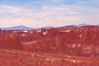
RRHA333

Orange Avenue, Northeast.


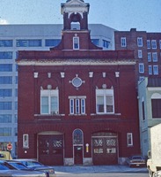
RRHA339

N&W Offices
RRHA341

Victory Stadium fountain
RRHA342

Victory Stadium fountain


RRHA374

Riverdale
RRHA375

Riverdale
RRHA376

Riverdale
RRHA377

Riverdale

RRHA381

Riverdale
RRHA382

Riverdale
RRHA383

Riverdale
RRHA387

Riverdale
RRHA388

Riverdale
RRHA389

Riverdale
RRHA390

Riverdale
RRHA391

Riverdale
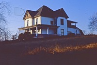
RRHA392

1533 Riverdale Road.
RRHA393

Riverdale
RRHA394

1742 Jerome Street, Riverdale.
RRHA395

1534 Edgerton Avenue, Riverdale.
RRHA396

1536 Edgerton Avenue, Riverdale.
RRHA397

1737 16th Street, Riverdale.
RRHA398

1712 Edgerton Avenue, Riverdale.
RRHA399

1708 Edgerton Avenue, Riverdale.
RRHA4
Harrison School
RRHA400

1704 Edgerton Avenue, Riverdale.
RRHA401

1614 Edgerton Avenue, Riverdale.
RRHA402

1602 Edgerton Avenue, Riverdale.
RRHA405

Riverdale
RRHA406

Riverdale
RRHA407

Riverdale
RRHA408

1546 Edgerton Avenue, Riverdale.
RRHA409

Riverdale
RRHA410

Riverdale
RRHA411

Riverdale
RRHA413

Riverdale
RRHA414

Riverdale
RRHA415

Riverdale
RRHA416

Riverdale
RRHA419

Elmwood Park, Downtown East
RRHA420

Downtown East
RRHA421

Downtown East
RRHA423

Downtown East
RRHA424

Downtown East
RRHA425

Downtown East
RRHA426

Downtown East
RRHA427

Downtown East
RRHA430

Downtown East
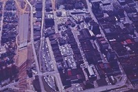
RRHA433

Downtown
RRHA434

Downtown
RRHA435

Downtown
RRHA437

Downtown
RRHA438

Downtown
RRHA439

Downtown East
RRHA442

Downtown East
RRHA443

Downtown East
RRHA444

Downtown East
RRHA445

Downtown East
RRHA446

Downtown East

RRHA451

Downtown East
RRHA458

Downtown East
RRHA459

Downtown East
RRHA460

Downtown East
RRHA461

Downtown East
RRHA462

Downtown East
RRHA463

Downtown East
RRHA464

Downtown East
RRHA465

Downtown East
RRHA467
Downtown
RRHA468
Downtown
RRHA469

Downtown
RRHA470

Downtown
RRHA472
Downtown
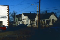
RRHA473

Post Office
RRHA474

Auto Spring & Bearing
RRHA475

Dixie Distributing Company
RRHA476

Magic City Ford
RRHA477
Commonwealth
RRHA478
Commonwealth
RRHA479
Commonwealth
RRHA480

Commonwealth
RRHA481
Commonwealth
RRHA482

Travel Lodge, Commonwealth
RRHA483

Travel Lodge, Commonwealth
RRHA484

Travel Lodge, Commonwealth
RRHA485

Magic City Ford, Commonwealth
RRHA486

Holiday Inn, Commonwealth
RRHA487

Dixie Distributing Company
RRHA488

In the late 1970’s the Greyhound Bus Station was located at 521 Rutherford Ave NE at the corner of Kimball Ave. The building is currently occupied by Avis Construction Company (2018). This depot opened in 1974 when the previous depot at 44 Bullitt…
RRHA491

Civic Center
RRHA492

Post Office


RRHA5
A view of Henry Street. The Palace Hotel can be seen in the background.


RRHA502

Magic City Ford

RRHA504

Post Office
RRHA505

Roanoke Gas
RRHA506

Days Inn, Kimball
RRHA509

Day Avenue, SW
RRHA510

618 Mountain Avenue, SW
RRHA511

1328 3rd Street, SW
RRHA512

122 Mountain Avenue, SW
RRHA513

1401 Maple Avenue, SW
RRHA514

414 Walnut Avenue, SW
RRHA515

400 Block, Mountain Avenue, SW
RRHA516

301 Elm Avenue, SW
RRHA517

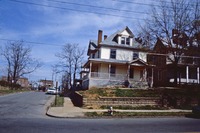
Second Presbyterian church
RRHA519

371 Walnut Avenue, SW
RRHA520

1201 Maple Avenue, SW


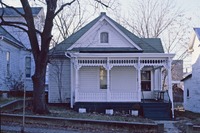
RRHA524

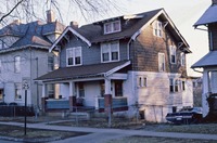
429 Allison Avenue, SW

RRHA526

368 Allison Avenue, SW


RRHA53
Morningside Park

RRHA531

409 Albemarle Avenue, SW

RRHA533

360 Albemarle Avenue, SW
RRHA540

Gainsboro
RRHA541

Gainsboro
RRHA542

Gainsboro
RRHA543

Gainsboro
RRHA544

Gainsboro
RRHA551

Madison Avenue
RRHA552

Gainsboro
RRHA556

333 Madison Avenue, Gainsboro
RRHA557

315 Madison Avenue, Gainsboro
RRHA558

321 Madison Avenue, Gainsboro
RRHA559

353 Madison Avenue, Gainsboro
RRHA560

321 Madison Avenue, Gainsboro
RRHA561

337 Madison Avenue, Gainsboro
RRHA562

301 Madison Avenue, Gainsboro
RRHA563

Madison Avenue, Gainsboro
RRHA565

333 Madison Avenue, Gainsboro
RRHA566

402 Madison Avenue, Gainsboro
RRHA571

Deanwood
RRHA572

Deanwood
RRHA66
Riverdale
RRHA69
Riverdale
RRHA70
Riverdale
RRHA71
Riverdale
RRHA73
Riverdale
RRHA75
Riverdale
RRHA77
Riverdale
RRHA83
Riverdale
RRHA84
Riverdale

RT Map
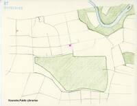
RT's Map of Special Places.
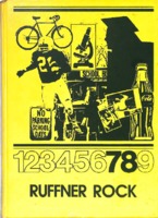
Ruffner Rock 1971
The Ruffner Rock was the annual for William Ruffner Middle School.
Ruffner Rock 1972
The Ruffner Rock was the annual for William Ruffner Middle School.
Ruffner Rock 1973
The Ruffner Rock was the annual for William Ruffner Middle School.
Ruffner Rock 1974
The Ruffner Rock was the annual for William Ruffner Middle School.
Ruffner Rock 1975
The Ruffner Rock was the annual for William Ruffner Middle School.
Ruffner Rock 1976
The Ruffner Rock was the annual for William Ruffner Middle School.
Ruffner Rock 1977

The Ruffner Rock was the annual for William Ruffner Middle School
Ruffner Rock 1978
The Ruffner Rock was the annual for William Ruffner Middle School.
Ruffner Rock 1979

The Ruffner Rock was the annual for William Ruffner Middle School.
Ruffner Rock 1980

The Ruffner Rock was the annual for William Ruffner Middle School.
RVNH20246 WSLS TV

WSLS TV filming a show inside Ewald-Clark store.
RVNH4001 Junior Grocery

A fireworks explosion leveled the Junior Grocery located at 205 Franklin Road SW. Five people were injured in the explosion.
RVNH4002 Junior Grocery

A large crowd gathers to view the damage after a fireworks explosion at the Junior Grocery on Franklin Road.
RVNH4003 JP Sandlot Football Team

The Jackson Park Sandlot Football Team. Coach Sam Elliott on far right in back row.
RVNH4004 Young Men

A group of young men at home located at 926 (later 1100 block) 14th Street SE. Roy Minnix is in the back row, second from right.
RVNH4005 Kiddie Pool

As indicated by the caption, "a Southeast kiddie pool in the back yard with chickens" The child is Roy Minnix.
RVNH4006 Southeast

A section of the Southeast neighborhood. Jamison School visible in the background.
RVNH4007 Dale Avenue

Houses along Dale Avenue SE.
RVNH4008 Wanderers of the Wasteland

Wanderers of the Wasteland musical group. Left to right: Roy Lemmon, Bob Pauley, Glenwood Howell, and Woody "Lucky" Mashburn.
RVNH4009 Forbes-Hodges Reunion

Forbes-Hodges family reunion in Wirtz, Virginia.
RVNH40113 Rev. William Simmons

Reverend William J. Simmons at Fifth Avenue Presbyterian Church.
RVNH40115 Smartwear Irving-Saks

Photo postcard of Smartwear-Irving Saks to promote opening of remodeled store.
RVNH40116 Jefferson Street

View of a flooded S. Jefferson Street. The Roanoke River crested at 21.6 feet in 1940. Roanoke City Mills is visible on left.
RVNH40117 Community Drug Store

The Community Drug Store, formerly located on the corner of Henry Street and Centre Avenue NW.
RVNH40118 Community Drug Store

Interior view of Community Drug Store on Henry Street. Dr. Beverly Adams was the pharmacist.
RVNH40119 Dr. Harry Penn

Dr. Harry T. Penn, dentist, in his office on Henry Street.
RVNH40120 The Aristocrats

The Aristocrats were a popular local dance band. Seen here in the Morocco Club on Henry Street, they are, left to right: Ed Wright, Audrey Pitman, Shelton Ramey, Bill Harper, Raphael Jackson, James Morris, St. Paul Thomas, John J. Locklayer. …
RVNH40121 Jennings-Shepherd

Interior of Jennings-Shepherd, formerly located at 411 1st Street, SW.
RVNH40122 Homer Turner

Motorman Homer Turner poses with Car 45 under the Walnut Avenue Bridge. Car 45 served the Belmont/9th Street/West End line.
RVNH40123 Car 42

A streetcar coming from American Viscose turns left onto Jamison Avenue from 9th Street, SE, en route to West End.
RVNH40125 Car 52

Car 52 on Grandin Road near Westover Avenue, SW.
RVNH40148 David McClung

A Jeep, driven by David McClung, II is nearly driven in to Andrew Lewis High School.
RVNH40149 Mary Brand

Mary H. Brand and an unidentified student on the lawn of Andrew Lewis High School.
RVNH40150 College and Fourth

Intersection of College Avenue and Fourth Street in front of Andrew Lewis High School.
RVNH40151 ALHS Students

Boys on lawn at Andrew Lewis High School. Left to right: ? Young, Hunter Miller, David Minichan, Brewster Robertson, unidentified, George St. John.
RVNH40152 Sea Scouts

Sea Scout Ship 50 annual banquet attendees at Longwood Community Center.
RVNH40153 Ralph Baker & Joe Hunter

Ralph Koiner Baker (left) and Joe Hunter in France.
RVNH40186 Tucker 48

Tucker 48 Car #15 in A.L. Nelson Company showroom on Shenandoah Avenue.
RVNH40187 Tucker 48

Councilman Richard Edwards removes cover from a Tucker 48 car at A.L. Nelson Company. Far right to left: Bob Nelson, Dorothy Nelson, and Richard Nelson.
RVNH40188 Tucker 48

Tucker 48 Car #15 in A.L. Nelson Company showroom on Shenandoah Avenue.
RVNH40189 A.L. Nelson Truck Company

Pyrofax gas truck in front on A.L. Nelson Truck Company on Shenandoah Avenue.
RVNH40190 A.L. Nelson Truck Company

A.L. Nelson Truck Company on Shenandoah Avenue.
RVNH40193 A.L. Nelson Company

Employees of A.L. Nelson Company stand in front of a Tucker 48. Third from right: Mary Nelson (moving left) Richard Nelson, Dorothy Nelson, Mary Alice Nelson, and Bob Nelson. All others unidentified.
RVNH40194 A.L. Nelson Company

A.L. Nelson Company with Tucker car showroom on Shenandoah Avenue. Mr. Nelson spent $40,000 to house one Tucker 48 model based on Tucker Company guidelines.
RVNH40195 Tucker 48

A Tucker 48 car is displayed in Downtown Roanoke in front of Smartwear-Irving Saks.
RVNH40196 United Cooperage Truck

A truck customized by A.L. Nelson Truck Company for United Cooperage of Virginia.
RVNH40197 Jack Dempsey

Jack Dempsey refereeing a wrestling match at Roanoke Auditorium.
RVNH40198 Roanoke Parade

A balloon float in the Roanoke Christmas parade.
RVNH4020 American Viscose

An unidentified woman works with strands of silk at American Viscose.
RVNH40200 Garst Brothers Dairy

Garst Brothers Dairy, formerly located at 14 W. Salem Avenue.
RVNH40201 Plaza Tourist Court

Plaza Tourist Court, formerly located at 3011 Williamson Road.
RVNH40203 Plaza Restaurant

The Plaza Restaurant, formerly located at 3011 Williamson Road.
RVNH40204 Lucy Addison High

Lucy Addison High School opened in 1928. Located at 40 Douglass Avenue NW, the building now houses Roanoke City Public Schools Administrative Offices.
RVNH40206 Friendly Guest House

Postcard of Friendly Guest House, formerly located at 2606 Williamson Road. It was owned and operated by Blanche Myers and Addie Taylor.
RVNH40207 Archie's Lobster House

Archie’s Lobster House, formerly located at Williamson Road and Peters Creek Road, was Roanoke’s first seafood restaurant when it opened in 1947. Until 1978, it was operated by Archie Parrish. It was razed in 1981.
RVNH40208 Blue Jay Motel

Postcard of the Blue Jay Restaurant and Motel, formerly located on Route 11, 6 miles west of Salem.
RVNH4021 American Viscose

An unidentified man in the reeling room at American Viscose.
RVNH40210 Silver Gable

A postcard for Silver Gable Tourist Court, formerly located on Route 11.
RVNH40211 Big Lick

Big Lick in 1881. Location unknown.
RVNH40212 American Viscose
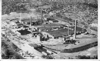
Aerial view of American Viscose.
RVNH40213 Moonlight Tourist Camp

Postcard for Moonlight Tourist Camp, formerly located 2 miles south of Roanoke on Route 220.
RVNH40214 Campbell Avenue

Looking east on Campbell Avenue from intersection with Jefferson Street.
RVNH40216 Hollins Inn

Hollins Inn Restaurant and Tourist Court, formerly located 5 miles north of Roanoke on Route 11.
RVNH40218 MJ Patsel Druggists

M.J. Patsel Druggists, formerly located at 202 2nd Street SW.
RVNH40218 Tom's Service Station

Tom's Service Station, formerly located on the corner of Henry Street and Wells Avenue.
RVNH4022 American Viscose

An unidentified woman in the reeling room at American Viscose.
RVNH40220 Little River Baptist

Little River Baptist Church, located on Route 221 in Floyd County.
RVNH40222 Coffee Pot

Customers at the Coffee Pot on Brambleton Avenue. Bob Nelson (front left) and Dick Nelson (back left) are pictured. All others unidentified.
RVNH40223 Appalachian Power

Mary Alice Nelson demonstrating the new after-hours deposit box at the Appalachian Power Company building front entrance.
RVNH40227 Virginia Heights Baptist

First chapel and parsonage for Virginia Heights Baptist Church on Memorial Avenue.
RVNH40228 Virginia Heights Baptist

First chapel of Virginia Heights Baptist Church (left), construction on second church (middle), and parsonage (right).
RVNH4023 Hillcrest House

Hillcrest Hall was one of the dormitories for American Viscose employees.
RVNH4024 Yellow Cab

Yellow Cab began offering limousine service on 20 July 1947, under contract with American and Eastern Airlines. Seen next to this Desoto limousine at Woodrum Field at Mae Williams (left) and Margaret Franklin (right).
RVNH40240 Ewald-Clark

Grand opening of Ewald-Clark in Downtown Roanoke, formerly located at 17 Church Avenue.
RVNH40247 Irv Sharp

"Cousin" Irv Sharp in the studio of WDBJ Radio.
RVNH40248 Orange Blossom Boys

Tommy Magness and the Orange Blossom Boys was a popular Roanoke radio and dance band. Left to right: Slim Idaho, Warren Poindexter, Tommy Magness, Dexter Mills, Clayton Hall, and Saford Hall.
RVNH40249 Jefferson Street

Looking north on S. Jefferson Street. Patrick Henry Hotel visible at left; Elmwood Diner visible at right.
RVNH40250 Virginian Railway

Virginian Railway Engine No. 127 in Roanoke.
RVNH40251 High Street Baptist

Postcard depicting High Street Baptist Church.
RVNH40253 Scrap Drive

Children collection scrap metal in their neighborhood in order to assist with the war efforts for World War II.
RVNH40257 Tinnell's

Tinnell's Grocery, formerly located on Crystal Spring Avenue in South Roanoke.
RVNH40258 Virginia Heights Lutheran

Virginia Heights Lutheran Church, formerly located at what is now 1320 Grandin Road.
RVNH40259 Virginia Heights Lutheran

Members inside Virginia Heights Lutheran Church, formerly located at what is now 1320 Grandin Road.
RVNH4026 Mason-Dixon Airlines

A Mason-Dixon Airlines passenger plane at Woodrum Field.
RVNH40260 Christ Lutheran

Construction of Christ Lutheran Church at the corner of Grandin Road and Brandon Avenue.
RVNH40262 Christ Lutheran

Construction of Christ Lutheran Church at the corner of Grandin Road and Brandon Avenue.
RVNH40263 Christ Lutheran

Laying of cornerstone for Christ Lutheran Church.
RVNH40264 Christ Lutheran

Corner of Grandin Road and Brandon Avenue which would become the site of Christ Lutheran Church.
RVNH40267 Fort Lewis

Ruins of Fort Lewis mansion after it was destroyed by fire on 25 July 1949.
RVNH40268 Our Lady of Perpetual Help

First chapel of Our Lady of Perpetual Help Catholic Church in Salem.
RVNH40269 Dr. Harry Penn

Dr. Harry T. Penn. In addition to practicing dentistry, Dr. Penn was the first African American school board member for the City of Roanoke and a prominent civic and civil rights leader.
RVNH4027 CAA Tower

A Civil Aviation Authority control tower on top of the Cannaday farmhouse at Woodrum Field.
RVNH40274 Military Aircraft

Military airplane at Woodrum Field. Left to right: Lawrence Hall, Buddy Wingfield, and Raymond Hall.
RVNH40275 Schley Home

Home of William S. and Daisy Schley, located at 203 Gilmer Avenue NW.
RVNH40276 Blue Ridge Entertainers

The Blue Ridge Entertainers played regularly on local radio and played in the studio the day WROV went on the air. There was another group by the same name and this group was the "second unit". Back row, left to right: Rufus Hall, Hank Angle, Jay…
RVNH40277 Johnny Non-Voter

The "funeral procession" for "Johnny Non-Voter" on Jefferson Street in route to the municipal building. The funeral was a promotion by the Roanoke Junior Chamber of Commerce as a means to get Roanokers to vote in the Democratic primaries for…
RVNH40279 Jesse Owens

Olympian Jesse Owens signs autographs at Carver School in Salem.
RVNH4028 CAA Tower

A close-up view of the Civil Aviation Authority control tower on top of the Cannaday farmhouse.
RVNH40280 Viaud School

Viaud School was founded by Madame Viaud in 1926. The school was located at 105 Mountain Avenue SW when this photo was taken.
RVNH40281 Young Roanoke Sings

The "Young Roanoke Sings" Chorus was heard weekly on WSLS Radio.
RVNH40282 William Fleming High

William Fleming High School. This building would later become Breckinridge Middle School.
RVNH40283 Snow Queen

Coronation of first annual Snow Queen (Joanne Friend) at Jefferson High School during Christmas Dance.
RVNH40284 Jefferson vs. Byrd

Jefferson High School versus William Byrd High School in football.
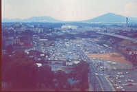
RVNH40287 Victory Stadium
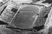
Aerial view of Victory Stadium during a Jefferson High School football game.
RVNH40288 Eddie Bennett

Eddie Bennett stands beside his father's (Joseph Bennett) brand new 1949 Mercury. Photo was taken at the family home on 30th Street, NW.
RVNH4029 Woodrum Field

Looking toward Tinker Mountain from Woodrum Field.
RVNH40290 Roanoke Police Department

Roanoke City Police Department on the steps of the municipal building.
RVNH40291 Roanoke Police Department

Roanoke City Police Department, 3rd Platoon.
RVNH40292 Church Avenue

Looking west on Church Avenue near the Jefferson Street intersection.
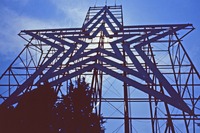
RVNH40293 Mill Mountain Star

Close-up of the Mill Mountain Star shortly after completion.
RVNH40294 Gilmer Avenue

Gilmer Avenue NW. Reliable Service Grocers visible at left.
RVNH40295 Rish Equipment

Rish Equipment Company, formerly located at 405 Centre Avenue, NW.
RVNH40296 Salem Avenue

Intersection of 2nd Street and Salem Avenue SW. M.J. Patsel Druggists visible at right.
RVNH40297 Parade

Soldiers march in a parade on Campbell Avenue at 3rd Street SW.
RVNH40299 Washington Park

Washington Park pool.
RVNH40300 Monroe Junior High

Monroe Junior High School, formerly located at 1122 19th Street NW.
RVNH40301 Fleming Avenue

Looking west on Fleming Avenue from the intersection of Winsloe Avenue NE.
RVNH40302 Tazewell Avenue

Looking east on Tazewell Avenue near the intersection with 8th Street SE.
RVNH40303 Hunter Memorial

W.P. Hunter Memorial at Hunter Viaduct. The inscription reads, "Hunter Memorial Bridge in grateful memorial of William Pearce Hunter; May 29, 1884 - March 13, 1956; first city manager, October 1, 1918 - December 31, 1947; member City Council,…
RVNH40304 Esso Station

Unidentified employees of an Esso Station.
RVNH40305 6th Street

Looking north on 6th Street near Marshall Avenue SW.
RVNH40306 Lucy Addison High

The second Lucy Addison High School (now Lucy Addison Middle School) under construction.
RVNH40307 Grandin Road

Looking north on Grandin Road.
RVNH40308 Grandin Road

Looking south on Grandin Road.
RVNH40309 N&W Station

Norfolk & Western passenger station.
RVNH4031 Sikorsky

A Sikorsky helicopter hovers as spectators look on at Woodrum Field.
RVNH40310 Henry Street Bridge

A snowy birds-eye view of the Henry Street bridge.
RVNH40311 Franklin Road

Intersection of Franklin Road and Marshall Avenue SW.
RVNH40312 Franklin Road

Looking north on Franklin Road from the intersection with Elm Avenue SW.
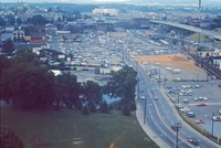
RVNH40313 Reserve Avenue

Birds-eye view of Reserve Avenue with Victory Stadium on left. Virginian Railway operations at right.
RVNH40314 Lansdowne

Construction of Lansdowne Park.
RVNH40315 Kirk Avenue

Looking east on Kirk Avenue SW.
RVNH40316 Detective Interview

The Detective Division of Roanoke City Police Department gives an interview to WSLS, WDBJ, and WROV radio stations in connection with the Dana Marie Weaver murder investigation.
RVNH4032 Crash Truck

Woodrum Field's first crash truck was a 1939 Cadillac that was modified at the city's garage..
RVNH4033 C-47

A Douglas C-47 takes off from Woodrum Field.
RVNH4034 Woodrum Field

Runway construction at Woodrum Field. The airfield was expanded when it became classified as a national defense project.
RVNH4035 Woodrum Field
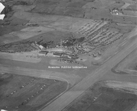
Aerial view of Woodrum Field taken during its dedication weekend. The photographer was Lambert Martin of the Roanoke World-News.
RVNH4036 Woodrum Field
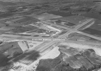
Aerial view of Woodrum Field showing A-configuration of runways.
RVNH40400 Albert Taugora

January 1940
RVNH40401 N&W Shops

Norfolk & Western East End Shops.
RVNH40402 N&W Band

Norfolk & Western Railway Band.